Beetham

Settlement in Westmorland South Lakeland

England

Beetham

Farmland, Hang Hill
Farmland, Hang Hill Credit: N Chadwick

Beetham is a village located in the county of Westmorland, in the North West of England. Situated approximately 5 miles north-west of the market town of Kendal, Beetham is nestled at the southern edge of the picturesque Lake District National Park.

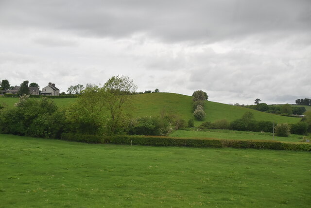
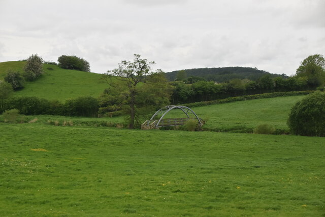
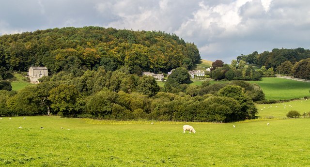
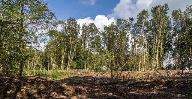
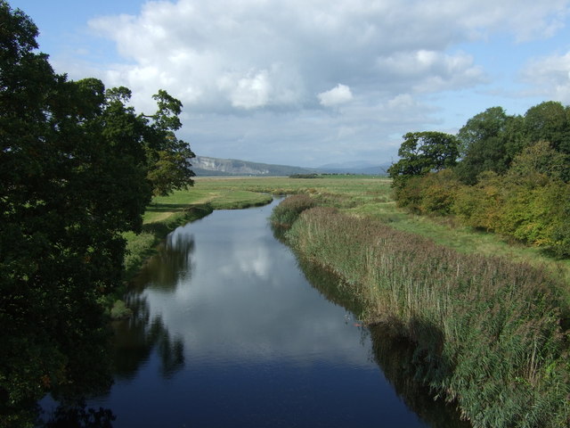
The village is known for its charming rural setting, with rolling hills and lush greenery surrounding it. It is positioned on the banks of the River Bela, which winds its way through the village, providing a tranquil and scenic backdrop.

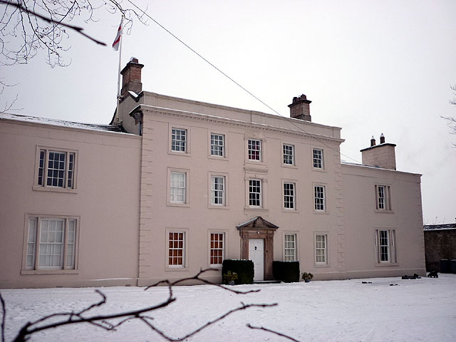
Beetham boasts a rich history, with evidence of human settlement dating back to the prehistoric era. The village is home to several historical landmarks, including the 12th-century St. Michael and All Angels Church, known for its well-preserved Norman tower and beautiful stained glass windows. Another notable attraction is Beetham Hall, a Grade II listed Georgian mansion that now operates as a wedding venue and luxury accommodation.

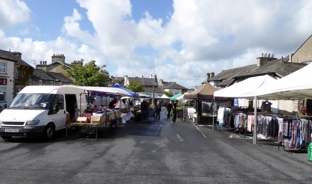
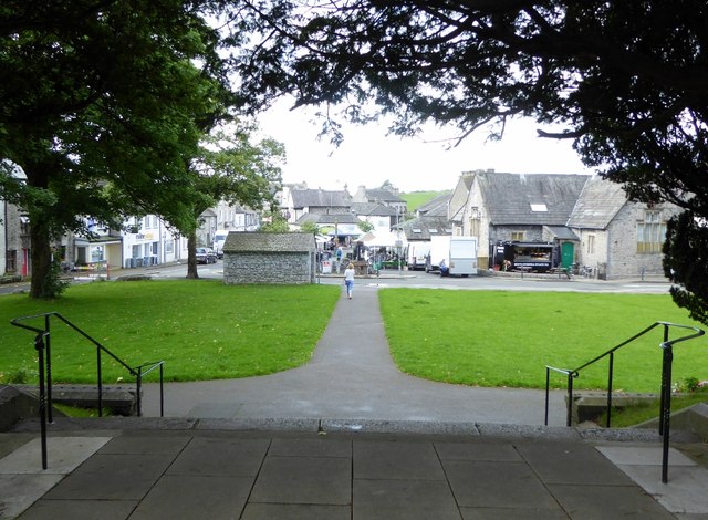
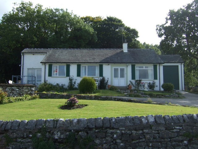
In addition to its historical sites, Beetham offers a range of amenities for residents and visitors alike. It has a primary school, a village shop, and a pub, providing essential services and a sense of community. The surrounding countryside offers numerous opportunities for outdoor activities such as hiking and cycling. The nearby Silverdale and Arnside Area of Outstanding Natural Beauty also offers stunning coastal landscapes and diverse wildlife.

Overall, Beetham is a charming village that combines historical significance, natural beauty, and a sense of community, making it an attractive destination for both locals and tourists.

If you have any feedback on the listing, please let us know in the comments section below.

Beetham Images

Images are sourced within 2km of 54.209734/-2.773231 or Grid Reference SD4979. Thanks to Geograph Open Source API. All images are credited.

Farmland, Hang Hill
Farmland, Hang Hill
Farmland
Farmland
Footbridge, River Bela
Farm sheds near Beetham These sheds lie to the south of the River Bela.
Farm sheds near Beetham
These sheds lie to the south of the River Bela.
On the A6 The M6 takes most of the traffic away from the old trunk road which makes it less stressful to use.
On the A6
The M6 takes most of the traffic away from the old trunk road which makes it less stressful to use.
Crossroads at Hale This is where Pye’s Bridge Lane joins the A6 near Beetham.
Crossroads at Hale
This is where Pye’s Bridge Lane joins the A6 near Beetham.
Pye’s Bridge Lane Viewed in late April with the roadside flowers showing well.
Pye’s Bridge Lane
Viewed in late April with the roadside flowers showing well.
Pye’s Bridge The bridge crosses Holme Beck.
Pye’s Bridge
The bridge crosses Holme Beck.
A6 near Hale
A6 near Hale
Milnthorpe market In Milnthorpe, Friday is market day.
Milnthorpe market
In Milnthorpe, Friday is market day.
From the steps of St. Thomas' Looking down at the market square in Milnthorpe.
From the steps of St. Thomas'
Looking down at the market square in Milnthorpe.
A6 The junction of Paradise Lane with the A6.
A6
The junction of Paradise Lane with the A6.
Haverbrack
Haverbrack
Wray Cottages Visible after the felling of trees.
Wray Cottages
Visible after the felling of trees.
Bungalow on Park Road (B5292)
The River Bela From Milnthorpe Bridge.
The River Bela
From Milnthorpe Bridge.
Park Road (B5282) towards Milnthorpe Heading east.
Park Road (B5282) towards Milnthorpe
Heading east.
Grazing off Park Road (B5282)
Show me another place!

Beetham is located at Grid Ref: SD4979 (Lat: 54.209734, Lng: -2.773231)

Administrative County: Cumbria

District: South Lakeland

Police Authority: Cumbria

What 3 Words

///brothers.springing.scoots. Near Milnthorpe, Cumbria

Nearby Locations

Fieryhouse Wood Beetham

Related Wikis

St Michael's Church, Beetham

St Michael's Church is in the village of Beetham, Cumbria, England. It is an active Anglican parish church in the deanery of Kendal, the archdeaconry of...

Ashton House, Cumbria

Ashton House is a large country house in Beetham in Cumbria. It is a Grade II* listed building. == History == The house was built in 1678 probably for...

Beetham

Beetham is a village and civil parish in the South Lakeland district, in Cumbria, England, situated on the border with Lancashire, 6 miles (10 km) north...
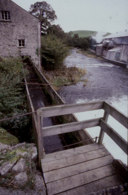
Heron Corn Mill

The Heron Corn Mill is a working 18th-century water mill on the River Bela at Beetham, Cumbria, England. The mill and its mill race are Grade II* listed...

Nearby Amenities

Located within 500m of 54.209734,-2.773231
Beetham
Is In: South Lakeland, Cumbria, England, UK
Place: village
Wikidata: Q2790966
Wikipedia: en:Beetham
Lat/Long: 54.2090007/-2.7721762
Barrier: stile
Source: Recent walk, GPS and photos
Lat/Long: 54.2095448/-2.7768669
Primary School
Bus: yes
Public Transport: stop_position
Lat/Long: 54.207747/-2.7704351
Bus Stop
St Michael's Church (N bound)
Bus: yes
Naptan AtcoCode: 090079061329
Naptan Bearing: N
Naptan BusStopType: CUS
Naptan CommonName: St Michael's Church (N bound)
Naptan Indicator: o/s
Naptan Landmark: The Weatsheaf Hotel in village centre
Naptan NaptanCode: cumdgpdw
Naptan Street: No name
Naptan Verified: no
Public Transport: platform
Source: naptan_import
Lat/Long: 54.208986/-2.7738893
Bus Stop
Primary School
Bus: yes
Departures Board: timetable
Naptan AtcoCode: 090079061864
Naptan Bearing: S
Naptan BusStopType: CUS
Naptan CommonName: Primary School
Naptan Indicator: opp
Naptan Landmark: Beetham Primary School
Naptan NaptanCode: cumdgpgp
Naptan Street: A6
Naptan Verified: no
Public Transport: platform
Shelter: no
Source: naptan_import
Lat/Long: 54.2077749/-2.7702873
Bus Stop
Beetham (Heron Theatre)
Bus: yes
Departures Board: timetable
Naptan AtcoCode: 090079062326
Naptan Bearing: W
Naptan BusStopType: CUS
Naptan CommonName: Heron Theatre
Naptan Indicator: o/s
Naptan Landmark: Heron Theatre car park
Naptan NaptanCode: cumdgpgt
Naptan Street: A6
Naptan Verified: no
Public Transport: platform
Shelter: no
Source: naptan_import
Lat/Long: 54.2083331/-2.7716445
Bus Stop
St Michael's Church (e/bound)
Bus: yes
Naptan AtcoCode: 090079903624
Naptan Bearing: S
Naptan BusStopType: CUS
Naptan CommonName: St Michael's Church (e/bound)
Naptan Indicator: opp
Naptan Landmark: The Wheatsheaf hotel in village centre
Naptan NaptanCode: cumdmtgp
Naptan Street: No name
Naptan Verified: no
Public Transport: platform
Source: naptan_import
Lat/Long: 54.2087978/-2.7737606
Barrier: stile
Source: Recent walk, GPS and photos
Lat/Long: 54.2082382/-2.7789819
Cafe
Beetham Nurseries Cafe
Addr City: Beetham
Addr Housename: Beetham Nurseries
Addr Postcode: LA7 7AP
Fhrs Id: 299781
Lat/Long: 54.2114954/-2.7714654
Barrier: stile
Lat/Long: 54.2056495/-2.7759963
Barrier: stile
Lat/Long: 54.2056956/-2.776253
Barrier: stile
Stile: squeezer
Lat/Long: 54.2126964/-2.7751076
Power: pole
Lat/Long: 54.21204/-2.7707487
Power: pole
Lat/Long: 54.2125466/-2.769295
Power: pole
Lat/Long: 54.2095946/-2.7805629
Power: pole
Lat/Long: 54.2101075/-2.7798119
Power: pole
Lat/Long: 54.2110549/-2.7785647
Power: pole
Lat/Long: 54.2118376/-2.7777547
Power: pole
Lat/Long: 54.2124807/-2.7770492
Power: pole
Lat/Long: 54.2131097/-2.7763706
Power: pole
Lat/Long: 54.2136979/-2.7756679
Give Way
Direction: forward
Lat/Long: 54.2079645/-2.7709438
Give Way
Direction: backward
Lat/Long: 54.2086582/-2.7737892
Give Way
Direction: backward
Lat/Long: 54.2089373/-2.773723
Waste Basket
Lat/Long: 54.2090339/-2.7742998
Give Way
Direction: backward
Lat/Long: 54.209766/-2.7732343
Give Way
Direction: backward
Lat/Long: 54.209723/-2.772998
Give Way
Direction: backward
Lat/Long: 54.2121537/-2.7712498
Post Box
Collection Times: Mo-Fr 17:15; Sa 10:30
Drive Through: no
Post Box Type: lamp
Ref: LA7 228
Royal Cypher: EIIR
Lat/Long: 54.2090459/-2.7743545
Entrance: main
Lat/Long: 54.2092544/-2.7742403
Bench
Backrest: yes
Lat/Long: 54.2101335/-2.7772391
Barrier: cattle_grid
Lat/Long: 54.2100462/-2.7777175
Beetham (Heron Theatre)
Bus: yes
Public Transport: stop_position
Lat/Long: 54.2083557/-2.771584
Generator Method: run-of-the-river
Generator Output Electricity: 100 kW
Generator Source: hydro
Generator Type: kaplan_turbine
Operator: Heron Corn Mill
Power: generator
Start Date: 2010-04
Lat/Long: 54.212801/-2.773986
Entrance: yes
Lat/Long: 54.2127779/-2.7740051
Man Made: watermill
Lat/Long: 54.2129067/-2.773985
Power: pole
Lat/Long: 54.2052883/-2.7733877
Power: pole
Lat/Long: 54.2057722/-2.7754669
Power: pole
Lat/Long: 54.2060409/-2.7732965
Power: pole
Lat/Long: 54.2070621/-2.7731633
Power: pole
Lat/Long: 54.2079746/-2.7730546
Information: guidepost
Tourism: information
Lat/Long: 54.2083226/-2.7727366
Information: guidepost
Tourism: information
Lat/Long: 54.2127158/-2.7751043
Generator Method: photovoltaic
Generator Output Electricity: yes
Generator Source: solar
Generator Type: solar_photovoltaic_panel
Power: generator
Lat/Long: 54.2083815/-2.7723029
Defibrillator
Access: yes
Booth: KX100
Covered: booth
Defibrillator Location: inside old phone box, Stanley Street, Beetham
Disused Amenity: telephone
Emergency: defibrillator
Man Made: telephone_box
Lat/Long: 54.2083113/-2.77268
Give Way
Direction: backward
Lat/Long: 54.2137541/-2.7711107
Power: pole
Lat/Long: 54.206506/-2.7764281
Power: pole
Lat/Long: 54.2069325/-2.7770145
Power: pole
Lat/Long: 54.2083467/-2.7790642
Power: pole
Lat/Long: 54.2089974/-2.7801767
The data included in this document is from www.openstreetmap.org. The data is made available under ODbL.

Have you been to Beetham?

Leave your review of Beetham below (or comments, questions and feedback).