Beeswing

Settlement in Kirkcudbrightshire

Scotland

Beeswing

Beeswing Church complete with guard horse!
Beeswing Church Credit: Alison Stamp

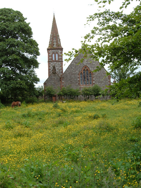
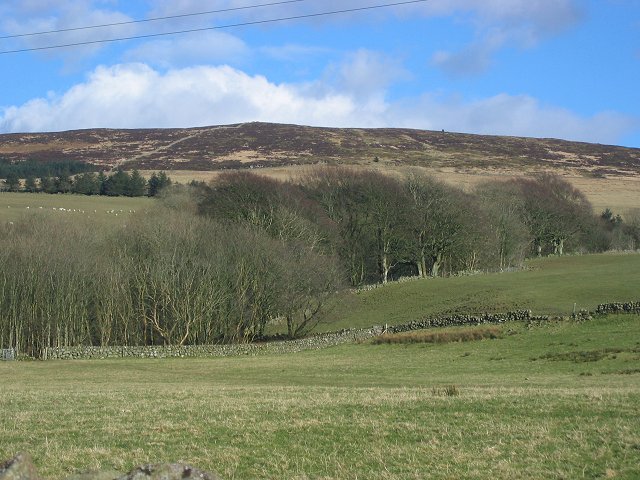
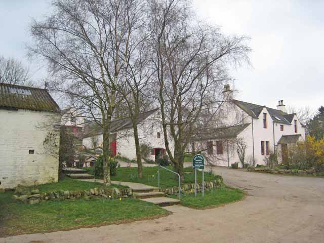
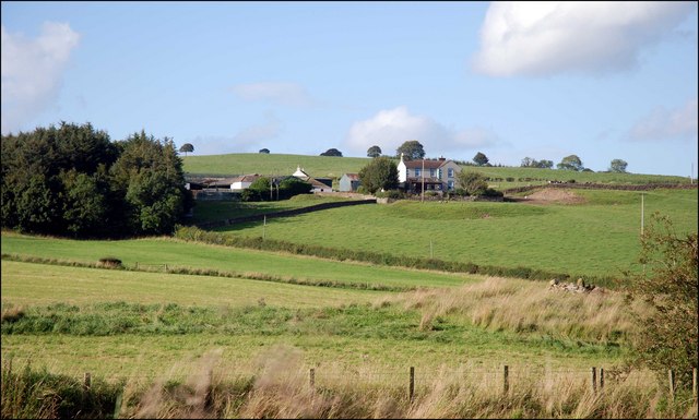
Beeswing is a small village located in the historical county of Kirkcudbrightshire in Scotland. Situated on the eastern shore of Carlingwark Loch, it is known for its picturesque setting and tranquil atmosphere. The village is approximately 2 miles south of the town of Castle Douglas, making it easily accessible for both locals and visitors.

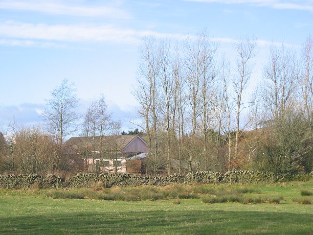
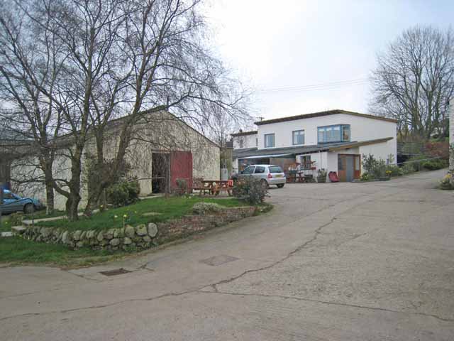
Beeswing is named after a popular racehorse from the 19th century, who won the prestigious Grand National in 1842. The village itself is relatively small, with a population of around 300 residents. It is primarily a residential area, with a scattering of houses and cottages dotting the landscape.

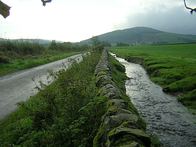
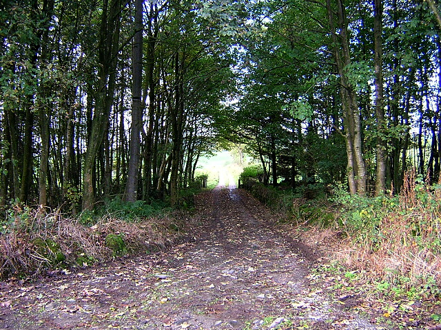
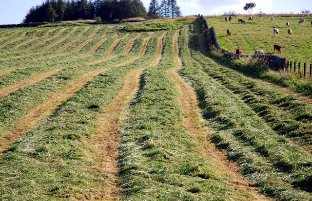
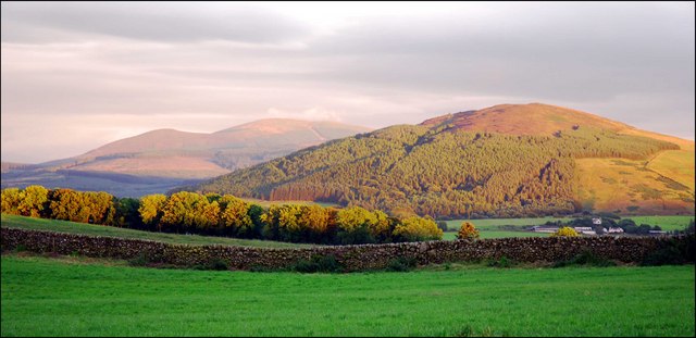
One of the main attractions in Beeswing is Carlingwark Loch, a freshwater lake popular for fishing and boating activities. The loch is surrounded by stunning natural beauty and offers breathtaking views. The area is also home to an abundance of wildlife, including various bird species, making it a haven for birdwatchers and nature enthusiasts.

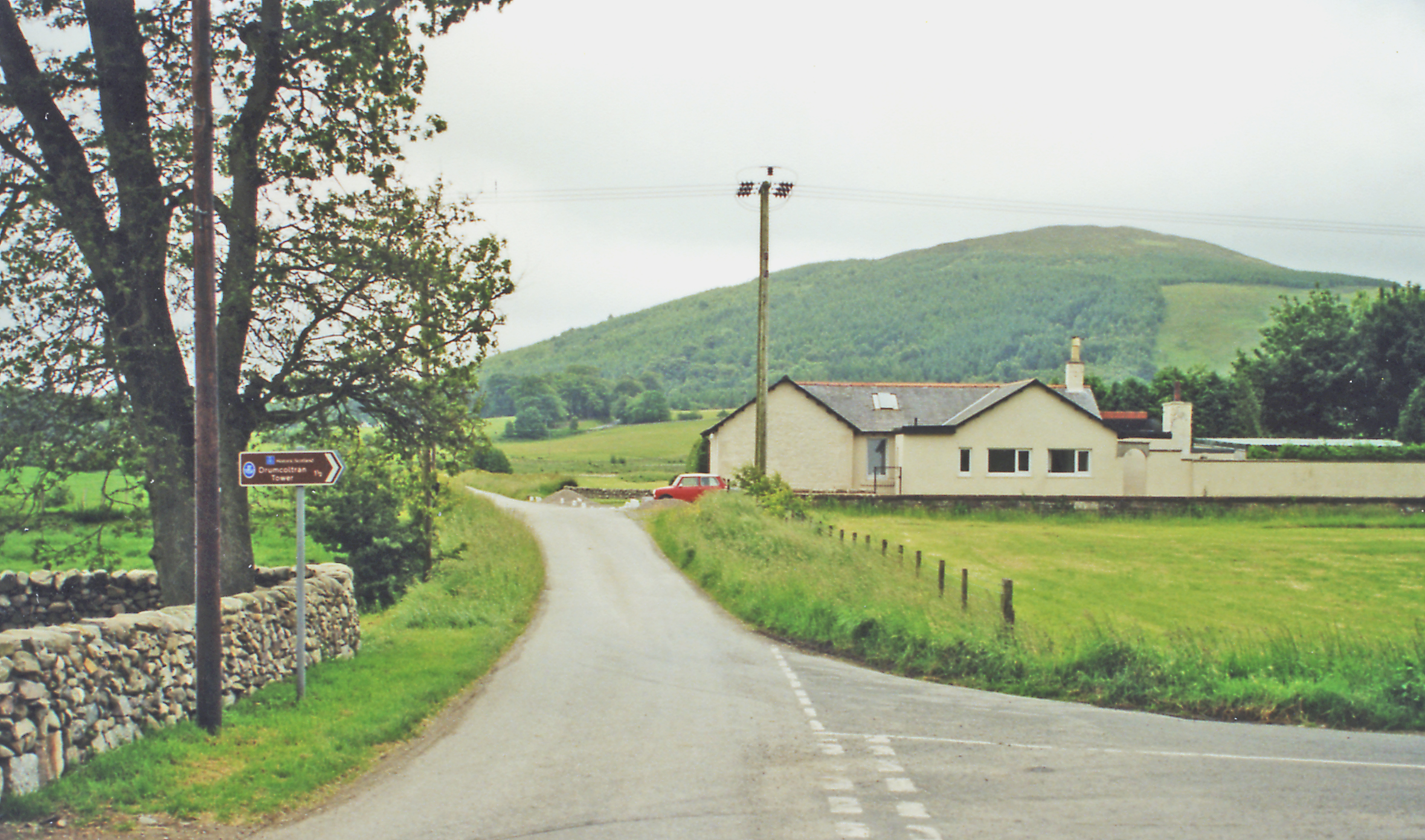
The village is well-connected by road, with the A745 passing through it, providing easy access to neighboring towns and cities. Despite its small size, Beeswing has a strong sense of community, with various local events and gatherings taking place throughout the year. The nearby town of Castle Douglas offers a wider range of amenities, including shops, restaurants, and schools, ensuring that residents have access to all necessary facilities.

Overall, Beeswing is a charming village that offers a serene and idyllic lifestyle, surrounded by natural beauty and a close-knit community.

If you have any feedback on the listing, please let us know in the comments section below.

Beeswing Images

Images are sourced within 2km of 55.004918/-3.729461 or Grid Reference NX8969. Thanks to Geograph Open Source API. All images are credited.

Beeswing Church complete with guard horse!
Beeswing Church
complete with guard horse!
Whiteside House just off the A711.
Whiteside
House just off the A711.
Whiteside View east and up the hill as farmland gives way to moorland on granite hills.
Whiteside
View east and up the hill as farmland gives way to moorland on granite hills.
Loch Arthur Creamery Loch Arthur Community belongs to the Camphill Village Trust. It was established in 1984 and offers a shared way of life providing support and challenges for men and women with special needs. The Creamery provides work for some of the community members, who produce award-winning cheeses, butter and yoghurts which along with farm produce and crafts are sold in the shop.

There are now Camphill Communities in more than 20 countries. The first community was founded in 1940 at Camphill, near Aberdeen, by Karl Konig, an Austrian doctor who had come to Scotland as a refugee.
Loch Arthur Creamery
Loch Arthur Community belongs to the Camphill Village Trust. It was established in 1984 and offers a shared way of life providing support and challenges for men and women with special needs. The Creamery provides work for some of the community members, who produce award-winning cheeses, butter and yoghurts which along with farm produce and crafts are sold in the shop. There are now Camphill Communities in more than 20 countries. The first community was founded in 1940 at Camphill, near Aberdeen, by Karl Konig, an Austrian doctor who had come to Scotland as a refugee.
Burn Near Killywhan
Burn Near Killywhan
Track to Lawston
Track to Lawston
Loch Arthur Creamery The Loch Arthur Creamery is the focus of the Loch Arthur Community, a rural community for adults with special needs. <span class="nowrap"><a title="http://www.camphill.org.uk/guide/locharth/locharth.htm" rel="nofollow ugc noopener" href="http://www.camphill.org.uk/guide/locharth/locharth.htm">Link</a><img style="margin-left:2px;" alt="External link" title="External link - shift click to open in new window" src="https://s1.geograph.org.uk/img/external.png" width="10" height="10"/></span>
Loch Arthur Creamery
The Loch Arthur Creamery is the focus of the Loch Arthur Community, a rural community for adults with special needs. LinkExternal link
Farm Shop, Loch Arthur Creamery This is the farm shop, the outlet for the Loch Arthur Creamery which is the focus of the Loch Arthur Community, a rural community for adults with special needs. <span class="nowrap"><a title="http://www.camphill.org.uk/guide/locharth/locharth.htm" rel="nofollow ugc noopener" href="http://www.camphill.org.uk/guide/locharth/locharth.htm">Link</a><img style="margin-left:2px;" alt="External link" title="External link - shift click to open in new window" src="https://s1.geograph.org.uk/img/external.png" width="10" height="10"/></span>
Farm Shop, Loch Arthur Creamery
This is the farm shop, the outlet for the Loch Arthur Creamery which is the focus of the Loch Arthur Community, a rural community for adults with special needs. LinkExternal link
Make Silage when the Sun Shines
Looking over to Drum
View towards Drum
View towards Drum
Sunlit Tree Clump
Sunlit Tree Clump
Blairshinnoch
Blairshinnoch
Shetland ponies at Killywhan
Beeswing Kirk
Beeswing Kirk
Organic Fruit & Vegetables Entrance to the shop at Loch Arthur Creamery
Organic Fruit & Vegetables
Entrance to the shop at Loch Arthur Creamery
Substantial field wall Stone wall north of Blairshinnoch farm.
Substantial field wall
Stone wall north of Blairshinnoch farm.
Trunk shadows on dead leaves To the east of Whiteside farm.
Trunk shadows on dead leaves
To the east of Whiteside farm.
Show me another place!

Beeswing is located at Grid Ref: NX8969 (Lat: 55.004918, Lng: -3.729461)

Unitary Authority: Dumfries and Galloway

Police Authority: Dumfries and Galloway

What 3 Words

///stutter.pill.salaried. Near Dalbeattie, Dumfries & Galloway

Nearby Locations

Beeswing

Related Wikis

Beeswing, Dumfries and Galloway

Beeswing is a small village in the historical county of Kirkcudbrightshire in Scotland. == Etymology == Before Beeswing became known as Beeswing, it was...

Killywhan railway station

Killywhan railway station served the hamlet of Killywhan, Dumfries and Galloway, Scotland from 1859 to 1959 on the Castle Douglas and Dumfries Railway...

Loch Arthur

Loch Arthur (also known as Loch Lotus) is a lake in the council area of Dumfries and Galloway in Scotland near the village of Beeswing.Loch Arthur lies...

Loch Arthur logboat

The Loch Arthur logboat or dugout canoe (also called Loch Arthur 1, Loch Lotus or Lotus Loch) was found in 1874 when the water level was low on the south...

Lochaber Loch

Lochaber Loch is a small, lowland freshwater loch that lies among steep-sided hills, approximately 4.5 mi (7.2 km) to the west of Dumfries, Scotland. The...

Lochanhead railway station

Lochanhead railway station served the settlement of Lochanhead, Dumfries and Galloway, Scotland from 1859 to 1965 on the Castle Douglas and Dumfries Railway...

Kirkgunzeon railway station

Kirkgunzeon railway station served the village of Kirkgunzeon, Dumfries and Galloway, Scotland from 1859 to 1950 on the Castle Douglas and Dumfries Railway...

Kirkgunzeon

Kirkgunȝeon (Scottish Gaelic: Cill Fhionnain) is a village and civil parish in Dumfries and Galloway, south west Scotland. The village is 10.4 miles (16...

Nearby Amenities

Located within 500m of 55.004918,-3.729461
Loch Arthur Creamery
Shop: farm
Lat/Long: 55.0011051/-3.7324286
Bus Stop
School
Naptan AtcoCode: 680000043333
Naptan Bearing: SW
Naptan BusStopType: CUS
Naptan CommonName: School
Naptan Indicator: opp Road End
Naptan Landmark: School
Naptan NaptanCode: 34236293
Naptan Notes: none
Naptan Street: Main Street
Naptan Verified: no
Source: naptan_import
Lat/Long: 55.0075548/-3.7264476
Bus Stop
School
Naptan AtcoCode: 680000043444
Naptan Bearing: NE
Naptan CommonName: School
Naptan Indicator: Road End
Naptan Landmark: School
Naptan NaptanCode: 34236292
Naptan Notes: none
Naptan Street: Main Street
Naptan Verified: no
Source: naptan_import
Lat/Long: 55.0080565/-3.7259219
Bus Stop
Church
Naptan AtcoCode: 680000043501
Naptan Bearing: SW
Naptan CommonName: Church
Naptan Indicator: o/s Church
Naptan Landmark: Church
Naptan NaptanCode: 34236294
Naptan Notes: none
Naptan Street: Main Street
Naptan Verified: no
Source: naptan_import
Lat/Long: 55.0055507/-3.7295984
Bus Stop
Church
Naptan AtcoCode: 680000043502
Naptan Bearing: NE
Naptan CommonName: Church
Naptan Indicator: opp Church
Naptan Landmark: Church
Naptan NaptanCode: 34236295
Naptan Notes: none
Naptan Street: Main Street
Naptan Verified: no
Source: naptan_import
Lat/Long: 55.0056744/-3.7297445
Post Box
Ref: DG2 93
Lat/Long: 55.0079486/-3.7260782
Loch Arthur Farm Shop
Addr City: Beeswing
Addr Housename: Loch Arthur Farm Shop
Addr Postcode: DG2 8JQ
Description: Organic and locally produced foods: Artisan cheeses and dairy products; Breads and rolls baked fresh daily in the bakery; Organic meats from our own and locally reared animals; Extensive range of organic fruit and vegetables; Cakes, pies, biscuits,...
Opening Hours: Mo-Fr 09:00-17:30, Sa 09:00-17:00
Operator: Loch Arthur Camphill Community
Organic: only
Shop: supermarket
Lat/Long: 55.0037932/-3.7289271
Cafe
Loch Arthur Cafe
Addr City: Beeswing
Addr Housename: Loch Arthur Farm Shop
Addr Postcode: DG2 8JQ
Cuisine: regional;ice_cream
Diet Meat: yes
Diet Organic: yes
Diet Vegan: yes
Diet Vegetarian: yes
Internet Access: no
Opening Hours: Mo-Sa 09:30-16:30
Outdoor Seating: yes
Source: local knowledge
Wheelchair: yes
Lat/Long: 55.0036846/-3.7289695
Loch Arthur Bakery
Addr City: Beeswing
Addr Housename: Loch Arthur Farm Shop
Addr Postcode: DG2 8JQ
Operator: Loch Arthur Camphill Community
Shop: bakery
Lat/Long: 55.0037464/-3.7288194
Telephone
Booth: K6
Colour: yellow
Covered: booth
Man Made: telephone_box
Tourism: information
Lat/Long: 55.0056919/-3.7292515
Bench
Lat/Long: 55.0056388/-3.7294554
Power: pole
Lat/Long: 55.0075591/-3.7242848
Power: pole
Lat/Long: 55.0071613/-3.7251949
Power: pole
Lat/Long: 55.0067781/-3.7260795
Power: pole
Lat/Long: 55.0061819/-3.7274245
Power: pole
Lat/Long: 55.0056916/-3.7282625
Power: pole
Lat/Long: 55.0048485/-3.7297517
Power: pole
Lat/Long: 55.0042998/-3.7306958
Power: pole
Lat/Long: 55.0035904/-3.7319029
Power: pole
Lat/Long: 55.0029164/-3.7330866
Power: pole
Lat/Long: 55.0024524/-3.7339138
Power: pole
Lat/Long: 55.0019905/-3.7347371
Power: pole
Lat/Long: 55.0021365/-3.7328427
Power: pole
Lat/Long: 55.0018031/-3.7317035
Power: pole
Lat/Long: 55.0015828/-3.7309249
Power: pole
Lat/Long: 55.0012543/-3.7299702
Power: pole
Lat/Long: 55.0009233/-3.7289901
Power: pole
Lat/Long: 55.0005851/-3.7280058
Power: pole
Lat/Long: 55.0041367/-3.7329806
Power: pole
Lat/Long: 55.0046806/-3.7340752
Power: pole
Lat/Long: 55.0042243/-3.7295311
Power: pole
Lat/Long: 55.006171/-3.728534
The data included in this document is from www.openstreetmap.org. The data is made available under ODbL.

Have you been to Beeswing?

Leave your review of Beeswing below (or comments, questions and feedback).