Stoop

Settlement in Dumfriesshire

Scotland

Stoop

Cresswell Gardens, Grierson Avenue
Cresswell Gardens, Grierson Avenue Credit: David Dixon

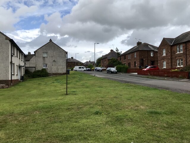
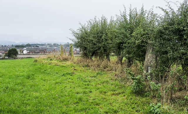
Stoop is a small village located in the historic county of Dumfriesshire, Scotland. Situated in the southern part of the country, it lies approximately 20 miles northwest of the town of Dumfries. The village is nestled amidst picturesque rolling hills and offers scenic views of the surrounding countryside.

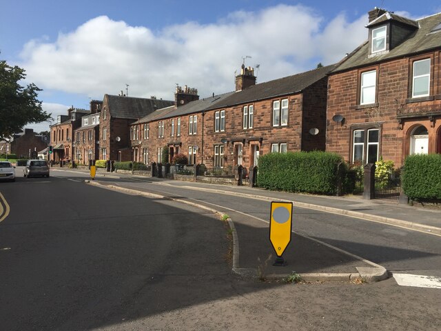
With its rural charm and peaceful atmosphere, Stoop is an ideal destination for those seeking a tranquil retreat. The village is primarily residential, consisting of a small cluster of houses and a few local amenities. While it may lack the hustle and bustle of larger towns, Stoop provides a close-knit community where residents enjoy a strong sense of camaraderie.

Despite its modest size, Stoop benefits from its proximity to the nearby town of Dumfries, which offers a wider range of amenities and services. This allows residents to easily access shops, schools, healthcare facilities, and other essentials.

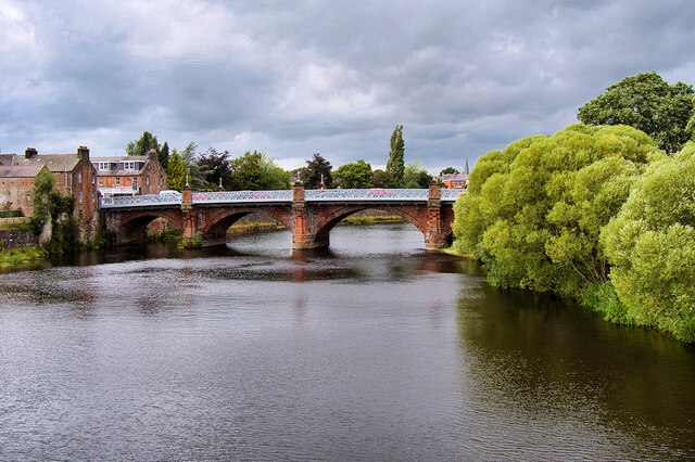
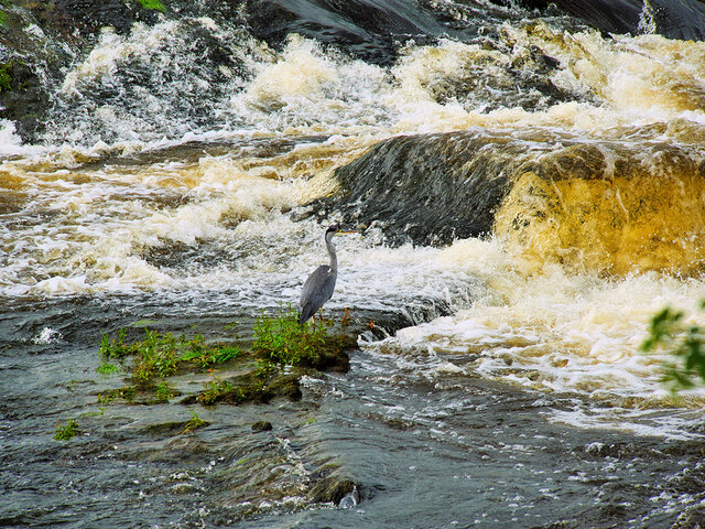
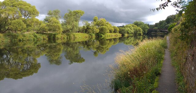
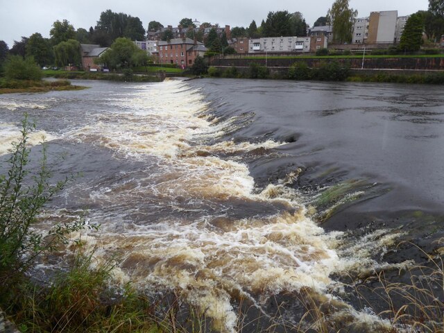
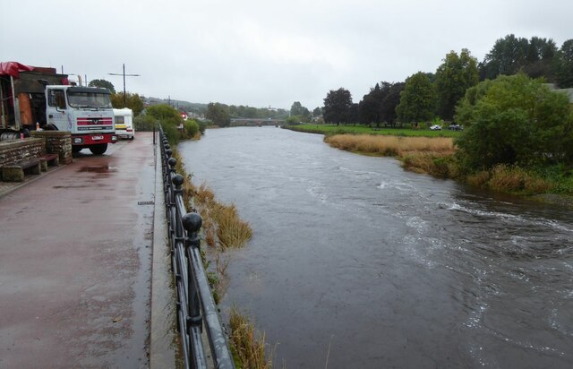
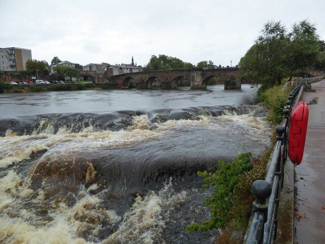
Nature enthusiasts will appreciate the abundance of outdoor recreational opportunities available in and around Stoop. The surrounding countryside offers ample opportunities for hiking, cycling, and exploring the scenic landscapes. The nearby River Nith also provides opportunities for fishing and water activities.

Overall, Stoop presents a peaceful and idyllic setting for those seeking a quiet village lifestyle. Its close-knit community, stunning natural surroundings, and proximity to larger towns make it a desirable place to call home for those wishing to live in the beautiful Dumfriesshire region.

If you have any feedback on the listing, please let us know in the comments section below.

Stoop Images

Images are sourced within 2km of 55.072361/-3.5882101 or Grid Reference NX9876. Thanks to Geograph Open Source API. All images are credited.

Cresswell Gardens, Grierson Avenue
Boundary Stone, Graigs Road Parliamentary & Police Burgh boundary in 1900.

Milestone Society National ID: DF_DUMF02pb
Boundary Stone, Graigs Road
Parliamentary & Police Burgh boundary in 1900. Milestone Society National ID: DF_DUMF02pb
Devorgilla Bridge, Dumfries The original Devorgilla Bridge was built in 1431, replacing an earlier, wooden structure named after Lady Devorgilla, the mother of King John Balliol. The bridge survived for almost two centuries until it was destroyed in a major flood in the 1620s, resulting in a nine-arched bridge being built.

The bridge was shortened by the removal of the three easternmost arches in the late eighteenth century.  It is a Category A listed building (LB26354 <span class="nowrap"><a title="http://portal.historicenvironment.scot/designation/LB26354" rel="nofollow ugc noopener" href="http://portal.historicenvironment.scot/designation/LB26354">Link</a><img style="margin-left:2px;" alt="External link" title="External link - shift click to open in new window" src="https://s1.geograph.org.uk/img/external.png" width="10" height="10"/></span> Historic Environment Scotland).
Devorgilla Bridge, Dumfries
The original Devorgilla Bridge was built in 1431, replacing an earlier, wooden structure named after Lady Devorgilla, the mother of King John Balliol. The bridge survived for almost two centuries until it was destroyed in a major flood in the 1620s, resulting in a nine-arched bridge being built. The bridge was shortened by the removal of the three easternmost arches in the late eighteenth century. It is a Category A listed building (LB26354 LinkExternal link Historic Environment Scotland).
Old Bridge House, Dumfries Built ca1660 at the western end of Devorgilla Bridge by James Birkmyre, a barrel maker, as his house and workshop. It is reputedly the oldest surviving domestic dwelling in Dumfries. It was used as an inn for much of the 18th and 19th centuries and was converted to a museum, following the death of its last occupant in 1959.

It is a Category B listed building (LB26310 <span class="nowrap"><a title="http://portal.historicenvironment.scot/designation/LB26310" rel="nofollow ugc noopener" href="http://portal.historicenvironment.scot/designation/LB26310">Link</a><img style="margin-left:2px;" alt="External link" title="External link - shift click to open in new window" src="https://s1.geograph.org.uk/img/external.png" width="10" height="10"/></span> Historic Environment Scotland).
Old Bridge House, Dumfries
Built ca1660 at the western end of Devorgilla Bridge by James Birkmyre, a barrel maker, as his house and workshop. It is reputedly the oldest surviving domestic dwelling in Dumfries. It was used as an inn for much of the 18th and 19th centuries and was converted to a museum, following the death of its last occupant in 1959. It is a Category B listed building (LB26310 LinkExternal link Historic Environment Scotland).
Buccleuch Street Bridge (Dumfries "New" Bridge) A five-arched bridge over the River Nith, built in 1793. The roadway was widened on steel cantilevers in 1893 (see <a href="https://www.geograph.org.uk/photo/3333780">NX9676 : Plaque on New Bridge</a>). It is a Category B listed building (LB26096 <span class="nowrap"><a title="http://portal.historicenvironment.scot/designation/LB26096" rel="nofollow ugc noopener" href="http://portal.historicenvironment.scot/designation/LB26096">Link</a><img style="margin-left:2px;" alt="External link" title="External link - shift click to open in new window" src="https://s1.geograph.org.uk/img/external.png" width="10" height="10"/></span> Historic Environment Scotland).
Buccleuch Street Bridge (Dumfries "New" Bridge)
A five-arched bridge over the River Nith, built in 1793. The roadway was widened on steel cantilevers in 1893 (see NX9676 : Plaque on New Bridge). It is a Category B listed building (LB26096 LinkExternal link Historic Environment Scotland).
River Nith Weir at Dumfries A solitary heron stands motionless on Whitesands Caul, waiting for fish to tumble over.
River Nith Weir at Dumfries
A solitary heron stands motionless on Whitesands Caul, waiting for fish to tumble over.
Heron at Dumfries A solitary heron stands motionless on Whitesands Caul, waiting for fish to tumble over.
Heron at Dumfries
A solitary heron stands motionless on Whitesands Caul, waiting for fish to tumble over.
River Nith Dumfries The River Nith and towpath near the rowing club headquarters.
River Nith Dumfries
The River Nith and towpath near the rowing club headquarters.
River Nith at Dumfries A beautiful suspension bridge provides a footbridge for pedestrians
River Nith at Dumfries
A beautiful suspension bridge provides a footbridge for pedestrians
Statue of Jean Armour Statue to Robert Burns' wife, standing in Dumfries between her home and her church. Mother to nine of his children, including two sets of twins, while he also had four more children by other women. <span class="nowrap"><a title="https://en.wikipedia.org/wiki/Jean_Armour" rel="nofollow ugc noopener" href="https://en.wikipedia.org/wiki/Jean_Armour">Link</a><img style="margin-left:2px;" alt="External link" title="External link - shift click to open in new window" src="https://s1.geograph.org.uk/img/external.png" width="10" height="10"/></span>
Statue of Jean Armour
Statue to Robert Burns' wife, standing in Dumfries between her home and her church. Mother to nine of his children, including two sets of twins, while he also had four more children by other women. LinkExternal link
Houses on Annan Road, Dumfries
The caul or weir in Dumfries The caul on the Nith below the old Devorgilla Bridge is of early origin, built originally of stakes, but reconstructed many times in timber and rubble. Although the lade is infilled, the site of the sluice gate at the S end of the caul can still be seen.
The caul or weir in Dumfries
The caul on the Nith below the old Devorgilla Bridge is of early origin, built originally of stakes, but reconstructed many times in timber and rubble. Although the lade is infilled, the site of the sluice gate at the S end of the caul can still be seen.
St Michael's Primary School Originally, the school began as a Church School attached to the South Free Territorial Church. The school opened in 1865 and provided a general education - including Latin, for some pupils.

'At St Michael’s Primary we aim to provide a secure, supportive and friendly environment in which the children will develop skills and experiences, which will allow them to reach their full potential.' <span class="nowrap"><a title="https://stmichaelsdumfries.dumgal.sch.uk/" rel="nofollow ugc noopener" href="https://stmichaelsdumfries.dumgal.sch.uk/">Link</a><img style="margin-left:2px;" alt="External link" title="External link - shift click to open in new window" src="https://s1.geograph.org.uk/img/external.png" width="10" height="10"/></span>
St Michael's Primary School
Originally, the school began as a Church School attached to the South Free Territorial Church. The school opened in 1865 and provided a general education - including Latin, for some pupils. 'At St Michael’s Primary we aim to provide a secure, supportive and friendly environment in which the children will develop skills and experiences, which will allow them to reach their full potential.' LinkExternal link
Advert at St Michael's Services garage Nith Inshore Rescue is an independent lifeboat serving the Dumfries area. We are based in Glencaple, 5 miles south of Dumfries in south-west Scotland, on the estuary of the River Nith close to where it joins the Solway Firth.
Advert at St Michael's Services garage
Nith Inshore Rescue is an independent lifeboat serving the Dumfries area. We are based in Glencaple, 5 miles south of Dumfries in south-west Scotland, on the estuary of the River Nith close to where it joins the Solway Firth.
The River Nith in Dumfries The lorry is unloading the components of the fair being erected beside the river.
The River Nith in Dumfries
The lorry is unloading the components of the fair being erected beside the river.
Dumfries Old Bridge This bridge carries a footpath across the River Nith to the N of the weir (caul), the end of which is visible in image, and on the W side of the central area of Dumfries.
Dumfries Old Bridge
This bridge carries a footpath across the River Nith to the N of the weir (caul), the end of which is visible in image, and on the W side of the central area of Dumfries.
Hedge with embedded trig point The trig point is on Clumpton Hill in the line of an incomplete hedge dividing two grassed fields. It lies close to the north-eastern edge of Dumfries and houses of that part of the town can be seen in the distance.
Hedge with embedded trig point
The trig point is on Clumpton Hill in the line of an incomplete hedge dividing two grassed fields. It lies close to the north-eastern edge of Dumfries and houses of that part of the town can be seen in the distance.
Derelict Mill, Dumfries
Show me another place!

Stoop is located at Grid Ref: NX9876 (Lat: 55.072361, Lng: -3.5882101)

Unitary Authority: Dumfries and Galloway

Police Authority: Dumfries and Galloway

What 3 Words

///spice.concerned.bleak. Near Dumfries, Dumfries & Galloway

Related Wikis

Dumfries

Dumfries ( dum-FREESS; Scots: Dumfries; from Scottish Gaelic: Dùn Phris [ˌt̪un ˈfɾʲiʃ]) is a market town and former royal burgh in Dumfries and Galloway...

Dumfries railway station

Dumfries railway station serves the town of Dumfries in Dumfries and Galloway, Scotland. It is located on the Glasgow South Western Line. The station is...

Greyfriars, Dumfries

Greyfriars, Dumfries, was a friary of the Friars Minor, commonly known as the Franciscans, established in Dumfries, Scotland. Following dissolution the...

County Buildings, Dumfries

County Buildings is a municipal structure in English Street, Dumfries, Scotland. The structure, which is the headquarters of Dumfries and Galloway Council...

Nearby Amenities

Located within 500m of 55.072361,-3.5882101
Crossing
Crossing: traffic_signals
Crossing Ref: pelican
Lat/Long: 55.070394/-3.5944481
Traffic Signals
Source: survey
Lat/Long: 55.0750254/-3.584534
Traffic Signals
Lat/Long: 55.0685096/-3.5857924
Traffic Signals
Lat/Long: 55.0688753/-3.5861968
Mini Roundabout
Direction: clockwise
Lat/Long: 55.0695866/-3.5871613
Bus Stop
Annan Road
Bus: yes
Naptan AtcoCode: 680000004333
Naptan Bearing: W
Naptan CommonName: Annan Road
Naptan Indicator: no 190
Naptan Landmark: Georgetown Road
Naptan NaptanCode: 34235345
Naptan Notes: none
Naptan PlusbusZoneRef: DUMFRES
Naptan Street: Annan Road
Naptan Verified: no
Public Transport: platform
Source: naptan_import
Lat/Long: 55.0696751/-3.5880064
Bus Stop
Annan Road
Bus: yes
Naptan AtcoCode: 680000004503
Naptan Bearing: E
Naptan CommonName: Annan Road
Naptan Indicator: no 167
Naptan Landmark: Kirkowens Street
Naptan NaptanCode: 34235346
Naptan Notes: none
Naptan PlusbusZoneRef: DUMFRES
Naptan Street: Annan Road
Naptan Verified: no
Public Transport: platform
Source: naptan_import
Lat/Long: 55.0702279/-3.5917872
Bus Stop
Annan Road
Bus: yes
Naptan AtcoCode: 680000004506
Naptan Bearing: W
Naptan CommonName: Annan Road
Naptan Indicator: no 110
Naptan Landmark: Brooms Road
Naptan NaptanCode: 34235347
Naptan Notes: none
Naptan PlusbusZoneRef: DUMFRES
Naptan Street: Annan Road
Naptan Verified: no
Public Transport: platform
Source: naptan_import
Lat/Long: 55.0701989/-3.5926318
Bus Stop
Lockerbie Road
Naptan AtcoCode: 680000551333
Naptan Bearing: W
Naptan CommonName: Lockerbie Road
Naptan Indicator: opp School
Naptan Landmark: Balmoral Road
Naptan NaptanCode: 34238653
Naptan Notes: none
Naptan PlusbusZoneRef: DUMFRES
Naptan Street: Lockerbie Road
Naptan Verified: no
Source: naptan_import
Lat/Long: 55.0731366/-3.5940956
Bus Stop
Lockerbie Road
Naptan AtcoCode: 680000551444
Naptan Bearing: E
Naptan CommonName: Lockerbie Road
Naptan Indicator: o/s School
Naptan Landmark: Balmoral Road
Naptan NaptanCode: 34234583
Naptan Notes: none
Naptan PlusbusZoneRef: DUMFRES
Naptan Street: Lockerbie Road
Naptan Verified: no
Source: naptan_import
Lat/Long: 55.0732999/-3.5934073
Bus Stop
Lockerbie Road
Bus: yes
Naptan AtcoCode: 680000552333
Naptan Bearing: SW
Naptan CommonName: Lockerbie Road
Naptan Indicator: Stoop
Naptan Landmark: Stoop Loaning
Naptan NaptanCode: 34234578
Naptan Notes: none
Naptan PlusbusZoneRef: DUMFRES
Naptan Street: Lockerbie Road
Naptan Verified: no
Public Transport: platform
Source: naptan_import
Lat/Long: 55.0730478/-3.5878267
Bus Stop
Lockerbie Road
Bus: yes
Naptan AtcoCode: 680000552444
Naptan Bearing: NE
Naptan CommonName: Lockerbie Road
Naptan Indicator: opp Stoop
Naptan Landmark: Stoop Loaning
Naptan NaptanCode: 34234579
Naptan Notes: none
Naptan PlusbusZoneRef: DUMFRES
Naptan Street: Lockerbie Road
Naptan Verified: no
Public Transport: platform
Source: naptan_import
Lat/Long: 55.0732836/-3.5876638
Bus Stop
Annan Road
Bus: yes
Naptan AtcoCode: 680000632333
Naptan Bearing: NW
Naptan CommonName: Annan Road
Naptan Indicator: opp Aldi
Naptan Landmark: Aldi
Naptan NaptanCode: 34235343
Naptan Notes: none
Naptan PlusbusZoneRef: DUMFRES
Naptan Street: Annan Road
Naptan Verified: no
Public Transport: platform
Source: naptan_import
Lat/Long: 55.0692661/-3.5847537
Bus Stop
Annan Road
Bus: yes
Naptan AtcoCode: 680000632444
Naptan Bearing: SE
Naptan CommonName: Annan Road
Naptan Indicator: at Aldi
Naptan Landmark: Aldi
Naptan NaptanCode: 34238658
Naptan Notes: none
Naptan PlusbusZoneRef: DUMFRES
Naptan Street: Annan Road
Naptan Verified: no
Public Transport: platform
Source: naptan_import
Lat/Long: 55.0695785/-3.5864521
Bus Stop
Lockerbie Road
Bus: yes
Naptan AtcoCode: 680005007333
Naptan Bearing: SW
Naptan CommonName: Lockerbie Road
Naptan Indicator: Matalan
Naptan Landmark: Peel Centre
Naptan NaptanCode: 34234575
Naptan Notes: none
Naptan PlusbusZoneRef: DUMFRES
Naptan Street: A709
Naptan Verified: no
Public Transport: platform
Source: naptan_import
Lat/Long: 55.0742946/-3.5854761
Bus Stop
Lockerbie Road
Bus: yes
Naptan AtcoCode: 680005007444
Naptan Bearing: NE
Naptan CommonName: Lockerbie Road
Naptan Indicator: opp Matalan
Naptan Landmark: Peel Centre
Naptan NaptanCode: 34234567
Naptan Notes: none
Naptan PlusbusZoneRef: DUMFRES
Naptan Street: A709
Naptan Verified: no
Public Transport: platform
Source: naptan_import
Lat/Long: 55.0739838/-3.5863445
Post Box
Brand: Royal Mail
Brand Wikidata: Q638098
Mapillary: 624815085874931
Operator: Royal Mail
Operator Wikidata: Q638098
Post Box Type: pillar
Ref: DG1 15
Survey Date: 2022-09-03
Lat/Long: 55.0702987/-3.595025
Turning Circle
Lat/Long: 55.070517/-3.5841993
Mini Roundabout
Direction: clockwise
Lat/Long: 55.0702799/-3.5934465
Crossing
Crossing: traffic_signals
Crossing Island: no
Tactile Paving: yes
Lat/Long: 55.0741484/-3.5858535
Post Box
Ref: DG1 13
Lat/Long: 55.0733378/-3.5922974
Turning Circle
Lat/Long: 55.0694488/-3.5874152
Post Box
Brand: Royal Mail
Brand Wikidata: Q638098
Operator: Royal Mail
Operator Wikidata: Q638098
Post Box Mounting: pier
Post Box Type: lamp
Ref: DG1 18
Lat/Long: 55.0694753/-3.5872913
Crossing
Crossing: traffic_signals
Lat/Long: 55.0692063/-3.5839738
Mini Roundabout
Lat/Long: 55.0746497/-3.5839074
Fast Food
Balmoral Fish and Chicken Bar
Addr Street: Balmoral Road
Lat/Long: 55.0710162/-3.5951901
Restaurant
Bruno’s Authentic Italian Cuisine
Lat/Long: 55.0709222/-3.5951861
Crossing
Crossing: traffic_signals
Crossing Island: no
Tactile Paving: yes
Lat/Long: 55.0751482/-3.5843251
Crossing
Crossing: marked
Lat/Long: 55.0741005/-3.5851047
Generator Method: photovoltaic
Generator Output Electricity: yes
Generator Source: solar
Generator Type: solar_photovoltaic_panel
Power: generator
Lat/Long: 55.075295/-3.5895398
Bus Stop
Bus: yes
Public Transport: platform
Lat/Long: 55.0758398/-3.588209
Generator Method: photovoltaic
Generator Output Electricity: yes
Generator Source: solar
Generator Type: solar_photovoltaic_panel
Power: generator
Lat/Long: 55.0746283/-3.5898415
Bus Stop
Bus: yes
Public Transport: platform
Lat/Long: 55.0759369/-3.5913672
Matalan
Brand: Matalan
Brand Wikidata: Q12061509
Brand Wikipedia: en:Matalan
Shop: clothes
Lat/Long: 55.0735882/-3.585599
Pets at Home
Brand: Pets at Home
Brand Wikidata: Q7179258
Brand Wikipedia: en:Pets at Home
Shop: pet
Website: https://community.petsathome.com/store/dumfries/
Lat/Long: 55.0737499/-3.5841475
Crossing
Crossing: traffic_signals
Tactile Paving: yes
Lat/Long: 55.0731779/-3.5940091
Defibrillator
Defibrillator Location: On lamppost 12, Birchwood Drive
Emergency: defibrillator
Indoor: no
Lat/Long: 55.0758713/-3.5879271
Baby: no
Capacity: 2
Playground: swing
Lat/Long: 55.0719646/-3.5867735
Baby: yes
Capacity: 2
Playground: swing
Lat/Long: 55.0719694/-3.586695
Power: pole
Lat/Long: 55.0730139/-3.5830613
Power: pole
Lat/Long: 55.0730405/-3.5829363
Power: pole
Lat/Long: 55.0731725/-3.5831167
Power: pole
Lat/Long: 55.0723341/-3.5819639
Power: pole
Lat/Long: 55.0716055/-3.5809516
Power: pole
Lat/Long: 55.071548/-3.5810173
Power: pole
Lat/Long: 55.0722898/-3.5820554
Power: pole
Lat/Long: 55.0731371/-3.5832313
Crossing
Crossing: marked
Lat/Long: 55.0738326/-3.5858881
Crossing
Crossing: marked
Lat/Long: 55.0755356/-3.5828799
Crossing
Crossing: traffic_signals
Crossing Island: yes
Tactile Paving: yes
Lat/Long: 55.0749394/-3.5843957
Generator Method: photovoltaic
Generator Output Electricity: yes
Generator Source: solar
Generator Type: solar_photovoltaic_panel
Power: generator
Lat/Long: 55.074143/-3.5870883
John Pagan & Son
Brand: Dignity
Brand Wikidata: Q5276343
Shop: funeral_directors
Lat/Long: 55.0702328/-3.59369
Ssang Yong
Shop: car
Lat/Long: 55.0701226/-3.5945141
Shop: yes
Lat/Long: 55.0702731/-3.594828
Fast Food
Phoenix
Cuisine: chinese
Takeaway: yes
Lat/Long: 55.0702715/-3.5949822
Fast Food
Lat/Long: 55.0702723/-3.5950734
Crossing
Crossing: traffic_signals
Lat/Long: 55.0698242/-3.5887838
Barrier: cycle_barrier
Lat/Long: 55.0743247/-3.5882036
The data included in this document is from www.openstreetmap.org. The data is made available under ODbL.

Have you been to Stoop?

Leave your review of Stoop below (or comments, questions and feedback).