Shillinglee

Settlement in Sussex Chichester

England

Shillinglee

Old Milestone, A283, Cripplecrutch Hill, Ramsnest Common The milestone, is located 270 m south of the Mulberry Inn on the North West side of the road in the bushes at the back of the verge. Parish of Chiddingfold (Waverley District).  Carved stone post, Petworth stone design, erected by the Petworth turnpike trust in the 18th century.

Inscription reads:-   HYDE PARK CORNER / 40 MILES / PETWORTH / 7 MILES / GODALMING / 8 MILES / CHIDDINGFOLD / 2 MILES

Milestone Society National ID: SY_LMP40
Old Milestone, A283, Cripplecrutch Hill, Ramsnest Common Credit: George Fitt

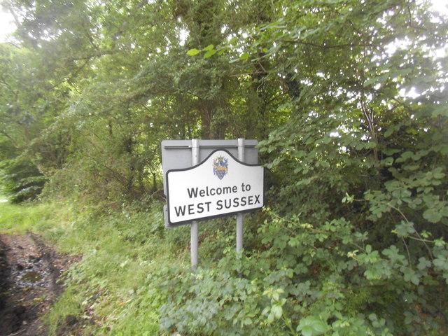
Shillinglee is a picturesque village located in the county of Sussex, England. Situated amidst the stunning countryside, it is a place of natural beauty and tranquility. The village is part of the Chichester district and lies approximately 15 miles south-west of the historic city of Guildford.

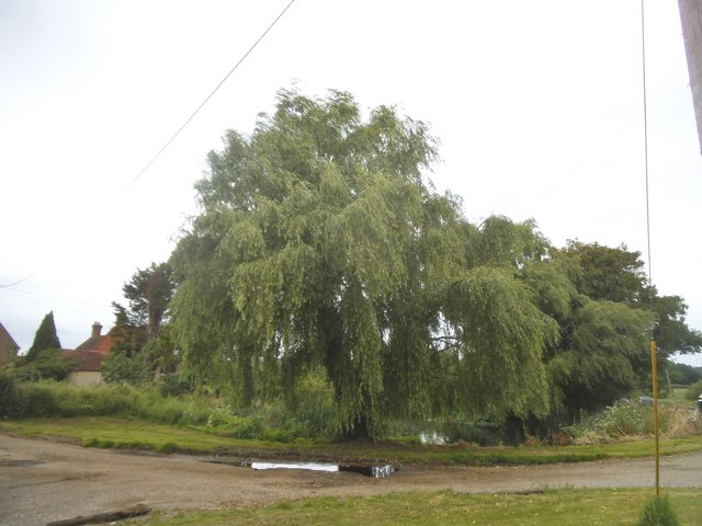
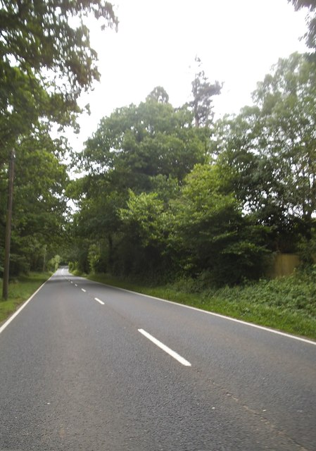
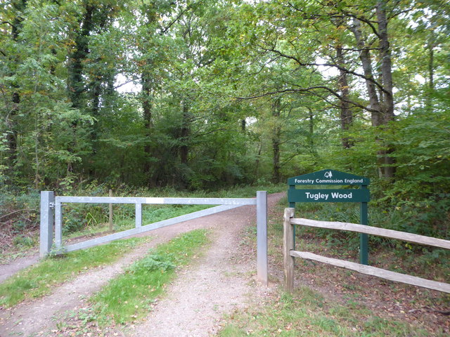
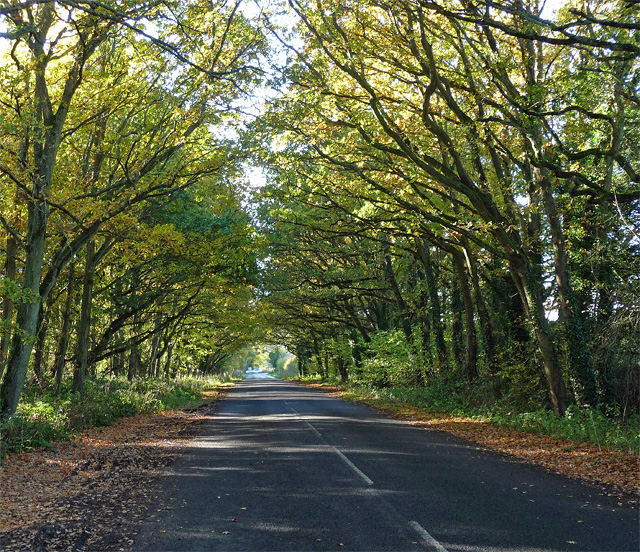
Shillinglee is renowned for its stunning landscapes and idyllic surroundings. Nestled in the heart of the South Downs National Park, it offers a perfect escape from the hustle and bustle of city life. The area is characterized by rolling hills, lush green fields, and dense woodlands, making it a haven for nature lovers and outdoor enthusiasts.

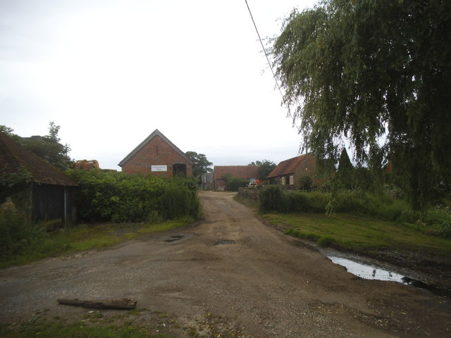
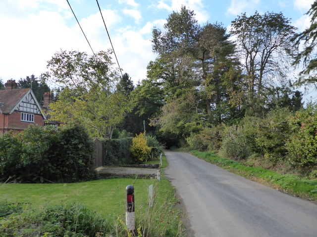
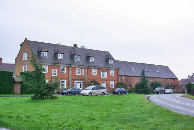
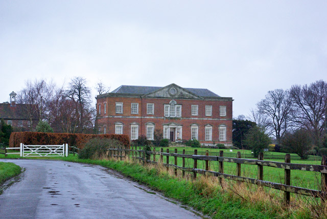
The village itself is small, with a population of around 200 residents. It exudes a charming and peaceful atmosphere, with traditional cottages and historic buildings dotting the landscape. Shillinglee is also home to a beautiful 17th-century manor house, which adds to the village's historic charm.

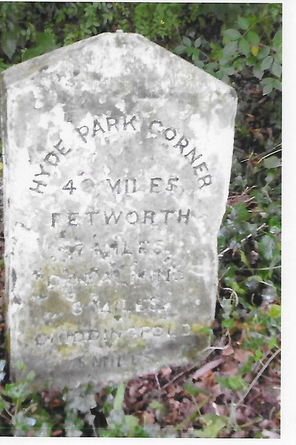
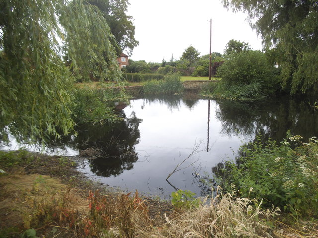
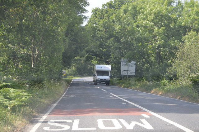
The surrounding area offers plenty of recreational activities, including hiking, cycling, and horse riding. The nearby Shillinglee Lake is a popular spot for fishing and boating enthusiasts. The village is also close to several other notable attractions, such as the historic town of Petworth, with its grand Petworth House and Park, and the picturesque village of Chiddingfold.

Overall, Shillinglee is a hidden gem in Sussex, offering a peaceful retreat and an abundance of natural beauty. Whether for a day trip or a longer stay, visitors to Shillinglee will find themselves immersed in the tranquility and charm of this delightful village.

If you have any feedback on the listing, please let us know in the comments section below.
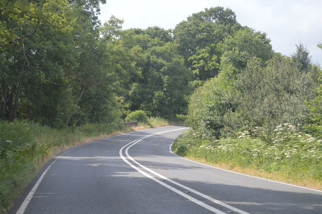
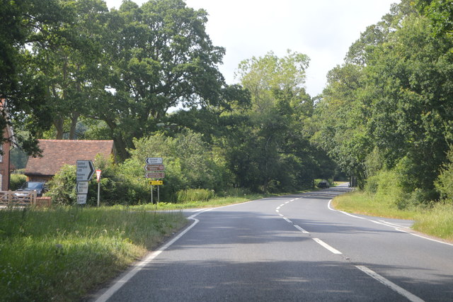
Shillinglee Images

Images are sourced within 2km of 51.080701/-0.6237162 or Grid Reference SU9632. Thanks to Geograph Open Source API. All images are credited.

Old Milestone, A283, Cripplecrutch Hill, Ramsnest Common The milestone, is located 270 m south of the Mulberry Inn on the North West side of the road in the bushes at the back of the verge. Parish of Chiddingfold (Waverley District).  Carved stone post, Petworth stone design, erected by the Petworth turnpike trust in the 18th century.

Inscription reads:-   HYDE PARK CORNER / 40 MILES / PETWORTH / 7 MILES / GODALMING / 8 MILES / CHIDDINGFOLD / 2 MILES

Milestone Society National ID: SY_LMP40
Old Milestone, A283, Cripplecrutch Hill, Ramsnest Common
The milestone, is located 270 m south of the Mulberry Inn on the North West side of the road in the bushes at the back of the verge. Parish of Chiddingfold (Waverley District). Carved stone post, Petworth stone design, erected by the Petworth turnpike trust in the 18th century. Inscription reads:- HYDE PARK CORNER / 40 MILES / PETWORTH / 7 MILES / GODALMING / 8 MILES / CHIDDINGFOLD / 2 MILES Milestone Society National ID: SY_LMP40
Fisherstreet Farm
Fisherstreet Farm
Pond by the A283, Fisherstreet
Willow tree by the A283, Fisherstreet
Cripplecrutch Hill, Ramsnest Common
Where am I? Cripplecrutch Hill, Ramsnest Common
Where am I?
Cripplecrutch Hill, Ramsnest Common
The entrance to Ramster Garden
Petworth Road, Ramsnest Common
Exploring eastwards  along the Bashire (4) Looking west-northwest along Killinghurst Lane
Running total: 23 B points
Exploring eastwards along the Bashire (4)
Looking west-northwest along Killinghurst Lane Running total: 23 B points
Exploring eastwards along the Bashire (6) Looking from Shillinglee Park Road into Pickhurst Road
Running total: 25 B points
Exploring eastwards along the Bashire (6)
Looking from Shillinglee Park Road into Pickhurst Road Running total: 25 B points
Exploring eastwards along the Bashire (7) Footpath sign opposite Robin Farm Racing Stables
Exploring eastwards along the Bashire (7)
Footpath sign opposite Robin Farm Racing Stables
Exploring eastwards along the Bashire (8) Entrance to Tugley Wood
Running total: 27 B points
Exploring eastwards along the Bashire (8)
Entrance to Tugley Wood Running total: 27 B points
Shillinglee Road near Fisherstreet Minor road heading for the A283 through a canopy of oaks.
Shillinglee Road near Fisherstreet
Minor road heading for the A283 through a canopy of oaks.
Converted stables and barn, Shillinglee Early 18th century, grade II listed.
Converted stables and barn, Shillinglee
Early 18th century, grade II listed.
House, Shillinglee Park A grade II*(star) listed building from 1735 and 1770s. Gutted by fire 1943, restored and converted to flats in the 1970s.
House, Shillinglee Park
A grade II*(star) listed building from 1735 and 1770s. Gutted by fire 1943, restored and converted to flats in the 1970s.
A283, northbound The A283 runs 37 miles from Milford near Guildford south to Shoreham-on-Sea across rural Surrey and West Sussex.
<span class="nowrap"><a title="https://www.sabre-roads.org.uk/wiki/index.php?title=A283" rel="nofollow ugc noopener" href="https://www.sabre-roads.org.uk/wiki/index.php?title=A283">Link</a><img style="margin-left:2px;" alt="External link" title="External link - shift click to open in new window" src="https://s1.geograph.org.uk/img/external.png" width="10" height="10"/></span>
A283, northbound
The A283 runs 37 miles from Milford near Guildford south to Shoreham-on-Sea across rural Surrey and West Sussex. LinkExternal link
Sweeping curve, A283 The A283 runs 37 miles from Milford near Guildford south to Shoreham-on-Sea across rural Surrey and West Sussex.
<span class="nowrap"><a title="https://www.sabre-roads.org.uk/wiki/index.php?title=A283" rel="nofollow ugc noopener" href="https://www.sabre-roads.org.uk/wiki/index.php?title=A283">Link</a><img style="margin-left:2px;" alt="External link" title="External link - shift click to open in new window" src="https://s1.geograph.org.uk/img/external.png" width="10" height="10"/></span>
Sweeping curve, A283
The A283 runs 37 miles from Milford near Guildford south to Shoreham-on-Sea across rural Surrey and West Sussex. LinkExternal link
A283, northbound The A283 runs 37 miles from Milford near Guildford south to Shoreham-on-Sea across rural Surrey and West Sussex.
<span class="nowrap"><a title="https://www.sabre-roads.org.uk/wiki/index.php?title=A283" rel="nofollow ugc noopener" href="https://www.sabre-roads.org.uk/wiki/index.php?title=A283">Link</a><img style="margin-left:2px;" alt="External link" title="External link - shift click to open in new window" src="https://s1.geograph.org.uk/img/external.png" width="10" height="10"/></span>
A283, northbound
The A283 runs 37 miles from Milford near Guildford south to Shoreham-on-Sea across rural Surrey and West Sussex. LinkExternal link
Show me another place!

Shillinglee is located at Grid Ref: SU9632 (Lat: 51.080701, Lng: -0.6237162)

Administrative County: West Sussex

District: Chichester

Police Authority: Sussex

What 3 Words

///legend.riverboat.fussed. Near Chiddingfold, Surrey

Related Wikis

Shillinglee

Shillinglee is an 18th-century house and estate in West Sussex, England near the Surrey border, in between the villages of Chiddingfold and Plaistow. It...

Shillinglee Lake

Shillinglee Lake is a 17-hectare (42-acre) biological Site of Special Scientific Interest west of Plaistow in West Sussex.The lake has been designated...

The Farm (recording studio)

The Farm (also known as Fisher Lane Farm) was a recording studio in Chiddingfold, Surrey owned by the rock band Genesis. The group bought the property...

Pickhurst

Pickhurst is a grade II* listed house set in 130 acres (53 ha) of land near Chiddingfold, Surrey, England. == History == It was designed by the Scottish...

Ramster

Ramster Garden is an open garden, near Chiddingfold, Surrey, covering over 20 acres (81,000 m2). First landscaped and laid out in the 1890s by Gauntlett...

Ramsnest Common

Ramsnest Common is a hamlet in the far south of the Borough of Waverley, the largest district of Surrey, England centred on the A283 1.5 miles (2.4 km...

Northchapel

Northchapel is a village and civil parish in Chichester District in West Sussex, England. It stands on the A283 road just south of the Surrey border, around...

Netherside Stream Outcrops

Netherside Stream Outcrops is a 2.9-hectare (7.2-acre) geological Site of Special Scientific Interest north-east of Haslemere in Surrey. It is a Geological...

Nearby Amenities

Located within 500m of 51.080701,-0.6237162
Bus Stop
Upper North Pond
Naptan AtcoCode: 4400HR0894
Naptan Bearing: W
Naptan BusStopType: CUS
Naptan CommonName: Upper North Pond
Naptan Indicator: opp
Naptan Landmark: Hail & Ride
Naptan NaptanCode: wsxgagtg
Naptan Street: Shillinglee Road
Naptan Verified: no
Source: naptan_import
Lat/Long: 51.0810302/-0.6284583
Shillinglee Road
Naptan AtcoCode: 4400HR0895
Naptan Bearing: E
Naptan BusStopType: CUS
Naptan CommonName: Shillinglee Road
Naptan Indicator: HAR
Naptan Landmark: Hail & Ride
Naptan NaptanCode: wsxgagtj
Naptan Street: Shillinglee Road
Naptan Verified: no
Source: naptan_import
Lat/Long: 51.0788451/-0.6223556
Shillinglee Road
Naptan AtcoCode: 4400HR0896
Naptan Bearing: W
Naptan BusStopType: CUS
Naptan CommonName: Shillinglee Road
Naptan Indicator: HAR
Naptan Landmark: Hail & Ride
Naptan NaptanCode: wsxgagtm
Naptan Street: Shillinglee Road
Naptan Verified: no
Source: naptan_import
Lat/Long: 51.0787823/-0.6223717
Bus Stop
Upper North Pond
Naptan AtcoCode: 4400HR893
Naptan Bearing: E
Naptan BusStopType: CUS
Naptan CommonName: Upper North Pond
Naptan Indicator: opp
Naptan Landmark: Hail & Ride
Naptan NaptanCode: wsxgagtd
Naptan Street: Shillinglee Road
Naptan Verified: no
Source: naptan_import
Lat/Long: 51.0811026/-0.628499
Shillinglee
Is In: Sussex,England,UK
Place: hamlet
Lat/Long: 51.0805111/-0.622631
Barrier: stile
Lat/Long: 51.0846647/-0.6213371
Post Box
Post Box Type: wall
Ref: GU8 99
Royal Cypher: EIIR
Royal Cypher Wikidata: Q33102113
Lat/Long: 51.0804427/-0.6235552
The data included in this document is from www.openstreetmap.org. The data is made available under ODbL.

Have you been to Shillinglee?

Leave your review of Shillinglee below (or comments, questions and feedback).