Sgarasta

Settlement in Inverness-shire

Scotland

Sgarasta

Isle of Harris Golf Club Looking south-west over the course with Scarista beach beyond.
Isle of Harris Golf Club Credit: Richard Dorrell

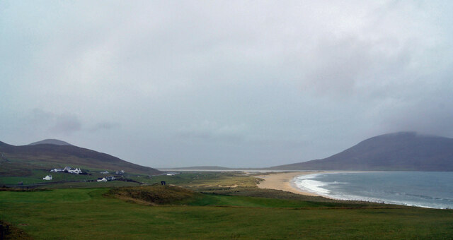
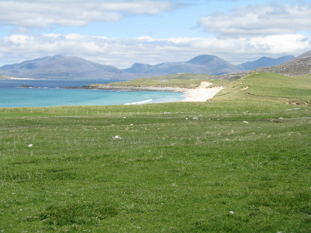
Sgarasta is a small village located in the Scottish Highlands, specifically in the county of Inverness-shire. Situated on the western coast of Scotland, it overlooks the picturesque Isle of Skye and offers stunning views of the surrounding landscape.

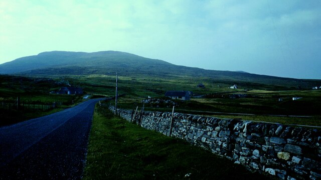
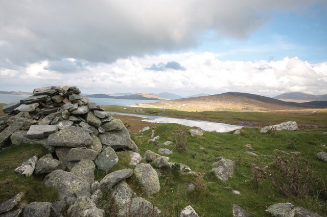
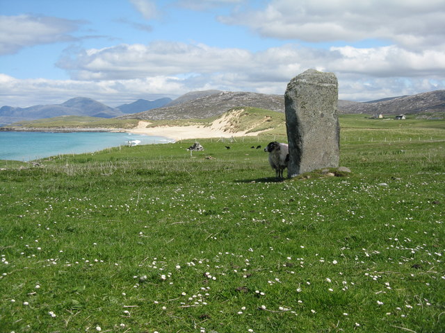
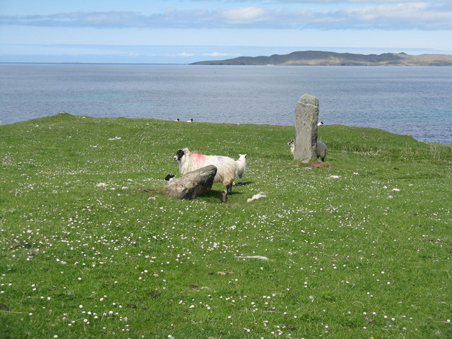
Despite its small size, Sgarasta is known for its natural beauty and tranquility. The village is surrounded by rolling hills, vast moorlands, and an abundance of wildlife. Visitors often come to explore the area's numerous hiking trails, which lead to breathtaking viewpoints and secluded beaches.

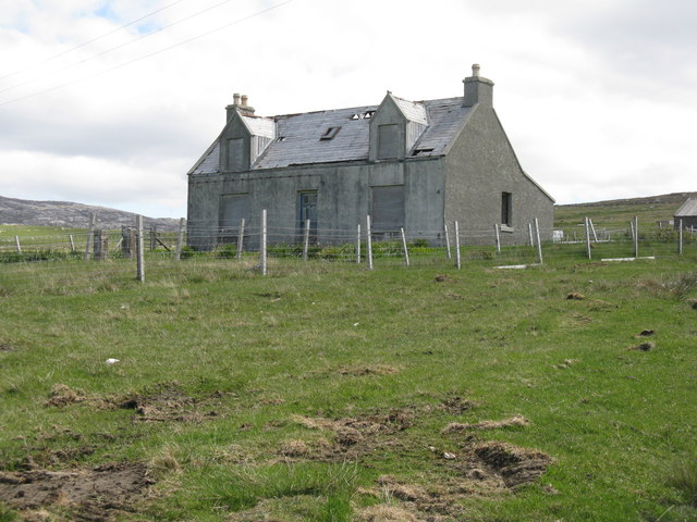
The village itself is characterized by charming stone cottages, some of which date back several centuries. Its close-knit community is friendly and welcoming, offering a glimpse into traditional Scottish culture. Sgarasta also boasts a small but cozy pub, where locals and visitors can gather for a pint and enjoy the lively atmosphere.

For those interested in history, Sgarasta is located near several archaeological sites, including ancient burial grounds and ruined castles. The nearby town of Portree offers additional amenities, including shops, restaurants, and accommodations.

Sgarasta's location makes it an ideal base for exploring the wider Highlands region. Visitors can easily access attractions such as the famous Loch Ness, the Isle of Skye, and the Cairngorms National Park.

In summary, Sgarasta is a charming village in Inverness-shire, Scotland, offering stunning natural scenery, a friendly community, and easy access to a wealth of historic and natural attractions.

If you have any feedback on the listing, please let us know in the comments section below.
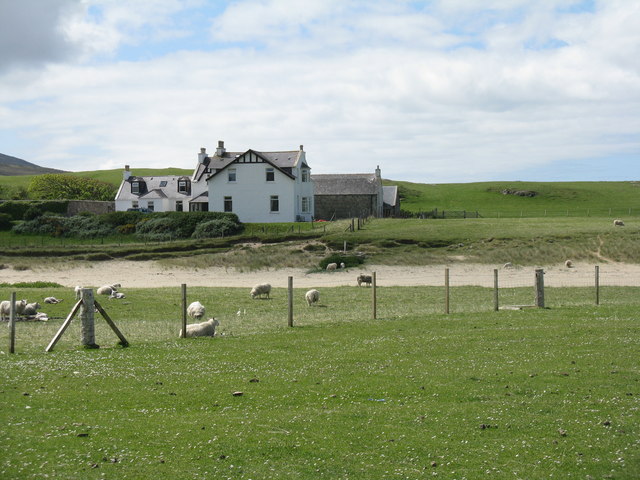
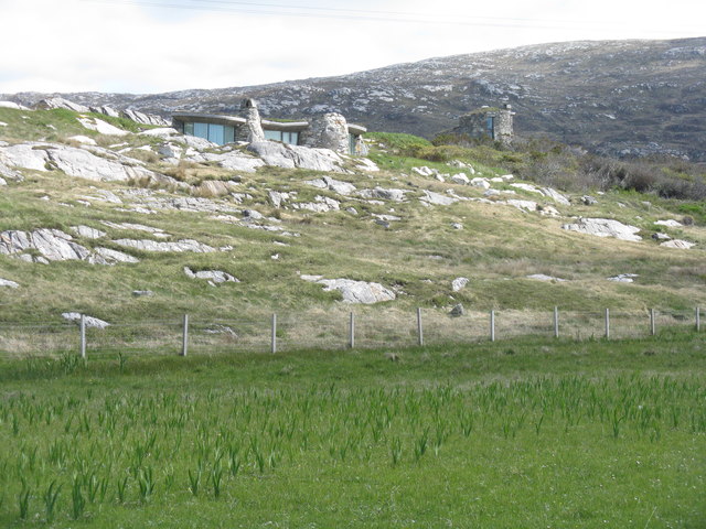
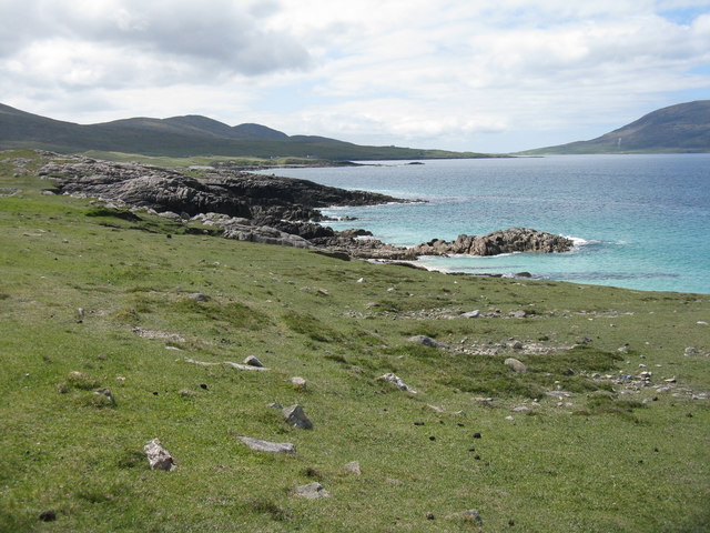
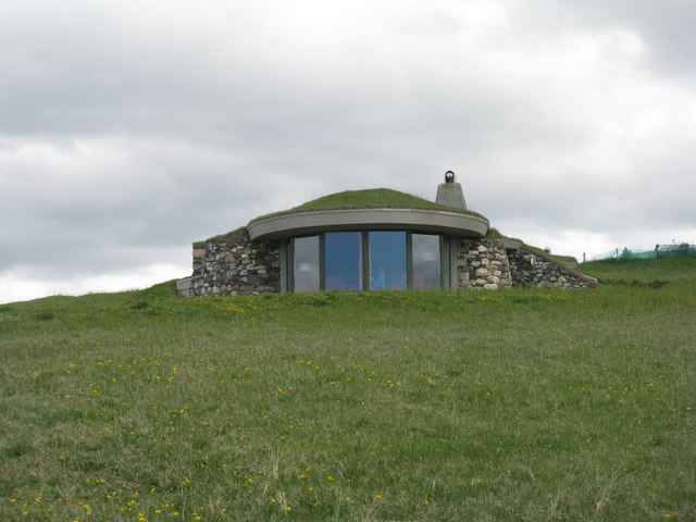
Sgarasta Images

Images are sourced within 2km of 57.836676/-7.0124895 or Grid Reference NG0294. Thanks to Geograph Open Source API. All images are credited.

Isle of Harris Golf Club Looking south-west over the course with Scarista beach beyond.
Isle of Harris Golf Club
Looking south-west over the course with Scarista beach beyond.
Groundworks for a New House at Scarasta
Borvemore in 1981
Borvemore in 1981
Borve Dun from the South The summit cairn of Borve Dun with the township of Borve in the middle distance and Taransay beyond
Borve Dun from the South
The summit cairn of Borve Dun with the township of Borve in the middle distance and Taransay beyond
Golfing on Harris Whatever next? The waltz?
Golfing on Harris
Whatever next? The waltz?
A view from Scarasta Looking north east to Taransay and Luskentyre.
A view from Scarasta
Looking north east to Taransay and Luskentyre.
Remains of stone circle at Sgarista/Sgarasta Looking northeast to Tràigh Scarasta and the hills of Harris beyond <a href="https://www.geograph.org.uk/photo/4992918">NG0293 : Clach Steineagaidh Standing Stone</a>.
Remains of stone circle at Sgarista/Sgarasta
Looking northeast to Tràigh Scarasta and the hills of Harris beyond NG0293 : Clach Steineagaidh Standing Stone.
Standing stone at Scarasta Looking northwards across the Sound of Taransay to Taransay <a href="https://www.geograph.org.uk/photo/4992918">NG0293 : Clach Steineagaidh Standing Stone</a>.
Standing stone at Scarasta
Looking northwards across the Sound of Taransay to Taransay NG0293 : Clach Steineagaidh Standing Stone.
Clach Steineagaidh Standing Stone Information about the stone <a href="https://www.geograph.org.uk/photo/4992884">NG0293 : Remains of stone circle at Sgarista/Sgarasta</a>, which is part of what was once a much larger complex, with an impression of what the site might have looked like about 5000 BP, in the Neolithic or early Bronze Age.
Clach Steineagaidh Standing Stone
Information about the stone NG0293 : Remains of stone circle at Sgarista/Sgarasta, which is part of what was once a much larger complex, with an impression of what the site might have looked like about 5000 BP, in the Neolithic or early Bronze Age.
Empty house at Sgarasta A frequent sight on the islands.
Empty house at Sgarasta
A frequent sight on the islands.
Borve Lodge Part of the Borve Estate. Looking over the outflow burn from Loch Bhuirgh.
Borve Lodge
Part of the Borve Estate. Looking over the outflow burn from Loch Bhuirgh.
Modern 'stone age' houses at Borve Two interesting houses that fit in well with the natural landscape.
Modern 'stone age' houses at Borve
Two interesting houses that fit in well with the natural landscape.
Harris coast near Na Buirgh Looking southwest towards Sgarasta.
Harris coast near Na Buirgh
Looking southwest towards Sgarasta.
House on a hillside One of the Blue Reef Cottages, available as holiday accommodation, with a fine view over the coast at Sgarasta.
House on a hillside
One of the Blue Reef Cottages, available as holiday accommodation, with a fine view over the coast at Sgarasta.
The Isle of Harris Golf Club Overlooking Tràigh Sgarasta, with Ceapabhal across the bay.
The Isle of Harris Golf Club
Overlooking Tràigh Sgarasta, with Ceapabhal across the bay.
Òran na Mara Luxury holiday accommodation at Sgarasta Mhòr.
Òran na Mara
Luxury holiday accommodation at Sgarasta Mhòr.
Òran na Mara  Luxury holiday accommodation at Sgarasta Mhòr.
Òran na Mara
Luxury holiday accommodation at Sgarasta Mhòr.
Sgarasta Post Office
Show me another place!

Sgarasta is located at Grid Ref: NG0294 (Lat: 57.836676, Lng: -7.0124895)

Unitary Authority: Na h-Eileanan an Iar

Police Authority: Highlands and Islands

Also known as: Scarista

What 3 Words

///edicts.twinkled.transcribes. Near Leverburgh, Na h-Eileanan Siar

Related Wikis

Borve, Harris

Borve (Scottish Gaelic: Na Buirgh) is a village in Harris in the Outer Hebrides, Scotland. Borve is also within the parish of Harris, and is on the A859...

1990 Scotland RAF Shackleton crash

On 30 April 1990, a Royal Air Force Avro Shackleton AEW Mk II aircraft, of No. 8 Squadron RAF, based at RAF Lossiemouth, crashed into a hill on the Isle...

Luskentyre

Luskentyre (Scottish Gaelic: Losgaintir) is a sparse settlement on the west coast of Harris, in the Outer Hebrides, Scotland. Luskentyre is situated within...

Taransay

Taransay (Scottish Gaelic: Tarasaigh, pronounced [ˈt̪ʰaɾas̪aj]) is an island in the Outer Hebrides of Scotland. It was the host of the British television...

Leverburgh

Leverburgh (Scottish Gaelic: An t-Òb [ən̪ˠ ˈt̪ɔːp]) is the second largest village, after Tarbert, in Harris in the Outer Hebrides of Scotland. Leverburgh...

Roineabhal

Roineabhal is a hill in Harris, in the Western Isles of Scotland. The granite on the summit plateau of the mountain is anorthosite, and is similar in composition...

Outer Hebrides

The Outer Hebrides ( HEB-rid-eez) or Western Isles (Scottish Gaelic: na h-Eileanan Siar [nə ˈhelanən ˈʃiəɾ] , na h-Eileanan an Iar [nə ˈhelanən əɲ ˈiəɾ...

Ensay (Outer Hebrides)

Ensay (Gaelic Easaigh) is a currently unpopulated and privately owned island in the Outer Hebrides of Scotland. The island lies in the Sound of Harris...

Nearby Amenities

Located within 500m of 57.836676,-7.0124895
Bus Stop
Scarista
Naptan AtcoCode: 6010731797
Naptan Bearing: W
Naptan CommonName: Scarista
Naptan Indicator: Scarista
Naptan Landmark: Scarista
Naptan NaptanCode: 94723648
Naptan Street: Scarista
Naptan Verified: no
Source: naptan_import
Lat/Long: 57.8350782/-7.0186634
Telephone
Booth: K6
Covered: booth
Note: half-width doors have been replaced with a normal door
Operator: BT
Phone: +44 1859 550273
Source: survey
Lat/Long: 57.8365085/-7.0123242
Post Box
Collection Times: Mo-Fr 09:00; Sa 09:00
Operator: Royal Mail
Operator Wikidata: Q638098
Post Box Mounting: pier
Post Box Type: lamp
Ref: HS3 134
Royal Cypher: scottish_crown
Source: survey
Lat/Long: 57.8366081/-7.0123854
Gasker House
Facebook: https://www.facebook.com/Gaskerhouse/
Tourism: apartment
Website: http://www.gaskerhouse.co.uk/
Lat/Long: 57.8389406/-7.008462
Borvemor Cottages
Tourism: apartment
Website: https://www.borvemorcottages.co.uk/
Lat/Long: 57.8380868/-7.0103127
Turning Circle
Lat/Long: 57.8384824/-7.0078464
Barrier: cattle_grid
Lat/Long: 57.8390121/-7.0083028
Barrier: cattle_grid
Lat/Long: 57.8372152/-7.0110685
Barrier: cattle_grid
Lat/Long: 57.8356522/-7.0162374
Barrier: cattle_grid
Lat/Long: 57.8348403/-7.018887
Material: wood
Power: pole
Lat/Long: 57.8346932/-7.0181246
Material: wood
Power: pole
Lat/Long: 57.8350757/-7.0165791
Material: wood
Power: pole
Lat/Long: 57.8354903/-7.0149537
Material: wood
Power: pole
Lat/Long: 57.8355726/-7.0137278
Material: wood
Power: pole
Lat/Long: 57.8359238/-7.013213
Material: wood
Power: pole
Lat/Long: 57.8363986/-7.0115057
Material: wood
Power: pole
Lat/Long: 57.836779/-7.0102437
Material: wood
Power: pole
Lat/Long: 57.8371075/-7.0092781
Material: wood
Power: pole
Lat/Long: 57.8382005/-7.0081677
Material: wood
Power: pole
Lat/Long: 57.8385795/-7.0074555
Material: wood
Power: pole
Lat/Long: 57.8354539/-7.0166032
Material: wood
Power: pole
Lat/Long: 57.8352241/-7.0171221
Material: wood
Power: pole
Lat/Long: 57.8360023/-7.0131499
Material: wood
Power: pole
Lat/Long: 57.8349861/-7.0176658
Material: wood
Power: pole
Lat/Long: 57.8347667/-7.0181775
Material: wood
Power: pole
Lat/Long: 57.8367436/-7.0117079
Material: wood
Power: pole
Lat/Long: 57.8369071/-7.0109824
Barrier: cattle_grid
Lat/Long: 57.8381312/-7.0099862
Barrier: cattle_grid
Lat/Long: 57.8375314/-7.0104839
Material: wood
Power: pole
Lat/Long: 57.8393148/-7.0069988
Material: wood
Power: pole
Lat/Long: 57.8379413/-7.0096542
Material: wood
Power: pole
Lat/Long: 57.8390378/-7.0073072
Material: wood
Power: pole
Lat/Long: 57.8400433/-7.0069588
Material: wood
Power: pole
Lat/Long: 57.8396902/-7.0065716
Material: wood
Power: pole
Lat/Long: 57.8392659/-7.0082055
Power: pole
Lat/Long: 57.839304/-7.0075816
Power: pole
Lat/Long: 57.8344734/-7.0187343
Power: pole
Lat/Long: 57.837853/-7.008924
Power: pole
Lat/Long: 57.8403672/-7.0076574
Power: pole
Lat/Long: 57.8365082/-7.0121753
Power: pole
Lat/Long: 57.8362533/-7.0126513
Power: pole
Lat/Long: 57.8346269/-7.0186076
Power: pole
Lat/Long: 57.8361226/-7.0124063
The data included in this document is from www.openstreetmap.org. The data is made available under ODbL.

Have you been to Sgarasta?

Leave your review of Sgarasta below (or comments, questions and feedback).