Saham Waite

Settlement in Norfolk Breckland

England

Saham Waite

Bradenham: 'Rose Hill'
Bradenham: 'Rose Hill' Credit: Michael Garlick

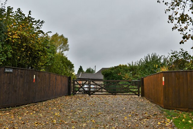
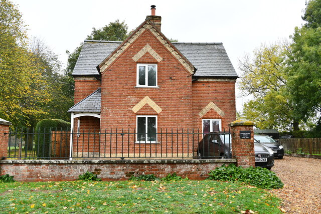
Saham Waite is a small village located in the county of Norfolk, England. Situated approximately 10 miles east of the market town of Thetford, it falls within the district of Breckland. With a population of around 600 residents, Saham Waite is known for its quaint and peaceful atmosphere.

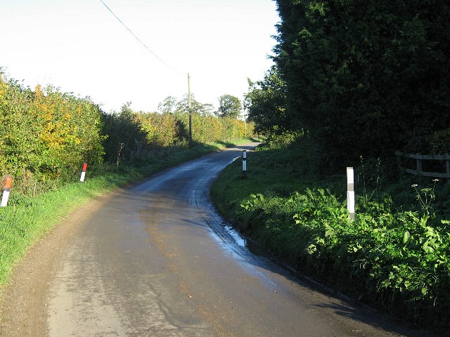
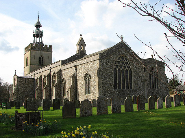
The village is surrounded by picturesque countryside, offering stunning views and a tranquil environment. It is characterized by its traditional English architecture, with many houses dating back to the 18th and 19th centuries. The village is home to a charming church, St. George's, which was built in the 14th century and is a popular landmark for visitors.

Despite its small size, Saham Waite has a strong sense of community, with various local organizations and activities bringing residents together. The village has a primary school, providing education for children in the area. There are also a few local amenities, including a village hall and a pub, where locals can socialize and enjoy a drink or meal.

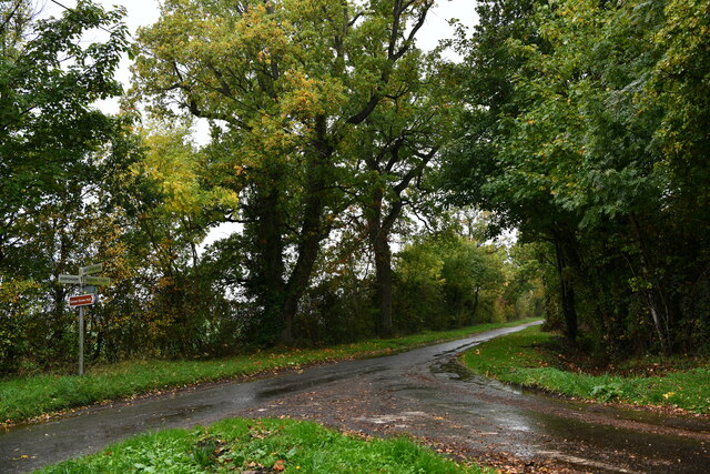
The surrounding area offers plenty of opportunities for outdoor activities, with numerous walking and cycling routes nearby. The village is also conveniently located for those who wish to explore further afield, with good transport links to nearby towns and cities.

Overall, Saham Waite offers a peaceful and idyllic setting, making it an appealing place for those seeking a slower-paced lifestyle and a strong sense of community.

If you have any feedback on the listing, please let us know in the comments section below.

Saham Waite Images

Images are sourced within 2km of 52.619254/0.83884783 or Grid Reference TF9206. Thanks to Geograph Open Source API. All images are credited.

Bradenham: 'Rose Hill'
Bradenham: 'The Lodge'
Bradenham: The High Green/ Mill Lane junction
A Glimpse of Norfolk Near Saham Hills.
A Glimpse of Norfolk
Near Saham Hills.
High Farm, Bradenham Seen from the permissive footpaths around the Grazing Grounds.
High Farm, Bradenham
Seen from the permissive footpaths around the Grazing Grounds.
Parish Walks map, Bradenham One set of an increasing number of permissive paths - not rights-of-way but paths designated by the landowner as available for public use. The sign not only maps the routes but also describes Pooley's Lane (a traditional green lane, probably used for driving sheep to the Grazing Grounds), and old hedges which include pollards, often used as parish boundary markers.
Parish Walks map, Bradenham
One set of an increasing number of permissive paths - not rights-of-way but paths designated by the landowner as available for public use. The sign not only maps the routes but also describes Pooley's Lane (a traditional green lane, probably used for driving sheep to the Grazing Grounds), and old hedges which include pollards, often used as parish boundary markers.
Blackcurrants, Bradenham This area has a small concentration of fields growing blackcurrants - most of which go to make Ribena.
Blackcurrants, Bradenham
This area has a small concentration of fields growing blackcurrants - most of which go to make Ribena.
Grazing Grounds, Bradenham The Grazing Grounds field pattern can be seen on the map as an early example of 19th century enclosures.
Grazing Grounds, Bradenham
The Grazing Grounds field pattern can be seen on the map as an early example of 19th century enclosures.
High Grove, Bradenham
The Road To Shipdham From Saham Hills.
The Road To Shipdham
From Saham Hills.
A Public Path Signposted as a Public Path, rather than as a Public Footpath, the Right of Way in the photograph runs only a short distance between Waite Farm (shown on some older maps as Weight Farm) and Quidney Farm.
A Public Path
Signposted as a Public Path, rather than as a Public Footpath, the Right of Way in the photograph runs only a short distance between Waite Farm (shown on some older maps as Weight Farm) and Quidney Farm.
The Road To Bradenham From Saham Hills; part of Route 13 of the National Cycle Network.
The Road To Bradenham
From Saham Hills; part of Route 13 of the National Cycle Network.
Turn Left For Route 13 A turning towards High Green on the National Cycle Network between Saham Hills and Shipdham.
Turn Left For Route 13
A turning towards High Green on the National Cycle Network between Saham Hills and Shipdham.
A Bridleway To Bradenham From High Green.
A Bridleway To Bradenham
From High Green.
Approaching Quidney Farm From Ashill Common. At one time, Quidney Farm was known as Grounds Farm. Even earlier, there was a Roman Villa in the field on the left of the photograph.
Approaching Quidney Farm
From Ashill Common. At one time, Quidney Farm was known as Grounds Farm. Even earlier, there was a Roman Villa in the field on the left of the photograph.
Autumnal Hues Between Saham Hills and Shipdham.
Autumnal Hues
Between Saham Hills and Shipdham.
A Cycle Route The Sustrans route to Bradenham. Sustrans is the organisation behind the National Cycle Network, frequently, as in this case, following country roads.
A Cycle Route
The Sustrans route to Bradenham. Sustrans is the organisation behind the National Cycle Network, frequently, as in this case, following country roads.
Approaching Waite Farm Cottages Between Saham Hills and Shipdham.
Approaching Waite Farm Cottages
Between Saham Hills and Shipdham.
Show me another place!

Saham Waite is located at Grid Ref: TF9206 (Lat: 52.619254, Lng: 0.83884783)

Administrative County: Norfolk

District: Breckland

Police Authority: Norfolk

What 3 Words

///pumps.fumes.equipping. Near Shipdham, Norfolk

Nearby Locations

Saham Waite

Related Wikis

Bradenham, Norfolk

Bradenham is a village and civil parish, a conglomeration of East and West Bradenham, in the English county of Norfolk. It is situated some 5 miles (8...

St Mary's Church, East Bradenham

St Mary's Church, East Bradenham, is a redundant Anglican church in the village of Bradenham, Norfolk, England. It is recorded in the National Heritage...

Ovington, Norfolk

Ovington is a civil parish in the English county of Norfolk. It covers an area of 6.44 km2 (2.49 sq mi) and had a population of 239 in 92 households at...

Shipdham

Shipdham is a village and civil parish in the Breckland district, in Norfolk, England, approximately 5 miles (8.0 km) south-south-west of Dereham. In...

Holme Hale

Holme Hale is a village situated in the Breckland District of Norfolk and covers an area of 1069 hectares (4.13 square miles) with an estimated population...

Old Manor, Saham Toney

The Old Manor is a Grade II listed building, which stands in Pages Lane/Page's Place in the Norfolk village of Saham Toney. The building was owned by...

Ashill, Norfolk

Ashill (pronounced Ash- ill ) is a village and civil parish in the English county of Norfolk. The village is between Watton and Swaffham. == Parish... ==

Holme Hale railway station

Holme Hale railway station was located in Holme Hale, Norfolk, near Swaffham. It was on the Great Eastern Railway line between Swaffham and Thetford, and...

Nearby Amenities

Located within 500m of 52.619254,0.83884783
Post Box
Collection Times: Mo-Fr 09:00; Sa 09:00
Post Box Mounting: pier
Post Box Type: lamp
Ref: IP25 3244
Royal Cypher: EIIR
Royal Cypher Wikidata: Q33102113
Lat/Long: 52.6209299/0.844742
Pipeline: marker
Substance: gas
Lat/Long: 52.6206745/0.84278
The data included in this document is from www.openstreetmap.org. The data is made available under ODbL.

Have you been to Saham Waite?

Leave your review of Saham Waite below (or comments, questions and feedback).