Roborough Down

Settlement in Devon West Devon

England

Roborough Down

Yelverton Tennis Club
Yelverton Tennis Club Credit: David Smith

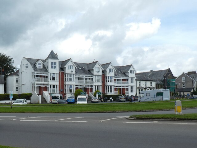
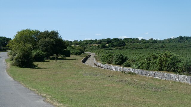
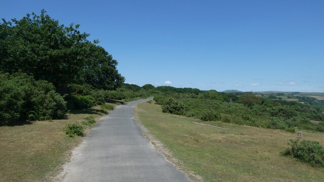
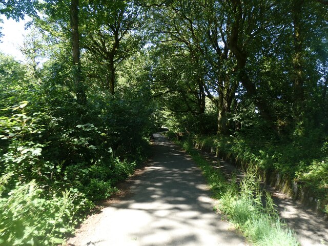
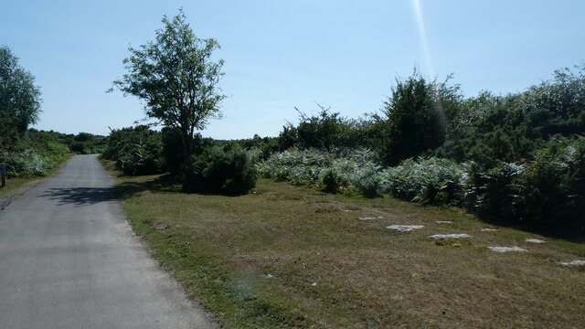
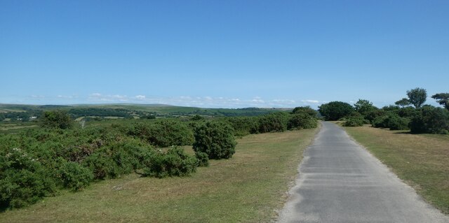
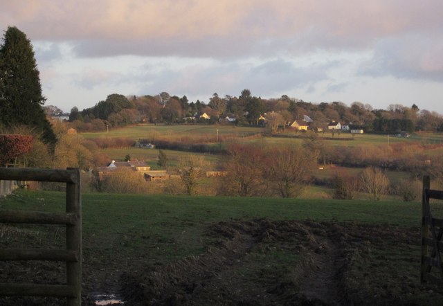
Roborough Down is a scenic area located in the county of Devon, England. Situated approximately 6 miles to the north of the city of Plymouth, this vast expanse of open land covers an area of about 400 hectares. It is characterized by rolling hills, heathland, and pockets of woodland, all of which contribute to its natural beauty and appeal.

The Down is managed by the National Trust and offers visitors a range of recreational activities and opportunities to explore its diverse landscape. Hiking enthusiasts can enjoy various trails that crisscross the area, providing stunning views of the surrounding countryside. The Down is also a popular spot for picnics, with designated areas offering peaceful settings for outdoor gatherings.

Flora and fauna thrive in this habitat, with heather, gorse, and grasses dominating the landscape. Birdwatchers will be delighted by the presence of various avian species, including skylarks, stonechats, and meadow pipits. The area is also home to small mammals such as rabbits and voles.

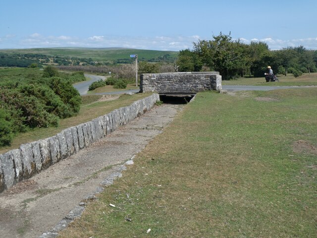
Roborough Down holds historical significance, as it was once the site of an Iron Age hillfort. Visitors can still see remnants of the fort's earthworks and gain insight into the region's ancient past.

Overall, Roborough Down in Devon is a haven for nature lovers, history enthusiasts, and those seeking tranquility amidst breathtaking scenery. Its accessibility and range of activities make it a popular destination for locals and tourists alike.

If you have any feedback on the listing, please let us know in the comments section below.

Roborough Down Images

Images are sourced within 2km of 50.477206/-4.0967763 or Grid Reference SX5166. Thanks to Geograph Open Source API. All images are credited.

Yelverton Tennis Club
Terraced building in Yelverton, now a bar and restaurant
Board describing RAF Harrowbeer, a WW2 airfield A detailed picture is at <a href="https://www.geograph.org.uk/photo/6157158">SX5167 : RAF Harrowbeer: a tour of a WW2 airfield (1)</a>
Board describing RAF Harrowbeer, a WW2 airfield
Old Tramway Milestone, Clearbrook On the Western side of the Drakes Trail which follows the old Plymouth Tramway at this point. The stone marks 13 miles to Plymouth.

Inscription: not visible
Old Tramway Milestone, Clearbrook
On the Western side of the Drakes Trail which follows the old Plymouth Tramway at this point. The stone marks 13 miles to Plymouth. Inscription: not visible
The Skylark inn, Clearbrook National Cycle Network Route 27 is a 99 miles long route between Ilfracombe and Plymouth, of which 71 miles are traffic-free. The route combines the beaches and estuaries of North Devon with the lush green valleys of the Torridge, the Tavy, the Walkham and other evocative West Country rivers. The route also skirts round the western flank of Dartmoor offering superb views of Cornwall and the surrounding area. There is also many local links and spurs to explore. Largely tracing the course of former railway lines, the route takes you through tunnels and across the breathtaking viaducts and bridges bequeathed by Victorian railway engineers.
The Skylark inn, Clearbrook
National Cycle Network Route 27 is a 99 miles long route between Ilfracombe and Plymouth, of which 71 miles are traffic-free. The route combines the beaches and estuaries of North Devon with the lush green valleys of the Torridge, the Tavy, the Walkham and other evocative West Country rivers. The route also skirts round the western flank of Dartmoor offering superb views of Cornwall and the surrounding area. There is also many local links and spurs to explore. Largely tracing the course of former railway lines, the route takes you through tunnels and across the breathtaking viaducts and bridges bequeathed by Victorian railway engineers.
The road leading uphill from Clearbrook National Cycle Network Route 27 is a 99 miles long route between Ilfracombe and Plymouth, of which 71 miles are traffic-free. The route combines the beaches and estuaries of North Devon with the lush green valleys of the Torridge, the Tavy, the Walkham and other evocative West Country rivers. The route also skirts round the western flank of Dartmoor offering superb views of Cornwall and the surrounding area. There is also many local links and spurs to explore. Largely tracing the course of former railway lines, the route takes you through tunnels and across the breathtaking viaducts and bridges bequeathed by Victorian railway engineers.
The road leading uphill from Clearbrook
National Cycle Network Route 27 is a 99 miles long route between Ilfracombe and Plymouth, of which 71 miles are traffic-free. The route combines the beaches and estuaries of North Devon with the lush green valleys of the Torridge, the Tavy, the Walkham and other evocative West Country rivers. The route also skirts round the western flank of Dartmoor offering superb views of Cornwall and the surrounding area. There is also many local links and spurs to explore. Largely tracing the course of former railway lines, the route takes you through tunnels and across the breathtaking viaducts and bridges bequeathed by Victorian railway engineers.
Drake's Leat south-west of Clearbrook Clearbrook and Hoo Meavy are hamlets, 2km south of Yelverton. They are located either side of the River Meavy, Clearbrook on the west, Hoo Meavy on the east. The former South Devon and Tavistock Railway passes throuth Clearbrook and there was a station there (Clearbrook Halt). Hoo Meavy is an old mining community, which has a, now closed, chapel and burial ground.
Drake's Leat south-west of Clearbrook
Clearbrook and Hoo Meavy are hamlets, 2km south of Yelverton. They are located either side of the River Meavy, Clearbrook on the west, Hoo Meavy on the east. The former South Devon and Tavistock Railway passes throuth Clearbrook and there was a station there (Clearbrook Halt). Hoo Meavy is an old mining community, which has a, now closed, chapel and burial ground.
NCN27 crossing moorland west of Clearbrook
NCN27 beside Drake's Leat south of Yelverton National Cycle Network Route 27 is a 99 miles long route between Ilfracombe and Plymouth, of which 71 miles are traffic-free. The route combines the beaches and estuaries of North Devon with the lush green valleys of the Torridge, the Tavy, the Walkham and other evocative West Country rivers. The route also skirts round the western flank of Dartmoor offering superb views of Cornwall and the surrounding area. There is also many local links and spurs to explore. Largely tracing the course of former railway lines, the route takes you through tunnels and across the breathtaking viaducts and bridges bequeathed by Victorian railway engineers.
NCN27 beside Drake's Leat south of Yelverton
National Cycle Network Route 27 is a 99 miles long route between Ilfracombe and Plymouth, of which 71 miles are traffic-free. The route combines the beaches and estuaries of North Devon with the lush green valleys of the Torridge, the Tavy, the Walkham and other evocative West Country rivers. The route also skirts round the western flank of Dartmoor offering superb views of Cornwall and the surrounding area. There is also many local links and spurs to explore. Largely tracing the course of former railway lines, the route takes you through tunnels and across the breathtaking viaducts and bridges bequeathed by Victorian railway engineers.
Yelverton Methodist church Yelverton is a large village in south west Devon. It is located on the A386 between Plymouth and Tavistock.
Wikipedia: <span class="nowrap"><a title="https://en.wikipedia.org/wiki/Yelverton,_Devon" rel="nofollow ugc noopener" href="https://en.wikipedia.org/wiki/Yelverton,_Devon">Link</a><img style="margin-left:2px;" alt="External link" title="External link - shift click to open in new window" src="https://s1.geograph.org.uk/img/external.png" width="10" height="10"/></span>
Yelverton Methodist church
Yelverton is a large village in south west Devon. It is located on the A386 between Plymouth and Tavistock. Wikipedia: LinkExternal link
The supports for the railings of a bridge over Drake's Leat, Yelverton Four uprights to support handrails, but the rest of the bridge has vanished.
The supports for the railings of a bridge over Drake's Leat, Yelverton
Four uprights to support handrails, but the rest of the bridge has vanished.
Yelverton Golf Club
Yelverton Golf Club
Remains (sleepers) for moorland tramway, Chub Tor Beside the cycle route NCN27
Remains (sleepers) for moorland tramway, Chub Tor
Beside the cycle route NCN27
NCN27 adjacent to the sleepers of a moorland tramway
NCN27 on moorland, Chub Tor  National Cycle Network Route 27 is a 99 miles long route between Ilfracombe and Plymouth, of which 71 miles are traffic-free. The route combines the beaches and estuaries of North Devon with the lush green valleys of the Torridge, the Tavy, the Walkham and other evocative West Country rivers. The route also skirts round the western flank of Dartmoor offering superb views of Cornwall and the surrounding area. There is also many local links and spurs to explore. Largely tracing the course of former railway lines, the route takes you through tunnels and across the breathtaking viaducts and bridges bequeathed by Victorian railway engineers.
NCN27 on moorland, Chub Tor
National Cycle Network Route 27 is a 99 miles long route between Ilfracombe and Plymouth, of which 71 miles are traffic-free. The route combines the beaches and estuaries of North Devon with the lush green valleys of the Torridge, the Tavy, the Walkham and other evocative West Country rivers. The route also skirts round the western flank of Dartmoor offering superb views of Cornwall and the surrounding area. There is also many local links and spurs to explore. Largely tracing the course of former railway lines, the route takes you through tunnels and across the breathtaking viaducts and bridges bequeathed by Victorian railway engineers.
Bridge over Drake's Leat
Clearbrook hall and millennium bench The bench is solid, built to last
Clearbrook hall and millennium bench
The bench is solid, built to last
Seat (shaped rock) by NCN27 south of Clearbrook National Cycle Network Route 27 is a 99 miles long route between Ilfracombe and Plymouth, of which 71 miles are traffic-free. The route combines the beaches and estuaries of North Devon with the lush green valleys of the Torridge, the Tavy, the Walkham and other evocative West Country rivers. The route also skirts round the western flank of Dartmoor offering superb views of Cornwall and the surrounding area. There is also many local links and spurs to explore. Largely tracing the course of former railway lines, the route takes you through tunnels and across the breathtaking viaducts and bridges bequeathed by Victorian railway engineers.
Seat (shaped rock) by NCN27 south of Clearbrook
National Cycle Network Route 27 is a 99 miles long route between Ilfracombe and Plymouth, of which 71 miles are traffic-free. The route combines the beaches and estuaries of North Devon with the lush green valleys of the Torridge, the Tavy, the Walkham and other evocative West Country rivers. The route also skirts round the western flank of Dartmoor offering superb views of Cornwall and the surrounding area. There is also many local links and spurs to explore. Largely tracing the course of former railway lines, the route takes you through tunnels and across the breathtaking viaducts and bridges bequeathed by Victorian railway engineers.
Show me another place!

Roborough Down is located at Grid Ref: SX5166 (Lat: 50.477206, Lng: -4.0967763)

Administrative County: Devon

District: West Devon

Police Authority: Devon and Cornwall

What 3 Words

///expect.organisms.digitally. Near Yelverton, Devon

Related Wikis

Roborough Rock

Yelverton Rock (also known as The Rock) is a tor-like igneous rock outcrop immediately south-west of Yelverton, Devon. It is located at the southern end...

Axtown

Axtown is a village in Devon, England.

Clearbrook Halt railway station

Clearbrook Halt was a railway station on the South Devon and Tavistock Railway serving the villages of Clearbrook and Meavy in South Devon, nine miles...
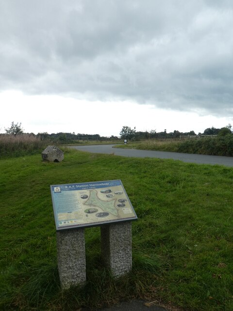
RAF Harrowbeer

Royal Air Force Harrowbeer or more simply RAF Harrowbeer is a former Royal Air Force station situated next to Yelverton in the parish of Buckland Monachorum...

Yelverton Paperweight Centre

Yelverton Paperweight Centre was a paperweight museum and supplier in Leg O'Mutton, a small hamlet near Yelverton, in the English county of Devon. The...

Yelverton, Devon

Yelverton is a large village on the south-western edge of Dartmoor, Devon, in England. When Yelverton railway station (on the Great Western Railway (GWR...

Crapstone

Crapstone is a village in the county of Devon. The village is located on the edge of Dartmoor, in the parish of Buckland Monachorum and is approximately...

Dousland

Dousland is a small settlement in Devon, England. It is near the A386 road and is 10 kilometres (6 mi) northeast of the city of Plymouth - 10 kilometres...

Nearby Amenities

Located within 500m of 50.477206,-4.0967763
Barrier: cattle_grid
Bicycle: yes
Foot: yes
Motorcar: yes
Motorcycle: yes
Source: bing
Lat/Long: 50.4753958/-4.0960001
Barrier: cattle_grid
Bicycle: yes
Foot: yes
Motorcar: yes
Motorcycle: yes
Source: bing
Lat/Long: 50.4789666/-4.0921698
Post Box
Brand: Royal Mail
Brand Wikidata: Q638098
Brand Wikipedia: en:Royal Mail
Collection Times: Mo-Sa 09:15; Su off
Operator: Royal Mail
Operator Wikidata: Q638098
Post Box Design: type_b
Post Box Mounting: brick_pillar
Post Box Type: wall
Ref: PL20 738
Royal Cypher: GR
Royal Cypher Wikidata: Q33102273
Source: survey;streetlevel imagery;aerial imagery
Lat/Long: 50.4776633/-4.1015711
The data included in this document is from www.openstreetmap.org. The data is made available under ODbL.

Have you been to Roborough Down?

Leave your review of Roborough Down below (or comments, questions and feedback).