Ratton Village

Settlement in Sussex Eastbourne

England

Ratton Village

Midday, Christmas Day 2023 view of care home, Eastbourne, East Sussex This midday photo on Christmas Day 2023, shows Hallmark’s Willingdon Park Manor 85-bed care and nursing home. The building is nearing completion and it is due to open in early 2004.
Midday, Christmas Day 2023 view of care home, Eastbourne, East Sussex Credit: Andrew Diack

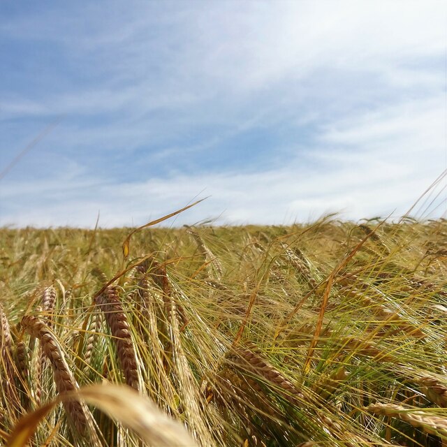
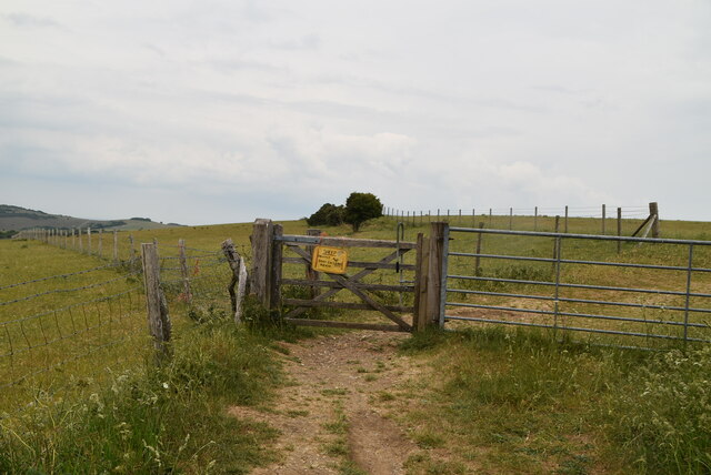
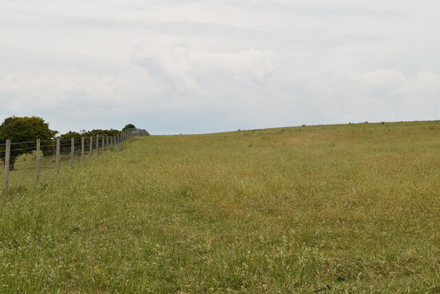
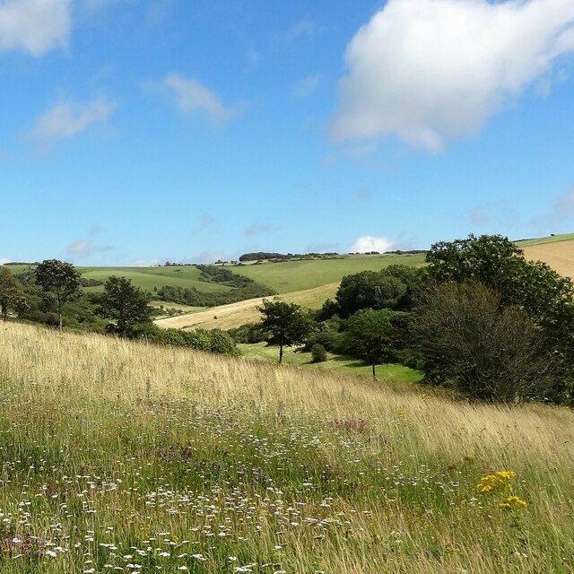
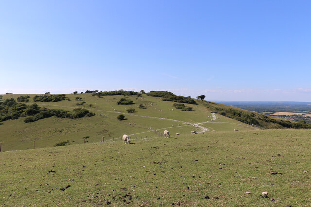
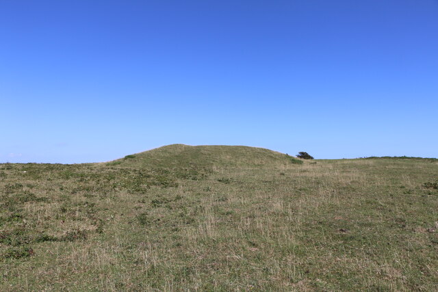
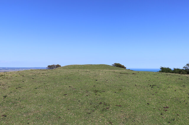
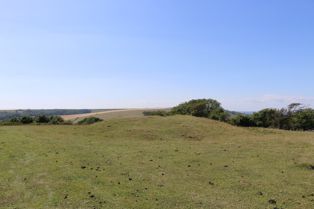
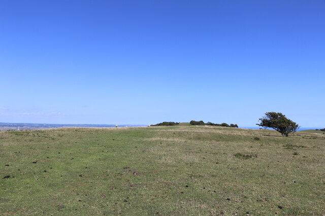
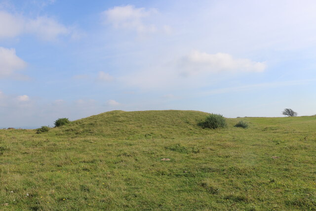
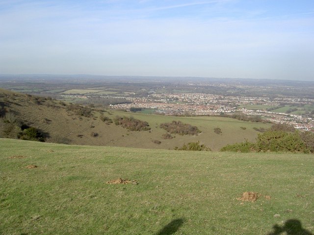
Ratton Village is a charming residential area located in Sussex, England. Situated on the outskirts of Eastbourne, Ratton Village offers a tranquil and picturesque setting for its residents. The village is known for its idyllic countryside views, lush green fields, and rolling hills, making it a popular choice for nature lovers and those seeking a peaceful retreat.

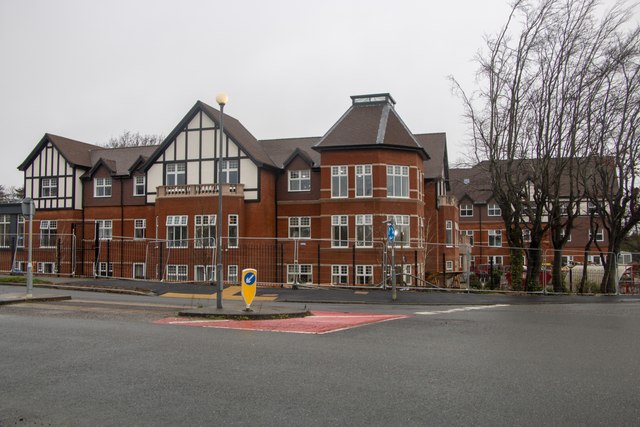
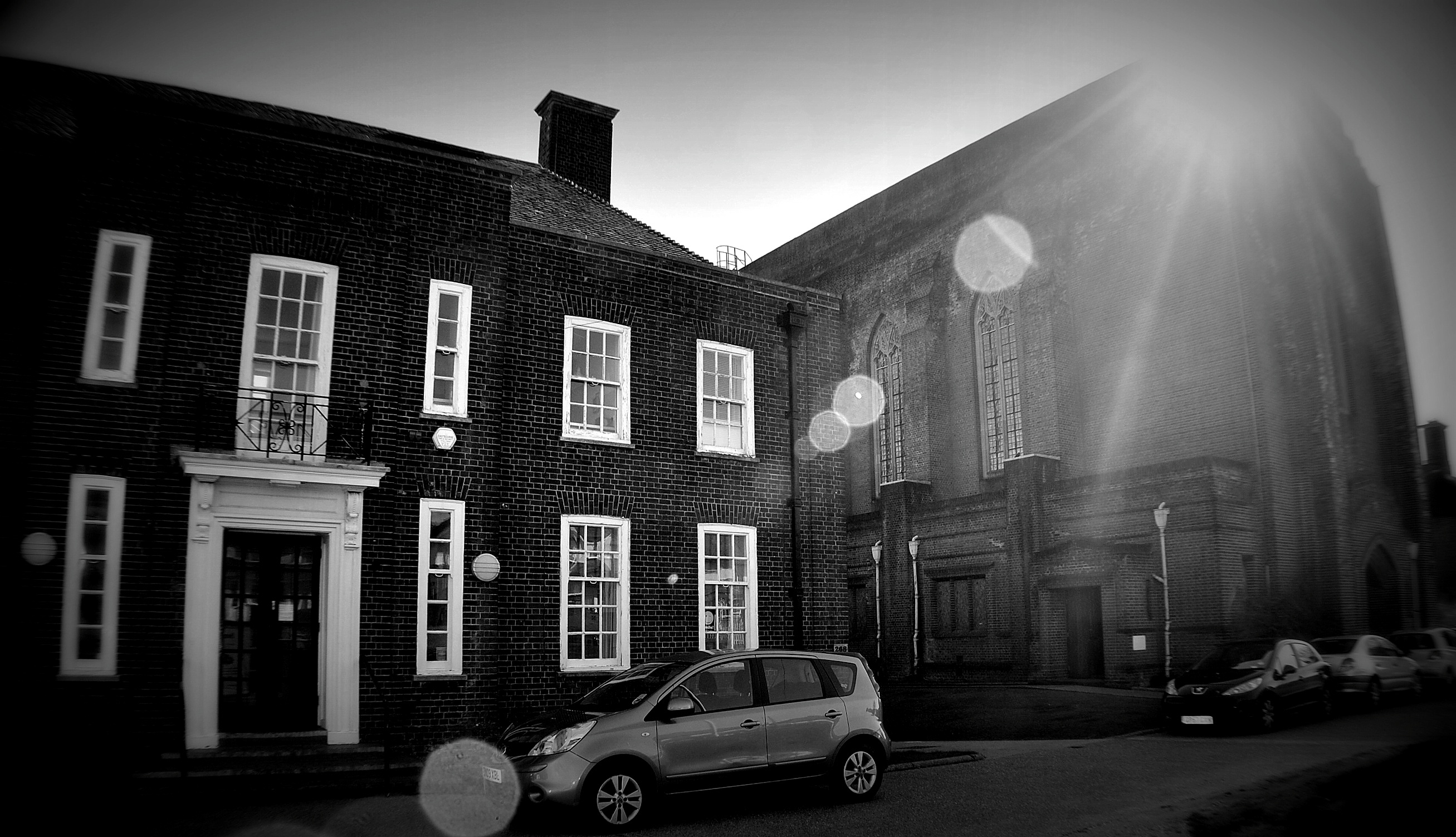
Ratton Village is characterized by its traditional architecture, with a mix of quaint cottages and elegant period houses. The village exudes a sense of historical charm, with some properties dating back several centuries. Its well-preserved buildings add to the overall aesthetic appeal of the area.

The village boasts excellent transport links, with easy access to the nearby town of Eastbourne and its amenities. Residents can enjoy a range of local shops, cafes, and restaurants, as well as access to quality schools and medical facilities. Additionally, Ratton Village is only a short distance from the stunning Sussex coastline, allowing residents to enjoy beautiful sandy beaches and coastal walks.

For outdoor enthusiasts, Ratton Village is surrounded by an abundance of natural beauty. The South Downs National Park is within close proximity, offering numerous walking and cycling trails, as well as breathtaking views. The area is also home to several golf courses, providing opportunities for leisure activities.

Overall, Ratton Village in Sussex offers a perfect blend of rural tranquility and convenient access to amenities, making it an attractive place to live for those seeking a peaceful and picturesque village lifestyle.

If you have any feedback on the listing, please let us know in the comments section below.

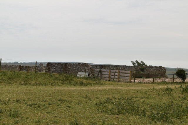
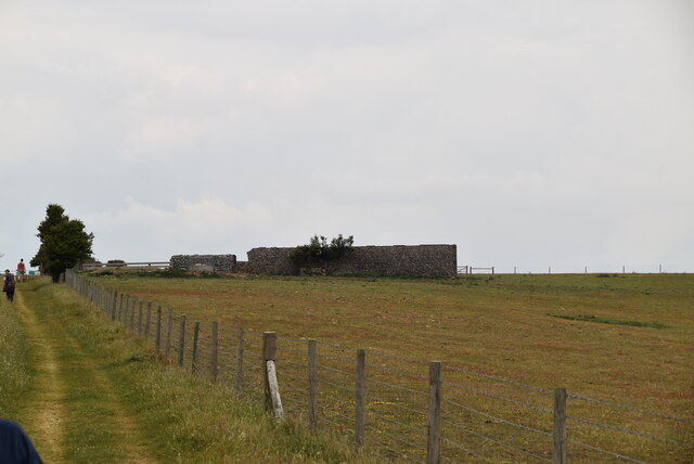
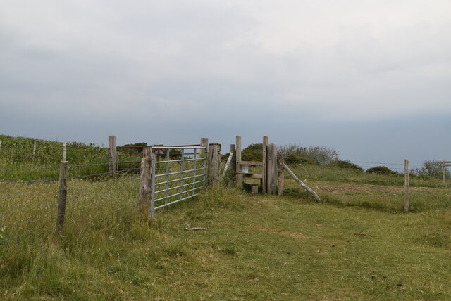
Ratton Village Images

Images are sourced within 2km of 50.790917/0.25258314 or Grid Reference TQ5801. Thanks to Geograph Open Source API. All images are credited.

Midday, Christmas Day 2023 view of care home, Eastbourne, East Sussex This midday photo on Christmas Day 2023, shows Hallmark’s Willingdon Park Manor 85-bed care and nursing home. The building is nearing completion and it is due to open in early 2004.
Midday, Christmas Day 2023 view of care home, Eastbourne, East Sussex
This midday photo on Christmas Day 2023, shows Hallmark’s Willingdon Park Manor 85-bed care and nursing home. The building is nearing completion and it is due to open in early 2004.
Midday, Christmas Day 2023 view of Christmas tree, Eastbourne This noon day photo on Christmas Day 2003, shows the Christmas tree, set among other trees, at Willingdon Roundabout in Eastbourne, East Sussex.
Midday, Christmas Day 2023 view of Christmas tree, Eastbourne
This noon day photo on Christmas Day 2003, shows the Christmas tree, set among other trees, at Willingdon Roundabout in Eastbourne, East Sussex.
Field of barley on the west side of Bourne Hill
Gate on bridleway
Gate on bridleway
Grassland, Willingdon Hill
Ruin, Willingdon Hill
Ruin on Willingdon Hill
Decoy Pond, Hampden Park A park and woodland area to the suburbs north of Eastbourne Hospital. To the south of the park is a large pond.
Decoy Pond, Hampden Park
A park and woodland area to the suburbs north of Eastbourne Hospital. To the south of the park is a large pond.
Stile and gate
Stile and gate
Wealdway The South Downs Way is a long distance footpath in Southern England and is one of Britain's National Trails. It runs for around 100 miles from Winchester in Hampshire to Eastbourne in Sussex, with a small loop around Eastbourne. The South Downs Way passes through the South Downs, a beautiful area which is now a National Park. The path mainly follows old routes and droveways along the Chalk escarpment. The majority of the path is a bridleway and so can be used by horse-riders and cyclists too. 
More information is available from <span class="nowrap"><a title="http://www.nationaltrail.co.uk/southdowns/index.asp?PageId=1" rel="nofollow ugc noopener" href="http://www.nationaltrail.co.uk/southdowns/index.asp?PageId=1">Link</a><img style="margin-left:2px;" alt="External link" title="External link - shift click to open in new window" src="https://s1.geograph.org.uk/img/external.png" width="10" height="10"/></span>
Wealdway
The South Downs Way is a long distance footpath in Southern England and is one of Britain's National Trails. It runs for around 100 miles from Winchester in Hampshire to Eastbourne in Sussex, with a small loop around Eastbourne. The South Downs Way passes through the South Downs, a beautiful area which is now a National Park. The path mainly follows old routes and droveways along the Chalk escarpment. The majority of the path is a bridleway and so can be used by horse-riders and cyclists too. More information is available from LinkExternal link
South Downs Way waymarker The South Downs Way is a long distance footpath in Southern England and is one of Britain's National Trails. It runs for around 100 miles from Winchester in Hampshire to Eastbourne in Sussex, with a small loop around Eastbourne. The South Downs Way passes through the South Downs, a beautiful area which is now a National Park. The path mainly follows old routes and droveways along the Chalk escarpment. The majority of the path is a bridleway and so can be used by horse-riders and cyclists too. 
More information is available from <span class="nowrap"><a title="http://www.nationaltrail.co.uk/southdowns/index.asp?PageId=1" rel="nofollow ugc noopener" href="http://www.nationaltrail.co.uk/southdowns/index.asp?PageId=1">Link</a><img style="margin-left:2px;" alt="External link" title="External link - shift click to open in new window" src="https://s1.geograph.org.uk/img/external.png" width="10" height="10"/></span>
South Downs Way waymarker
The South Downs Way is a long distance footpath in Southern England and is one of Britain's National Trails. It runs for around 100 miles from Winchester in Hampshire to Eastbourne in Sussex, with a small loop around Eastbourne. The South Downs Way passes through the South Downs, a beautiful area which is now a National Park. The path mainly follows old routes and droveways along the Chalk escarpment. The majority of the path is a bridleway and so can be used by horse-riders and cyclists too. More information is available from LinkExternal link
View east over Willingdon Bottom
Coombe Hill viewed in a west-northwest direction, East Sussex This photo looks over part of the dry valley of Willingdon Bottom toward Coombe Hill. The archaeological features on Coombe Hill, including a causewayed enclosure and barrows, lie on the crest of the hill and in a saddle of land on the western side.
Coombe Hill viewed in a west-northwest direction, East Sussex
This photo looks over part of the dry valley of Willingdon Bottom toward Coombe Hill. The archaeological features on Coombe Hill, including a causewayed enclosure and barrows, lie on the crest of the hill and in a saddle of land on the western side.
Bronze-Age bowl barrow on Combe Hill, East Sussex This westerly looking photo shows the most easterly of the barrows on Combe Hill.
Bronze-Age bowl barrow on Combe Hill, East Sussex
This westerly looking photo shows the most easterly of the barrows on Combe Hill.
Bronze Age bowl barrow viewed from the west, East Sussex The bowl barrow in the photo is being viewed from the west. It appears to have been originally dug in Victorian times without proper records being kept.
Bronze Age bowl barrow viewed from the west, East Sussex
The bowl barrow in the photo is being viewed from the west. It appears to have been originally dug in Victorian times without proper records being kept.
Westward view of the most westerly bowl barrow on Combe Hill This Bronze Age bowl barrow is the most westerly barrow on Combe Hill, East Sussex. The top of the barrow has a circular depression indicating that it has been excavated.
Westward view of the most westerly bowl barrow on Combe Hill
This Bronze Age bowl barrow is the most westerly barrow on Combe Hill, East Sussex. The top of the barrow has a circular depression indicating that it has been excavated.
Ring and ditch of the causewayed enclosure on Combe Hill This photo looks eastward along the top of Combe Hill in East Sussex. The photo shows a segment of the ring and ditch feature which forms part of the causewayed enclosure. There are several causeways which cut the rings into parts and one of these is indicated to the north of centre in the photo. The most easterly of the bowl barrows on this ceremonial site can be seen on the high ground which marks the horizon.
Ring and ditch of the causewayed enclosure on Combe Hill
This photo looks eastward along the top of Combe Hill in East Sussex. The photo shows a segment of the ring and ditch feature which forms part of the causewayed enclosure. There are several causeways which cut the rings into parts and one of these is indicated to the north of centre in the photo. The most easterly of the bowl barrows on this ceremonial site can be seen on the high ground which marks the horizon.
Eastward view of the more westerly bowl barrow on Coombe Hill In 1908, three and a half bronze axes were unearthed from the bowl barrow in the photo by the then owner of Friston Place, (Curwen 1940 p.108) Three of the four axes had been broken. It is likely that the breakages were deliberate, and done in a ritual manner, in order to "kill" the objects so that they could be used as votive offerings.
Eastward view of the more westerly bowl barrow on Coombe Hill
In 1908, three and a half bronze axes were unearthed from the bowl barrow in the photo by the then owner of Friston Place, (Curwen 1940 p.108) Three of the four axes had been broken. It is likely that the breakages were deliberate, and done in a ritual manner, in order to "kill" the objects so that they could be used as votive offerings.
Show me another place!

Ratton Village is located at Grid Ref: TQ5801 (Lat: 50.790917, Lng: 0.25258314)

Administrative County: East Sussex

District: Eastbourne

Police Authority: Sussex

What 3 Words

///focus.luck.onion. Near Eastbourne, East Sussex

Related Wikis

Ratton School

Ratton School is a secondary school with academy status in Eastbourne, East Sussex, England. All of the communities are named after theatres in London...

More Radio Eastbourne

More Radio Eastbourne, formerly Sovereign FM, is an Independent Local Radio station serving Eastbourne, Hailsham, Polegate and surrounding areas. It is...

St Elisabeth's Church, Eastbourne

St Elisabeth's Church is a church in the Old Town area of Eastbourne, England. It was built in 1938 to the designs of local architects Stonham & Sons and...

The Hoo, Willingdon and Jevington

The Hoo is an Neoclassical country house in Willingdon, in the Wealden district of East Sussex, England. It was designed by Edwin Lutyens in 1902 for Alexander...

Willingdon and Jevington

Willingdon and Jevington is one of the civil parishes in the Wealden District of East Sussex, England. The two villages lie one mile (1.6 km) south of...

Cavendish School, Eastbourne

The Cavendish School, commonly known as Cavendish School or Cavendish, is a coeducational All-through school with academy status, located in Eastbourne...

Eastbourne District General Hospital

Eastbourne District General Hospital is a National Health Service hospital in Eastbourne in East Sussex, England. It is managed by the East Sussex Healthcare...

Willingdon Down

Willingdon Down is a 67.5-hectare (167-acre) biological Site of Special Scientific Interest west of Willingdon, a suburb of Eastbourne in East Sussex....

Nearby Amenities

Located within 500m of 50.790917,0.25258314
Turning Circle
Lat/Long: 50.7918965/0.2514233
Turning Circle
Lat/Long: 50.7901585/0.2473155
Post Box
Brand: Royal Mail
Brand Wikidata: Q638098
Operator: Royal Mail
Operator Wikidata: Q638098
Ref: BN20 817
Lat/Long: 50.7912819/0.2522451
Post Box
Brand: Royal Mail
Brand Wikidata: Q638098
Operator: Royal Mail
Operator Wikidata: Q638098
Ref: BN20 816
Lat/Long: 50.7930422/0.2481485
Post Box
Operator: Royal Mail
Ref: BN20 815
Lat/Long: 50.7937872/0.2503657
Post Box
Brand: Royal Mail
Brand Wikidata: Q638098
Brand Wikipedia: en:Royal Mail
Operator: Royal Mail
Operator Wikidata: Q638098
Ref: BN20 800
Lat/Long: 50.7947389/0.2547376
Post Box
Brand: Royal Mail
Brand Wikidata: Q638098
Brand Wikipedia: en:Royal Mail
Collection Times: Mo-Fr 09:00; Sa 07:00; Su off
Operator: Royal Mail
Operator Wikidata: Q638098
Post Box Type: pillar
Ref: BN20 809D
Royal Cypher: EIIR
Royal Cypher Wikidata: Q33102113
Source: survey
Lat/Long: 50.7909522/0.2567579
Bus Stop
Golf Club
Bus: yes
Public Transport: platform
Lat/Long: 50.7881107/0.2564553
Bus Stop
Willingdon Roundabout (Wish Hill)
Bus: yes
Public Transport: platform
Lat/Long: 50.7944181/0.2569702
Bus Stop
Garnett Drive
Bench: yes
Bin: yes
Bus: yes
Mapillary: 200584658547690
Passenger Information Display: yes
Public Transport: platform
Shelter: yes
Survey Date: 2019-12-26
Lat/Long: 50.7895819/0.2569528
Bus Stop
Garnett Drive
Bus: yes
Public Transport: platform
Lat/Long: 50.7898971/0.2566884
Bus Stop
Willingdon Roundabout (Wish Hill)
Bus: yes
Public Transport: platform
Lat/Long: 50.7944913/0.2567422
Bus Stop
Golf Club
Bench: no
Bin: no
Bus: yes
Image: https://storage13.openstreetcam.org/files/photo/2020/9/24/lth/3069506_a093a_5f6ca2dad6000.jpg
Public Transport: platform
Shelter: no
Survey Date: 2020-09-24
Lat/Long: 50.7882288/0.2563245
Addr City: Willingdon
Addr Housename: site of Ratton
Building: yes
Lat/Long: 50.792697/0.2477367
Turning Circle
Lat/Long: 50.7913129/0.2515797
Traffic Signals
Cycleway: asl
Traffic Signals Direction: forward
Lat/Long: 50.7885868/0.2572822
Traffic Signals
Traffic Signals Direction: forward
Lat/Long: 50.7885503/0.2573171
Traffic Signals
Traffic Signals Direction: forward
Lat/Long: 50.7886173/0.2569972
Traffic Signals
Cycleway: asl
Traffic Signals Direction: backward
Lat/Long: 50.7890688/0.2569503
Traffic Signals
Traffic Signals Direction: backward
Lat/Long: 50.7891086/0.2569301
Crossing
Button Operated: yes
Crossing: traffic_signals
Crossing Island: yes
Crossing Ref: puffin
Kerb: lowered
Tactile Paving: yes
Traffic Signals Sound: yes
Lat/Long: 50.7890036/0.2569884
Information: guidepost
Tourism: information
Lat/Long: 50.7910225/0.2564922
Ratton Village
Place: suburb
Source: OS Open Names
Lat/Long: 50.7909115/0.2526111
The data included in this document is from www.openstreetmap.org. The data is made available under ODbL.

Have you been to Ratton Village?

Leave your review of Ratton Village below (or comments, questions and feedback).