Allotment Belt

Wood, Forest in Sussex Eastbourne

England

Allotment Belt

Midday, Christmas Day 2023 view of care home, Eastbourne, East Sussex This midday photo on Christmas Day 2023, shows Hallmark’s Willingdon Park Manor 85-bed care and nursing home. The building is nearing completion and it is due to open in early 2004.
Midday, Christmas Day 2023 view of care home, Eastbourne, East Sussex Credit: Andrew Diack

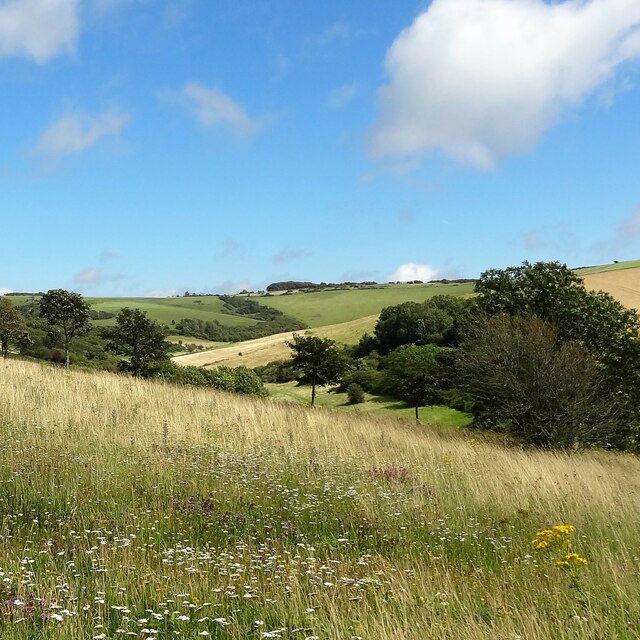
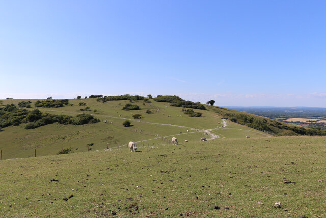
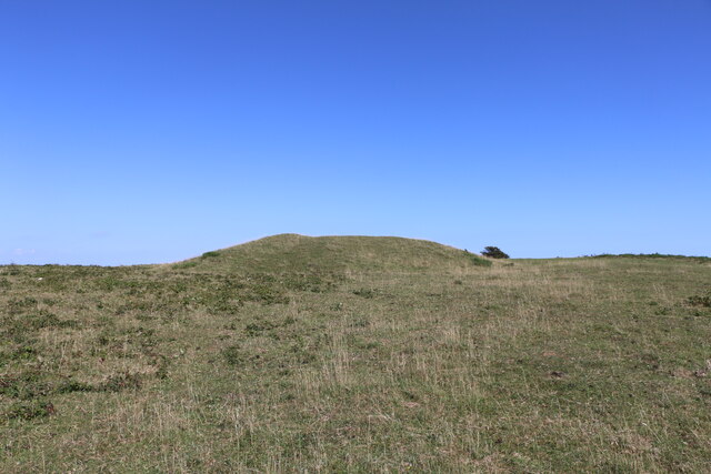
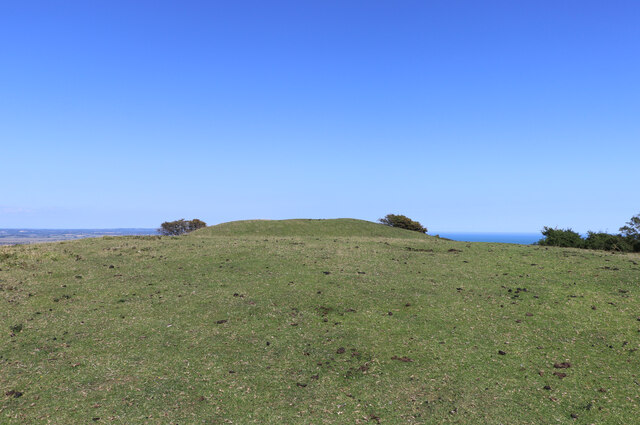
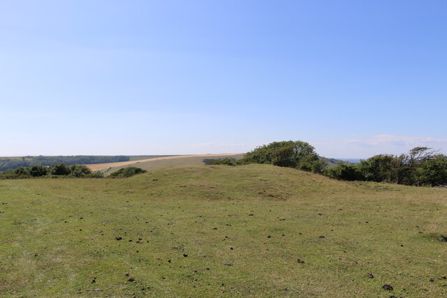
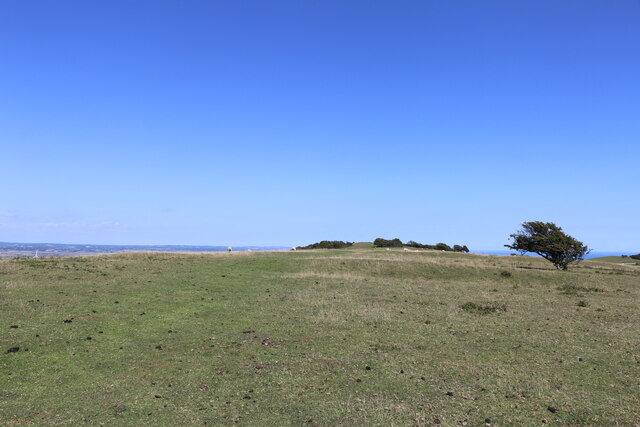
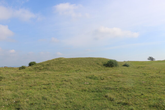
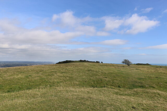
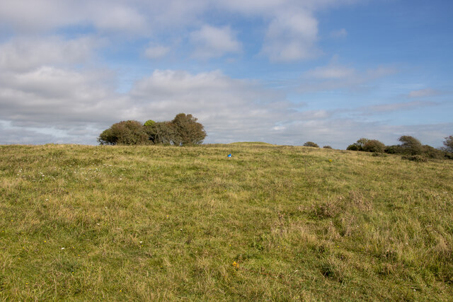
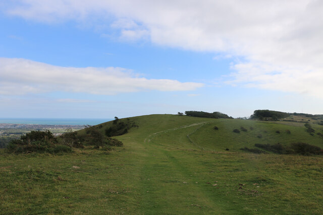
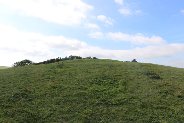
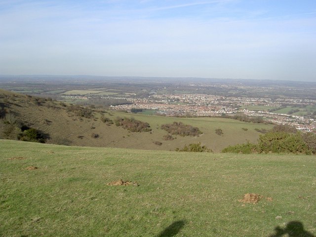
Allotment Belt, Sussex, located in the southern region of England, is a beautiful woodland area known for its abundant natural resources and lush greenery. It is a part of the Sussex Weald, which is characterized by its rolling hills, dense forests, and fertile soil.

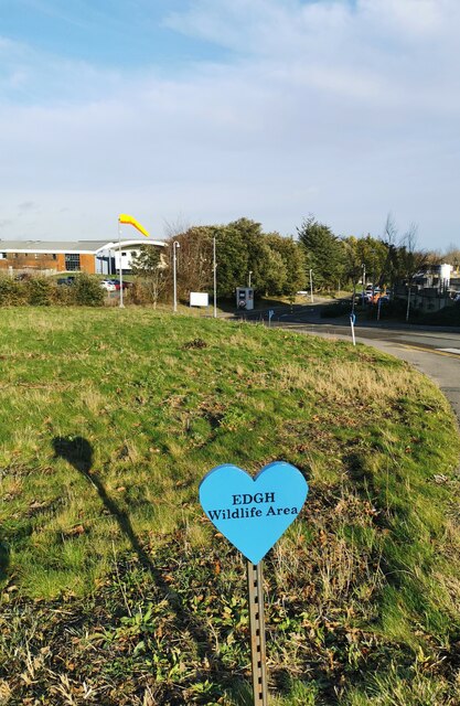
The Allotment Belt is specifically recognized for its numerous allotments, which are small plots of land rented by individuals for gardening purposes. These allotments are highly sought after by local residents who have a passion for growing their own fruits, vegetables, and flowers. The area is filled with well-maintained plots, each carefully cultivated to maximize the yield of its owner. It is a common sight to see gardeners tending to their plants, nurturing them with care and expertise.

The woodland in the Allotment Belt is a mix of native trees and shrubs, providing a diverse habitat for numerous wildlife species. The forest is home to a wide array of bird species, including woodpeckers, owls, and thrushes. Squirrels, rabbits, and foxes can also be spotted here, adding to the natural charm of the area.

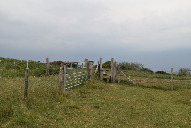
The Allotment Belt is not only a haven for gardeners and nature enthusiasts but also a popular destination for leisurely walks and picnics. The well-maintained footpaths and trails meander through the woodland, offering visitors a chance to admire the breathtaking scenery and enjoy the peaceful ambiance.

Overall, Allotment Belt, Sussex, is an enchanting woodland area renowned for its allotments, flourishing flora and fauna, and picturesque landscapes. It is a place where nature and human cultivation harmoniously coexist, providing a serene escape from the hustle and bustle of everyday life.

If you have any feedback on the listing, please let us know in the comments section below.

Allotment Belt Images

Images are sourced within 2km of 50.794421/0.25226919 or Grid Reference TQ5801. Thanks to Geograph Open Source API. All images are credited.

Midday, Christmas Day 2023 view of care home, Eastbourne, East Sussex This midday photo on Christmas Day 2023, shows Hallmark’s Willingdon Park Manor 85-bed care and nursing home. The building is nearing completion and it is due to open in early 2004.
Midday, Christmas Day 2023 view of care home, Eastbourne, East Sussex
This midday photo on Christmas Day 2023, shows Hallmark’s Willingdon Park Manor 85-bed care and nursing home. The building is nearing completion and it is due to open in early 2004.
Midday, Christmas Day 2023 view of Christmas tree, Eastbourne This noon day photo on Christmas Day 2003, shows the Christmas tree, set among other trees, at Willingdon Roundabout in Eastbourne, East Sussex.
Midday, Christmas Day 2023 view of Christmas tree, Eastbourne
This noon day photo on Christmas Day 2003, shows the Christmas tree, set among other trees, at Willingdon Roundabout in Eastbourne, East Sussex.
Decoy Pond, Hampden Park A park and woodland area to the suburbs north of Eastbourne Hospital. To the south of the park is a large pond.
Decoy Pond, Hampden Park
A park and woodland area to the suburbs north of Eastbourne Hospital. To the south of the park is a large pond.
Stile and gate
Stile and gate
Wealdway The South Downs Way is a long distance footpath in Southern England and is one of Britain's National Trails. It runs for around 100 miles from Winchester in Hampshire to Eastbourne in Sussex, with a small loop around Eastbourne. The South Downs Way passes through the South Downs, a beautiful area which is now a National Park. The path mainly follows old routes and droveways along the Chalk escarpment. The majority of the path is a bridleway and so can be used by horse-riders and cyclists too. 
More information is available from <span class="nowrap"><a title="http://www.nationaltrail.co.uk/southdowns/index.asp?PageId=1" rel="nofollow ugc noopener" href="http://www.nationaltrail.co.uk/southdowns/index.asp?PageId=1">Link</a><img style="margin-left:2px;" alt="External link" title="External link - shift click to open in new window" src="https://s1.geograph.org.uk/img/external.png" width="10" height="10"/></span>
Wealdway
The South Downs Way is a long distance footpath in Southern England and is one of Britain's National Trails. It runs for around 100 miles from Winchester in Hampshire to Eastbourne in Sussex, with a small loop around Eastbourne. The South Downs Way passes through the South Downs, a beautiful area which is now a National Park. The path mainly follows old routes and droveways along the Chalk escarpment. The majority of the path is a bridleway and so can be used by horse-riders and cyclists too. More information is available from LinkExternal link
South Downs Way waymarker The South Downs Way is a long distance footpath in Southern England and is one of Britain's National Trails. It runs for around 100 miles from Winchester in Hampshire to Eastbourne in Sussex, with a small loop around Eastbourne. The South Downs Way passes through the South Downs, a beautiful area which is now a National Park. The path mainly follows old routes and droveways along the Chalk escarpment. The majority of the path is a bridleway and so can be used by horse-riders and cyclists too. 
More information is available from <span class="nowrap"><a title="http://www.nationaltrail.co.uk/southdowns/index.asp?PageId=1" rel="nofollow ugc noopener" href="http://www.nationaltrail.co.uk/southdowns/index.asp?PageId=1">Link</a><img style="margin-left:2px;" alt="External link" title="External link - shift click to open in new window" src="https://s1.geograph.org.uk/img/external.png" width="10" height="10"/></span>
South Downs Way waymarker
The South Downs Way is a long distance footpath in Southern England and is one of Britain's National Trails. It runs for around 100 miles from Winchester in Hampshire to Eastbourne in Sussex, with a small loop around Eastbourne. The South Downs Way passes through the South Downs, a beautiful area which is now a National Park. The path mainly follows old routes and droveways along the Chalk escarpment. The majority of the path is a bridleway and so can be used by horse-riders and cyclists too. More information is available from LinkExternal link
View east over Willingdon Bottom
Coombe Hill viewed in a west-northwest direction, East Sussex This photo looks over part of the dry valley of Willingdon Bottom toward Coombe Hill. The archaeological features on Coombe Hill, including a causewayed enclosure and barrows, lie on the crest of the hill and in a saddle of land on the western side.
Coombe Hill viewed in a west-northwest direction, East Sussex
This photo looks over part of the dry valley of Willingdon Bottom toward Coombe Hill. The archaeological features on Coombe Hill, including a causewayed enclosure and barrows, lie on the crest of the hill and in a saddle of land on the western side.
Bronze-Age bowl barrow on Combe Hill, East Sussex This westerly looking photo shows the most easterly of the barrows on Combe Hill.
Bronze-Age bowl barrow on Combe Hill, East Sussex
This westerly looking photo shows the most easterly of the barrows on Combe Hill.
Bronze Age bowl barrow viewed from the west, East Sussex The bowl barrow in the photo is being viewed from the west. It appears to have been originally dug in Victorian times without proper records being kept.
Bronze Age bowl barrow viewed from the west, East Sussex
The bowl barrow in the photo is being viewed from the west. It appears to have been originally dug in Victorian times without proper records being kept.
Westward view of the most westerly bowl barrow on Combe Hill This Bronze Age bowl barrow is the most westerly barrow on Combe Hill, East Sussex. The top of the barrow has a circular depression indicating that it has been excavated.
Westward view of the most westerly bowl barrow on Combe Hill
This Bronze Age bowl barrow is the most westerly barrow on Combe Hill, East Sussex. The top of the barrow has a circular depression indicating that it has been excavated.
Ring and ditch of the causewayed enclosure on Combe Hill This photo looks eastward along the top of Combe Hill in East Sussex. The photo shows a segment of the ring and ditch feature which forms part of the causewayed enclosure. There are several causeways which cut the rings into parts and one of these is indicated to the north of centre in the photo. The most easterly of the bowl barrows on this ceremonial site can be seen on the high ground which marks the horizon.
Ring and ditch of the causewayed enclosure on Combe Hill
This photo looks eastward along the top of Combe Hill in East Sussex. The photo shows a segment of the ring and ditch feature which forms part of the causewayed enclosure. There are several causeways which cut the rings into parts and one of these is indicated to the north of centre in the photo. The most easterly of the bowl barrows on this ceremonial site can be seen on the high ground which marks the horizon.
Eastward view of the more westerly bowl barrow on Coombe Hill In 1908, three and a half bronze axes were unearthed from the bowl barrow in the photo by the then owner of Friston Place, (Curwen 1940 p.108) Three of the four axes had been broken. It is likely that the breakages were deliberate, and done in a ritual manner, in order to "kill" the objects so that they could be used as votive offerings.
Eastward view of the more westerly bowl barrow on Coombe Hill
In 1908, three and a half bronze axes were unearthed from the bowl barrow in the photo by the then owner of Friston Place, (Curwen 1940 p.108) Three of the four axes had been broken. It is likely that the breakages were deliberate, and done in a ritual manner, in order to "kill" the objects so that they could be used as votive offerings.
View from the western barrow to the eastern one, Coombe Hill This photo was taken from the top of the western bowl barrow and it looks over the archaeological site of the Neolithic "causewayed enclosure" toward the eastern, bowl barrow. The bowl barrows are Bronze Age features.
View from the western barrow to the eastern one, Coombe Hill
This photo was taken from the top of the western bowl barrow and it looks over the archaeological site of the Neolithic "causewayed enclosure" toward the eastern, bowl barrow. The bowl barrows are Bronze Age features.
Saucer or disc barrow on Combe Hill, East Sussex The disc or saucer shaped barrow is an example of one of the rarest forms of round barrow with only approximately 60 of them in the country. Because of this rarity they are always considered to be of national importance and they are bestowed with official recognition and protected status.
The saucer barrow, in the photo, is a shallow depression which is difficult to see and photograph and it is for that reason that I placed a blue bag in the centre of the feature. Although the saucer shaped barrow lacks the visual impact of either of the nearby bowl barrows, it retains considerable archaeological potential for research as there is no evidence of antiquarian investigation.
Saucer or disc barrow on Combe Hill, East Sussex
The disc or saucer shaped barrow is an example of one of the rarest forms of round barrow with only approximately 60 of them in the country. Because of this rarity they are always considered to be of national importance and they are bestowed with official recognition and protected status. The saucer barrow, in the photo, is a shallow depression which is difficult to see and photograph and it is for that reason that I placed a blue bag in the centre of the feature. Although the saucer shaped barrow lacks the visual impact of either of the nearby bowl barrows, it retains considerable archaeological potential for research as there is no evidence of antiquarian investigation.
Wildlife Area, District General Hospital Eastbourne
Prehistoric barrow between Cold Crouch and Coombe Hill, East Sussex The convex hill to the east of the Wealdway, in the photo, is made of chalk and it is a natural part of the escarpment. Built on top of the hill, there is an earthen, prehistoric barrow with panoramic, eastern views towards Eastbourne and the English Channel.
Prehistoric barrow between Cold Crouch and Coombe Hill, East Sussex
The convex hill to the east of the Wealdway, in the photo, is made of chalk and it is a natural part of the escarpment. Built on top of the hill, there is an earthen, prehistoric barrow with panoramic, eastern views towards Eastbourne and the English Channel.
Westward view of a barrow between Cold Crouch and Coombe Hill This photo shows a barrow on the summit of a steep hill between Cold Crouch and Coombe Hill in East Sussex.
Westward view of a barrow between Cold Crouch and Coombe Hill
This photo shows a barrow on the summit of a steep hill between Cold Crouch and Coombe Hill in East Sussex.
Show me another place!

Allotment Belt is located at Grid Ref: TQ5801 (Lat: 50.794421, Lng: 0.25226919)

Administrative County: East Sussex

District: Eastbourne

Police Authority: Sussex

What 3 Words

///tubes.plates.lies. Near Eastbourne, East Sussex

Related Wikis

The Hoo, Willingdon and Jevington

The Hoo is an Neoclassical country house in Willingdon, in the Wealden district of East Sussex, England. It was designed by Edwin Lutyens in 1902 for Alexander...

Willingdon and Jevington

Willingdon and Jevington is one of the civil parishes in the Wealden District of East Sussex, England. The two villages lie one mile (1.6 km) south of...

Ratton School

Ratton School is a secondary school with academy status in Eastbourne, East Sussex, England. All of the communities are named after theatres in London...

More Radio Eastbourne

More Radio Eastbourne, formerly Sovereign FM, is an Independent Local Radio station serving Eastbourne, Hailsham, Polegate and surrounding areas. It is...

Willingdon Down

Willingdon Down is a 67.5-hectare (167-acre) biological Site of Special Scientific Interest west of Willingdon, a suburb of Eastbourne in East Sussex....

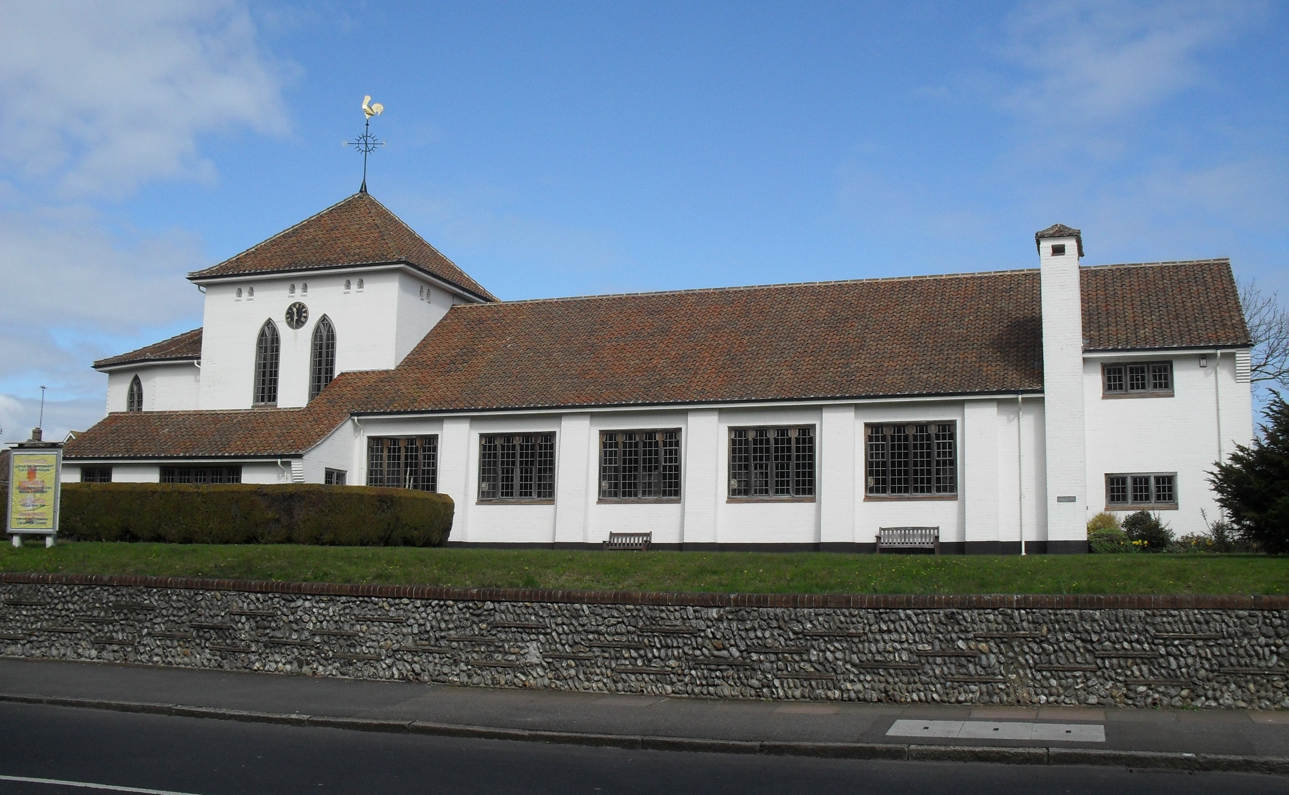
St Elisabeth's Church, Eastbourne

St Elisabeth's Church is a church in the Old Town area of Eastbourne, England. It was built in 1938 to the designs of local architects Stonham & Sons and...

Combe Hill, East Sussex

Combe Hill is a causewayed enclosure, near Eastbourne in East Sussex, on the northern edge of the South Downs. It consists of an inner circuit of ditches...

St Mary's Church, Hampden Park, Eastbourne

St Mary's Church (dedicated to St Mary the Virgin) is the Anglican parish church of the Hampden Park suburb of Eastbourne, a town and borough in the English...

Nearby Amenities

Located within 500m of 50.794421,0.25226919
Turning Circle
Lat/Long: 50.7948167/0.2455035
Turning Circle
Lat/Long: 50.7918965/0.2514233
Post Box
Brand: Royal Mail
Brand Wikidata: Q638098
Operator: Royal Mail
Operator Wikidata: Q638098
Ref: BN20 817
Lat/Long: 50.7912819/0.2522451
Post Box
Brand: Royal Mail
Brand Wikidata: Q638098
Operator: Royal Mail
Operator Wikidata: Q638098
Ref: BN20 816
Lat/Long: 50.7930422/0.2481485
Post Box
Operator: Royal Mail
Ref: BN20 815
Lat/Long: 50.7937872/0.2503657
Post Box
Collection Times: Mo-Fr 17:15; Sa 12:30; Su off
Operator: Royal Mail
Post Box Type: wall
Ref: BN20 801
Royal Cypher: GR
Royal Cypher Wikidata: Q33102273
Source: survey
Lat/Long: 50.7983514/0.2514049
Post Box
Brand: Royal Mail
Brand Wikidata: Q638098
Brand Wikipedia: en:Royal Mail
Operator: Royal Mail
Operator Wikidata: Q638098
Ref: BN20 800
Lat/Long: 50.7947389/0.2547376
Post Box
Brand: Royal Mail
Brand Wikidata: Q638098
Brand Wikipedia: en:Royal Mail
Collection Times: Mo-Fr 09:00; Sa 07:00; Su off
Operator: Royal Mail
Operator Wikidata: Q638098
Post Box Type: pillar
Ref: BN20 809D
Royal Cypher: EIIR
Royal Cypher Wikidata: Q33102113
Source: survey
Lat/Long: 50.7909522/0.2567579
Post Box
Brand: Royal Mail
Brand Wikidata: Q638098
Brand Wikipedia: en:Royal Mail
Operator: Royal Mail
Operator Wikidata: Q638098
Post Box Type: pillar
Ref: BN20 823
Lat/Long: 50.7955055/0.2562012
Bus Stop
Willingdon Roundabout (Wish Hill)
Bus: yes
Public Transport: platform
Lat/Long: 50.7944181/0.2569702
Bus Stop
Willingdon Roundabout (Wish Hill)
Bus: yes
Public Transport: platform
Lat/Long: 50.7944913/0.2567422
Addr City: Willingdon
Addr Housename: site of Ratton
Building: yes
Lat/Long: 50.792697/0.2477367
Turning Circle
Lat/Long: 50.7913129/0.2515797
Pub
Red Lion Pub
Addr City: Eastbourne
Addr Country: GB
Addr Housenumber: 99
Addr Postcode: BN20 9HQ
Addr Street: Wish Hill
Brand: Hall & Woodhouse
Brand Wikidata: Q5642555
Brand Wikipedia: en:Hall & Woodhouse
Website: https://theredlion-willingdon.co.uk/
Lat/Long: 50.7972869/0.251749
Information: guidepost
Tourism: information
Lat/Long: 50.7910225/0.2564922
Ratton Village
Place: suburb
Source: OS Open Names
Lat/Long: 50.7909115/0.2526111
Barrier: stile
Lat/Long: 50.7973979/0.2472416
Public Bookcase
Booth: K6
Disused Amenity: telephone
Listed Status: Grade II
Man Made: telephone_box
Public Bookcase Type: phone_box
Lat/Long: 50.7982925/0.2514453
Post Office
Wish Hill Post Office
Addr City: Eastbourne
Addr Postcode: BN20 9HL
Addr Street: Wish Hill
Brand: Post Office
Brand Wikidata: Q1783168
Check Date: 2023-09-27
Ref Pol Id: 123948
Website: https://www.postoffice.co.uk/branch-finder/4344588/wish-hill
Lat/Long: 50.7983394/0.251474
The data included in this document is from www.openstreetmap.org. The data is made available under ODbL.

Have you been to Allotment Belt?

Leave your review of Allotment Belt below (or comments, questions and feedback).