Priding

Settlement in Gloucestershire Stroud

England

Priding

Saul church I wonder if this village used to be called Paul... shame it's not on the way to a place called Damascus.
Saul church Credit: mym

Priding is a small village located in the county of Gloucestershire, England. Situated in the picturesque Cotswold Hills, it is known for its stunning natural landscapes and charming architectural heritage. The village is surrounded by rolling green fields, providing a peaceful and idyllic setting.

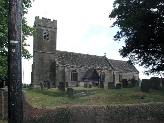
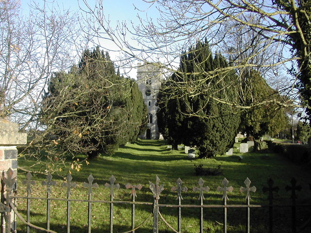
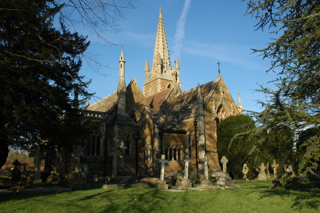
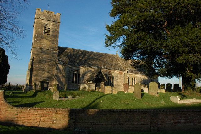
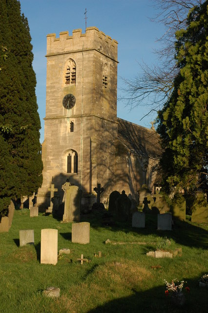
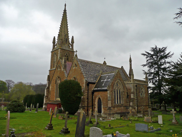
Priding has a rich history dating back to the Roman period, with evidence of settlements and Roman roads in the area. Today, the village maintains its historical charm through its well-preserved architecture, including traditional stone cottages and a beautiful 12th-century church, St. Mary's.

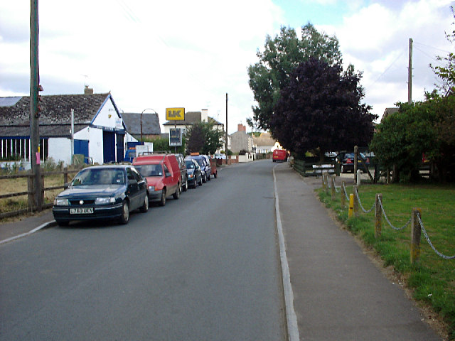
Despite its small size, Priding has a close-knit community that takes pride in its heritage and natural surroundings. The village offers a range of amenities, including a local pub, village hall, and a primary school. These facilities serve as gathering places for residents and contribute to the strong community spirit.

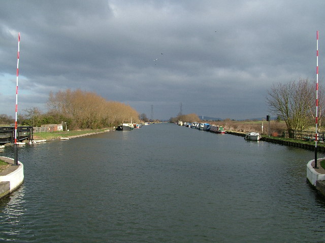
The surrounding countryside provides ample opportunities for outdoor activities such as hiking, cycling, and horse riding. Priding is also within close proximity to the Cotswold Way, a popular long-distance footpath that offers breathtaking views of the region.

For those seeking a peaceful and picturesque escape, Priding in Gloucestershire offers a quintessential English village experience. With its historic charm, stunning landscapes, and strong community spirit, it is a place that truly embodies the beauty and tranquility of the Cotswolds.

If you have any feedback on the listing, please let us know in the comments section below.
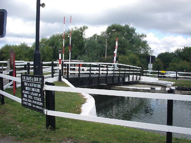
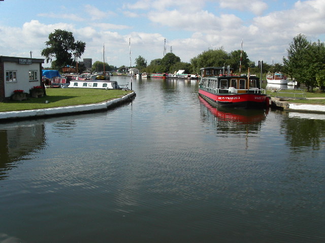
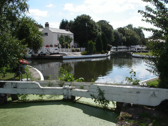
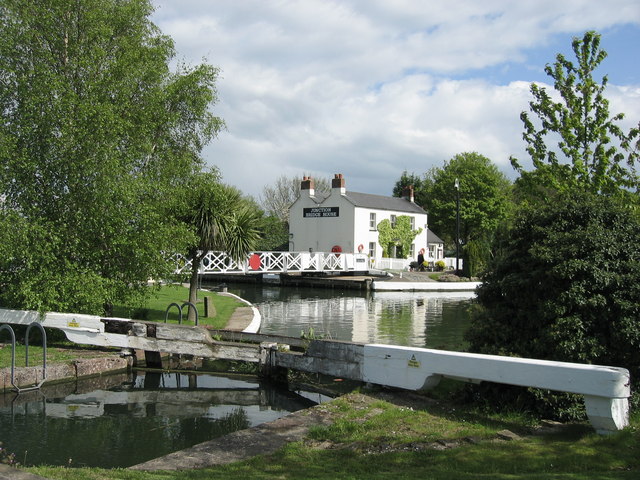
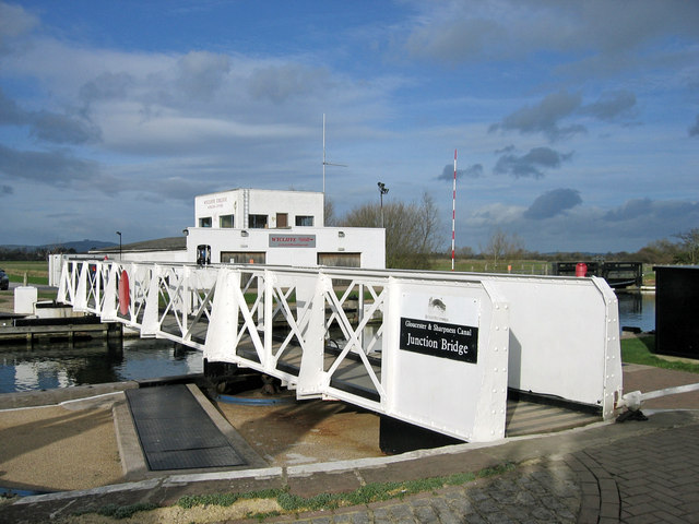
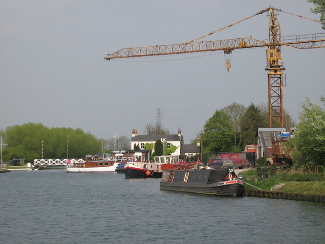
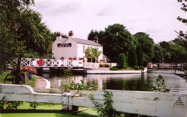
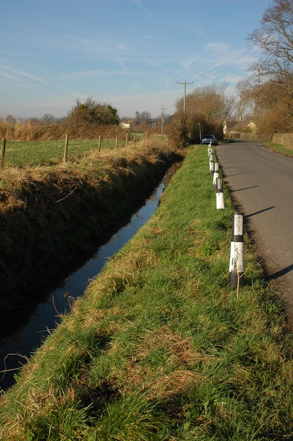
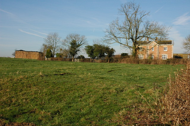
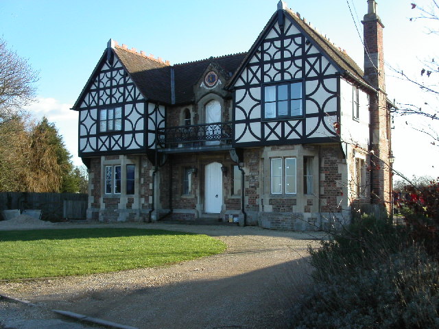
Priding Images

Images are sourced within 2km of 51.792901/-2.3760939 or Grid Reference SO7410. Thanks to Geograph Open Source API. All images are credited.

Saul church I wonder if this village used to be called Paul... shame it's not on the way to a place called Damascus.
Saul church
I wonder if this village used to be called Paul... shame it's not on the way to a place called Damascus.
Gloucester and Sharpness Canal, Saul
Fretherne (Glos) St Mary's Church
High Street, Saul Looking north along High Street from just north of the junction with Church Lane. Saul has a pub and garage but no shop or post office.
High Street, Saul
Looking north along High Street from just north of the junction with Church Lane. Saul has a pub and garage but no shop or post office.
Swing bridge, Church Lane, Saul Bridge across the Gloucester & Sharpness Canal. There is a boat builders near here at Saul Junction.
Swing bridge, Church Lane, Saul
Bridge across the Gloucester & Sharpness Canal. There is a boat builders near here at Saul Junction.
Saul Junction on the Gloucester and Sharpness Canal Saul Junction is the point where the Stroudwater canal met the Gloucester and Sharpness canal. The view is south west towards the Frampton on Severn direction.
Saul Junction on the Gloucester and Sharpness Canal
Saul Junction is the point where the Stroudwater canal met the Gloucester and Sharpness canal. The view is south west towards the Frampton on Severn direction.
Stroudwater canal entrance at  Saul  Junction Across the water is the entrance to the Stroudwater Canal (disused) as it leaves the Gloucester and Sharpness canal at Saul Junction.
Stroudwater canal entrance at Saul Junction
Across the water is the entrance to the Stroudwater Canal (disused) as it leaves the Gloucester and Sharpness canal at Saul Junction.
Saul Church
Saul Church
Bridge House, Saul Junction, Sharpness Canal. A short Distance from Frampton-on-Serven, Saul Junction is a pleasant place to spend a little time on a nice day.
Bridge House, Saul Junction, Sharpness Canal.
A short Distance from Frampton-on-Serven, Saul Junction is a pleasant place to spend a little time on a nice day.
Swing Bridge, Saul Junction This pedestrian Swing Bridge is one of two to be found at Saul Junction on The Gloucester & Sharpness Canal
Swing Bridge, Saul Junction
This pedestrian Swing Bridge is one of two to be found at Saul Junction on The Gloucester & Sharpness Canal
Saul Junction An old crane and boats at Saul Junction on the Gloucester and Sharpness canal.
Saul Junction
An old crane and boats at Saul Junction on the Gloucester and Sharpness canal.
Saul Junction, Bridge House This is the junction with the Stroudwater Navigation with the Gloucester and Berkeley Canal.  The Stroudwater, an early canal from the River Severn to the town of Stroud, comes through the lock where we are standing (now derelict) and continues across to where the boats are moored on the right.  That section will eventually be restored throughout.  The Gloucester and Berkeley Canal (later renamed the Gloucester and Sharpness) was built to avoid the worst sections of the tidal River Severn and crosses the earlier canal on the level from left to right.
Saul Junction, Bridge House
This is the junction with the Stroudwater Navigation with the Gloucester and Berkeley Canal. The Stroudwater, an early canal from the River Severn to the town of Stroud, comes through the lock where we are standing (now derelict) and continues across to where the boats are moored on the right. That section will eventually be restored throughout. The Gloucester and Berkeley Canal (later renamed the Gloucester and Sharpness) was built to avoid the worst sections of the tidal River Severn and crosses the earlier canal on the level from left to right.
Fretherne Church Fretherne church is dedicated to St Mary.
Fretherne Church
Fretherne church is dedicated to St Mary.
Roadside ditch at Fretherne
Overton Farm, Fretherne Attractive red brick farmhouse in Fretherne.
Overton Farm, Fretherne
Attractive red brick farmhouse in Fretherne.
Saul Church Saul church is dedicated to St James, it was largely rebuilt in 1864-65 by Thomas Fulljames.
Saul Church
Saul church is dedicated to St James, it was largely rebuilt in 1864-65 by Thomas Fulljames.
Saul Church The tower of St James' church, Saul.
Saul Church
The tower of St James' church, Saul.
St Mary's church, Fretherne This building was constructed in the 1840's, replacing two earlier churches on the site. It is faced with Stinchcombe sandstone with Bath stone dressings.
St Mary's church, Fretherne
This building was constructed in the 1840's, replacing two earlier churches on the site. It is faced with Stinchcombe sandstone with Bath stone dressings.
Show me another place!

Priding is located at Grid Ref: SO7410 (Lat: 51.792901, Lng: -2.3760939)

Administrative County: Gloucestershire

District: Stroud

Police Authority: Gloucestershire

What 3 Words

///sectors.shippers.acids. Near Frampton on Severn, Gloucestershire

Related Wikis

Priding

Priding is a hamlet in the civil parish of Arlingham, in the Stroud district, in the county of Gloucestershire, England. == References ==

Wick Court, Arlingham

Wick Court, Arlingham, Gloucestershire, England is a country house constructed between the late 14th and the mid-17th centuries. Now a base for the charity...

Framilode

Framilode is a village on the banks of the River Severn in Gloucestershire, England, in the parish of Fretherne with Saul. It consists of two settlements...

Rodley, Gloucestershire

Rodley is a settlement in Westbury-on-Severn parish, Forest of Dean District, Gloucestershire, England. It lies to the south east of Westbury-on-Severn...

River Frome, Stroud

The River Frome, once also known as the Stroudwater, is a small river in Gloucestershire, England. It is to be distinguished from another River Frome...

Saul, Gloucestershire

Saul is a village and former civil parish, now in the parish of Fretherne with Saul, in the Stroud district, in the county of Gloucestershire, England...

Fretherne Court

Fretherne Court was a handsome residential sporting mansion with picturesque grounds and deer park estate of some 676 acres, situated in the Severn Vale...

Fretherne with Saul

Fretherne with Saul is a civil parish in the Stroud district of Gloucestershire, England. It includes the villages of Framilode, Fretherne, Saul and Upper...

Nearby Amenities

Located within 500m of 51.792901,-2.3760939
Source: PGS
Lat/Long: 51.7969333/-2.3760303
Created By: almien_coastlines
Source: PGS
Lat/Long: 51.796442/-2.3749297
Source: PGS
Lat/Long: 51.796235/-2.3741379
Source: PGS
Lat/Long: 51.7955754/-2.3727962
Source: PGS
Lat/Long: 51.7952275/-2.371834
Source: PGS
Lat/Long: 51.7949909/-2.3711465
Created By: almien_coastlines
Source: PGS
Lat/Long: 51.7945691/-2.3702137
Source: PGS
Lat/Long: 51.7921137/-2.3707975
Source: PGS
Lat/Long: 51.7923157/-2.3723918
Created By: almien_coastlines
Source: PGS
Lat/Long: 51.7925209/-2.3734607
Created By: almien_coastlines
Source: PGS
Lat/Long: 51.7927312/-2.374296
Created By: almien_coastlines
Source: PGS
Lat/Long: 51.7929089/-2.3749202
Created By: almien_coastlines
Source: PGS
Lat/Long: 51.7933545/-2.3761247
Created By: almien_coastlines
Source: PGS
Lat/Long: 51.79382/-2.37779
Created By: almien_coastlines
Source: PGS
Lat/Long: 51.7941814/-2.3788573
Created By: almien_coastlines
Source: PGS
Lat/Long: 51.7944404/-2.3795693
Created By: almien_coastlines
Source: PGS
Lat/Long: 51.7948405/-2.38088
Bus Stop
Severnleigh
Bus: yes
Naptan AtcoCode: 1600GLS1065
Naptan Bearing: NE
Naptan CommonName: Severnleigh
Naptan NaptanCode: gloapdmw
Naptan Street: Passage Rd
Naptan Verified: no
Public Transport: platform
Source: naptan_import
Lat/Long: 51.7918074/-2.3724162
Bus Stop
Severnleigh
Bus: yes
Naptan AtcoCode: 1600GLS1066
Naptan Bearing: SW
Naptan CommonName: Severnleigh
Naptan NaptanCode: gloapdpa
Naptan Street: Passage Rd
Naptan Verified: no
Public Transport: platform
Source: naptan_import
Lat/Long: 51.7918351/-2.3721845
Priding
Place: hamlet
Source: survey
Wikidata: Q109056776
Wikipedia: en:Priding
Lat/Long: 51.7925324/-2.3746084
Addr Housename: Priding House
Building: yes
Lat/Long: 51.7948777/-2.3824437
Priding Farm
Place: farm
Wikidata: Q26380788
Lat/Long: 51.7931664/-2.3777862
Barrier: stile
Bicycle: yes
Foot: yes
Lat/Long: 51.7916597/-2.3691054
Post Box
Brand: Royal Mail
Brand Wikidata: Q638098
Collection Times: Mo-Fr 16:30; Sa 07:30; Su off
Drive Through: no
Operator: Royal Mail
Operator Wikidata: Q638098
Post Box Type: lamp
Ref: GL2 209
Royal Cypher: EIIR
Royal Cypher Wikidata: Q33102113
Source: survey
Lat/Long: 51.7917651/-2.3705764
Barrier: wicket_gate
Lat/Long: 51.791811/-2.3701779
Barrier: kissing_gate
Bicycle: yes
Foot: yes
Lat/Long: 51.7951593/-2.3823338
Framilode
Place: hamlet
Wikidata: Q5477996
Wikipedia: en:Framilode
Lat/Long: 51.7914056/-2.37187
The data included in this document is from www.openstreetmap.org. The data is made available under ODbL.

Have you been to Priding?

Leave your review of Priding below (or comments, questions and feedback).