Crown Point

Coastal Marsh, Saltings in Gloucestershire Forest of Dean

England

Crown Point

Saul church I wonder if this village used to be called Paul... shame it's not on the way to a place called Damascus.
Saul church Credit: mym

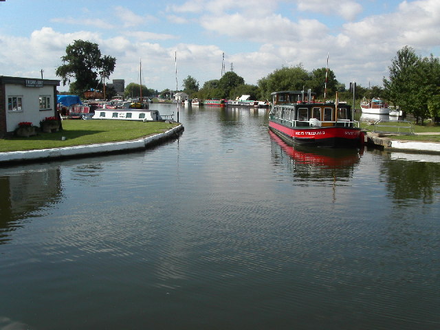
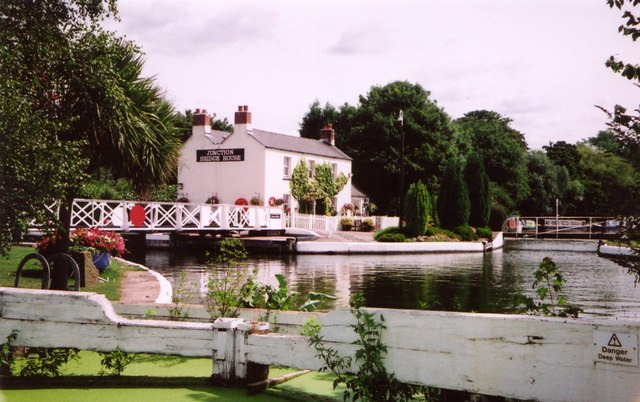
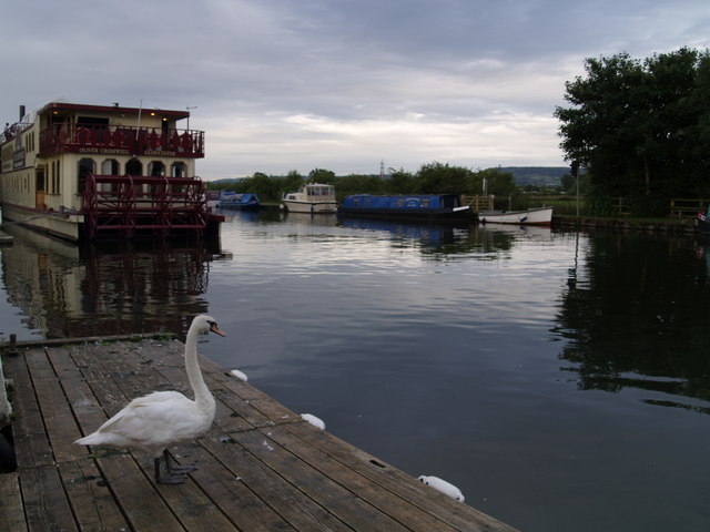
Crown Point is a small coastal marsh area located in Gloucestershire, England. Situated on the banks of the River Severn, it is renowned for its picturesque saltings and unique ecological characteristics. The marshland stretches across an approximate area of 3 square kilometers and is characterized by its marshy terrain and abundant wildlife.

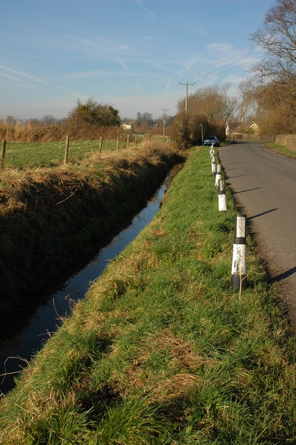
The coastal marsh of Crown Point is primarily composed of saltmarsh vegetation, which thrives in the brackish water conditions formed by the mixing of freshwater from the river and the tidal seawater. This combination creates a unique habitat that supports a diverse range of plant and animal species. The saltings are known for their rich biodiversity, attracting numerous bird species, such as curlews, oystercatchers, and dunlins, making it an ideal location for birdwatching enthusiasts.

The marshland also serves as an essential habitat for various marine and terrestrial organisms. It acts as a breeding ground for several fish species, including flounders and bass, which rely on the marsh's nutrient-rich environment. In addition, the marshes provide a vital feeding ground for migratory birds during their long journeys.

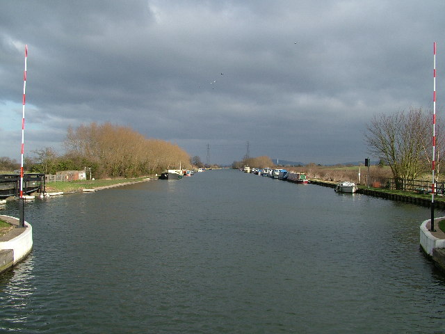
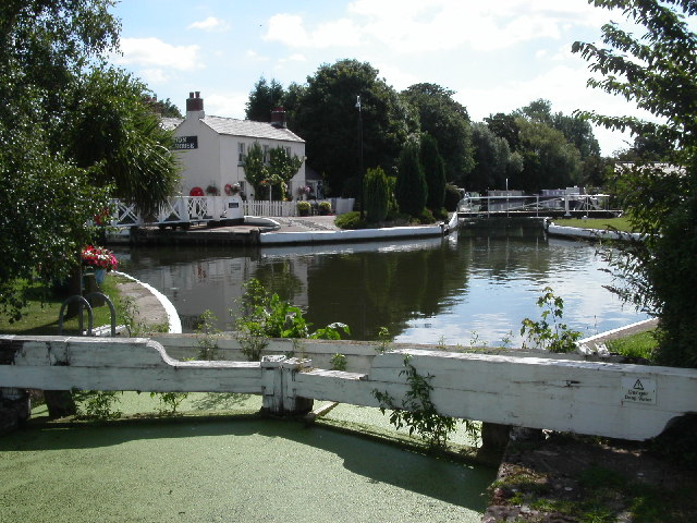
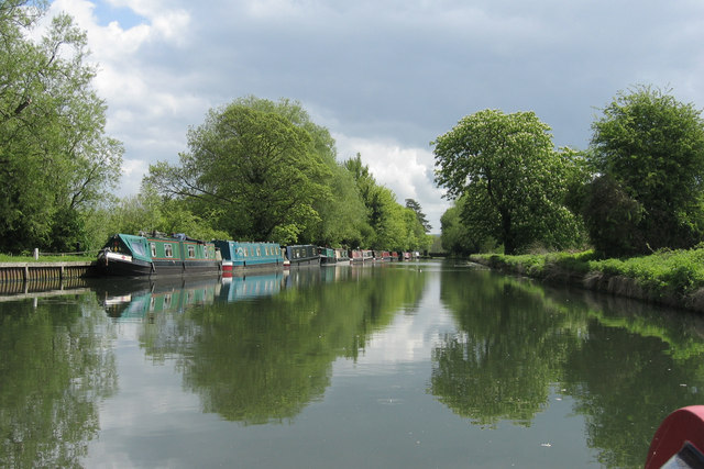
Visitors to Crown Point can enjoy stunning views of the River Severn and the surrounding countryside. The area offers several walking trails and observation points for visitors to explore and immerse themselves in the natural beauty of the marshes. The local authorities have taken steps to preserve the ecological integrity of the area, ensuring that visitors can experience the unique ecosystem while minimizing any negative impact on the delicate balance of the habitat.

Overall, Crown Point's coastal marsh and saltings provide a captivating glimpse into the diverse and fragile ecosystems found along the Gloucestershire coastline. Whether for birdwatching, nature walks, or simply enjoying the tranquil atmosphere, this area offers a unique experience for nature enthusiasts and visitors alike.

If you have any feedback on the listing, please let us know in the comments section below.

Crown Point Images

Images are sourced within 2km of 51.793927/-2.3671707 or Grid Reference SO7410. Thanks to Geograph Open Source API. All images are credited.

Saul church I wonder if this village used to be called Paul... shame it's not on the way to a place called Damascus.
Saul church
I wonder if this village used to be called Paul... shame it's not on the way to a place called Damascus.
Gloucester and Sharpness Canal, Saul
High Street, Saul Looking north along High Street from just north of the junction with Church Lane. Saul has a pub and garage but no shop or post office.
High Street, Saul
Looking north along High Street from just north of the junction with Church Lane. Saul has a pub and garage but no shop or post office.
Swing bridge, Church Lane, Saul Bridge across the Gloucester & Sharpness Canal. There is a boat builders near here at Saul Junction.
Swing bridge, Church Lane, Saul
Bridge across the Gloucester & Sharpness Canal. There is a boat builders near here at Saul Junction.
Saul Junction on the Gloucester and Sharpness Canal Saul Junction is the point where the Stroudwater canal met the Gloucester and Sharpness canal. The view is south west towards the Frampton on Severn direction.
Saul Junction on the Gloucester and Sharpness Canal
Saul Junction is the point where the Stroudwater canal met the Gloucester and Sharpness canal. The view is south west towards the Frampton on Severn direction.
Stroudwater canal entrance at  Saul  Junction Across the water is the entrance to the Stroudwater Canal (disused) as it leaves the Gloucester and Sharpness canal at Saul Junction.
Stroudwater canal entrance at Saul Junction
Across the water is the entrance to the Stroudwater Canal (disused) as it leaves the Gloucester and Sharpness canal at Saul Junction.
Narrow boats moored on Stroudwater canal This is the first section of the Stroudwater canal just up stream from Saul Junction and the Gloucester and Sharpness canal.
Narrow boats moored on Stroudwater canal
This is the first section of the Stroudwater canal just up stream from Saul Junction and the Gloucester and Sharpness canal.
Saul Church
Saul Church
Stroudwater canal, Saul Junction. Looking south east along the Stroudwater Canal.
Stroudwater canal, Saul Junction.
Looking south east along the Stroudwater Canal.
Bridge House, Saul Junction, Sharpness Canal. A short Distance from Frampton-on-Serven, Saul Junction is a pleasant place to spend a little time on a nice day.
Bridge House, Saul Junction, Sharpness Canal.
A short Distance from Frampton-on-Serven, Saul Junction is a pleasant place to spend a little time on a nice day.
Swing Bridge, Saul Junction This pedestrian Swing Bridge is one of two to be found at Saul Junction on The Gloucester & Sharpness Canal
Swing Bridge, Saul Junction
This pedestrian Swing Bridge is one of two to be found at Saul Junction on The Gloucester & Sharpness Canal
Saul Junction An old crane and boats at Saul Junction on the Gloucester and Sharpness canal.
Saul Junction
An old crane and boats at Saul Junction on the Gloucester and Sharpness canal.
Saul Junction, Bridge House This is the junction with the Stroudwater Navigation with the Gloucester and Berkeley Canal.  The Stroudwater, an early canal from the River Severn to the town of Stroud, comes through the lock where we are standing (now derelict) and continues across to where the boats are moored on the right.  That section will eventually be restored throughout.  The Gloucester and Berkeley Canal (later renamed the Gloucester and Sharpness) was built to avoid the worst sections of the tidal River Severn and crosses the earlier canal on the level from left to right.
Saul Junction, Bridge House
This is the junction with the Stroudwater Navigation with the Gloucester and Berkeley Canal. The Stroudwater, an early canal from the River Severn to the town of Stroud, comes through the lock where we are standing (now derelict) and continues across to where the boats are moored on the right. That section will eventually be restored throughout. The Gloucester and Berkeley Canal (later renamed the Gloucester and Sharpness) was built to avoid the worst sections of the tidal River Severn and crosses the earlier canal on the level from left to right.
Roadside ditch at Fretherne
Saul Church Saul church is dedicated to St James, it was largely rebuilt in 1864-65 by Thomas Fulljames.
Saul Church
Saul church is dedicated to St James, it was largely rebuilt in 1864-65 by Thomas Fulljames.
Saul Church The tower of St James' church, Saul.
Saul Church
The tower of St James' church, Saul.
Saul Junction
Saul Junction
Saul Festival
Saul Festival
Show me another place!

Crown Point is located at Grid Ref: SO7410 (Lat: 51.793927, Lng: -2.3671707)

Administrative County: Gloucestershire

District: Forest of Dean

Police Authority: Gloucestershire

What 3 Words

///urgent.hawks.messaging. Near Frampton on Severn, Gloucestershire

Related Wikis

Framilode

Framilode is a village on the banks of the River Severn in Gloucestershire, England, in the parish of Fretherne with Saul. It consists of two settlements...

River Frome, Stroud

The River Frome, once also known as the Stroudwater, is a small river in Gloucestershire, England. It is to be distinguished from another River Frome...

Priding

Priding is a hamlet in the civil parish of Arlingham, in the Stroud district, in the county of Gloucestershire, England. == References ==

Rodley, Gloucestershire

Rodley is a settlement in Westbury-on-Severn parish, Forest of Dean District, Gloucestershire, England. It lies to the south east of Westbury-on-Severn...

Wick Court, Arlingham

Wick Court, Arlingham, Gloucestershire, England is a country house constructed between the late 14th and the mid-17th centuries. Now a base for the charity...

Saul, Gloucestershire

Saul is a village and former civil parish, now in the parish of Fretherne with Saul, in the Stroud district, in the county of Gloucestershire, England...

Wycliffe College Boat Club

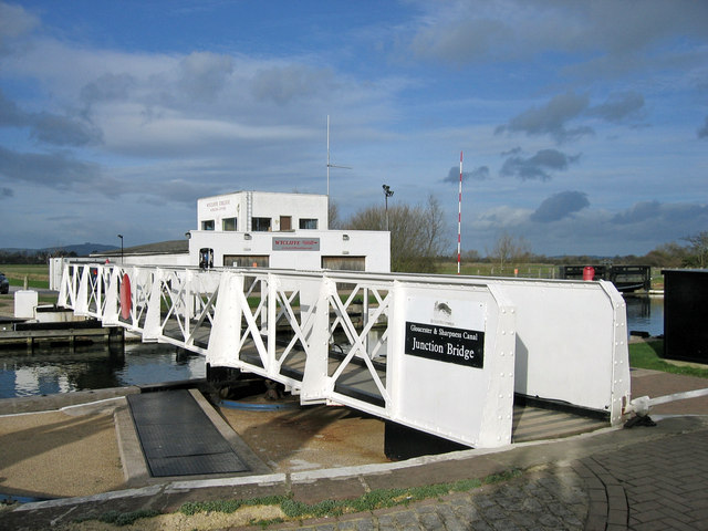
Wycliffe College Boat Club is a rowing club on the Gloucester and Sharpness Canal, based at Wycliffe College boathouse, Junction Bridge, Saul, Gloucestershire...

University of the West of England Boat Club

University of the West of England Boat Club is a rowing club on the Gloucester and Sharpness Canal, based at Wycliffe College boathouse, Junction Bridge...

Nearby Amenities

Located within 500m of 51.793927,-2.3671707
Source: PGS
Lat/Long: 51.7955754/-2.3727962
Source: PGS
Lat/Long: 51.7952275/-2.371834
Source: PGS
Lat/Long: 51.7949909/-2.3711465
Created By: almien_coastlines
Source: PGS
Lat/Long: 51.7945691/-2.3702137
Source: PGS
Lat/Long: 51.7942069/-2.3690058
Source: PGS
Lat/Long: 51.7941233/-2.3681984
Source: PGS
Lat/Long: 51.7940895/-2.367511
Source: PGS
Lat/Long: 51.7940627/-2.3666898
Source: PGS
Lat/Long: 51.7940752/-2.3661768
Source: PGS
Lat/Long: 51.7942285/-2.3642587
Source: PGS
Lat/Long: 51.794332/-2.3635049
Source: PGS
Lat/Long: 51.794541/-2.3621171
Source: PGS
Lat/Long: 51.7948353/-2.3603985
Source: PGS
Lat/Long: 51.7929906/-2.360209
Source: PGS
Lat/Long: 51.7929329/-2.3603756
Source: PGS
Lat/Long: 51.7927299/-2.3628218
Source: PGS
Lat/Long: 51.7924312/-2.3634822
Source: PGS
Lat/Long: 51.7922995/-2.3640205
Source: PGS
Lat/Long: 51.7920191/-2.3658186
Source: PGS
Lat/Long: 51.7919626/-2.3664413
Source: PGS
Lat/Long: 51.7919048/-2.3669724
Source: PGS
Lat/Long: 51.7918876/-2.3685596
Source: PGS
Lat/Long: 51.7921137/-2.3707975
Source: PGS
Lat/Long: 51.7923157/-2.3723918
Created By: almien_coastlines
Source: PGS
Lat/Long: 51.7925209/-2.3734607
Upper Framilode
Is In: Gloucestershire, England, UK
Place: hamlet
Postal Code: GL2 7
Lat/Long: 51.7914339/-2.3625062
Barrier: stile
Lat/Long: 51.7920259/-2.3642826
Bus Stop
Severnleigh
Bus: yes
Naptan AtcoCode: 1600GLS1065
Naptan Bearing: NE
Naptan CommonName: Severnleigh
Naptan NaptanCode: gloapdmw
Naptan Street: Passage Rd
Naptan Verified: no
Public Transport: platform
Source: naptan_import
Lat/Long: 51.7918074/-2.3724162
Bus Stop
Severnleigh
Bus: yes
Naptan AtcoCode: 1600GLS1066
Naptan Bearing: SW
Naptan CommonName: Severnleigh
Naptan NaptanCode: gloapdpa
Naptan Street: Passage Rd
Naptan Verified: no
Public Transport: platform
Source: naptan_import
Lat/Long: 51.7918351/-2.3721845
Barrier: stile
Bicycle: yes
Foot: yes
Material: wood
Step Count: 1
Stile: stepover
Lat/Long: 51.7917181/-2.3660989
Waterway: lock_gate
Lat/Long: 51.7924706/-2.3623696
Waterway: lock_gate
Lat/Long: 51.7925933/-2.3624253
Barrier: stile
Bicycle: yes
Foot: yes
Lat/Long: 51.7916597/-2.3691054
Post Box
Brand: Royal Mail
Brand Wikidata: Q638098
Collection Times: Mo-Fr 16:30; Sa 07:30; Su off
Drive Through: no
Operator: Royal Mail
Operator Wikidata: Q638098
Post Box Type: lamp
Ref: GL2 209
Royal Cypher: EIIR
Royal Cypher Wikidata: Q33102113
Source: survey
Lat/Long: 51.7917651/-2.3705764
Barrier: wicket_gate
Lat/Long: 51.791811/-2.3701779
Addr Housenumber: 8
Addr Street: Canal Row
Lat/Long: 51.7916178/-2.3621201
Post Box
Brand: Royal Mail
Brand Wikidata: Q638098
Collection Times: Mo-Fr 16:00; Sa 10:00; Su off
Drive Through: no
Operator: Royal Mail
Operator Wikidata: Q638098
Post Box Type: lamp
Ref: GL2 139
Royal Cypher: EIIR
Royal Cypher Wikidata: Q33102113
Source: survey
Lat/Long: 51.7919874/-2.3621503
Crown Point
Place: locality
Lat/Long: 51.7940634/-2.3670075
Turning Loop
Lat/Long: 51.7922428/-2.3617086
Framilode
Place: hamlet
Wikidata: Q5477996
Wikipedia: en:Framilode
Lat/Long: 51.7914056/-2.37187
The data included in this document is from www.openstreetmap.org. The data is made available under ODbL.

Have you been to Crown Point?

Leave your review of Crown Point below (or comments, questions and feedback).