Orange End

Settlement in Gloucestershire

England

Orange End

Stone Stile, St Mary's Church Curious cut-outs to let boots pass. There is a wider view showing the lychgate, see <a href="https://www.geograph.org.uk/photo/6493091">ST7686 : Lych gate, St Mary's, Hawkesbury</a>.
Stone Stile, St Mary's Church Credit: Matt Bigwood

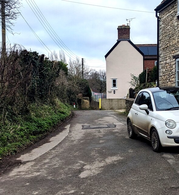
Orange End is a quaint village located in the county of Gloucestershire, England. Situated in the beautiful Cotswolds region, Orange End offers a picturesque countryside setting with its rolling green hills, charming stone cottages, and peaceful atmosphere. The village is nestled between the larger towns of Cirencester and Stroud, providing easy access to amenities while still maintaining its rural character.

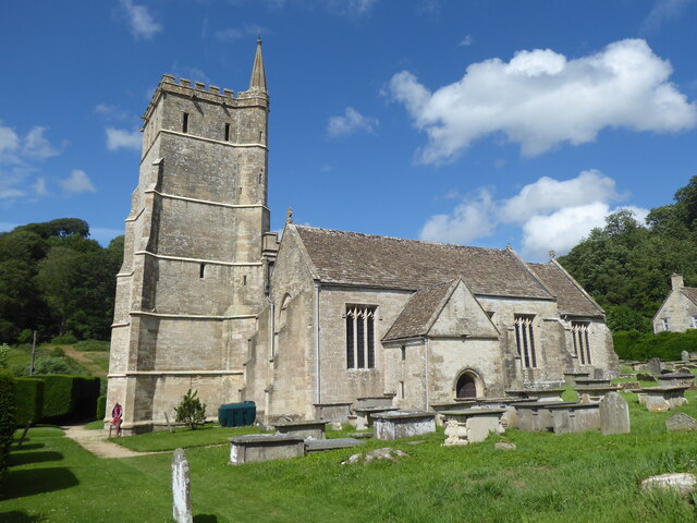
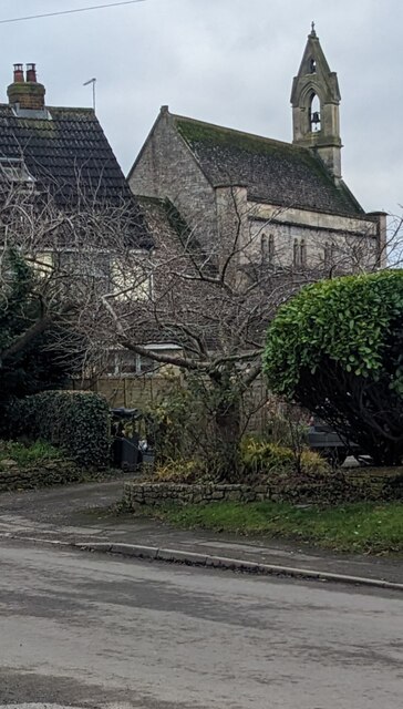
The history of Orange End can be traced back to medieval times, as evidenced by the architecture and layout of the village. The centerpiece of the village is the historic St. Mary's Church, a stunning example of Gothic architecture that dates back to the 12th century. The church is known for its intricate stained glass windows and impressive spire, making it a popular attraction for visitors.

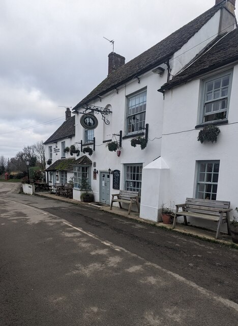
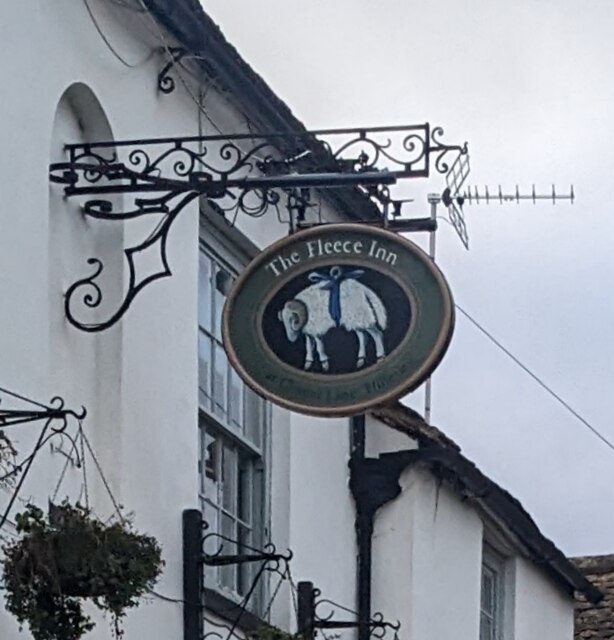
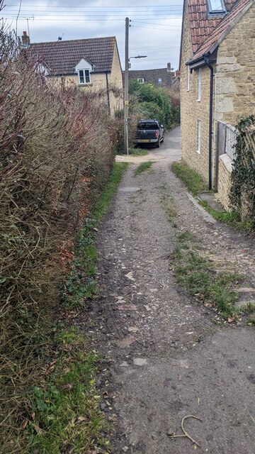
Despite its small size, Orange End boasts a strong sense of community. The village has a local pub, The Orange Tree, which serves as a gathering place for residents and visitors alike. The pub offers a warm and friendly atmosphere, serving traditional English fare and a wide selection of beverages.

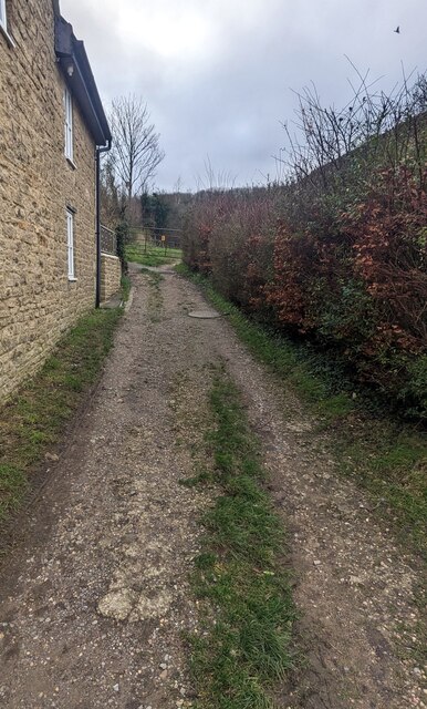
Orange End is surrounded by natural beauty and offers plenty of opportunities for outdoor activities. The nearby countryside provides ample space for walking, hiking, and cycling, and the village is also close to several nature reserves and parks. In addition, the Cotswolds area is known for its scenic drives and charming villages, making Orange End an ideal base for exploring the region.

Overall, Orange End is a tranquil and picturesque village that offers a peaceful escape from the hustle and bustle of city life. With its rich history, stunning architecture, and natural beauty, it is a hidden gem in the heart of Gloucestershire.

If you have any feedback on the listing, please let us know in the comments section below.
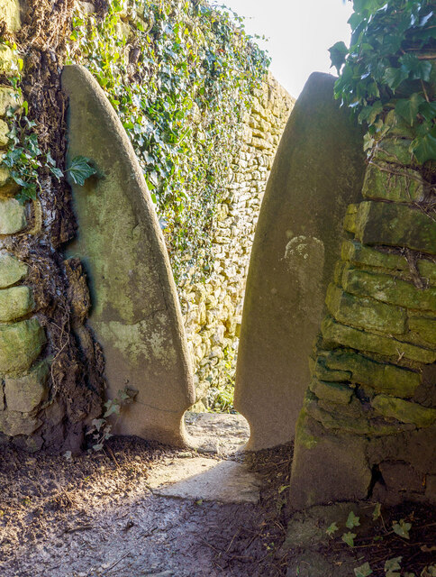
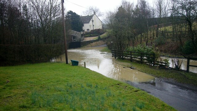
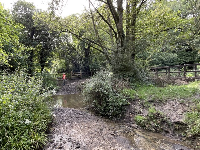
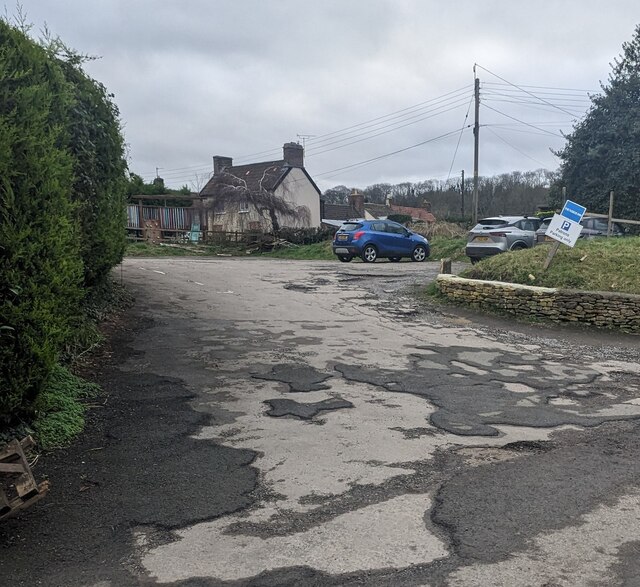
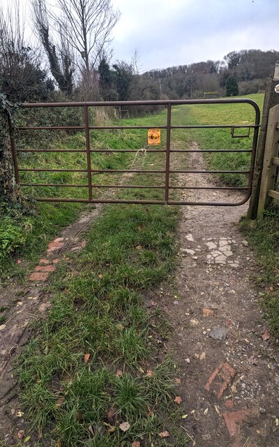
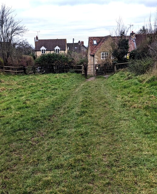
Orange End Images

Images are sourced within 2km of 51.588652/-2.3452756 or Grid Reference ST7687. Thanks to Geograph Open Source API. All images are credited.

Stone Stile, St Mary's Church Curious cut-outs to let boots pass. There is a wider view showing the lychgate, see <a href="https://www.geograph.org.uk/photo/6493091">ST7686 : Lych gate, St Mary's, Hawkesbury</a>.
Stone Stile, St Mary's Church
Curious cut-outs to let boots pass. There is a wider view showing the lychgate, see ST7686 : Lych gate, St Mary's, Hawkesbury.
Flooded road at Lower Chalkley Farm The result of a rapid thaw of snow.
Flooded road at Lower Chalkley Farm
The result of a rapid thaw of snow.
Hawkesbury, St Mary
Hawkesbury, St Mary
Lower Wood Ford This ford is found in Lower Wood Nature Reserve a short walk down from the carpark.
Lower Wood Ford
This ford is found in Lower Wood Nature Reserve a short walk down from the carpark.
The Fleece Inn, Hillesley, Gloucestershire Viewed across Chapel Lane.
The Fleece Inn, Hillesley, Gloucestershire
Viewed across Chapel Lane.
The Fleece Inn name sign, Hillesley, Gloucestershire Hanging from a wall bracket here. <a title="https://www.geograph.org.uk/photo/7671003" href="https://www.geograph.org.uk/photo/7671003">Link</a>
The Fleece Inn name sign, Hillesley, Gloucestershire
Hanging from a wall bracket here. Link
Yellow box, Chapel Lane, Hillesley, Gloucestershire Defibrillator box at an entrance to the Fleece Inn. <a title="https://www.geograph.org.uk/photo/7671003" href="https://www.geograph.org.uk/photo/7671003">Link</a>
Yellow box, Chapel Lane, Hillesley, Gloucestershire
Defibrillator box at an entrance to the Fleece Inn. Link
Chapel Lane houses, Hillesley, Gloucestershire The Fleece Inn <a title="https://www.geograph.org.uk/photo/7671003" href="https://www.geograph.org.uk/photo/7671003">Link</a> is behind the camera.
Chapel Lane houses, Hillesley, Gloucestershire
The Fleece Inn Link is behind the camera.
Fleece Inn Car Park, Hillesley, Gloucestershire Accessed from Chapel Lane a few metres from the inn. <a title="https://www.geograph.org.uk/photo/7671003" href="https://www.geograph.org.uk/photo/7671003">Link</a>
Fleece Inn Car Park, Hillesley, Gloucestershire
Accessed from Chapel Lane a few metres from the inn. Link
Gate across a public footpath, Hillesley, Gloucestershire SE of Chapel Lane. Text on the small yellow notice on the gate includes
POOP SCOOP AREA and CLEAN IT UP.
Gate across a public footpath, Hillesley, Gloucestershire
SE of Chapel Lane. Text on the small yellow notice on the gate includes POOP SCOOP AREA and CLEAN IT UP.
Public footpath through a field,  Hillesley, Gloucestershire SE of this <a title="https://www.geograph.org.uk/photo/7671047" href="https://www.geograph.org.uk/photo/7671047">Link</a> gate.
Public footpath through a field, Hillesley, Gloucestershire
SE of this Link gate.
NW along a public footpath, Hillesley, Gloucestershire Ahead for Chapel Lane and the Fleece Inn. <a title="https://www.geograph.org.uk/photo/7671003" href="https://www.geograph.org.uk/photo/7671003">Link</a>
NW along a public footpath, Hillesley, Gloucestershire
Ahead for Chapel Lane and the Fleece Inn. Link
Stile access to a public footpath, Hillesley, Gloucestershire No need for walkers to use this stile today - the adjacent gate <a title="https://www.geograph.org.uk/photo/7671047" href="https://www.geograph.org.uk/photo/7671047">Link</a> is not locked.
Stile access to a public footpath, Hillesley, Gloucestershire
No need for walkers to use this stile today - the adjacent gate Link is not locked.
Public footpath notices, Hillesley, Gloucestershire Gloucestershire County Council information for dog walkers.
The notices are alongside this <a title="https://www.geograph.org.uk/photo/7671047" href="https://www.geograph.org.uk/photo/7671047">Link</a> gate
Public footpath notices, Hillesley, Gloucestershire
Gloucestershire County Council information for dog walkers. The notices are alongside this Link gate
ENE along Chapel Lane, Hillesley, Gloucestershire Ahead for the former Baptist Chapel <a title="https://www.geograph.org.uk/photo/3662562" href="https://www.geograph.org.uk/photo/3662562">Link</a>
ENE along Chapel Lane, Hillesley, Gloucestershire
Ahead for the former Baptist Chapel Link
From Chapel Lane towards a public footpath, Hillesley, Gloucestershire Looking to the SE from Chapel Lane towards this <a title="https://www.geograph.org.uk/photo/7671047" href="https://www.geograph.org.uk/photo/7671047">Link</a> gate.
From Chapel Lane towards a public footpath, Hillesley, Gloucestershire
Looking to the SE from Chapel Lane towards this Link gate.
Towards Chapel Lane from a public footpath, Hillesley, Gloucestershire This <a title="https://www.geograph.org.uk/photo/7671047" href="https://www.geograph.org.uk/photo/7671047">Link</a> gate is behind the camera.
Towards Chapel Lane from a public footpath, Hillesley, Gloucestershire
This Link gate is behind the camera.
Towards the village church,  Hillesley, Gloucestershire Looking across High Street towards the Church of St Giles.
Towards the village church, Hillesley, Gloucestershire
Looking across High Street towards the Church of St Giles.
Show me another place!

Orange End is located at Grid Ref: ST7687 (Lat: 51.588652, Lng: -2.3452756)

Unitary Authority: South Gloucestershire

Police Authority: Avon and Somerset

What 3 Words

///elects.skate.fast. Near Horton, Gloucestershire

Related Wikis

Hawkesbury Meadow

Hawkesbury Meadow (grid reference ST754874) is a 3.3 hectare biological Site of Special Scientific Interest (SSSI) in South Gloucestershire, notified in...

Lord Robert Somerset

General Lord Robert Edward Henry Somerset (19 December 1776 – 1 September 1842) was a British soldier who fought during the Peninsular War and the War...

Hawkesbury, Gloucestershire

Hawkesbury is a hamlet and civil parish in the area of the South Gloucestershire unitary authority in England. The hamlet, consisting of a few cottages...

Hawkesbury Quarry

Hawkesbury Quarry (grid reference ST771873) is a 0.25-hectare (0.62-acre) geological Site of Special Scientific Interest near the village of Hawkesbury...

Nearby Amenities

Located within 500m of 51.588652,-2.3452756
Telephone
Defibrillator
Booth: K6
Covered: booth
Defibrillator Location: inside red phone box, Inglestone Common
Emergency: defibrillator
Man Made: telephone_box
Lat/Long: 51.5886322/-2.34477
Barrier: cattle_grid
Lat/Long: 51.5887098/-2.3444297
Bus Stop
Orange End
Naptan AtcoCode: 0170SGA19727
Naptan Bearing: W
Naptan CommonName: Orange End
Naptan NaptanCode: sglpjdg
Naptan Street: Chase Lane
Naptan Verified: no
Source: naptan_import
Lat/Long: 51.5886597/-2.345545
Bus Stop
Orange End
Naptan AtcoCode: 0170SGA19728
Naptan Bearing: E
Naptan CommonName: Orange End
Naptan NaptanCode: sglpjda
Naptan Street: Chase Lane
Naptan Verified: no
Source: naptan_import
Lat/Long: 51.5887189/-2.3453628
Bus Stop
Inglestone Common
Naptan AtcoCode: 0170SGA19729
Naptan Bearing: N
Naptan CommonName: Inglestone Common
Naptan NaptanCode: sglpjaw
Naptan Street: Oxleaze Farm Road
Naptan Verified: no
Source: naptan_import
Lat/Long: 51.5918613/-2.3469312
Bus Stop
Inglestone Common
Naptan AtcoCode: 0170SGA19730
Naptan Bearing: S
Naptan CommonName: Inglestone Common
Naptan NaptanCode: sglpjat
Naptan Street: Oxleaze Farm Road
Naptan Verified: no
Source: naptan_import
Lat/Long: 51.5917359/-2.346757
Post Box
Post Box Type: wall
Ref: GL9 203D
Royal Cypher: GR
Royal Cypher Wikidata: Q33102273
Lat/Long: 51.5887623/-2.3461954
Power: pole
Lat/Long: 51.5901685/-2.3464547
Power: pole
Lat/Long: 51.5896957/-2.345709
Power: pole
Lat/Long: 51.5896096/-2.344529
Power: pole
Lat/Long: 51.589501/-2.3433612
Power: pole
Lat/Long: 51.5888125/-2.3445841
Power: pole
Lat/Long: 51.5883242/-2.3454652
Power: pole
Lat/Long: 51.5875734/-2.3460701
Power: pole
Lat/Long: 51.5865212/-2.3469483
Power: pole
Lat/Long: 51.5861029/-2.347278
Power: pole
Lat/Long: 51.5855755/-2.347717
Power: pole
Lat/Long: 51.5893871/-2.3419673
Power: pole
Lat/Long: 51.5889965/-2.3400891
Power: pole
Lat/Long: 51.5853144/-2.3462253
Power: pole
Lat/Long: 51.5851052/-2.3481459
Direction: 200
Generator Method: photovoltaic
Generator Output Electricity: yes
Generator Solar Modules: 12
Generator Source: solar
Generator Type: solar_photovoltaic_panel
Location: roof
Power: generator
Lat/Long: 51.5889851/-2.3463433
The data included in this document is from www.openstreetmap.org. The data is made available under ODbL.

Have you been to Orange End?

Leave your review of Orange End below (or comments, questions and feedback).