Offmore Farm

Settlement in Worcestershire Wyre Forest

England

Offmore Farm

Spennells Valley Nature Reserve A nature reserve situated within an extensive housing development. Picture taken looking west into the reserve from grid reference SO84790 75310, a few metres west of the A448.
Spennells Valley Nature Reserve Credit: Martyn B

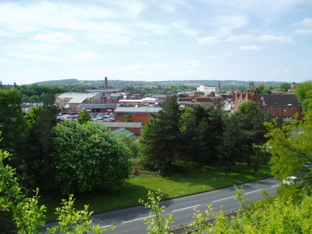
Offmore Farm is a rural area located in Worcestershire, a county in the West Midlands region of England. This picturesque farm is situated approximately 3 miles south of the bustling town of Kidderminster.

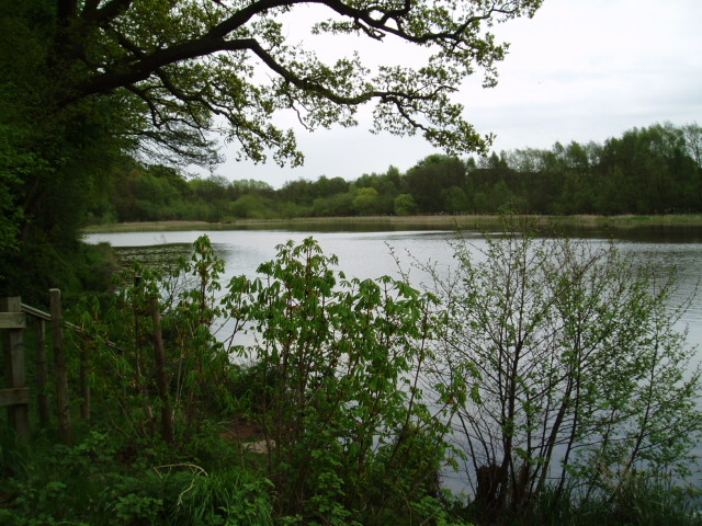
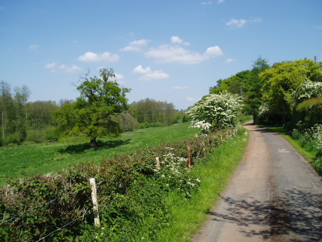
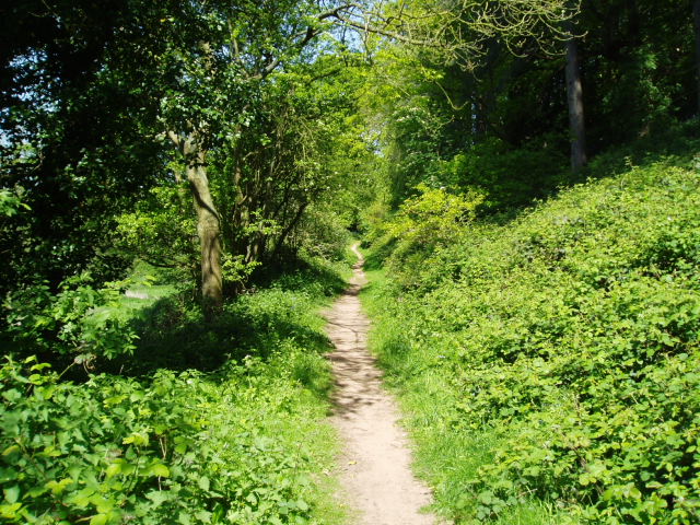
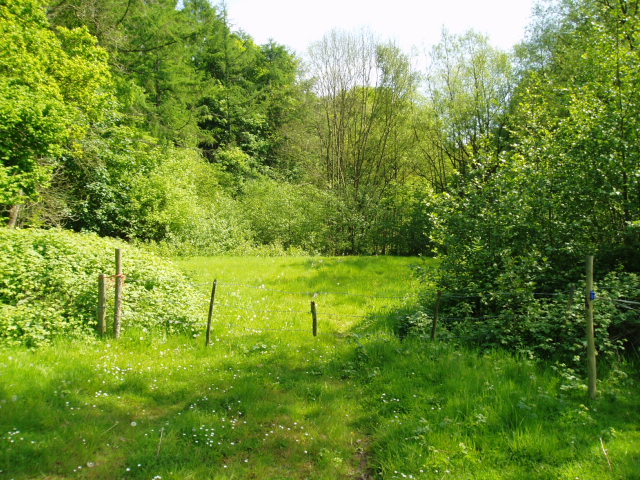
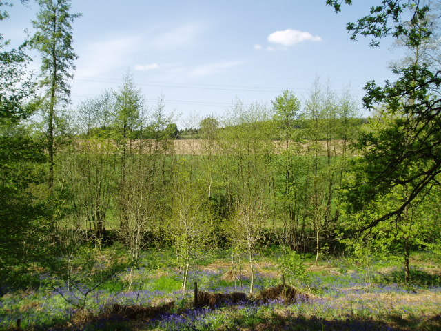
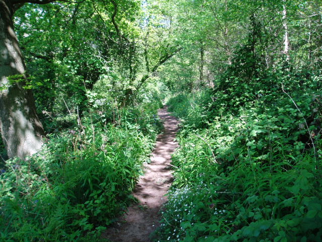
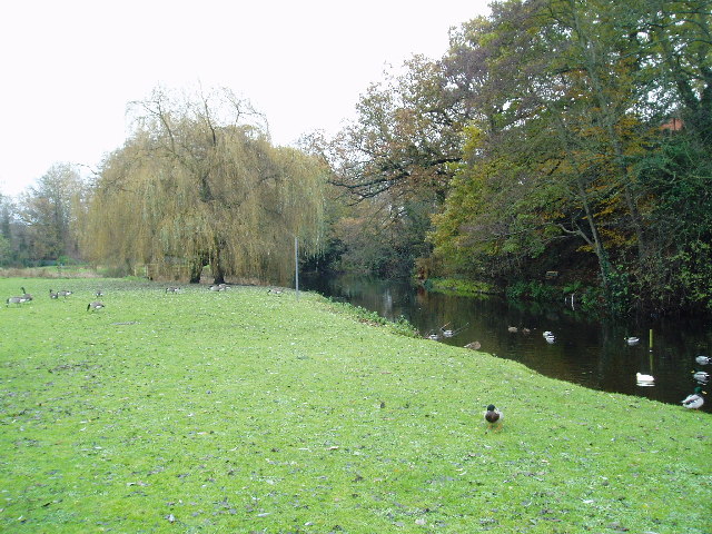
Offmore Farm is known for its serene and idyllic countryside setting, characterized by rolling hills, meadows, and lush green fields. The landscape is dotted with traditional farmhouses, barns, and outbuildings, which add to the charm and character of the area. The farm is surrounded by a patchwork of farmland, providing a tranquil and peaceful atmosphere.

The farm primarily focuses on agriculture, with a variety of crops grown throughout the year. The fertile soil and favorable climate of Worcestershire contribute to the success of the farm's agricultural endeavors. Common crops grown at Offmore Farm include wheat, barley, oilseed rape, and potatoes.

Livestock farming is also an important aspect of Offmore Farm's operations. The farm rears a range of animals, including cattle and sheep. The livestock is well-cared for and grazes freely in the extensive pastures surrounding the farm.

Offmore Farm offers a glimpse into the traditional rural way of life in Worcestershire. Visitors to the area can enjoy scenic walks, exploring the countryside and taking in the natural beauty of the surroundings. The farm's peaceful atmosphere provides a welcome escape from the hustle and bustle of urban life.

If you have any feedback on the listing, please let us know in the comments section below.
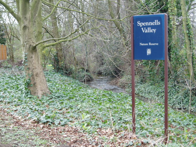
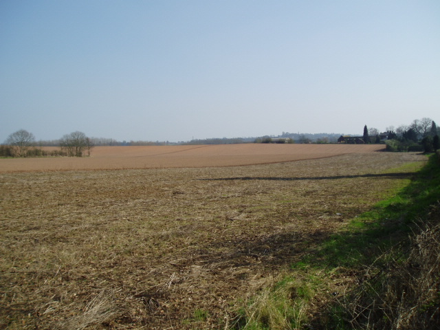
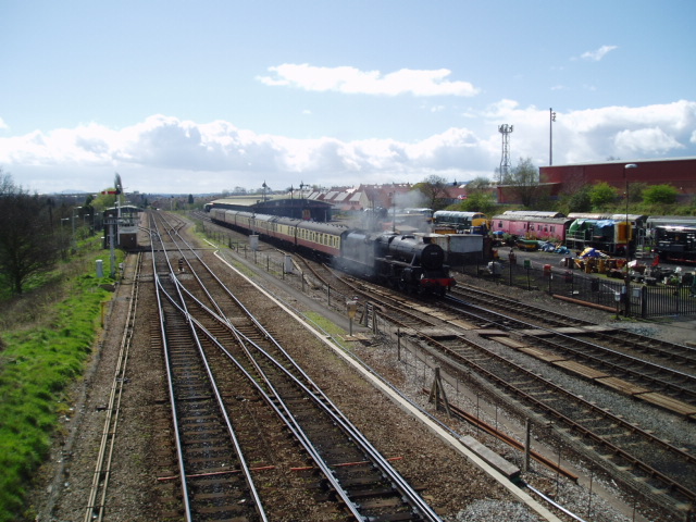
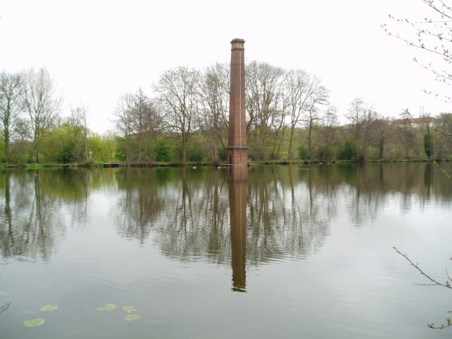
Offmore Farm Images

Images are sourced within 2km of 52.388035/-2.223047 or Grid Reference SO8476. Thanks to Geograph Open Source API. All images are credited.

Spennells Valley Nature Reserve A nature reserve situated within an extensive housing development. Picture taken looking west into the reserve from grid reference SO84790 75310, a few metres west of the A448.
Spennells Valley Nature Reserve
A nature reserve situated within an extensive housing development. Picture taken looking west into the reserve from grid reference SO84790 75310, a few metres west of the A448.
Farmland Taken at the western edge of the grid square at reference SO85028 75636, at the junction of a rough farm track and bridleway, looking in a north-easterly direction. There are not so many geographical features publicly accessible in this square, although the pylon in the north-east section of the square is just visible.
Farmland
Taken at the western edge of the grid square at reference SO85028 75636, at the junction of a rough farm track and bridleway, looking in a north-easterly direction. There are not so many geographical features publicly accessible in this square, although the pylon in the north-east section of the square is just visible.
Open farmland, east of Kidderminster. Picture taken from the minor road at SO8513 76982, looking south-east towards Offmore Farm, visible on the right of the photograph. Lack of public access limits the scope of recording geographical features within this square.
Open farmland, east of Kidderminster.
Picture taken from the minor road at SO8513 76982, looking south-east towards Offmore Farm, visible on the right of the photograph. Lack of public access limits the scope of recording geographical features within this square.
Severn Valley & mainline railways, Kidderminster Looking South from the footbridge at SO 83727 75926, a steam train slowly makes its way along the last few hundred metres into the Severn Valley railway station in Kidderminster. On the left is the main line between Kidderminster & Worcester. Towards the top right of the picture is the back of the stand at Kidderminster Harriers Football Club.
Severn Valley & mainline railways, Kidderminster
Looking South from the footbridge at SO 83727 75926, a steam train slowly makes its way along the last few hundred metres into the Severn Valley railway station in Kidderminster. On the left is the main line between Kidderminster & Worcester. Towards the top right of the picture is the back of the stand at Kidderminster Harriers Football Club.
Stack Pool, Kidderminster The chimney built at the edge of the pool can be identified on the 1:25,000 map as the small dot on the north bank of the main pool. Picture taken from SO 83389 77754.
Stack Pool, Kidderminster
The chimney built at the edge of the pool can be identified on the 1:25,000 map as the small dot on the north bank of the main pool. Picture taken from SO 83389 77754.
Hurcott Pool Picture taken from SO 85164 77937, the car park at the west end of the pool, looking east.
Hurcott Pool
Picture taken from SO 85164 77937, the car park at the west end of the pool, looking east.
Kidderminster Taken from the minor road at SO 83515 76309, the photograph depicts the view looking north-west across the town centre of Kidderminster. This is a view which has changed considerably over the past four years during which time some of the former carpet factories have made way for new retail developments. Much of the town’s layout  differs from its current representation on the OS map : the bus station and law courts now occupy different sites, and the river has been re-routed in order to accommodate a super-market car park.
Kidderminster
Taken from the minor road at SO 83515 76309, the photograph depicts the view looking north-west across the town centre of Kidderminster. This is a view which has changed considerably over the past four years during which time some of the former carpet factories have made way for new retail developments. Much of the town’s layout differs from its current representation on the OS map : the bus station and law courts now occupy different sites, and the river has been re-routed in order to accommodate a super-market car park.
Around Dunclent Picture taken from SO 86387 75602 from the track south-west of Dunclent House, shown on the OS map as a public footpath, looking north-east across pastureland.
Around Dunclent
Picture taken from SO 86387 75602 from the track south-west of Dunclent House, shown on the OS map as a public footpath, looking north-east across pastureland.
Around Dunclent Supplementary photograph taken from the public footpath at SO 86539 75769, looking north-east along the edge of the wood
Around Dunclent
Supplementary photograph taken from the public footpath at SO 86539 75769, looking north-east along the edge of the wood
Fenny Rough Supplementary photograph taken from the public footpath at SO 86396 75285, looking south-east into the steep-sided valley known as Fenny Rough
Fenny Rough
Supplementary photograph taken from the public footpath at SO 86396 75285, looking south-east into the steep-sided valley known as Fenny Rough
Around Dunclent, Mount Segg Public access is limited to a footpath across the south-east corner of this square, thus limiting photographic opportunities. The picture is taken from the public footpath at SO 86912 76245, looking north across the farmland towards the southern tip of Bissell Wood.
Around Dunclent, Mount Segg
Public access is limited to a footpath across the south-east corner of this square, thus limiting photographic opportunities. The picture is taken from the public footpath at SO 86912 76245, looking north across the farmland towards the southern tip of Bissell Wood.
Mount Segg Taken from the same location as the main picture at SO 86912 76245, looking north-east along the footpath through woodland at Mount Segg
Mount Segg
Taken from the same location as the main picture at SO 86912 76245, looking north-east along the footpath through woodland at Mount Segg
Kidderminster Magistrates Court The new Magistrates Court building is situated in Comberton Place, just below the Severn Valley Railway station.
Kidderminster Magistrates Court
The new Magistrates Court building is situated in Comberton Place, just below the Severn Valley Railway station.
Farmland Taken from the same spot as the first geograph picture, compare this early winter view with the early spring view taken eight months earlier.
Farmland
Taken from the same spot as the first geograph picture, compare this early winter view with the early spring view taken eight months earlier.
The pool which does not exist! For some inexplicable reason, this pool is not shown on the Ordnance Survey map. The picture has been taken from SO 85469 75614, looking north, and the pool is situated on the north side of the public footpath which runs roughly east to west between Heathy Mill Farm and Dunclent Farm. The obvious explanation for its non-appearance on the maps would be that it has only recently been artificially created, but to my knowledge, it has existed in its current location for at least seven years and probably much longer than that! Perhaps the next revised editions of the relevant maps will include the pool - or perhaps there is something lurking within its depths which render it invisible to aerial and satellite photography....!!
The pool which does not exist!
For some inexplicable reason, this pool is not shown on the Ordnance Survey map. The picture has been taken from SO 85469 75614, looking north, and the pool is situated on the north side of the public footpath which runs roughly east to west between Heathy Mill Farm and Dunclent Farm. The obvious explanation for its non-appearance on the maps would be that it has only recently been artificially created, but to my knowledge, it has existed in its current location for at least seven years and probably much longer than that! Perhaps the next revised editions of the relevant maps will include the pool - or perhaps there is something lurking within its depths which render it invisible to aerial and satellite photography....!!
Broadwaters Mill Broadwaters Mill is situated immediately adjacent to the A449 trunk road, at the foot of the grid square. Picture taken from SO 84138 78036.
Broadwaters Mill
Broadwaters Mill is situated immediately adjacent to the A449 trunk road, at the foot of the grid square. Picture taken from SO 84138 78036.
Broadwaters Mill pool The picture shows the feeder pool situated to the east of Broadwaters Mill. Taken from SO 84166 78026.
Broadwaters Mill pool
The picture shows the feeder pool situated to the east of Broadwaters Mill. Taken from SO 84166 78026.
Kidderminster Town Station This is the southern terminus of the Severn Valley Railway <span class="nowrap"><a title="http://www.svr.org.uk" rel="nofollow ugc noopener" href="http://www.svr.org.uk">Link</a><img style="margin-left:2px;" alt="External link" title="External link - shift click to open in new window" src="https://s1.geograph.org.uk/img/external.png" width="10" height="10"/></span> , not to be confused with the more modest affair next door <a href="https://www.geograph.org.uk/photo/118927">SO8376 : Kidderminster (Network Rail) Station</a> .  Despite appearances the station building was only constructed in 1986 and is a classic Great Western Railway design modelled on the now closed Ross on Wye station <span class="nowrap"><a title="http://www.ross-on-wye.com/index.php?page=ross_541-Old_pictures_and_photos_from_Ross&pg=1" rel="nofollow ugc noopener" href="http://www.ross-on-wye.com/index.php?page=ross_541-Old_pictures_and_photos_from_Ross&pg=1">Link</a><img style="margin-left:2px;" alt="External link" title="External link - shift click to open in new window" src="https://s1.geograph.org.uk/img/external.png" width="10" height="10"/></span> on the former Gloucester to Hereford line. Details such as the roof crestings and the porte cochere (the canopy over the entrance) have been added over the years through the work of The Friends of Kidderminster Station <span class="nowrap"><a title="http://www.kfriends.org.uk" rel="nofollow ugc noopener" href="http://www.kfriends.org.uk">Link</a><img style="margin-left:2px;" alt="External link" title="External link - shift click to open in new window" src="https://s1.geograph.org.uk/img/external.png" width="10" height="10"/></span> .  Extension work is currently in progress by the SVR to extend the station building with another wing and a canopy over the concourse <a href="https://www.geograph.org.uk/photo/118931">SO8376 : Building work at Kidderminster Town Station</a>.
Kidderminster Town Station
This is the southern terminus of the Severn Valley Railway LinkExternal link , not to be confused with the more modest affair next door SO8376 : Kidderminster (Network Rail) Station . Despite appearances the station building was only constructed in 1986 and is a classic Great Western Railway design modelled on the now closed Ross on Wye station LinkExternal link on the former Gloucester to Hereford line. Details such as the roof crestings and the porte cochere (the canopy over the entrance) have been added over the years through the work of The Friends of Kidderminster Station LinkExternal link . Extension work is currently in progress by the SVR to extend the station building with another wing and a canopy over the concourse SO8376 : Building work at Kidderminster Town Station.
Show me another place!

Offmore Farm is located at Grid Ref: SO8476 (Lat: 52.388035, Lng: -2.223047)

Administrative County: Worcestershire

District: Wyre Forest

Police Authority: West Merica

What 3 Words

///flood.camera.hope. Near Kidderminster, Worcestershire

Nearby Locations

Comberton Offmore Farm

Related Wikis

Chester Road North Ground, Kidderminster

The Chester Road North Ground, often referred to simply as Chester Road or Kidderminster, is a cricket ground in Kidderminster, Worcestershire, England...

The Shrubbery, Kidderminster

The Shrubbery is a former military installation in Kidderminster, Worcestershire. It is a Grade II listed building. == History == The building is an early...

Wyre Forest School

Wyre Forest School (formerly Stourminster Special School) is a school in Kidderminster, Worcestershire, for students with complex special needs, and...

Holy Trinity School, Kidderminster

Holy Trinity School is a co-educational free school located in Kidderminster, Worcestershire, England, offering education to children from 4 years up to...

Nearby Amenities

Located within 500m of 52.388035,-2.223047
Crossing
Crossing: uncontrolled
Source: bing
Lat/Long: 52.3882967/-2.2230583
Bus Stop
Offmore- Tennyson Way-First School
Bus: yes
Naptan AtcoCode: 2000G096900
Naptan Bearing: SE
Naptan CommonName: Offmore- Tennyson Way-First School
Naptan Indicator: Adj
Naptan Landmark: Wordsworth Crescent
Naptan NaptanCode: wocdpmwj
Naptan PlusbusZoneRef: KDRMNST
Naptan Street: Wordsworth Crescent
Naptan Verified: no
Public Transport: platform
Source: naptan_import
Lat/Long: 52.3889755/-2.2246893
Bus Stop
Offmore Shops
Bus: yes
Naptan AtcoCode: 2000G096901
Naptan Bearing: W
Naptan CommonName: Offmore Shops
Naptan Indicator: Adj
Naptan Landmark: Shops
Naptan NaptanCode: wocdpmwm
Naptan PlusbusZoneRef: KDRMNST
Naptan Street: Tennyson Way
Public Transport: platform
Shelter: no
Source: naptan_import;survey
Wheelchair: yes
Lat/Long: 52.3891113/-2.2216692
Bus Stop
Chaucer Crescent
Asset Ref: 2809 0030
Bus: yes
Naptan AtcoCode: 2000G096996
Naptan Bearing: N
Naptan CommonName: Chaucer Crescent
Naptan Crossing: Chaucer Crescent
Naptan Indicator: opp
Naptan NaptanCode: wocdpmwp
Naptan PlusbusZoneRef: KDRMNST
Naptan Street: Tennyson Way
Public Transport: platform
Route Ref: 10
Shelter: yes
Source: naptan_import;source
Lat/Long: 52.3867842/-2.2198052
Bus Stop
Ashdene Close
Bus: yes
Layby: yes
Naptan AtcoCode: 2000G096997
Naptan Bearing: NE
Naptan CommonName: Ashdene Close
Naptan Crossing: Ashdene Close
Naptan Indicator: opp
Naptan NaptanCode: wocdpmwt
Naptan PlusbusZoneRef: KDRMNST
Naptan Street: Tennyson Way
Public Transport: platform
Route Ref: 10
Shelter: no
Source: naptan_import;survey
Lat/Long: 52.3847202/-2.2205604
Bus Stop
Byron Close
Bus: yes
Naptan AtcoCode: 2000G096998
Naptan Bearing: N
Naptan CommonName: Byron Close
Naptan Crossing: Byron Close
Naptan Indicator: adj
Naptan NaptanCode: wocdptad
Naptan PlusbusZoneRef: KDRMNST
Naptan Street: Tennyson Way
Naptan Verified: no
Public Transport: platform
Source: naptan_import
Lat/Long: 52.3853205/-2.2225549
Bus Stop
Kipling Walk
Asset Ref: 2809 0023
Bus: yes
Layby: yes
Naptan AtcoCode: 2000G096999
Naptan Bearing: N
Naptan CommonName: Kipling Walk
Naptan Crossing: Kipling Walk
Naptan Indicator: adj
Naptan NaptanCode: wocdptag
Naptan PlusbusZoneRef: KDRMNST
Naptan Street: Tennyson Way
Public Transport: platform
Route Ref: 10
Shelter: yes
Source: naptan_import;survey
Lat/Long: 52.3874651/-2.2228685
Bus Stop
Keats Place
Bus: yes
Naptan AtcoCode: 2000G102600
Naptan Bearing: N
Naptan CommonName: Keats Place
Naptan Crossing: Keats Place
Naptan Indicator: Adj
Naptan NaptanCode: wocdjawd
Naptan PlusbusZoneRef: KDRMNST
Naptan Street: Wordsworth Crescent
Naptan Verified: no
Public Transport: platform
Source: naptan_import
Lat/Long: 52.388361/-2.2263466
Bus Stop
Comberton- Comberton Arms
Bus: yes
Naptan AtcoCode: 2000G196801
Naptan Bearing: SW
Naptan CommonName: Comberton- Comberton Arms
Naptan Indicator: Adj
Naptan Landmark: Post Office
Naptan NaptanCode: wocdpjga
Naptan PlusbusZoneRef: KDRMNST
Naptan Street: Doverdale Avenue
Naptan Verified: no
Public Transport: platform
Source: naptan_import
Lat/Long: 52.3858578/-2.2283614
Bus Stop
Queen Elizabeth Road
Bus: yes
Naptan AtcoCode: 2000G196804
Naptan Bearing: N
Naptan CommonName: Queen Elizabeth Road
Naptan Indicator: Adj
Naptan Landmark: Queen Elizabeth Road
Naptan NaptanCode: wocdapjw
Naptan PlusbusZoneRef: KDRMNST
Naptan Street: Queen Elizabeth Road
Naptan Verified: no
Public Transport: platform
Source: naptan_import
Lat/Long: 52.3861248/-2.2251156
Bus Stop
Queen Elizabeth Road
Bus: yes
Naptan AtcoCode: 2000G196805
Naptan Bearing: N
Naptan CommonName: Queen Elizabeth Road
Naptan Indicator: Adj
Naptan Landmark: Queen Elizabeth Road
Naptan NaptanCode: wocdapma
Naptan PlusbusZoneRef: KDRMNST
Naptan Street: Queen Elizabeth Road
Naptan Verified: no
Public Transport: platform
Source: naptan_import
Lat/Long: 52.3857753/-2.2245261
Bus Stop
Claines Crescent- Comberton
Bus: yes
Naptan AtcoCode: 2000G196807
Naptan Bearing: NE
Naptan CommonName: Claines Crescent- Comberton
Naptan Indicator: Adj
Naptan Landmark: Post Office
Naptan NaptanCode: wocdapmg
Naptan PlusbusZoneRef: KDRMNST
Naptan Street: Doverdale Avenue
Naptan Verified: no
Public Transport: platform
Source: naptan_import
Lat/Long: 52.3863179/-2.2275557
Bus Stop
Comberton Church
Bus: yes
Naptan AtcoCode: 2000G502297
Naptan Bearing: SE
Naptan CommonName: Comberton Church
Naptan Indicator: adj
Naptan Landmark: Church
Naptan NaptanCode: wocgjtmw
Naptan PlusbusZoneRef: KDRMNST
Naptan Street: Coronation Way
Naptan Verified: no
Public Transport: platform
Source: naptan_import
Lat/Long: 52.385114/-2.2271381
Bus Stop
Coronation Way
Bus: yes
Naptan AtcoCode: 2000G502301
Naptan Bearing: N
Naptan CommonName: Coronation Way
Naptan Indicator: adj
Naptan NaptanCode: wocgjtpd
Naptan PlusbusZoneRef: KDRMNST
Naptan Street: Coronation Way
Naptan Verified: no
Public Transport: platform
Source: naptan_import
Lat/Long: 52.3837691/-2.2252065
Barrier: bollard
Source: survey
Lat/Long: 52.3887109/-2.2293953
Operator: National Grid Electricity Distribution
Operator Wikidata: Q7988183
Power: substation
Ref: 0708739
Source: survey
Lat/Long: 52.3887311/-2.2292798
Turning Circle
Source: survey
Lat/Long: 52.3919094/-2.2214651
Barrier: cycle_barrier
Source: survey
Lat/Long: 52.3902683/-2.2268998
Operator: National Grid Electricity Distribution
Operator Wikidata: Q7988183
Power: substation
Source: visual survey;estimate
Lat/Long: 52.3899881/-2.2265114
Grit Bin
Source: survey
Lat/Long: 52.3902467/-2.2245957
Grit Bin
Ref: N112
Source: survey
Lat/Long: 52.390904/-2.2213646
Noexit: yes
Lat/Long: 52.3920335/-2.2203753
Barrier: cycle_barrier
Source: survey
Lat/Long: 52.389606/-2.225674
Barrier: bollard
Source: survey
Lat/Long: 52.3894297/-2.2254413
Barrier: bollard
Source: survey
Lat/Long: 52.3892632/-2.225361
Mini Roundabout
Direction: clockwise
Source: survey
Lat/Long: 52.3885193/-2.2230093
Mini Roundabout
Direction: clockwise
Source: survey
Lat/Long: 52.384446/-2.222586
Grit Bin
Ref: N113
Source: survey
Lat/Long: 52.3907339/-2.2233527
Pub
The Cavalier
Source: survey
Wheelchair: limited
Lat/Long: 52.3886758/-2.2205781
Operator: National Grid Electricity Distribution
Operator Wikidata: Q7988183
Power: substation
Source: survey
Lat/Long: 52.3877332/-2.2212037
Barrier: bollard
Lat/Long: 52.3877861/-2.2198845
Barrier: bollard
Lat/Long: 52.3878005/-2.2212939
Barrier: bollard
Source: survey
Lat/Long: 52.3873934/-2.2191845
Barrier: bollard
Source: survey
Lat/Long: 52.3878857/-2.221379
Nisa Local
Brand: Nisa Local
Brand Wikidata: Q16999069
Brand Wikipedia: en:Nisa (retailer)
Shop: convenience
Source: survey
Wheelchair: yes
Lat/Long: 52.3885811/-2.2210014
L A Styles
Shop: hairdresser
Source: survey
Lat/Long: 52.3887331/-2.2211056
Fast Food
Salena's Fish Bar
Cuisine: fish_and_chips
Source: survey
Lat/Long: 52.3888354/-2.2211373
Post Box
Post Box Type: pillar
Postal Code: DY10
Ref: DY10 1
Source: GPS Survey
Lat/Long: 52.3888956/-2.2212874
Offmoor Community Centre
Building: public
Source: survey
Lat/Long: 52.3882484/-2.2223169
Barrier: bollard
Source: survey
Lat/Long: 52.3874965/-2.2228434
Barrier: bollard
Source: survey
Lat/Long: 52.3875214/-2.2218308
Barrier: bollard
Source: survey
Lat/Long: 52.3871776/-2.2211484
Barrier: bollard
Source: survey
Lat/Long: 52.3872034/-2.2198271
Place Of Worship
Offmoor Evagelical Church
Postal Code: DY10
Religion: christian
Source: survey
Lat/Long: 52.3884901/-2.2224655
Noexit: yes
Lat/Long: 52.38826/-2.221078
Barrier: bollard
Source: survey
Lat/Long: 52.3868633/-2.2227363
Barrier: bollard
Source: survey
Lat/Long: 52.3866164/-2.2198312
Barrier: bollard
Source: survey
Lat/Long: 52.3866123/-2.2210914
Barrier: bollard
Source: survey
Lat/Long: 52.3868836/-2.2213965
Barrier: bollard
Source: survey
Lat/Long: 52.3862831/-2.2227375
Barrier: bollard
Source: survey
Lat/Long: 52.3863128/-2.2213771
Barrier: bollard
Source: survey
Lat/Long: 52.3856974/-2.2225811
Barrier: bollard
Source: survey
Lat/Long: 52.3859994/-2.2210647
Barrier: bollard
Source: survey
Lat/Long: 52.3857333/-2.2212674
Barrier: bollard
Source: survey
Lat/Long: 52.3860197/-2.2197503
Operator: National Grid Electricity Distribution
Operator Wikidata: Q7988183
Power: substation
Source: survey
Lat/Long: 52.3853966/-2.2237477
Barrier: cycle_barrier
Source: survey
Lat/Long: 52.385492/-2.2238303
Barrier: bollard
Source: survey
Lat/Long: 52.3852485/-2.2214172
Barrier: bollard
Source: survey
Lat/Long: 52.384505/-2.2221263
Post Box
Postal Code: DY10
Ref: DY10 27
Source: GPS Survey
Lat/Long: 52.3845062/-2.2212094
Offmore Farm
Is In: Kidderminster
Note: speeling changed for OS Streetview in lin ewith all surrounding data
Place: village
Source: OS OpenData StreetView
Lat/Long: 52.3887746/-2.2230681
Select & Save
Shop: supermarket
Source: survey
Lat/Long: 52.3852551/-2.2267958
Post Office
Burcher Green Post Office
Addr City: Kidderminster
Addr Housenumber: 3
Addr Postcode: DY10 3AY
Addr Street: Burcher Green
Brand: Post Office
Brand Wikidata: Q1783168
Opening Hours: Mo-Sa 05:30-20:00; Su 07:00-20:00
Ref Pol Id: 9184
Source: survey
Website: https://www.postoffice.co.uk/branch-finder/2372088/burcher-green
Lat/Long: 52.3855857/-2.2275178
Post Box
Post Box Type: pillar
Ref: DY10 217
Royal Cypher: GR
Royal Cypher Wikidata: Q33102273
Source: GPS Survey
Lat/Long: 52.3855263/-2.2275356
Fast Food
Catch of the Day
Cuisine: fish_and_chips
Source: survey
Wheelchair: limited
Lat/Long: 52.3857227/-2.228735
Generator Method: photovoltaic
Generator Output Electricity: yes
Generator Source: solar
Generator Type: solar_photovoltaic_panel
Location: roof
Power: generator
Lat/Long: 52.3915712/-2.227132
Bench
Lat/Long: 52.3837858/-2.2217659
Bench
Lat/Long: 52.3837208/-2.2216696
Bench
Lat/Long: 52.3839349/-2.2220179
Bench
Lat/Long: 52.3839724/-2.2219485
Bench
Lat/Long: 52.3840319/-2.2218494
Bench
Lat/Long: 52.3840944/-2.2217518
Bench
Lat/Long: 52.3841585/-2.2216478
Entrance: yes
Lat/Long: 52.3836122/-2.2230883
Entrance: yes
Lat/Long: 52.3843652/-2.2220367
Entrance: yes
Lat/Long: 52.3839499/-2.2227764
Generator Method: photovoltaic
Generator Output Electricity: yes
Generator Source: solar
Generator Type: solar_photovoltaic_panel
Location: roof
Power: generator
Lat/Long: 52.3893262/-2.2193563
Generator Method: photovoltaic
Generator Output Electricity: yes
Generator Source: solar
Generator Type: solar_photovoltaic_panel
Location: roof
Power: generator
Lat/Long: 52.3893409/-2.2195226
Generator Method: photovoltaic
Generator Output Electricity: yes
Generator Source: solar
Generator Type: solar_photovoltaic_panel
Location: roof
Power: generator
Lat/Long: 52.390481/-2.2284074
Generator Method: photovoltaic
Generator Output Electricity: yes
Generator Source: solar
Generator Type: solar_photovoltaic_panel
Location: roof
Power: generator
Lat/Long: 52.3905399/-2.2249098
Generator Method: photovoltaic
Generator Output Electricity: yes
Generator Source: solar
Generator Type: solar_photovoltaic_panel
Location: roof
Power: generator
Lat/Long: 52.3906111/-2.2241172
Generator Method: photovoltaic
Generator Output Electricity: yes
Generator Source: solar
Generator Type: solar_photovoltaic_panel
Location: roof
Power: generator
Lat/Long: 52.3905948/-2.2242674
Generator Method: photovoltaic
Generator Output Electricity: yes
Generator Source: solar
Generator Type: solar_photovoltaic_panel
Location: roof
Power: generator
Lat/Long: 52.3904245/-2.2225481
Generator Method: photovoltaic
Generator Output Electricity: yes
Generator Source: solar
Generator Type: solar_photovoltaic_panel
Location: roof
Power: generator
Lat/Long: 52.3904278/-2.2224918
Generator Method: photovoltaic
Generator Output Electricity: yes
Generator Source: solar
Generator Type: solar_photovoltaic_panel
Location: roof
Power: generator
Lat/Long: 52.3902543/-2.2218052
Generator Method: photovoltaic
Generator Output Electricity: yes
Generator Source: solar
Generator Type: solar_photovoltaic_panel
Location: roof
Power: generator
Lat/Long: 52.3900481/-2.2208811
Generator Method: photovoltaic
Generator Output Electricity: yes
Generator Source: solar
Generator Type: solar_photovoltaic_panel
Location: roof
Power: generator
Lat/Long: 52.3893016/-2.2212566
Generator Method: photovoltaic
Generator Output Electricity: yes
Generator Source: solar
Generator Type: solar_photovoltaic_panel
Location: roof
Power: generator
Lat/Long: 52.3895709/-2.220971
Generator Method: photovoltaic
Generator Output Electricity: yes
Generator Source: solar
Generator Type: solar_photovoltaic_panel
Location: roof
Power: generator
Lat/Long: 52.3895987/-2.2212419
Generator Method: photovoltaic
Generator Output Electricity: yes
Generator Source: solar
Generator Type: solar_photovoltaic_panel
Location: roof
Power: generator
Lat/Long: 52.3898173/-2.2225079
Generator Method: photovoltaic
Generator Output Electricity: yes
Generator Source: solar
Generator Type: solar_photovoltaic_panel
Location: roof
Power: generator
Lat/Long: 52.3895226/-2.2221284
Generator Method: photovoltaic
Generator Output Electricity: yes
Generator Source: solar
Generator Type: solar_photovoltaic_panel
Location: roof
Power: generator
Lat/Long: 52.3871506/-2.2264628
Generator Method: photovoltaic
Generator Output Electricity: yes
Generator Source: solar
Generator Type: solar_photovoltaic_panel
Location: roof
Power: generator
Lat/Long: 52.3866784/-2.2260819
Generator Method: photovoltaic
Generator Output Electricity: yes
Generator Source: solar
Generator Type: solar_photovoltaic_panel
Location: roof
Power: generator
Lat/Long: 52.3861046/-2.2201033
Generator Method: photovoltaic
Generator Output Electricity: yes
Generator Source: solar
Generator Type: solar_photovoltaic_panel
Location: roof
Power: generator
Lat/Long: 52.3851428/-2.2182968
Generator Method: photovoltaic
Generator Output Electricity: yes
Generator Source: solar
Generator Type: solar_photovoltaic_panel
Location: roof
Power: generator
Lat/Long: 52.3851101/-2.2183853
Generator Method: photovoltaic
Generator Output Electricity: yes
Generator Source: solar
Generator Type: solar_photovoltaic_panel
Location: roof
Power: generator
Lat/Long: 52.3856118/-2.2181761
Generator Method: photovoltaic
Generator Output Electricity: yes
Generator Source: solar
Generator Type: solar_photovoltaic_panel
Location: roof
Power: generator
Lat/Long: 52.3856077/-2.2175981
Generator Method: photovoltaic
Generator Output Electricity: yes
Generator Source: solar
Generator Type: solar_photovoltaic_panel
Location: roof
Power: generator
Lat/Long: 52.3859008/-2.2178583
Generator Method: photovoltaic
Generator Output Electricity: yes
Generator Source: solar
Generator Type: solar_photovoltaic_panel
Location: roof
Power: generator
Lat/Long: 52.3874748/-2.2189164
Generator Method: photovoltaic
Generator Output Electricity: yes
Generator Source: solar
Generator Type: solar_photovoltaic_panel
Location: roof
Power: generator
Lat/Long: 52.3870491/-2.2199397
Generator Method: photovoltaic
Generator Output Electricity: yes
Generator Source: solar
Generator Type: solar_photovoltaic_panel
Location: roof
Power: generator
Lat/Long: 52.3870459/-2.2201341
Generator Method: photovoltaic
Generator Output Electricity: yes
Generator Source: solar
Generator Type: solar_photovoltaic_panel
Location: roof
Power: generator
Lat/Long: 52.387045/-2.2202428
Generator Method: photovoltaic
Generator Output Electricity: yes
Generator Source: solar
Generator Type: solar_photovoltaic_panel
Location: roof
Power: generator
Lat/Long: 52.387636/-2.2200376
Generator Method: photovoltaic
Generator Output Electricity: yes
Generator Source: solar
Generator Type: solar_photovoltaic_panel
Location: roof
Power: generator
Lat/Long: 52.3876426/-2.2195481
Generator Method: photovoltaic
Generator Output Electricity: yes
Generator Source: solar
Generator Type: solar_photovoltaic_panel
Location: roof
Power: generator
Lat/Long: 52.3881631/-2.220574
Generator Method: photovoltaic
Generator Output Electricity: yes
Generator Source: solar
Generator Type: solar_photovoltaic_panel
Location: roof
Power: generator
Lat/Long: 52.3881639/-2.2204922
Generator Method: photovoltaic
Generator Output Electricity: yes
Generator Source: solar
Generator Type: solar_photovoltaic_panel
Location: roof
Power: generator
Lat/Long: 52.3881672/-2.2203715
The data included in this document is from www.openstreetmap.org. The data is made available under ODbL.

Have you been to Offmore Farm?

Leave your review of Offmore Farm below (or comments, questions and feedback).