North Cuil

Settlement in Inverness-shire

Scotland

North Cuil

Uig Tower
Uig Tower Credit: Chris Morgan

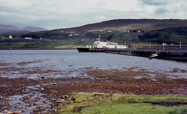
North Cuil is a small village located in the Inverness-shire region of Scotland. Situated in the picturesque Scottish Highlands, it is nestled amongst stunning landscapes and natural beauty. The village is positioned approximately 15 miles northwest of Inverness, the largest city in the Highlands.

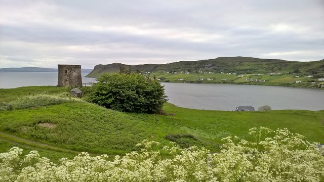
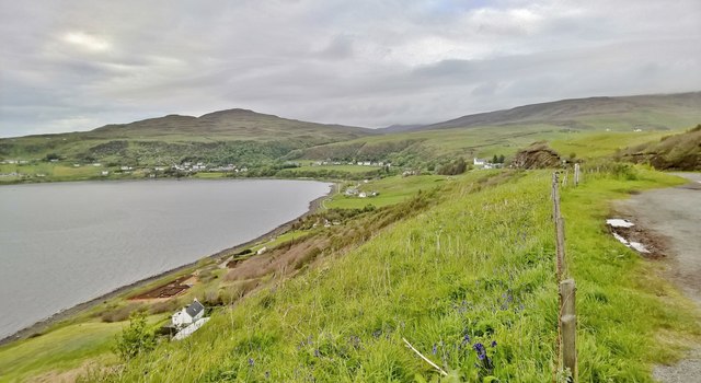
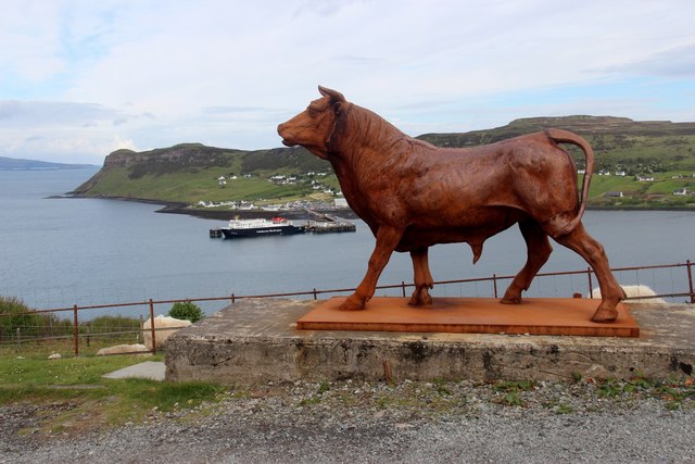
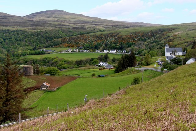
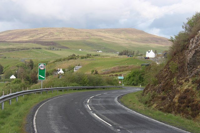
North Cuil is known for its tranquil and peaceful atmosphere, making it an ideal destination for those seeking a retreat from the hustle and bustle of city life. The village is surrounded by rolling hills, lush greenery, and breathtaking views of the nearby mountains. Outdoor enthusiasts are drawn to the area, as it offers a plethora of opportunities for hiking, cycling, and exploring the great outdoors.

Although North Cuil is a small village, it boasts a strong sense of community and a friendly population. The local residents take pride in their village and often organize community events and gatherings. The village also has a few amenities, including a small convenience store and a local pub, where locals and visitors can enjoy a drink or a meal.

For those interested in history and culture, North Cuil is in close proximity to several notable landmarks and attractions. Nearby attractions include the iconic Loch Ness, famous for the legendary Loch Ness Monster, and the historic Urquhart Castle.

Overall, North Cuil offers a serene and idyllic setting for visitors who appreciate the beauty of the Scottish countryside and seek a peaceful retreat.

If you have any feedback on the listing, please let us know in the comments section below.

North Cuil Images

Images are sourced within 2km of 57.591215/-6.3556463 or Grid Reference NG3964. Thanks to Geograph Open Source API. All images are credited.

Uig Tower
Uig Tower
Uig from above South Cuil Beside A87
Uig from above South Cuil
Beside A87
Looking over Captain Fraser's Folly Tower at CalMac's MV Hebrides in Uig Bay The 99m 5,506 tonne MV Hebrides is the third vessel of that name in the CalMac fleet and carries the bell of the first Hebrides an 1898 steamer. The second vessel was MacBrayne's first car ferry in 1964 also sailing from Uig. Launched by the Queen on 2nd August 2000 MV Hebrides III's maiden voyage was on 21st March 2001 with the ability to carry about 98 cars and 600 passengers. Sailing mostly from Uig she also carried out relief duties in winter 2012/3 and is set for relief duties in early 2016.
Looking over Captain Fraser's Folly Tower at CalMac's MV Hebrides in Uig Bay
The 99m 5,506 tonne MV Hebrides is the third vessel of that name in the CalMac fleet and carries the bell of the first Hebrides an 1898 steamer. The second vessel was MacBrayne's first car ferry in 1964 also sailing from Uig. Launched by the Queen on 2nd August 2000 MV Hebrides III's maiden voyage was on 21st March 2001 with the ability to carry about 98 cars and 600 passengers. Sailing mostly from Uig she also carried out relief duties in winter 2012/3 and is set for relief duties in early 2016.
Uig Free Church and Uig Bay Here we have three interesting subjects. In the bay is the 99m 5,506 tonne MV Hebrides the third vessel of that name in the CalMac fleet and carrying the bell of the first Hebrides an 1898 steamer. The second vessel was MacBrayne's first car ferry in 1964 also sailing from Uig. Launched by the Queen on 2nd August 2000 MV Hebrides III's maiden voyage was on 21st March 2001 with the ability to carry about 98 cars and 600 passengers.
Almost out of shot is the Category B Listed Round Tower or Fraser's Folly built about 1860 by Captain Fraser of Kilmuir. It could have been a place were the local crofters paid their rents to his factor. His house, Uig Lodge, was washed away in the great flood of 13th October 1877. It is claimed that the tower was occupied as a house until the 1950s.
The main subject however is the Category C Listed Alexander Ross and William Joass designed Uig Free Church built 1860-61. The Ross and Joass Architectural Practice was short lived starting in 1859 and then dissolved in 1865. It appears that the tower was a late 19th century addition. A number of references to the church claim it to have been built in 1847 but the Historic Scotland Listing and Dictionary of Scottish Architects are clear that it was 1860-61. The Inverness Advertiser Friday, October 4, 1861 reports on 'Uig, Skye - Opening of new church' having previously reported in July 1860 of the laying of a foundation stone.
Uig Free Church and Uig Bay
Here we have three interesting subjects. In the bay is the 99m 5,506 tonne MV Hebrides the third vessel of that name in the CalMac fleet and carrying the bell of the first Hebrides an 1898 steamer. The second vessel was MacBrayne's first car ferry in 1964 also sailing from Uig. Launched by the Queen on 2nd August 2000 MV Hebrides III's maiden voyage was on 21st March 2001 with the ability to carry about 98 cars and 600 passengers. Almost out of shot is the Category B Listed Round Tower or Fraser's Folly built about 1860 by Captain Fraser of Kilmuir. It could have been a place were the local crofters paid their rents to his factor. His house, Uig Lodge, was washed away in the great flood of 13th October 1877. It is claimed that the tower was occupied as a house until the 1950s. The main subject however is the Category C Listed Alexander Ross and William Joass designed Uig Free Church built 1860-61. The Ross and Joass Architectural Practice was short lived starting in 1859 and then dissolved in 1865. It appears that the tower was a late 19th century addition. A number of references to the church claim it to have been built in 1847 but the Historic Scotland Listing and Dictionary of Scottish Architects are clear that it was 1860-61. The Inverness Advertiser Friday, October 4, 1861 reports on 'Uig, Skye - Opening of new church' having previously reported in July 1860 of the laying of a foundation stone.
A warm Skye welcome awaits you at Uig! The journey has taken almost three hours longer than usual today as an intermediate stop was carried out at Loch Maddy. Anyway what's the hurry?
A warm Skye welcome awaits you at Uig!
The journey has taken almost three hours longer than usual today as an intermediate stop was carried out at Loch Maddy. Anyway what's the hurry?
Fraser's folly looks down on Uig pier
Fishing boat alongside Uig jetty
MV Isle of Arran on King Edward Pier The Isle of Arran is one of two boats standing in for the MV Hebrides during the winter of 2015/16 on the Uig/Lochmaddy/Tarbert crossings. The other is the Hebridean Isles, seen in <a href="https://www.geograph.org.uk/photo/4837505">NG3863 : MV Hebridean Isles in Uig Bay</a>

The Isle of Arran was launched in 1983 and was CalMac's first roll-on, roll-off ferry.
MV Isle of Arran on King Edward Pier
The Isle of Arran is one of two boats standing in for the MV Hebrides during the winter of 2015/16 on the Uig/Lochmaddy/Tarbert crossings. The other is the Hebridean Isles, seen in NG3863 : MV Hebridean Isles in Uig Bay The Isle of Arran was launched in 1983 and was CalMac's first roll-on, roll-off ferry.
MV Hebridean Isles in Uig Bay The Hebridean Isles is one of two boats standing in for the MV Hebrides during the winter of 2015/16 on the Uig/Lochmaddy/Tarbert crossings. The other is the Isle of Arran, seen in <a href="https://www.geograph.org.uk/photo/4837489">NG3863 : MV Isle of Arran on King Edward Pier</a>

The Hebridean Isles was the permanent boat on this route from 1986 until 2000, so it's something of a return home.
MV Hebridean Isles in Uig Bay
The Hebridean Isles is one of two boats standing in for the MV Hebrides during the winter of 2015/16 on the Uig/Lochmaddy/Tarbert crossings. The other is the Isle of Arran, seen in NG3863 : MV Isle of Arran on King Edward Pier The Hebridean Isles was the permanent boat on this route from 1986 until 2000, so it's something of a return home.
Crofting land at Totescore
King Edward Pier, Uig, Skye Car ferries leave from here to Lochmaddy (North Uist) and Tarbert (Harris).
King Edward Pier, Uig, Skye
Car ferries leave from here to Lochmaddy (North Uist) and Tarbert (Harris).
CalMac's 'Hebrides' at Uig Recently arrived from Lochmaddy, North Uist. Looking across Uig Bay from South Cuil.
CalMac's 'Hebrides' at Uig
Recently arrived from Lochmaddy, North Uist. Looking across Uig Bay from South Cuil.
King Edward Pier, Uig
Bull at The Cow Shed, Uig
Eastern part of Uig The pasture was still home to a corncrake or two in the early 1980s.
Eastern part of Uig
The pasture was still home to a corncrake or two in the early 1980s.
The A87 dropping in to Uig
Barn and Folly, Uig, Isle of Skye
Uig Free Church overlooking Uig Bay
Show me another place!

North Cuil is located at Grid Ref: NG3964 (Lat: 57.591215, Lng: -6.3556463)

Unitary Authority: Highland

Police Authority: Highlands and Islands

What 3 Words

///maybe.fruits.trying. Near Uig, Highland

Nearby Locations

Rha Uig North Cuil

Related Wikis

Hebridean Light Railway Company

The Hebridean Light Railway Company proposed to operate on the Scottish islands of Skye and Lewis. The Skye line was to have connected the port of Isleornsay...
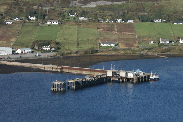
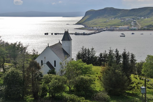
Uig, Snizort

Uig (Scottish Gaelic: Ùige [ˈuːkʲə]) is a village at the head of Uig Bay on the west coast of the Trotternish peninsula on the Isle of Skye, Scotland....
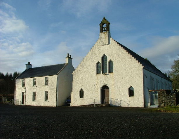
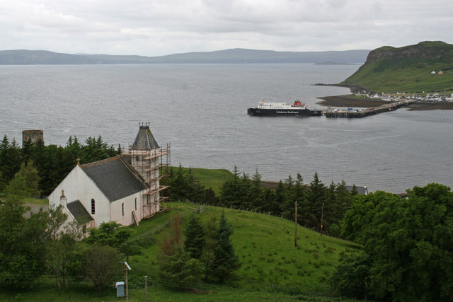
Snizort Free Church

The Snizort Free Church, is a place of worship of the Free Church of Scotland (Continuing) in the township of Skeabost in Snizort on the island of Skye...
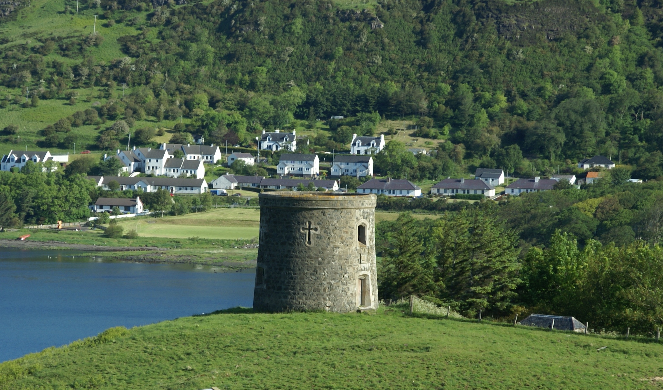
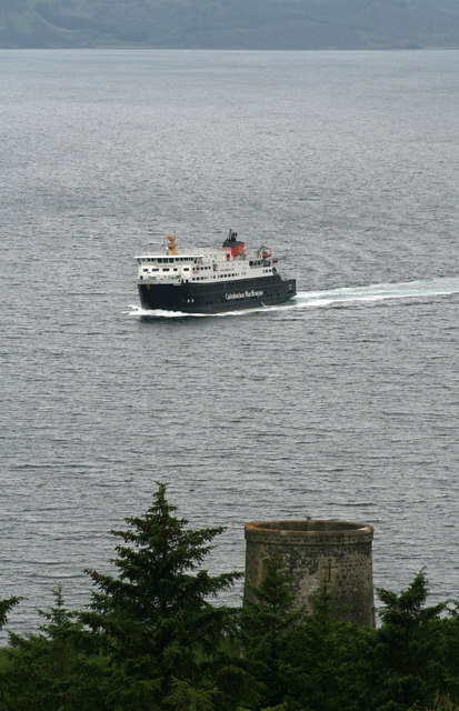
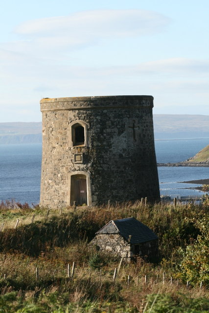
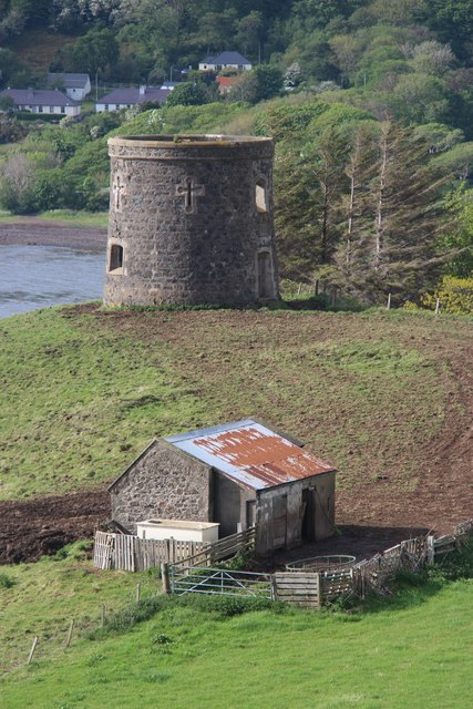
Uig Tower

The Uig Tower, also known as Captain Fraser's Folly, is a nineteenth century folly located in Uig on the island of Skye in the Highlands of Scotland. It...

Nearby Amenities

Located within 500m of 57.591215,-6.3556463
Source: PGS
Lat/Long: 57.5898595/-6.3614208
Source: PGS
Lat/Long: 57.589506/-6.3605862
Source: PGS
Lat/Long: 57.5892383/-6.3605009
Created By: dmgroom_coastlines
Source: PGS
Lat/Long: 57.58912/-6.35999
Source: PGS
Lat/Long: 57.5890871/-6.3595519
Source: PGS
Lat/Long: 57.5887421/-6.3596275
Source: PGS
Lat/Long: 57.58815/-6.3594966
Source: PGS
Lat/Long: 57.5879215/-6.3594704
Source: PGS
Lat/Long: 57.5877679/-6.3598142
Bus Stop
Police Station
Bus: yes
Naptan AtcoCode: 6700713230
Naptan Bearing: W
Naptan CommonName: Police Station
Naptan Indicator: o/s Police Station
Naptan Landmark: Police Station
Naptan NaptanCode: 45328587
Naptan Street: A855
Naptan Verified: no
Public Transport: platform
Source: naptan_import
Lat/Long: 57.592074/-6.3593112
Bus Stop
Police Station
Bus: yes
Naptan AtcoCode: 6700713230A
Naptan Bearing: E
Naptan CommonName: Police Station
Naptan Indicator: opp Police Station
Naptan Landmark: Police Station
Naptan NaptanCode: 45329547
Naptan Street: A855
Naptan Verified: no
Public Transport: platform
Source: naptan_import
Lat/Long: 57.5922974/-6.3592291
Post Office
Uig Post Office (Rankins)
Addr City: Uig
Addr Country: GB
Addr Postcode: IV51 9XP
Brand: Post Office
Brand Wikidata: Q1783168
Contact Website: https://www.postoffice.co.uk/branch-finder/1638289/uig
Ref Pol Id: 3968
Lat/Long: 57.5898556/-6.3553007
Pub
Ferry Inn
Facebook: https://www.facebook.com/theferryinnskye/
Source: survey
Twitter: theferryinnskye
Website: https://theferryinnskye.com/
Lat/Long: 57.5913296/-6.3552694
Rha Waterfall
Waterway: waterfall
Lat/Long: 57.593485/-6.3603295
Post Box
Collection Times: Mo-Fr 09:15; Sa 09:15
Note: On wall of PO. There is a sticker showing a picture of a VR wall box but this is not a royal cypher
Operator: Royal Mail
Operator Wikidata: Q638098
Post Box Type: wall
Ref: IV51 22
Royal Cypher: no
Source: survey
Lat/Long: 57.5898752/-6.3551881
Power: pole
Lat/Long: 57.5895406/-6.349977
Power: pole
Lat/Long: 57.5900768/-6.3511169
Power: pole
Lat/Long: 57.5905785/-6.3522622
Power: pole
Lat/Long: 57.5909192/-6.3530535
Power: pole
Lat/Long: 57.592282/-6.3561058
Power: pole
Lat/Long: 57.5934119/-6.3584206
Power: pole
Lat/Long: 57.5938316/-6.3610062
Power: pole
Lat/Long: 57.5938977/-6.3621864
Power: pole
Lat/Long: 57.591201/-6.3488317
Power: pole
Lat/Long: 57.5922978/-6.3506234
Power: pole
Lat/Long: 57.5933688/-6.3523614
Power: pole
Lat/Long: 57.5939797/-6.3534048
Power: pole
Lat/Long: 57.5945295/-6.354298
Power: pole
Lat/Long: 57.5947882/-6.3547178
Power: pole
Lat/Long: 57.5950491/-6.3551684
Power: pole
Lat/Long: 57.5952949/-6.3591152
Power: pole
Lat/Long: 57.590524/-6.3483506
Power: pole
Lat/Long: 57.5897839/-6.347799
Power: pole
Lat/Long: 57.589929/-6.3486384
Bus Stop
opp Rha Bank
Bench: no
Bin: no
Bus: yes
Line: 57c
Lit: no
Naptan AtcoCode: 670071
Naptan NaptanCode: 45343246
Public Transport: platform
Shelter: no
Tactile Paving: no
Lat/Long: 57.5913778/-6.3623419
Bus Stop
at Post office
Line: 57c
Naptan AtcoCode: 6700112
Naptan NaptanCode: 45343424
Lat/Long: 57.5899302/-6.355163
Power: pole
Lat/Long: 57.5913815/-6.354089
Power: pole
Lat/Long: 57.5916783/-6.3546849
Bench
Backrest: no
Lat/Long: 57.5891313/-6.3588769
Waste Basket
Lat/Long: 57.5908006/-6.3622559
Bench
Backrest: no
Lat/Long: 57.5899118/-6.3609385
The data included in this document is from www.openstreetmap.org. The data is made available under ODbL.

Have you been to North Cuil?

Leave your review of North Cuil below (or comments, questions and feedback).