Nelson Park
Settlement in Kent Dover
England
Nelson Park
Nelson Park is a charming residential area located in the county of Kent, England. Situated in the town of Dartford, this neighborhood offers a peaceful and family-friendly environment for its residents.
The park itself is a prominent feature of the area, providing a green and open space for recreational activities. Nelson Park is well-maintained, with neatly trimmed lawns, beautiful flowerbeds, and a variety of trees that add to its natural appeal. The park is also equipped with playgrounds, making it an ideal spot for children to play and families to gather for picnics.
In addition to its recreational facilities, Nelson Park boasts several sports fields and courts, including football pitches, tennis courts, and a cricket pitch. These amenities make the park a popular destination for sports enthusiasts, as well as local sports clubs and teams.
Nelson Park is conveniently located near various amenities and services. Within walking distance, residents can find shops, supermarkets, schools, and healthcare facilities. The neighborhood is also well-connected to public transportation, with bus stops and train stations nearby, allowing for easy access to other areas of Dartford and beyond.
Overall, Nelson Park offers a serene and community-focused living experience. Its well-maintained park, sports facilities, and convenient location make it an attractive place to reside for families, sports enthusiasts, and individuals seeking a peaceful environment in Kent.
If you have any feedback on the listing, please let us know in the comments section below.
Nelson Park Images
Images are sourced within 2km of 51.159995/1.365253 or Grid Reference TR3545. Thanks to Geograph Open Source API. All images are credited.
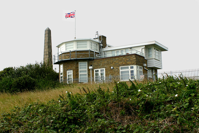
![A walk from St Margaretâs at Cliffe to Kingsdown and return [1] This monument at Leathercoat Point was erected in 1921 as a memorial to the Dover Patrol in WWI. There are identical monuments in France and in New York. Constructed of ashlar blocks, about 80 feet high. Listed, grade II*, with details at: historicengland.org.uk/listing/the-list/list-entry/1070067
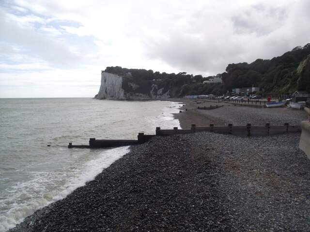
Starting from the Dover Patrol Monument, the walk follows the long distance Saxon Shore Way along the top of the cliffs before descending to the bay at Kingsdown. Heading inland there is an ascent of Wood Hill before various rights of way run across fields to the wonderfully named Otty Bottom, then on to Free Down and a return to the starting point. A little more than 5 miles.](https://s0.geograph.org.uk/geophotos/07/08/49/7084960_5fb94790.jpg)
![A walk from St Margaretâs at Cliffe to Kingsdown and return [41] From here the line of the bridleway runs straight across to the corner of this field. The line of the right of way has not been re-established after ploughing and an alternative route along the field edge is offered - see <a href="https://www.geograph.org.uk/photo/7086227">TR3646 : A walk from St Margaret&rsquo;s at Cliffe to Kingsdown and return [42]</a>. For the reverse view of this image see <a href="https://www.geograph.org.uk/photo/7086230">TR3646 : A walk from St Margaret&rsquo;s at Cliffe to Kingsdown and return [45]</a>.
Starting from the Dover Patrol Monument, the walk follows the long distance Saxon Shore Way along the top of the cliffs before descending to the bay at Kingsdown. Heading inland there is an ascent of Wood Hill before various rights of way run across fields to the wonderfully named Otty Bottom, then on to Free Down and a return to the starting point. A little more than 5 miles.](https://s2.geograph.org.uk/geophotos/07/08/62/7086226_fc2cdda3.jpg)
![A walk from St Margaretâs at Cliffe to Kingsdown and return [42] From the same viewpoint as <a href="https://www.geograph.org.uk/photo/7086226">TR3646 : A walk from St Margaret&rsquo;s at Cliffe to Kingsdown and return [41]</a> this is the alternative route along the field edge to the track between the hedges. The golf course on East Hill is in the distance.
Starting from the Dover Patrol Monument, the walk follows the long distance Saxon Shore Way along the top of the cliffs before descending to the bay at Kingsdown. Heading inland there is an ascent of Wood Hill before various rights of way run across fields to the wonderfully named Otty Bottom, then on to Free Down and a return to the starting point. A little more than 5 miles.](https://s3.geograph.org.uk/geophotos/07/08/62/7086227_cd12a75c.jpg)
![A walk from St Margaretâs at Cliffe to Kingsdown and return [43] The bridleway now follows the well surfaced track towards Upper Freedown.
Starting from the Dover Patrol Monument, the walk follows the long distance Saxon Shore Way along the top of the cliffs before descending to the bay at Kingsdown. Heading inland there is an ascent of Wood Hill before various rights of way run across fields to the wonderfully named Otty Bottom, then on to Free Down and a return to the starting point. A little more than 5 miles.](https://s0.geograph.org.uk/geophotos/07/08/62/7086228_6335abe3.jpg)
![A walk from St Margaretâs at Cliffe to Kingsdown and return [45] This is the reverse view of <a href="https://www.geograph.org.uk/photo/7086226">TR3646 : A walk from St Margaret&rsquo;s at Cliffe to Kingsdown and return [41]</a> and is where the right of way would meet the track. However, the bridleway has not been re-established after ploughing, and an alternative route has been used.
Starting from the Dover Patrol Monument, the walk follows the long distance Saxon Shore Way along the top of the cliffs before descending to the bay at Kingsdown. Heading inland there is an ascent of Wood Hill before various rights of way run across fields to the wonderfully named Otty Bottom, then on to Free Down and a return to the starting point. A little more than 5 miles.](https://s2.geograph.org.uk/geophotos/07/08/62/7086230_17cbc437.jpg)
![A walk from St Margaretâs at Cliffe to Kingsdown and return [46] Posts have been erected across the track, a public bridleway, to prevent vehicles passing beyond this point.
Starting from the Dover Patrol Monument, the walk follows the long distance Saxon Shore Way along the top of the cliffs before descending to the bay at Kingsdown. Heading inland there is an ascent of Wood Hill before various rights of way run across fields to the wonderfully named Otty Bottom, then on to Free Down and a return to the starting point. A little more than 5 miles.](https://s3.geograph.org.uk/geophotos/07/08/62/7086231_4041273d.jpg)
![A walk from St Margaretâs at Cliffe to Kingsdown and return [47] This tall concrete post is alongside the track, purpose unknown. Another of these objects is seen at <a href="https://www.geograph.org.uk/photo/7086852">TR3645 : A walk from St Margaret&rsquo;s at Cliffe to Kingsdown and return [59]</a>
Starting from the Dover Patrol Monument, the walk follows the long distance Saxon Shore Way along the top of the cliffs before descending to the bay at Kingsdown. Heading inland there is an ascent of Wood Hill before various rights of way run across fields to the wonderfully named Otty Bottom, then on to Free Down and a return to the starting point. A little more than 5 miles.](https://s0.geograph.org.uk/geophotos/07/08/62/7086232_e319f2e7.jpg)
![A walk from St Margaretâs at Cliffe to Kingsdown and return [48] The track, a public bridleway, continues to ascend gently towards Freedown.
Starting from the Dover Patrol Monument, the walk follows the long distance Saxon Shore Way along the top of the cliffs before descending to the bay at Kingsdown. Heading inland there is an ascent of Wood Hill before various rights of way run across fields to the wonderfully named Otty Bottom, then on to Free Down and a return to the starting point. A little more than 5 miles.](https://s1.geograph.org.uk/geophotos/07/08/62/7086233_1073c389.jpg)
![A walk from St Margaretâs at Cliffe to Kingsdown and return [49] The view looking southwest from the track. The twin towers of the transmitting station at Dover are seen in the far distance.
Starting from the Dover Patrol Monument, the walk follows the long distance Saxon Shore Way along the top of the cliffs before descending to the bay at Kingsdown. Heading inland there is an ascent of Wood Hill before various rights of way run across fields to the wonderfully named Otty Bottom, then on to Free Down and a return to the starting point. A little more than 5 miles.](https://s2.geograph.org.uk/geophotos/07/08/62/7086234_feaa026b.jpg)
![A walk from St Margaretâs at Cliffe to Kingsdown and return [50] From the track, this footpath leads to St Margaret&#039;s Free Down.
Starting from the Dover Patrol Monument, the walk follows the long distance Saxon Shore Way along the top of the cliffs before descending to the bay at Kingsdown. Heading inland there is an ascent of Wood Hill before various rights of way run across fields to the wonderfully named Otty Bottom, then on to Free Down and a return to the starting point. A little more than 5 miles.](https://s3.geograph.org.uk/geophotos/07/08/62/7086235_67b7386f.jpg)
![A walk from St Margaretâs at Cliffe to Kingsdown and return [51] From the bridleway, this footpath runs to Old Bottom Free Down then on to Ringwould.
Starting from the Dover Patrol Monument, the walk follows the long distance Saxon Shore Way along the top of the cliffs before descending to the bay at Kingsdown. Heading inland there is an ascent of Wood Hill before various rights of way run across fields to the wonderfully named Otty Bottom, then on to Free Down and a return to the starting point. A little more than 5 miles.](https://s0.geograph.org.uk/geophotos/07/08/68/7086844_588697a9.jpg)
![A walk from St Margaretâs at Cliffe to Kingsdown and return [52] From the track, a public bridleway, this track leads to Little Banks.
Starting from the Dover Patrol Monument, the walk follows the long distance Saxon Shore Way along the top of the cliffs before descending to the bay at Kingsdown. Heading inland there is an ascent of Wood Hill before various rights of way run across fields to the wonderfully named Otty Bottom, then on to Free Down and a return to the starting point. A little more than 5 miles.](https://s1.geograph.org.uk/geophotos/07/08/68/7086845_349942ee.jpg)
![A walk from St Margaretâs at Cliffe to Kingsdown and return [53] The well surfaced track, now an &#039;other route with public access&#039;, continues to head towards Free Down.
Starting from the Dover Patrol Monument, the walk follows the long distance Saxon Shore Way along the top of the cliffs before descending to the bay at Kingsdown. Heading inland there is an ascent of Wood Hill before various rights of way run across fields to the wonderfully named Otty Bottom, then on to Free Down and a return to the starting point. A little more than 5 miles.](https://s2.geograph.org.uk/geophotos/07/08/68/7086846_cb6d6b13.jpg)
![A walk from St Margaretâs at Cliffe to Kingsdown and return [54] This footpath leaves the track and heads towards Bockell Hill.
Starting from the Dover Patrol Monument, the walk follows the long distance Saxon Shore Way along the top of the cliffs before descending to the bay at Kingsdown. Heading inland there is an ascent of Wood Hill before various rights of way run across fields to the wonderfully named Otty Bottom, then on to Free Down and a return to the starting point. A little more than 5 miles.](https://s3.geograph.org.uk/geophotos/07/08/68/7086847_66b904e3.jpg)
Nelson Park is located at Grid Ref: TR3545 (Lat: 51.159995, Lng: 1.365253)
Administrative County: Kent
District: Dover
Police Authority: Kent
What 3 Words
///suppers.bulk.professed. Near Dover, Kent
Nearby Locations
Related Wikis

West Cliffe
West Cliffe or Westcliffe is a village and former civil parish, now in the parish of St. Margaret's At Cliffe, in the Dover district, in east Kent, England...

St Margaret's at Cliffe
St. Margaret's at Cliffe is a three-part village situated just off the coast road between Deal and Dover in Kent, England. The centre of the village is...

Martin Mill
Martin Mill is a village in east Kent, England. It takes its name from the nearby village of Martin. Martin Mill railway station is on the Dover to Deal...

Dover to Kingsdown Cliffs
Dover to Kingsdown Cliffs is a 207.7-hectare (513-acre) biological and geological Site of Special Scientific Interest which runs along the Kent coast between...
Nearby Amenities
Located within 500m of 51.159995,1.365253Have you been to Nelson Park?
Leave your review of Nelson Park below (or comments, questions and feedback).