Mill Hill
Hill, Mountain in Kent Dover
England
Mill Hill
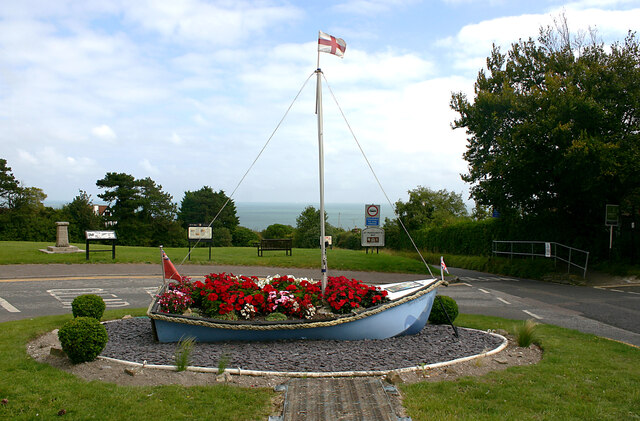
Mill Hill is a small residential area located in Kent, England. It is situated on a hill, which gives it its name, and offers stunning views of the surrounding countryside. The area is part of the larger town of Sevenoaks and is known for its peaceful and picturesque setting.
One of the defining features of Mill Hill is its close proximity to nature. The area is surrounded by lush green fields and woodland, making it a popular destination for nature enthusiasts and hikers. There are several walking trails and footpaths that wind through the hills, offering residents and visitors the opportunity to explore the beautiful countryside.
Despite its tranquil setting, Mill Hill is conveniently located near amenities and facilities. The nearby town of Sevenoaks provides residents with a range of shops, restaurants, and cafes, as well as schools and medical facilities. The area also benefits from excellent transport links, with regular bus services connecting Mill Hill to surrounding towns and villages.
Mill Hill is predominantly residential, with a mix of housing options available. From quaint cottages to modern apartments, there is a variety of properties that cater to different needs and preferences. The area is known for its tight-knit community, with residents taking pride in their neighborhood and actively participating in local events and initiatives.
Overall, Mill Hill offers a peaceful and idyllic lifestyle surrounded by natural beauty. It is a sought-after destination for those seeking a quiet retreat while still enjoying the conveniences of nearby amenities.
If you have any feedback on the listing, please let us know in the comments section below.
Mill Hill Images
Images are sourced within 2km of 51.160044/1.3626387 or Grid Reference TR3545. Thanks to Geograph Open Source API. All images are credited.
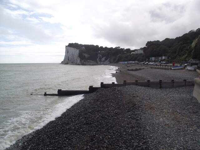
![A walk from St Margaretâs at Cliffe to Kingsdown and return [46] Posts have been erected across the track, a public bridleway, to prevent vehicles passing beyond this point.
Starting from the Dover Patrol Monument, the walk follows the long distance Saxon Shore Way along the top of the cliffs before descending to the bay at Kingsdown. Heading inland there is an ascent of Wood Hill before various rights of way run across fields to the wonderfully named Otty Bottom, then on to Free Down and a return to the starting point. A little more than 5 miles.](https://s3.geograph.org.uk/geophotos/07/08/62/7086231_4041273d.jpg)
![A walk from St Margaretâs at Cliffe to Kingsdown and return [47] This tall concrete post is alongside the track, purpose unknown. Another of these objects is seen at <a href="https://www.geograph.org.uk/photo/7086852">TR3645 : A walk from St Margaret&rsquo;s at Cliffe to Kingsdown and return [59]</a>
Starting from the Dover Patrol Monument, the walk follows the long distance Saxon Shore Way along the top of the cliffs before descending to the bay at Kingsdown. Heading inland there is an ascent of Wood Hill before various rights of way run across fields to the wonderfully named Otty Bottom, then on to Free Down and a return to the starting point. A little more than 5 miles.](https://s0.geograph.org.uk/geophotos/07/08/62/7086232_e319f2e7.jpg)
![A walk from St Margaretâs at Cliffe to Kingsdown and return [48] The track, a public bridleway, continues to ascend gently towards Freedown.
Starting from the Dover Patrol Monument, the walk follows the long distance Saxon Shore Way along the top of the cliffs before descending to the bay at Kingsdown. Heading inland there is an ascent of Wood Hill before various rights of way run across fields to the wonderfully named Otty Bottom, then on to Free Down and a return to the starting point. A little more than 5 miles.](https://s1.geograph.org.uk/geophotos/07/08/62/7086233_1073c389.jpg)
![A walk from St Margaretâs at Cliffe to Kingsdown and return [49] The view looking southwest from the track. The twin towers of the transmitting station at Dover are seen in the far distance.
Starting from the Dover Patrol Monument, the walk follows the long distance Saxon Shore Way along the top of the cliffs before descending to the bay at Kingsdown. Heading inland there is an ascent of Wood Hill before various rights of way run across fields to the wonderfully named Otty Bottom, then on to Free Down and a return to the starting point. A little more than 5 miles.](https://s2.geograph.org.uk/geophotos/07/08/62/7086234_feaa026b.jpg)
![A walk from St Margaretâs at Cliffe to Kingsdown and return [50] From the track, this footpath leads to St Margaret&#039;s Free Down.
Starting from the Dover Patrol Monument, the walk follows the long distance Saxon Shore Way along the top of the cliffs before descending to the bay at Kingsdown. Heading inland there is an ascent of Wood Hill before various rights of way run across fields to the wonderfully named Otty Bottom, then on to Free Down and a return to the starting point. A little more than 5 miles.](https://s3.geograph.org.uk/geophotos/07/08/62/7086235_67b7386f.jpg)
![A walk from St Margaretâs at Cliffe to Kingsdown and return [51] From the bridleway, this footpath runs to Old Bottom Free Down then on to Ringwould.
Starting from the Dover Patrol Monument, the walk follows the long distance Saxon Shore Way along the top of the cliffs before descending to the bay at Kingsdown. Heading inland there is an ascent of Wood Hill before various rights of way run across fields to the wonderfully named Otty Bottom, then on to Free Down and a return to the starting point. A little more than 5 miles.](https://s0.geograph.org.uk/geophotos/07/08/68/7086844_588697a9.jpg)
![A walk from St Margaretâs at Cliffe to Kingsdown and return [52] From the track, a public bridleway, this track leads to Little Banks.
Starting from the Dover Patrol Monument, the walk follows the long distance Saxon Shore Way along the top of the cliffs before descending to the bay at Kingsdown. Heading inland there is an ascent of Wood Hill before various rights of way run across fields to the wonderfully named Otty Bottom, then on to Free Down and a return to the starting point. A little more than 5 miles.](https://s1.geograph.org.uk/geophotos/07/08/68/7086845_349942ee.jpg)
![A walk from St Margaretâs at Cliffe to Kingsdown and return [53] The well surfaced track, now an &#039;other route with public access&#039;, continues to head towards Free Down.
Starting from the Dover Patrol Monument, the walk follows the long distance Saxon Shore Way along the top of the cliffs before descending to the bay at Kingsdown. Heading inland there is an ascent of Wood Hill before various rights of way run across fields to the wonderfully named Otty Bottom, then on to Free Down and a return to the starting point. A little more than 5 miles.](https://s2.geograph.org.uk/geophotos/07/08/68/7086846_cb6d6b13.jpg)
![A walk from St Margaretâs at Cliffe to Kingsdown and return [54] This footpath leaves the track and heads towards Bockell Hill.
Starting from the Dover Patrol Monument, the walk follows the long distance Saxon Shore Way along the top of the cliffs before descending to the bay at Kingsdown. Heading inland there is an ascent of Wood Hill before various rights of way run across fields to the wonderfully named Otty Bottom, then on to Free Down and a return to the starting point. A little more than 5 miles.](https://s3.geograph.org.uk/geophotos/07/08/68/7086847_66b904e3.jpg)
![A walk from St Margaretâs at Cliffe to Kingsdown and return [55] A view back along the track, seen from where the footpath to Bockell Hill branches off.
Starting from the Dover Patrol Monument, the walk follows the long distance Saxon Shore Way along the top of the cliffs before descending to the bay at Kingsdown. Heading inland there is an ascent of Wood Hill before various rights of way run across fields to the wonderfully named Otty Bottom, then on to Free Down and a return to the starting point. A little more than 5 miles.](https://s0.geograph.org.uk/geophotos/07/08/68/7086848_95fa9eda.jpg)
![A walk from St Margaretâs at Cliffe to Kingsdown and return [56] A view along the track, seen from where the footpath to Bockell Hill branches off.
Starting from the Dover Patrol Monument, the walk follows the long distance Saxon Shore Way along the top of the cliffs before descending to the bay at Kingsdown. Heading inland there is an ascent of Wood Hill before various rights of way run across fields to the wonderfully named Otty Bottom, then on to Free Down and a return to the starting point. A little more than 5 miles.](https://s1.geograph.org.uk/geophotos/07/08/68/7086849_4eb9e9ff.jpg)
![A walk from St Margaretâs at Cliffe to Kingsdown and return [57] The foot descends towards Bockell Hill through this area of woodland.
Starting from the Dover Patrol Monument, the walk follows the long distance Saxon Shore Way along the top of the cliffs before descending to the bay at Kingsdown. Heading inland there is an ascent of Wood Hill before various rights of way run across fields to the wonderfully named Otty Bottom, then on to Free Down and a return to the starting point. A little more than 5 miles.](https://s2.geograph.org.uk/geophotos/07/08/68/7086850_62f7cc05.jpg)
![A walk from St Margaretâs at Cliffe to Kingsdown and return [58] After passing through woodland, the path to Bockell Hill emerges into open fields.
Starting from the Dover Patrol Monument, the walk follows the long distance Saxon Shore Way along the top of the cliffs before descending to the bay at Kingsdown. Heading inland there is an ascent of Wood Hill before various rights of way run across fields to the wonderfully named Otty Bottom, then on to Free Down and a return to the starting point. A little more than 5 miles.](https://s3.geograph.org.uk/geophotos/07/08/68/7086851_b6420cae.jpg)
![A walk from St Margaretâs at Cliffe to Kingsdown and return [59] This tall concrete post is alongside the path, purpose unknown. Another of these objects is seen at <a href="https://www.geograph.org.uk/photo/7086232">TR3646 : A walk from St Margaret&rsquo;s at Cliffe to Kingsdown and return [47]</a>
Starting from the Dover Patrol Monument, the walk follows the long distance Saxon Shore Way along the top of the cliffs before descending to the bay at Kingsdown. Heading inland there is an ascent of Wood Hill before various rights of way run across fields to the wonderfully named Otty Bottom, then on to Free Down and a return to the starting point. A little more than 5 miles.](https://s0.geograph.org.uk/geophotos/07/08/68/7086852_49fac359.jpg)
![A walk from St Margaretâs at Cliffe to Kingsdown and return [60] The farmer is turning the hay to dry it. Seen from the path.
Starting from the Dover Patrol Monument, the walk follows the long distance Saxon Shore Way along the top of the cliffs before descending to the bay at Kingsdown. Heading inland there is an ascent of Wood Hill before various rights of way run across fields to the wonderfully named Otty Bottom, then on to Free Down and a return to the starting point. A little more than 5 miles.](https://s1.geograph.org.uk/geophotos/07/08/68/7086853_f51c648f.jpg)
Mill Hill is located at Grid Ref: TR3545 (Lat: 51.160044, Lng: 1.3626387)
Administrative County: Kent
District: Dover
Police Authority: Kent
What 3 Words
///snack.intrigued.pines. Near Dover, Kent
Nearby Locations
Related Wikis

West Cliffe
West Cliffe or Westcliffe is a village and former civil parish, now in the parish of St. Margaret's At Cliffe, in the Dover district, in east Kent, England...

St Margaret's at Cliffe
St. Margaret's at Cliffe is a three-part village situated just off the coast road between Deal and Dover in Kent, England. The centre of the village is...

Martin Mill
Martin Mill is a village in east Kent, England. It takes its name from the nearby village of Martin. Martin Mill railway station is on the Dover to Deal...
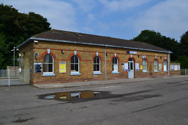
Martin Mill railway station
Martin Mill railway station serves the small village of Martin Mill in East Kent. The station and all trains serving it are operated by Southeastern. The...
Nearby Amenities
Located within 500m of 51.160044,1.3626387Have you been to Mill Hill?
Leave your review of Mill Hill below (or comments, questions and feedback).