Mossend

Settlement in Cheshire

England

Mossend

Smethwick Hall Smethwick Hall and barns. Taken mid July 05 before harvest.
Smethwick Hall Credit: Drawoh Noc

Mossend is a small village located in the county of Cheshire, England. Situated approximately 3 miles southeast of the town of Congleton, Mossend is a primarily rural area known for its picturesque landscapes and tranquil atmosphere.

The village is home to a modest population, consisting of a close-knit community that prides itself on its friendly and welcoming nature. The houses in Mossend are predominantly traditional in style, with many dating back several centuries, giving the area a charming and historic feel.

Surrounded by rolling hills and lush green fields, Mossend offers its residents and visitors plenty of opportunities for outdoor activities and exploration. The village is dotted with footpaths and bridleways, making it an ideal location for walkers, cyclists, and horse riders to enjoy the stunning countryside scenery. The nearby Macclesfield Canal also provides an attractive setting for leisurely walks and boat trips.

Although Mossend is primarily a residential area, it benefits from its close proximity to Congleton, which offers a wider range of amenities such as shops, schools, and healthcare facilities. There are also several pubs and restaurants in the surrounding area, where locals and visitors can enjoy a meal or a drink.

Overall, Mossend is a tranquil and picturesque village that appeals to those seeking a peaceful and idyllic setting. With its beautiful landscapes and friendly community, it is a charming place to call home or visit for a relaxing countryside getaway.

If you have any feedback on the listing, please let us know in the comments section below.
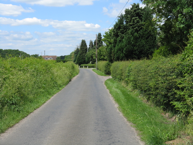
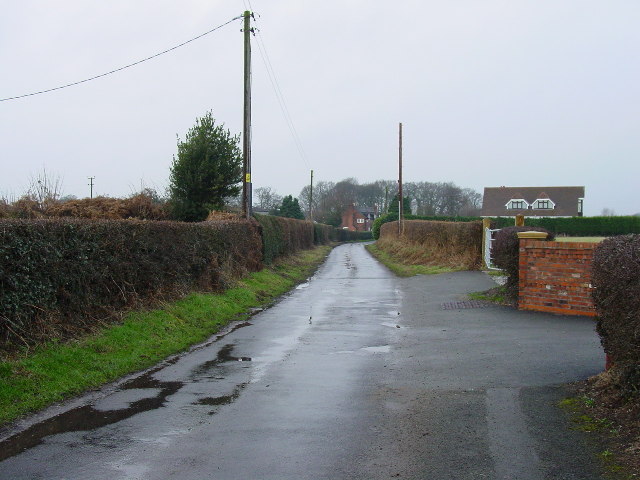
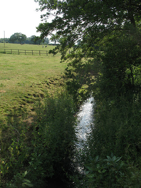
Mossend Images

Images are sourced within 2km of 53.156408/-2.2965074 or Grid Reference SJ8062. Thanks to Geograph Open Source API. All images are credited.

Smethwick Hall Smethwick Hall and barns. Taken mid July 05 before harvest.
Smethwick Hall
Smethwick Hall and barns. Taken mid July 05 before harvest.
Lower Medhurst Green Farm On the Dane Valley Way looking west towards Lower Medhurst Green Farm.
Lower Medhurst Green Farm
On the Dane Valley Way looking west towards Lower Medhurst Green Farm.
The lane running through Smethwick Green Looking NW from Home Farm at Smethwick Green.
The lane running through Smethwick Green
Looking NW from Home Farm at Smethwick Green.
Farmland near Illidge Green View SW from the Dane Valley Way of typical farmland scenery in this area.
Farmland near Illidge Green
View SW from the Dane Valley Way of typical farmland scenery in this area.
Smethwick Lane End Cottages
Houses on Bankhouse Lane View across pasture land from the edge of Spen Green to the houses on Bankhouse Lane
Houses on Bankhouse Lane
View across pasture land from the edge of Spen Green to the houses on Bankhouse Lane
Brookhouse Green Methodist Church
path at Brookhouse Moss From Moss End Lane, this path continues along the left edge of the wood ahead, coming out near Brookhouse Green.
path at Brookhouse Moss
From Moss End Lane, this path continues along the left edge of the wood ahead, coming out near Brookhouse Green.
Goldeyslack Lane This green lane, rather overgrown at its far end, may soon become a public bridleway.
Goldeyslack Lane
This green lane, rather overgrown at its far end, may soon become a public bridleway.
track with birches - and rabbit The fresh spring greenness of a farm track.  There are lots of rabbits around here - and the odd pheasant.
track with birches - and rabbit
The fresh spring greenness of a farm track. There are lots of rabbits around here - and the odd pheasant.
Main road in Brookhouse Green
Pitcher Lane, Brookhouse Green
Brookhouse Lane
Brookhouse Lane
An extra jump? Skip parked at the side of a show-jumping practice course off Brookhouse Lane.
An extra jump?
Skip parked at the side of a show-jumping practice course off Brookhouse Lane.
Crossroads on Brookhouse Lane
Fields adjoining Brookhouse Lane
Smethwick Lane
Smethwick Lane
Fields adjoining Smethwick Lane
Show me another place!

Mossend is located at Grid Ref: SJ8062 (Lat: 53.156408, Lng: -2.2965074)

Unitary Authority: Cheshire East

Police Authority: Cheshire

What 3 Words

///chatting.crawler.absent. Near Rode Heath, Cheshire

Nearby Locations

Mossend

Related Wikis

Congleton (borough)

Congleton was, from 1974 to 2009, a local government district with borough status in Cheshire, England. It included the towns of Congleton, Alsager, Middlewich...

Smethwick Green

Smethwick Green is a hamlet near Congleton in Cheshire in England. Until 2009 it formed part of the Brereton Ward of Congleton district but, on the creation...

River Croco

The River Croco () is a small river in Cheshire in England. It starts as lowland field drainage west of Congleton, flows along the south edge of Holmes...

Arclid

Arclid is a village and civil parish in the unitary authority of Cheshire East and the ceremonial county of Cheshire, England. It is about two miles...

Medhurst Green

Medhurst Green is a hamlet in Cheshire, England that forms part of the civil parish of Brereton. It consists mainly of two farms, Upper and Lower Medhurst...

Smallwood, Cheshire

Smallwood is a civil parish and small village in the unitary authority of Cheshire East and the ceremonial county of Cheshire, England. The village is...

St John the Baptist's Church, Smallwood

St John the Baptist's Church is in Church Lane, Smallwood, Cheshire, England. It is an active Anglican parish church in the deanery of Congleton, the...

Congleton (UK Parliament constituency)

Congleton is a parliamentary constituency in Cheshire, represented in the House of Commons of the UK Parliament since 2010 by Fiona Bruce of the Conservative...

Nearby Amenities

Located within 500m of 53.156408,-2.2965074
Barrier: kissing_gate
Lat/Long: 53.1562458/-2.3025785
Barrier: kissing_gate
Lat/Long: 53.1577894/-2.3002772
Generator Method: photovoltaic
Generator Output Electricity: yes
Generator Source: solar
Generator Type: solar_photovoltaic_panel
Power: generator
Lat/Long: 53.1574346/-2.2985177
Generator Method: photovoltaic
Generator Output Electricity: yes
Generator Source: solar
Generator Type: solar_photovoltaic_panel
Power: generator
Lat/Long: 53.157455/-2.29859
Generator Method: photovoltaic
Generator Output Electricity: yes
Generator Source: solar
Generator Type: solar_photovoltaic_panel
Power: generator
Lat/Long: 53.1574465/-2.2990394
Generator Method: photovoltaic
Generator Output Electricity: yes
Generator Source: solar
Generator Type: solar_photovoltaic_panel
Power: generator
Lat/Long: 53.157217/-2.2994037
Generator Method: photovoltaic
Generator Output Electricity: yes
Generator Source: solar
Generator Type: solar_photovoltaic_panel
Power: generator
Lat/Long: 53.1571168/-2.2981006
Mossend
Place: hamlet
Lat/Long: 53.1563151/-2.2969234
Barrier: kissing_gate
Lat/Long: 53.1570364/-2.3015908
The data included in this document is from www.openstreetmap.org. The data is made available under ODbL.

Have you been to Mossend?

Leave your review of Mossend below (or comments, questions and feedback).