Mossat

Settlement in Aberdeenshire

Scotland

Mossat

The Burn of Linthaugh at Mossat
The Burn of Linthaugh at Mossat Credit: Gordon Brown

Mossat is a small village located in the Aberdeenshire region of Scotland. It is situated approximately 40 miles northwest of Aberdeen, the closest major city. Mossat falls within the parish of Auchindoir and is part of the Alford ward.

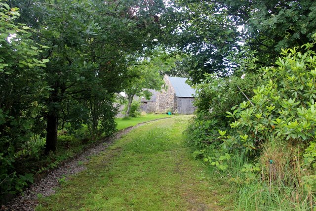
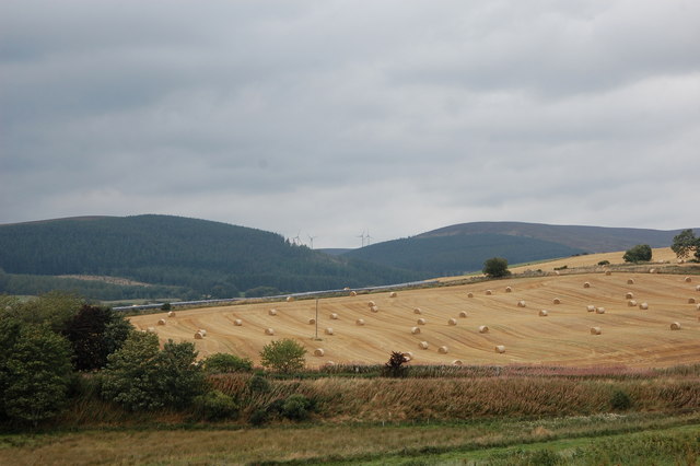
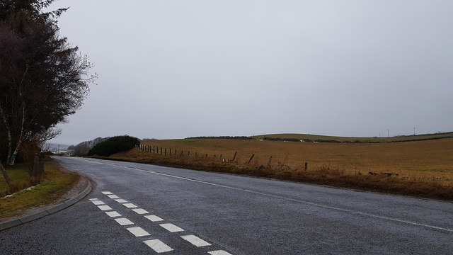
The village is nestled in a picturesque countryside setting, surrounded by rolling hills and lush green fields. It enjoys a peaceful and tranquil atmosphere, making it an ideal location for those seeking a quiet and rural lifestyle.

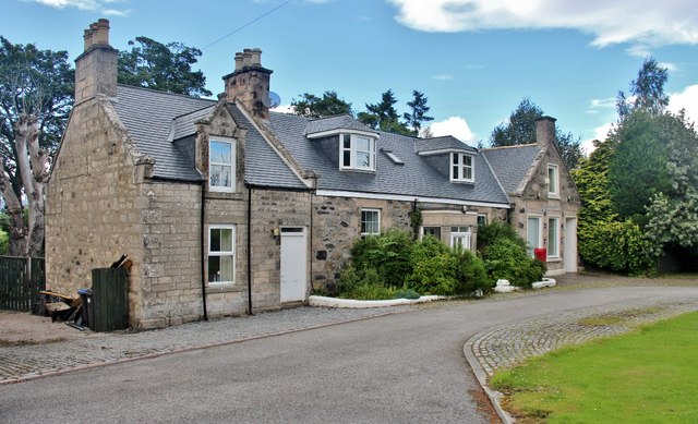
Mossat is primarily a residential area, with a small population of around 200 residents. The village features a mix of traditional stone-built houses and more modern dwellings, creating a charming blend of architectural styles. The community is close-knit and friendly, with a strong sense of community spirit.

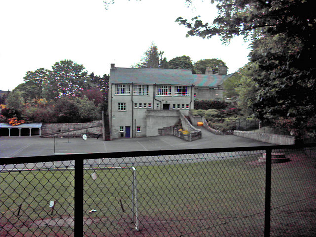
In terms of amenities, Mossat boasts a well-maintained village hall which serves as a hub for various social and recreational activities. The hall hosts events such as community meetings, local gatherings, and occasional celebrations. However, residents often rely on nearby towns such as Alford or Insch for essential services such as schools, medical facilities, and shopping.

Nature enthusiasts will appreciate the stunning surroundings of Mossat. The village is surrounded by beautiful countryside, offering ample opportunities for outdoor activities such as hiking, cycling, and birdwatching. The nearby River Don also provides fishing opportunities for angling enthusiasts.

Overall, Mossat offers a peaceful and idyllic lifestyle in the heart of Aberdeenshire's scenic countryside. Its close-knit community and natural beauty make it an attractive place to call home for those seeking a rural retreat.

If you have any feedback on the listing, please let us know in the comments section below.
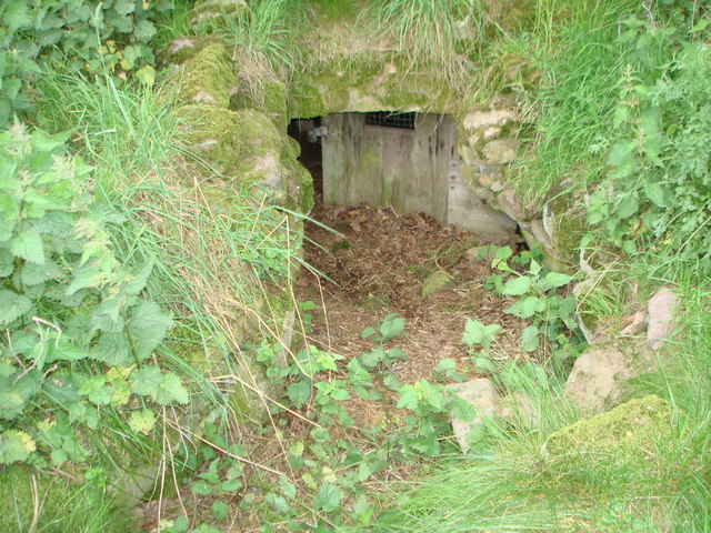
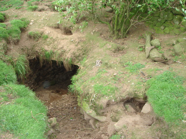
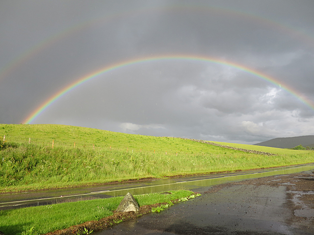
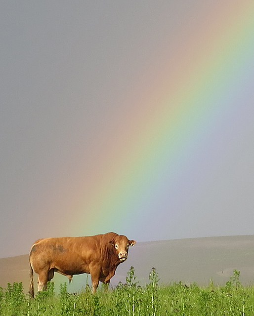
Mossat Images

Images are sourced within 2km of 57.26109/-2.8714639 or Grid Reference NJ4719. Thanks to Geograph Open Source API. All images are credited.

The Burn of Linthaugh at Mossat
Roadside Fountain An ornate fountain, probably originally a drinking fountain. At the time of the photo it was submerged in greenery, but there's a clearer view on Google Streetview.
Roadside Fountain
An ornate fountain, probably originally a drinking fountain. At the time of the photo it was submerged in greenery, but there's a clearer view on Google Streetview.
Souterrain near Kildrummy Entrance to one of the souterrains near Kildrummy - June,2008.
Souterrain near Kildrummy
Entrance to one of the souterrains near Kildrummy - June,2008.
Souterrain near Kildrummy Inside one of the souterrains near Kildrummy - June,2008.
Souterrain near Kildrummy
Inside one of the souterrains near Kildrummy - June,2008.
Souterrain near Kildrummy Entrance to one of the souterrains near Kildrummy - June,2008.
Souterrain near Kildrummy
Entrance to one of the souterrains near Kildrummy - June,2008.
Double Rainbow A break in the clouds at Mossat.
Double Rainbow
A break in the clouds at Mossat.
Pot of Gold If this had been a dairy bull, I could have pointed out that dairy farming is far from a gold mine, as the supermarkets insist on paying less for milk than it costs to produce it. In fact the processing plant in Aberdeen was closed almost without notice, and farmers are having to pay to ship their milk to the Central Belt for processing. How crazy is that? But this fellow isn't bothered by any of that. He's just waiting patiently for the beef industry to implode as well.
Pot of Gold
If this had been a dairy bull, I could have pointed out that dairy farming is far from a gold mine, as the supermarkets insist on paying less for milk than it costs to produce it. In fact the processing plant in Aberdeen was closed almost without notice, and farmers are having to pay to ship their milk to the Central Belt for processing. How crazy is that? But this fellow isn't bothered by any of that. He's just waiting patiently for the beef industry to implode as well.
The Mossat Only the antiques shop next door remains in operation. This was once the place to go for a Sunday run. Tea shop, garden centre, water garden and general store have all done business here.
The Mossat
Only the antiques shop next door remains in operation. This was once the place to go for a Sunday run. Tea shop, garden centre, water garden and general store have all done business here.
Tree lined driveway to Howmill
Elphinstone aisle, St Bride's Church The south aisle (wing) was built ca. 1605 (restored 1862) and was presumably part of a T-plan kirk (see: <span class="nowrap"><a title="https://en.wikipedia.org/wiki/Church_architecture_in_Scotland" rel="nofollow ugc noopener" href="https://en.wikipedia.org/wiki/Church_architecture_in_Scotland">Link</a><img style="margin-left:2px;" alt="External link" title="External link - shift click to open in new window" src="https://s1.geograph.org.uk/img/external.png" width="10" height="10"/></span> ) but where was the pulpit?  The rest of St Bride's (Bridget's) kirk is a ruin, having been replaced by the parish kirk next door in 1805.
Elphinstone aisle, St Bride's Church
The south aisle (wing) was built ca. 1605 (restored 1862) and was presumably part of a T-plan kirk (see: LinkExternal link ) but where was the pulpit? The rest of St Bride's (Bridget's) kirk is a ruin, having been replaced by the parish kirk next door in 1805.
'Ane Honorabile Man' Tomb of John Reid (d. 1563), now set into the remains of the north wall of St Bride's kirk, Kildrummy.  The blazon could(?) be azure three stags' heads erased or.
'Ane Honorabile Man'
Tomb of John Reid (d. 1563), now set into the remains of the north wall of St Bride's kirk, Kildrummy. The blazon could(?) be azure three stags' heads erased or.
Lumsden grave slab, Kildrummy kirkyard The sandstone slab from 1730 is sheltered from the elements by wooden shutters.
Lumsden grave slab, Kildrummy kirkyard
The sandstone slab from 1730 is sheltered from the elements by wooden shutters.
Harvested fields, Kildrummy... ...as viewed from the kirkyard.
Harvested fields, Kildrummy...
...as viewed from the kirkyard.
West Aberdeenshire scene Harvested fields, wind turbines, rain clouds...
West Aberdeenshire scene
Harvested fields, wind turbines, rain clouds...
Kildrummy kirk (curse of the scaffolding) The A-listed kirk from 1805 undergoing major repairs/renovations to walls and roof in summer 2017.  The large windows on the south-side flanking the pulpit are boarded over for protection.  See The Architecture of Scottish Post Reformation Churches by George Hay (p. 117) for more.   The raised kirkyard (and site of St Bride's church) is visible to the right.
Kildrummy kirk (curse of the scaffolding)
The A-listed kirk from 1805 undergoing major repairs/renovations to walls and roof in summer 2017. The large windows on the south-side flanking the pulpit are boarded over for protection. See The Architecture of Scottish Post Reformation Churches by George Hay (p. 117) for more. The raised kirkyard (and site of St Bride's church) is visible to the right.
St Bride's Kirk, Kildrummy, undergoing roof repair Seen from the minor road by Templeton, over Priest's Rig and grazing cattle, with Ardhuncart Hill in the background.
St Bride's Kirk, Kildrummy, undergoing roof repair
Seen from the minor road by Templeton, over Priest's Rig and grazing cattle, with Ardhuncart Hill in the background.
Old Milestone by the A97, Drumnahive, Kildrummy parish Aberdeen granite milestone by the A97, in parish of Kildrummy (Grampian District), Drumnahive, near white telephone exchange building, North side of road.

Inscription reads:-
34
(To Aberdeen)

Surveyed

Milestone Society National ID: AD_SDCB34
Old Milestone by the A97, Drumnahive, Kildrummy parish
Aberdeen granite milestone by the A97, in parish of Kildrummy (Grampian District), Drumnahive, near white telephone exchange building, North side of road. Inscription reads:- 34 (To Aberdeen) Surveyed Milestone Society National ID: AD_SDCB34
Junction on A97 at Mossat
Show me another place!

Mossat is located at Grid Ref: NJ4719 (Lat: 57.26109, Lng: -2.8714639)

Unitary Authority: Aberdeenshire

Police Authority: North East

What 3 Words

///smokers.pavilions.fidelity. Near Alford, Aberdeenshire

Nearby Locations

Mossat

Related Wikis

Mossat

Mossat is a settlement in Aberdeenshire, Scotland on the A97 road near Glenkindie and Lumsden, between Bridge of Alford and Strathdon, and is situated...

Kildrummy

Kildrummy (Scottish Gaelic: Cionn Droma) is a hamlet in Aberdeenshire, Scotland near the River Don, 7 miles (11 kilometres) west of Alford. The hamlet...

Lumsden, Aberdeenshire

Lumsden is an inland village in Aberdeenshire, Scotland on the A97 road. == Location == It crowns a rising-ground 227 m (745 ft) above sea level amid a...

Clova Monastery

Clova Monastery (also called Cloveth) was a medieval Culdee monastery in Kildrummy, Aberdeenshire, Scotland. == Founding == Clova was founded in the late...

Brux Castle

Brux Castle was a castle of the Forbeses, about 1.5 miles (2.4 km) east of Kildrummy, Aberdeenshire, Scotland, south of the river Don. The castle was...
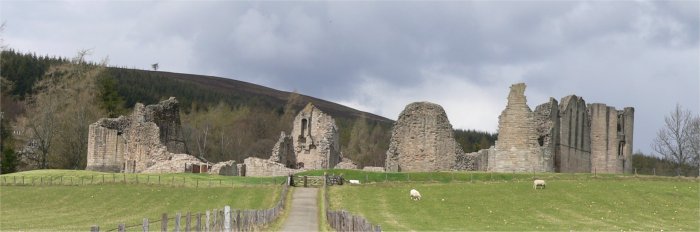
Kildrummy Castle

Kildrummy Castle is a ruined castle near Kildrummy, in Aberdeenshire, Scotland. Though ruined, it is one of the most extensive castles dating from the...

Scottish Sculpture Open

The Scottish Sculpture Open exhibition, sometimes known as the Kildrummy Open, was organised by the Scottish Sculpture Workshop from 1981 to 1997. The...

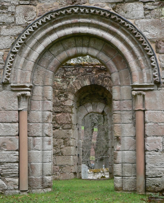
St Mary's Kirk, Auchindoir

St Mary's Kirk at Auchindoir, between Rhynie and Lumsden, in Aberdeenshire, Scotland, is one of the country's finest surviving medieval parish kirks. The...

Nearby Amenities

Located within 500m of 57.26109,-2.8714639
Parking
Lat/Long: 57.262592/-2.8704849
Material: wood
Power: pole
Lat/Long: 57.2571774/-2.8748218
Material: wood
Power: pole
Lat/Long: 57.2582304/-2.874164
Material: wood
Power: pole
Lat/Long: 57.2591905/-2.8735618
Material: wood
Power: pole
Lat/Long: 57.2600459/-2.8730201
Power: pole
Lat/Long: 57.2609457/-2.8724663
Power: pole
Lat/Long: 57.2615984/-2.8725243
Power: pole
Lat/Long: 57.2626499/-2.8726331
Power: pole
Lat/Long: 57.2635889/-2.872725
Power: pole
Lat/Long: 57.2642049/-2.8727831
Power: pole
Lat/Long: 57.2649818/-2.8724469
Power: pole
Lat/Long: 57.2655611/-2.8721857
Power: pole
Lat/Long: 57.2631443/-2.8651698
Power: pole
Lat/Long: 57.2623648/-2.8652448
Power: pole
Lat/Long: 57.2617318/-2.8652907
Material: wood
Power: pole
Lat/Long: 57.2615343/-2.8653077
Material: wood
Power: pole
Lat/Long: 57.2608921/-2.8653633
Material: wood
Power: pole
Lat/Long: 57.2603022/-2.8639679
Power: pole
Lat/Long: 57.2615866/-2.8641904
Post Box
Brand: Royal Mail
Brand Wikidata: Q638098
Operator: Royal Mail
Operator Wikidata: Q638098
Post Box Type: lamp
Ref: AB33 414
Royal Cypher: scottish_crown
Source: survey
Lat/Long: 57.2614714/-2.8712687
Bus Stop
Toll House
Bench: yes
Bin: no
Bus: yes
Lit: no
Naptan AtcoCode: 630032151
Naptan Bearing: NE
Naptan CommonName: Toll House
Naptan Indicator: adj
Naptan NaptanCode: 23623428
Naptan Street: A97
Naptan Verified: no
Public Transport: platform
Shelter: yes
Source: naptan;bing;naptan_compare_tool
Tactile Paving: no
Lat/Long: 57.2630057/-2.8701417
The data included in this document is from www.openstreetmap.org. The data is made available under ODbL.

Have you been to Mossat?

Leave your review of Mossat below (or comments, questions and feedback).