Moor Gate

Settlement in Yorkshire

England

Moor Gate

Billy Woods rock formation, Kippax
Billy Woods rock formation, Kippax Credit: derek dye

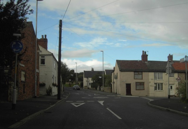
Moor Gate is a picturesque village located in the heart of the Yorkshire Dales, England. Nestled amidst rolling hills and vast moorlands, this charming hamlet offers a peaceful retreat for its residents and visitors alike. The village is situated approximately 10 miles northeast of the bustling market town of Skipton, making it easily accessible for both locals and tourists.

A defining feature of Moor Gate is its stunning natural surroundings. The village is surrounded by breathtaking landscapes, with heather-covered moors stretching as far as the eye can see. This makes it a haven for nature enthusiasts, who can enjoy long walks and hikes exploring the area's scenic beauty. The nearby River Wharfe also provides opportunities for fishing and boating.

Despite its small size, Moor Gate boasts a strong sense of community. The village is home to a close-knit population that takes pride in preserving its rural heritage. Traditional stone cottages, some dating back centuries, line the streets, adding to the area's timeless charm.

While Moor Gate may lack the amenities of a larger town, it compensates with its tranquility and idyllic setting. The village has a small local pub, The Moor's Head, which serves as a meeting point for residents and visitors to socialize and enjoy a pint of locally brewed ale.

In conclusion, Moor Gate is a hidden gem in the Yorkshire Dales, offering a peaceful retreat and stunning natural beauty. It is a place where one can truly escape the hustle and bustle of modern life and immerse themselves in the tranquility of the countryside.

If you have any feedback on the listing, please let us know in the comments section below.
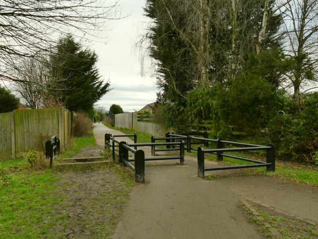
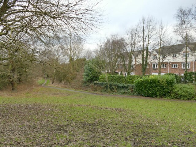
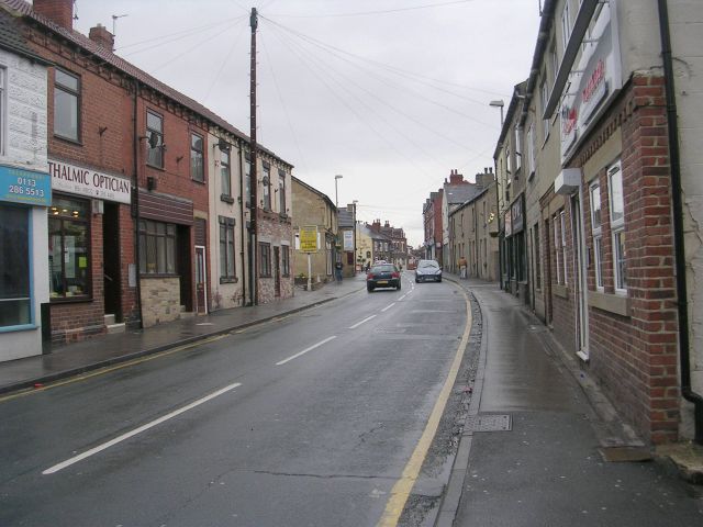
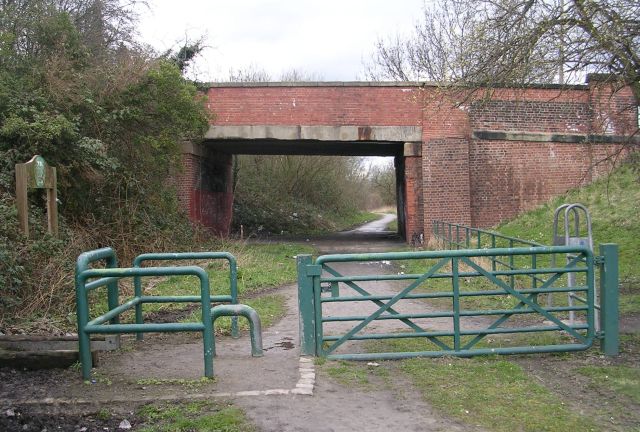
Moor Gate Images

Images are sourced within 2km of 53.772582/-1.3727842 or Grid Reference SE4130. Thanks to Geograph Open Source API. All images are credited.

Billy Woods rock formation, Kippax
Skatepark and playground, Glebelands recreation ground
Changing rooms, Glebelands recreation ground With rugby pitches beyond, home of the Garforth Tigers.
Changing rooms, Glebelands recreation ground
With rugby pitches beyond, home of the Garforth Tigers.
New housing estate, Ninelands Lane The development is not yet complete, though these houses fronting the main road are.  The side roads are named after Yorkshire towns, this one being Middleham Drive.
New housing estate, Ninelands Lane
The development is not yet complete, though these houses fronting the main road are. The side roads are named after Yorkshire towns, this one being Middleham Drive.
New housing estate, Skipton Lane The development is not yet complete.  The side roads are named after Yorkshire towns, this one being Skipton Lane. At the end of the road is an open space on the site of the former Garforth Colliery.
New housing estate, Skipton Lane
The development is not yet complete. The side roads are named after Yorkshire towns, this one being Skipton Lane. At the end of the road is an open space on the site of the former Garforth Colliery.
Ninelands Primary School, Garforth A local authority school (increasingly rare as Academy trusts take over) for children aged three to eleven.
Ninelands Primary School, Garforth
A local authority school (increasingly rare as Academy trusts take over) for children aged three to eleven.
Second zebra crossing on Ninelands Lane There are three such crossings in a few hundred metres, probably because of the nearby school.
Second zebra crossing on Ninelands Lane
There are three such crossings in a few hundred metres, probably because of the nearby school.
Third zebra crossing on Ninelands Lane There are three such crossings in a few hundred metres, probably because of the nearby school.  This one is at the start of the Lines Way cycle route and the dip in the road is because it used to pass under the North Eastern Railway here.
Third zebra crossing on Ninelands Lane
There are three such crossings in a few hundred metres, probably because of the nearby school. This one is at the start of the Lines Way cycle route and the dip in the road is because it used to pass under the North Eastern Railway here.
Gas installation, Ninelands Lane
North end of the Lines Way The route starts at Ninelands Lane in Garforth.
North end of the Lines Way
The route starts at Ninelands Lane in Garforth.
Road bridge over the Lines Way The bridge takes the A63 Selby Road over the route of a former railway.
Road bridge over the Lines Way
The bridge takes the A63 Selby Road over the route of a former railway.
Positive graffiti (1) The messages here are more meaningful and affirming than most graffiti: "Peace on earth, good will to all persons"; "People not profits"; "You are loved, you are needed", and "Feliz Navidad" (is there a Hispanic community in Garforth?) For context, see <a href="https://www.geograph.org.uk/photo/7081277">SE4032 : Road bridge over the Lines Way</a>.
Positive graffiti (1)
The messages here are more meaningful and affirming than most graffiti: "Peace on earth, good will to all persons"; "People not profits"; "You are loved, you are needed", and "Feliz Navidad" (is there a Hispanic community in Garforth?) For context, see SE4032 : Road bridge over the Lines Way.
Positive graffiti (2) The messages here are more meaningful and (mostly) affirming than most graffiti: "Talk more, love more"; "Brexit = Suffering"; and "Buon Natale" (is there an Italian community in Garforth?) I guess "Low the Graff" is the nickname of the person or group responsible. For context, see <a href="https://www.geograph.org.uk/photo/7081277">SE4032 : Road bridge over the Lines Way</a>.
Positive graffiti (2)
The messages here are more meaningful and (mostly) affirming than most graffiti: "Talk more, love more"; "Brexit = Suffering"; and "Buon Natale" (is there an Italian community in Garforth?) I guess "Low the Graff" is the nickname of the person or group responsible. For context, see SE4032 : Road bridge over the Lines Way.
Power line along the Lines Way A four mile cycle route along a former North Eastern Railway route between Garforth and Kippax, East of Leeds.  Passenger services on the line ceased in 1951 and freight along this section of it in 1969.  It is now maintained as a nature reserve by the Yorkshire Wildlife Trust <span class="nowrap"><a title="https://www.ywt.org.uk/nature-reserves/lines-way" rel="nofollow ugc noopener" href="https://www.ywt.org.uk/nature-reserves/lines-way">Link</a><img style="margin-left:2px;" alt="External link" title="External link - shift click to open in new window" src="https://s1.geograph.org.uk/img/external.png" width="10" height="10"/></span>
Power line along the Lines Way
A four mile cycle route along a former North Eastern Railway route between Garforth and Kippax, East of Leeds. Passenger services on the line ceased in 1951 and freight along this section of it in 1969. It is now maintained as a nature reserve by the Yorkshire Wildlife Trust LinkExternal link
Footpath off the Lines Way This public footpath leads to Church Lane and the town centre.
Footpath off the Lines Way
This public footpath leads to Church Lane and the town centre.
Link to the Lines Way A short section of path linking Selby Road to the cycleway that passes beneath it <a href="https://www.geograph.org.uk/photo/7081277">SE4032 : Road bridge over the Lines Way</a>.
Link to the Lines Way
A short section of path linking Selby Road to the cycleway that passes beneath it SE4032 : Road bridge over the Lines Way.
Rear of Garforth Academy The secondary school <a href="https://www.geograph.org.uk/photo/7081402">SE4032 : Garforth Academy</a> was formerly called Garforth Community College.
Rear of Garforth Academy
The secondary school SE4032 : Garforth Academy was formerly called Garforth Community College.
Selby Road crossing the Lines Way For the former railway route that now passes beneath the A63 here, see <a href="https://www.geograph.org.uk/photo/7081277">SE4032 : Road bridge over the Lines Way</a>.  Since an earlier photo in 2012 <a href="https://www.geograph.org.uk/photo/2754932">SE4032 : A63 towards Selby</a> warning signs of a sharp bend and possible queuing traffic have been added.
Selby Road crossing the Lines Way
For the former railway route that now passes beneath the A63 here, see SE4032 : Road bridge over the Lines Way. Since an earlier photo in 2012 SE4032 : A63 towards Selby warning signs of a sharp bend and possible queuing traffic have been added.
Show me another place!

Moor Gate is located at Grid Ref: SE4130 (Lat: 53.772582, Lng: -1.3727842)

Division: West Riding

Unitary Authority: Leeds

Police Authority: West Yorkshire

What 3 Words

///ruffle.series.bridge. Near Kippax, West Yorkshire

Related Wikis

Kippax, West Yorkshire

Kippax is a village and civil parish in the City of Leeds metropolitan borough, West Yorkshire, England. It is situated to the east of the city, near...

Kippax railway station

Kippax railway station was a railway station on the Castleford–Garforth line in West Yorkshire, England. The station opened in 1878 and closed to passengers...

Great Preston

Great Preston is a small rural village in the City of Leeds metropolitan borough, West Yorkshire, England. It has incorporated the once neighbouring hamlet...

Brigshaw High School

Brigshaw High School is a coeducational secondary school and sixth form located in the village of Allerton Bywater, West Yorkshire, England. == History... ==

Garforth Academy

Garforth Academy (formerly known as Garforth Comprehensive School until September 1992 and Garforth Community College until November 2010) is a secondary...

East Garforth railway station

East Garforth railway station serves Garforth in West Yorkshire, England. It is on the Selby Line, and operated by Northern. The station was opened by...

St Mary's Church, Garforth

The Church of St Mary the Blessed Virgin in Garforth, West Yorkshire, England is an active Anglican parish church in the archdeaconry of Leeds and the...

Bowers railway station

Bowers railway station was a station opened in 1934 by the London and North Eastern Railway (LNER) on the Castleford–Garforth line, in the West Riding...

Nearby Amenities

Located within 500m of 53.772582,-1.3727842
Kippax
Is In: West Yorkshire, England, UK
Place: town
Source: npe
Wikidata: Q2562575
Wikipedia: en:Kippax, West Yorkshire
Lat/Long: 53.7701302/-1.3701581
Traffic Calming: cushion
Lat/Long: 53.7728583/-1.3731472
Bus Stop
Rutland Close
Bus: yes
Local Ref: 45010184
Naptan AtcoCode: 450010184
Naptan Bearing: NW
Naptan CommonName: Rutland Close
Naptan Crossing: Ebor Mount
Naptan Indicator: Stop 45010184
Naptan Landmark: Health Centre
Naptan PlusbusZoneRef: LEEDS
Naptan ShortCommonName: Ebor Mount
Naptan Street: Leeds Road
Naptan Verified: yes
Network: Metro West Yorkshire
Network Wikidata: Q7987043
Public Transport: platform
Ref: 45010184
Source: naptan_import
Lat/Long: 53.7718051/-1.3721743
Bus Stop
Valley Road
Bus: yes
Local Ref: 45013308
Naptan AtcoCode: 450013308
Naptan Bearing: NW
Naptan CommonName: Valley Road
Naptan Crossing: Valley Ridge
Naptan Indicator: Stop 45013308
Naptan PlusbusZoneRef: LEEDS
Naptan ShortCommonName: Valley Ridge
Naptan Street: Valley Road
Naptan Verified: yes
Public Transport: platform
Ref: 45013308
Source: naptan_import
Lat/Long: 53.7734735/-1.3786254
Bus Stop
Valley Road Birch Road
Bus: yes
Local Ref: 45010173
Naptan AtcoCode: 450010173
Naptan Bearing: NE
Naptan CommonName: Valley Road Birch Road
Naptan Crossing: Birch Road
Naptan Indicator: Stop 45010173
Naptan PlusbusZoneRef: LEEDS
Naptan ShortCommonName: Birch Road
Naptan Street: Valley Road
Naptan Verified: no
Public Transport: platform
Source: naptan_import
Lat/Long: 53.7729761/-1.3756806
Bus Stop
Leeds Road Moorgate Road
Bus: yes
Local Ref: 45010174
Naptan AtcoCode: 450010174
Naptan Bearing: SE
Naptan CommonName: Leeds Road Moorgate Road
Naptan Crossing: Moorgate Road
Naptan Indicator: Stop 45010174
Naptan Landmark: Filling Station
Naptan PlusbusZoneRef: LEEDS
Naptan ShortCommonName: Moorgate Road
Naptan Street: Leeds Road
Naptan Verified: no
Public Transport: platform
Source: naptan_import
Lat/Long: 53.7741396/-1.3747226
Bus Stop
Leeds Road Calvert Close
Bus: yes
Local Ref: 45010175
Naptan AtcoCode: 450010175
Naptan Bearing: SE
Naptan CommonName: Leeds Road Calvert Close
Naptan Crossing: Calvert Close
Naptan Indicator: Stop 45010175
Naptan PlusbusZoneRef: LEEDS
Naptan ShortCommonName: Calvert Close
Naptan Street: Leeds Road
Naptan Verified: no
Network: Metro West Yorkshire
Network Wikidata: Q7987043
Public Transport: platform
Source: naptan_import
Lat/Long: 53.7761304/-1.3768876
Bus Stop
Rutland Close
Bus: yes
Local Ref: 45010183
Naptan AtcoCode: 450010183
Naptan Bearing: SE
Naptan CommonName: Rutland Close
Naptan Crossing: Rutland Close
Naptan Indicator: Stop 45010183
Naptan Landmark: Health Centre
Naptan PlusbusZoneRef: LEEDS
Naptan ShortCommonName: Rutland Close
Naptan Street: Leeds Road
Naptan Verified: no
Network: Metro West Yorkshire
Network Wikidata: Q7987043
Public Transport: platform
Source: naptan_import
Lat/Long: 53.7715256/-1.3716975
Bus Stop
Moorgate Road
Bus: yes
Local Ref: 45012894
Naptan AtcoCode: 450012894
Naptan Bearing: NW
Naptan CommonName: Moorgate Road
Naptan Crossing: Moorgate Road
Naptan Indicator: Stop 45012894
Naptan Landmark: Post Office
Naptan PlusbusZoneRef: LEEDS
Naptan ShortCommonName: Moorgate Road
Naptan Street: Leeds Road
Naptan Verified: no
Public Transport: platform
Source: naptan_import
Lat/Long: 53.7746373/-1.3753525
Bus Stop
Leeds Road Church Lane
Bus: yes
Local Ref: 45012895
Naptan AtcoCode: 450012895
Naptan Bearing: N
Naptan CommonName: Leeds Road Church Lane
Naptan Crossing: Church Lane
Naptan Indicator: Stop 45012895
Naptan Landmark: Greenfield Primary School
Naptan PlusbusZoneRef: LEEDS
Naptan ShortCommonName: Robinson Lane
Naptan Street: Leeds Road
Naptan Verified: no
Public Transport: platform
Source: naptan_import
Lat/Long: 53.7686094/-1.3708297
Bus Stop
Leeds Road Church Lane
Bus: yes
Local Ref: 45012896
Naptan AtcoCode: 450012896
Naptan Bearing: S
Naptan CommonName: Leeds Road Church Lane
Naptan Crossing: Church Lane
Naptan Indicator: Stop 45012896
Naptan Landmark: Greenfield Primary School
Naptan PlusbusZoneRef: LEEDS
Naptan ShortCommonName: Church Lane
Naptan Street: Leeds Road
Naptan Verified: no
Public Transport: platform
Source: naptan_import
Lat/Long: 53.7684465/-1.3706197
Bus Stop
Gibson Lane
Bus: yes
Local Ref: 45013302
Naptan AtcoCode: 450013302
Naptan Bearing: E
Naptan CommonName: Gibson Lane
Naptan Crossing: Manor Garth Road
Naptan Indicator: Stop 45013302
Naptan PlusbusZoneRef: LEEDS
Naptan ShortCommonName: Manor Garth Road
Naptan Street: Gibson Lane
Naptan Verified: no
Network: Metro West Yorkshire
Network Wikidata: Q7987043
Public Transport: platform
Source: naptan_import
Lat/Long: 53.7715558/-1.3664297
Bus Stop
Gibson Lane Pondfields Drive
Bus: yes
Local Ref: 45013303
Naptan AtcoCode: 450013303
Naptan Bearing: W
Naptan CommonName: Gibson Lane Pondfields Drive
Naptan Crossing: Pondfields Drive
Naptan Indicator: Stop 45013303
Naptan Landmark: Dental Centre
Naptan PlusbusZoneRef: LEEDS
Naptan ShortCommonName: Pondfields Drive
Naptan Street: Gibson Lane
Naptan Verified: no
Network: Metro West Yorkshire
Network Wikidata: Q7987043
Public Transport: platform
Source: naptan_import
Lat/Long: 53.7715329/-1.369557
Bus Stop
Kippax Valley Road
Bus: yes
Local Ref: 45013307
Naptan AtcoCode: 450013307
Naptan Bearing: SE
Naptan CommonName: Kippax Valley Road
Naptan Crossing: Valley Ridge
Naptan Indicator: Stop 45013307
Naptan PlusbusZoneRef: LEEDS
Naptan ShortCommonName: Valley Ridge
Naptan Street: Valley Road
Naptan Verified: no
Public Transport: platform
Source: naptan_import
Lat/Long: 53.7738561/-1.3789603
Bus Stop
Gibson Lane Moorgate Drive
Bus: yes
Local Ref: 45025930
Naptan AtcoCode: 450025930
Naptan Bearing: E
Naptan CommonName: Gibson Lane Moorgate Drive
Naptan Crossing: Moorgate Drive
Naptan Indicator: Stop 45025930
Naptan Landmark: Nursing Home
Naptan PlusbusZoneRef: LEEDS
Naptan ShortCommonName: Moorgate Drive
Naptan Street: Gibson Lane
Naptan Verified: no
Network: Metro West Yorkshire
Network Wikidata: Q7987043
Public Transport: platform
Source: naptan_import
Lat/Long: 53.7715078/-1.370458
Valley Road Birch Road
Local Ref: 45050006
Naptan AtcoCode: 450050006
Naptan Bearing: SW
Naptan BusStopType: CUS
Naptan CommonName: Valley Road Birch Road
Naptan Indicator: Stop 45050006
Naptan PlusbusZoneRef: LEEDS
Naptan ShortCommonName: Birch Road
Naptan Street: Valley Road
Naptan Verified: no
Source: naptan_import
Lat/Long: 53.7729218/-1.3756055
Westfield Lane - Kippax
Local Ref: 45050106
Naptan AtcoCode: 450050106
Naptan Bearing: SE
Naptan BusStopType: CUS
Naptan CommonName: Westfield Lane - Kippax
Naptan Indicator: Stop 45050106
Naptan PlusbusZoneRef: LEEDS
Naptan ShortCommonName: Oxford Drive
Naptan Street: Westfield Lane
Naptan Verified: no
Source: naptan_import
Lat/Long: 53.7689542/-1.3745037
Noexit: yes
Lat/Long: 53.7684726/-1.3717345
Noexit: yes
Lat/Long: 53.7685615/-1.3722405
Turning Circle
Lat/Long: 53.7711143/-1.3783587
Turning Circle
Lat/Long: 53.7721099/-1.3769576
Turning Circle
Lat/Long: 53.7698116/-1.3755179
Turning Circle
Lat/Long: 53.7697208/-1.3744129
Noexit: yes
Lat/Long: 53.7709525/-1.3761976
Turning Circle
Lat/Long: 53.7710462/-1.3760514
Turning Circle
Lat/Long: 53.770633/-1.373285
Turning Circle
Lat/Long: 53.7715011/-1.3744216
Noexit: yes
Lat/Long: 53.7721273/-1.373651
Turning Circle
Lat/Long: 53.7707961/-1.3753164
Turning Circle
Lat/Long: 53.7735807/-1.3775867
Traffic Calming: cushion
Lat/Long: 53.770625/-1.3711883
Sainsbury's Local
Addr City: Leeds
Addr Housenumber: 155-157
Addr Postcode: LS25 7ET
Addr Street: Moorgate Road
Addr Suburb: Kippax
Brand: Sainsbury's Local
Brand Wikidata: Q13218434
Brand Wikipedia: en:Sainsbury's Local
Fhrs Id: 321889
Shop: convenience
Website: https://stores.sainsburys.co.uk/4744/kippax-local
Wheelchair: yes
Lat/Long: 53.7746139/-1.3748385
Turning Circle
Turning Circle: square
Lat/Long: 53.7724526/-1.3677262
Turning Circle
Turning Circle: square
Lat/Long: 53.7724663/-1.3687997
Gibson Lane
Bus: yes
Local Ref: 45013302
Public Transport: stop_position
Lat/Long: 53.7714593/-1.3661883
Traffic Calming: cushion
Lat/Long: 53.7715355/-1.3700836
Turning Circle
Lat/Long: 53.773607/-1.3676204
Turning Circle
Lat/Long: 53.7753639/-1.3722067
Turning Circle
Lat/Long: 53.7722235/-1.3712412
Noexit: yes
Lat/Long: 53.7704036/-1.3683215
Noexit: yes
Lat/Long: 53.7744257/-1.3737989
Turning Circle
Lat/Long: 53.7740264/-1.3731432
Turning Circle
Lat/Long: 53.7728572/-1.3723915
Noexit: yes
Lat/Long: 53.7717318/-1.3751386
Noexit: yes
Lat/Long: 53.771851/-1.3752783
Noexit: yes
Lat/Long: 53.7755413/-1.3714116
Post Box
Operator: Royal Mail
Post Box Type: pillar
Ref: LS25 35
Lat/Long: 53.7746096/-1.375135
Crossing
Crossing: traffic_signals
Crossing Island: no
Tactile Paving: yes
Lat/Long: 53.774432/-1.3751116
Turning Circle
Lat/Long: 53.7727978/-1.3785249
Noexit: yes
Lat/Long: 53.7744043/-1.3746721
Pharmacy
Boots
Addr City: Leeds
Addr Housename: Kippax Health Centre
Addr Postcode: LS25 7QT
Addr Street: Moorgate Drive
Addr Suburb: Kippax
Brand: Boots
Brand Wikidata: Q6123139
Brand Wikipedia: en:Boots UK
Fhrs Id: 322205
Healthcare: pharmacy
Lat/Long: 53.77195/-1.3700084
Noexit: yes
Lat/Long: 53.7723814/-1.3701332
Fast Food
Sunrise
Addr City: Leeds
Addr Housenumber: 153
Addr Postcode: LS25 7ET
Addr Street: Moorgate Road
Addr Suburb: Kippax
Cuisine: chinese
Fhrs Id: 868204
Takeaway: yes
Lat/Long: 53.774654/-1.3746938
Fuel
Oakdale Garage
Addr City: Leeds
Addr Postcode: LS25 7EP
Addr Street: Leeds
Addr Suburb: Kippax
Fhrs Id: 818449
Lat/Long: 53.7742474/-1.374549
Post Box
Operator: Royal Mail
Post Box Type: pillar
Ref: LS25 689
Lat/Long: 53.7715245/-1.369886
Childcare
Greenfield Out Of School Club
Addr City: Leeds
Addr Housename: Kippax Greenfield School
Addr Postcode: LS25 7PA
Addr Street: Ebor Mount
Addr Suburb: Kippax
Fhrs Id: 467434
Lat/Long: 53.7702123/-1.3722718
Noexit: yes
Lat/Long: 53.7722603/-1.3756672
Noexit: yes
Lat/Long: 53.774069/-1.3676181
Noexit: yes
Lat/Long: 53.7727077/-1.3741315
Waste Basket
Collection Times: Tu
Ref UK Leedscc Bin: 2176
Lat/Long: 53.774646/-1.375023
Waste Basket
Collection Times: Tu
Ref UK Leedscc Bin: 2177
Lat/Long: 53.774688/-1.374861
Waste Basket
Collection Times: Tu
Ref UK Leedscc Bin: 3517
Lat/Long: 53.775939/-1.371039
Waste Basket
Collection Times: Tu
Ref UK Leedscc Bin: 1810
Lat/Long: 53.773931/-1.374462
Waste Basket
Collection Times: Tu
Ref UK Leedscc Bin: 996
Lat/Long: 53.772148/-1.371463
Waste Basket
Collection Times: Tu
Ref UK Leedscc Bin: 1811
Lat/Long: 53.771562/-1.371685
Waste Basket
Collection Times: Tu
Ref UK Leedscc Bin: 2175
Lat/Long: 53.771705/-1.369956
Waste Basket
Collection Times: Tu
Ref UK Leedscc Bin: 1088
Lat/Long: 53.771513/-1.369509
Noexit: yes
Lat/Long: 53.7722337/-1.3669696
Noexit: yes
Lat/Long: 53.7722527/-1.3668559
Noexit: yes
Lat/Long: 53.7748498/-1.3729376
Noexit: yes
Lat/Long: 53.7706685/-1.3721054
Noexit: yes
Lat/Long: 53.7704066/-1.3713907
Noexit: yes
Lat/Long: 53.7716976/-1.3699646
Noexit: yes
Lat/Long: 53.7718411/-1.3699576
Traffic Calming: cushion
Lat/Long: 53.7756365/-1.3762502
Leeds Road Calvert Close
Bus: yes
Local Ref: 45010175
Public Transport: stop_position
Lat/Long: 53.7759984/-1.3767393
Traffic Calming: cushion
Lat/Long: 53.768274/-1.3707205
Noexit: yes
Lat/Long: 53.7735329/-1.3719479
Noexit: yes
Lat/Long: 53.7745557/-1.3727408
Noexit: yes
Lat/Long: 53.7727483/-1.3777287
Traffic Calming: cushion
Lat/Long: 53.7720737/-1.3723092
Traffic Calming: cushion
Lat/Long: 53.7736173/-1.3743611
Passing Place
Lat/Long: 53.7724696/-1.3754903
Noexit: yes
Lat/Long: 53.7725557/-1.3719405
Turning Circle
Lat/Long: 53.7717776/-1.3734958
Traffic Calming: cushion
Lat/Long: 53.7695064/-1.3708795
Noexit: yes
Lat/Long: 53.7702155/-1.3714566
Entrance: yes
Lat/Long: 53.7702887/-1.3719764
Noexit: yes
Lat/Long: 53.7704129/-1.3722785
Noexit: yes
Lat/Long: 53.769233/-1.3713397
Noexit: yes
Lat/Long: 53.7682054/-1.3733757
Noexit: yes
Lat/Long: 53.7750172/-1.3689367
Noexit: yes
Lat/Long: 53.7749846/-1.3670941
Turning Circle
Turning Circle: knuckle
Lat/Long: 53.7741313/-1.3675688
Noexit: yes
Lat/Long: 53.774626/-1.3671738
Noexit: yes
Lat/Long: 53.7749521/-1.3664191
Noexit: yes
Lat/Long: 53.7745058/-1.3692838
Noexit: yes
Lat/Long: 53.7756816/-1.3702099
Noexit: yes
Lat/Long: 53.7716154/-1.3711368
Turning Circle
Turning Circle: hammer
Lat/Long: 53.770037/-1.3675734
Traffic Calming: cushion
Lat/Long: 53.7715377/-1.3669155
Traffic Calming: cushion
Lat/Long: 53.7715587/-1.3686139
Leeds Road Moorgate Road
Bus: yes
Local Ref: 45010174
Public Transport: stop_position
Lat/Long: 53.7740479/-1.3747569
Rutland Close
Bus: yes
Local Ref: 45010183
Public Transport: stop_position
Lat/Long: 53.7714347/-1.371774
Gibson Lane Moorgate Drive
Bus: yes
Local Ref: 45025930
Public Transport: stop_position
Lat/Long: 53.7715012/-1.3702598
Leeds Road Church Lane
Bus: yes
Local Ref: 45012896
Public Transport: stop_position
Lat/Long: 53.7683578/-1.3707294
Gibson Lane Parkfield Close
Bus: yes
Local Ref: 45028211
Public Transport: stop_position
Lat/Long: 53.7713797/-1.3654894
Gibson Lane Pondfields Drive
Bus: yes
Local Ref: 45013303
Public Transport: stop_position
Lat/Long: 53.7715647/-1.3697315
Rutland Close
Bus: yes
Local Ref: 45010184
Public Transport: stop_position
Lat/Long: 53.7718668/-1.3721267
Moorgate Road
Bus: yes
Local Ref: 45012894
Public Transport: stop_position
Lat/Long: 53.7748974/-1.37555
The data included in this document is from www.openstreetmap.org. The data is made available under ODbL.

Have you been to Moor Gate?

Leave your review of Moor Gate below (or comments, questions and feedback).