Kippax

Settlement in Yorkshire

England

Kippax

Billy Woods rock formation, Kippax
Billy Woods rock formation, Kippax Credit: derek dye

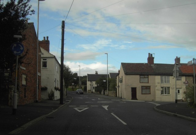
Kippax is a small town located in West Yorkshire, England. Situated approximately 10 miles east of Leeds city center, it falls under the metropolitan borough of Leeds. With a population of around 11,000 people, Kippax has a close-knit community atmosphere.

The town has a rich history dating back to at least the 12th century, with several historical landmarks still standing. One of the most notable is the All Saints Church, a Grade II listed building that dates back to the 15th century. The church's stunning architecture attracts visitors from both near and far.

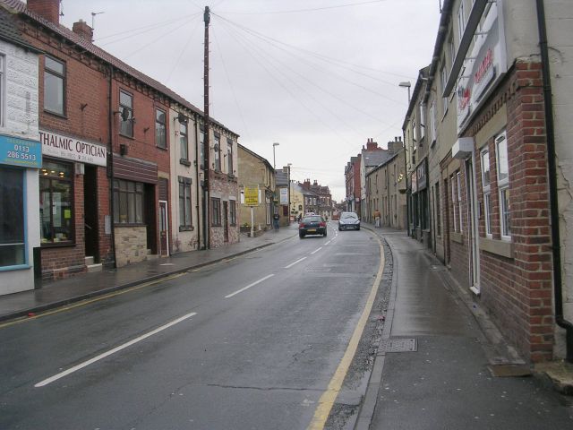
Kippax offers a range of amenities to its residents, including a variety of shops, pubs, and restaurants. The town center is bustling with local businesses, providing a convenient and vibrant shopping experience. Additionally, Kippax benefits from excellent transport links, with regular bus services connecting it to nearby towns and cities.

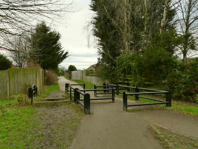
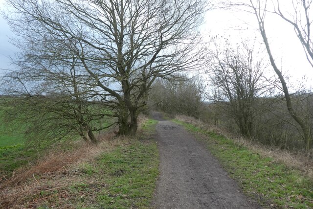
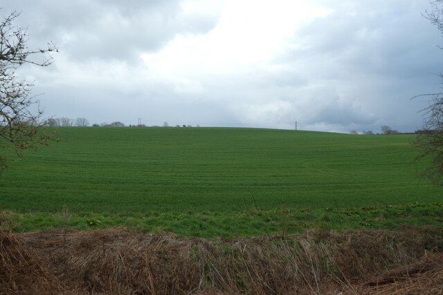
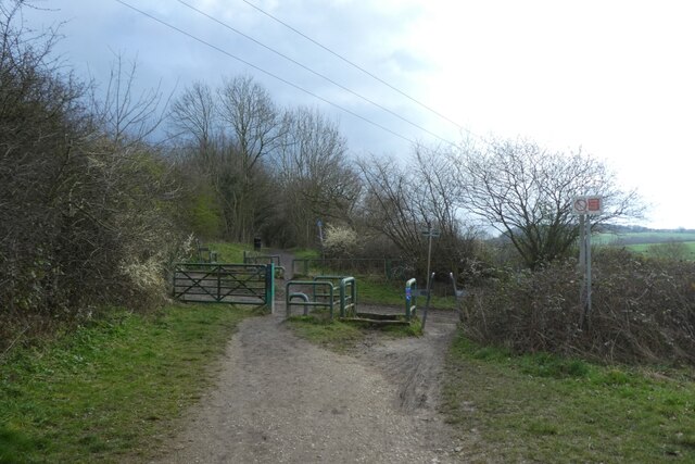
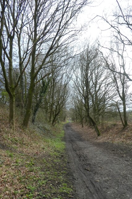
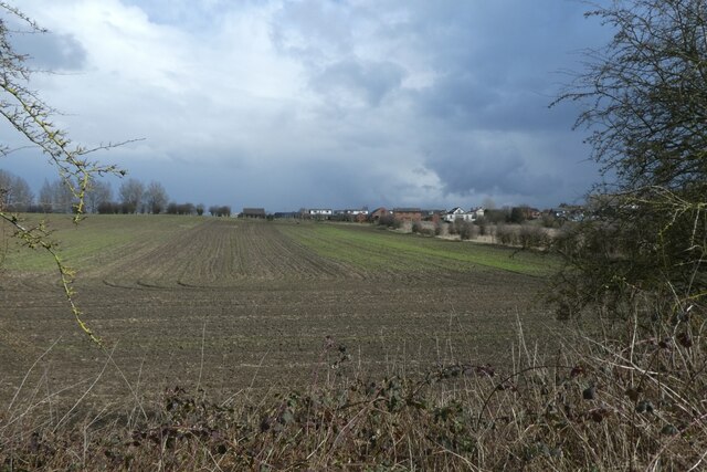
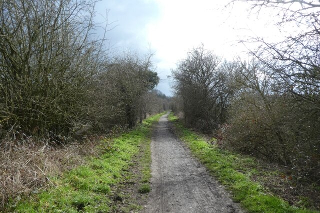
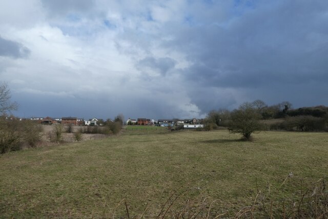
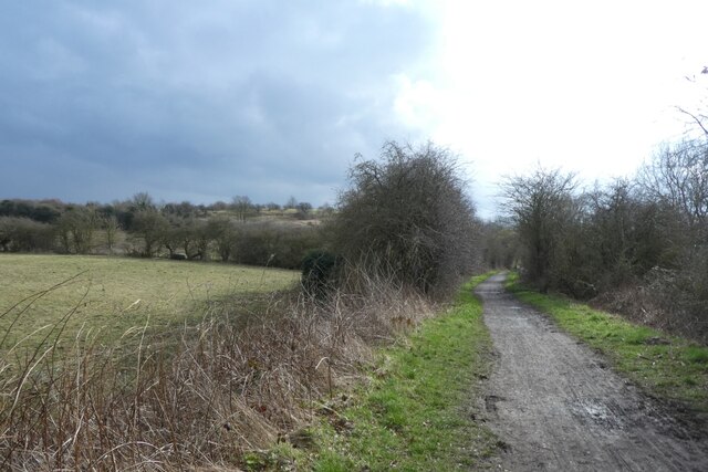
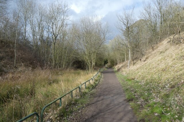
Nature enthusiasts can enjoy the scenic beauty of Kippax and its surrounding areas. The town lies close to the stunning countryside of the Lower Airedale and the Aire Valley, offering picturesque walking and cycling routes. Nearby, Fairburn Ings Nature Reserve provides a haven for wildlife, attracting bird watchers and nature lovers alike.

Kippax boasts a lively community spirit, with various events and activities taking place throughout the year. The town hosts an annual carnival, featuring a parade, fairground rides, and live entertainment. It also has a thriving sports scene, with local clubs offering opportunities to participate in activities such as football, rugby, and cricket.

Overall, Kippax is a charming town that combines historical charm with modern amenities, making it an attractive place to live or visit in Yorkshire.

If you have any feedback on the listing, please let us know in the comments section below.

Kippax Images

Images are sourced within 2km of 53.769284/-1.371853 or Grid Reference SE4130. Thanks to Geograph Open Source API. All images are credited.

Billy Woods rock formation, Kippax
Third zebra crossing on Ninelands Lane There are three such crossings in a few hundred metres, probably because of the nearby school.  This one is at the start of the Lines Way cycle route and the dip in the road is because it used to pass under the North Eastern Railway here.
Third zebra crossing on Ninelands Lane
There are three such crossings in a few hundred metres, probably because of the nearby school. This one is at the start of the Lines Way cycle route and the dip in the road is because it used to pass under the North Eastern Railway here.
Gas installation, Ninelands Lane
North end of the Lines Way The route starts at Ninelands Lane in Garforth.
North end of the Lines Way
The route starts at Ninelands Lane in Garforth.
Zebra crossing over Ninelands Lane The Zebra crossing indicates where the railway would have crossed the road. The railway is now a recreational path called The Lines Way and runs to Allerton Bywater.
Zebra crossing over Ninelands Lane
The Zebra crossing indicates where the railway would have crossed the road. The railway is now a recreational path called The Lines Way and runs to Allerton Bywater.
Flower beds and The Lines Way The Lines Way is a cycle path from Garforth to Allerton Bywater along the former railway line. It is designated as part of National Cycle Network route 697.
Flower beds and The Lines Way
The Lines Way is a cycle path from Garforth to Allerton Bywater along the former railway line. It is designated as part of National Cycle Network route 697.
Fence along The Lines Way The Lines Way is a cycle path from Garforth to Allerton Bywater along the former railway line. It is designated as part of National Cycle Network route 697.
Fence along The Lines Way
The Lines Way is a cycle path from Garforth to Allerton Bywater along the former railway line. It is designated as part of National Cycle Network route 697.
Gate in a hedge beside The Lines Way The Lines Way is a cycle path from Garforth to Allerton Bywater along the former railway line. It is designated as part of National Cycle Network route 697.
Gate in a hedge beside The Lines Way
The Lines Way is a cycle path from Garforth to Allerton Bywater along the former railway line. It is designated as part of National Cycle Network route 697.
Bridge over the cutting The Lines Way is a cycle path from Garforth to Allerton Bywater along the former railway line. It is designated as part of National Cycle Network route 697.
Bridge over the cutting
The Lines Way is a cycle path from Garforth to Allerton Bywater along the former railway line. It is designated as part of National Cycle Network route 697.
Lines Way south of Garforth The Lines Way is a cycle path from Garforth to Allerton Bywater along the former railway line. It is designated as part of National Cycle Network route 697.
Lines Way south of Garforth
The Lines Way is a cycle path from Garforth to Allerton Bywater along the former railway line. It is designated as part of National Cycle Network route 697.
Farmland beside The Lines Way The Lines Way is a cycle path from Garforth to Allerton Bywater along the former railway line. It is designated as part of National Cycle Network route 697.
Farmland beside The Lines Way
The Lines Way is a cycle path from Garforth to Allerton Bywater along the former railway line. It is designated as part of National Cycle Network route 697.
Crossing Brecks Lane The Lines Way is a cycle path from Garforth to Allerton Bywater along the former railway line. It is designated as part of National Cycle Network route 697.
Crossing Brecks Lane
The Lines Way is a cycle path from Garforth to Allerton Bywater along the former railway line. It is designated as part of National Cycle Network route 697.
The Lines Way near Sparrowhall Farm The Lines Way is a cycle path from Garforth to Allerton Bywater along the former railway line. It is designated as part of National Cycle Network route 697.
The Lines Way near Sparrowhall Farm
The Lines Way is a cycle path from Garforth to Allerton Bywater along the former railway line. It is designated as part of National Cycle Network route 697.
Fields near Kippax Looking towards Kippax from the Lines Way path along the former railway line.
Fields near Kippax
Looking towards Kippax from the Lines Way path along the former railway line.
Lines Way to the west of Kippax The Lines Way is a cycle path from Garforth to Allerton Bywater along the former railway line. It is designated as part of National Cycle Network route 697.
Lines Way to the west of Kippax
The Lines Way is a cycle path from Garforth to Allerton Bywater along the former railway line. It is designated as part of National Cycle Network route 697.
Field near Kippax Looking towards Kippax from The Lines Way, a path along the old railway line.
Field near Kippax
Looking towards Kippax from The Lines Way, a path along the old railway line.
Cycle path to Allerton Bywater The Lines Way is a cycle path from Garforth to Allerton Bywater along the former railway line. It is designated as part of National Cycle Network route 697.
Cycle path to Allerton Bywater
The Lines Way is a cycle path from Garforth to Allerton Bywater along the former railway line. It is designated as part of National Cycle Network route 697.
Pond beside The Lines Way The Lines Way is a cycle path from Garforth to Allerton Bywater along the former railway line. It is designated as part of National Cycle Network route 697.
Pond beside The Lines Way
The Lines Way is a cycle path from Garforth to Allerton Bywater along the former railway line. It is designated as part of National Cycle Network route 697.
Show me another place!

Kippax is located at Grid Ref: SE4130 (Lat: 53.769284, Lng: -1.371853)

Division: West Riding

Unitary Authority: Leeds

Police Authority: West Yorkshire

What 3 Words

///meant.insolvent.wins. Near Kippax, West Yorkshire

Related Wikis

Kippax, West Yorkshire

Kippax is a village and civil parish in the City of Leeds metropolitan borough, West Yorkshire, England. It is situated to the east of the city, near...

Kippax railway station

Kippax railway station was a railway station on the Castleford–Garforth line in West Yorkshire, England. The station opened in 1878 and closed to passengers...

Brigshaw High School

Brigshaw High School is a coeducational secondary school and sixth form located in the village of Allerton Bywater, West Yorkshire, England. == History... ==

Great Preston

Great Preston is a small rural village in the City of Leeds metropolitan borough, West Yorkshire, England. It has incorporated the once neighbouring hamlet...

Bowers railway station

Bowers railway station was a station opened in 1934 by the London and North Eastern Railway (LNER) on the Castleford–Garforth line, in the West Riding...

Garforth Academy

Garforth Academy (formerly known as Garforth Comprehensive School until September 1992 and Garforth Community College until November 2010) is a secondary...

East Garforth railway station

East Garforth railway station serves Garforth in West Yorkshire, England. It is on the Selby Line, and operated by Northern. The station was opened by...

St Mary's Church, Garforth

The Church of St Mary the Blessed Virgin in Garforth, West Yorkshire, England is an active Anglican parish church in the archdeaconry of Leeds and the...

Nearby Amenities

Located within 500m of 53.769284,-1.371853
Kippax
Is In: West Yorkshire, England, UK
Place: town
Source: npe
Wikidata: Q2562575
Wikipedia: en:Kippax, West Yorkshire
Lat/Long: 53.7701302/-1.3701581
Crossing
Crossing: uncontrolled
Crossing Island: no
Crossing Markings: zebra
Crossing Ref: zebra
Tactile Paving: yes
Lat/Long: 53.7664341/-1.3720669
Traffic Calming: cushion
Lat/Long: 53.7728583/-1.3731472
Bus Stop
Kippax Cross Hills
Bus: yes
Local Ref: 45010168
Naptan AtcoCode: 450010168
Naptan Bearing: N
Naptan CommonName: Kippax Cross Hills
Naptan Crossing: Well Lane
Naptan Indicator: Stop 45010168
Naptan Landmark: The White Swan PH
Naptan PlusbusZoneRef: LEEDS
Naptan ShortCommonName: Cross Hills
Naptan Street: Leeds Road
Naptan Verified: yes
Network: Metro West Yorkshire
Network Wikidata: Q7987043
Public Transport: platform
Ref: 45010168
Source: naptan_import
Lat/Long: 53.7668559/-1.3712521
Pub
The White Swan
Addr City: Leeds
Addr Postcode: LS25 7JP
Addr Street: Cross Hills
Addr Suburb: Kippax
Fhrs Id: 1155503
Lat/Long: 53.7669966/-1.3708847
Bus Stop
Rutland Close
Bus: yes
Local Ref: 45010184
Naptan AtcoCode: 450010184
Naptan Bearing: NW
Naptan CommonName: Rutland Close
Naptan Crossing: Ebor Mount
Naptan Indicator: Stop 45010184
Naptan Landmark: Health Centre
Naptan PlusbusZoneRef: LEEDS
Naptan ShortCommonName: Ebor Mount
Naptan Street: Leeds Road
Naptan Verified: yes
Network: Metro West Yorkshire
Network Wikidata: Q7987043
Public Transport: platform
Ref: 45010184
Source: naptan_import
Lat/Long: 53.7718051/-1.3721743
Bus Stop
Valley Road Birch Road
Bus: yes
Local Ref: 45010173
Naptan AtcoCode: 450010173
Naptan Bearing: NE
Naptan CommonName: Valley Road Birch Road
Naptan Crossing: Birch Road
Naptan Indicator: Stop 45010173
Naptan PlusbusZoneRef: LEEDS
Naptan ShortCommonName: Birch Road
Naptan Street: Valley Road
Naptan Verified: no
Public Transport: platform
Source: naptan_import
Lat/Long: 53.7729761/-1.3756806
Bus Stop
Rutland Close
Bus: yes
Local Ref: 45010183
Naptan AtcoCode: 450010183
Naptan Bearing: SE
Naptan CommonName: Rutland Close
Naptan Crossing: Rutland Close
Naptan Indicator: Stop 45010183
Naptan Landmark: Health Centre
Naptan PlusbusZoneRef: LEEDS
Naptan ShortCommonName: Rutland Close
Naptan Street: Leeds Road
Naptan Verified: no
Network: Metro West Yorkshire
Network Wikidata: Q7987043
Public Transport: platform
Source: naptan_import
Lat/Long: 53.7715256/-1.3716975
Bus Stop
Leeds Road Church Lane
Bus: yes
Local Ref: 45012895
Naptan AtcoCode: 450012895
Naptan Bearing: N
Naptan CommonName: Leeds Road Church Lane
Naptan Crossing: Church Lane
Naptan Indicator: Stop 45012895
Naptan Landmark: Greenfield Primary School
Naptan PlusbusZoneRef: LEEDS
Naptan ShortCommonName: Robinson Lane
Naptan Street: Leeds Road
Naptan Verified: no
Public Transport: platform
Source: naptan_import
Lat/Long: 53.7686094/-1.3708297
Bus Stop
Leeds Road Church Lane
Bus: yes
Local Ref: 45012896
Naptan AtcoCode: 450012896
Naptan Bearing: S
Naptan CommonName: Leeds Road Church Lane
Naptan Crossing: Church Lane
Naptan Indicator: Stop 45012896
Naptan Landmark: Greenfield Primary School
Naptan PlusbusZoneRef: LEEDS
Naptan ShortCommonName: Church Lane
Naptan Street: Leeds Road
Naptan Verified: no
Public Transport: platform
Source: naptan_import
Lat/Long: 53.7684465/-1.3706197
Bus Stop
High Street Chapel Lane
Bus: yes
Local Ref: 45012897
Naptan AtcoCode: 450012897
Naptan Bearing: W
Naptan CommonName: High Street Chapel Lane
Naptan Crossing: Chapel Lane
Naptan Indicator: Stop 45012897
Naptan Landmark: Post Office
Naptan PlusbusZoneRef: LEEDS
Naptan ShortCommonName: Chapel Lane
Naptan Street: High Street
Naptan Verified: no
Network: Metro West Yorkshire
Network Wikidata: Q7987043
Public Transport: platform
Source: naptan_import
Lat/Long: 53.7665338/-1.3677298
Bus Stop
High Street Ashtree Grove
Bus: yes
Local Ref: 45012898
Naptan AtcoCode: 450012898
Naptan Bearing: E
Naptan CommonName: High Street Ashtree Grove
Naptan Crossing: Ashtree Grove
Naptan Indicator: Stop 45012898
Naptan PlusbusZoneRef: LEEDS
Naptan ShortCommonName: Ashtree Grove
Naptan Street: High Street
Naptan Verified: no
Network: Metro West Yorkshire
Network Wikidata: Q7987043
Public Transport: platform
Source: naptan_import
Lat/Long: 53.7666208/-1.3676429
Bus Stop
Gibson Lane
Bus: yes
Local Ref: 45013302
Naptan AtcoCode: 450013302
Naptan Bearing: E
Naptan CommonName: Gibson Lane
Naptan Crossing: Manor Garth Road
Naptan Indicator: Stop 45013302
Naptan PlusbusZoneRef: LEEDS
Naptan ShortCommonName: Manor Garth Road
Naptan Street: Gibson Lane
Naptan Verified: no
Network: Metro West Yorkshire
Network Wikidata: Q7987043
Public Transport: platform
Source: naptan_import
Lat/Long: 53.7715558/-1.3664297
Bus Stop
Gibson Lane Pondfields Drive
Bus: yes
Local Ref: 45013303
Naptan AtcoCode: 450013303
Naptan Bearing: W
Naptan CommonName: Gibson Lane Pondfields Drive
Naptan Crossing: Pondfields Drive
Naptan Indicator: Stop 45013303
Naptan Landmark: Dental Centre
Naptan PlusbusZoneRef: LEEDS
Naptan ShortCommonName: Pondfields Drive
Naptan Street: Gibson Lane
Naptan Verified: no
Network: Metro West Yorkshire
Network Wikidata: Q7987043
Public Transport: platform
Source: naptan_import
Lat/Long: 53.7715329/-1.369557
Bus Stop
Kippax Cross Hills Kippax
Bus: yes
Local Ref: 45013328
Naptan AtcoCode: 450013328
Naptan Bearing: E
Naptan CommonName: Kippax Cross Hills Kippax
Naptan Crossing: Leeds Road
Naptan Indicator: Stop 45013328
Naptan Landmark: Bank
Naptan PlusbusZoneRef: LEEDS
Naptan ShortCommonName: Cross Hills
Naptan Street: High Street
Naptan Verified: no
Network: Metro West Yorkshire
Network Wikidata: Q7987043
Public Transport: platform
Source: naptan_import
Lat/Long: 53.7669096/-1.3706427
Bus Stop
Gibson Lane Moorgate Drive
Bus: yes
Local Ref: 45025930
Naptan AtcoCode: 450025930
Naptan Bearing: E
Naptan CommonName: Gibson Lane Moorgate Drive
Naptan Crossing: Moorgate Drive
Naptan Indicator: Stop 45025930
Naptan Landmark: Nursing Home
Naptan PlusbusZoneRef: LEEDS
Naptan ShortCommonName: Moorgate Drive
Naptan Street: Gibson Lane
Naptan Verified: no
Network: Metro West Yorkshire
Network Wikidata: Q7987043
Public Transport: platform
Source: naptan_import
Lat/Long: 53.7715078/-1.370458
Bus Stop
Gibson Lane Parkfield Close
Bus: yes
Local Ref: 45028211
Naptan AtcoCode: 450028211
Naptan Bearing: W
Naptan CommonName: Gibson Lane Parkfield Close
Naptan Crossing: Parkfield Close
Naptan Indicator: Stop 45028211
Naptan Notes: LC-11G92At House No 237
Naptan PlusbusZoneRef: LEEDS
Naptan ShortCommonName: Gibson Lane
Naptan Street: Gibson Lane
Naptan Verified: no
Network: Metro West Yorkshire
Network Wikidata: Q7987043
Public Transport: platform
Source: naptan_import
Lat/Long: 53.7713488/-1.3653265
Bus Stop
Kippax Cross Hills
Bus: yes
Naptan AtcoCode: 450028645
Naptan Bearing: SW
Naptan CommonName: Kippax Cross Hills
Naptan Crossing: Cross Hills
Naptan Landmark: Unknown
Naptan PlusbusZoneRef: LEEDS
Naptan ShortCommonName: Cross Hills
Naptan Street: Butt Hill at High St
Naptan Verified: no
Network: Metro West Yorkshire
Network Wikidata: Q7987043
Public Transport: platform
Ref: 45028645
Source: naptan_import
Lat/Long: 53.7667592/-1.3711001
Valley Road Birch Road
Local Ref: 45050006
Naptan AtcoCode: 450050006
Naptan Bearing: SW
Naptan BusStopType: CUS
Naptan CommonName: Valley Road Birch Road
Naptan Indicator: Stop 45050006
Naptan PlusbusZoneRef: LEEDS
Naptan ShortCommonName: Birch Road
Naptan Street: Valley Road
Naptan Verified: no
Source: naptan_import
Lat/Long: 53.7729218/-1.3756055
Westfield Lane - Kippax
Local Ref: 45050106
Naptan AtcoCode: 450050106
Naptan Bearing: SE
Naptan BusStopType: CUS
Naptan CommonName: Westfield Lane - Kippax
Naptan Indicator: Stop 45050106
Naptan PlusbusZoneRef: LEEDS
Naptan ShortCommonName: Oxford Drive
Naptan Street: Westfield Lane
Naptan Verified: no
Source: naptan_import
Lat/Long: 53.7689542/-1.3745037
Turning Circle
Lat/Long: 53.7657829/-1.3761182
Noexit: yes
Lat/Long: 53.7657322/-1.3763699
Turning Circle
Lat/Long: 53.7661206/-1.3738396
Turning Circle
Lat/Long: 53.7667904/-1.3777163
Noexit: yes
Lat/Long: 53.766495/-1.3735169
Turning Circle
Lat/Long: 53.7678673/-1.3757421
Turning Circle
Turning Circle: square
Lat/Long: 53.7650389/-1.3701576
Noexit: yes
Lat/Long: 53.7674518/-1.3736153
Turning Circle
Lat/Long: 53.7682868/-1.3782199
Noexit: yes
Lat/Long: 53.7658359/-1.370872
Noexit: yes
Lat/Long: 53.7679356/-1.3695755
Noexit: yes
Lat/Long: 53.7684726/-1.3717345
Noexit: yes
Lat/Long: 53.7685615/-1.3722405
Turning Circle
Lat/Long: 53.7711143/-1.3783587
Turning Circle
Lat/Long: 53.7721099/-1.3769576
Turning Circle
Lat/Long: 53.7698116/-1.3755179
Turning Circle
Lat/Long: 53.7697208/-1.3744129
Noexit: yes
Lat/Long: 53.7709525/-1.3761976
Turning Circle
Lat/Long: 53.7710462/-1.3760514
Turning Circle
Lat/Long: 53.770633/-1.373285
Turning Circle
Lat/Long: 53.7715011/-1.3744216
Noexit: yes
Lat/Long: 53.7721273/-1.373651
Turning Circle
Lat/Long: 53.7707961/-1.3753164
High Street Chapel Lane
Bus: yes
Local Ref: 45012897
Public Transport: stop_position
Lat/Long: 53.7665835/-1.3677343
Traffic Calming: cushion
Lat/Long: 53.770625/-1.3711883
Place Of Worship
Kippax Methodist Church
Denomination: methodist
Religion: christian
Source: OS_OpenData_StreetView
Lat/Long: 53.767549/-1.3682404
Atm
Fee: no
Operator: Co-op
Lat/Long: 53.7661249/-1.3679874
Fast Food
Chilli Junction
Addr City: Leeds
Addr Housenumber: 49
Addr Postcode: LS25 7AF
Addr Street: High Street
Cuisine: indian
Fhrs Id: 1170840
Old Name: Kippax Tandoori
Takeaway: yes
Wheelchair: no
Lat/Long: 53.7667297/-1.3679578
Fast Food
King Du
Addr City: Leeds
Addr Housenumber: 47
Addr Postcode: LS25 7AF
Addr Street: High Street
Cuisine: chinese
Fhrs Id: 1218002
Old Name: Fuller
Wheelchair: no
Lat/Long: 53.7667336/-1.3680249
Fast Food
Caesars
Addr City: Leeds
Addr Housenumber: 24-26
Addr Postcode: LS25 7JP
Addr Street: Cross Hills
Cuisine: pizza
Fhrs Id: 897879
Lat/Long: 53.7667114/-1.3703638
Pub
The Old Tree Inn
Addr City: Leeds
Addr Housenumber: 53
Addr Postcode: LS25 7AH
Addr Street: High Street
Fhrs Id: 712539
Internet Access: no
Lat/Long: 53.7667083/-1.367762
Atm
Fee: no
Operator: Barclays Bank PLC
Lat/Long: 53.7666575/-1.3700634
Turning Circle
Turning Circle: square
Lat/Long: 53.7724526/-1.3677262
Turning Circle
Turning Circle: square
Lat/Long: 53.7724663/-1.3687997
Gibson Lane
Bus: yes
Local Ref: 45013302
Public Transport: stop_position
Lat/Long: 53.7714593/-1.3661883
Traffic Calming: cushion
Lat/Long: 53.7715355/-1.3700836
Turning Circle
Turning Circle: hammer
Lat/Long: 53.7694559/-1.3647466
Turning Circle
Lat/Long: 53.7722235/-1.3712412
Noexit: yes
Lat/Long: 53.7704036/-1.3683215
Turning Circle
Turning Circle: hammer
Lat/Long: 53.7697864/-1.3656754
Turning Circle
Lat/Long: 53.7728572/-1.3723915
Noexit: yes
Lat/Long: 53.7717318/-1.3751386
Noexit: yes
Lat/Long: 53.771851/-1.3752783
Crossing
Crossing: uncontrolled
Crossing Markings: zebra
Crossing Ref: zebra
Tactile Paving: yes
Lat/Long: 53.7666254/-1.3682121
Noexit: yes
Lat/Long: 53.7675299/-1.3671336
Turning Circle
Turning Circle: circle
Lat/Long: 53.7676899/-1.3662148
Turning Circle
Lat/Long: 53.7677789/-1.3667859
Turning Circle
Lat/Long: 53.7678806/-1.3676334
Noexit: yes
Lat/Long: 53.7680674/-1.364624
Recycling
Lat/Long: 53.7657417/-1.367195
Pharmacy
Boots
Addr City: Leeds
Addr Housenumber: 56
Addr Postcode: LS25 7AB
Addr Street: High Street
Addr Suburb: Kippax
Brand: Boots
Brand Wikidata: Q6123139
Brand Wikipedia: en:Boots UK
Fhrs Id: 322195
Healthcare: pharmacy
Website: https://www.boots.com/stores/5928-kippax-high-street-ls25-7ab
Lat/Long: 53.7664679/-1.3680104
Mega Bet
Shop: bookmaker
Lat/Long: 53.7664615/-1.367879
Post Box
Collection Times: Mo-Fr 09:00; Sa 07:00; Su off
Operator: Royal Mail
Operator Wikidata: Q638098
Post Box Type: wall
Ref: LS25 776
Lat/Long: 53.7676958/-1.3708715
Kippax News
Addr City: Leeds
Addr Housenumber: 44
Addr Postcode: LS25 7AB
Addr Street: High Street
Fhrs Id: 550356
Shop: newsagent
Wheelchair: limited
Lat/Long: 53.7665623/-1.3683502
Noexit: yes
Lat/Long: 53.7660503/-1.3681572
Post Office
Kippax Post Office
Addr City: Leeds
Addr Country: GB
Addr Housenumber: 41
Addr Postcode: LS25 7AF
Addr Street: High Street
Brand: Post Office
Brand Wikidata: Q1783168
Brand Wikipedia: en:Post Office Ltd
Contact Website: https://www.postoffice.co.uk/branch-finder/2553236/kippax
Ref Pol Id: 10079
Wheelchair: limited
Lat/Long: 53.7667446/-1.3682268
Post Box
Operator: Royal Mail
Post Box Type: pillar
Ref: LS25 768
Lat/Long: 53.766686/-1.3681517
Pharmacy
Boots
Addr City: Leeds
Addr Housename: Kippax Health Centre
Addr Postcode: LS25 7QT
Addr Street: Moorgate Drive
Addr Suburb: Kippax
Brand: Boots
Brand Wikidata: Q6123139
Brand Wikipedia: en:Boots UK
Fhrs Id: 322205
Healthcare: pharmacy
Lat/Long: 53.77195/-1.3700084
Noexit: yes
Lat/Long: 53.7723814/-1.3701332
Cafe
Oliver's
Addr City: Leeds
Addr Housenumber: 82-84
Addr Postcode: LS25 7AJ
Addr Street: High Street
Addr Suburb: Kippax
Fhrs Id: 1369683
Lat/Long: 53.7660865/-1.3665278
Fast Food
The Fish Shop
Addr City: Leeds
Addr Housenumber: 70
Addr Postcode: LS25 7AJ
Addr Street: High Street
Addr Suburb: Kippax
Cuisine: fish_and_chips
Fhrs Id: 631830
Lat/Long: 53.7663172/-1.3671219
Pat's Sweets
Addr City: Leeds
Addr Housenumber: 45
Addr Postcode: LS25 7AF
Addr Street: High Street
Fhrs Id: 467261
Shop: confectionery
Wheelchair: limited
Lat/Long: 53.7667365/-1.3681063
Fast Food
Central Fisheries
Addr City: Leeds
Addr Housenumber: 28
Addr Postcode: LS25 7AB
Addr Street: High Street
Addr Suburb: Kippax
Cuisine: fish_and_chips
Fhrs Id: 589868
Takeaway: yes
Lat/Long: 53.7665661/-1.3693146
Paul Flintoft
Addr City: Leeds
Addr Housenumber: 12
Addr Postcode: LS25 7AB
Addr Street: High Street
Addr Suburb: Kippax
Fhrs Id: 320585
Shop: butcher
Lat/Long: 53.76662/-1.3699329
Fast Food
Top Fish Bar
Addr City: Leeds
Addr Housenumber: 14
Addr Postcode: LS25 7JP
Addr Street: Cross Hills
Addr Suburb: Kippax
Cuisine: fish_and_chips
Fhrs Id: 1096898
Old Name: Lane's Fish and Chips
Takeaway: yes
Lat/Long: 53.7667223/-1.3710272
Fast Food
China China
Addr City: Leeds
Addr Housenumber: 2
Addr Postcode: LS25 7LT
Addr Street: Leeds Road
Addr Suburb: Kippax
Cuisine: chinese
Fhrs Id: 1560919
Takeaway: yes
Lat/Long: 53.7670988/-1.3708609
Restaurant
Sylhety Balti
Addr City: Leeds
Addr Housenumber: 4-6
Addr Postcode: LS25 7LT
Addr Street: Leeds Road
Addr Suburb: Kippax
Cuisine: indian
Fhrs Id: 321245
Lat/Long: 53.7671836/-1.3708073
Restaurant
Grand Bengal
Addr City: Leeds
Addr Housenumber: 18
Addr Postcode: LS25 7JP
Addr Street: Cross Hills
Addr Suburb: Kippax
Cuisine: indian
Fhrs Id: 1512863
Lat/Long: 53.7667437/-1.3708851
Fast Food
TKS Pizzeria
Addr City: Leeds
Addr Housenumber: 16
Addr Postcode: LS25 7JP
Addr Street: Cross Hills
Addr Suburb: Kippax
Cuisine: pizza
Fhrs Id: 1012344
Takeaway: yes
Lat/Long: 53.7667294/-1.3709696
Cafe
Tasty Bites
Addr City: Leeds
Addr Housenumber: 26
Addr Postcode: LS25 7AB
Addr Street: High Street
Addr Suburb: Kippax
Fhrs Id: 1110104
Takeaway: yes
Lat/Long: 53.7665732/-1.3693817
Defibrillator
Defibrillator Location: External wall of community hub to right of disabled parking space
Emergency: defibrillator
Lat/Long: 53.7675791/-1.371045
Pinnacle FM
Addr City: Leeds
Addr Housename: Kippax Ash Tree Primary School
Addr Postcode: LS25 7JL
Addr Street: Gibson Lane
Craft: caterer
Fhrs Id: 322151
Lat/Long: 53.7690456/-1.3658452
Post Box
Operator: Royal Mail
Post Box Type: pillar
Ref: LS25 689
Lat/Long: 53.7715245/-1.369886
Childcare
Greenfield Out Of School Club
Addr City: Leeds
Addr Housename: Kippax Greenfield School
Addr Postcode: LS25 7PA
Addr Street: Ebor Mount
Addr Suburb: Kippax
Fhrs Id: 467434
Lat/Long: 53.7702123/-1.3722718
Noexit: yes
Lat/Long: 53.7696429/-1.3792127
Noexit: yes
Lat/Long: 53.7722603/-1.3756672
Noexit: yes
Lat/Long: 53.7673489/-1.3772372
Noexit: yes
Lat/Long: 53.7669999/-1.369792
Noexit: yes
Lat/Long: 53.7663111/-1.3715658
William Hill
Addr City: Leeds
Addr Housenumber: 11b
Addr Postcode: LS25 7AF
Addr Street: High Street
Addr Suburb: Kippax
Brand: William Hill
Brand Wikidata: Q4053147
Brand Wikipedia: en:William Hill (bookmaker)
Fhrs Id: 1205280
Shop: bookmaker
Lat/Long: 53.7668673/-1.3699061
Noexit: yes
Lat/Long: 53.7665621/-1.3726792
Noexit: yes
Lat/Long: 53.7727077/-1.3741315
Waste Basket
Collection Times: Tu
Ref UK Leedscc Bin: 996
Lat/Long: 53.772148/-1.371463
Waste Basket
Collection Times: Tu
Ref UK Leedscc Bin: 1811
Lat/Long: 53.771562/-1.371685
Waste Basket
Collection Times: Tu
Ref UK Leedscc Bin: 2175
Lat/Long: 53.771705/-1.369956
Waste Basket
Collection Times: Tu
Ref UK Leedscc Bin: 1088
Lat/Long: 53.771513/-1.369509
Waste Basket
Collection Times: Tu
Ref UK Leedscc Bin: 1441
Lat/Long: 53.766509/-1.376579
Waste Basket
Collection Times: Tu
Ref UK Leedscc Bin: 1812
Lat/Long: 53.767316/-1.370979
Waste Basket
Collection Times: Tu
Ref UK Leedscc Bin: 508
Lat/Long: 53.766838/-1.371366
Waste Basket
Collection Times: Tu
Ref UK Leedscc Bin: 1473
Lat/Long: 53.766798/-1.370782
Waste Basket
Collection Times: Tu
Ref UK Leedscc Bin: 1444
Lat/Long: 53.766843/-1.369981
Waste Basket
Collection Times: Tu
Ref UK Leedscc Bin: 1472
Lat/Long: 53.766788/-1.36985
Waste Basket
Collection Times: Tu
Ref UK Leedscc Bin: 1471
Lat/Long: 53.766751/-1.369466
Waste Basket
Collection Times: Tu
Ref UK Leedscc Bin: 1443
Lat/Long: 53.766745/-1.369481
Waste Basket
Collection Times: Tu
Ref UK Leedscc Bin: 1470
Lat/Long: 53.766583/-1.36929
Waste Basket
Collection Times: Tu
Ref UK Leedscc Bin: 1442
Lat/Long: 53.76653/-1.369194
Waste Basket
Collection Times: Tu
Ref UK Leedscc Bin: 1469
Lat/Long: 53.766581/-1.369016
Waste Basket
Collection Times: Tu
Ref UK Leedscc Bin: 1467
Lat/Long: 53.7666255/-1.3676679
Waste Basket
Collection Times: Tu
Ref UK Leedscc Bin: 1468
Lat/Long: 53.766535/-1.367855
Waste Basket
Collection Times: Tu
Ref UK Leedscc Bin: 1466
Lat/Long: 53.766472/-1.367548
Waste Basket
Collection Times: Tu
Ref UK Leedscc Bin: 1465
Lat/Long: 53.766338/-1.367114
Noexit: yes
Lat/Long: 53.7722337/-1.3669696
Noexit: yes
Lat/Long: 53.7722527/-1.3668559
Noexit: yes
Lat/Long: 53.7658942/-1.3716944
Entrance: yes
Lat/Long: 53.7664872/-1.3722907
Noexit: yes
Lat/Long: 53.7665522/-1.3721229
Community Centre
Kippax Community Hub
Addr City: Leeds
Addr Housename: Kippax Library
Addr Postcode: LS25 7LY
Addr Street: Westfield Lane
Lat/Long: 53.7674406/-1.3710677
Noexit: yes
Lat/Long: 53.7677128/-1.370361
Noexit: yes
Lat/Long: 53.7706685/-1.3721054
Noexit: yes
Lat/Long: 53.7704066/-1.3713907
Noexit: yes
Lat/Long: 53.7716976/-1.3699646
Noexit: yes
Lat/Long: 53.7718411/-1.3699576
Noexit: yes
Lat/Long: 53.766091/-1.3672038
Noexit: yes
Lat/Long: 53.7663508/-1.3686671
Peacocks
Addr City: Leeds
Addr Housenumber: 60
Addr Postcode: LS25 7AJ
Addr Street: High Street
Brand: Peacocks
Brand Wikidata: Q7157762
Brand Wikipedia: en:Peacocks (clothing)
Contact Website: https://www.peacocks.co.uk/store-finder/index/storeDetail/id/449/
Shop: clothes
Lat/Long: 53.7663806/-1.3673563
Addr City: Leeds
Addr Housenumber: 43
Addr Postcode: LS25 7AF
Addr Street: High Street
Lat/Long: 53.7667425/-1.368158
Traffic Calming: cushion
Lat/Long: 53.768274/-1.3707205
Noexit: yes
Lat/Long: 53.7735329/-1.3719479
Traffic Calming: cushion
Lat/Long: 53.7720737/-1.3723092
Passing Place
Lat/Long: 53.7724696/-1.3754903
Noexit: yes
Lat/Long: 53.7725557/-1.3719405
Turning Circle
Lat/Long: 53.7717776/-1.3734958
Noexit: yes
Lat/Long: 53.769728/-1.3790234
Turning Circle
Lat/Long: 53.7679176/-1.3738603
Traffic Calming: cushion
Lat/Long: 53.7695064/-1.3708795
Noexit: yes
Lat/Long: 53.7702155/-1.3714566
Entrance: yes
Lat/Long: 53.7702887/-1.3719764
Noexit: yes
Lat/Long: 53.7704129/-1.3722785
Noexit: yes
Lat/Long: 53.769233/-1.3713397
Noexit: yes
Lat/Long: 53.7682054/-1.3733757
Noexit: yes
Lat/Long: 53.7665497/-1.3746244
Noexit: yes
Lat/Long: 53.7672643/-1.3742872
Noexit: yes
Lat/Long: 53.7671484/-1.3732927
Noexit: yes
Lat/Long: 53.7673841/-1.3725358
Noexit: yes
Lat/Long: 53.7716154/-1.3711368
Turning Circle
Turning Circle: hammer
Lat/Long: 53.770037/-1.3675734
Traffic Calming: cushion
Lat/Long: 53.7715377/-1.3669155
Traffic Calming: cushion
Lat/Long: 53.7715587/-1.3686139
Traffic Calming: cushion
Lat/Long: 53.7713785/-1.3652459
Noexit: yes
Lat/Long: 53.7687315/-1.3658323
Noexit: yes
Lat/Long: 53.7685459/-1.3675927
Noexit: yes
Lat/Long: 53.7685588/-1.3669238
Noexit: yes
Lat/Long: 53.7677176/-1.368376
Noexit: yes
Lat/Long: 53.7670813/-1.3684237
Turning Circle
Turning Circle: circle
Lat/Long: 53.7673152/-1.3661813
Traffic Calming: cushion
Lat/Long: 53.7666271/-1.3686138
High Street Ashtree Grove
Bus: yes
Local Ref: 45012898
Public Transport: stop_position
Lat/Long: 53.7665003/-1.3673713
Noexit: yes
Lat/Long: 53.7665998/-1.3672453
Noexit: yes
Lat/Long: 53.7677015/-1.3679021
Noexit: yes
Lat/Long: 53.7664614/-1.3700434
Noexit: yes
Lat/Long: 53.7665693/-1.3703942
Noexit: yes
Lat/Long: 53.7666164/-1.3708817
Rutland Close
Bus: yes
Local Ref: 45010183
Public Transport: stop_position
Lat/Long: 53.7714347/-1.371774
Gibson Lane Moorgate Drive
Bus: yes
Local Ref: 45025930
Public Transport: stop_position
Lat/Long: 53.7715012/-1.3702598
Kippax Cross Hills
Bus: yes
Public Transport: stop_position
Ref: 45028645
Lat/Long: 53.7668379/-1.3711241
Kippax Cross Hills
Bus: yes
Local Ref: 45010168
Public Transport: stop_position
Lat/Long: 53.7668539/-1.3710961
Kippax Cross Hills Kippax
Bus: yes
Local Ref: 45013328
Public Transport: stop_position
Lat/Long: 53.7668333/-1.3706414
Leeds Road Church Lane
Bus: yes
Local Ref: 45012896
Public Transport: stop_position
Lat/Long: 53.7683578/-1.3707294
Gibson Lane Parkfield Close
Bus: yes
Local Ref: 45028211
Public Transport: stop_position
Lat/Long: 53.7713797/-1.3654894
Gibson Lane Pondfields Drive
Bus: yes
Local Ref: 45013303
Public Transport: stop_position
Lat/Long: 53.7715647/-1.3697315
Rutland Close
Bus: yes
Local Ref: 45010184
Public Transport: stop_position
Lat/Long: 53.7718668/-1.3721267
The data included in this document is from www.openstreetmap.org. The data is made available under ODbL.

Have you been to Kippax?

Leave your review of Kippax below (or comments, questions and feedback).