Beenham

Settlement in Berkshire

England

Beenham

Caravan and motor caravan shop, Lower Padworth The Caravan Company occupies the front; Webb's Motor Caravans is the name on the building. The view is from the top deck of a No.1 bus (Reading-Newbury) stopped at Aldermaston Wharf.
Caravan and motor caravan shop, Lower Padworth Credit: Robin Stott

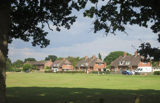
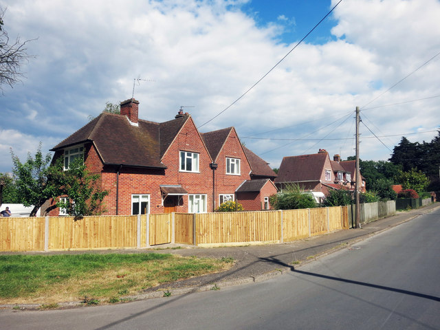
Beenham is a picturesque village located in the ceremonial county of Berkshire, England. Situated in the West Berkshire district, it lies approximately 8 miles west of the town of Reading and 5 miles east of Newbury. This rural village is nestled between the River Kennet and the River Enborne, offering stunning natural beauty and a peaceful atmosphere.

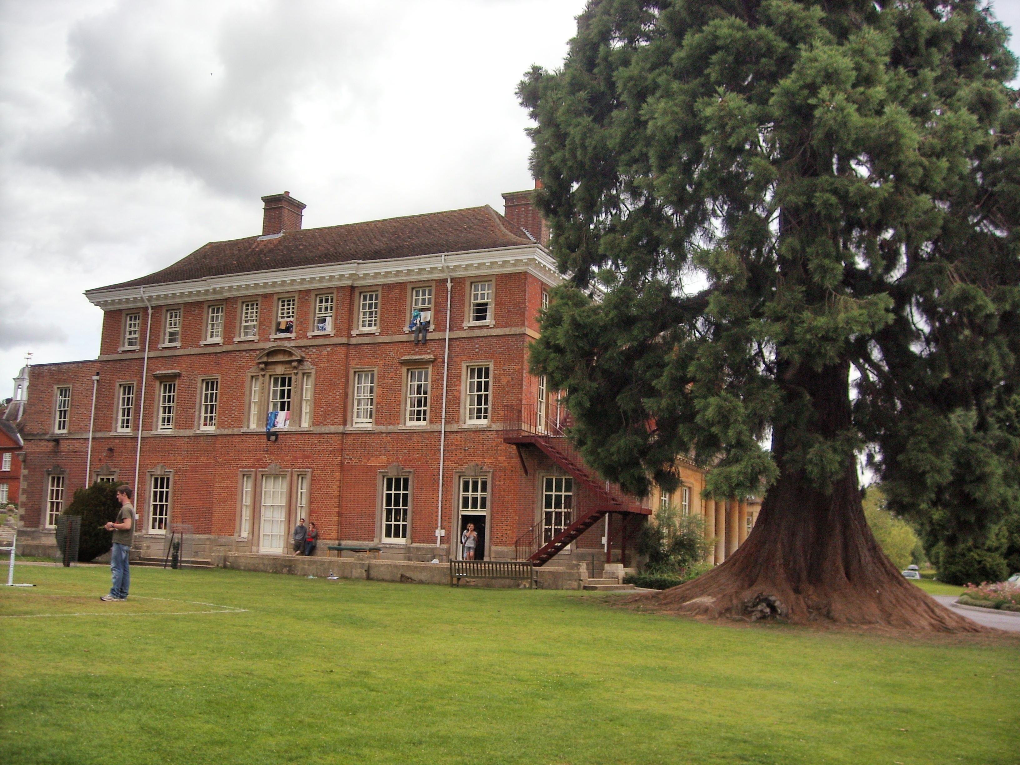
Beenham has a rich history dating back to the Saxon era, with evidence of its existence mentioned in the Domesday Book of 1086. The village is known for its charming thatched cottages, historic buildings, and traditional English countryside landscapes. The Parish Church of St. Mary's, a Grade II listed building, is a prominent feature of the village and showcases beautiful architectural details.

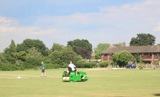
Despite its small size, Beenham offers a range of amenities for its residents. These include a primary school, a village hall, a popular pub called The Six Bells, and a cricket club. The village also benefits from being located near several larger towns and cities, providing easy access to a wider range of services and employment opportunities.

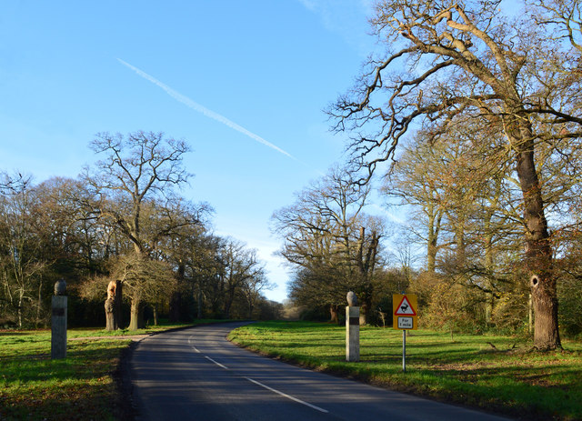
The surrounding countryside provides ample opportunities for outdoor activities and leisure pursuits. The area is traversed by numerous footpaths and bridleways, making it ideal for walking, cycling, and horse riding. The nearby North Wessex Downs Area of Outstanding Natural Beauty further enhances the attractiveness of the region.

Overall, Beenham, Berkshire, is a delightful village that combines its historical charm, idyllic landscapes, and community spirit to offer a high quality of life for its residents.

If you have any feedback on the listing, please let us know in the comments section below.
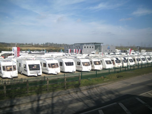
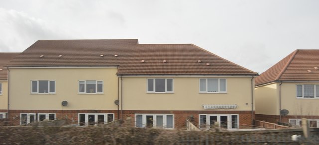
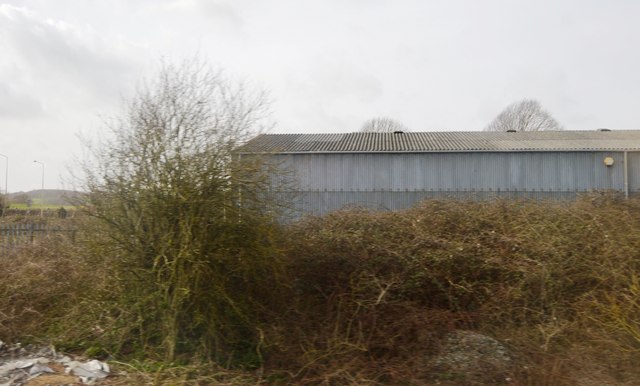
Beenham Images

Images are sourced within 2km of 51.415541/-1.152569 or Grid Reference SU5968. Thanks to Geograph Open Source API. All images are credited.

Caravan and motor caravan shop, Lower Padworth The Caravan Company occupies the front; Webb's Motor Caravans is the name on the building. The view is from the top deck of a No.1 bus (Reading-Newbury) stopped at Aldermaston Wharf.
Caravan and motor caravan shop, Lower Padworth
The Caravan Company occupies the front; Webb's Motor Caravans is the name on the building. The view is from the top deck of a No.1 bus (Reading-Newbury) stopped at Aldermaston Wharf.
Houses, Aldermaston Wharf
Depot, Lower Padworth
Avenue of Oaks, Bucklebury, Berkshire The inner row of oaks was planted to celebrate a visit by Elizabeth I and the outer row to commemorate Wellington's victory at Waterloo in 1815. 

(Source:website of the Bucklebury Estate)

The gate posts were erected in 2015 to mark the marriage of Catherine Middleton, a resident of the village, to Prince William.
Avenue of Oaks, Bucklebury, Berkshire
The inner row of oaks was planted to celebrate a visit by Elizabeth I and the outer row to commemorate Wellington's victory at Waterloo in 1815. (Source:website of the Bucklebury Estate) The gate posts were erected in 2015 to mark the marriage of Catherine Middleton, a resident of the village, to Prince William.
Basingstoke Road meets the A4, Aldermaston Wharf
The A4 at Lower Padworth
Six houses
Six houses
Rainbow Runner The Kennet and Avon is made up of two river navigations and a linking stretch of canal. It runs from Hanham Lock near Bristol to the River Thames at Reading, over 100 miles long with more than 100 locks, some magnificent engineering and crossing some of the most beautiful scenery in southern England. It was only reopened in 1990 after decades of dereliction.
Rainbow Runner
The Kennet and Avon is made up of two river navigations and a linking stretch of canal. It runs from Hanham Lock near Bristol to the River Thames at Reading, over 100 miles long with more than 100 locks, some magnificent engineering and crossing some of the most beautiful scenery in southern England. It was only reopened in 1990 after decades of dereliction.
A4 The A4 (Great Western Road) runs 127 miles from London (Holborn Circus) to Avonmouth. It heads west out of London through Slough, Reading, Newbury, Marlborough, Bath and Bristol. Today it is paralleled by the M4.
Wikipedia: <span class="nowrap"><a title="http://en.wikipedia.org/wiki/A4_road_(England)" rel="nofollow ugc noopener" href="http://en.wikipedia.org/wiki/A4_road_(England)">Link</a><img style="margin-left:2px;" alt="External link" title="External link - shift click to open in new window" src="https://s1.geograph.org.uk/img/external.png" width="10" height="10"/></span>
A4
The A4 (Great Western Road) runs 127 miles from London (Holborn Circus) to Avonmouth. It heads west out of London through Slough, Reading, Newbury, Marlborough, Bath and Bristol. Today it is paralleled by the M4. Wikipedia: LinkExternal link
Approaching a roundabout, A4 The A4 (Great Western Road) runs 127 miles from London (Holborn Circus) to Avonmouth. It heads west out of London through Slough, Reading, Newbury, Marlborough, Bath and Bristol. Today it is paralleled by the M4.
Wikipedia: <span class="nowrap"><a title="http://en.wikipedia.org/wiki/A4_road_(England)" rel="nofollow ugc noopener" href="http://en.wikipedia.org/wiki/A4_road_(England)">Link</a><img style="margin-left:2px;" alt="External link" title="External link - shift click to open in new window" src="https://s1.geograph.org.uk/img/external.png" width="10" height="10"/></span>
Approaching a roundabout, A4
The A4 (Great Western Road) runs 127 miles from London (Holborn Circus) to Avonmouth. It heads west out of London through Slough, Reading, Newbury, Marlborough, Bath and Bristol. Today it is paralleled by the M4. Wikipedia: LinkExternal link
Roundabout, A4 The A4 (Great Western Road) runs 127 miles from London (Holborn Circus) to Avonmouth. It heads west out of London through Slough, Reading, Newbury, Marlborough, Bath and Bristol. Today it is paralleled by the M4.
Wikipedia: <span class="nowrap"><a title="http://en.wikipedia.org/wiki/A4_road_(England)" rel="nofollow ugc noopener" href="http://en.wikipedia.org/wiki/A4_road_(England)">Link</a><img style="margin-left:2px;" alt="External link" title="External link - shift click to open in new window" src="https://s1.geograph.org.uk/img/external.png" width="10" height="10"/></span>
Roundabout, A4
The A4 (Great Western Road) runs 127 miles from London (Holborn Circus) to Avonmouth. It heads west out of London through Slough, Reading, Newbury, Marlborough, Bath and Bristol. Today it is paralleled by the M4. Wikipedia: LinkExternal link
A4, eastbound The A4 (Great Western Road) runs 127 miles from London (Holborn Circus) to Avonmouth. It heads west out of London through Slough, Reading, Newbury, Marlborough, Bath and Bristol. Today it is paralleled by the M4.
Wikipedia: <span class="nowrap"><a title="http://en.wikipedia.org/wiki/A4_road_(England)" rel="nofollow ugc noopener" href="http://en.wikipedia.org/wiki/A4_road_(England)">Link</a><img style="margin-left:2px;" alt="External link" title="External link - shift click to open in new window" src="https://s1.geograph.org.uk/img/external.png" width="10" height="10"/></span>
A4, eastbound
The A4 (Great Western Road) runs 127 miles from London (Holborn Circus) to Avonmouth. It heads west out of London through Slough, Reading, Newbury, Marlborough, Bath and Bristol. Today it is paralleled by the M4. Wikipedia: LinkExternal link
A4, Padworth The A4 (Great Western Road) runs 127 miles from London (Holborn Circus) to Avonmouth. It heads west out of London through Slough, Reading, Newbury, Marlborough, Bath and Bristol. Today it is paralleled by the M4.
Wikipedia: <span class="nowrap"><a title="http://en.wikipedia.org/wiki/A4_road_(England)" rel="nofollow ugc noopener" href="http://en.wikipedia.org/wiki/A4_road_(England)">Link</a><img style="margin-left:2px;" alt="External link" title="External link - shift click to open in new window" src="https://s1.geograph.org.uk/img/external.png" width="10" height="10"/></span>
A4, Padworth
The A4 (Great Western Road) runs 127 miles from London (Holborn Circus) to Avonmouth. It heads west out of London through Slough, Reading, Newbury, Marlborough, Bath and Bristol. Today it is paralleled by the M4. Wikipedia: LinkExternal link
New Way from the Cricket Ground New Way is one of the residential streets which surround the large cricket ground which occupies the prime spot in the centre of the village.
New Way from the Cricket Ground
New Way is one of the residential streets which surround the large cricket ground which occupies the prime spot in the centre of the village.
Houses in Heath Road
Rolling the Pitch Routine groundwork on the village cricket field.
Rolling the Pitch
Routine groundwork on the village cricket field.
Show me another place!

Beenham is located at Grid Ref: SU5968 (Lat: 51.415541, Lng: -1.152569)

Unitary Authority: West Berkshire

Police Authority: Thames Valley

What 3 Words

///witty.slug.shout. Near Bradfield, Berkshire

Related Wikis

Beenham

Beenham is a village and civil parish centred 6 miles (9.7 km) east of Newbury in the West Berkshire district of Berkshire, England. == Geography == Beenham...

Old Copse, Beenham

Old Copse, Beenham is an 8-hectare (20-acre) biological Site of Special Scientific Interest south of Beenham in Berkshire. The site is private land with...

Douai Abbey

Douai Abbey is a Benedictine Abbey at Upper Woolhampton, near Thatcham, in the English county of Berkshire, situated within the Roman Catholic Diocese...

Lower Padworth

Lower Padworth is a hamlet in Berkshire, and part of the civil parishes of Padworth, Aldermaston and Beenham. According to the Post Office at the 2011...

Aldermaston railway station

Aldermaston railway station serves the village of Aldermaston in Berkshire, England. The station is at nearby Aldermaston Wharf and about 2 miles (3 km...

Upper Woolhampton

Upper Woolhampton is a village in the English county of Berkshire. It is situated on higher ground, 0.5 miles (800 m) to the north of the parent village...

Elstree School

Elstree School is an English preparatory school for children aged 3–13 at Woolhampton House in Woolhampton, near Newbury in the English county of Berkshire...

Chapel Row

Chapel Row is a hamlet in West Berkshire, England, and part of the civil parish of Bucklebury. In 2019 it had an estimated population of 627. == History... ==

Nearby Amenities

Located within 500m of 51.415541,-1.152569
Mini Roundabout
Lat/Long: 51.416768/-1.1463833
Beenham
Place: village
Lat/Long: 51.4157978/-1.1507608
Parking
Lat/Long: 51.4154023/-1.1537751
Entrance: main
Lat/Long: 51.4153453/-1.1537799
Defibrillator
Defibrillator Location: outside Beenham Victory Hall
Emergency: defibrillator
Indoor: no
Lat/Long: 51.4154288/-1.154331
Post Box
Operator: Royal Mail
Post Box Type: wall
Ref: RG7 124D
Royal Cypher: GR
Lat/Long: 51.4162771/-1.147905
Give Way
Direction: forward
Lat/Long: 51.4162559/-1.147812
Public Bookcase
Booth: K6
Disused Amenity: telephone
Man Made: telephone_box
Public Bookcase Type: phone_box
Lat/Long: 51.4153872/-1.1539561
Leisure: playground
Lat/Long: 51.4153181/-1.1589056
The data included in this document is from www.openstreetmap.org. The data is made available under ODbL.

Have you been to Beenham?

Leave your review of Beenham below (or comments, questions and feedback).