Lower Drummond

Settlement in Inverness-shire

Scotland

Lower Drummond

Inverness Castle Although not very old - it was built in 1835 - the castle occupies the site of an earlier fortress, dominating the River Ness
Inverness Castle Credit: Anne Burgess

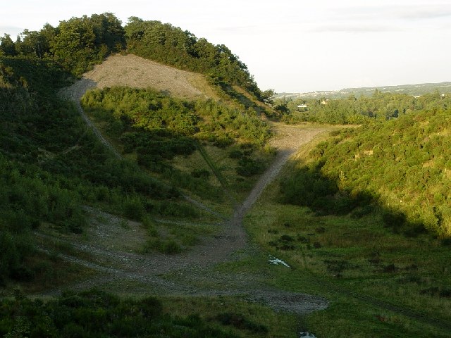
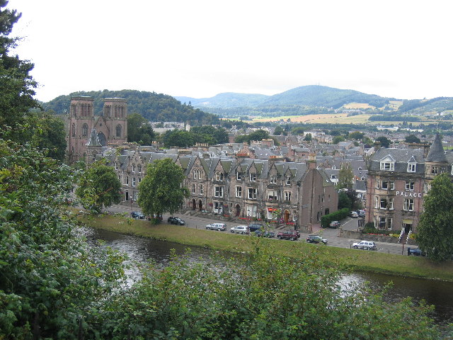
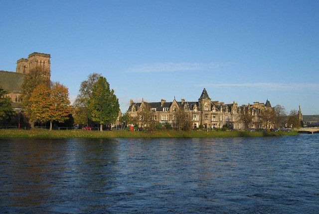
Lower Drummond is a small village located in the county of Inverness-shire, Scotland. Situated in the Highland region, this rural community lies approximately 10 miles northeast of the town of Inverness. Nestled amidst breathtaking natural beauty, Lower Drummond offers residents and visitors a peaceful and idyllic setting to escape the hustle and bustle of city life.

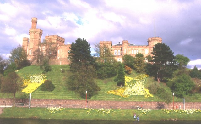
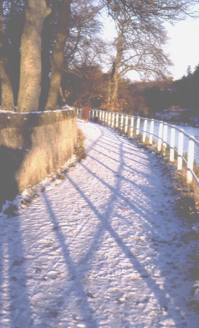
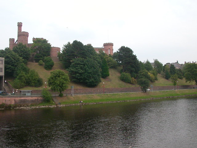
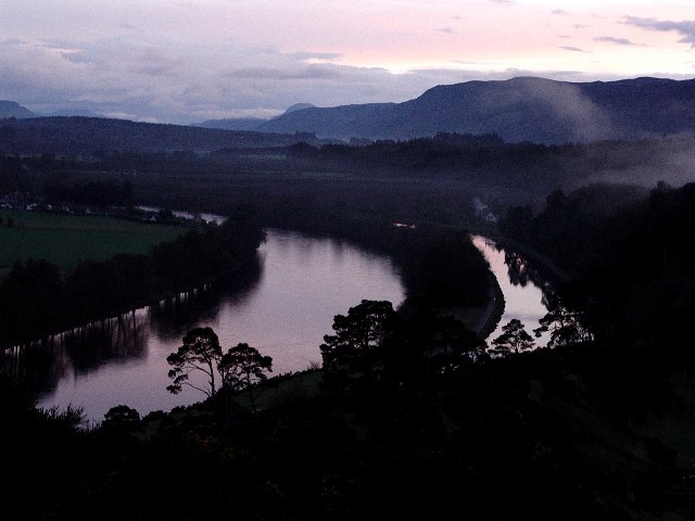
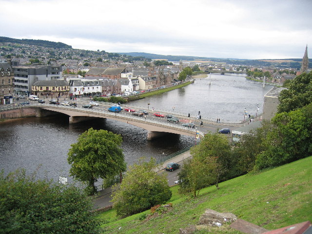
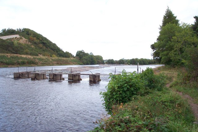
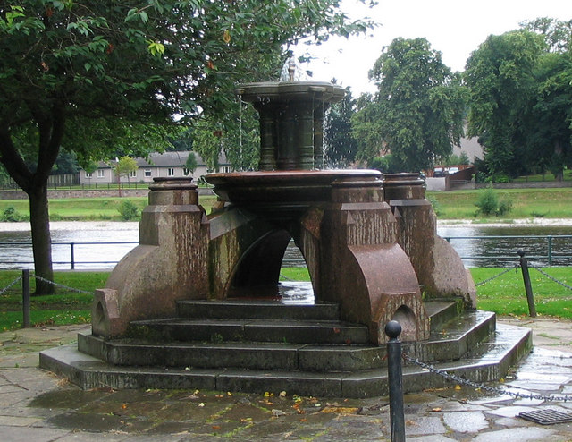
The village is characterized by its picturesque landscape, with rolling green hills, serene meadows, and the tranquil River Ness flowing nearby. Lower Drummond is surrounded by dense forests and woodlands, providing ample opportunities for outdoor activities such as hiking, cycling, and wildlife spotting. The area is particularly renowned for its diverse bird population, making it an ideal destination for birdwatching enthusiasts.

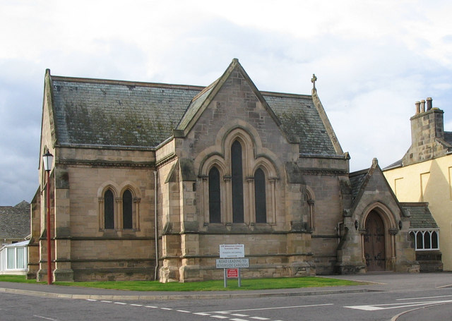
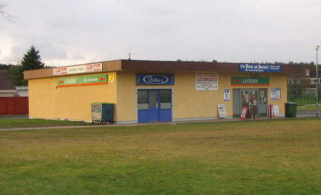
Though small in size, Lower Drummond is home to a close-knit community with a strong sense of camaraderie. The village boasts a few local amenities, including a primary school, a community center, and a charming village pub. The community center serves as a hub for various social and recreational activities, fostering a strong community spirit among residents.

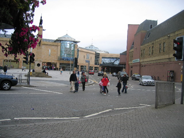
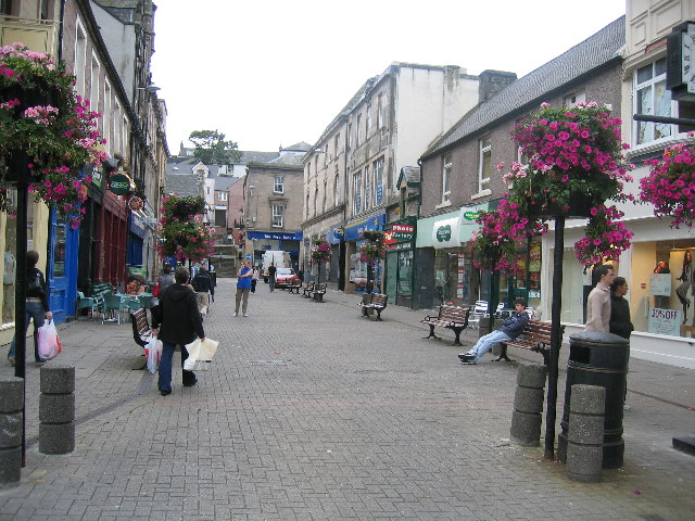
In terms of access, Lower Drummond is well-connected to nearby towns and cities. The A9 road runs close by, providing convenient transportation links for those wishing to explore the wider region. The village is also well-served by public transportation, with regular bus services connecting it to Inverness and other surrounding areas.

Lower Drummond is a hidden gem in Inverness-shire, offering a tranquil and picturesque escape for nature lovers and those seeking a close-knit community atmosphere.

If you have any feedback on the listing, please let us know in the comments section below.

Lower Drummond Images

Images are sourced within 2km of 57.463318/-4.2274077 or Grid Reference NH6643. Thanks to Geograph Open Source API. All images are credited.

Inverness Castle Although not very old - it was built in 1835 - the castle occupies the site of an earlier fortress, dominating the River Ness
Inverness Castle
Although not very old - it was built in 1835 - the castle occupies the site of an earlier fortress, dominating the River Ness
Footpath along River Ness Inverness benefits from a good network of paths along both banks of the river and on to the islands. This is near the sports centre, looking downstream.
Footpath along River Ness
Inverness benefits from a good network of paths along both banks of the river and on to the islands. This is near the sports centre, looking downstream.
Inverness Castle The view of the castle from the bridge on the River Ness.
Inverness Castle
The view of the castle from the bridge on the River Ness.
View over Millburn to Inverness golf course  clubhouse The burn had a number of mills in the past, now seems mostly to have shopping trolleys and other junk.  The building in the background is the clubhouse which is marked on the 1:50000, as is the course.
View over Millburn to Inverness golf course clubhouse
The burn had a number of mills in the past, now seems mostly to have shopping trolleys and other junk. The building in the background is the clubhouse which is marked on the 1:50000, as is the course.
River Ness & Canal River Ness & Canal <a href="https://www.geograph.org.uk/gridref/NH+645+428">NH 645 428</a> photographed from elevated part of Torvean Quarry <a href="https://www.geograph.org.uk/gridref/NH+651+433">NH 651 433</a>.
River Ness & Canal
River Ness & Canal NH 645 428 photographed from elevated part of Torvean Quarry NH 651 433.
Torvean Quarry
Torvean Quarry
Eastgate Shopping Centre, Inverness
Inglis Street, Inverness
The Bridge, from the Castle, Inverness
Inverness Cathedral and the River Ness from the Castle with Dunain Hill top right
The Falcon's Return, Eastgate Shopping Centre, Inverness ‘The Falcon’s Return’ a larger than life-size statue cast in bronze by local artist, Leonie Gibbs. Surrounding the statue, you’ll find The Baked Potato, Café Centro, Lorimers, Pizza Hut Express and KFC.
The Falcon's Return, Eastgate Shopping Centre, Inverness
‘The Falcon’s Return’ a larger than life-size statue cast in bronze by local artist, Leonie Gibbs. Surrounding the statue, you’ll find The Baked Potato, Café Centro, Lorimers, Pizza Hut Express and KFC.
River Ness
River Ness
Chapel of Royal Northern Infirmary This chapel was built next to the RNI around 1896. It was dedicated to the memory of the first Lord Tweedmouth. The main nave was designed for Presbyterian worship but the transepts were used for Episcopalian and Roman Catholic worship. Old photographs show a slender turret but I believe this was removed in 1966.
Chapel of Royal Northern Infirmary
This chapel was built next to the RNI around 1896. It was dedicated to the memory of the first Lord Tweedmouth. The main nave was designed for Presbyterian worship but the transepts were used for Episcopalian and Roman Catholic worship. Old photographs show a slender turret but I believe this was removed in 1966.
River Ness near Ness-side The picture shows a sluice (foreground) and a weir. In the middle left of the picture the straight edge a few metres above river level is the bank of the Caledonian Canal (not itself visible) which then veers away to the left. The distant trees just to right of centre show where the river divides around Whin Island.
River Ness near Ness-side
The picture shows a sluice (foreground) and a weir. In the middle left of the picture the straight edge a few metres above river level is the bank of the Caledonian Canal (not itself visible) which then veers away to the left. The distant trees just to right of centre show where the river divides around Whin Island.
Lochardil Stores Local convenience store in Lochardil area of Inverness on the right of the building. There is a ladies hairdresser (blue frontage) on the left. Lies at one end of an open grassed area.
Lochardil Stores
Local convenience store in Lochardil area of Inverness on the right of the building. There is a ladies hairdresser (blue frontage) on the left. Lies at one end of an open grassed area.
Forbes Fountain An old fountain of Inverness which I think used to have a canopy. It has also been moved from its original, more central, position. River Ness can be seen in the background. The fountain lies between "The Islands" and "Ladies Walk" on the east bank.
Forbes Fountain
An old fountain of Inverness which I think used to have a canopy. It has also been moved from its original, more central, position. River Ness can be seen in the background. The fountain lies between "The Islands" and "Ladies Walk" on the east bank.
Supermarket in Inverness Morrison's supermarket (formerly Safeway) in Millburn Road, Inverness. Kessock Bridge and Black Isle can be seen in background.
Supermarket in Inverness
Morrison's supermarket (formerly Safeway) in Millburn Road, Inverness. Kessock Bridge and Black Isle can be seen in background.
St Stephen's Brae, Inverness This steep lane, mostly used by pedestrians, goes from Eastgate pedestrian precinct to the Crown area.
St Stephen's Brae, Inverness
This steep lane, mostly used by pedestrians, goes from Eastgate pedestrian precinct to the Crown area.
Show me another place!

Lower Drummond is located at Grid Ref: NH6643 (Lat: 57.463318, Lng: -4.2274077)

Unitary Authority: Highland

Police Authority: Highlands and Islands

What 3 Words

///rates.mining.gives. Near Inverness, Highland

Related Wikis

Ness Islands

The Ness Islands (Scottish Gaelic: Na h-Eileanan Nis) are situated on the River Ness, opposite the Bught Park, in the city of Inverness, Scotland. The...

Bught Park

Bught Park (Gaelic: Pàirc nam Bochd ) is the largest park in the city of Inverness, Scotland, and is situated on the western bank of the River Ness. It...

Bught

The Bught ( BUKHT; Scottish Gaelic: Am Bucht) is an area of the Scottish city of Inverness. A "bught" is defined in the Dictionary of the Scots Language...

Ness Islands Railway

The Ness Islands Railway is a 7+1⁄4 in (184 mm) gauge miniature railway in Inverness, Scotland, opened in 1983. == Overview == Operating around a site...

Related Videos

Our INVERNESS PUB CRAWL Was So Much Better Than We Expected! Join Us For a Dram in The Highlands!

We had no idea Inverness was such an awesome destination, especially for a pub crawl. Come along with us for what must be the ...

Inverness Scotland Walking Tour 4K, July 2023

Inverness Scotland Walking Tour 4K, July 2023. Step into the enchanting world of Inverness, Scotland, with this captivating 4K ...

Walking in Inverness - Scotland

A walk through the city of Inverness in Scotland. It's known as the capital of the highlands. We pass through the city centre before ...

Hiking 78 Miles Across Scotland | Great Glen Way Vlog | Day #5 🏴󠁧󠁢󠁳󠁣󠁴󠁿

Vlog 37 Day 5 Final day on the #GreatGlenWay- Supported by Cicerone @ciceronePress #ChallengeWithCicerone ℹ️Stats: ...

Nearby Amenities

Located within 500m of 57.463318,-4.2274077
Bench
Backrest: no
Lat/Long: 57.4614268/-4.2344496
Post Box
Collection Times: Mo-Fr 09:00; Sa 07:00
Operator: Royal Mail
Operator Wikidata: Q638098
Post Box Type: wall
Postal Code: IV2
Ref: IV2 20
Royal Cypher: scottish_crown
Source: survey
Lat/Long: 57.4644514/-4.2279232
Artwork Type: statue
Description: snake/monster made from a tree
Material: wood
Tourism: artwork
Lat/Long: 57.4643177/-4.2298296
The General's Well
Historic: well
Lat/Long: 57.4628146/-4.234212
Access: no
Barrier: bollard
Bicycle: yes
Bollard: fixed
Foot: yes
Lat/Long: 57.4608342/-4.2305608
Post Box
Collection Times: Mo-Fr 09:00; Sa 07:00
Operator: Royal Mail
Post Box Type: lamp
Ref: IV2 17D
Royal Cypher: scottish_crown
Source: survey
Lat/Long: 57.4610363/-4.2323902
Bus Stop
Island Bank Rd
Naptan AtcoCode: 670000067
Naptan Bearing: S
Naptan CommonName: Island Bank Rd
Naptan Indicator: o/s No 11
Naptan Landmark: Aquaduct
Naptan NaptanCode: 45327454
Naptan PlusbusZoneRef: IVRNESS
Naptan Street: Island Bank Rd
Naptan Verified: no
Source: naptan_import
Lat/Long: 57.4671167/-4.2273337
Bus Stop
Island Bank Rd
Naptan AtcoCode: 670000068
Naptan Bearing: N
Naptan CommonName: Island Bank Rd
Naptan Indicator: opp No 11
Naptan Landmark: Aquaduct
Naptan NaptanCode: 45327456
Naptan PlusbusZoneRef: IVRNESS
Naptan Street: Island Bank Rd
Naptan Verified: no
Source: naptan_import
Lat/Long: 57.4671224/-4.2275174
Bus Stop
Island Bank Rd
Bench: no
Bin: no
Naptan AtcoCode: 670000069
Naptan Bearing: NE
Naptan CommonName: Island Bank Rd
Naptan Indicator: at Ness Islands
Naptan Landmark: Bus Shelter
Naptan NaptanCode: 45327457
Naptan PlusbusZoneRef: IVRNESS
Naptan Street: Island Bank Rd
Naptan Verified: no
Shelter: yes
Source: naptan_import
Tactile Paving: no
Lat/Long: 57.4653294/-4.2277919
Bus Stop
Island Bank Rd
Bench: no
Bin: no
Naptan AtcoCode: 670000070
Naptan Bearing: SW
Naptan CommonName: Island Bank Rd
Naptan Indicator: opp Ness Islands
Naptan Landmark: Ach-An-Eas House
Naptan NaptanCode: 45327458
Naptan PlusbusZoneRef: IVRNESS
Naptan Street: Island Bank Rd
Naptan Verified: no
Shelter: no
Source: naptan_import
Tactile Paving: no
Lat/Long: 57.4651879/-4.2276665
Bus Stop
Drummond Road
Naptan AtcoCode: 6700600047
Naptan Bearing: SW
Naptan CommonName: Drummond Road
Naptan Indicator: at Burn Road
Naptan Landmark: Burn Road
Naptan NaptanCode: 45325459
Naptan PlusbusZoneRef: IVRNESS
Naptan Street: Drummond Road
Naptan Verified: no
Source: naptan_import
Lat/Long: 57.4634795/-4.2211095
Bus Stop
Drummond Road
Naptan AtcoCode: 6700600048
Naptan Bearing: NE
Naptan CommonName: Drummond Road
Naptan Indicator: opp Burn Road
Naptan Landmark: Burn Road
Naptan NaptanCode: 45325462
Naptan PlusbusZoneRef: IVRNESS
Naptan Street: Drummond Road
Naptan Verified: no
Source: naptan_import
Lat/Long: 57.4639523/-4.221305
Bus Stop
Drummond Road
Naptan AtcoCode: 6700600049
Naptan Bearing: SW
Naptan CommonName: Drummond Road
Naptan Indicator: o/s 53
Naptan Landmark: 53 Drummond Road
Naptan NaptanCode: 45325463
Naptan PlusbusZoneRef: IVRNESS
Naptan Street: Drummond Road
Naptan Verified: no
Source: naptan_import
Lat/Long: 57.4597531/-4.2240179
Bus Stop
Drummond Road
Naptan AtcoCode: 6700600050
Naptan Bearing: SW
Naptan CommonName: Drummond Road
Naptan Indicator: at Lodge Road
Naptan Landmark: Lodge Road
Naptan NaptanCode: 45325464
Naptan PlusbusZoneRef: IVRNESS
Naptan Street: Drummond Road
Naptan Verified: no
Source: naptan_import
Lat/Long: 57.4611355/-4.222568
Bus Stop
Island Bank Road
Naptan AtcoCode: 6700600111
Naptan Bearing: NE
Naptan CommonName: Island Bank Road
Naptan Indicator: opp Drummond Crescent
Naptan Landmark: Drummond Cres
Naptan NaptanCode: 45325698
Naptan PlusbusZoneRef: IVRNESS
Naptan Street: Island Bank Road
Naptan Verified: no
Source: naptan_import
Lat/Long: 57.4613569/-4.2319019
Bus Stop
Island Bank Road
Naptan AtcoCode: 6700600111A
Naptan Bearing: SW
Naptan CommonName: Island Bank Road
Naptan Indicator: at Drummond Crescent
Naptan Landmark: Drummond Cres
Naptan NaptanCode: 45329343
Naptan PlusbusZoneRef: IVRNESS
Naptan Street: Island Bank Road
Naptan Verified: no
Source: naptan_import
Lat/Long: 57.4610497/-4.2319999
Rapids: 2
Waterway: rapids
Lat/Long: 57.4660062/-4.2294594
Ness Islands
Name Gd: Eileanan Nis
Place: locality
Wikidata: Q15261795
Wikipedia: en:Ness Islands
Lat/Long: 57.464031/-4.2305264
Post Box
Collection Times: Mo-Fr 18:00; Sa 12:45
Operator: Royal Mail
Operator Wikidata: Q638098
Post Box Type: lamp
Ref: IV2 29
Royal Cypher: scottish_crown
Lat/Long: 57.4622129/-4.2217551
Hillview House
Addr City: Inverness
Addr Housenumber: 26
Addr Postcode: IV2 4NL
Addr Street: Merlewood Road
Tourism: hotel
Lat/Long: 57.4629839/-4.2244594
Glenburn Drive 11kV/414V Substation
Location: outdoor
Operator: SSE Power Distribution
Power: substation
Substation: minor_distribution
Voltage: 11000;414
Lat/Long: 57.4647366/-4.2211906
Pet cemetery
Landuse: cemetery
Lat/Long: 57.4655367/-4.2284833
Bench
Backrest: no
Bench: yes
Description: Curvey wooden bench. The bench is carved from a tree trunk with a view overlooking the river Ness.
Material: wood
Seats: 4
Lat/Long: 57.4629728/-4.2328119
Drummond
Name Gd: An Druimean
Place: suburb
Lat/Long: 57.464957/-4.2210806
Tourism: viewpoint
Lat/Long: 57.4670919/-4.2289242
Waste Basket
Lat/Long: 57.4657703/-4.2284629
Waste Basket
Lat/Long: 57.4616268/-4.2341486
Waste Basket
Lat/Long: 57.4653592/-4.230945
Bench
Backrest: yes
Lat/Long: 57.4669636/-4.2278555
Bench
Backrest: yes
Lat/Long: 57.4664033/-4.2277329
Bench
Backrest: no
Lat/Long: 57.465429/-4.2290761
Bench
Lat/Long: 57.4646097/-4.2300012
Waste Basket
Lat/Long: 57.4646256/-4.2298879
Waste Basket
Lat/Long: 57.4632489/-4.2317835
Waste Basket
Lat/Long: 57.4634863/-4.2309458
Bench
Lat/Long: 57.4635084/-4.2309027
Bench
Lat/Long: 57.4634016/-4.2308851
Bench
Covered: no
Leisure: picnic_table
Material: wood
Lat/Long: 57.462682/-4.2331707
Waste Basket
Lat/Long: 57.4673089/-4.2293992
Bench
Backrest: no
Lat/Long: 57.4675322/-4.2292061
Bench
Backrest: no
Lat/Long: 57.4673321/-4.2292067
Waste Basket
Lat/Long: 57.4623893/-4.2327106
Bench
Lat/Long: 57.4651141/-4.2311614
Waste Basket
Lat/Long: 57.4630782/-4.2339816
Bench
Backrest: yes
Lat/Long: 57.4672947/-4.2291938
Rossal house apartments
Tourism: guest_house
Lat/Long: 57.4611808/-4.2302745
Bench
Backrest: yes
Colour: brown
Direction: 270
Lat/Long: 57.4677515/-4.2278085
Waste Basket
Lat/Long: 57.4674014/-4.2277944
Bench
Backrest: yes
Colour: brown
Direction: 260
Lat/Long: 57.4673754/-4.2277864
Bench
Backrest: yes
Lat/Long: 57.465938/-4.2285079
Shop: kiosk
Lat/Long: 57.4630442/-4.2347145
The data included in this document is from www.openstreetmap.org. The data is made available under ODbL.

Have you been to Lower Drummond?

Leave your review of Lower Drummond below (or comments, questions and feedback).