Lower Drayton

Settlement in Staffordshire South Staffordshire

England

Lower Drayton

Farmland and motorway near Acton Trussell, Staffordshire Looking west-south-west from the Staffordshire and Worcestershire Canal. Cockpit Plantation is on the left. The M6 motorway crosses the view, and just below it, the River Penk (hidden) meanders, flowing from left to right.
Farmland and motorway near Acton Trussell, Staffordshire Credit: Roger D Kidd

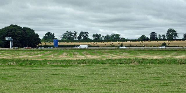
Lower Drayton is a small village located in the county of Staffordshire, England. Situated approximately 4 miles northwest of the county town of Stafford, Lower Drayton is a rural community surrounded by rolling countryside and farmland.

The village is known for its picturesque setting and charming character. It is home to a number of traditional, stone-built cottages that add to its quaint and peaceful atmosphere. The local population is relatively small, creating a close-knit community where residents know each other well.

Lower Drayton is also famous for its historic features. The centerpiece of the village is Lower Drayton Farm, a working farm that dates back to the 18th century. The farm not only provides a glimpse into the agricultural heritage of the area but also offers visitors the opportunity to engage with farm animals and enjoy various outdoor activities.

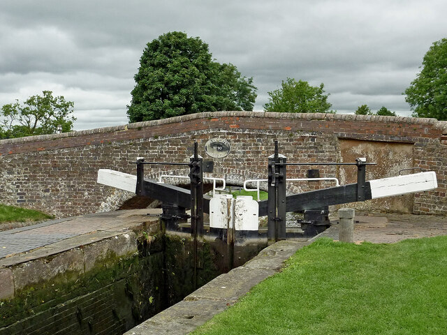
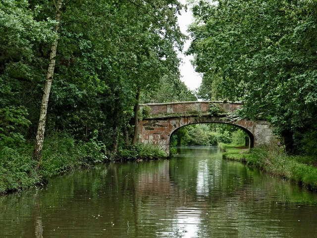
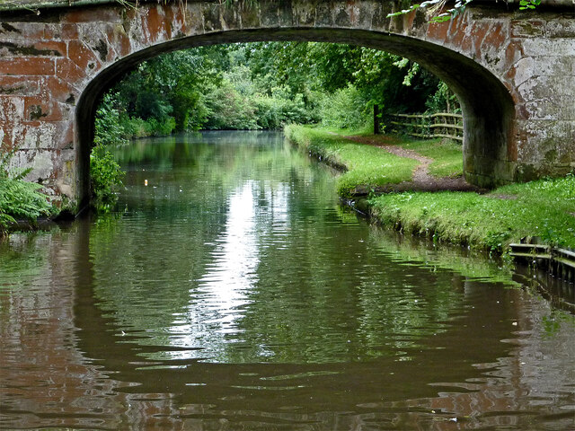
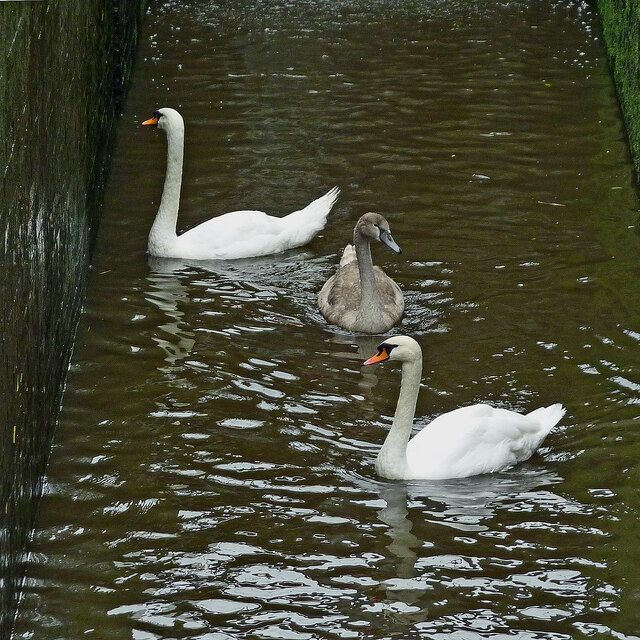
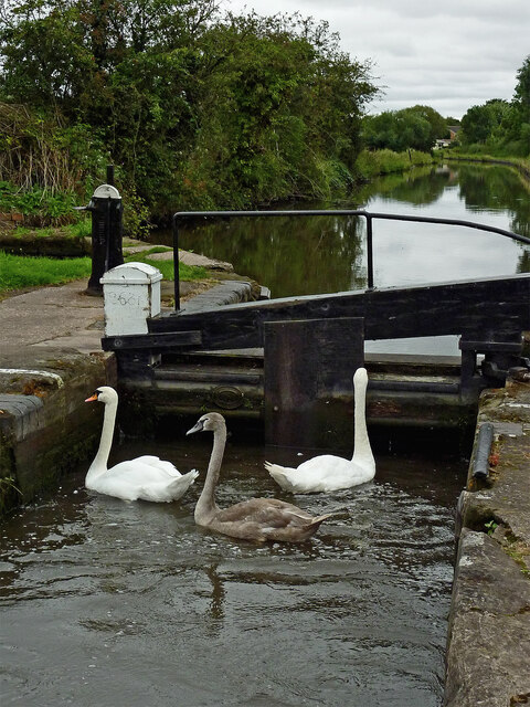
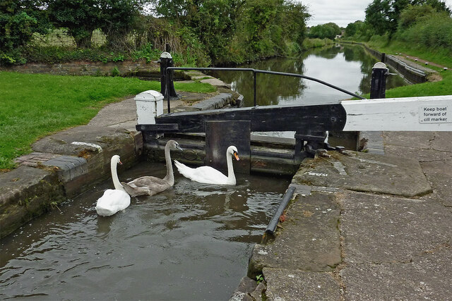
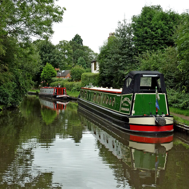
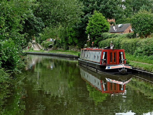
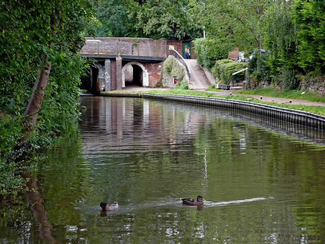
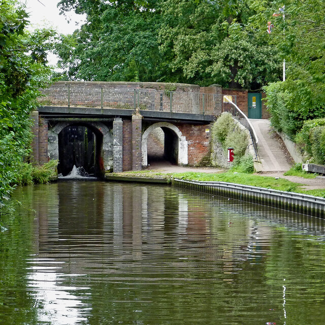
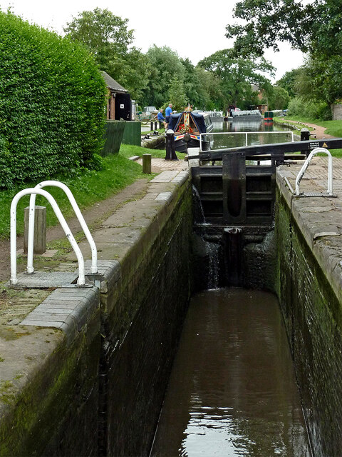
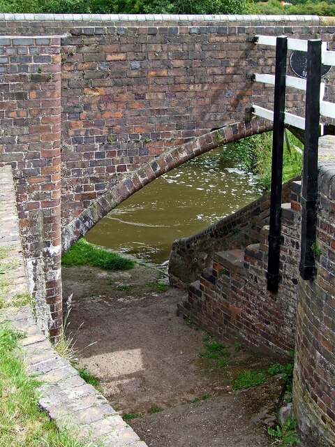
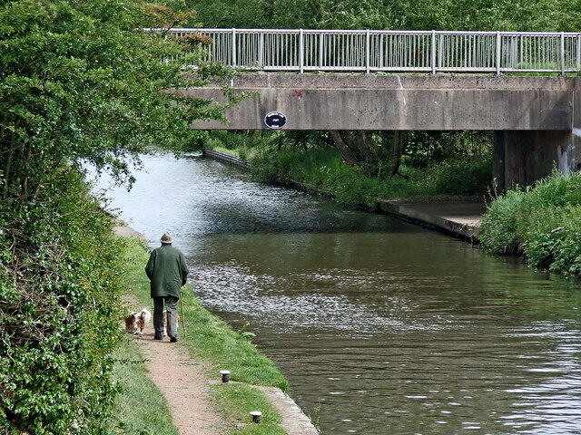
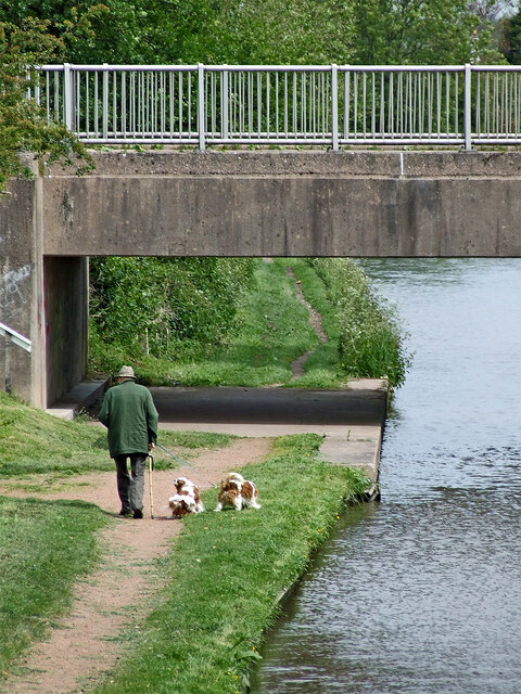
In addition to the farm, Lower Drayton boasts a range of amenities and attractions. The village has a primary school, providing education for the local children, and a village hall that hosts community events and activities. The nearby Staffordshire and Worcestershire Canal runs through the village, offering scenic walks and opportunities for boating enthusiasts.

Overall, Lower Drayton is a charming village that offers a tranquil escape from the hustle and bustle of nearby urban areas. Its scenic surroundings, historic features, and close-knit community make it an attractive place to live or visit for those seeking a peaceful and idyllic rural setting.

If you have any feedback on the listing, please let us know in the comments section below.

Lower Drayton Images

Images are sourced within 2km of 52.739272/-2.1031035 or Grid Reference SJ9315. Thanks to Geograph Open Source API. All images are credited.

Farmland and motorway near Acton Trussell, Staffordshire Looking west-south-west from the Staffordshire and Worcestershire Canal. Cockpit Plantation is on the left. The M6 motorway crosses the view, and just below it, the River Penk (hidden) meanders, flowing from left to right.
Farmland and motorway near Acton Trussell, Staffordshire
Looking west-south-west from the Staffordshire and Worcestershire Canal. Cockpit Plantation is on the left. The M6 motorway crosses the view, and just below it, the River Penk (hidden) meanders, flowing from left to right.
Park Gate Lock and Bridge near Penkridge, Staffordshire Park Gate Bridge is No 90 across the Staffordshire and Worcestershire Canal, and now allows access to the Midland Chandlers warehouse, Park Gate Lockhouse and the (now former) Teddesley Boat Compaany wharf.

Note the two gate paddle ratchets (between the bridge plate) are both up so the lock is being drained to allow a south bound boat to enter.
Park Gate Lock and Bridge near Penkridge, Staffordshire
Park Gate Bridge is No 90 across the Staffordshire and Worcestershire Canal, and now allows access to the Midland Chandlers warehouse, Park Gate Lockhouse and the (now former) Teddesley Boat Compaany wharf. Note the two gate paddle ratchets (between the bridge plate) are both up so the lock is being drained to allow a south bound boat to enter.
Canal cruising near Penkridge in Staffordshire This is the Staffordshire and Worcestershire Canal meandering southwards towards Penkridge and Wolverhampton. The narrowboat is called "Beeston Castle".
Canal cruising near Penkridge in Staffordshire
This is the Staffordshire and Worcestershire Canal meandering southwards towards Penkridge and Wolverhampton. The narrowboat is called "Beeston Castle".
Teddesley Park Bridge near Penkridge in Staffordshire Looking south-south-east towards Penkridge and Wolverhampton.
Teddesley Park Bridge is No 89 across the Staffordshire and Worcestershire Canal. The accommodation bridge carries a farm track and public footpath.
Teddesley Park Bridge near Penkridge in Staffordshire
Looking south-south-east towards Penkridge and Wolverhampton. Teddesley Park Bridge is No 89 across the Staffordshire and Worcestershire Canal. The accommodation bridge carries a farm track and public footpath.
Swans in Longford Lock near Penkridge, Staffordshire These three wanted a free lift up to the next water level.

<a href="https://www.geograph.org.uk/photo/7049547">SJ9314 : Swans using Longford Lock near Penkridge, Staffordshire</a>
Swans in Longford Lock near Penkridge, Staffordshire
These three wanted a free lift up to the next water level. SJ9314 : Swans using Longford Lock near Penkridge, Staffordshire
Mixed usage of Longord Lock near Penkridge The three swans swam into the lock chamber in front of the narrowboat. Despite the turbulence of the water entering the lock through the gate paddles, they showed little sign of distress or concern.

Longford Lock is No 39 on the Staffordshire and Worcestershire Canal, providing a rise (or fall) of ten feet (three metres).


<a href="https://www.geograph.org.uk/photo/7049572">SJ9314 : Longford Lock with swans, north of Penkridge</a>
Mixed usage of Longord Lock near Penkridge
The three swans swam into the lock chamber in front of the narrowboat. Despite the turbulence of the water entering the lock through the gate paddles, they showed little sign of distress or concern. Longford Lock is No 39 on the Staffordshire and Worcestershire Canal, providing a rise (or fall) of ten feet (three metres). SJ9314 : Longford Lock with swans, north of Penkridge
Swans using Longford Lock near Penkridge, Staffordshire Looking south towards Penkridge and Wolverhampton.
The three swans swam into the lock chamber in front of a narrowboat. Despite the turbulence of the water entering the lock through the gate paddles, they showed little sign of distress or concern, and waited patiently for me to open the gate.

Longford Lock is No 39 on the Staffordshire and Worcestershire Canal, providing a rise (or fall) of ten feet (three metres).
Swans using Longford Lock near Penkridge, Staffordshire
Looking south towards Penkridge and Wolverhampton. The three swans swam into the lock chamber in front of a narrowboat. Despite the turbulence of the water entering the lock through the gate paddles, they showed little sign of distress or concern, and waited patiently for me to open the gate. Longford Lock is No 39 on the Staffordshire and Worcestershire Canal, providing a rise (or fall) of ten feet (three metres).
Longford Lock with swans, north of Penkridge Looking south towards Penkridge and Wolverhampton.
The three swans swam into the lock chamber in front of a narrowboat. Despite the initial turbulence of the water entering the lock through the gate paddles, they showed little sign of distress or concern, and are waiting patiently for me to open the gate.

<a href="https://www.geograph.org.uk/photo/7049535">SJ9314 : Mixed usage of Longord Lock near Penkridge</a>

Longford Lock is No 39 on the Staffordshire and Worcestershire Canal, providing a rise (or fall) of ten feet (three metres).
Longford Lock with swans, north of Penkridge
Looking south towards Penkridge and Wolverhampton. The three swans swam into the lock chamber in front of a narrowboat. Despite the initial turbulence of the water entering the lock through the gate paddles, they showed little sign of distress or concern, and are waiting patiently for me to open the gate. SJ9314 : Mixed usage of Longord Lock near Penkridge Longford Lock is No 39 on the Staffordshire and Worcestershire Canal, providing a rise (or fall) of ten feet (three metres).
Housing by the canal near Penkridge in Staffordshire This is the Staffordshire and Worcestershire Canal, looking south-west towards Penkridge Lock. The mobile homes are in Little Marsh Grove.
Housing by the canal near Penkridge in Staffordshire
This is the Staffordshire and Worcestershire Canal, looking south-west towards Penkridge Lock. The mobile homes are in Little Marsh Grove.
Moored narrowboats near Penkridge in Staffordshire This is the Staffordshire and Worcestershire Canal, looking south-west towards Penkridge Lock (just past the bend). There are plenty of visitor moorings here north of Penkridge Lock.
Moored narrowboats near Penkridge in Staffordshire
This is the Staffordshire and Worcestershire Canal, looking south-west towards Penkridge Lock (just past the bend). There are plenty of visitor moorings here north of Penkridge Lock.
Staffordshire and Worcestershire Canal at Penkridge in Staffordshire This is the Staffordshire and Worcestershire Canal, looking south-west towards Penkridge Lock (just past the bend). There are plenty of visitor moorings here north of Penkridge Bridge and Lock.
Staffordshire and Worcestershire Canal at Penkridge in Staffordshire
This is the Staffordshire and Worcestershire Canal, looking south-west towards Penkridge Lock (just past the bend). There are plenty of visitor moorings here north of Penkridge Bridge and Lock.
Canal by Penkridge Bridge, Staffordshire This is the Staffordshire and Worcestershire Canal at Penkridge Bridge (No 86) and Lock (No 38 (just visible). There are plenty of visitor moorings behind the camera. The popular Boat Inn is off to the right.
Canal by Penkridge Bridge, Staffordshire
This is the Staffordshire and Worcestershire Canal at Penkridge Bridge (No 86) and Lock (No 38 (just visible). There are plenty of visitor moorings behind the camera. The popular Boat Inn is off to the right.
Penkridge Bridge and Lock in Staffordshire This is the Staffordshire and Worcestershire Canal at Penkridge Bridge (No 86) and Lock (No 38). There are plenty of visitor moorings behind the camera. The bridge carries Cannock Road. The lock provides a rise of 9ft 3in (2·8 metres), and its tail gates are leaking badly. The popular Boat Inn is off to the right.
Penkridge Bridge and Lock in Staffordshire
This is the Staffordshire and Worcestershire Canal at Penkridge Bridge (No 86) and Lock (No 38). There are plenty of visitor moorings behind the camera. The bridge carries Cannock Road. The lock provides a rise of 9ft 3in (2·8 metres), and its tail gates are leaking badly. The popular Boat Inn is off to the right.
Penkridge Lock in Staffordshire Looking south towards Wolverhampton and Stourport.
Penkridge Lock is No 38 on the Staffordshire and Worcestershire Canal. The lock provides a rise of 9ft 3in (2·8 metres), and has been drained in this image in anticipation of a narrowboat approaching from behind the camera. Contrasting with the bottom gates, the top gate is leaking minimally.
Penkridge Lock in Staffordshire
Looking south towards Wolverhampton and Stourport. Penkridge Lock is No 38 on the Staffordshire and Worcestershire Canal. The lock provides a rise of 9ft 3in (2·8 metres), and has been drained in this image in anticipation of a narrowboat approaching from behind the camera. Contrasting with the bottom gates, the top gate is leaking minimally.
Bridge and towpath at Longford Lock near Penkridge Longford Lock No 39 and Broom Bridge No 87 are on the Staffordshire and Worcestershire Canal north-east of Penkridge in Staffordshire.
Bridge and towpath at Longford Lock near Penkridge
Longford Lock No 39 and Broom Bridge No 87 are on the Staffordshire and Worcestershire Canal north-east of Penkridge in Staffordshire.
Canal north-east of Penkridge in Staffordshire This is the Staffordshire and Worcestershire Canal, looking north-north-east at Longford Lock, towards Woodbank Lane Bridge, No 87A.
Canal north-east of Penkridge in Staffordshire
This is the Staffordshire and Worcestershire Canal, looking north-north-east at Longford Lock, towards Woodbank Lane Bridge, No 87A.
Walking the dogs near Penkridge, Staffordshire This is the Staffordshire and Worcestershire Canal, looking north-north-east at Longford Lock, towards Woodbank Lane Bridge, No 87A.
Walking the dogs near Penkridge, Staffordshire
This is the Staffordshire and Worcestershire Canal, looking north-north-east at Longford Lock, towards Woodbank Lane Bridge, No 87A.
Show me another place!

Lower Drayton is located at Grid Ref: SJ9315 (Lat: 52.739272, Lng: -2.1031035)

Administrative County: Staffordshire

District: South Staffordshire

Police Authority: Staffordshire

What 3 Words

///crunch.awaiting.clapper. Near Penkridge, Staffordshire

Nearby Locations

Lower Drayton

Related Wikis

Teddesley Hall

Teddesley Hall was a large Georgian English country house located close to Penkridge in Staffordshire, now demolished. It was the main seat firstly of...

Penkridge Viaduct

Penkridge Viaduct is a railway viaduct on the West Coast Main Line where it crosses the River Penk and Levedale Road near the village of Penkridge, Staffordshire...

Penkridge

Penkridge ( PENG-krij) is a large village and civil parish in South Staffordshire District in Staffordshire, England. It is to the south of Stafford, north...

Wolgarston High School

Wolgarston High School is a coeducational upper school and sixth form located in Penkridge, Staffordshire, England. Wolgarston High School is an age 13...

Nearby Amenities

Located within 500m of 52.739272,-2.1031035
Bus Stop
Lower Drayton Lane
Naptan AtcoCode: 3800C638301
Naptan Bearing: N
Naptan BusStopType: CUS
Naptan CommonName: Lower Drayton Lane
Naptan Indicator: Opp
Naptan Landmark: Lower Drayton Lane
Naptan Street: Stafford Rd
Naptan Verified: no
Public Transport: platform
Source: naptan_import
Lat/Long: 52.7385736/-2.1100939
Bus Stop
Lower Drayton Lane
Naptan AtcoCode: 3800C638302
Naptan Bearing: S
Naptan CommonName: Lower Drayton Lane
Naptan Indicator: Adj
Naptan Landmark: Lower Drayton Lane
Naptan Street: Stafford Rd
Naptan Verified: no
Public Transport: platform
Source: naptan_import
Lat/Long: 52.738421/-2.1098565
Bus Stop
Stone Cottages
Naptan AtcoCode: 3800C638401
Naptan Bearing: S
Naptan BusStopType: CUS
Naptan CommonName: Stone Cottages
Naptan Indicator: Adj
Naptan Landmark: Stone Cottages
Naptan Street: Stafford Rd
Naptan Verified: no
Public Transport: platform
Source: naptan_import
Lat/Long: 52.7424049/-2.1083704
Parking
Description: Layby
Lat/Long: 52.7404328/-2.1094033
Power: pole
Lat/Long: 52.7434844/-2.1056943
Power: pole
Lat/Long: 52.741652/-2.105942
Power: pole
Lat/Long: 52.7405539/-2.1057865
Power: pole
Lat/Long: 52.7396065/-2.1057101
Power: pole
Lat/Long: 52.7386895/-2.1056614
Power: pole
Lat/Long: 52.7374462/-2.1057944
Power: pole
Lat/Long: 52.7363313/-2.105996
Power: pole
Lat/Long: 52.7354676/-2.1061316
Power: pole
Lat/Long: 52.7425144/-2.1059814
The data included in this document is from www.openstreetmap.org. The data is made available under ODbL.

Have you been to Lower Drayton?

Leave your review of Lower Drayton below (or comments, questions and feedback).