Low Caythorpe

Settlement in Yorkshire

England

Low Caythorpe

Rudston war memorial Opposite the church is this well maintained memorial to men who lost their lives in the first world war.
Rudston war memorial Credit: Steve Fareham

Low Caythorpe is a small village located in the picturesque county of Yorkshire, in the northern part of England. Situated in the district of Scarborough, it is nestled between the larger towns of Scarborough and Filey. Low Caythorpe is part of the civil parish of Cayton and benefits from its close proximity to the stunning Yorkshire coast, which is just a short drive away.

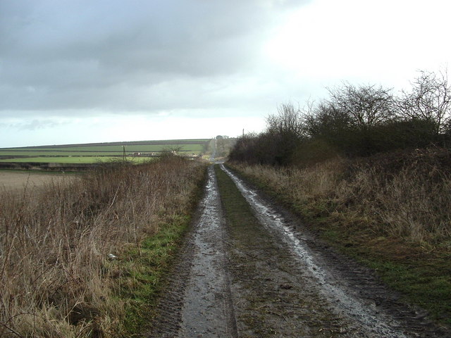
The village itself is characterized by its charming and tranquil atmosphere, with a population of around 500 residents. The houses in Low Caythorpe are predominantly traditional stone cottages, adding to the village's rustic and timeless appeal. The surrounding countryside is filled with rolling hills and green fields, making it a haven for nature lovers and hikers.

Despite its small size, Low Caythorpe offers a range of amenities for its residents. These include a local pub, a primary school, a village hall, and a community center. Additionally, there are several shops and services available in nearby Cayton and the surrounding towns.

Low Caythorpe's location provides easy access to a variety of attractions and activities. The stunning coastline, with its sandy beaches and dramatic cliffs, is perfect for seaside walks and water sports. The village is also within reach of the North York Moors National Park, offering opportunities for hiking, biking, and exploring the region's natural beauty.

Overall, Low Caythorpe is a charming village in Yorkshire, offering a peaceful and idyllic setting for its residents, while also providing access to the natural wonders of the surrounding area.

If you have any feedback on the listing, please let us know in the comments section below.

Low Caythorpe Images

Images are sourced within 2km of 54.094911/-0.29075593 or Grid Reference TA1167. Thanks to Geograph Open Source API. All images are credited.

Rudston war memorial Opposite the church is this well maintained memorial to men who lost their lives in the first world war.
Rudston war memorial
Opposite the church is this well maintained memorial to men who lost their lives in the first world war.
View E from Low Caythorpe trig
Sands Wood Looking north down the forest road which heads to Boynton in the adjacent square north.
Sands Wood
Looking north down the forest road which heads to Boynton in the adjacent square north.
Farmland to Sands Wood A typical view NE of the farmland in this area.
Farmland to Sands Wood
A typical view NE of the farmland in this area.
Woldgate Bridleway The bridleway heads north to the top NW corner of the grid square.
Woldgate Bridleway
The bridleway heads north to the top NW corner of the grid square.
Communications Mast The mast is at the roadside. This view south down the reservoir access road.
Communications Mast
The mast is at the roadside. This view south down the reservoir access road.
Reservoir A NW view of the reservoir.
Reservoir
A NW view of the reservoir.
Green Lane Looking north to the head of the lane and the road which passes through the grid square EW.
Green Lane
Looking north to the head of the lane and the road which passes through the grid square EW.
North Wood This is the north edge of North Wood on the south edge of the grid square. View looking NE.
North Wood
This is the north edge of North Wood on the south edge of the grid square. View looking NE.
Boynton Looking north across the B1253 which cuts EW through Boynton.
Boynton
Looking north across the B1253 which cuts EW through Boynton.
West Lawn Wood Looking east to the wood and the path that runs along its edge.The B1253 Runs EW along the north edge of the grid square. The minor road from here heads through Sands Wood on the south edge of the square.
West Lawn Wood
Looking east to the wood and the path that runs along its edge.The B1253 Runs EW along the north edge of the grid square. The minor road from here heads through Sands Wood on the south edge of the square.
Low Caythorpe Cottages The cottages are near the north edge of the grid square on the B1253. To the south side of the road are the grounds of Thorpe Hall and Carr Plantation.
Low Caythorpe Cottages
The cottages are near the north edge of the grid square on the B1253. To the south side of the road are the grounds of Thorpe Hall and Carr Plantation.
Rudston - Bridleway The bridleway heads off towards the south edge of the grid square to continue on NE in the adjacent square north.
Rudston - Bridleway
The bridleway heads off towards the south edge of the grid square to continue on NE in the adjacent square north.
Bridleway NE of Rudston This grid square is all farmland. View NE from the bridleway to the narrow stand of trees near the south edge of the square.
Bridleway NE of Rudston
This grid square is all farmland. View NE from the bridleway to the narrow stand of trees near the south edge of the square.
St Andrew's Church Tower , Boynton
St Andrew's Church, Boynton
The Vicarage, Boynton
Road To High Caythorpe
Show me another place!

Low Caythorpe is located at Grid Ref: TA1167 (Lat: 54.094911, Lng: -0.29075593)

Division: East Riding

Unitary Authority: East Riding of Yorkshire

Police Authority: Humberside

What 3 Words

///airbag.crumb.richer. Near Boynton, East Yorkshire

Related Wikis

Bridlington Rural District

Bridlington was a rural district in the East Riding of Yorkshire in England from 1894 to 1974. It covered a coastal area, and surrounded the municipal...

Woldgate

Woldgate is a minor road in the East Riding of Yorkshire, England, which follows the line of a Roman road. It runs for a distance of 10 miles (16 km)...

Boynton, East Riding of Yorkshire

Boynton is a village and civil parish in the East Riding of Yorkshire, England. It is situated approximately 3 miles (5 km) west of the town of Bridlington...

Boynton Hall

Boynton Hall is a country house in the village of Boynton near Bridlington, East Riding of Yorkshire, England. It is a Grade I listed building.Originally...

Nearby Amenities

Located within 500m of 54.094911,-0.29075593
CAYTHORPE1
Disused: yes
Man Made: petroleum_well
Ref GB Decc: L41/29-8
Source: DECC
Lat/Long: 54.0947494/-0.2837473
CAYTHORPE2
Disused: yes
Man Made: petroleum_well
Ref GB Decc: L41/29-9
Source: DECC
Lat/Long: 54.0947476/-0.2838376
old chalk pit
Historic: quarry
Mineral: chalk
Source: OS 1:25k
Lat/Long: 54.095546/-0.2962022
Low Caythorpe
Description: Site of former village
Historic: archaeological_site
Source: OS 1:25k
Lat/Long: 54.093934/-0.2918677
old chalk pit
Historic: quarry
Mineral: chalk
Source: OS 1:25k
Lat/Long: 54.0914939/-0.2887778
Ford: yes
Lat/Long: 54.0923135/-0.2896311
The data included in this document is from www.openstreetmap.org. The data is made available under ODbL.

Have you been to Low Caythorpe?

Leave your review of Low Caythorpe below (or comments, questions and feedback).