Carr Plantation

Wood, Forest in Yorkshire

England

Carr Plantation

The Rudston Monolith and Church of All Saints The monolith is an ancient scheduled monument and now a Grade I listed building.
A feature in the landscape for over 2000 years
The Rudston Monolith and Church of All Saints Credit: Kevin Waterhouse

Carr Plantation is a picturesque woodland located in the beautiful county of Yorkshire, England. Situated in the heart of the region, this enchanting forest covers an area of approximately 200 acres, making it an ideal destination for nature enthusiasts and outdoor enthusiasts alike.

The plantation is primarily composed of a diverse range of deciduous trees, including oak, beech, and ash, which create a stunning tapestry of colors throughout the year. The dense canopy of foliage provides a sanctuary for a wide variety of wildlife, such as deer, foxes, and numerous species of birds, making it a haven for wildlife enthusiasts and birdwatchers.

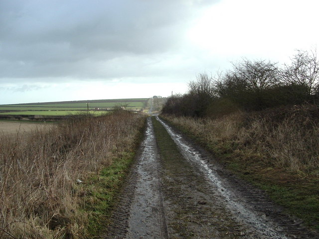
Traversing through Carr Plantation, visitors are treated to an extensive network of well-maintained walking trails and footpaths, allowing them to explore the woodland at their own pace. These trails offer breathtaking views of the surrounding countryside and provide an opportunity to immerse oneself in the tranquil atmosphere of the forest.

In addition to its natural beauty, Carr Plantation also offers a range of recreational activities. There are designated picnic areas, where visitors can enjoy a leisurely lunch amidst the stunning backdrop of the woodland. Furthermore, the plantation is also a popular spot for cycling and horse riding, with dedicated trails catering to these activities.

Carr Plantation is easily accessible, with ample parking facilities and well-signposted entrances. Whether it's a peaceful walk in nature, a family picnic, or an adventurous bike ride, this woodland offers something for everyone, making it a must-visit destination for those seeking solace in the midst of Yorkshire's enchanting landscape.

If you have any feedback on the listing, please let us know in the comments section below.

Carr Plantation Images

Images are sourced within 2km of 54.090429/-0.29795849 or Grid Reference TA1167. Thanks to Geograph Open Source API. All images are credited.

The Rudston Monolith and Church of All Saints The monolith is an ancient scheduled monument and now a Grade I listed building.
A feature in the landscape for over 2000 years
The Rudston Monolith and Church of All Saints
The monolith is an ancient scheduled monument and now a Grade I listed building. A feature in the landscape for over 2000 years
Cottages  on  Long  Street  Rudston East Gate to the right. A postbox in the wall of the first cottage by the door
Cottages on Long Street Rudston
East Gate to the right. A postbox in the wall of the first cottage by the door
Postbox  in  cottage  wall  onto  pavement.  George  VI
Postbox in cottage wall onto pavement. George VI
Burton  Agnes  Balk.  Manor  House  Farm  on  the  left Another lane walking walk
Burton Agnes Balk. Manor House Farm on the left
Another lane walking walk
Track  to  fields  from  Burton  Agnes  Balk
Track to fields from Burton Agnes Balk
Wildlife  Conservation  Zone  Burton  Agnes  Balk For 565m north and south of this point including the verge on the east side of the road
Wildlife Conservation Zone Burton Agnes Balk
For 565m north and south of this point including the verge on the east side of the road
Burton  Agnes  Balk.  Verge  Nature  Reserve  on  the  right
Burton Agnes Balk. Verge Nature Reserve on the right
The Rudston Monolith The Rudston Monolith is a standing stone in the cemetery of All Saints Church in the village of Rudston, a few miles away from where we stayed in Harpham. It has been estimated to have been heaved into place and put upright sometime during the late Neolithic or early Bronze Age. At roughly 25 feet(7.6 m) tall, it’s considered to be the United Kingdom’s tallest megalith.
A few minutes of detailed research on the web gives two possible sources for the stone – (i) glomerate Moorstone grit, from the Cleveland Hills, west of Whitby, possibly at Grosmont, over 40 miles away or (ii) grey sandstone or gritstone from the Cayton Bay area south of Scarborough10 miles away. Either way, as it may weigh up to 2 tons, it is pretty impressive.
An excavation conducted by Sir William Strickland in the late 18th century suggested that its depth below ground is as great as its height. 
The stone most likely marked a prehistoric holy place or worship centre for the indigenous pagan religion, and that Anglo—Saxon missionaries followed the successful strategy of "Christianising" this already sacred object, possibly by fixing a cross to the top. This could account for the name 'Rudston' for the old English word for cross is 'rood' and stane means 'stone'.
The Rudston Monolith
The Rudston Monolith is a standing stone in the cemetery of All Saints Church in the village of Rudston, a few miles away from where we stayed in Harpham. It has been estimated to have been heaved into place and put upright sometime during the late Neolithic or early Bronze Age. At roughly 25 feet(7.6 m) tall, it’s considered to be the United Kingdom’s tallest megalith. A few minutes of detailed research on the web gives two possible sources for the stone – (i) glomerate Moorstone grit, from the Cleveland Hills, west of Whitby, possibly at Grosmont, over 40 miles away or (ii) grey sandstone or gritstone from the Cayton Bay area south of Scarborough10 miles away. Either way, as it may weigh up to 2 tons, it is pretty impressive. An excavation conducted by Sir William Strickland in the late 18th century suggested that its depth below ground is as great as its height. The stone most likely marked a prehistoric holy place or worship centre for the indigenous pagan religion, and that Anglo—Saxon missionaries followed the successful strategy of "Christianising" this already sacred object, possibly by fixing a cross to the top. This could account for the name 'Rudston' for the old English word for cross is 'rood' and stane means 'stone'.
All Saints Church, Rudston  All saints is an early Norman church built around the year 1100 by William Peverel, lord of the manor. Of that Norman church, the tower remains.
All Saints Church, Rudston
All saints is an early Norman church built around the year 1100 by William Peverel, lord of the manor. Of that Norman church, the tower remains.
Houses  on  East  Gate  Rudston
Houses on East Gate Rudston
Rudston  Village  Hall  former  Wesleyan  Chapel  built  1879
Rudston Village Hall former Wesleyan Chapel built 1879
Rudston  Monolith  and  side  of  All  Saints  Parish  Church
Rudston Monolith and side of All Saints Parish Church
All  Saints  Parish  Church  and  Monolith  Rudston Norman with E. E. arcades, chancel arch 14th century. It had a major restoration in 1861 including heightening the tower. The monolith is to the right
All Saints Parish Church and Monolith Rudston
Norman with E. E. arcades, chancel arch 14th century. It had a major restoration in 1861 including heightening the tower. The monolith is to the right
The Rudston Monolith To be found in the churchyard of All Saints, in Rudston.  It is the tallest standing stone in the United Kingdom, dating back from the late Neolithic and Early Bronze Age Period.
A 28ft slab of gritstone that had to be moved here for erection.
Grade I Listed.
The Rudston Monolith
To be found in the churchyard of All Saints, in Rudston. It is the tallest standing stone in the United Kingdom, dating back from the late Neolithic and Early Bronze Age Period. A 28ft slab of gritstone that had to be moved here for erection. Grade I Listed.
All Saints Church, Rudston Grade I Listed Building dating back to Norman times, particularly visible in the tower.  Major alterations and renovations were undertaken in the Victorian Era.
Hidden from view, behind the church, is the Rudston Monolith - the tallest standing stone in the United Kingdom
All Saints Church, Rudston
Grade I Listed Building dating back to Norman times, particularly visible in the tower. Major alterations and renovations were undertaken in the Victorian Era. Hidden from view, behind the church, is the Rudston Monolith - the tallest standing stone in the United Kingdom
How big am I? The tallest in England Standing stone predates church and churchyard
How big am I? The tallest in England
Standing stone predates church and churchyard
Junction of School Lane and High Street, Rudston The High Street is the B1253.
Junction of School Lane and High Street, Rudston
The High Street is the B1253.
War memorial, Rudston The white cross stands beside the B1253 as you enter the village from the east. Viewed here from the churchyard.
War memorial, Rudston
The white cross stands beside the B1253 as you enter the village from the east. Viewed here from the churchyard.
Show me another place!

Carr Plantation is located at Grid Ref: TA1167 (Lat: 54.090429, Lng: -0.29795849)

Division: East Riding

Unitary Authority: East Riding of Yorkshire

Police Authority: Humberside

What 3 Words

///prancing.upstarts.flops. Near Boynton, East Yorkshire

Related Wikis

Woldgate

Woldgate is a minor road in the East Riding of Yorkshire, England, which follows the line of a Roman road. It runs for a distance of 10 miles (16 km)...

Bridlington Rural District

Bridlington was a rural district in the East Riding of Yorkshire in England from 1894 to 1974. It covered a coastal area, and surrounded the municipal...
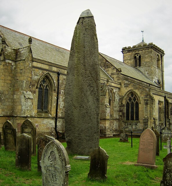
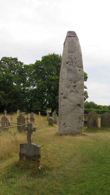
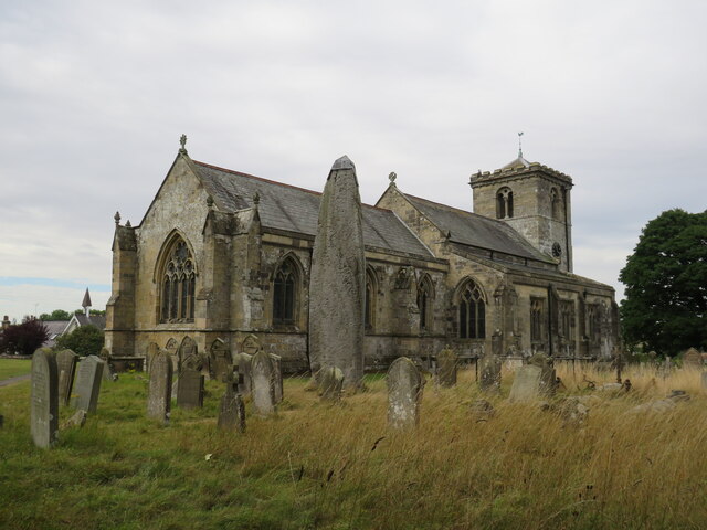
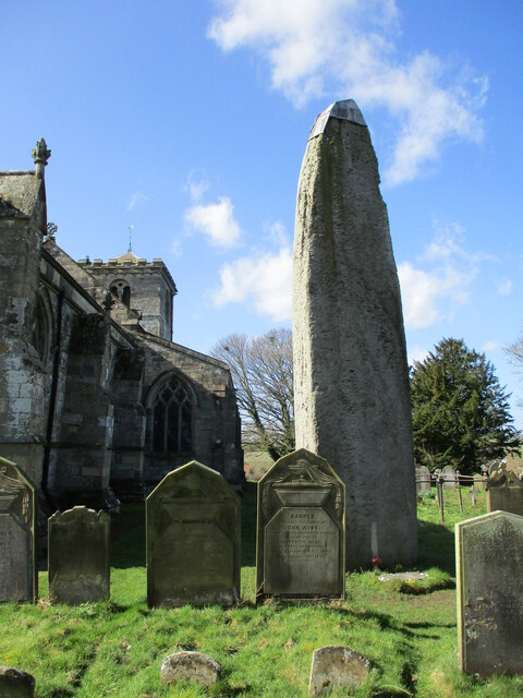
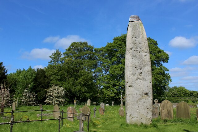
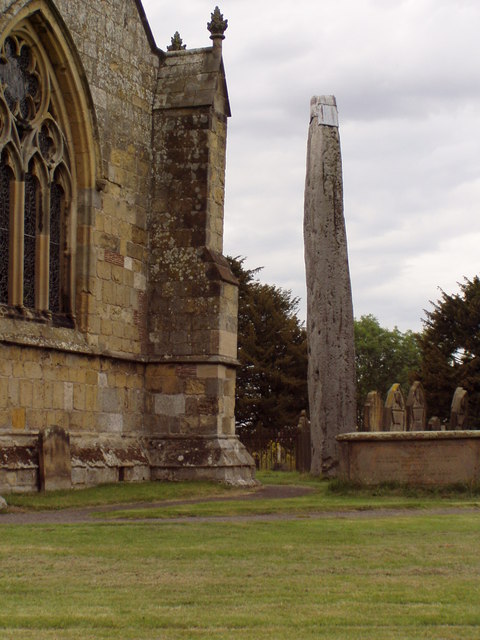
Rudston Monolith

The Rudston Monolith at over 25 feet (7.6 m) is the tallest megalith (standing stone) in the United Kingdom. It is situated in the churchyard in the village...
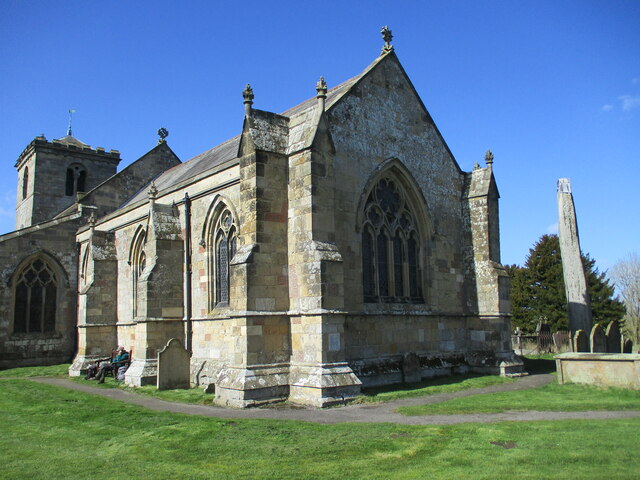
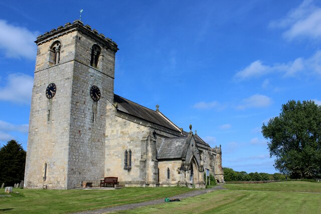
Rudston

Rudston is a small village and civil parish in the East Riding of Yorkshire, England. It is situated between Driffield and Bridlington approximately 6...

Nearby Amenities

Located within 500m of 54.090429,-0.29795849
old sandpit
Historic: quarry
Source: OS 1:25k
Lat/Long: 54.0885993/-0.2985625
tumulus
Historic: archaeological_site
Source: OS 1:25k
Lat/Long: 54.0882469/-0.3034549
earthwork
Historic: archaeological_site
Source: OS 1:25k
Lat/Long: 54.0871557/-0.2944255
The data included in this document is from www.openstreetmap.org. The data is made available under ODbL.

Have you been to Carr Plantation?

Leave your review of Carr Plantation below (or comments, questions and feedback).