Loaneckheim

Settlement in Inverness-shire

Scotland

Loaneckheim

Bruiach ring cairn This in amongst some trees, beside the road near Kiltarlity village.
It is the remains of some sort of ring cairn, one of the group of Clava cairns. There is a hollow with a kerb of stones around it, as well as an outer ring of standing stones. The rest of the cairn material has been removed. Apparently the inner hollow was once dug out to create a pond.

More details on the Highland Council Historic Environment Record: <span class="nowrap"><a title="http://her.highland.gov.uk/SingleResult.aspx?uid=MHG2739" rel="nofollow ugc noopener" href="http://her.highland.gov.uk/SingleResult.aspx?uid=MHG2739">Link</a><img style="margin-left:2px;" alt="External link" title="External link - shift click to open in new window" src="https://s1.geograph.org.uk/img/external.png" width="10" height="10"/></span>
Bruiach ring cairn Credit: Craig Wallace

Loaneckheim is a quaint village located in the picturesque region of Inverness-shire, Scotland. Situated on the banks of the River Ness, this idyllic settlement is nestled amidst rolling green hills and surrounded by breathtaking natural beauty.

With a population of approximately 500 residents, Loaneckheim exudes a charming small-town atmosphere. The village is characterized by its traditional Scottish architecture, with stone cottages and thatched roofs dotting the landscape. The streets are lined with well-manicured gardens and colorful flower displays, adding to the village's picturesque appeal.

Loaneckheim is known for its rich history, dating back to ancient times. The village is home to several historical landmarks, including a centuries-old castle that stands as a testament to the area's past. Visitors can explore the castle's ruins and immerse themselves in the stories of the village's ancestors.

Nature enthusiasts will be delighted by the stunning surroundings of Loaneckheim. The village serves as a gateway to the Scottish Highlands, offering easy access to hiking trails, fishing spots, and breathtaking viewpoints. The nearby Loch Ness, famous for its mythical monster, is also within reach, attracting tourists from all over the world.

Despite its small size, Loaneckheim boasts a vibrant community spirit. The village hosts various cultural events and festivals throughout the year, showcasing traditional Scottish music, dance, and cuisine. The local pubs and restaurants offer a warm welcome to visitors, serving delicious local dishes and refreshing beverages.

Overall, Loaneckheim is a hidden gem in Inverness-shire, offering a tranquil escape from the bustling city life and providing a glimpse into Scotland's rich history and natural wonders.

If you have any feedback on the listing, please let us know in the comments section below.
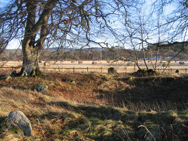
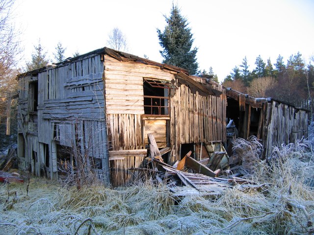
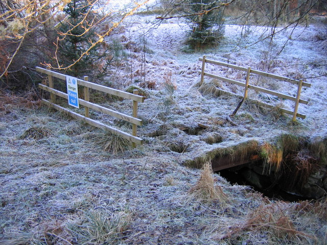
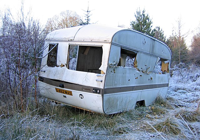
Loaneckheim Images

Images are sourced within 2km of 57.42735/-4.4898713 or Grid Reference NH5040. Thanks to Geograph Open Source API. All images are credited.

Bruiach ring cairn This in amongst some trees, beside the road near Kiltarlity village.
It is the remains of some sort of ring cairn, one of the group of Clava cairns. There is a hollow with a kerb of stones around it, as well as an outer ring of standing stones. The rest of the cairn material has been removed. Apparently the inner hollow was once dug out to create a pond.

More details on the Highland Council Historic Environment Record: <span class="nowrap"><a title="http://her.highland.gov.uk/SingleResult.aspx?uid=MHG2739" rel="nofollow ugc noopener" href="http://her.highland.gov.uk/SingleResult.aspx?uid=MHG2739">Link</a><img style="margin-left:2px;" alt="External link" title="External link - shift click to open in new window" src="https://s1.geograph.org.uk/img/external.png" width="10" height="10"/></span>
Bruiach ring cairn
This in amongst some trees, beside the road near Kiltarlity village. It is the remains of some sort of ring cairn, one of the group of Clava cairns. There is a hollow with a kerb of stones around it, as well as an outer ring of standing stones. The rest of the cairn material has been removed. Apparently the inner hollow was once dug out to create a pond. More details on the Highland Council Historic Environment Record: LinkExternal link
Teanacoil Sawmill This building was the main accommodation block for the sawmill. It was the only building still standing, though parts of it were falling down.

As of August 2012, this building has been demolished, see <a href="https://www.geograph.org.uk/photo/3079254">NH4940 : Teanacoil Sawmill demolished</a>
Teanacoil Sawmill
This building was the main accommodation block for the sawmill. It was the only building still standing, though parts of it were falling down. As of August 2012, this building has been demolished, see NH4940 : Teanacoil Sawmill demolished
Old bridge over the Black Burn This is the old track leading to Teanacoil Sawmill. The bridge was falling into disrepair, and fenced off with a "Danger Keep Out" sign. The main beams of the bridge still seem pretty solid, so it was possible to carefully walk across.

The bridge has since been rebuilt and repaired, see <a href="https://www.geograph.org.uk/photo/3081041">NH4940 : Bridge over the Black Burn</a>
Old bridge over the Black Burn
This is the old track leading to Teanacoil Sawmill. The bridge was falling into disrepair, and fenced off with a "Danger Keep Out" sign. The main beams of the bridge still seem pretty solid, so it was possible to carefully walk across. The bridge has since been rebuilt and repaired, see NH4940 : Bridge over the Black Burn
Old caravan at Teanacoil Sawmill This caravan has been here for a number of years, and it is now in rather poor condition.
It would be rather difficult to remove it now, as much of the surrounding area is overgrown with bushes and trees.
Old caravan at Teanacoil Sawmill
This caravan has been here for a number of years, and it is now in rather poor condition. It would be rather difficult to remove it now, as much of the surrounding area is overgrown with bushes and trees.
Yellow-banded pine trees A number of trees in this area have sticky yellow bands around them - they are for monitoring for Pine-tree lappet moths (Dendrolimus pini). When the caterpillars of this moth crawl down the trees, they will get stuck on the yellow bands.

Pine-tree lappet moths are usually found in Eastern Europe and Russia, but in 2009 a number of them were found breeding in Boblainy Forest. The moths feed on Scots pine, and can cause severe damage and death to the trees. The Forestry Commission are monitoring the moths, to find out how many there are and how to deal with them. They have also restricted timber movement from forests in the area, to limit the spread of the moth.

See the Forestry Commission pages for more details: <span class="nowrap"><a title="http://www.forestry.gov.uk/fr/INFD-8HNHK9" rel="nofollow ugc noopener" href="http://www.forestry.gov.uk/fr/INFD-8HNHK9">Link</a><img style="margin-left:2px;" alt="External link" title="External link - shift click to open in new window" src="https://s1.geograph.org.uk/img/external.png" width="10" height="10"/></span> and <span class="nowrap"><a title="http://www.forestry.gov.uk/website/forestry.nsf/byunique/infd-8aflrb" rel="nofollow ugc noopener" href="http://www.forestry.gov.uk/website/forestry.nsf/byunique/infd-8aflrb">Link</a><img style="margin-left:2px;" alt="External link" title="External link - shift click to open in new window" src="https://s1.geograph.org.uk/img/external.png" width="10" height="10"/></span>
Yellow-banded pine trees
A number of trees in this area have sticky yellow bands around them - they are for monitoring for Pine-tree lappet moths (Dendrolimus pini). When the caterpillars of this moth crawl down the trees, they will get stuck on the yellow bands. Pine-tree lappet moths are usually found in Eastern Europe and Russia, but in 2009 a number of them were found breeding in Boblainy Forest. The moths feed on Scots pine, and can cause severe damage and death to the trees. The Forestry Commission are monitoring the moths, to find out how many there are and how to deal with them. They have also restricted timber movement from forests in the area, to limit the spread of the moth. See the Forestry Commission pages for more details: LinkExternal link and LinkExternal link
Teanacoil Sawmill demolished This was the site of the last remaining building of Teanacoil Sawmill. It was in poor condition, and probably rather dangerous. It has now all been demolished, leaving just the concrete floor and a pile of rubble.
For the building six months ago, see <a href="https://www.geograph.org.uk/photo/2789975">NH4940 : Teanacoil Sawmill</a>
Teanacoil Sawmill demolished
This was the site of the last remaining building of Teanacoil Sawmill. It was in poor condition, and probably rather dangerous. It has now all been demolished, leaving just the concrete floor and a pile of rubble. For the building six months ago, see NH4940 : Teanacoil Sawmill
Old chimney, Teanacoil Sawmill All that remains of this building is a pair of brick chimneys. They are now rather well hidden amongst the trees.
I don't know what this building was used for.
Old chimney, Teanacoil Sawmill
All that remains of this building is a pair of brick chimneys. They are now rather well hidden amongst the trees. I don't know what this building was used for.
Bridge over the Black Burn This is the route to the site of Teanacoil Sawmill. The track has been recently cleared and improved, and this bridge has been repaired or rebuilt. The bridge was in rather poor condition, with holes in the decking, see <a href="https://www.geograph.org.uk/photo/2791294">NH4940 : Old bridge over the Black Burn</a>

On the right is a sign saying "Path 1km, Country Walk", though I'm not sure if it actually leads anywhere. Across the bridge on the left is a pile of sawdust.
Bridge over the Black Burn
This is the route to the site of Teanacoil Sawmill. The track has been recently cleared and improved, and this bridge has been repaired or rebuilt. The bridge was in rather poor condition, with holes in the decking, see NH4940 : Old bridge over the Black Burn On the right is a sign saying "Path 1km, Country Walk", though I'm not sure if it actually leads anywhere. Across the bridge on the left is a pile of sawdust.
Barley by Bruiach Fields of barley near Kiltarlity. The farm at Bruiach is in the centre distance.
Barley by Bruiach
Fields of barley near Kiltarlity. The farm at Bruiach is in the centre distance.
Culburnie Burn
Culburnie Burn
Bridge over the Black Burn
Log stacks, Boblainy Forest Stacks of timber alongside the track, on a grey evening.
Log stacks, Boblainy Forest
Stacks of timber alongside the track, on a grey evening.
Track, Boblainy Forest Looking back down the hill. Conifer trees alongside the track, including spruce and pine.
Track, Boblainy Forest
Looking back down the hill. Conifer trees alongside the track, including spruce and pine.
Track, Boblainy Forest Looking down the hill. Some tall pine trees alongside the track.
Track, Boblainy Forest
Looking down the hill. Some tall pine trees alongside the track.
Forest track down the hill This track was upgraded last year, with this gate added. The gate is usually locked, but there is space around the sides for pedestrians or cyclists. There is a sign warning of "Timber Operations Ahead", but there didn't seem to be much happening today.
Some houses and fields near Femnock and Boblainy are visible in the distance.
Forest track down the hill
This track was upgraded last year, with this gate added. The gate is usually locked, but there is space around the sides for pedestrians or cyclists. There is a sign warning of "Timber Operations Ahead", but there didn't seem to be much happening today. Some houses and fields near Femnock and Boblainy are visible in the distance.
Valley of the Bruiach Burn Much of the forest on the slopes either side of the burn was felled a few years ago. It looks like not much has been replanted - instead the area is becoming covered with bushes, heather, and a few small trees.
Valley of the Bruiach Burn
Much of the forest on the slopes either side of the burn was felled a few years ago. It looks like not much has been replanted - instead the area is becoming covered with bushes, heather, and a few small trees.
Footbridge over the Bruiach Burn This bridge was built here fairly recently, probably sometime last year. 
I'm not sure why it is here, as it doesn't seem to lead to anywhere on the west side. Though you could cut across fields to the road or houses at Femnock.
Footbridge over the Bruiach Burn
This bridge was built here fairly recently, probably sometime last year. I'm not sure why it is here, as it doesn't seem to lead to anywhere on the west side. Though you could cut across fields to the road or houses at Femnock.
Abandoned van, in Boblainy forest It looks like this van has been pushed off the forest track and down the hill. It has been here for quite a few years now, and is now rather rusty.
The van is a Ford Escort Mk3 or Mk4, dating from the 1980s.

The fence on the right is the boundary of the Forestry Commission land.
Abandoned van, in Boblainy forest
It looks like this van has been pushed off the forest track and down the hill. It has been here for quite a few years now, and is now rather rusty. The van is a Ford Escort Mk3 or Mk4, dating from the 1980s. The fence on the right is the boundary of the Forestry Commission land.
Show me another place!

Loaneckheim is located at Grid Ref: NH5040 (Lat: 57.42735, Lng: -4.4898713)

Unitary Authority: Highland

Police Authority: Highlands and Islands

What 3 Words

///yacht.forces.journey. Near Beauly, Highland

Nearby Locations

Camault Muir Loaneckheim

Related Wikis

Glaichbea

Glaichbea is a small hamlet in the Highland council area, located directly south of Camault Muir in the Highlands of Scotland. It is located 3.8 miles...

Camault Muir

Camault Muir is a scattered crofting community and part of the village of Kiltarlity, in the Highland council area of Scotland. It is situated on a boggy...

Tomnacross

Tomnacross is a small hamlet and part of the village of Kiltarlity, about 20 km west of the city of Inverness in the Highland Council area of Scotland...

Kiltarlity

Kiltarlity (Scottish Gaelic: Cill Targhlain) is a small village in the Highland council area of Scotland. It is 12 miles (19 km) west of Inverness and...

Nearby Amenities

Located within 500m of 57.42735,-4.4898713
Camault Muir
Place: hamlet
Lat/Long: 57.4302956/-4.489047
Loaneckheim
Place: hamlet
Lat/Long: 57.4312187/-4.4920165
Addr Housenumber: 14
Lat/Long: 57.4308059/-4.4946572
Entrance: main
Lat/Long: 57.4268601/-4.495752
Power: pole
Lat/Long: 57.4274792/-4.4951582
Power: pole
Lat/Long: 57.4281805/-4.4924899
Power: pole
Lat/Long: 57.4289644/-4.4917453
Power: pole
Lat/Long: 57.4279467/-4.492712
Power: pole
Lat/Long: 57.4294986/-4.4920347
Power: pole
Lat/Long: 57.4298257/-4.4903376
Power: pole
Lat/Long: 57.4290489/-4.4914801
Power: pole
Lat/Long: 57.4290441/-4.4916016
Power: pole
Lat/Long: 57.4231396/-4.48933
Power: pole
Lat/Long: 57.4238309/-4.4895156
Power: pole
Lat/Long: 57.4245162/-4.4897034
Power: pole
Lat/Long: 57.4251229/-4.4888306
Power: pole
Lat/Long: 57.4259272/-4.4891068
Power: pole
Lat/Long: 57.4267279/-4.4893919
Power: pole
Lat/Long: 57.4271954/-4.4904216
Power: pole
Lat/Long: 57.4273965/-4.4905034
Power: pole
Lat/Long: 57.4282209/-4.4908459
Power: pole
Lat/Long: 57.4301897/-4.4926601
Power: pole
Lat/Long: 57.4308487/-4.4932589
Power: pole
Lat/Long: 57.4309094/-4.4898736
Power: pole
Lat/Long: 57.430267/-4.4904061
Power: pole
Lat/Long: 57.4290632/-4.4901697
Power: pole
Lat/Long: 57.428554/-4.4901365
Power: pole
Lat/Long: 57.4280056/-4.4900658
Power: pole
Lat/Long: 57.427519/-4.489878
Power: pole
Lat/Long: 57.4268314/-4.4891134
Power: pole
Lat/Long: 57.4262437/-4.4888394
Power: pole
Lat/Long: 57.4257487/-4.4886273
Power: pole
Lat/Long: 57.4251908/-4.4883731
Power: pole
Lat/Long: 57.423976/-4.4878207
Power: pole
Lat/Long: 57.4234442/-4.4869191
Power: pole
Lat/Long: 57.4256723/-4.4969278
Power: pole
Lat/Long: 57.4256235/-4.4961028
Power: pole
Lat/Long: 57.4249078/-4.4957348
Power: pole
Lat/Long: 57.4241623/-4.4953634
Power: pole
Lat/Long: 57.4238647/-4.4946761
Power: pole
Lat/Long: 57.4235625/-4.4939284
Power: pole
Lat/Long: 57.426022/-4.4954281
Power: pole
Lat/Long: 57.426411/-4.4947602
Power: pole
Lat/Long: 57.426397/-4.4937528
Power: pole
Lat/Long: 57.4264874/-4.4925841
Power: pole
Lat/Long: 57.4268235/-4.4914717
Addr Housenumber: 15
Lat/Long: 57.429299/-4.490836
Addr Housename: Bruiach Croft
Lat/Long: 57.4291395/-4.4938065
The data included in this document is from www.openstreetmap.org. The data is made available under ODbL.

Have you been to Loaneckheim?

Leave your review of Loaneckheim below (or comments, questions and feedback).