Llanlleian-wen

Settlement in Glamorgan

Wales

Llanlleian-wen

Semi derelict stable Small shed used as a stable on side of single track road, with possible stile on side of building (no footpath sign though so probably private).
Semi derelict stable Credit: John Phoenix

Llanlleian-wen is a small village located in the historic county of Glamorgan, Wales. Situated in the southern part of the country, it lies approximately 10 miles northwest of the vibrant city of Cardiff. The name Llanlleian-wen derives from the Welsh language, with "Llan" meaning church, and "Lleian-wen" referring to a local saint associated with the area.

The village is nestled amidst picturesque rolling hills and lush green countryside, providing residents and visitors with stunning views and a tranquil atmosphere. Llanlleian-wen boasts a rich history, with evidence of human habitation dating back to the Bronze Age. The area was predominantly agricultural, with farming playing a significant role in the local economy for centuries.

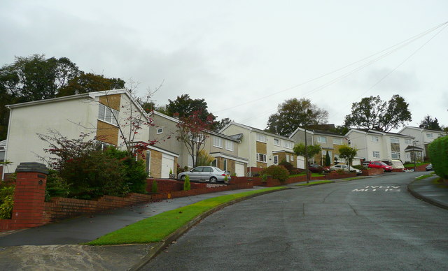
Today, Llanlleian-wen retains its rural charm, with a small population of around 300 inhabitants. The village is characterized by a collection of traditional Welsh cottages and houses, some of which date back several centuries. The local community is tight-knit, and the village often organizes events and celebrations to bring residents together.

Although small in size, Llanlleian-wen benefits from its close proximity to the city of Cardiff, providing residents with easy access to a range of amenities and services. The village is well-connected to the wider region through a network of roads, making it an ideal location for those seeking a peaceful rural lifestyle while still being within easy reach of urban amenities.

Overall, Llanlleian-wen offers a serene and idyllic setting, making it a desirable place to live for those looking to escape the hustle and bustle of city life.

If you have any feedback on the listing, please let us know in the comments section below.

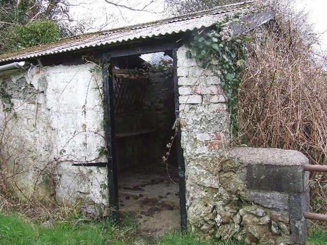
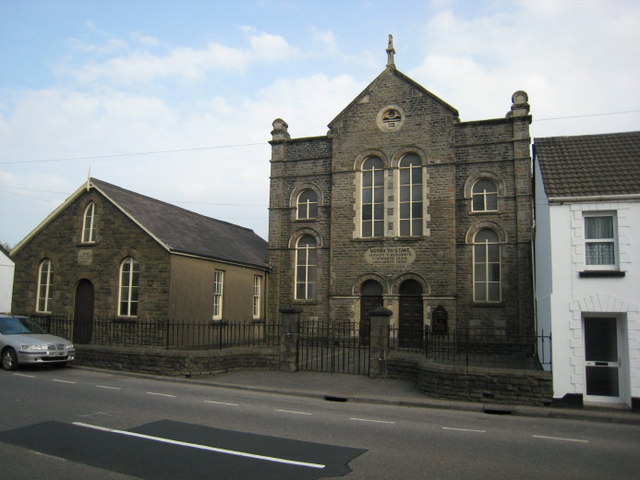
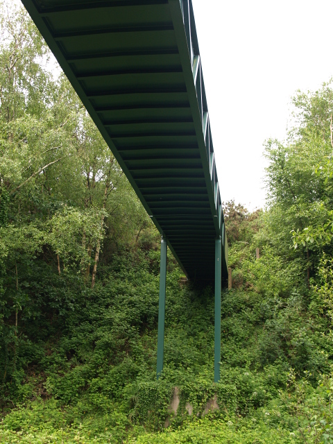
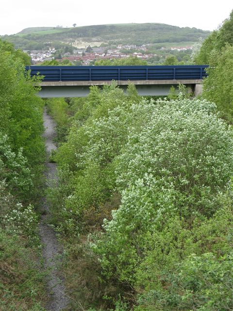
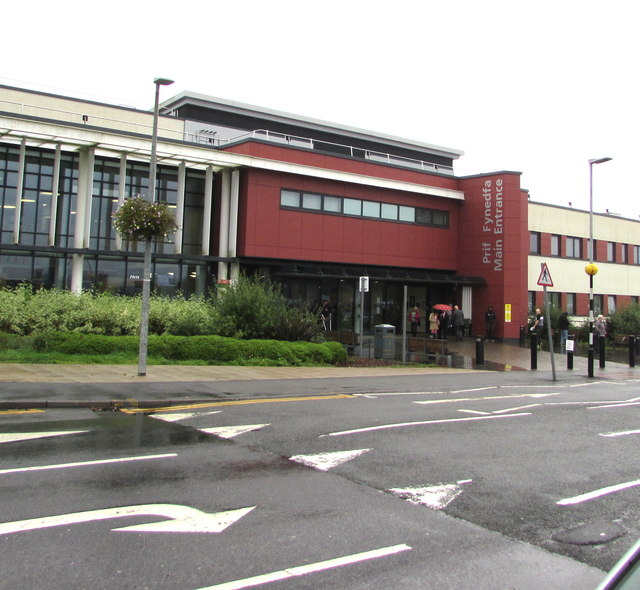
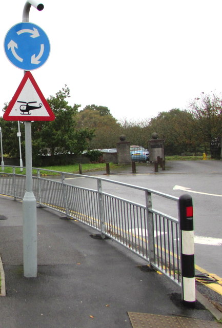
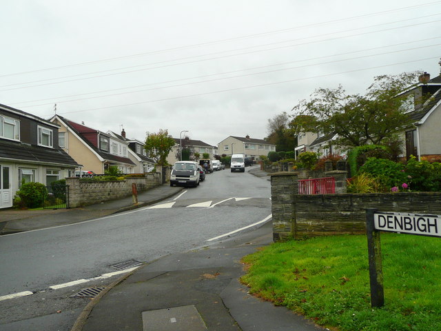
Llanlleian-wen Images

Images are sourced within 2km of 51.677438/-3.9167632 or Grid Reference SS6799. Thanks to Geograph Open Source API. All images are credited.

Semi derelict stable Small shed used as a stable on side of single track road, with possible stile on side of building (no footpath sign though so probably private).
Semi derelict stable
Small shed used as a stable on side of single track road, with possible stile on side of building (no footpath sign though so probably private).
Moriah, Ynystawe. Capel y Bedyddwyr, mae'r garreg uwchben y drysau yn cofnodi 1892 fel blwyddyn yr adeiladu.  Helaethwyd yr  adeilad yn 1928.

A Baptist chapel, the stone above the doors gives 1892 as the year of construction.  The chapel was enlarged in 1928.
Moriah, Ynystawe.
Capel y Bedyddwyr, mae'r garreg uwchben y drysau yn cofnodi 1892 fel blwyddyn yr adeiladu. Helaethwyd yr adeilad yn 1928. A Baptist chapel, the stone above the doors gives 1892 as the year of construction. The chapel was enlarged in 1928.
Ysbyty Treforys.  Morriston Hospital. Mae'r simdde amryliw ar y chwith yn un o nodweddion pensaerniol y fro.

The multi coloured chimney on the left is a prominent local landmark.
Ysbyty Treforys. Morriston Hospital.
Mae'r simdde amryliw ar y chwith yn un o nodweddion pensaerniol y fro. The multi coloured chimney on the left is a prominent local landmark.
Footbridge, Glais The footpath crosses the line of an old railway below.
Footbridge, Glais
The footpath crosses the line of an old railway below.
Bryntawe, Ynystawe A very steep suburban road on the northern edge of the Swansea conurbation.
Bryntawe, Ynystawe
A very steep suburban road on the northern edge of the Swansea conurbation.
Dismantled railway to Clydach tinplate works As seen from <a href="https://www.geograph.org.uk/photo/831194">SN6900 : Footbridge, Glais</a>
The OS have recently updated their maps to remove the rails from this line but the tree growth suggests they have been gone for much longer. The cutting is wide enough for two tracks and there are now two worn paths side by side along the course.
The visible bridge is part of the more recently built A4067.
Dismantled railway to Clydach tinplate works
As seen from SN6900 : Footbridge, Glais The OS have recently updated their maps to remove the rails from this line but the tree growth suggests they have been gone for much longer. The cutting is wide enough for two tracks and there are now two worn paths side by side along the course. The visible bridge is part of the more recently built A4067.
Ordnance Survey Cut Mark This OS cut mark can be found on the school. It marks a point 22.9000m above mean sea level.
Ordnance Survey Cut Mark
This OS cut mark can be found on the school. It marks a point 22.9000m above mean sea level.
Ynystawe Primary School Ynystawe Primary School, Clydach.
Ynystawe Primary School
Ynystawe Primary School, Clydach.
Junction in Pantlasau, Swansea The southern end of Rhydypandy Road viewed across Mynydd Gelli Wastad Road.
Junction in Pantlasau, Swansea
The southern end of Rhydypandy Road viewed across Mynydd Gelli Wastad Road.
Queen Elizabeth II postbox, Pantlasau, Swansea Alongside Mynydd Gelli Wastad Road.
Queen Elizabeth II postbox, Pantlasau, Swansea
Alongside Mynydd Gelli Wastad Road.
Minor road to Maes-eglwys from Pantlasau, Swansea From the west side of Mynydd Gelli Wastad Road.
Minor road to Maes-eglwys from Pantlasau, Swansea
From the west side of Mynydd Gelli Wastad Road.
Cross House, Mynydd Gelli Wastad Road, Pantlasau, Swansea Greenfields Evangelical Church <a title="https://www.geograph.org.uk/photo/5943376" href="https://www.geograph.org.uk/photo/5943376">Link</a> is on the left.
Cross House, Mynydd Gelli Wastad Road, Pantlasau, Swansea
Greenfields Evangelical Church Link is on the left.
Warning sign - horse riders, Pantlasau, Swansea Alongside Pant Lasau Road.
Warning sign - horse riders, Pantlasau, Swansea
Alongside Pant Lasau Road.
Main entrance to Morriston Hospital, Swansea Located in Cwmrhydyceirw north of Morriston in the north of Swansea, Morriston is the largest hospital in the City and County of Swansea. It is operated by Abertawe Bro Morgannwg University Health Board.

The Coflein website records that Morriston Hospital was founded in 1942 as an emergency wartime hospital. It was government owned and managed by Swansea Corporation. During the war the hospital had 15 Nightingale type wards with some 600 beds. The hospital has been modified and altered significantly in more recent times, and now has 750 beds, mostly in modern accommodation built since 1981. The hospital has an Accident and Emergency department and facilities for acute general medical and elderly care, trauma and orthopedic services, specialist surgery and paediatric services.
Main entrance to Morriston Hospital, Swansea
Located in Cwmrhydyceirw north of Morriston in the north of Swansea, Morriston is the largest hospital in the City and County of Swansea. It is operated by Abertawe Bro Morgannwg University Health Board. The Coflein website records that Morriston Hospital was founded in 1942 as an emergency wartime hospital. It was government owned and managed by Swansea Corporation. During the war the hospital had 15 Nightingale type wards with some 600 beds. The hospital has been modified and altered significantly in more recent times, and now has 750 beds, mostly in modern accommodation built since 1981. The hospital has an Accident and Emergency department and facilities for acute general medical and elderly care, trauma and orthopedic services, specialist surgery and paediatric services.
Start of the 15mph zone on the approach to Morriston Hospital, Swansea The 30mph speed limit drops to 15mph on the approach to the hospital main entrance. <a title="https://www.geograph.org.uk/photo/5944692" href="https://www.geograph.org.uk/photo/5944692">Link</a>
Start of the 15mph zone on the approach to Morriston Hospital, Swansea
The 30mph speed limit drops to 15mph on the approach to the hospital main entrance. Link
Metro bus outside Morriston Hospital, Swansea The Swansea Metro service 4/4A links Morriston Hospital with Swansea University/Singleton Hospital via the Liberty Stadium, Swansea railway station, the city centre and Swansea bus station. First South & West Wales fleet number in view is 47662.
Metro bus outside Morriston Hospital, Swansea
The Swansea Metro service 4/4A links Morriston Hospital with Swansea University/Singleton Hospital via the Liberty Stadium, Swansea railway station, the city centre and Swansea bus station. First South & West Wales fleet number in view is 47662.
End of the 15mph zone near Morriston Hospital, Swansea The 15mph speed limit in force near the hospital increases to 30mph.
End of the 15mph zone near Morriston Hospital, Swansea
The 15mph speed limit in force near the hospital increases to 30mph.
Helicopter warning sign near Morriston Hospital, Swansea Be prepared for air turbulence created by a Welsh Air Ambulance 
helicopter taking off from, or landing at, the nearby hospital.
Helicopter warning sign near Morriston Hospital, Swansea
Be prepared for air turbulence created by a Welsh Air Ambulance helicopter taking off from, or landing at, the nearby hospital.
Show me another place!

Llanlleian-wen is located at Grid Ref: SS6799 (Lat: 51.677438, Lng: -3.9167632)

Unitary Authority: Swansea

Police Authority: South Wales

What 3 Words

///loudly.rises.melt. Near Morriston, Swansea

Related Wikis

Ynysforgan

Ynysforgan is a village in Swansea, Wales, between Morriston and Ynystawe, just off junction 45 of the M4 motorway The origins of its name are not known...

Lower Swansea valley

The Lower Swansea valley (Welsh: Cwm Tawe Isaf) is the lower half of the valley of the River Tawe in south Wales. It runs from approximately the level...

Morriston Town A.F.C.

Morriston Town Football Club is an amateur association football team based in Morriston, Swansea, Wales. The club plays in the Ardal Leagues South West...

Cwmrhydyceirw

Cwmrhydyceirw is a village in the City and County of Swansea, south Wales. The village is located about 1 mile north of Morriston town centre. It is home...

Related Videos

Nearby Amenities

Located within 500m of 51.677438,-3.9167632
Motorway Junction
Ynysforgan
Exit To: A4067 Pontardawe
Layer: 3
Ref: 45
Lat/Long: 51.6792981/-3.9196147
Mini Roundabout
Lat/Long: 51.6773602/-3.9150278
Power: tower
Lat/Long: 51.6802425/-3.912376
Power: tower
Lat/Long: 51.6811602/-3.9164849
Power: tower
Lat/Long: 51.6803093/-3.9117978
Power: tower
Lat/Long: 51.6812688/-3.9186639
Power: tower
Lat/Long: 51.6818116/-3.9170516
Power: tower
Lat/Long: 51.6806162/-3.9210644
Power: tower
Lat/Long: 51.6806267/-3.913422
Traffic Signals
Lat/Long: 51.6769935/-3.9137912
Motorway Junction
Lat/Long: 51.6745521/-3.916614
Bus Stop
Maes-yr-Onnen
Bus: yes
Naptan AtcoCode: 5810AWC51316
Naptan Bearing: SE
Naptan CommonName: Maes-yr-Onnen
Naptan Crossing: Maes-yr-Onnen
Naptan NaptanCode: swadtgw
Naptan PlusbusZoneRef: SWANSEA
Naptan Street: Llanllienwen Road
Naptan Verified: no
Public Transport: platform
Source: naptan_import
Lat/Long: 51.6774205/-3.9239518
Bus Stop
Glyn Hir Nant (NE)
Bus: yes
Naptan AtcoCode: 5810AWC51335
Naptan Bearing: N
Naptan CommonName: Glyn Hir Nant (NE)
Naptan Landmark: O/S No. 251.
Naptan NaptanCode: swajgja
Naptan PlusbusZoneRef: SWANSEA
Naptan ShortCommonName: Glyn Hir Nant
Naptan Street: CLYDACH ROAD
Naptan Verified: no
Public Transport: platform
Source: naptan_import
Lat/Long: 51.6736124/-3.9181641
Bus Stop
Cae-nan (SW)
Bus: yes
Naptan AtcoCode: 5810AWC51336
Naptan Bearing: SW
Naptan CommonName: Cae-nan (SW)
Naptan NaptanCode: swadtjt
Naptan PlusbusZoneRef: SWANSEA
Naptan Street: Clydach Road
Naptan Verified: no
Public Transport: platform
Source: naptan_import
Lat/Long: 51.6761898/-3.915626
Bus Stop
Cae-nan (NE)
Bus: yes
Naptan AtcoCode: 5810AWC51337
Naptan Bearing: NE
Naptan CommonName: Cae-nan (NE)
Naptan NaptanCode: swadtjw
Naptan PlusbusZoneRef: SWANSEA
Naptan Street: Clydach Road
Naptan Verified: no
Public Transport: platform
Source: naptan_import
Lat/Long: 51.6769127/-3.9154106
Bus Stop
Llanllienwen Road East (NW)
Bus: yes
Naptan AtcoCode: 5810AWC51338
Naptan Bearing: NW
Naptan CommonName: Llanllienwen Road East (NW)
Naptan NaptanCode: swadtdj
Naptan PlusbusZoneRef: SWANSEA
Naptan Street: Llanllienwen Road
Naptan Verified: no
Public Transport: platform
Source: naptan_import
Lat/Long: 51.677392/-3.9152428
Bus Stop
Llanllienwen Road East (SE)
Bus: yes
Naptan AtcoCode: 5810AWC51339
Naptan Bearing: SE
Naptan CommonName: Llanllienwen Road East (SE)
Naptan NaptanCode: swadtdm
Naptan PlusbusZoneRef: SWANSEA
Naptan Street: Llanllienwen Road
Naptan Verified: no
Public Transport: platform
Source: naptan_import
Lat/Long: 51.6775623/-3.9153494
Bus Stop
Ynysforgan Roundabout (SW)
Bus: yes
Naptan AtcoCode: 5810AWC51342
Naptan Bearing: SW
Naptan CommonName: Ynysforgan Roundabout (SW)
Naptan NaptanCode: swaptdj
Naptan PlusbusZoneRef: SWANSEA
Naptan Street: Clydach Road
Naptan Verified: no
Public Transport: platform
Source: naptan_import
Lat/Long: 51.6797687/-3.9123199
Bus Stop
Ynysforgan Roundabout (NE)
Bus: yes
Naptan AtcoCode: 5810AWC51343
Naptan Bearing: NE
Naptan CommonName: Ynysforgan Roundabout (NE)
Naptan NaptanCode: swaptdm
Naptan PlusbusZoneRef: SWANSEA
Naptan Street: Clydach Road
Naptan Verified: no
Public Transport: platform
Source: naptan_import
Lat/Long: 51.6807984/-3.912045
Traffic Signals
Lat/Long: 51.6786332/-3.9134662
Traffic Signals
Lat/Long: 51.6789651/-3.912746
Traffic Signals
Lat/Long: 51.678827/-3.9120582
Power: tower
Lat/Long: 51.6792767/-3.9110143
Traffic Signals
Lat/Long: 51.6773753/-3.9140928
Traffic Signals
Lat/Long: 51.6785553/-3.9133248
Traffic Signals
Lat/Long: 51.677385/-3.9122662
Traffic Signals
Lat/Long: 51.6769573/-3.9140103
Traffic Signals
Lat/Long: 51.6787661/-3.9122522
Traffic Signals
Lat/Long: 51.6772862/-3.9136853
Traffic Signals
Lat/Long: 51.6775162/-3.9123959
Traffic Signals
Lat/Long: 51.67891/-3.9129034
Riverside Caravan Park Shop
Addr Postcode: SA6 6QL
Fhrs Id: 691351
Fixme: Location is wrong...
Shop: convenience
Lat/Long: 51.6752067/-3.9123366
Clwb Rygbi Treforys
Access: yes
Addr City: Morriston
Addr Postcode: SA6 6JS
Addr Street: Heol Gwernen
Club: sport
Fhrs Id: 442818
Name Cy: Clwb Rygbi Treforys
Name En: Morriston RFC
Opening Hours: Mo 18:00-23:00; Tu 18:00-22:30; We 18:00-23:30; Th 18:00-23:00; Fr 16:00-01:00, Sa 11:30-01:00, Su 11:30-23:00
Rugby: union
Sport: rugby
Website: https://morriston.rfc.wales/
Wikidata: Q6914101
Wikipedia: en:Morriston RFC
Lat/Long: 51.6750138/-3.922188
Material: steel
Power: pole
Lat/Long: 51.6793462/-3.9108378
Direction: 165
Generator Method: photovoltaic
Generator Output Electricity: yes
Generator Solar Modules: 12
Generator Source: solar
Generator Type: solar_photovoltaic_panel
Location: roof
Power: generator
Lat/Long: 51.6813145/-3.9136186
Direction: SSE
Generator Method: photovoltaic
Generator Output Electricity: yes
Generator Solar Modules: 8
Generator Source: solar
Generator Type: solar_photovoltaic_panel
Location: roof
Power: generator
Lat/Long: 51.6808432/-3.9159953
Direction: 195
Generator Method: photovoltaic
Generator Output Electricity: yes
Generator Solar Modules: 12
Generator Source: solar
Generator Type: solar_photovoltaic_panel
Location: roof
Power: generator
Lat/Long: 51.6817448/-3.9146596
Direction: SW
Generator Method: photovoltaic
Generator Output Electricity: yes
Generator Solar Modules: 14
Generator Source: solar
Generator Type: solar_photovoltaic_panel
Location: roof
Power: generator
Lat/Long: 51.6795383/-3.9166354
Direction: 125
Generator Method: photovoltaic
Generator Output Electricity: yes
Generator Solar Modules: 10
Generator Source: solar
Generator Type: solar_photovoltaic_panel
Location: roof
Power: generator
Lat/Long: 51.6800647/-3.9138935
Direction: SSW
Generator Method: photovoltaic
Generator Output Electricity: yes
Generator Solar Modules: 9
Generator Source: solar
Generator Type: solar_photovoltaic_panel
Location: roof
Power: generator
Lat/Long: 51.6794381/-3.9138653
Direction: 105
Generator Method: photovoltaic
Generator Output Electricity: yes
Generator Solar Modules: 16
Generator Source: solar
Generator Type: solar_photovoltaic_panel
Location: roof
Power: generator
Lat/Long: 51.6736505/-3.9183493
Direction: ESE
Generator Method: photovoltaic
Generator Output Electricity: yes
Generator Solar Modules: 7
Generator Source: solar
Generator Type: solar_photovoltaic_panel
Location: roof
Power: generator
Lat/Long: 51.6793963/-3.9137061
Direction: 185
Generator Method: photovoltaic
Generator Output Electricity: yes
Generator Solar Modules: 12
Generator Source: solar
Generator Type: solar_photovoltaic_panel
Location: roof
Power: generator
Lat/Long: 51.6770669/-3.9206594
Direction: S
Generator Method: photovoltaic
Generator Output Electricity: yes
Generator Solar Modules: 13
Generator Source: solar
Generator Type: solar_photovoltaic_panel
Location: roof
Power: generator
Lat/Long: 51.6768132/-3.9210583
Direction: 190
Generator Method: photovoltaic
Generator Output Electricity: yes
Generator Solar Modules: 12
Generator Source: solar
Generator Type: solar_photovoltaic_panel
Location: roof
Power: generator
Lat/Long: 51.6782269/-3.9162961
Direction: SW
Generator Method: photovoltaic
Generator Output Electricity: yes
Generator Solar Modules: 13
Generator Source: solar
Generator Type: solar_photovoltaic_panel
Location: roof
Power: generator
Lat/Long: 51.6763059/-3.9209926
Direction: SW
Generator Method: photovoltaic
Generator Output Electricity: yes
Generator Solar Modules: 12
Generator Source: solar
Generator Type: solar_photovoltaic_panel
Location: roof
Power: generator
Lat/Long: 51.676188/-3.920822
Direction: S
Generator Method: photovoltaic
Generator Output Electricity: yes
Generator Solar Modules: 12
Generator Source: solar
Generator Type: solar_photovoltaic_panel
Location: roof
Power: generator
Lat/Long: 51.6764635/-3.9187741
Direction: 175
Generator Method: photovoltaic
Generator Output Electricity: yes
Generator Solar Modules: 8
Generator Source: solar
Generator Type: solar_photovoltaic_panel
Location: roof
Power: generator
Lat/Long: 51.6766689/-3.9174615
Direction: W
Generator Method: photovoltaic
Generator Output Electricity: yes
Generator Solar Modules: 8
Generator Source: solar
Generator Type: solar_photovoltaic_panel
Location: roof
Power: generator
Lat/Long: 51.6777313/-3.9170913
Direction: E
Generator Method: photovoltaic
Generator Output Electricity: yes
Generator Solar Modules: 8
Generator Source: solar
Generator Type: solar_photovoltaic_panel
Location: roof
Power: generator
Lat/Long: 51.6777244/-3.917025
Direction: 190
Generator Method: photovoltaic
Generator Output Electricity: yes
Generator Solar Modules: 15
Generator Source: solar
Generator Type: solar_photovoltaic_panel
Location: roof
Power: generator
Lat/Long: 51.6778577/-3.916221
Direction: 190
Generator Method: photovoltaic
Generator Output Electricity: yes
Generator Solar Modules: 15
Generator Source: solar
Generator Type: solar_photovoltaic_panel
Location: roof
Power: generator
Lat/Long: 51.6779176/-3.9164865
Direction: 190
Generator Method: photovoltaic
Generator Output Electricity: yes
Generator Solar Modules: 15
Generator Source: solar
Generator Type: solar_photovoltaic_panel
Location: roof
Power: generator
Lat/Long: 51.6779691/-3.9166528
Direction: W
Generator Method: photovoltaic
Generator Output Electricity: yes
Generator Solar Modules: 16
Generator Source: solar
Generator Type: solar_photovoltaic_panel
Location: roof
Power: generator
Lat/Long: 51.6777579/-3.9216658
Direction: 185
Generator Method: photovoltaic
Generator Output Electricity: yes
Generator Solar Modules: 18
Generator Source: solar
Generator Type: solar_photovoltaic_panel
Location: roof
Power: generator
Lat/Long: 51.67834/-3.9231813
Direction: 185
Generator Method: photovoltaic
Generator Output Electricity: yes
Generator Solar Modules: 20
Generator Source: solar
Generator Type: solar_photovoltaic_panel
Location: roof
Power: generator
Lat/Long: 51.6781521/-3.9236614
Direction: ESE
Generator Method: photovoltaic
Generator Output Electricity: yes
Generator Solar Modules: 13
Generator Source: solar
Generator Type: solar_photovoltaic_panel
Location: roof
Power: generator
Lat/Long: 51.6786103/-3.919386
Barrier: bollard
Lat/Long: 51.6773036/-3.9185763
Barrier: bollard
Lat/Long: 51.6767115/-3.9185456
The data included in this document is from www.openstreetmap.org. The data is made available under ODbL.

Have you been to Llanlleian-wen?

Leave your review of Llanlleian-wen below (or comments, questions and feedback).