Littlemoor

Settlement in Yorkshire

England

Littlemoor

Greenwood Weir from downstream The river is non-navigable at this point, being bypassed by Greenwood Cut. See <a href="https://www.geograph.org.uk/photo/6408992">SE2119 : River Calder Barrage, Mirfield</a> for a view of the full length of the weir from above.
Greenwood Weir from downstream Credit: Stephen Craven

Littlemoor is a small village located in the county of Yorkshire, England. Situated in the northern part of the country, it falls within the district of Ryedale. With a population of approximately 500 residents, Littlemoor is known for its picturesque landscapes, charming cottages, and a strong sense of community.

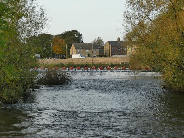
Surrounded by rolling hills and lush green fields, Littlemoor offers a tranquil and idyllic setting for its inhabitants. The village is characterized by its traditional architecture, with many stone-built houses and buildings dating back to the 18th and 19th centuries. The village center features a small square with a village green, where locals often gather for community events and celebrations.

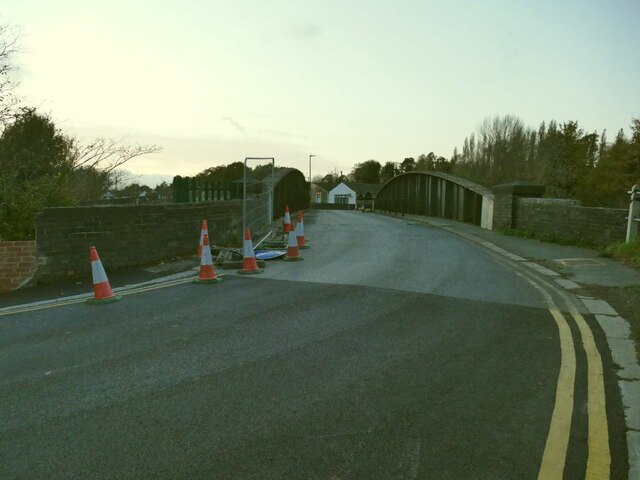
While primarily an agricultural community, Littlemoor also benefits from its proximity to larger towns and cities, such as York and Scarborough, which provide employment opportunities and access to amenities. The village is well-connected to the region's transportation network, with regular bus services that link it to nearby towns and villages.

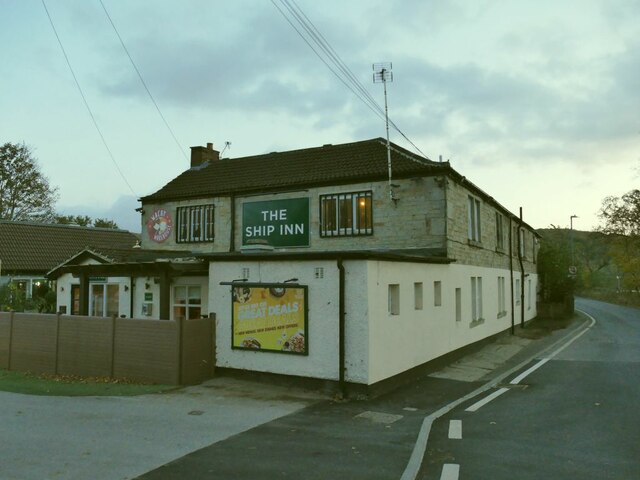
Littlemoor boasts a strong community spirit, with various social and recreational activities available for residents. The village has a local pub, village hall, and a primary school, providing essential amenities for its inhabitants. Additionally, the surrounding countryside offers ample opportunities for outdoor pursuits, including walking, cycling, and horse riding.

In conclusion, Littlemoor is a charming village in Yorkshire, known for its beautiful landscapes, historic architecture, and close-knit community. Its peaceful atmosphere and access to nearby towns make it an attractive place to live for those seeking a tranquil rural lifestyle.

If you have any feedback on the listing, please let us know in the comments section below.
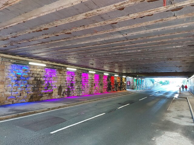
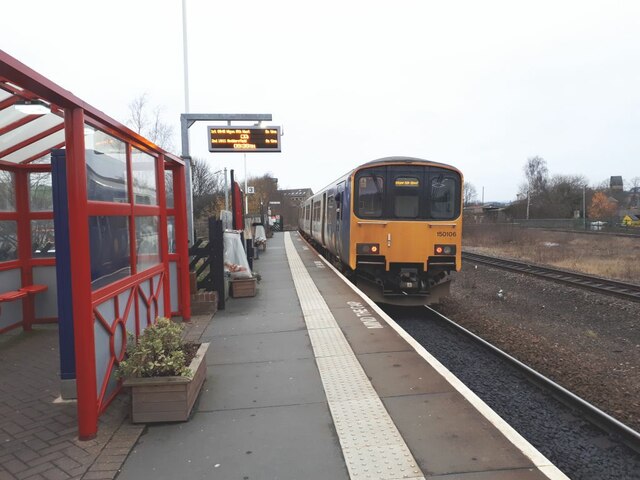
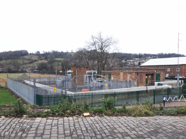
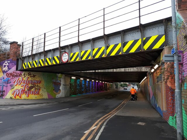
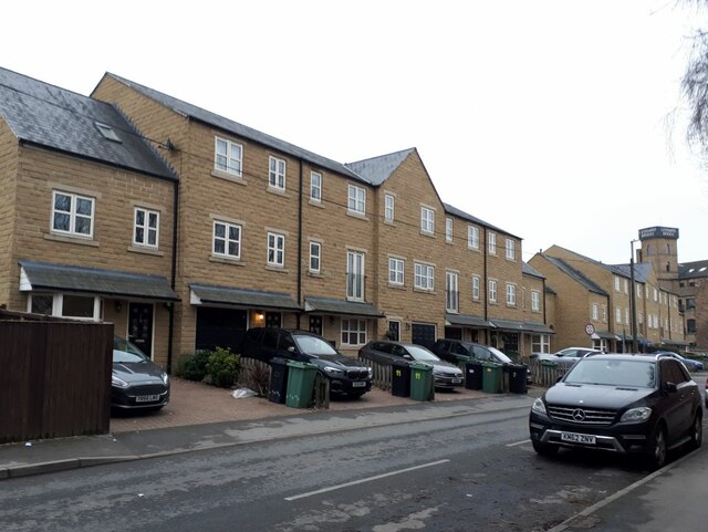
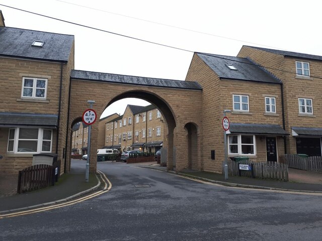
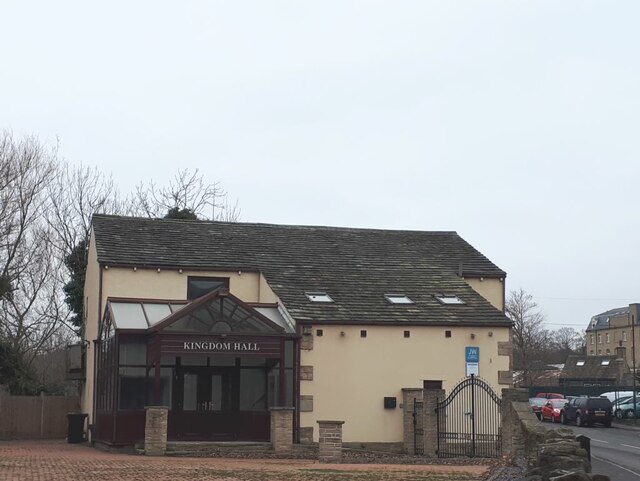
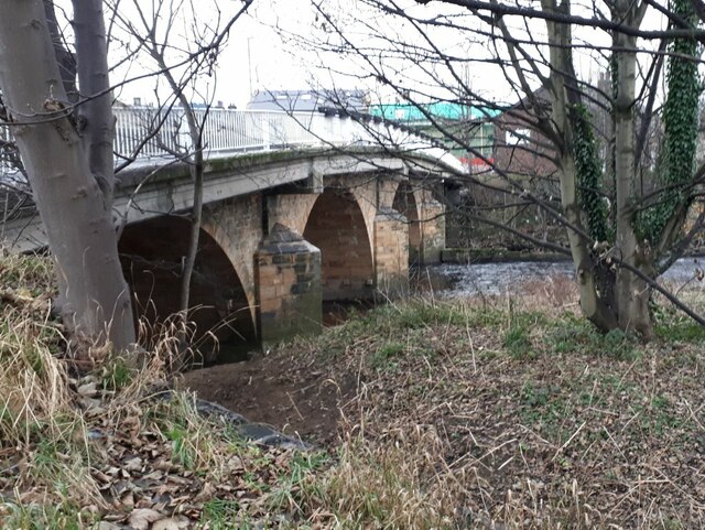
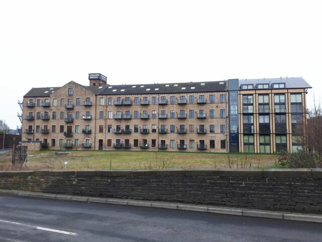
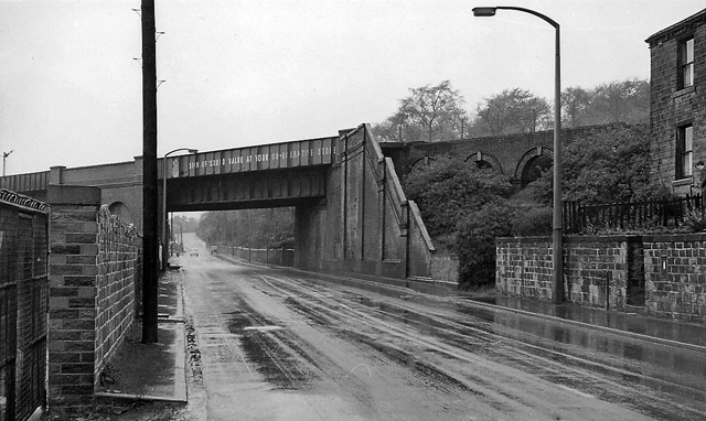
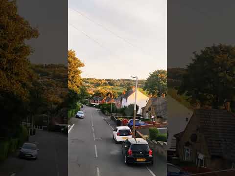
Littlemoor Images

Images are sourced within 2km of 53.675788/-1.6971453 or Grid Reference SE2019. Thanks to Geograph Open Source API. All images are credited.

Greenwood Weir from downstream The river is non-navigable at this point, being bypassed by Greenwood Cut. See <a href="https://www.geograph.org.uk/photo/6408992">SE2119 : River Calder Barrage, Mirfield</a> for a view of the full length of the weir from above.
Greenwood Weir from downstream
The river is non-navigable at this point, being bypassed by Greenwood Cut. See SE2119 : River Calder Barrage, Mirfield for a view of the full length of the weir from above.
Power line termination A pair of three-phase lines terminates near the river bank, suggesting that cable are laid under the river.
Power line termination
A pair of three-phase lines terminates near the river bank, suggesting that cable are laid under the river.
The Ship Inn at Shepley Bridge A Greene King house.
The Ship Inn at Shepley Bridge
A Greene King house.
Shepley Bridge - top A bridge carrying a road over the river Calder. Resurfacing seemed to be in progress.
Shepley Bridge - top
A bridge carrying a road over the river Calder. Resurfacing seemed to be in progress.
Shepley Bridge A bridge carrying a road over the river Calder. See <a href="https://www.geograph.org.uk/photo/2538522">SE2119 : Shepley Bridge</a> for a closer view of the structure.
Shepley Bridge
A bridge carrying a road over the river Calder. See SE2119 : Shepley Bridge for a closer view of the structure.
Swans on the Calder at Shepley Bridge The River Calder is a river in West Yorkshire.
The Calder rises on the eastern slopes of the Pennines flows through alternating countryside, former woollen-mill villages, and large and small towns before joining the River Aire near Castleford, 45 miles later.
The river's valley is generally known as the Calder Valley. The name Calderdale usually refers to the large urban and rural borough (centred on Halifax) through which the upper river flows. The lower reaches flow through the boroughs of Kirklees (based on Huddersfield) and Wakefield. However, the river does not flow through the centres of Halifax and Huddersfield, which are on the Calder's main tributaries, the River Hebble and River Colne respectively. The only large town centres through which the Calder flows are Brighouse, Mirfield, Dewsbury and Wakefield.
Swans on the Calder at Shepley Bridge
The River Calder is a river in West Yorkshire. The Calder rises on the eastern slopes of the Pennines flows through alternating countryside, former woollen-mill villages, and large and small towns before joining the River Aire near Castleford, 45 miles later. The river's valley is generally known as the Calder Valley. The name Calderdale usually refers to the large urban and rural borough (centred on Halifax) through which the upper river flows. The lower reaches flow through the boroughs of Kirklees (based on Huddersfield) and Wakefield. However, the river does not flow through the centres of Halifax and Huddersfield, which are on the Calder's main tributaries, the River Hebble and River Colne respectively. The only large town centres through which the Calder flows are Brighouse, Mirfield, Dewsbury and Wakefield.
Site of the Swan Inn at Shepley Bridge The pub was one of three inns shown in the area on the earliest OS map of 1855, named along with the Ship and the Bulls Head, both of which are still going concerns. The Swan was still open in 2008 <a href="https://www.geograph.org.uk/photo/903586">SE2119 : The Swan - Huddersfield Road, Ravensthorpe</a> but had been demolished by 2021. There were however actual swans on the river just across the road <a href="https://www.geograph.org.uk/photo/7014391">SE2119 : Swans on the Calder at Shepley Bridge</a>.
Site of the Swan Inn at Shepley Bridge
The pub was one of three inns shown in the area on the earliest OS map of 1855, named along with the Ship and the Bulls Head, both of which are still going concerns. The Swan was still open in 2008 SE2119 : The Swan - Huddersfield Road, Ravensthorpe but had been demolished by 2021. There were however actual swans on the river just across the road SE2119 : Swans on the Calder at Shepley Bridge.
Site of the Swan Inn car park The Swan was still open in 2008 <a href="https://www.geograph.org.uk/photo/903586">SE2119 : The Swan - Huddersfield Road, Ravensthorpe</a> but had been demolished by 2021 <a href="https://www.geograph.org.uk/photo/7014395">SE2119 : Site of the Swan Inn at Shepley Bridge</a>.
Site of the Swan Inn car park
The Swan was still open in 2008 SE2119 : The Swan - Huddersfield Road, Ravensthorpe but had been demolished by 2021 SE2119 : Site of the Swan Inn at Shepley Bridge.
Mirfield Station artwork
Mirfield Station road underpass
Sprinter departing Mirfield Unit 150106 departs on time at 9.40 with the Northern service from Leeds to Wigan.
Sprinter departing Mirfield
Unit 150106 departs on time at 9.40 with the Northern service from Leeds to Wigan.
Substation near Mirfield railway station It's not a railway substation, as this line is not yet electrified.  See also <a href="https://www.geograph.org.uk/photo/4095006">SE2019 : Electricity Substation No 16 - Station Road</a>.
Substation near Mirfield railway station
It's not a railway substation, as this line is not yet electrified. See also SE2019 : Electricity Substation No 16 - Station Road.
Railway bridge over Hopton New Road  There are actually two bridges here, a relatively narrow one that now only carries one westbound track, and a much wider one, forming a short tunnel, that runs beneath the island platform of the two eastbound tracks.

On the left abutment is a mural saying "Welcome to Mirfield". I did take a close-up of it, but found that someone else had submitted a virtually identical shot only a week earlier <a href="https://www.geograph.org.uk/photo/7043565">SE2019 : Mirfield Station artwork</a>. To the right, a Council workman pushes a traditional dustcart.
Railway bridge over Hopton New Road
There are actually two bridges here, a relatively narrow one that now only carries one westbound track, and a much wider one, forming a short tunnel, that runs beneath the island platform of the two eastbound tracks. On the left abutment is a mural saying "Welcome to Mirfield". I did take a close-up of it, but found that someone else had submitted a virtually identical shot only a week earlier SE2019 : Mirfield Station artwork. To the right, a Council workman pushes a traditional dustcart.
Modern houses on Back Station Road  The development occupies the site of the former South Brook woollen mill, though the mill building didn't come right up to the road.
Modern houses on Back Station Road
The development occupies the site of the former South Brook woollen mill, though the mill building didn't come right up to the road.
Entrance to South Brook Gardens, off Back Station Road  The development occupies the site of the former South Brook woollen mill <a href="https://www.geograph.org.uk/photo/1459973">SE2019 : Southbrook Mill, Mirfield</a>, built in 1881, enlarged in 1896 and demolished in 2009, of which the only remains are some carved words now situated on a wall half a mile away <a href="https://www.geograph.org.uk/photo/5258054">SE2118 : South Brook Mill 1881 enlarged 1896</a>.
Entrance to South Brook Gardens, off Back Station Road
The development occupies the site of the former South Brook woollen mill SE2019 : Southbrook Mill, Mirfield, built in 1881, enlarged in 1896 and demolished in 2009, of which the only remains are some carved words now situated on a wall half a mile away SE2118 : South Brook Mill 1881 enlarged 1896.
Kingdom Hall, Newgate, Mirfield Built on the site of the former Ledgard sawmill (water powered), the tail race of which ran through what is now the church car park.
Kingdom Hall, Newgate, Mirfield
Built on the site of the former Ledgard sawmill (water powered), the tail race of which ran through what is now the church car park.
Ledgard Bridge, Mirfield The road bridge over the river Calder was built c.1800, later widened, and is listed grade II (list entry 1183989). It seems to have survived the major floods of recent years.
Ledgard Bridge, Mirfield
The road bridge over the river Calder was built c.1800, later widened, and is listed grade II (list entry 1183989). It seems to have survived the major floods of recent years.
Ledgard Bridge Mills, Mirfield The former woollen mill was converted to apartments some time before 2010, judging by other photos on this site. The southern end seems to have been totally rebuilt. Ledgard Bridge Mill is the name on old maps, but <a href="https://www.geograph.org.uk/photo/2779520">SE2019 : Forty passing Mill</a> shows it in 1980 when it bore the name Lyles.  There may be a connection between the Ledgard after whom the bridge and mill were named, and the family of that name in Leeds (brewers and bus operators), but a brief online search didn't establish that.
Ledgard Bridge Mills, Mirfield
The former woollen mill was converted to apartments some time before 2010, judging by other photos on this site. The southern end seems to have been totally rebuilt. Ledgard Bridge Mill is the name on old maps, but SE2019 : Forty passing Mill shows it in 1980 when it bore the name Lyles. There may be a connection between the Ledgard after whom the bridge and mill were named, and the family of that name in Leeds (brewers and bus operators), but a brief online search didn't establish that.
Show me another place!

Littlemoor is located at Grid Ref: SE2019 (Lat: 53.675788, Lng: -1.6971453)

Division: West Riding

Unitary Authority: Kirklees

Police Authority: West Yorkshire

What 3 Words

///promotes.ushering.scribble. Near Mirfield, West Yorkshire

Related Wikis

Mirfield Town Hall

Mirfield Town Hall is a former municipal building in Huddersfield Road in Mirfield, a town in West Yorkshire in England. The building, which was previously...
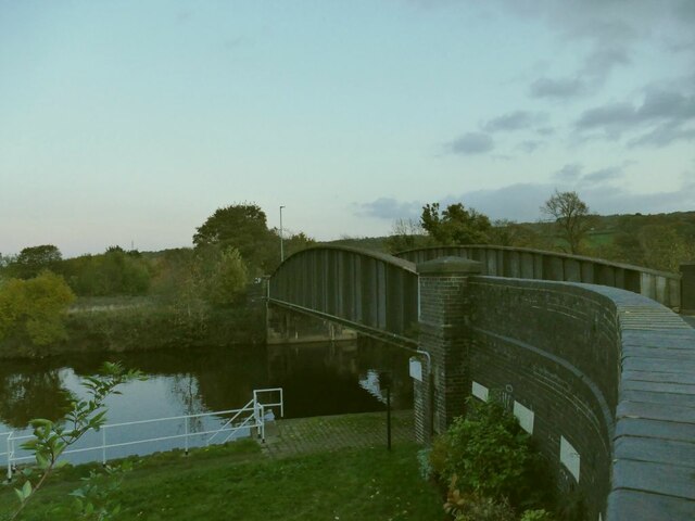
Ledgard Bridge

Ledgard Bridge crosses the River Calder in Mirfield, West Yorkshire, England. It was built in 1800 as a replacement for an earlier bridge in the same location...

Holly Bank Trust

Hollybank was one of the first registered schools for disabled children to be built in the North of England. It is a registered charity and care home,...

Battyeford railway station

Battyeford railway station served the village of Battyeford in West Yorkshire, England. == History == Built by the London and North Western Railway and...

Related Videos

Mirfield Family fun fair May 2021 in UK/Anywhere Walking Tour

Mirfield family fun fair May 2021 in UK/Anywhere Walking Tour Mirfield family fun fair 2021 is held in Mirfield Showground, West ...

Nearby Amenities

Located within 500m of 53.675788,-1.6971453
Waterway: weir
Lat/Long: 53.672985/-1.6975453
Mirfield
Place: town
Population: 18621
Wikidata: Q1301336
Lat/Long: 53.673216/-1.6946052
Traffic Signals
Crossing: traffic_signals
Crossing Ref: pelican
Kerb: flush
Tactile Paving: yes
Lat/Long: 53.6742822/-1.6960234
Bus Stop
Nettleton Road Littlemoor Grove
Bench: no
Bin: no
Check Date Shelter: 2024-03-29
Kerb: raised
Lit: no
Local Ref: 45020650
Naptan AtcoCode: 450020650
Naptan Bearing: NW
Naptan CommonName: Nettleton Road Littlemoor Grove
Naptan Crossing: Littlemoor Grove
Naptan Indicator: Stop 45020650
Naptan Landmark: Salvation Arrmy Hostel
Naptan PlusbusZoneRef: LEEDS
Naptan ShortCommonName: Littlemoor Grove
Naptan Street: Nettleton Road
Naptan Verified: yes
Ref: 45020650
Shelter: no
Source: naptan_import
Tactile Paving: no
Lat/Long: 53.6764551/-1.6980515
Bus Stop
Huddersfield Rd/Station Rd
Layby: yes
Local Ref: 45015145
Naptan AtcoCode: 450015145
Naptan Bearing: W
Naptan CommonName: Huddersfield Road Station Road
Naptan Crossing: Station Road
Naptan Indicator: Stop 45015145
Naptan Landmark: Tesco
Naptan PlusbusZoneRef: LEEDS
Naptan ShortCommonName: Huddersfield Rd M5
Naptan Street: Huddersfield Road
Note: name corrected
Ref: 45015145
Shelter: yes
Source: naptan_import;survey
Towards: Brighouse, Bradford, Cleckheaton, Halifax, Huddersfield, Kirkheaton
Lat/Long: 53.673962/-1.6924006
Traffic Signals
Crossing: traffic_signals
Crossing Ref: pelican
Lat/Long: 53.6740107/-1.6928114
Crossing
Crossing: uncontrolled
Crossing Ref: zebra
Lat/Long: 53.6737757/-1.6945154
Traffic Signals
Lat/Long: 53.673934/-1.6943819
Fire Station
Lat/Long: 53.6739311/-1.6910336
Post Box
Operator: Royal Mail
Post Box Design: type_k
Post Box Type: pillar
Ref: WF14 475
Royal Cypher: EIIR
Royal Cypher Wikidata: Q33102113
Lat/Long: 53.6736836/-1.694435
Bus Stop
Ing Grove Park Huddersfield Road
Check Date Shelter: 2024-03-29
Kerb: raised
Local Ref: 45015150
Naptan AtcoCode: 450015150
Naptan Bearing: SE
Naptan CommonName: Ing Grove Park Huddersfield Road
Naptan Crossing: Doctor Road
Naptan Indicator: Stop 45015150
Naptan Landmark: Ing Grove Park
Naptan PlusbusZoneRef: LEEDS
Naptan ShortCommonName: Doctor Lane
Naptan Street: Huddersfield Road
Naptan Verified: yes
Shelter: yes
Shop: yes
Source: naptan_import
Timetable: yes
Lat/Long: 53.675007/-1.6966328
Post Box
Operator: Royal Mail
Post Box Type: pillar
Ref: WF14 469
Royal Cypher: EIIR
Royal Cypher Wikidata: Q33102113
Lat/Long: 53.6738345/-1.6927023
Post Box
Operator: Royal Mail
Post Box Type: wall
Ref: WF14 175
Royal Cypher: GR
Royal Cypher Wikidata: Q33102273
Lat/Long: 53.6715034/-1.6978706
Recycling
Recycling Cans: no
Recycling Clothes: yes
Recycling Glass: yes
Recycling Paper: yes
Recycling Shoes: yes
Recycling Textiles: yes
Lat/Long: 53.6732869/-1.6938276
Abandoned Amenity: bank
Old Name: Barclays
Lat/Long: 53.673965/-1.6913965
Bicycle Parking
Bicycle Parking: lockers
Capacity: 4
Lat/Long: 53.6734419/-1.6929791
Traffic Signals
Crossing: traffic_signals
Crossing Ref: pelican
Tactile Paving: yes
Lat/Long: 53.673992/-1.6931094
Pharmacy
Boots
Addr City: Mirfield
Addr Housenumber: 142
Addr Street: Huddersfield Road
Brand: Boots
Brand Wikidata: Q6123139
Brand Wikipedia: en:Boots UK
Dispensing: yes
Healthcare: pharmacy
Lat/Long: 53.6740505/-1.6936566
Abandoned Amenity: bank
Old Name: NatWest
Lat/Long: 53.6740714/-1.692995
Fast Food
Calder Road Fisheries
Addr City: Mirfield
Addr Housenumber: 26
Addr Postcode: WF14 8PJ
Addr Street: Calder Road
Addr Suburb: Lower Hopton
Cuisine: fish_and_chips
Phone: +44 1924 490358
Lat/Long: 53.6714185/-1.6977758
Post Box
Operator: Royal Mail
Post Box Type: lamp
Ref: WF14 474
Lat/Long: 53.6783376/-1.692089
Bench
Backrest: yes
Lat/Long: 53.6726611/-1.6947993
Bench
Backrest: yes
Lat/Long: 53.6729768/-1.6958021
Bus Stop
Newgate / Huddersfield Road
Local Ref: 45017583
Naptan AtcoCode: 450017583
Naptan Bearing: NE
Naptan CommonName: Newgate Huddersfield Road
Naptan Crossing: Huddersfield Road
Naptan Indicator: Stop 45017583
Naptan PlusbusZoneRef: LEEDS
Naptan ShortCommonName: Huddersfield Road
Naptan Street: Newgate
Shelter: no
Source: naptan_import; survey
Towards: Dewsbury
Lat/Long: 53.6739214/-1.6965165
Bench
Backrest: yes
Lat/Long: 53.6727779/-1.695305
Waterway: lock_gate
Lat/Long: 53.6730599/-1.6962746
Waterway: lock_gate
Lat/Long: 53.6732818/-1.6969158
Turning Circle
Lat/Long: 53.6753812/-1.6925826
Leisure: playground
Lat/Long: 53.6779448/-1.6938076
Pub
Navigation Tavern
Addr City: Mirfield
Addr Country: GB
Addr Housenumber: 6
Addr Postcode: WF14 8NL
Addr Street: Station Road
Fhrs Id: 226727
Source Addr: FHRS Open Data
Lat/Long: 53.6721451/-1.6939542
Bus Stop
Knowl Road / St. Pauls Road
Local Ref: 45020617
Naptan AtcoCode: 450020617
Naptan Bearing: SE
Naptan CommonName: Knowl Road St Pauls Road
Naptan Crossing: St Pauls Road
Naptan Indicator: Stop 45020617
Naptan PlusbusZoneRef: LEEDS
Naptan ShortCommonName: St Pauls Road
Naptan Street: Knowl Road
Opposite: yes
Ref: 45020617
Shelter: yes
Source: naptan_import; survey
Timetable: no
Lat/Long: 53.6763768/-1.6925506
Barrier: bollard
Bicycle: yes
Foot: yes
Lat/Long: 53.6736275/-1.6936055
Fast Food
Mirfield Fisheries
Cuisine: fish_and_chips
Lat/Long: 53.6740635/-1.6959646
Bench
Backrest: no
Lat/Long: 53.6772901/-1.6938475
Bench
Backrest: yes
Lat/Long: 53.6780422/-1.6926257
Home & Body
Shop: convenience
Lat/Long: 53.6740681/-1.6931855
Sue Ryder Care
Shop: charity
Lat/Long: 53.6740665/-1.6932808
Jackson's
Shop: shoes
Lat/Long: 53.6740676/-1.6933881
Mirfield Market
Shop: alcohol
Lat/Long: 53.6740572/-1.6939432
Hanson Opticians
Addr City: Mirfield
Addr Housenumber: 164
Addr Postcode: WF14 8AN
Addr Street: Huddersfield Road
Phone: +44 1924 495066
Shop: optician
Url: www.a-ka.co.uk
Lat/Long: 53.6740529/-1.6941003
Betfred
Brand: Betfred
Brand Wikidata: Q4897425
Brand Wikipedia: en:Betfred
Shop: bookmaker
Lat/Long: 53.6740498/-1.6941873
D. Aveyard
Addr City: Mirfield
Addr Housenumber: 170
Addr Postcode: WF14 8AN
Addr Street: Huddersfield Road
Shop: optician
Lat/Long: 53.6740498/-1.6943326
Kirkwood Hospice
Shop: charity
Lat/Long: 53.6740422/-1.6944276
to have & to hold
Phone: +44 1924 493037
Shop: wedding
Lat/Long: 53.6740412/-1.694903
Salon 84
Shop: hairdresser
Lat/Long: 53.6739992/-1.6949714
Flowers at180
Phone: +44 1924 493496
Shop: florist
Lat/Long: 53.6740083/-1.6950655
Fast Food
Kowloom
Cuisine: chinese
Phone: +44 1924 480006
Lat/Long: 53.6741408/-1.6953869
Fast Food
Pizza Island
Addr City: Mirfield
Addr Country: GB
Addr Housenumber: 186A
Addr Postcode: WF14 8AN
Addr Street: Huddersfield Road
Cuisine: pizza
Fhrs Id: 227055
Phone: +44 1924 491000
Source Addr: FHRS Open Data
Lat/Long: 53.6741573/-1.6954342
Cafe
Taylors Cafe
Addr City: Mirfield
Addr Country: GB
Addr Housenumber: 188
Addr Postcode: WF14 8AT
Addr Street: Huddersfield Road
Fhrs Id: 228481
Source Addr: FHRS Open Data
Lat/Long: 53.6741731/-1.6954771
Bargain Booze
Brand: Bargain Booze
Brand Wikidata: Q16971315
Brand Wikipedia: en:Bargain Booze
Shop: alcohol
Lat/Long: 53.6741908/-1.6955653
L.D. Smith Hardware
Phone: +44 1924 493191
Shop: doityourself
Lat/Long: 53.6742143/-1.6957243
Cafe
Ravello
Lat/Long: 53.6742659/-1.69582
Bus Stop
Mirfield Huddersfield Rd
Bus: yes
Kerb: raised
Local Ref: 45015146
Naptan AtcoCode: 450015146
Naptan Bearing: E
Naptan CommonName: Huddersfield Road
Naptan Crossing: Queen Street
Naptan Indicator: Stop M5
Naptan Landmark: Co-op - Rubens Hairdressers
Naptan PlusbusZoneRef: LEEDS
Naptan ShortCommonName: Mirfield PO M5
Naptan Street: Huddersfield Road
Public Transport: platform
Ref: 45015146
Shelter: no
Source: naptan_import
Timetable: yes
Towards: Birstall, Dewsbury, Heckmondwike, Leeds, Wakefield, White Rose Centre
Lat/Long: 53.6739908/-1.6939629
Bus Stop
Huddersfield Road Ings Grove Park
Kerb: raised
Local Ref: 45015147
Naptan AtcoCode: 450015147
Naptan Bearing: NW
Naptan CommonName: Huddersfield Road Ings Grove Park
Naptan Crossing: Ing Grove Park
Naptan Indicator: Stop 45015147
Naptan PlusbusZoneRef: LEEDS
Naptan ShortCommonName: Ings Grove Park
Naptan Street: Huddersfield Road
Naptan Verified: yes
Ref: 45015156
Shelter: yes
Source: naptan_import
Lat/Long: 53.6747775/-1.6966729
Bus Stop
Ing Grove Park Huddersfield Road
Bench: yes
Bin: yes
Check Date Shelter: 2024-03-29
Kerb: raised
Local Ref: 45015148
Naptan AtcoCode: 450015148
Naptan Bearing: SE
Naptan CommonName: Ing Grove Park Huddersfield Road
Naptan Crossing: Doctor Lane
Naptan Indicator: Stop 45015148
Naptan PlusbusZoneRef: LEEDS
Naptan ShortCommonName: Doctor Lane
Naptan Street: Huddersfield Road
Naptan Verified: yes
Shelter: yes
Source: naptan_import
Timetable: yes
Lat/Long: 53.6753017/-1.6969659
Bus Stop
Huddersfield Road Wilson Terrace
Local Ref: 45015151
Naptan AtcoCode: 450015151
Naptan Bearing: NW
Naptan CommonName: Huddersfield Road Wilson Terrace
Naptan Crossing: Wilson Terrace
Naptan Indicator: Stop 45015151
Naptan Landmark: Snake Hill Business Park
Naptan PlusbusZoneRef: LEEDS
Naptan ShortCommonName: Snake Hill
Naptan Street: Huddersfield Road
Naptan Verified: no
Shelter: no
Source: naptan_import
Lat/Long: 53.6768616/-1.7025106
Bus Stop
Huddersfield Road Wilson Terrace
Local Ref: 45015152
Naptan AtcoCode: 450015152
Naptan Bearing: SE
Naptan CommonName: Huddersfield Road Wilson Terrace
Naptan Crossing: Wilson Terrace
Naptan Indicator: Stop 45015152
Naptan Landmark: Snake Hill Business Park
Naptan PlusbusZoneRef: LEEDS
Naptan ShortCommonName: Wilson Terrace
Naptan Street: Huddersfield Road
Naptan Verified: no
Shelter: no
Source: naptan_import
Lat/Long: 53.676879/-1.7022682
Bus Stop
Knowl Road Town Hall Street
Local Ref: 45020616
Naptan AtcoCode: 450020616
Naptan Bearing: N
Naptan CommonName: Knowl Road Town Hall Street
Naptan Crossing: Town Hall Street
Naptan Indicator: Stop 45020616
Naptan PlusbusZoneRef: LEEDS
Naptan ShortCommonName: Town Hall Street
Naptan Street: Knowl Road
Naptan Verified: no
Shelter: no
Source: naptan_import
Lat/Long: 53.6746519/-1.6911755
Bus Stop
Knowl Road Doctor Lane
Local Ref: 45020618
Naptan AtcoCode: 450020618
Naptan Bearing: E
Naptan CommonName: Knowl Road Doctor Lane
Naptan Crossing: Doctor Lane
Naptan Indicator: Stop 45020618
Naptan PlusbusZoneRef: LEEDS
Naptan ShortCommonName: Doctor Lane
Naptan Street: Knowl Road
Naptan Verified: no
Shelter: no
Source: naptan_import
Lat/Long: 53.6773711/-1.6942109
Bus Stop
Knowl Road Chapel Street
Kerb: raised
Local Ref: 45020619
Naptan AtcoCode: 450020619
Naptan Bearing: NW
Naptan CommonName: Knowl Road Chapel Street
Naptan Crossing: Nr-At Chapel Street
Naptan Indicator: Stop 45020619
Naptan PlusbusZoneRef: LEEDS
Naptan ShortCommonName: Chapel Street
Naptan Street: Knowl Road
Naptan Verified: no
Shelter: yes
Source: naptan_import
Timetable: yes
Lat/Long: 53.6778069/-1.6959487
Bus Stop
Nettleton Road Wilson Avenue
Bench: no
Bin: yes
Check Date Shelter: 2024-03-29
Kerb: raised
Local Ref: 45020647
Naptan AtcoCode: 450020647
Naptan Bearing: S
Naptan CommonName: Nettleton Road Wilson Avenue
Naptan Crossing: Wilson Avenue
Naptan Indicator: Stop 45020647
Naptan PlusbusZoneRef: LEEDS
Naptan ShortCommonName: Wilson Avenue
Naptan Street: Nettleton Road
Naptan Verified: no
Shelter: no
Source: naptan_import
Lat/Long: 53.6788439/-1.7008313
Bus Stop
Nettleton Road Littlemoor Grove
Bench: no
Bin: yes
Check Date Shelter: 2024-03-29
Kerb: raised
Local Ref: 45020648
Naptan AtcoCode: 450020648
Naptan Bearing: SE
Naptan CommonName: Nettleton Road Littlemoor Grove
Naptan Crossing: Littlemoor Grove
Naptan Indicator: Stop 45020648
Naptan Landmark: Mirfield Day Centre
Naptan PlusbusZoneRef: LEEDS
Naptan ShortCommonName: Littlemoor Grove
Naptan Street: Nettleton Road
Shelter: no
Source: naptan_import
Lat/Long: 53.6772755/-1.6990712
Bus Stop
Nettleton Road Littlemoor Grove
Check Date Shelter: 2024-03-29
Kerb: raised
Local Ref: 45020649
Naptan AtcoCode: 450020649
Naptan Bearing: NW
Naptan CommonName: Nettleton Road Littlemoor Grove
Naptan Crossing: Littlemoor Grove
Naptan Indicator: Stop 45020649
Naptan Landmark: Day Centre
Naptan PlusbusZoneRef: LEEDS
Naptan ShortCommonName: Littlemoor Grove
Naptan Street: Nettleton Road
Shelter: yes
Source: naptan_import
Lat/Long: 53.6773481/-1.6993431
Bus Stop
Newgate / Huddersfield Road
Local Ref: 45028095
Naptan AtcoCode: 450028095
Naptan Bearing: SW
Naptan CommonName: Newgate Huddersfield Road
Naptan Crossing: Huddersfield Road
Naptan Indicator: Stop 45028095
Naptan Landmark: Unknown
Naptan PlusbusZoneRef: LEEDS
Naptan ShortCommonName: Huddersfield Road
Naptan Street: Newgate
Shelter: no
Source: naptan_import; survey
Timetable: no
Towards: Huddersfield, Kirkheaton
Lat/Long: 53.6739205/-1.696374
Bus Stop
Knowl Road St Pauls Road
Local Ref: 45050977
Naptan AtcoCode: 450050977
Naptan Bearing: NW
Naptan BusStopType: CUS
Naptan CommonName: Knowl Road St Pauls Road
Naptan Crossing: St Pauls Road
Naptan Indicator: Stop 45050977
Naptan PlusbusZoneRef: LEEDS
Naptan ShortCommonName: St. Pauls Road
Naptan Street: Knowl Road
Physically Present: opposite
Source: naptan_import
Lat/Long: 53.6763155/-1.6926744
Nettleton Road Wilson Avenue
Local Ref: 45050981
Naptan AtcoCode: 450050981
Naptan Bearing: N
Naptan BusStopType: CUS
Naptan CommonName: Nettleton Road Wilson Avenue
Naptan Crossing: Wilson Avenue
Naptan Indicator: Stop 45050981
Naptan PlusbusZoneRef: LEEDS
Naptan ShortCommonName: Wilson Avenue
Naptan Street: Nettleton Road
Naptan Verified: no
Source: naptan_import
Lat/Long: 53.6788353/-1.7009827
Bus Stop
Nettleton Road Armoury Avenue
Bench: no
Bin: no
Kerb: raised
Lit: no
Local Ref: 45050982
Naptan AtcoCode: 450050982
Naptan Bearing: SE
Naptan BusStopType: MKD
Naptan CommonName: Nettleton Road Armoury Avenue
Naptan Crossing: Armoury Avenue
Naptan Indicator: Stop 45050982
Naptan PlusbusZoneRef: LEEDS
Naptan ShortCommonName: Armoury Avenue
Naptan Street: Nettleton Road
Naptan Verified: no
Notes: Changed busstoptype
Shelter: no
Source: naptan_import
Tactile Paving: no
Lat/Long: 53.6765176/-1.6979109
Sandwich Shop
Addr City: Mirfield
Addr Postcode: WF14 8PJ
Addr Street: Calder Road
Addr Suburb: Lower Hopton
Shop: sandwich
Lat/Long: 53.6713462/-1.6977482
Mirfield Marina
Leisure: marina
Phone: +44 7854 235117
Seamark Harbour Category: marina
Seamark Type: harbour
Lat/Long: 53.6725016/-1.6949975
Brown's Haridressing
Addr City: Mirfield
Addr Housenumber: 3
Addr Postcode: WF14 8PJ
Addr Street: Calder Road
Addr Suburb: Lower Hopton
Phone: +44 1924 494488
Shop: hairdresser
Lat/Long: 53.6719344/-1.6979918
Addr City: Mirfield
Addr Housenumber: 12
Addr Postcode: WF14 8PJ
Addr Street: Calder Road
Addr Suburb: Lower Hopton
Lat/Long: 53.6716528/-1.6980436
CR Interiors
Shop: curtain
Lat/Long: 53.6740241/-1.6958994
Taxi
Mirfield Cars
Addr City: Mirfield
Addr Postcode: WF14 8PJ
Addr Street: Calder Road
Addr Suburb: Lower Hopton
Building: yes
Phone: +44 1924 496969
Lat/Long: 53.6713829/-1.6977563
Addr Housenumber: 25
Lat/Long: 53.6729515/-1.6926708
Addr Housenumber: 23
Lat/Long: 53.6729996/-1.6926597
Forget Me Not Hospice
Shop: charity
Lat/Long: 53.6738631/-1.6925252
To Have and To Hold
Old Name: Blockbuster Video
Shop: wedding
Lat/Long: 53.6744219/-1.6913526
Addr Housenumber: 4
Lat/Long: 53.6715888/-1.6985356
R Kenmore Caravans
Shop: caravan
Lat/Long: 53.6760388/-1.7004796
Knowle Newsagent
Addr City: Mirfield
Addr Country: GB
Addr Housenumber: 1
Addr Postcode: WF14 9RH
Addr Street: The Knowl
Fhrs Id: 229376
Shop: newsagent
Source: photo
Source Addr: FHRS Open Data
Lat/Long: 53.6799124/-1.6980586
Rodger's
Shop: hairdresser
Source: photo
Lat/Long: 53.679884/-1.6979628
Social Club
Knowl Club
Lat/Long: 53.6754389/-1.6917635
Place Of Worship
The Salvation Army
Addr City: Mirfield
Addr Country: GB
Addr Housenumber: 106
Addr Postcode: WF14 8AF
Addr Street: Huddersfield Road
Denomination: salvation_army
Email: mirfield@salvationarmy.org.uk
Phone: 01924 491641
Religion: christian
Website: https://www.salvationarmy.org.uk/mirfield
Lat/Long: 53.6743053/-1.6913305
Aladdins' Cave
Shop: yes
Lat/Long: 53.67463/-1.691359
Pharmacy
Boots
Brand Wikidata: Q6123139
Dispensing: yes
Operator: Boots
Lat/Long: 53.6756332/-1.6970352
Bar
Lat/Long: 53.6740739/-1.6952749
Turning Circle
Source: Bing
Lat/Long: 53.6790345/-1.697971
Noexit: yes
Lat/Long: 53.6725364/-1.6932882
Noexit: yes
Lat/Long: 53.6720996/-1.6932206
Doctors
Mirfield Health Center
Lat/Long: 53.6757043/-1.6967066
Bus Stop
Knowls Road / Knowls Park
Local Ref: 45020620
Naptan AtcoCode: 450020620
Naptan Bearing: SE
Naptan CommonName: Knowle Road Knowle Park
Naptan Indicator: Stop 45020620
Naptan Landmark: Knowls Park
Naptan PlusbusZoneRef: LEEDS
Naptan ShortCommonName: Chapel Street
Naptan Street: Knowle Road
Naptan Verified: no
Shelter: no
Source: naptan_import
Towards: Mirfield
Lat/Long: 53.6779254/-1.6958535
Post Office
Mirfield Post Office
Brand: Post Office
Brand Wikidata: Q1783168
Check Date: 2023-09-27
Operator: Co-op Food
Ref Pol Id: 15616
Source: local_knowledge
Lat/Long: 53.6732838/-1.694267
Pub
The Railway
Addr City: Mirfield
Addr Country: GB
Addr Housenumber: 212
Addr Postcode: WF14 9PX
Addr Street: Huddersfield Road
Fhrs Id: 940378
Food: yes
Operator: Stonegate
Operator Wikidata: Q7619176
Real Ale: yes
Source Addr: FHRS Open Data
Website: https://www.craftunionpubs.com/the-railway-mirfield
Lat/Long: 53.6757238/-1.6978812
The Stables
Phone: +44 1924 480000
Shop: car
Lat/Long: 53.6757116/-1.6994665
Waterway: floating_barrier
Lat/Long: 53.6733525/-1.6975772
EarnshawKay
Addr City: Mirfield
Addr Housenumber: 108
Addr Postcode: WF14 8AF
Addr Street: Huddersfield Road
Office: estate_agent
Phone: +44 1924 497801
Lat/Long: 53.6741949/-1.69152
Lenscape
Shop: art
Lat/Long: 53.6741268/-1.6923122
Bar
Alexander's Bar & Kitchen
Addr City: Mirfield
Addr Country: GB
Addr Housenumber: 118
Addr Postcode: WF14 8AB
Addr Street: Huddersfield Road
Fhrs Id: 229056
Lat/Long: 53.6741676/-1.6920627
Wilcock & Co
Addr City: Mirfield
Addr Housenumber: 116
Addr Postcode: WF14 8AB
Addr Street: Huddersfield Road
Office: estate_agent
Lat/Long: 53.674175/-1.691961
Bramleys
Addr City: Mirfield
Addr Housenumber: 110
Addr Postcode: WF14 8AF
Addr Street: Huddersfield Road
Office: estate_agent
Phone: +44 1924 495334
Lat/Long: 53.6741852/-1.6916239
Infinity
Shop: beauty
Lat/Long: 53.6740073/-1.6946797
Turning Circle
Armoury Avenue
Lat/Long: 53.6774575/-1.6977688
Historic: memorial
Memorial: war_memorial
Lat/Long: 53.6752226/-1.6956387
Access: private
Barrier: chain
Lat/Long: 53.677051/-1.6957934
Bench
Backrest: yes
Seats: 4
Type: plastic
Lat/Long: 53.6744809/-1.6992534
Battyeford
Abandoned Railway: station
Railway: site
Wikidata: Q4873292
Wikipedia: en:Battyeford railway station
Lat/Long: 53.677576/-1.7029324
Crossing
Crossing: island
Lat/Long: 53.6776039/-1.6954078
Post Box
Operator: Royal Mail
Post Box Type: wall
Ref: WF14 171
Royal Cypher: GVIR
Royal Cypher Wikidata: Q33102169
Lat/Long: 53.6751675/-1.6967165
Post Box
Operator: Royal Mail
Post Box Type: pillar
Ref: WF14 173
Lat/Long: 53.6800426/-1.6981944
Generator Method: photovoltaic
Generator Output Electricity: yes
Generator Source: solar
Generator Type: solar_photovoltaic_panel
Location: roof
Power: generator
Lat/Long: 53.6773409/-1.697475
Generator Method: photovoltaic
Generator Output Electricity: yes
Generator Source: solar
Generator Type: solar_photovoltaic_panel
Location: roof
Power: generator
Lat/Long: 53.6774029/-1.6974155
Generator Method: photovoltaic
Generator Output Electricity: yes
Generator Source: solar
Generator Type: solar_photovoltaic_panel
Location: roof
Power: generator
Lat/Long: 53.6772771/-1.6976746
Generator Method: photovoltaic
Generator Output Electricity: yes
Generator Source: solar
Generator Type: solar_photovoltaic_panel
Location: roof
Power: generator
Lat/Long: 53.6772933/-1.697615
Generator Method: photovoltaic
Generator Output Electricity: yes
Generator Source: solar
Generator Type: solar_photovoltaic_panel
Location: roof
Power: generator
Lat/Long: 53.6775387/-1.6974437
Generator Method: photovoltaic
Generator Output Electricity: yes
Generator Source: solar
Generator Type: solar_photovoltaic_panel
Location: roof
Power: generator
Lat/Long: 53.6775825/-1.6974831
Generator Method: photovoltaic
Generator Output Electricity: yes
Generator Source: solar
Generator Type: solar_photovoltaic_panel
Location: roof
Power: generator
Lat/Long: 53.6776598/-1.697613
Generator Method: photovoltaic
Generator Output Electricity: yes
Generator Source: solar
Generator Type: solar_photovoltaic_panel
Location: roof
Power: generator
Lat/Long: 53.6776674/-1.697683
Generator Method: photovoltaic
Generator Output Electricity: yes
Generator Source: solar
Generator Type: solar_photovoltaic_panel
Location: roof
Power: generator
Lat/Long: 53.677635/-1.6978794
Generator Method: photovoltaic
Generator Output Electricity: yes
Generator Source: solar
Generator Type: solar_photovoltaic_panel
Location: roof
Power: generator
Lat/Long: 53.6776144/-1.697951
Generator Method: photovoltaic
Generator Output Electricity: yes
Generator Source: solar
Generator Type: solar_photovoltaic_panel
Location: roof
Power: generator
Lat/Long: 53.6774619/-1.6980089
Generator Method: photovoltaic
Generator Output Electricity: yes
Generator Source: solar
Generator Type: solar_photovoltaic_panel
Location: roof
Power: generator
Lat/Long: 53.6784415/-1.6964799
Generator Method: photovoltaic
Generator Output Electricity: yes
Generator Source: solar
Generator Type: solar_photovoltaic_panel
Location: roof
Power: generator
Lat/Long: 53.6784967/-1.6965643
Generator Method: photovoltaic
Generator Output Electricity: yes
Generator Source: solar
Generator Type: solar_photovoltaic_panel
Location: roof
Power: generator
Lat/Long: 53.6785625/-1.6966584
Generator Method: photovoltaic
Generator Output Electricity: yes
Generator Source: solar
Generator Type: solar_photovoltaic_panel
Location: roof
Power: generator
Lat/Long: 53.6786293/-1.6967019
Generator Method: photovoltaic
Generator Output Electricity: yes
Generator Source: solar
Generator Type: solar_photovoltaic_panel
Location: roof
Power: generator
Lat/Long: 53.6787232/-1.6968459
Generator Method: photovoltaic
Generator Output Electricity: yes
Generator Source: solar
Generator Type: solar_photovoltaic_panel
Location: roof
Power: generator
Lat/Long: 53.6787389/-1.6969843
Generator Method: photovoltaic
Generator Output Electricity: yes
Generator Source: solar
Generator Type: solar_photovoltaic_panel
Location: roof
Power: generator
Lat/Long: 53.6787532/-1.6971428
Generator Method: photovoltaic
Generator Output Electricity: yes
Generator Source: solar
Generator Type: solar_photovoltaic_panel
Location: roof
Power: generator
Lat/Long: 53.6783958/-1.6969835
Generator Method: photovoltaic
Generator Output Electricity: yes
Generator Source: solar
Generator Type: solar_photovoltaic_panel
Location: roof
Power: generator
Lat/Long: 53.6783353/-1.6969353
Generator Method: photovoltaic
Generator Output Electricity: yes
Generator Source: solar
Generator Type: solar_photovoltaic_panel
Location: roof
Power: generator
Lat/Long: 53.6782671/-1.696891
Generator Method: photovoltaic
Generator Output Electricity: yes
Generator Source: solar
Generator Type: solar_photovoltaic_panel
Location: roof
Power: generator
Lat/Long: 53.6783774/-1.6978397
Generator Method: photovoltaic
Generator Output Electricity: yes
Generator Source: solar
Generator Type: solar_photovoltaic_panel
Location: roof
Power: generator
Lat/Long: 53.678427/-1.6977625
Generator Method: photovoltaic
Generator Output Electricity: yes
Generator Source: solar
Generator Type: solar_photovoltaic_panel
Location: roof
Power: generator
Lat/Long: 53.6784765/-1.6977142
Generator Method: photovoltaic
Generator Output Electricity: yes
Generator Source: solar
Generator Type: solar_photovoltaic_panel
Location: roof
Power: generator
Lat/Long: 53.6782864/-1.6976965
Generator Method: photovoltaic
Generator Output Electricity: yes
Generator Source: solar
Generator Type: solar_photovoltaic_panel
Location: roof
Power: generator
Lat/Long: 53.6782387/-1.6976104
Generator Method: photovoltaic
Generator Output Electricity: yes
Generator Source: solar
Generator Type: solar_photovoltaic_panel
Location: roof
Power: generator
Lat/Long: 53.678161/-1.6974027
Generator Method: photovoltaic
Generator Output Electricity: yes
Generator Source: solar
Generator Type: solar_photovoltaic_panel
Location: roof
Power: generator
Lat/Long: 53.6781095/-1.6973223
Generator Method: photovoltaic
Generator Output Electricity: yes
Generator Source: solar
Generator Type: solar_photovoltaic_panel
Location: roof
Power: generator
Lat/Long: 53.6780624/-1.6972362
Generator Method: photovoltaic
Generator Output Electricity: yes
Generator Source: solar
Generator Type: solar_photovoltaic_panel
Location: roof
Power: generator
Lat/Long: 53.6780209/-1.6971597
Generator Method: photovoltaic
Generator Output Electricity: yes
Generator Source: solar
Generator Type: solar_photovoltaic_panel
Location: roof
Power: generator
Lat/Long: 53.6780214/-1.6969031
Generator Method: photovoltaic
Generator Output Electricity: yes
Generator Source: solar
Generator Type: solar_photovoltaic_panel
Location: roof
Power: generator
Lat/Long: 53.6780924/-1.696858
Generator Method: photovoltaic
Generator Output Electricity: yes
Generator Source: solar
Generator Type: solar_photovoltaic_panel
Location: roof
Power: generator
Lat/Long: 53.6781372/-1.6967647
Generator Method: photovoltaic
Generator Output Electricity: yes
Generator Source: solar
Generator Type: solar_photovoltaic_panel
Location: roof
Power: generator
Lat/Long: 53.6781457/-1.6963575
Generator Method: photovoltaic
Generator Output Electricity: yes
Generator Source: solar
Generator Type: solar_photovoltaic_panel
Location: roof
Power: generator
Lat/Long: 53.6782415/-1.6963406
Generator Method: photovoltaic
Generator Output Electricity: yes
Generator Source: solar
Generator Type: solar_photovoltaic_panel
Location: roof
Power: generator
Lat/Long: 53.6783068/-1.6963277
Generator Method: photovoltaic
Generator Output Electricity: yes
Generator Source: solar
Generator Type: solar_photovoltaic_panel
Location: roof
Power: generator
Lat/Long: 53.6783495/-1.6984438
Generator Method: photovoltaic
Generator Output Electricity: yes
Generator Source: solar
Generator Type: solar_photovoltaic_panel
Location: roof
Power: generator
Lat/Long: 53.6787001/-1.7022596
Haighs Solicitors
Addr City: Mirfield
Addr Housenumber: 124
Addr Postcode: WF14 8AB
Addr Street: Huddersfield Road
Office: lawyer
Phone: +44 1924 489197
Lat/Long: 53.6741306/-1.692386
The Mirfield Emporium
Addr City: Mirfield
Addr Housenumber: 74
Addr Postcode: WF14 9NE
Addr Street: Huddersfield Road
Shop: gift
Lat/Long: 53.6738485/-1.6948863
Granthams
Addr City: Mirfield
Addr Housenumber: 73
Addr Postcode: WF14 8AN
Addr Street: Huddersfield Road
Shop: bakery
Lat/Long: 53.6738503/-1.6947938
K. S. Fox Jewellers
Addr City: Mirfield
Addr Housenumber: 81
Addr Postcode: WF14 8AT
Addr Street: Huddersfield Road
Shop: jewelry
Lat/Long: 53.673999/-1.6957998
Beauty Works
Addr City: Mirfield
Addr Housenumber: 85
Addr Postcode: WF14 8AT
Addr Street: Huddersfield Road
Shop: beauty
Lat/Long: 53.6740885/-1.696017
Chris Grant & Co
Addr City: Mirfield
Addr Housenumber: 87
Addr Postcode: WF14 8AT
Addr Street: Huddersfield Road
Office: accountant
Lat/Long: 53.6741177/-1.6960771
Cafe
Cafe 53
Addr City: Mirfield
Addr Housenumber: 53
Addr Postcode: WF14 8AB
Addr Street: Huddersfield Road
Lat/Long: 53.6738898/-1.6924478
Humanity First
Shop: yes
Lat/Long: 53.6738874/-1.6923746
Istanbul Barber
Shop: hairdresser
Lat/Long: 53.6738946/-1.6923032
Sue Bradley
Shop: florist
Lat/Long: 53.6740566/-1.6935977
DRA Legal
Office: lawyer
Lat/Long: 53.6740663/-1.6934926
Fabricate
Addr City: Mirfield
Addr Housenumber: 146
Addr Postcode: WF14 8AN
Addr Street: Huddersfield Road
Shop: fabric
Lat/Long: 53.6740566/-1.6937238
Rubens
Addr City: Mirfield
Addr Housenumber: 162
Addr Postcode: WF14 8AN
Addr Street: Huddersfield Road
Shop: hairdresser
Lat/Long: 53.6740635/-1.6940273
new u
Shop: hairdresser
Lat/Long: 53.674014/-1.6945429
Tivoli Travel
Shop: travel_agency
Lat/Long: 53.674014/-1.694608
Power: substation
Lat/Long: 53.6747517/-1.6912918
Generator Method: photovoltaic
Generator Output Electricity: yes
Generator Source: solar
Generator Type: solar_photovoltaic_panel
Power: generator
Lat/Long: 53.6749039/-1.7026488
Crossing
Crossing: unmarked
Crossing Island: yes
Tactile Paving: yes
Lat/Long: 53.6722666/-1.6925957
Barrier: yes
Lat/Long: 53.6751257/-1.7028553
Leisure: pitch
Sport: skateboard
Lat/Long: 53.6785314/-1.6942143
Bicycle Parking
Bicycle Parking: stands
Covered: no
Lat/Long: 53.6737504/-1.6931933
Bicycle Parking
Access: yes
Bicycle Parking: post_hoop
Covered: no
Fee: no
Lat/Long: 53.6739204/-1.6925375
Bicycle Parking
Bicycle Parking: stands
Covered: no
Lat/Long: 53.6738044/-1.6946723
Defibrillator
Defibrillator Location En: sidewalk on the outside of Speights Lights
Emergency: defibrillator
Indoor: no
Note: Call 999 to unlock
Lat/Long: 53.6743534/-1.6962726
Feelgood Skin Centre
Addr City: Mirfield
Addr Housenumber: 1
Addr Postcode: WF14 8PJ
Addr Street: Calder Road
Addr Suburb: Lower Hopton
Shop: beauty
Lat/Long: 53.6719568/-1.6980586
Addr City: Mirfield
Addr Housenumber: 1C
Addr Postcode: WF14 8PJ
Addr Street: Calder Road
Addr Suburb: Lower Hopton
Lat/Long: 53.6720654/-1.6981726
Addr City: Mirfield
Addr Housenumber: 1B
Addr Postcode: WF14 8PJ
Addr Street: Calder Road
Addr Suburb: Lower Hopton
Lat/Long: 53.6721083/-1.6982111
Whistling Kettle
Shop: tea
Lat/Long: 53.674075/-1.6930203
The data included in this document is from www.openstreetmap.org. The data is made available under ODbL.

Have you been to Littlemoor?

Leave your review of Littlemoor below (or comments, questions and feedback).