Little London
Settlement in Gloucestershire Cotswold
England
Little London
Little London is a small village located in the county of Gloucestershire, England. Situated in the Cotswolds, it is nestled amidst picturesque countryside, offering residents and visitors a serene and tranquil environment. The village is conveniently positioned close to the larger towns of Cheltenham and Tewkesbury, providing easy access to a range of amenities and transport links.
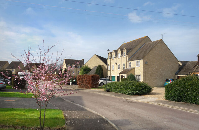
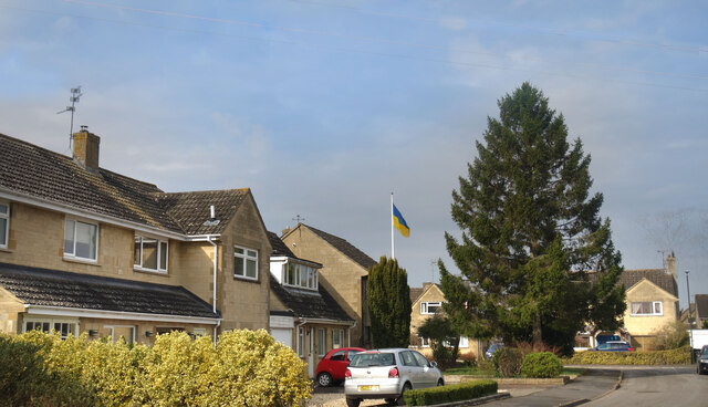
With a population of just over 500 residents, Little London has a close-knit community atmosphere. The village is characterized by its charming traditional architecture, with many Cotswold stone cottages lining the streets. These buildings, along with the well-maintained gardens and hedgerows, contribute to the village's idyllic aesthetic.
Little London boasts a range of amenities to cater to the needs of its residents. These include a primary school, a village hall, a local shop, and a village pub, providing a focal point for socializing and community events. The village also benefits from several recreational spaces, including a playground and a cricket pitch, where residents can enjoy outdoor activities.
The surrounding countryside offers ample opportunities for walking, cycling, and exploring nature, with numerous footpaths and trails to discover. Additionally, Little London is within close proximity to the Cotswold Area of Outstanding Natural Beauty, where visitors can experience stunning landscapes and charming villages.
Overall, Little London is an enchanting village that combines the tranquility of rural living with convenient access to nearby towns and amenities. Its picturesque scenery and strong sense of community make it an attractive place to live or visit for those seeking a peaceful and idyllic setting.
If you have any feedback on the listing, please let us know in the comments section below.
Little London Images
Images are sourced within 2km of 51.693814/-1.6966388 or Grid Reference SU2199. Thanks to Geograph Open Source API. All images are credited.
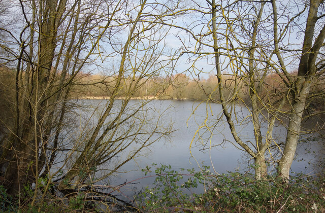
![A figure of eight walk from Lechlade-on-Thames [1] In celebration of the Queen's Jubilee is this delightful sculpture near Allcourt Meadow.
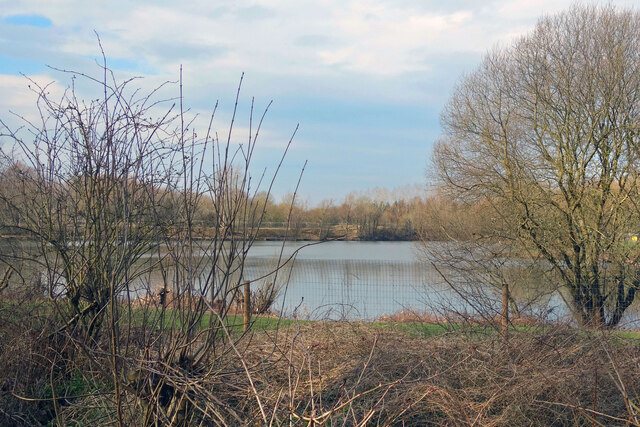
After leaving Lechlade, the route joins the long distance Thames and Severn Way and passes the southern edge of Bowmoor Lake. Turning north, and looping around the northern edge of the lake, the Thames and Severn Way is re-joined and followed to the banks of the River Thames and back to Lechlade. Slightly over 5 miles.](https://s2.geograph.org.uk/geophotos/07/26/33/7263314_ae732a73.jpg)
![A figure of eight walk from Lechlade-on-Thames [2] The route leaves High Street, A417, into a passage between houses.
After leaving Lechlade, the route joins the long distance Thames and Severn Way and passes the southern edge of Bowmoor Lake. Turning north, and looping around the northern edge of the lake, the Thames and Severn Way is re-joined and followed to the banks of the River Thames and back to Lechlade. Slightly over 5 miles.](https://s0.geograph.org.uk/geophotos/07/26/33/7263320_5f617053.jpg)
![A figure of eight walk from Lechlade-on-Thames [3] On its way to open fields, the route passes between houses.
After leaving Lechlade, the route joins the long distance Thames and Severn Way and passes the southern edge of Bowmoor Lake. Turning north, and looping around the northern edge of the lake, the Thames and Severn Way is re-joined and followed to the banks of the River Thames and back to Lechlade. Slightly over 5 miles.](https://s3.geograph.org.uk/geophotos/07/26/33/7263323_e1cc9b17.jpg)
![A figure of eight walk from Lechlade-on-Thames [4] After crossing the first of four drainage ditches, the path heads across the field towards the second ditch.
After leaving Lechlade, the route joins the long distance Thames and Severn Way and passes the southern edge of Bowmoor Lake. Turning north, and looping around the northern edge of the lake, the Thames and Severn Way is re-joined and followed to the banks of the River Thames and back to Lechlade. Slightly over 5 miles.](https://s1.geograph.org.uk/geophotos/07/26/33/7263329_9ba12c92.jpg)
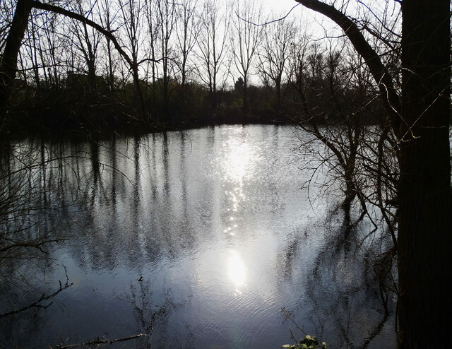
![A figure of eight walk from Lechlade-on-Thames [5] The path approaches another footbridge over a drainage ditch.
After leaving Lechlade, the route joins the long distance Thames and Severn Way and passes the southern edge of Bowmoor Lake. Turning north, and looping around the northern edge of the lake, the Thames and Severn Way is re-joined and followed to the banks of the River Thames and back to Lechlade. Slightly over 5 miles.](https://s3.geograph.org.uk/geophotos/07/26/41/7264119_203e228a.jpg)
![A figure of eight walk from Lechlade-on-Thames [6] Near another bridge over a drainage ditch, the way is obstructed by this fallen tree.
After leaving Lechlade, the route joins the long distance Thames and Severn Way and passes the southern edge of Bowmoor Lake. Turning north, and looping around the northern edge of the lake, the Thames and Severn Way is re-joined and followed to the banks of the River Thames and back to Lechlade. Slightly over 5 miles.](https://s0.geograph.org.uk/geophotos/07/26/41/7264120_8a0bb31b.jpg)
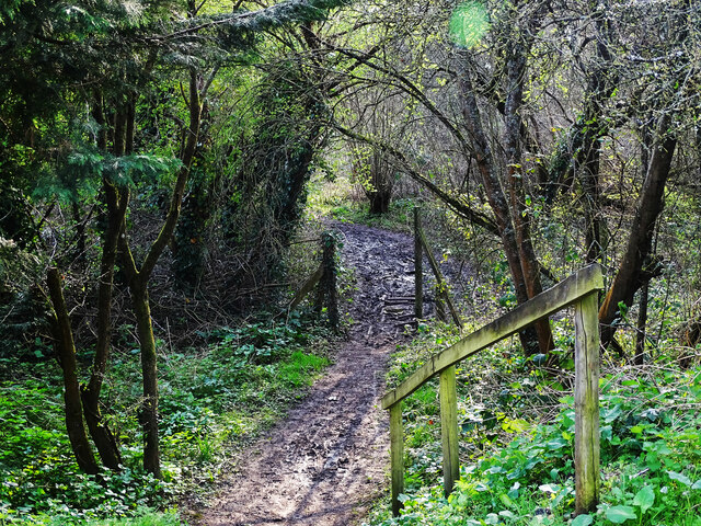
![A figure of eight walk from Lechlade-on-Thames [7] The path now runs along the field edge.
After leaving Lechlade, the route joins the long distance Thames and Severn Way and passes the southern edge of Bowmoor Lake. Turning north, and looping around the northern edge of the lake, the Thames and Severn Way is re-joined and followed to the banks of the River Thames and back to Lechlade. Slightly over 5 miles.](https://s1.geograph.org.uk/geophotos/07/26/41/7264121_27a44cb8.jpg)
![A figure of eight walk from Lechlade-on-Thames [8] The path approaches the point where it joins the Thames and Severn Way.
After leaving Lechlade, the route joins the long distance Thames and Severn Way and passes the southern edge of Bowmoor Lake. Turning north, and looping around the northern edge of the lake, the Thames and Severn Way is re-joined and followed to the banks of the River Thames and back to Lechlade. Slightly over 5 miles.](https://s2.geograph.org.uk/geophotos/07/26/41/7264122_b7e2555a.jpg)
![A figure of eight walk from Lechlade-on-Thames [9] The path to Main Street leaves the track that is the Thames and Severn Way.
After leaving Lechlade, the route joins the long distance Thames and Severn Way and passes the southern edge of Bowmoor Lake. Turning north, and looping around the northern edge of the lake, the Thames and Severn Way is re-joined and followed to the banks of the River Thames and back to Lechlade. Slightly over 5 miles.](https://s3.geograph.org.uk/geophotos/07/26/41/7264123_4324e15f.jpg)
Little London is located at Grid Ref: SU2199 (Lat: 51.693814, Lng: -1.6966388)
Administrative County: Gloucestershire
District: Cotswold
Police Authority: Gloucestershire
What 3 Words
///flopping.talked.behalf. Near Lechlade, Gloucestershire
Nearby Locations
Related Wikis

Thames meander
Thames meander refers to a long-distance journey over all or part of the River Thames in England. Walking the Thames Path is itself a meander, but the...

Halfpenny Bridge
Halfpenny Bridge is a bridge across the River Thames, at Lechlade, Gloucestershire, England. The bridge and its toll house are a Grade II listed building...

St Lawrence Church, Lechlade
The Anglican St Lawrence Church, dedicated to St. Lawrence of Rome, is the Church of England parish church of Lechlade in Gloucestershire, England. The...
Lechlade
Lechlade () is a town at the edge of the Cotswolds in Gloucestershire, England, 55 miles (89 km) south of Birmingham and 68 miles (109 km) west of London...

Southrop
Southrop is a village and civil parish in Gloucestershire, England. It is situated on the River Leach. The Grade I listed St Peter's Church dates from...

Lechlade Manor
Lechlade Manor in Lechlade, Gloucestershire, England, is a Victorian country house built for George Milward, a lawyer, by John Loughborough Pearson. Primarily...
River Coln
The River Coln is a river in Gloucestershire, England. It rises to the north of Brockhampton, a village to the east of Cheltenham, and flows in a south/south...
St John the Baptist Church, Inglesham
St John the Baptist Church in Inglesham, near Swindon, Wiltshire, England, has Anglo-Saxon origins but most of the current structure was built around 1205...
Nearby Amenities
Located within 500m of 51.693814,-1.6966388Have you been to Little London?
Leave your review of Little London below (or comments, questions and feedback).