Ledmore

Settlement in Sutherland

Scotland

Ledmore

Farm development at Ledmore
Farm development at Ledmore Credit: Alan Reid

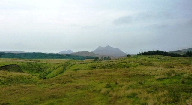
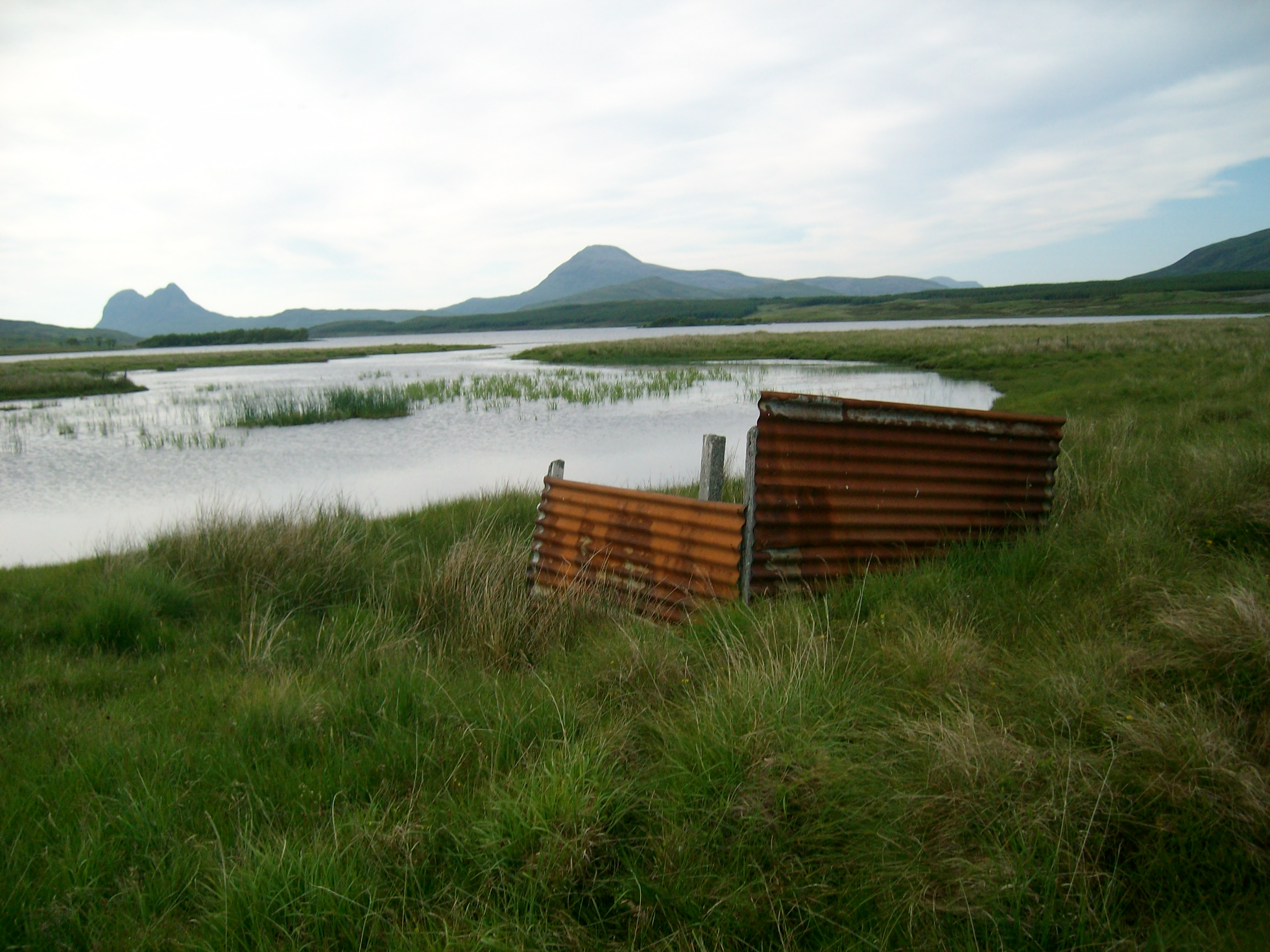
Ledmore is a small rural village located in the county of Sutherland, in the northern region of Scotland. Situated amidst the strikingly beautiful Scottish Highlands, Ledmore is surrounded by breathtaking landscapes and picturesque views. The village is nestled near the shores of Loch Ledmore, a tranquil freshwater loch that adds to the charm of the area.

Ledmore is renowned for its serene and peaceful atmosphere, making it an ideal destination for those seeking a tranquil retreat away from the hustle and bustle of city life. The village is characterized by its quaint cottages, many of which date back several centuries and showcase traditional Scottish architecture.

Although Ledmore is a small village, it offers a range of amenities to its residents and visitors. These include a village hall, a primary school, and a small shop catering to basic needs. The village is also home to a friendly and close-knit community, which contributes to its welcoming atmosphere.

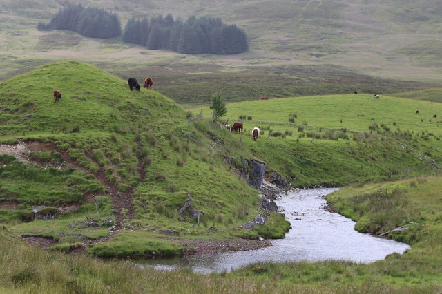
The natural beauty surrounding Ledmore provides ample opportunities for outdoor activities such as hiking, fishing, and birdwatching. The nearby hills and mountains offer stunning trails, while Loch Ledmore is a popular spot for fishing enthusiasts. Wildlife enthusiasts can also spot a variety of animals and birds in the area, including red deer, golden eagles, and red-throated divers.

Overall, Ledmore is a charming village that offers a peaceful and idyllic setting for visitors to enjoy the tranquility of the Scottish Highlands and explore the natural wonders of the region.

If you have any feedback on the listing, please let us know in the comments section below.

Ledmore Images

Images are sourced within 2km of 58.066299/-4.9736624 or Grid Reference NC2412. Thanks to Geograph Open Source API. All images are credited.

Farm development at Ledmore
Ice-covered Loch Borralan Cùl Mòr beyond.
Ice-covered Loch Borralan
Cùl Mòr beyond.
Slopes of Cnoc na Stroine
Loch Borralan From the A837.
Loch Borralan
From the A837.
Ledmore River Looking towards Ledmore from the A837.
Ledmore River
Looking towards Ledmore from the A837.
Ledmore River By the A837.
Ledmore River
By the A837.
Ledmore River Bend in Ledmore River viewed from the A837. Cul Mor visible in distance in middle of image.
Ledmore River
Bend in Ledmore River viewed from the A837. Cul Mor visible in distance in middle of image.
Sheep Pen at Ledmore Taken from A837. Cul Mor prominent in distance.
Sheep Pen at Ledmore
Taken from A837. Cul Mor prominent in distance.
Snowy landscape from Ledmore A view from the A837 past Ledmore Junction - Cul Mor (R), the smaller snowy top of An Laogh left of centre and the two tops of Cul Beag in cloud beyond the rocky spur of Creag Dhubh.
Snowy landscape from Ledmore
A view from the A837 past Ledmore Junction - Cul Mor (R), the smaller snowy top of An Laogh left of centre and the two tops of Cul Beag in cloud beyond the rocky spur of Creag Dhubh.
Fundamental bench mark beside A837 The FBM is known to the OS as Ledmore Junction which is actually about 1.5 km. to the south. The distant, central mountain is the Corbett, Breabag.
Fundamental bench mark beside A837
The FBM is known to the OS as Ledmore Junction which is actually about 1.5 km. to the south. The distant, central mountain is the Corbett, Breabag.
Loch Borralan
Loch Borralan
Boulder at entrance to quarry
Partially frozen Cam Loch
Old Milestone by the A837, Lairg parish Milestone by the A837, in parish of Lairg (Highland District), South East of Ledmore junction with the A836, on verge below farm, Borralan.

Surveyed

Milestone Society National ID: HI_LDIS00
Old Milestone by the A837, Lairg parish
Milestone by the A837, in parish of Lairg (Highland District), South East of Ledmore junction with the A836, on verge below farm, Borralan. Surveyed Milestone Society National ID: HI_LDIS00
Browsing cattle on the Cnoc an t-seagail
OSBM Bolt on Ledbeg Bridge OSBM Bolt: Ledbeg Bridge
OSBM Bolt on Ledbeg Bridge
OSBM Bolt: Ledbeg Bridge
Ledmore FBM and view
North Coast 500 roadsign At the A837 at its junction with the A835
North Coast 500 roadsign
At the A837 at its junction with the A835
Show me another place!

Ledmore is located at Grid Ref: NC2412 (Lat: 58.066299, Lng: -4.9736624)

Unitary Authority: Highland

Police Authority: Highlands and Islands

What 3 Words

///fittingly.homes.scrub. Near Inchnadamph, Highland

Nearby Locations

Ledmore

Related Wikis

Loch Borralan

Loch Borralan is a freshwater loch in the Assynt District of Sutherland in the Highland Council Area, northern Scotland.It is located adjacent to the A837...

Loch Urigill

Loch Urigill is a freshwater loch near Elphin at the southern tip of the Assynt District in north-west Sutherland, Scotland.It's 2 miles from Elphin and...

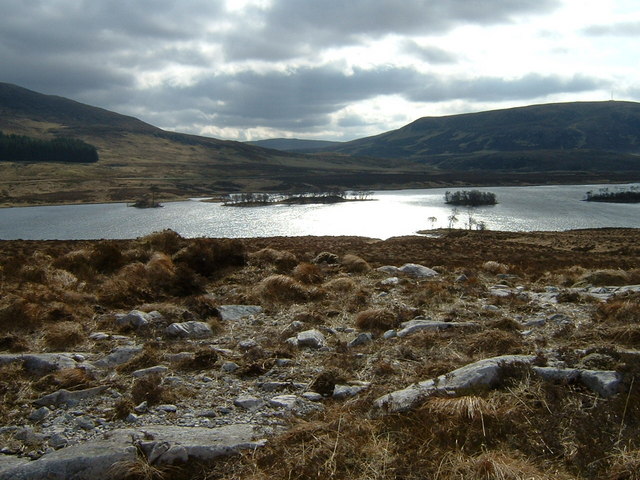
Loch Awe, Inchnadamph

Loch Awe is a small loch, located 4 miles south of Loch Assynt and next to the village of Ledmore, within the Assynt area of Sutherland, Scotland. The...

Cam Loch, Sutherland

Cam Loch (the crooked loch) is an irregularly-shaped freshwater loch, about 5 km long, on a north-west to south-east orientation, located slightly north...

Nearby Amenities

Located within 500m of 58.066299,-4.9736624
Ledmore Junction
Junction: yes
Name En: Ledmore Junction
Lat/Long: 58.0666458/-4.9719733
Bus Stop
Ledmore Junction
Naptan AtcoCode: 6700712912A
Naptan Bearing: SE
Naptan CommonName: Ledmore Junction
Naptan Indicator: opp Junction
Naptan Landmark: A835
Naptan NaptanCode: 45324743
Naptan Street: A837
Naptan Verified: no
Source: naptan_import
Lat/Long: 58.0667151/-4.9719268
Bus Stop
Ledmore Junction
Naptan AtcoCode: 6700712921
Naptan Bearing: N
Naptan CommonName: Ledmore Junction
Naptan Indicator: at Junction
Naptan Landmark: A835
Naptan NaptanCode: 45324745
Naptan Street: A837
Naptan Verified: no
Source: naptan_import
Lat/Long: 58.0668288/-4.9724451
Bus Stop
Ledmore Junction
Naptan AtcoCode: 6700712921B
Naptan Bearing: SW
Naptan CommonName: Ledmore Junction
Naptan Indicator: at Junction on A835
Naptan Landmark: A837
Naptan NaptanCode: 45324742
Naptan Street: A835
Naptan Verified: no
Source: naptan_import
Lat/Long: 58.0664829/-4.9722467
Parking
Lat/Long: 58.0686319/-4.974079
Ledmore
Name En: Ledmore
Name Gd: An Leathad Mòr
Place: hamlet
Lat/Long: 58.0659221/-4.972954
Power: pole
Lat/Long: 58.0662007/-4.9810611
Power: pole
Lat/Long: 58.0663625/-4.9799002
Power: pole
Lat/Long: 58.0663475/-4.9786158
Power: pole
Lat/Long: 58.0665104/-4.9772625
Power: pole
Lat/Long: 58.0666475/-4.9760267
Power: pole
Lat/Long: 58.0667718/-4.9749934
Power: pole
Lat/Long: 58.0670258/-4.9729351
Power: pole
Lat/Long: 58.067125/-4.9719498
Power: pole
Lat/Long: 58.0666164/-4.9710591
Power: pole
Lat/Long: 58.0699125/-4.9767438
Power: pole
Lat/Long: 58.0679816/-4.9734416
Power: pole
Lat/Long: 58.0675187/-4.9726393
Power: pole
Lat/Long: 58.0655133/-4.9688881
The data included in this document is from www.openstreetmap.org. The data is made available under ODbL.

Have you been to Ledmore?

Leave your review of Ledmore below (or comments, questions and feedback).