Ledgemoor

Settlement in Herefordshire

England

Ledgemoor

Fields End, near Weobley Viewed from the B4230 the farmhouse at Fields End is just a shell. The wooded hill behind is Burton Hill
Fields End, near Weobley Credit: Philip Halling

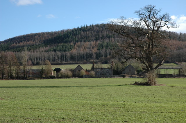
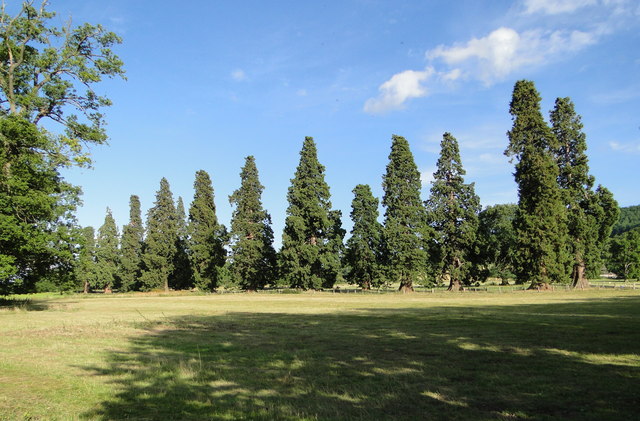
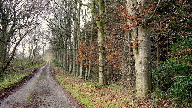
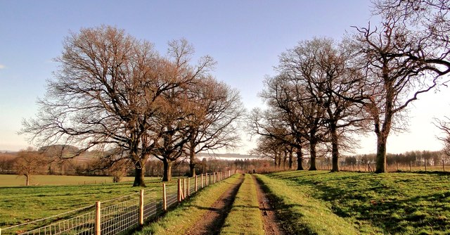
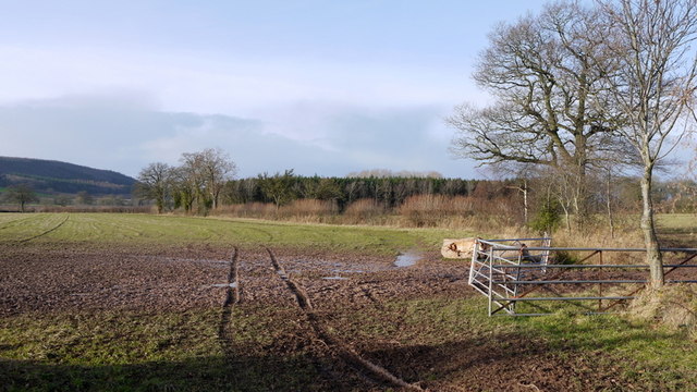
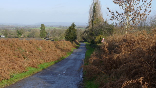
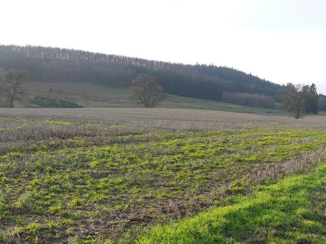
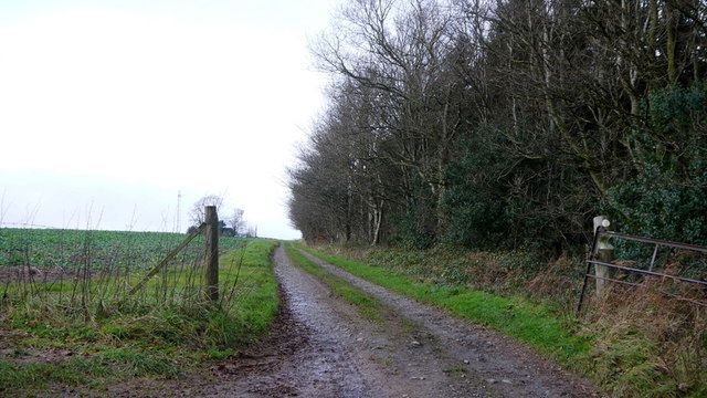
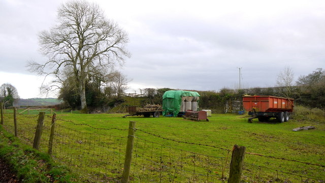
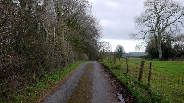
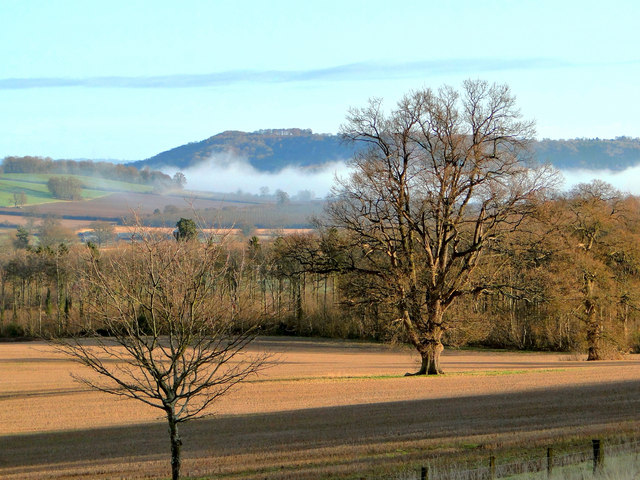
Ledgemoor is a small village located in the county of Herefordshire, England. Situated in the heart of the picturesque Wye Valley, Ledgemoor is known for its stunning natural beauty and tranquil atmosphere. The village is surrounded by rolling hills, lush green fields, and enchanting woodlands, making it a popular destination for nature enthusiasts and hikers.

Ledgemoor has a rich history that dates back centuries, with evidence of human settlement in the area since Roman times. The village is home to several historic landmarks, including a medieval church that stands as a testament to its past. The church features intricate architectural details and is a fascinating example of the region's heritage.

Despite its small size, Ledgemoor offers some amenities to its residents and visitors. The village boasts a cozy pub that serves traditional British fare, providing a friendly gathering spot for locals and tourists alike. Additionally, Ledgemoor is conveniently located near larger towns and cities, such as Hereford and Ross-on-Wye, which offer a wider range of services and amenities.

The community of Ledgemoor is close-knit, and residents take pride in maintaining the village's charm and character. The sense of community is evident through various events and activities organized throughout the year, including a summer fair and a Christmas market. Ledgemoor also benefits from its proximity to the stunning River Wye, which offers opportunities for boating, fishing, and other recreational activities.

In summary, Ledgemoor is a delightful village nestled in the beautiful Herefordshire countryside. Its historical significance, natural beauty, and strong sense of community make it a captivating destination for visitors seeking a peaceful retreat.

If you have any feedback on the listing, please let us know in the comments section below.
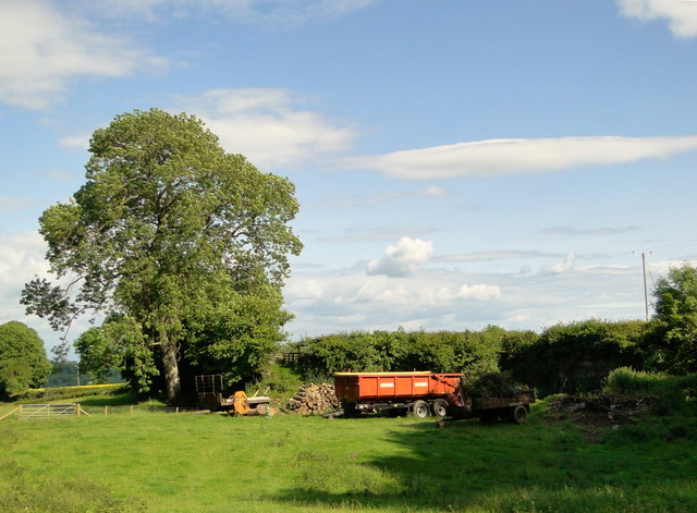
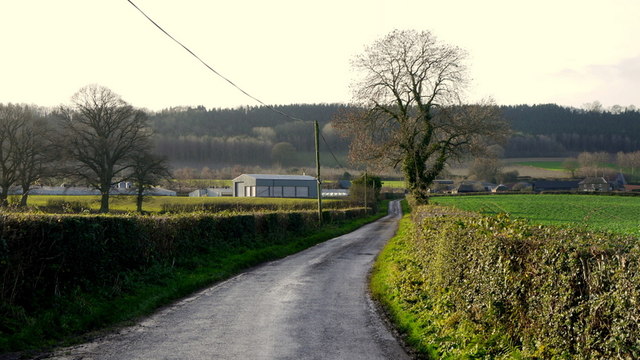
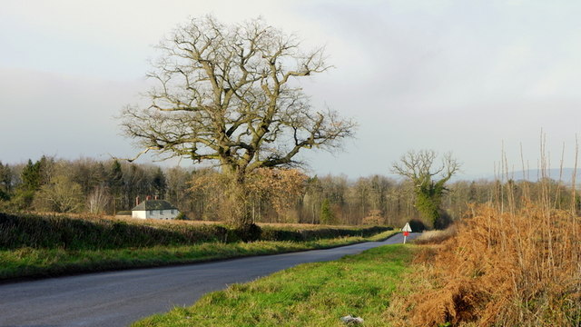
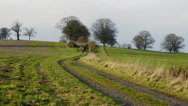
Ledgemoor Images

Images are sourced within 2km of 52.148548/-2.8563003 or Grid Reference SO4150. Thanks to Geograph Open Source API. All images are credited.

Fields End, near Weobley Viewed from the B4230 the farmhouse at Fields End is just a shell. The wooded hill behind is Burton Hill
Fields End, near Weobley
Viewed from the B4230 the farmhouse at Fields End is just a shell. The wooded hill behind is Burton Hill
West Lodge, Garnstone Castle, Weobley One of the last John Nash-designed buildings left on the estate. An avenue of huge Wellingtonia trees leads from the lodge to the site of the house, which was demolished in the mid 1950s.
West Lodge, Garnstone Castle, Weobley
One of the last John Nash-designed buildings left on the estate. An avenue of huge Wellingtonia trees leads from the lodge to the site of the house, which was demolished in the mid 1950s.
Wellingtonias, Garnstone Park, Weobley The early Verdins were clearly very fond of Wellingtonia trees - they are all over the estate and in neighbouring Ledgemoor. This avenue led from the West Lodge to the castle, now long gone. What remains there is very private and has recently been fenced in. The original castle railings are still in place in various places, as are some of the main gates. The show piece gates have found their way to Toronto, I believe.
Wellingtonias, Garnstone Park, Weobley
The early Verdins were clearly very fond of Wellingtonia trees - they are all over the estate and in neighbouring Ledgemoor. This avenue led from the West Lodge to the castle, now long gone. What remains there is very private and has recently been fenced in. The original castle railings are still in place in various places, as are some of the main gates. The show piece gates have found their way to Toronto, I believe.
Garden Cottage, Garnstone, Weobley Delicious Victorian cottage on the Home Farm of Garnstone Castle. Tucked away at the end of a private lane.
Garden Cottage, Garnstone, Weobley
Delicious Victorian cottage on the Home Farm of Garnstone Castle. Tucked away at the end of a private lane.
Garden Cottage, Garnstone, Weobley Delicious Victorian cottage on the Home Farm of Garnstone Castle. Tucked away at the end of a private lane.
Garden Cottage, Garnstone, Weobley
Delicious Victorian cottage on the Home Farm of Garnstone Castle. Tucked away at the end of a private lane.
Ancient quarry, Wormsley Hill Disused for centuries, I am told.
Ancient quarry, Wormsley Hill
Disused for centuries, I am told.
Country lane to Wootton Farm A poultry business at the foot of Beacon Hill.
Country lane to Wootton Farm
A poultry business at the foot of Beacon Hill.
Weobley road at Ledgemoor The poorer soil of the 'moor' is indicated by the bracken in the road verges.
The house is Holly Bush.
Weobley road at Ledgemoor
The poorer soil of the 'moor' is indicated by the bracken in the road verges. The house is Holly Bush.
Track and footpath to Burton A lady walking her dogs up ahead on this fine December morning.
Track and footpath to Burton
A lady walking her dogs up ahead on this fine December morning.
Beech-lined lane Ostey Wood is to the right and is mixed broadleaf and conifer.
Ostey Lane ahead leads to Hill Top Farm with a footpath continuing west to Garnstone Wood.
Beech-lined lane
Ostey Wood is to the right and is mixed broadleaf and conifer. Ostey Lane ahead leads to Hill Top Farm with a footpath continuing west to Garnstone Wood.
The Avenue An avenue of maturing trees line the track from Ledgemoor through the former park of Garnstone Castle on its way to Norton Canon, or for the fitter amongst us, up the hill to Burton Wood. The early Boxing Day morning mist shrouding Westhope has still to disperse and can be seen in the background.
The Avenue
An avenue of maturing trees line the track from Ledgemoor through the former park of Garnstone Castle on its way to Norton Canon, or for the fitter amongst us, up the hill to Burton Wood. The early Boxing Day morning mist shrouding Westhope has still to disperse and can be seen in the background.
The Moors Coniferous plantation on flat land between King's Pyon and Weobley.
The Moors
Coniferous plantation on flat land between King's Pyon and Weobley.
Road to Ledgemoor Poor quality land hereabouts indicated by the bracken.
Road to Ledgemoor
Poor quality land hereabouts indicated by the bracken.
Garnstone Wood and Park Bank Stubble left fallow in the foreground.
Garnstone Wood and Park Bank
Stubble left fallow in the foreground.
Footpath and track to Garnstone Wood The end of the public road at Ostey Wood.
Footpath and track to Garnstone Wood
The end of the public road at Ostey Wood.
Farm vehicles and implements In an old quarry by Ostey Lane. See same scene the previous summer; <a href="https://www.geograph.org.uk/photo/3552214">SO4248 : Ancient quarry, Wormsley Hill</a>.
Farm vehicles and implements
In an old quarry by Ostey Lane. See same scene the previous summer; SO4248 : Ancient quarry, Wormsley Hill.
Ostey Lane Ostey Wood to the left.
Ostey Lane
Ostey Wood to the left.
Lone oak, Garnstone Seen on Boxing Day morning. The mist still hangs over Westhope beyond.
Lone oak, Garnstone
Seen on Boxing Day morning. The mist still hangs over Westhope beyond.
Show me another place!

Ledgemoor is located at Grid Ref: SO4150 (Lat: 52.148548, Lng: -2.8563003)

Unitary Authority: County of Herefordshire

Police Authority: West Merica

What 3 Words

///beats.fires.lectured. Near Weobley, Herefordshire

Nearby Locations

Ledgemoor

Related Wikis

Weobley High School

Weobley High School is a mixed secondary school located in Weobley in the English county of Herefordshire.It is a community school administered by Herefordshire...

Weobley Castle, Herefordshire

Weobley Castle was a ringwork and bailey castle in the English county of Herefordshire (grid reference SO40365135). The castle belonged to the De Lacy...

Weobley

Weobley ( WEB-lee) is an ancient settlement and civil parish in Herefordshire, England. Formerly a market town, the market is long defunct and the settlement...

King's Pyon

King's Pyon is a village and civil parish in the county of Herefordshire, England, and is approximately 8 miles (13 km) north-west from the city and county...

Nearby Amenities

Located within 500m of 52.148548,-2.8563003
Village Bus Stop
Naptan AtcoCode: 2090A140600
Naptan Bearing: N
Naptan BusStopType: CUS
Naptan CommonName: Village Bus Stop
Naptan Indicator: adj
Naptan Landmark: N/K
Naptan NaptanCode: heragdjm
Naptan Street: N/K
Naptan Verified: no
Source: naptan_import
Lat/Long: 52.1486037/-2.8563232
Telephone
Booth: K6
Covered: booth
Lat/Long: 52.152059/-2.8555228
Ledgemoor
Place: hamlet
Source: OS OpenData StreetView
Lat/Long: 52.147658/-2.8562308
Generator Method: photovoltaic
Generator Output Electricity: yes
Generator Source: solar
Generator Type: solar_photovoltaic_panel
Location: roof
Power: generator
Lat/Long: 52.149503/-2.8571212
The data included in this document is from www.openstreetmap.org. The data is made available under ODbL.

Have you been to Ledgemoor?

Leave your review of Ledgemoor below (or comments, questions and feedback).