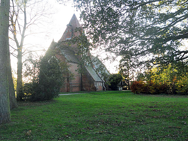
Lea Cross

Settlement in Shropshire

England

Lea Cross
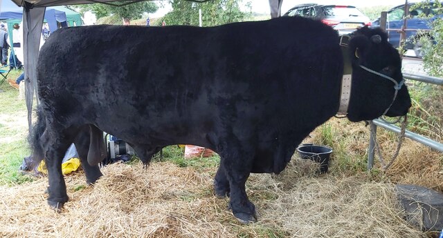
Bull at Minsterley Show
Bull at Minsterley Show Credit: Anthony Parkes

Lea Cross is a small rural hamlet located in the county of Shropshire, England. Situated approximately 10 miles southwest of the county town of Shrewsbury, it falls within the jurisdiction of the civil parish of Pontesbury.

The hamlet is characterized by its picturesque countryside setting, with rolling hills, meadows, and farmland surrounding the area. Lea Cross is predominantly made up of a cluster of houses, including traditional cottages and more modern dwellings. The architecture reflects the area's rural charm and historical heritage.

Despite its small size, Lea Cross offers a range of amenities to its residents and visitors. The hamlet is home to a village hall, which serves as a community hub and hosts various events and activities throughout the year. Additionally, there is a local pub that provides a social gathering place for locals and visitors alike.

The surrounding countryside offers ample opportunities for outdoor pursuits, such as walking, hiking, and cycling. The nearby Pontesbury Hill and Stiperstones National Nature Reserve are popular destinations for nature enthusiasts, providing stunning views and diverse wildlife.

Lea Cross benefits from its proximity to larger towns and cities, with Shrewsbury offering a wider range of amenities, including shopping centers, restaurants, and cultural attractions. The hamlet also benefits from good transportation links, with easy access to major road networks.

Overall, Lea Cross offers a tranquil and idyllic rural retreat, with its natural beauty, sense of community, and convenient location making it an attractive place to live or visit.

If you have any feedback on the listing, please let us know in the comments section below.

Lea Cross Images

Images are sourced within 2km of 52.668929/-2.8583073 or Grid Reference SJ4208. Thanks to Geograph Open Source API. All images are credited.

Bull at Minsterley Show
Show Jumping at Minsterley Show
Leading a heifer at Minsterley Show
Minsterley Show
Minsterley Show
Lining up the Champions - Minsterley Show The Minsterley Show is Shropshire’s oldest and most prestigious one day agricultural show. It has been operating since 1875.
Lining up the Champions - Minsterley Show
The Minsterley Show is Shropshire’s oldest and most prestigious one day agricultural show. It has been operating since 1875.
Judges Houses Not quite X-factor
Judges Houses
Not quite X-factor
Plealey Road railway station (site), Shropshire Opened in 1861 by the London & North Western Railway on the short branch line from Hanwood to Minsterley, this station closed to passengers in 1951.
View west from the road. The single railway line crossed left to right in front of the house, now a private residence, roughly where the modern gate now is. The single platform was to the left of the house, hidden from view.
Plealey Road railway station (site), Shropshire
Opened in 1861 by the London & North Western Railway on the short branch line from Hanwood to Minsterley, this station closed to passengers in 1951. View west from the road. The single railway line crossed left to right in front of the house, now a private residence, roughly where the modern gate now is. The single platform was to the left of the house, hidden from view.
Oaks - Plealey road
Oaks - Plealey road
Oilseed rape, Plealey Into its Spring growth spurt.
Oilseed rape, Plealey
Into its Spring growth spurt.
Cereals, Plealey
Cereals, Plealey
Halston Cottages and Plealey Road Site of Plealey Road Station on the Minsterley Branch.
Halston Cottages and Plealey Road
Site of Plealey Road Station on the Minsterley Branch.
Field edge and oaks, Shorthill
Hay for sale, Little Plealey
Old signpost in Cruckmeole Shropshire HER listed <span class="nowrap"><a title="https://www.heritagegateway.org.uk/Gateway/Results_Single.aspx?uid=MSA34026&resourceID=1015" rel="nofollow ugc noopener" href="https://www.heritagegateway.org.uk/Gateway/Results_Single.aspx?uid=MSA34026&resourceID=1015">Link</a><img style="margin-left:2px;" alt="External link" title="External link - shift click to open in new window" src="https://s1.geograph.org.uk/img/external.png" width="10" height="10"/></span>
Old signpost in Cruckmeole
Shropshire HER listed LinkExternal link
Well - that's easy to follow
Beware of horses west of Newnham Farm
Farm road and railway bridge
Farm track at Cruckmeole Looking from railway bridge southwards
Farm track at Cruckmeole
Looking from railway bridge southwards
Show me another place!

Lea Cross is located at Grid Ref: SJ4208 (Lat: 52.668929, Lng: -2.8583073)

Unitary Authority: Shropshire

Police Authority: West Merica

What 3 Words

///rollover.owns.depend. Near Pontesbury, Shropshire

Related Wikis

Shorthill, Shropshire

Shorthill is a small village in Shropshire, England. It is located just off the A488, near to Hanwood and Arscott, within Pontesbury civil parish. Shorthill...

Plealey Road railway station

Plealey Road railway station was a station to the north of Plealey, Shropshire, England. The station was opened in 1861 and closed in 1951. The station...

Plealey

Plealey is a small village in Shropshire, England. It is located between Pontesford and Longden. == Local governance == The village lies in the parish...

Arscott

Arscott is a small hamlet in Shropshire, England. It is near to Plealey, Shorthill and Annscroft and within the civil parish of Pontesbury.The hamlet is...

Nearby Amenities

Located within 500m of 52.668929,-2.8583073
Lea Cross
Place: hamlet
Source: OS 1:25k
Lat/Long: 52.6687438/-2.8593212
Parking
Rest Area
Parking: layby
Source: Bing;survey
Lat/Long: 52.6664286/-2.8597384
Give Way
Direction: backward
Lat/Long: 52.6689511/-2.8583403
Give Way
Direction: forward
Lat/Long: 52.6701562/-2.8565142
Bus Stop
Bus: yes
Naptan AtcoCode: 3500B455101
Naptan NaptanCode: shrdawmd
Public Transport: platform
Shelter: separate
Lat/Long: 52.6702758/-2.8563265
Post Box
Lat/Long: 52.6702842/-2.8563112
The data included in this document is from www.openstreetmap.org. The data is made available under ODbL.

Have you been to Lea Cross?

Leave your review of Lea Cross below (or comments, questions and feedback).