Laurieknowe

Settlement in Kirkcudbrightshire

Scotland

Laurieknowe

Cresswell Gardens, Grierson Avenue
Cresswell Gardens, Grierson Avenue Credit: David Dixon

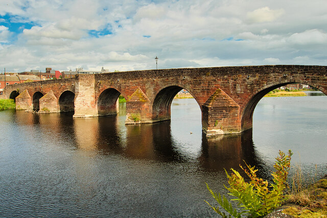
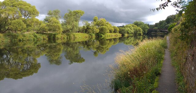
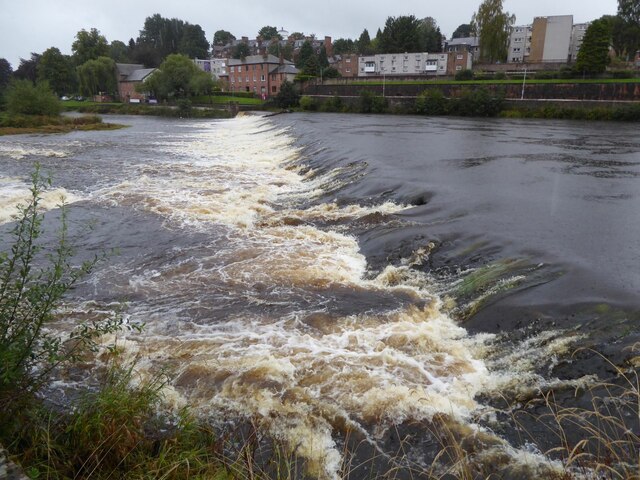
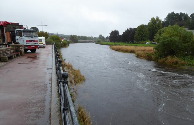
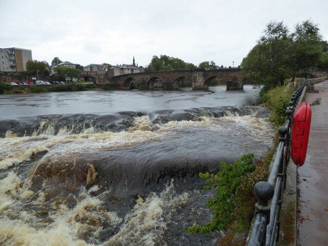
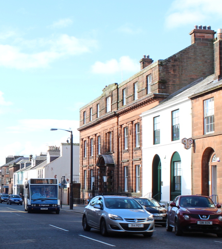
Laurieknowe is a small village located in the historical county of Kirkcudbrightshire, Scotland. Situated just south of the town of Kirkcudbright, Laurieknowe enjoys a picturesque setting surrounded by rolling hills and the tranquil River Dee.

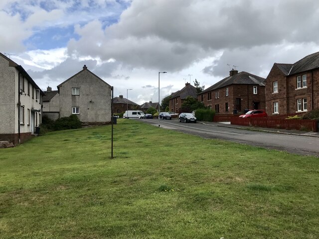
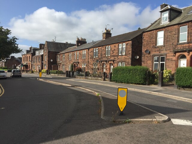
The village is characterized by its charming rural atmosphere, with a collection of traditional stone-built houses and cottages nestled among the lush greenery. The natural beauty of the surrounding landscape makes Laurieknowe an ideal destination for those seeking a peaceful retreat or an escape from the bustling city life.

Despite its small size, Laurieknowe offers a range of amenities and services to its residents and visitors. The village boasts a local shop, providing essential groceries and everyday necessities. Additionally, there are several recreational facilities available, including a community center and a playground, which cater to the needs of families and children.

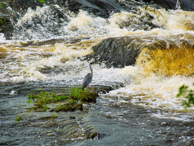
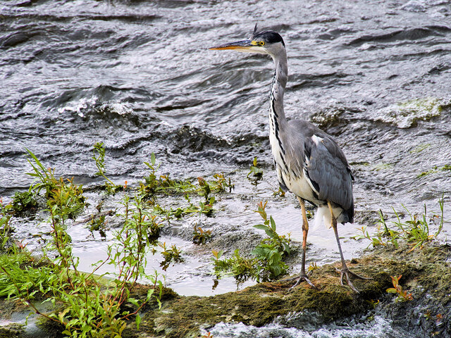
Laurieknowe is also known for its proximity to various outdoor activities and attractions. The nearby Galloway Forest Park offers opportunities for hiking, cycling, and wildlife spotting, while the coast is just a short drive away, providing access to stunning beaches and picturesque coastal walks.

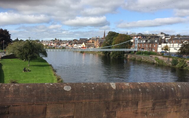
Furthermore, the village benefits from its close proximity to the town of Kirkcudbright, which offers a wider range of amenities such as supermarkets, restaurants, and cultural attractions. Kirkcudbright is renowned for its artistic heritage and is often referred to as the "Artists' Town," attracting artists and visitors from around the world.

In conclusion, Laurieknowe is a charming village in Kirkcudbrightshire, Scotland, offering a peaceful and idyllic lifestyle surrounded by natural beauty and opportunities for outdoor activities.

If you have any feedback on the listing, please let us know in the comments section below.

Laurieknowe Images

Images are sourced within 2km of 55.069168/-3.6231805 or Grid Reference NX9676. Thanks to Geograph Open Source API. All images are credited.

Cresswell Gardens, Grierson Avenue
Devorgilla Bridge, Dumfries The original Devorgilla Bridge was built in 1431, replacing an earlier, wooden structure named after Lady Devorgilla, the mother of King John Balliol. The bridge survived for almost two centuries until it was destroyed in a major flood in the 1620s, resulting in a nine-arched bridge being built.

The bridge was shortened by the removal of the three easternmost arches in the late eighteenth century.  It is a Category A listed building (LB26354 <span class="nowrap"><a title="http://portal.historicenvironment.scot/designation/LB26354" rel="nofollow ugc noopener" href="http://portal.historicenvironment.scot/designation/LB26354">Link</a><img style="margin-left:2px;" alt="External link" title="External link - shift click to open in new window" src="https://s1.geograph.org.uk/img/external.png" width="10" height="10"/></span> Historic Environment Scotland).
Devorgilla Bridge, Dumfries
The original Devorgilla Bridge was built in 1431, replacing an earlier, wooden structure named after Lady Devorgilla, the mother of King John Balliol. The bridge survived for almost two centuries until it was destroyed in a major flood in the 1620s, resulting in a nine-arched bridge being built. The bridge was shortened by the removal of the three easternmost arches in the late eighteenth century. It is a Category A listed building (LB26354 LinkExternal link Historic Environment Scotland).
Old Bridge House, Dumfries Built ca1660 at the western end of Devorgilla Bridge by James Birkmyre, a barrel maker, as his house and workshop. It is reputedly the oldest surviving domestic dwelling in Dumfries. It was used as an inn for much of the 18th and 19th centuries and was converted to a museum, following the death of its last occupant in 1959.

It is a Category B listed building (LB26310 <span class="nowrap"><a title="http://portal.historicenvironment.scot/designation/LB26310" rel="nofollow ugc noopener" href="http://portal.historicenvironment.scot/designation/LB26310">Link</a><img style="margin-left:2px;" alt="External link" title="External link - shift click to open in new window" src="https://s1.geograph.org.uk/img/external.png" width="10" height="10"/></span> Historic Environment Scotland).
Old Bridge House, Dumfries
Built ca1660 at the western end of Devorgilla Bridge by James Birkmyre, a barrel maker, as his house and workshop. It is reputedly the oldest surviving domestic dwelling in Dumfries. It was used as an inn for much of the 18th and 19th centuries and was converted to a museum, following the death of its last occupant in 1959. It is a Category B listed building (LB26310 LinkExternal link Historic Environment Scotland).
Buccleuch Street Bridge (Dumfries "New" Bridge) A five-arched bridge over the River Nith, built in 1793. The roadway was widened on steel cantilevers in 1893 (see <a href="https://www.geograph.org.uk/photo/3333780">NX9676 : Plaque on New Bridge</a>). It is a Category B listed building (LB26096 <span class="nowrap"><a title="http://portal.historicenvironment.scot/designation/LB26096" rel="nofollow ugc noopener" href="http://portal.historicenvironment.scot/designation/LB26096">Link</a><img style="margin-left:2px;" alt="External link" title="External link - shift click to open in new window" src="https://s1.geograph.org.uk/img/external.png" width="10" height="10"/></span> Historic Environment Scotland).
Buccleuch Street Bridge (Dumfries "New" Bridge)
A five-arched bridge over the River Nith, built in 1793. The roadway was widened on steel cantilevers in 1893 (see NX9676 : Plaque on New Bridge). It is a Category B listed building (LB26096 LinkExternal link Historic Environment Scotland).
River Nith Weir at Dumfries A solitary heron stands motionless on Whitesands Caul, waiting for fish to tumble over.
River Nith Weir at Dumfries
A solitary heron stands motionless on Whitesands Caul, waiting for fish to tumble over.
Heron at Dumfries A solitary heron stands motionless on Whitesands Caul, waiting for fish to tumble over.
Heron at Dumfries
A solitary heron stands motionless on Whitesands Caul, waiting for fish to tumble over.
River Nith Dumfries The River Nith and towpath near the rowing club headquarters.
River Nith Dumfries
The River Nith and towpath near the rowing club headquarters.
River Nith at Dumfries A beautiful suspension bridge provides a footbridge for pedestrians
River Nith at Dumfries
A beautiful suspension bridge provides a footbridge for pedestrians
Statue of Jean Armour Statue to Robert Burns' wife, standing in Dumfries between her home and her church. Mother to nine of his children, including two sets of twins, while he also had four more children by other women. <span class="nowrap"><a title="https://en.wikipedia.org/wiki/Jean_Armour" rel="nofollow ugc noopener" href="https://en.wikipedia.org/wiki/Jean_Armour">Link</a><img style="margin-left:2px;" alt="External link" title="External link - shift click to open in new window" src="https://s1.geograph.org.uk/img/external.png" width="10" height="10"/></span>
Statue of Jean Armour
Statue to Robert Burns' wife, standing in Dumfries between her home and her church. Mother to nine of his children, including two sets of twins, while he also had four more children by other women. LinkExternal link
Houses on Annan Road, Dumfries
The caul or weir in Dumfries The caul on the Nith below the old Devorgilla Bridge is of early origin, built originally of stakes, but reconstructed many times in timber and rubble. Although the lade is infilled, the site of the sluice gate at the S end of the caul can still be seen.
The caul or weir in Dumfries
The caul on the Nith below the old Devorgilla Bridge is of early origin, built originally of stakes, but reconstructed many times in timber and rubble. Although the lade is infilled, the site of the sluice gate at the S end of the caul can still be seen.
St Michael's Primary School Originally, the school began as a Church School attached to the South Free Territorial Church. The school opened in 1865 and provided a general education - including Latin, for some pupils.

'At St Michael’s Primary we aim to provide a secure, supportive and friendly environment in which the children will develop skills and experiences, which will allow them to reach their full potential.' <span class="nowrap"><a title="https://stmichaelsdumfries.dumgal.sch.uk/" rel="nofollow ugc noopener" href="https://stmichaelsdumfries.dumgal.sch.uk/">Link</a><img style="margin-left:2px;" alt="External link" title="External link - shift click to open in new window" src="https://s1.geograph.org.uk/img/external.png" width="10" height="10"/></span>
St Michael's Primary School
Originally, the school began as a Church School attached to the South Free Territorial Church. The school opened in 1865 and provided a general education - including Latin, for some pupils. 'At St Michael’s Primary we aim to provide a secure, supportive and friendly environment in which the children will develop skills and experiences, which will allow them to reach their full potential.' LinkExternal link
Advert at St Michael's Services garage Nith Inshore Rescue is an independent lifeboat serving the Dumfries area. We are based in Glencaple, 5 miles south of Dumfries in south-west Scotland, on the estuary of the River Nith close to where it joins the Solway Firth.
Advert at St Michael's Services garage
Nith Inshore Rescue is an independent lifeboat serving the Dumfries area. We are based in Glencaple, 5 miles south of Dumfries in south-west Scotland, on the estuary of the River Nith close to where it joins the Solway Firth.
The River Nith in Dumfries The lorry is unloading the components of the fair being erected beside the river.
The River Nith in Dumfries
The lorry is unloading the components of the fair being erected beside the river.
Dumfries Old Bridge This bridge carries a footpath across the River Nith to the N of the weir (caul), the end of which is visible in image, and on the W side of the central area of Dumfries.
Dumfries Old Bridge
This bridge carries a footpath across the River Nith to the N of the weir (caul), the end of which is visible in image, and on the W side of the central area of Dumfries.
Derelict Mill, Dumfries
Old Boundary Marker on the B726 Kingholm Road, Dumfries War Department Boundary Marker inscribed in a gatepost on the northwest side of the B726 Kingholm Road, Dumfries, where a footpath leaves towards the riverside. 

Milestone Society National ID: DF_WDKING02em
Old Boundary Marker on the B726 Kingholm Road, Dumfries
War Department Boundary Marker inscribed in a gatepost on the northwest side of the B726 Kingholm Road, Dumfries, where a footpath leaves towards the riverside. Milestone Society National ID: DF_WDKING02em
River Nith, Old Bridge Early morning mist at the old bridge Dumfries.
River Nith, Old Bridge
Early morning mist at the old bridge Dumfries.
Show me another place!

Laurieknowe is located at Grid Ref: NX9676 (Lat: 55.069168, Lng: -3.6231805)

Unitary Authority: Dumfries and Galloway

Police Authority: Dumfries and Galloway

What 3 Words

///poets.outdone.animates. Near Dumfries, Dumfries & Galloway

Related Wikis

Palmerston Park

Palmerston Park is a football stadium on Terregles Street in Dumfries, Dumfries and Galloway, Scotland. It is the home ground of Scottish League One club...

HM Prison Dumfries

HM Prison Dumfries services the courts of Dumfries and Galloway, Scotland. The establishment serves as a local community prison that holds adult and under...

Maxwelltown

Maxwelltown (Scottish Gaelic: Ceann Drochaid, IPA:[ˈkʰʲaun̴̪ˈt̪ɾɔxətʲ]) was formerly a burgh of barony and police burgh and by the time of the burgh's...

Summerhill, Dumfries

Summerhill in Dumfries is a post war residential suburb on the west side of the town. It is located on the Maxwelltown side of the River Nith that runs...

Nithsdale Amateur Rowing Club

Nithsdale Amateur Rowing Club is a rowing club on the River Nith, based at Nith Avenue, Dumfries, Dumfries and Galloway, Scotland. The club is affiliated...

Municipal Buildings, Dumfries

The Municipal Buildings are based on the north side of Buccleuch Street, Dumfries, Dumfries and Galloway, Scotland. The structure, which was the headquarters...

Greyfriars Church, Dumfries

Greyfriars Church, Dumfries is a Category A listed building in Dumfries, in south west Scotland. The current Greyfriars Church building was built from...
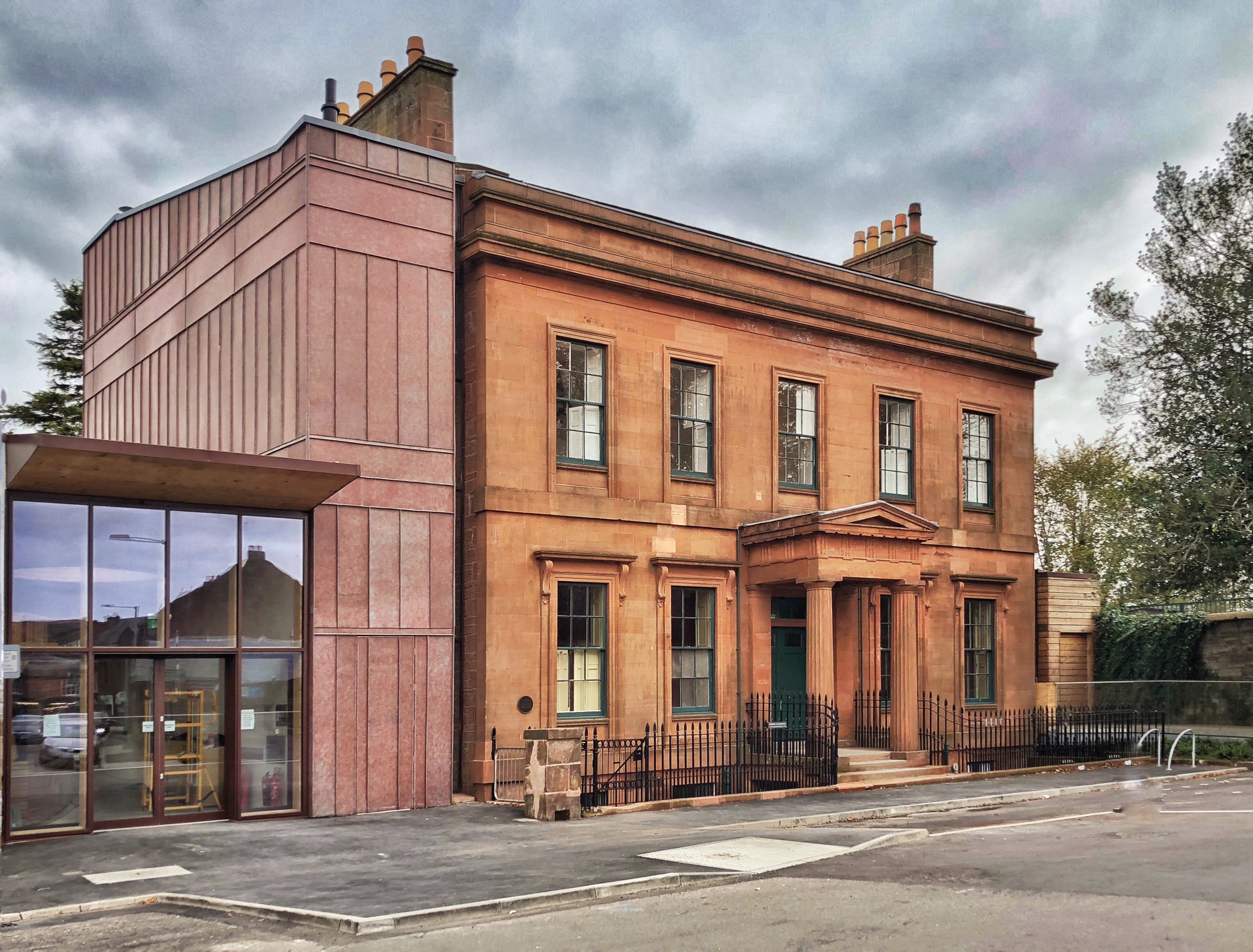
Moat Brae

Moat Brae is a Georgian townhouse designed by Walter Newall in Dumfries, Scotland. It was built in 1823 in the Greek revival style. J. M. Barrie, creator...

Nearby Amenities

Located within 500m of 55.069168,-3.6231805
Source: PGS
Lat/Long: 55.0675085/-3.6160382
Source: PGS
Lat/Long: 55.0677357/-3.6164559
Created By: almien_coastlines
Source: PGS
Lat/Long: 55.068095/-3.6169651
Created By: almien_coastlines
Source: PGS
Lat/Long: 55.068406/-3.617526
Source: PGS
Lat/Long: 55.0685747/-3.6177435
Source: PGS
Lat/Long: 55.0688941/-3.6180761
Source: PGS
Lat/Long: 55.0691767/-3.6183336
Created By: almien_coastlines
Source: PGS
Lat/Long: 55.069423/-3.6184715
Source: PGS
Lat/Long: 55.0703283/-3.6185916
Source: PGS
Lat/Long: 55.0711714/-3.6182995
Source: PGS
Lat/Long: 55.0712866/-3.6178728
Source: PGS
Lat/Long: 55.071477/-3.6176689
Source: PGS
Lat/Long: 55.0718356/-3.6170511
Source: PGS
Lat/Long: 55.0714134/-3.6165709
Source: PGS
Lat/Long: 55.07109/-3.6172076
Source: PGS
Lat/Long: 55.0708381/-3.617626
Source: PGS
Lat/Long: 55.070445/-3.6178406
Source: PGS
Lat/Long: 55.0699474/-3.6177762
Source: PGS
Lat/Long: 55.0696587/-3.6176582
Source: PGS
Lat/Long: 55.0694498/-3.6175509
Source: PGS
Lat/Long: 55.0690198/-3.6169608
Source: PGS
Lat/Long: 55.0687802/-3.6167141
Source: PGS
Lat/Long: 55.0685713/-3.6163064
Created By: almien_coastlines
Source: PGS
Lat/Long: 55.0682597/-3.615948
Crossing
Crossing: unmarked
Tactile Paving: yes
Lat/Long: 55.0718554/-3.6211479
Cycleway: asl
Lat/Long: 55.0688854/-3.6188416
Traffic Signals
Traffic Signals: signal
Lat/Long: 55.0686229/-3.6187361
Crossing
Crossing: unmarked
Tactile Paving: yes
Lat/Long: 55.0717903/-3.6212748
Traffic Signals
Lat/Long: 55.0692327/-3.616678
Mini Roundabout
Direction: clockwise
Lat/Long: 55.0707387/-3.6302915
Mini Roundabout
Direction: clockwise
Lat/Long: 55.0701595/-3.627842
Mini Roundabout
Lat/Long: 55.0715051/-3.6271072
Barrier: bollard
Source: survey
Lat/Long: 55.0689368/-3.618418
Bus Stop
Whitesands
Bus: yes
Local Ref: 4
Naptan AtcoCode: 680000001504
Naptan CommonName: Whitesands
Naptan Indicator: Stance 4
Naptan Landmark: Rural Stances
Naptan NaptanCode: 34232642
Naptan Notes: none
Naptan PlusbusZoneRef: DUMFRES
Naptan ShortCommonName: Dfs Whitesands 4
Naptan Street: Whitesands
Naptan Verified: no
Public Transport: platform
Source: naptan_import
Lat/Long: 55.0684956/-3.6154925
Bus Stop
Whitesands
Bench: yes
Bus: yes
Local Ref: 5
Naptan AtcoCode: 680000001505
Naptan CommonName: Whitesands
Naptan Indicator: Stance 5
Naptan Landmark: Rural Stances
Naptan NaptanCode: 34232643
Naptan Notes: none
Naptan PlusbusZoneRef: DUMFRES
Naptan ShortCommonName: Dfs Whitesands 5
Naptan Street: Whitesands
Naptan Verified: no
Public Transport: platform
Shelter: yes
Source: naptan_import
Lat/Long: 55.0686962/-3.6159548
Bus Stop
Whitesands
Bus: yes
Local Ref: 6
Naptan AtcoCode: 680000001506
Naptan Bearing: SE
Naptan CommonName: Whitesands
Naptan Indicator: Stance 6
Naptan Landmark: Opp Rural Stances
Naptan NaptanCode: 34232825
Naptan Notes: none
Naptan PlusbusZoneRef: DUMFRES
Naptan Street: Whitesands
Naptan Verified: no
Public Transport: platform
Source: naptan_import
Lat/Long: 55.0688686/-3.6158365
Bus Stop
Ellisland Dr
Naptan AtcoCode: 680000018504
Naptan Bearing: NE
Naptan CommonName: Ellisland Dr
Naptan Indicator: Park
Naptan Landmark: Summerhill Community Centre
Naptan NaptanCode: 34235462
Naptan Notes: none
Naptan PlusbusZoneRef: DUMFRES
Naptan Street: Ellisland Drive
Naptan Verified: no
Source: naptan_import
Lat/Long: 55.0685912/-3.6292924
Bus Stop
Lochfield Road
Bench: no
Naptan AtcoCode: 680000053501
Naptan Bearing: NE
Naptan CommonName: Lochfield Road
Naptan Indicator: opp Old Tesco
Naptan Landmark: Windsor Place
Naptan NaptanCode: 34235463
Naptan Notes: none
Naptan PlusbusZoneRef: DUMFRES
Naptan Street: Lochfield Road
Naptan Verified: no
Shelter: no
Source: naptan_import
Lat/Long: 55.0707061/-3.627673
Bus Stop
Alexandra Drive
Bench: no
Bin: no
Naptan AtcoCode: 680000053502
Naptan Bearing: NW
Naptan BusStopType: CUS
Naptan CommonName: Alexandra Drive
Naptan Indicator: no 11
Naptan Landmark: Gloucester Avenue
Naptan NaptanCode: 34235464
Naptan Notes: none
Naptan PlusbusZoneRef: DUMFRES
Naptan Street: Alexandra Drive
Naptan Verified: no
Shelter: no
Source: naptan_import
Tactile Paving: no
Lat/Long: 55.0717648/-3.6284834
Bus Stop
Hardthorn Road
Naptan AtcoCode: 680000053505
Naptan Bearing: N
Naptan CommonName: Hardthorn Road
Naptan Indicator: at Park
Naptan Landmark: Ashfield Drive
Naptan NaptanCode: 34235468
Naptan Notes: none
Naptan PlusbusZoneRef: DUMFRES
Naptan Street: Lochfield Road
Naptan Verified: no
Source: naptan_import
Lat/Long: 55.0731461/-3.624655
Bus Stop
Lochfield Road
Bench: no
Naptan AtcoCode: 680000053506
Naptan Bearing: S
Naptan BusStopType: CUS
Naptan CommonName: Lochfield Road
Naptan Indicator: Old Tesco
Naptan Landmark: Windsor Place
Naptan NaptanCode: 34238962
Naptan Street: Lochfield Road
Naptan Verified: no
Shelter: no
Source: naptan_import
Lat/Long: 55.0706742/-3.627493
Bus Stop
Alexandra Drive
Bench: no
Bin: no
Naptan AtcoCode: 680000053507
Naptan Bearing: E
Naptan BusStopType: CUS
Naptan CommonName: Alexandra Drive
Naptan Indicator: Opp no 11
Naptan Landmark: Gloucester Avenue
Naptan NaptanCode: 34238963
Naptan Street: Alexandra Drive
Naptan Verified: no
Shelter: no
Source: naptan_import
Tactile Paving: no
Lat/Long: 55.0718601/-3.6281639
Hardthorn Road
Naptan AtcoCode: 680000053510
Naptan Bearing: W
Naptan BusStopType: CUS
Naptan CommonName: Hardthorn Road
Naptan Indicator: Opp Park
Naptan Landmark: Ashfield Dive
Naptan NaptanCode: 34238967
Naptan Street: Hardthorn Road
Naptan Verified: no
Source: naptan_import
Lat/Long: 55.0730922/-3.6246528
Bus Stop
Hill Street
Naptan AtcoCode: 680000070333
Naptan Bearing: NW
Naptan BusStopType: CUS
Naptan CommonName: Hill Street
Naptan Indicator: opp Edenbank
Naptan Landmark: Rosemount Street
Naptan NaptanCode: 34235726
Naptan Notes: none
Naptan PlusbusZoneRef: DUMFRES
Naptan Street: Hill Street
Naptan Verified: no
Source: naptan_import
Lat/Long: 55.0663058/-3.6213397
Bus Stop
Hill Street
Naptan AtcoCode: 680000070444
Naptan Bearing: SE
Naptan BusStopType: CUS
Naptan CommonName: Hill Street
Naptan Indicator: o/s Edenbank
Naptan Landmark: Rosemount Street
Naptan NaptanCode: 34235727
Naptan Notes: none
Naptan PlusbusZoneRef: DUMFRES
Naptan Street: Hill Street
Naptan Verified: no
Source: naptan_import
Lat/Long: 55.0663704/-3.621217
Bus Stop
King Street
Naptan AtcoCode: 680000123501
Naptan Bearing: NE
Naptan CommonName: King Street
Naptan Indicator: Ice Bowl
Naptan Landmark: Ice Bowl
Naptan NaptanCode: 34238529
Naptan Notes: none
Naptan PlusbusZoneRef: DUMFRES
Naptan Street: King Street
Naptan Verified: no
Source: naptan_import
Lat/Long: 55.0696817/-3.6224263
Bus Stop
Glasgow Street
Naptan AtcoCode: 680000565111
Naptan Bearing: NW
Naptan CommonName: Glasgow Street
Naptan Indicator: Bridge Vet Centre
Naptan Landmark: David Street
Naptan NaptanCode: 34232645
Naptan Notes: none
Naptan PlusbusZoneRef: DUMFRES
Naptan Street: Glasgow Street
Naptan Verified: no
Shelter: yes
Source: naptan_import
Lat/Long: 55.0697417/-3.6198062
Bus Stop
Glasgow Street
Naptan AtcoCode: 680000565222
Naptan Bearing: SE
Naptan CommonName: Glasgow Street
Naptan Indicator: Farmfoods
Naptan Landmark: College Street
Naptan NaptanCode: 34232824
Naptan Notes: none
Naptan PlusbusZoneRef: DUMFRES
Naptan Street: Glasgow Street
Naptan Verified: no
Shelter: yes
Source: naptan_import
Lat/Long: 55.0698811/-3.6195237
Bus Stop
Glasgow Street
Naptan AtcoCode: 680000566111
Naptan Bearing: NW
Naptan CommonName: Glasgow Street
Naptan Indicator: opp St Teresas Church
Naptan Landmark: Lochfield Road
Naptan NaptanCode: 34232646
Naptan Notes: none
Naptan PlusbusZoneRef: DUMFRES
Naptan Street: Glasgow Street
Naptan Verified: no
Source: naptan_import
Lat/Long: 55.072384/-3.6216943
Bus Stop
Glasgow Street
Naptan AtcoCode: 680000566222
Naptan Bearing: SE
Naptan CommonName: Glasgow Street
Naptan Indicator: St Teresas
Naptan Landmark: Union Street
Naptan NaptanCode: 34232823
Naptan Notes: none
Naptan PlusbusZoneRef: DUMFRES
Naptan Street: Glasgow Street
Naptan Verified: no
Source: naptan_import
Lat/Long: 55.072651/-3.6213457
Bus Stop
Laurieknowe
Bench: no
Naptan AtcoCode: 680000769333
Naptan Bearing: SW
Naptan CommonName: Laurieknowe
Naptan Indicator: Dalston House
Naptan Landmark: Terregles Street
Naptan NaptanCode: 34236273
Naptan Notes: none
Naptan PlusbusZoneRef: DUMFRES
Naptan Street: Laurieknowe
Naptan Verified: no
Shelter: no
Source: naptan_import
Lat/Long: 55.0678256/-3.6206024
Bus Stop
Dumfries
Bench: no
Naptan AtcoCode: 680000769444
Naptan Bearing: NE
Naptan CommonName: Laurieknowe
Naptan Indicator: opp Dalston House
Naptan Landmark: Terregles Street
Naptan NaptanCode: 34236274
Naptan Notes: none
Naptan PlusbusZoneRef: DUMFRES
Naptan Street: Laurieknowe
Naptan Verified: no
Shelter: no
Source: naptan_import
Lat/Long: 55.0678594/-3.6207604
Bus Stop
Laurieknowe
Bench: no
Naptan AtcoCode: 680000769501
Naptan Bearing: NE
Naptan CommonName: Laurieknowe
Naptan Indicator: no 44
Naptan Landmark: North Laurieknowe Place
Naptan NaptanCode: 34236278
Naptan Notes: none
Naptan PlusbusZoneRef: DUMFRES
Naptan Street: Laurieknowe
Naptan Verified: no
Shelter: no
Source: naptan_import
Lat/Long: 55.0664293/-3.6228638
Bus Stop
Dalbeattie Road
Bench: no
Bin: no
Naptan AtcoCode: 680000769506
Naptan Bearing: NE
Naptan CommonName: Dalbeattie Road
Naptan Indicator: no 2
Naptan Landmark: Ettrick Court
Naptan NaptanCode: 34235987
Naptan Notes: none
Naptan PlusbusZoneRef: DUMFRES
Naptan Street: Dalbeattie Road
Naptan Verified: no
Shelter: no
Source: naptan_import
Tactile Paving: no
Lat/Long: 55.0648597/-3.6253215
Bus Stop
New Abbey Rd
Naptan AtcoCode: 680000770111
Naptan Bearing: N
Naptan CommonName: New Abbey Rd
Naptan Indicator: no 11
Naptan Landmark: Corberry Avenue
Naptan NaptanCode: 34235728
Naptan Notes: none
Naptan PlusbusZoneRef: DUMFRES
Naptan Street: New Abbey Road
Naptan Verified: no
Source: naptan_import
Lat/Long: 55.0653151/-3.62285
Bus Stop
New Abbey Rd
Bench: no
Bin: no
Lit: yes
Naptan AtcoCode: 680000770222
Naptan Bearing: S
Naptan CommonName: New Abbey Rd
Naptan Indicator: no 4
Naptan Landmark: Corberry Avenue
Naptan NaptanCode: 34235729
Naptan Notes: none
Naptan PlusbusZoneRef: DUMFRES
Naptan Street: New Abbey Road
Naptan Verified: no
Shelter: no
Source: naptan_import
Tactile Paving: no
Lat/Long: 55.0653645/-3.6226349
Bus Stop
Terregles St
Bench: no
Bin: no
Naptan AtcoCode: 680000798333
Naptan Bearing: NW
Naptan CommonName: Terregles St
Naptan Indicator: opp King St
Naptan Landmark: King Street
Naptan NaptanCode: 34235452
Naptan Notes: none
Naptan PlusbusZoneRef: DUMFRES
Naptan Street: Terregles Street
Naptan Verified: no
Shelter: no
Source: naptan_import
Lat/Long: 55.0685135/-3.6209121
Bus Stop
Terregles St
Bench: no
Bin: no
Naptan AtcoCode: 680000798444
Naptan Bearing: SE
Naptan CommonName: Terregles St
Naptan Indicator: no 10
Naptan Landmark: King Street
Naptan NaptanCode: 34235439
Naptan Notes: none
Naptan PlusbusZoneRef: DUMFRES
Naptan Street: Terregles Street
Naptan Verified: no
Shelter: no
Source: naptan_import
Lat/Long: 55.0685078/-3.6206613
Bus Stop
Terregles St
Bench: no
Bin: no
Lit: yes
Naptan AtcoCode: 680000799333
Naptan Bearing: NW
Naptan CommonName: Terregles St
Naptan Indicator: opp Palmerston
Naptan Landmark: Palmerston Drive
Naptan NaptanCode: 34235454
Naptan Notes: none
Naptan PlusbusZoneRef: DUMFRES
Naptan Street: Terregles Street
Naptan Verified: no
Shelter: no
Source: naptan_import
Tactile Paving: no
Lat/Long: 55.0698296/-3.6260085
Bus Stop
Terregles St
Bench: no
Bin: no
Lit: yes
Naptan AtcoCode: 680000799444
Naptan Bearing: SE
Naptan CommonName: Terregles St
Naptan Indicator: Palmerston
Naptan Landmark: Victoria Avenue
Naptan NaptanCode: 34235453
Naptan Notes: none
Naptan PlusbusZoneRef: DUMFRES
Naptan Street: Terregles Street
Naptan Verified: no
Shelter: no
Source: naptan_import
Tactile Paving: no
Lat/Long: 55.0698718/-3.6255404
Bus Stop
Albert Road
Bench: no
Bin: no
Naptan AtcoCode: 680004015222
Naptan Bearing: SE
Naptan BusStopType: CUS
Naptan CommonName: Albert Road
Naptan Indicator: opp no 72
Naptan Landmark: at A711 Junction
Naptan NaptanCode: 34238727
Naptan PlusbusZoneRef: DUMFRES
Naptan Street: Albert Road
Naptan Verified: no
Shelter: no
Source: naptan_import
Lat/Long: 55.0654916/-3.6251122
Old Bridge House Museum
Addr City: Dumfries
Addr Postcode: DG2 7BE
Addr Street: Mill Road
Fee: no
Fixme: validate opening_hours
Opening Hours: Apr-Sep: Mo-Sa 10:00-17:00; Apr-Sep: Su 14:00-17:00
Seasonal: yes
Tourism: museum
Website: https://www.dgculture.co.uk/venue/old-bridge-house-museum/
Wikidata: Q113369799
Lat/Long: 55.0678233/-3.6167159
Bicycle Parking
Bicycle Parking: stands
Capacity: 8
Covered: no
Lat/Long: 55.0687314/-3.6165275
Noexit: yes
Lat/Long: 55.0692556/-3.6163151
Ncn Milepost: rowe
Sustrans Ref: MP351
Lat/Long: 55.0720561/-3.6175654
Pub
The Globe Inn
Toilets Wheelchair: no
Lat/Long: 55.0684395/-3.6183229
Pub
Salutation Inn
Lat/Long: 55.0685255/-3.6179795
Pub
Devorgilla Lounge
Addr Housenumber: 22
Addr Street: Market Square
Name Ga: Dearbhfhorghaill Lounge
Lat/Long: 55.068114/-3.6182479
Theatre
The Brigend Theatre
Source: survey
Lat/Long: 55.0678829/-3.6180893
Telephone
Booth: KX100
Check Date: 2021-11-08
Covered: booth
Lat/Long: 55.0680917/-3.6179256
Post Box
Brand: Royal Mail
Brand Wikidata: Q638098
Collection Times: Mo-Fr 17:15, Sa 12:00
Colour: red
Operator: Royal Mail
Operator Wikidata: Q638098
Post Box Type: wall
Ref: DG2 11
Lat/Long: 55.0682741/-3.6195456
Post Office
Galloway Street Post Office
Addr City: Dumfries
Addr Country: GB
Addr Housenumber: 39
Addr Postcode: DG2 7TN
Addr Street: Galloway Street
Brand: Post Office
Brand Wikidata: Q1783168
Check Date: 2022‑05‑27
Check Date Opening Hours: 2022‑05‑27
Contact Website: https://www.postoffice.co.uk/branch-finder/1108182/galloway-street
Opening Hours: Mo-Fr 09:00-18:00; Sa 09:00-16:00
Ref Pol Id: 1596
Lat/Long: 55.0682127/-3.6193364
Post Box
Brand: Royal Mail
Brand Wikidata: Q638098
Collection Times: Mo-Fr 09:00, Sa 07:00
Colour: red
Operator: Royal Mail
Operator Wikidata: Q638098
Post Box Mounting: stone_wall
Post Box Type: wall
Ref: DG2 12D
Royal Cypher: GR
Royal Cypher Wikidata: Q33102273
Lat/Long: 55.0710297/-3.6208882
Post Box
Brand: Royal Mail
Brand Wikidata: Q638098
Collection Times: Mo-Fr 16:00, Sa 12:00
Colour: red
Operator: Royal Mail
Operator Wikidata: Q638098
Post Box Type: wall
Ref: DG2 191
Royal Cypher: scottish_crown
Source: Flickr
Lat/Long: 55.0705807/-3.6303534
Post Box
Brand: Royal Mail
Brand Wikidata: Q638098
Collection Times: Mo-Fr 09:00, Sa 07:00
Colour: red
Operator: Royal Mail
Operator Wikidata: Q638098
Post Box Type: lamp
Ref: DG2 20
Royal Cypher: scottish_crown
Lat/Long: 55.0695135/-3.6243192
Post Box
Brand: Royal Mail
Brand Wikidata: Q638098
Collection Times: Mo-Fr 09:00, Sa 07:00
Colour: red
Operator: Royal Mail
Operator Wikidata: Q638098
Post Box Type: wall
Ref: DG2 30
Royal Cypher: GVIR
Royal Cypher Wikidata: Q33102169
Source: Flickr
Lat/Long: 55.066356/-3.6267547
Traffic Calming: cushion
Lat/Long: 55.0702686/-3.615648
Pub
Caven Arms
Addr City: Dumfries
Addr Housenumber: 20
Addr Street: Buccleuch Street
Fhrs Id: 876232
Lat/Long: 55.0693767/-3.6158593
Crossing
Crossing: traffic_signals
Crossing Ref: pelican
Tactile Paving: yes
Lat/Long: 55.0686211/-3.6155707
Car Wash
Palmerston Car Wash
Automated: no
Self Service: no
Lat/Long: 55.0688969/-3.6212656
Restaurant
China Garden
Addr City: Dumfries
Addr Housenumber: 32
Addr Street: Galloway Street
Cuisine: chinese
Fhrs Id: 876330
Lat/Long: 55.0685049/-3.6195756
Atm
Lat/Long: 55.0709346/-3.6200537
Atm
Check Date: 2023-09-12
Lat/Long: 55.0682904/-3.6195807
In Step Dance Studio
Addr City: Dumfries
Addr Housenumber: 14
Addr Postcode: DG1 2RR
Addr Street: Whitesands
Dance Teaching: yes
Leisure: dance
Phone: +447824374008
Lat/Long: 55.0688833/-3.6158915
McGowan Memorial Fountain
Historic: memorial
Inscription: In loving memory of Jean McGowan died 1864. Erected by her youngest son James H McGowan. 1913.
Memorial: fountain
Lat/Long: 55.0652518/-3.6248818
Generator Method: photovoltaic
Generator Output Electricity: yes
Generator Source: solar
Generator Type: solar_photovoltaic_panel
Power: generator
Lat/Long: 55.0700447/-3.6261237
Generator Method: photovoltaic
Generator Output Electricity: yes
Generator Source: solar
Generator Type: solar_photovoltaic_panel
Power: generator
Lat/Long: 55.0717555/-3.6207527
Generator Method: photovoltaic
Generator Output Electricity: yes
Generator Source: solar
Generator Type: solar_photovoltaic_panel
Power: generator
Lat/Long: 55.0717752/-3.6277512
Cycleway: asl
Lat/Long: 55.0693981/-3.6161508
Cycleway: asl
Lat/Long: 55.0686552/-3.6186195
Crossing
Crossing: traffic_signals
Tactile Paving: yes
Lat/Long: 55.0688369/-3.6188088
Crossing
Crossing: traffic_signals
Tactile Paving: yes
Lat/Long: 55.0687828/-3.618915
Generator Method: photovoltaic
Generator Output Electricity: yes
Generator Source: solar
Generator Type: solar_photovoltaic_panel
Power: generator
Lat/Long: 55.0690769/-3.619305
Cycleway: asl
Lat/Long: 55.0685105/-3.6191429
Traffic Calming: cushion
Lat/Long: 55.069783/-3.6254378
Traffic Calming: cushion
Lat/Long: 55.0698798/-3.626008
Traffic Calming: cushion
Lat/Long: 55.0700785/-3.6273087
Traffic Calming: cushion
Lat/Long: 55.0699845/-3.62669
Generator Method: photovoltaic
Generator Output Electricity: yes
Generator Source: solar
Generator Type: solar_photovoltaic_panel
Power: generator
Lat/Long: 55.0729912/-3.6260078
Generator Method: photovoltaic
Generator Output Electricity: yes
Generator Source: solar
Generator Type: solar_photovoltaic_panel
Power: generator
Lat/Long: 55.0731553/-3.6262009
Defibrillator
Defibrillator Location: On external wall of Laurieknowe Squash and Racketball Club on right hand side of main entrance.
Emergency: defibrillator
Indoor: no
Lat/Long: 55.0675186/-3.6222556
Defibrillator
Defibrillator Location: On external wall, left of entrance to Dumfries and Galloway Golf Club clubhouse
Emergency: defibrillator
Indoor: no
Lat/Long: 55.0653998/-3.6269972
Defibrillator
Defibrillator Location: External wall of The Globe Inn, far left of entrance.
Emergency: defibrillator
Indoor: no
Lat/Long: 55.0685461/-3.61825
Crossing
Crossing: traffic_signals
Crossing Island: yes
Lat/Long: 55.069362/-3.6162762
Crossing
Crossing: traffic_signals
Crossing Island: yes
Lat/Long: 55.0685333/-3.6190603
Fast Food
Out Your Box Takeaway
Addr City: Dumfries
Addr Street: Galloway Street
Contact Facebook: https://m.facebook.com/pages/category/Fast-food-restaurant/OUT-YOUR-BOX-109658054223159/
Opening Hours: We-Sa 16:00-21:00; Su 16:00-20:00
Phone: +441387 261769
Lat/Long: 55.0685307/-3.6194696
Grit Bin
Access: yes
Colour: yellow
Material: plastic
Lat/Long: 55.070991/-3.6280592
Street Lamp
Lamp Mount: bent_mast
Lamp Type: LED
Support: pole
Lat/Long: 55.0730582/-3.6257996
Street Lamp
Lamp Mount: bent_mast
Lamp Type: LED
Support: pole
Lat/Long: 55.0728943/-3.625578
Street Lamp
Lamp Mount: bent_mast
Lamp Type: LED
Ref: 462 D1
Support: pole
Lat/Long: 55.0730029/-3.6245001
Street Lamp
Lamp Mount: bent_mast
Lamp Type: LED
Support: pole
Lat/Long: 55.0730989/-3.6236255
Street Lamp
Lamp Mount: bent_mast
Lamp Type: LED
Ref: 445 D1
Support: pole
Lat/Long: 55.0730878/-3.6224957
Street Lamp
Lamp Mount: bent_mast
Lamp Type: LED
Ref: 446 D1
Support: pole
Lat/Long: 55.0728418/-3.6220913
Street Lamp
Lamp Mount: bent_mast
Lamp Type: LED
Ref: 447 D1
Support: pole
Lat/Long: 55.07258/-3.6218774
Street Lamp
Lamp Mount: bent_mast
Lamp Type: LED
Support: pole
Lat/Long: 55.0722708/-3.6218582
Street Lamp
Lamp Mount: bent_mast
Lamp Type: LED
Ref: 449 D1
Support: pole
Lat/Long: 55.0720495/-3.6216696
Street Lamp
Lamp Mount: bent_mast
Lamp Type: LED
Ref: 450 D1
Support: pole
Lat/Long: 55.0717619/-3.6215565
Street Lamp
Lamp Mount: bent_mast
Lamp Type: LED
Support: pole
Lat/Long: 55.071512/-3.6214554
Street Lamp
Lamp Mount: bent_mast
Lamp Type: LED
Support: pole
Lat/Long: 55.0712168/-3.6210455
Street Lamp
Lamp Mount: bent_mast
Lamp Type: LED
Ref: 417 D1
Support: pole
Lat/Long: 55.0709449/-3.6206963
Street Lamp
Lamp Mount: bent_mast
Lamp Type: LED
Support: pole
Lat/Long: 55.0699109/-3.6198811
Street Lamp
Lamp Mount: bent_mast
Lamp Type: LED
Support: pole
Lat/Long: 55.0696644/-3.619693
Street Lamp
Lamp Mount: bent_mast
Lamp Type: LED
Ref: 267 D1
Support: pole
Lat/Long: 55.0708012/-3.6301213
Street Lamp
Lamp Mount: bent_mast
Lamp Type: LED
Ref: 266 D1
Support: pole
Lat/Long: 55.0705875/-3.6297406
Street Lamp
Lamp Mount: bent_mast
Lamp Type: LED
Support: pole
Lat/Long: 55.0704165/-3.6289627
Street Lamp
Lamp Mount: bent_mast
Lamp Type: LED
Support: pole
Lat/Long: 55.0702581/-3.6280139
Street Lamp
Lamp Mount: bent_mast
Lamp Type: LED
Support: pole
Lat/Long: 55.0706953/-3.6276722
Street Lamp
Lamp Mount: bent_mast
Lamp Type: LED
Ref: 246 D1
Support: pole
Lat/Long: 55.0709413/-3.6277172
Street Lamp
Lamp Mount: bent_mast
Lamp Type: LED
Support: pole
Lat/Long: 55.0712308/-3.6273956
Street Lamp
Lamp Mount: bent_mast
Lamp Type: LED
Support: pole
Lat/Long: 55.0714277/-3.6273112
Street Lamp
Lamp Mount: bent_mast
Lamp Type: LED
Support: pole
Lat/Long: 55.0716066/-3.6274068
Street Lamp
Lamp Mount: bent_mast
Lamp Type: LED
Ref: 518 D1
Support: pole
Lat/Long: 55.0716577/-3.6275898
Street Lamp
Lamp Mount: bent_mast
Lamp Type: LED
Ref: 517 D1
Support: pole
Lat/Long: 55.0716852/-3.6279571
Street Lamp
Lamp Mount: bent_mast
Lamp Type: LED
Ref: 516 D1
Support: pole
Lat/Long: 55.0718141/-3.6284198
Street Lamp
Lamp Mount: bent_mast
Lamp Type: LED
Ref: 515 D1
Support: pole
Lat/Long: 55.0720564/-3.6287743
Street Lamp
Lamp Mount: bent_mast
Lamp Type: LED
Ref: 154 D3
Support: pole
Lat/Long: 55.0692621/-3.6196599
Street Lamp
Lamp Mount: bent_mast
Lamp Type: LED
Ref: 475 D1
Support: pole
Lat/Long: 55.0733432/-3.6260109
Street Lamp
Lamp Mount: bent_mast
Lamp Type: LED
Support: pole
Lat/Long: 55.0728279/-3.6261069
Street Lamp
Lamp Mount: bent_mast
Lamp Type: LED
Support: pole
Lat/Long: 55.0726157/-3.6264874
Street Lamp
Lamp Mount: bent_mast
Lamp Type: LED
Support: pole
Lat/Long: 55.0720641/-3.6269772
Street Lamp
Lamp Mount: bent_mast
Lamp Type: LED
Support: pole
Lat/Long: 55.0718675/-3.6268039
Street Lamp
Lamp Mount: bent_mast
Lamp Type: LED
Support: pole
Lat/Long: 55.0717783/-3.6269343
Street Lamp
Lamp Mount: bent_mast
Lamp Type: LED
Support: pole
Lat/Long: 55.0716242/-3.6271837
Street Lamp
Lamp Mount: bent_mast
Lamp Type: LED
Ref: 519 D1
Support: pole
Lat/Long: 55.0720232/-3.6283443
Street Lamp
Lamp Mount: bent_mast
Lamp Type: LED
Ref: 520 D1
Support: pole
Lat/Long: 55.0722458/-3.6280074
Street Lamp
Lamp Mount: bent_mast
Lamp Type: LED
Ref: 521 D1
Support: pole
Lat/Long: 55.0725141/-3.6279485
Street Lamp
Lamp Mount: bent_mast
Lamp Type: LED
Ref: 522 D1
Support: pole
Lat/Long: 55.072712/-3.6276209
Street Lamp
Lamp Mount: bent_mast
Lamp Type: LED
Support: pole
Lat/Long: 55.0723587/-3.6267897
Street Lamp
Lamp Mount: bent_mast
Lamp Type: LED
Support: pole
Lat/Long: 55.0713747/-3.6270201
Street Lamp
Lamp Mount: bent_mast
Lamp Type: LED
Support: pole
Lat/Long: 55.0715544/-3.6268435
Street Lamp
Lamp Mount: bent_mast
Lamp Type: LED
Support: pole
Lat/Long: 55.071395/-3.6268524
Street Lamp
Lamp Mount: bent_mast
Lamp Type: LED
Support: pole
Lat/Long: 55.0709385/-3.6273794
Street Lamp
Lamp Mount: bent_mast
Lamp Type: LED
Support: pole
Lat/Long: 55.0704111/-3.6276252
Street Lamp
Lamp Mount: bent_mast
Lamp Type: LED
Support: pole
Lat/Long: 55.0702077/-3.6276505
Street Lamp
Lamp Mount: bent_mast
Lamp Type: LED
Ref: 261 D1
Support: pole
Lat/Long: 55.0701398/-3.6272542
Street Lamp
Lamp Mount: bent_mast
Lamp Type: LED
Ref: 259 D1
Support: pole
Lat/Long: 55.0700448/-3.6266285
Street Lamp
Lamp Mount: bent_mast
Lamp Type: LED
Ref: 143 D3
Support: pole
Lat/Long: 55.0683031/-3.6203313
Street Lamp
Lamp Mount: bent_mast
Lamp Type: LED
Ref: 145 D3
Support: pole
Lat/Long: 55.0686112/-3.6211557
Street Lamp
Lamp Mount: bent_mast
Lamp Type: LED
Ref: 149 D3
Support: pole
Lat/Long: 55.0687746/-3.6226051
Street Lamp
Lamp Mount: bent_mast
Lamp Type: LED
Ref: 76 D2
Support: pole
Lat/Long: 55.0684682/-3.6227526
Street Lamp
Lamp Mount: bent_mast
Lamp Type: LED
Ref: 75 D2
Support: pole
Lat/Long: 55.0690234/-3.6227649
Street Lamp
Lamp Mount: bent_mast
Lamp Type: LED
Ref: 72 D2
Support: pole
Lat/Long: 55.069165/-3.6232862
Street Lamp
Lamp Mount: bent_mast
Lamp Type: LED
Ref: 70 D2
Support: pole
Lat/Long: 55.069333/-3.6238878
Street Lamp
Lamp Mount: bent_mast
Lamp Type: LED
Ref: 250 D1
Support: pole
Lat/Long: 55.0694037/-3.6241636
Street Lamp
Lamp Mount: bent_mast
Lamp Type: LED
Support: pole
Lat/Long: 55.0696052/-3.6249304
Street Lamp
Lamp Mount: bent_mast
Lamp Type: LED
Ref: 254 D1
Support: pole
Lat/Long: 55.0697102/-3.6253387
Street Lamp
Lamp Mount: bent_mast
Lamp Type: LED
Ref: 256 D1
Support: pole
Lat/Long: 55.0698273/-3.625999
Street Lamp
Lamp Mount: bent_mast
Lamp Type: LED
Ref: 258 D1
Support: pole
Lat/Long: 55.0698918/-3.6264123
Street Lamp
Lamp Mount: bent_mast
Lamp Type: LED
Ref: 260 D1
Support: pole
Lat/Long: 55.069977/-3.627049
Street Lamp
Lamp Mount: bent_mast
Lamp Type: LED
Support: pole
Lat/Long: 55.070066/-3.6277306
Street Lamp
Lamp Mount: bent_mast
Lamp Type: LED
Ref: 263 D1
Support: pole
Lat/Long: 55.0701536/-3.62823
Street Lamp
Lamp Mount: bent_mast
Lamp Type: LED
Ref: 264 D1
Support: pole
Lat/Long: 55.0702157/-3.6286531
Street Lamp
Lamp Mount: bent_mast
Lamp Type: LED
Ref: 265 D1
Support: pole
Lat/Long: 55.0703894/-3.6294479
Grit Bin
Access: yes
Colour: Yellow
Material: plastic
Operator: Dumfries and Galloway Council
Lat/Long: 55.0705683/-3.6301636
Street Lamp
Lamp Mount: bent_mast
Lamp Type: LED
Support: pole
Lat/Long: 55.0706339/-3.6301535
Street Lamp
Lamp Mount: bent_mast
Lamp Type: LED
Support: pole
Lat/Long: 55.0706741/-3.6303532
Generator Method: photovoltaic
Generator Source: solar
Generator Type: solar_photovoltaic_panel
Location: roof
Power: generator
Lat/Long: 55.0729163/-3.6262862
Summerville
Place: suburb
Lat/Long: 55.0728806/-3.6240218
Laurieknowe
Place: suburb
Lat/Long: 55.0678295/-3.6244295
The data included in this document is from www.openstreetmap.org. The data is made available under ODbL.

Have you been to Laurieknowe?

Leave your review of Laurieknowe below (or comments, questions and feedback).