Launde Abbey

Heritage SIte in Leicestershire Harborough

England

Launde Abbey

Launde Upper Reservoir The highest of a series of three small reservoirs below Launde Abbey.  Apparently they were originally fishponds for the Abbey.  They are now badly affected by algae, probably due to the runoff from the Abbey's septic tank just above the top pond.
Launde Upper Reservoir Credit: Stephen Craven

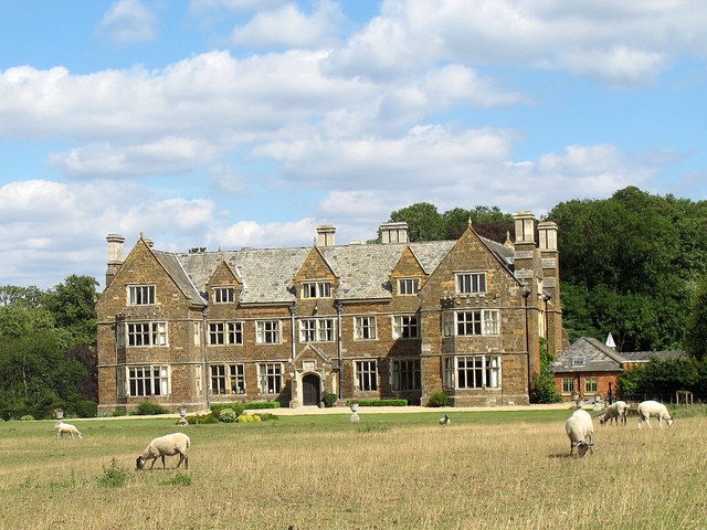
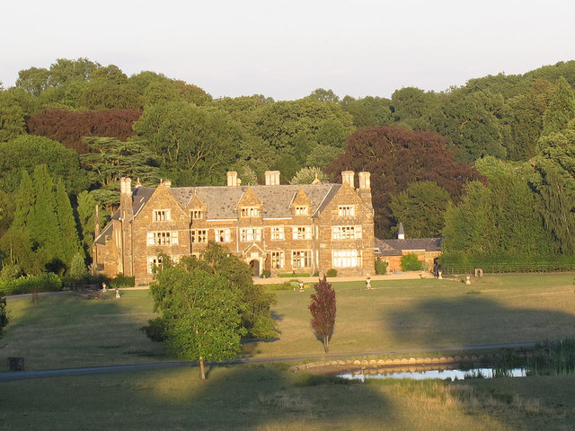
Launde Abbey is a historic site located in the county of Leicestershire, England. Situated in a picturesque and serene setting of over 450 acres of parkland and woodland, the abbey boasts a rich history that dates back to the 12th century.

Originally founded as a monastic house in 1119, Launde Abbey was a priory for Augustinian canons until the dissolution of the monasteries in the 16th century. Following its dissolution, the abbey and its lands were granted to Sir Thomas Chaloner, who converted it into a grand manor house.

Today, Launde Abbey serves as a retreat and conference center, offering a peaceful and contemplative environment for visitors. The site features a stunning medieval chapel, which still retains its original features, including beautiful stained glass windows and a magnificent timber roof. The chapel provides a tranquil space for prayer and worship, attracting both locals and tourists alike.

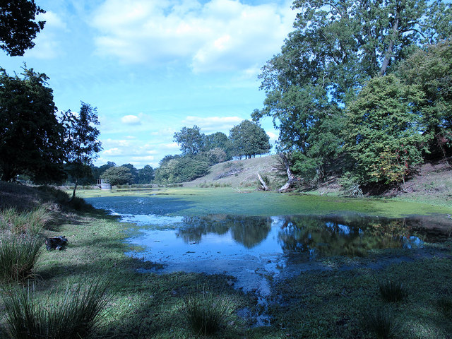
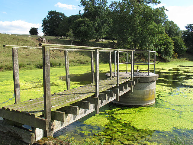
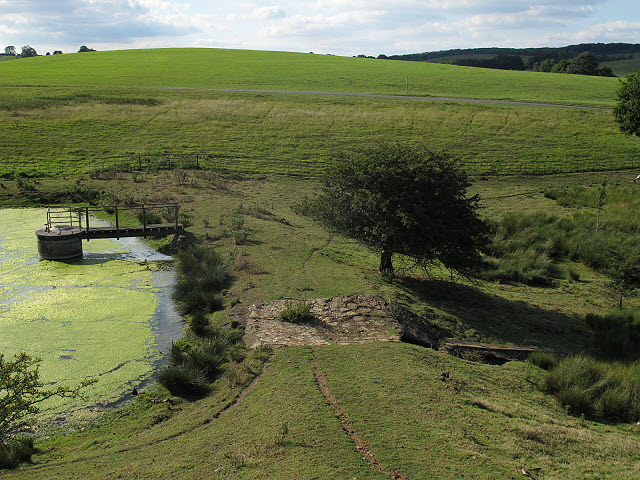
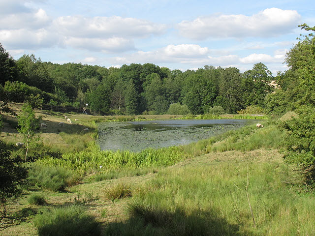
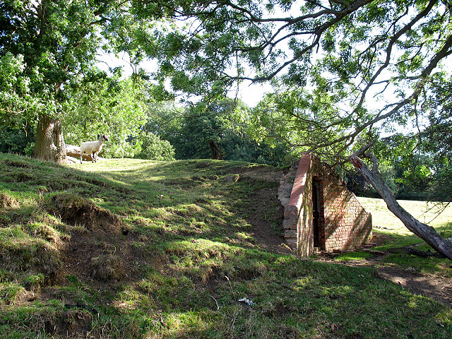
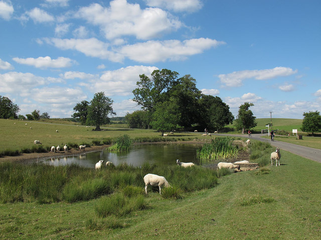
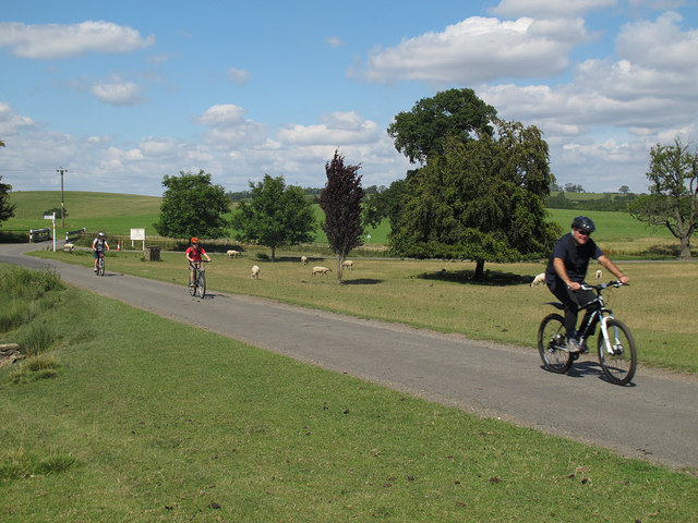
In addition to its spiritual offerings, Launde Abbey is also renowned for its natural beauty. The extensive grounds are home to diverse wildlife and offer numerous walking trails, allowing visitors to explore the idyllic countryside. The abbey's gardens, meticulously maintained, provide a colorful and fragrant oasis for relaxation and reflection.

Launde Abbey's rich history and tranquil surroundings make it a popular destination for those seeking a retreat from the hustle and bustle of modern life, as well as history enthusiasts and nature lovers. Whether one is interested in exploring the abbey's medieval past, engaging in spiritual practices, or simply enjoying the natural beauty of the surroundings, Launde Abbey offers a unique and enriching experience for all who visit.

If you have any feedback on the listing, please let us know in the comments section below.
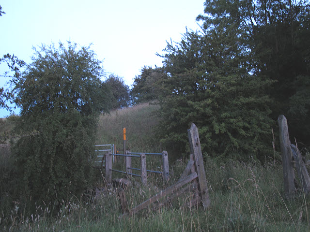
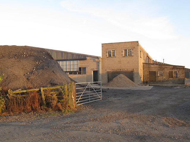
Launde Abbey Images

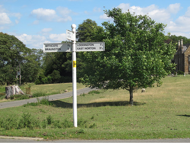
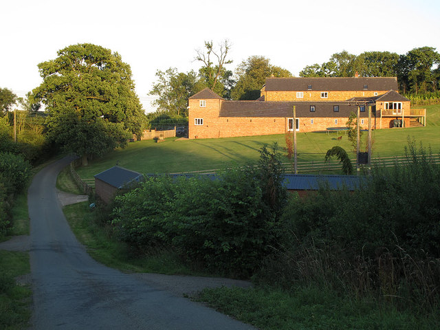
Images are sourced within 2km of 52.631824/-0.82539601 or Grid Reference SK7904. Thanks to Geograph Open Source API. All images are credited.

Launde Upper Reservoir The highest of a series of three small reservoirs below Launde Abbey.  Apparently they were originally fishponds for the Abbey.  They are now badly affected by algae, probably due to the runoff from the Abbey's septic tank just above the top pond.
Launde Upper Reservoir
The highest of a series of three small reservoirs below Launde Abbey. Apparently they were originally fishponds for the Abbey. They are now badly affected by algae, probably due to the runoff from the Abbey's septic tank just above the top pond.
Launde Upper Reservoir - drawoff A drawoff valve tower and footbridge.  For context, see <a href="https://www.geograph.org.uk/photo/2552269">SK7904 : Launde Upper Reservoir</a>.
Launde Upper Reservoir - drawoff
A drawoff valve tower and footbridge. For context, see SK7904 : Launde Upper Reservoir.
Launde Upper Reservoir - overflow The overflow consists of a stone-surfaced dip in the crest of the earth embankment.  For context, see <a href="https://www.geograph.org.uk/photo/2552269">SK7904 : Launde Upper Reservoir</a>.
Launde Upper Reservoir - overflow
The overflow consists of a stone-surfaced dip in the crest of the earth embankment. For context, see SK7904 : Launde Upper Reservoir.
Launde Middle Reservoir The middle of a series of three small reservoirs below Launde Abbey.  Apparently they were originally fishponds for the Abbey.  They are now badly affected by algae, probably due to the runoff from the Abbey's septic tank just above the top pond.

This view is from the earth embankment of the upper reservoir <a href="https://www.geograph.org.uk/photo/2552285">SK7904 : Launde Upper Reservoir - overflow</a>.
Launde Middle Reservoir
The middle of a series of three small reservoirs below Launde Abbey. Apparently they were originally fishponds for the Abbey. They are now badly affected by algae, probably due to the runoff from the Abbey's septic tank just above the top pond. This view is from the earth embankment of the upper reservoir SK7904 : Launde Upper Reservoir - overflow.
Ice House at Launde Abbey The brick-built ice house is no longer in use, but is situated adjacent to the upper reservoir <a href="https://www.geograph.org.uk/photo/2552269">SK7904 : Launde Upper Reservoir</a> from which ice would have been taken in winter.

It is listed grade 2 (list entry number 1177990).
Ice House at Launde Abbey
The brick-built ice house is no longer in use, but is situated adjacent to the upper reservoir SK7904 : Launde Upper Reservoir from which ice would have been taken in winter. It is listed grade 2 (list entry number 1177990).
Launde Abbey, front The present house is built on the site of a medieval abbey, but is in fact a 17th century manor house with 19th century additions.  It is listed grade 2* (list entry number 1074857).  It is now used as an Anglican retreat centre.

Since the first Geograph was submitted for this square in 2005 <a href="https://www.geograph.org.uk/photo/46027">SK7904 : Launde Abbey, near Loddington, Leicestershire</a>, the house has undergone extensive refurbishment (reopened in January 2011 by the Prince of Wales) with a new entrance and carpark on the south side, so the hardstanding in front of it is now longer used as a car park.  Sheep continue to graze the field in front of the abbey.
Launde Abbey, front
The present house is built on the site of a medieval abbey, but is in fact a 17th century manor house with 19th century additions. It is listed grade 2* (list entry number 1074857). It is now used as an Anglican retreat centre. Since the first Geograph was submitted for this square in 2005 SK7904 : Launde Abbey, near Loddington, Leicestershire, the house has undergone extensive refurbishment (reopened in January 2011 by the Prince of Wales) with a new entrance and carpark on the south side, so the hardstanding in front of it is now longer used as a car park. Sheep continue to graze the field in front of the abbey.
Launde Abbey, front with pond The present house is built on the site of a medieval abbey, but is in fact a 17th century manor house with 19th century additions.  It is listed grade 2* (list entry number 1074857).  It is now used as an Anglican retreat centre.

Since the first Geograph was submitted for this square in 2005 <a href="https://www.geograph.org.uk/photo/46027">SK7904 : Launde Abbey, near Loddington, Leicestershire</a>, the retreat house has undergone extensive refurbishment (reopened in January 2011 by the Prince of Wales) with a new entrance and carpark on the south side, so the hardstanding in front of it is now longer used as a car park.  

This view is shortly before sunset and includes a pond in the middle distance.
Launde Abbey, front with pond
The present house is built on the site of a medieval abbey, but is in fact a 17th century manor house with 19th century additions. It is listed grade 2* (list entry number 1074857). It is now used as an Anglican retreat centre. Since the first Geograph was submitted for this square in 2005 SK7904 : Launde Abbey, near Loddington, Leicestershire, the retreat house has undergone extensive refurbishment (reopened in January 2011 by the Prince of Wales) with a new entrance and carpark on the south side, so the hardstanding in front of it is now longer used as a car park. This view is shortly before sunset and includes a pond in the middle distance.
Launde Abbey, pond A pond adjacent to the public road through the grounds of Launde Abbey retreat house.
Launde Abbey, pond
A pond adjacent to the public road through the grounds of Launde Abbey retreat house.
Cyclists passing Launde Abbey Three cyclists on the public road through the grounds of the retreat house.
Cyclists passing Launde Abbey
Three cyclists on the public road through the grounds of the retreat house.
Signpost outside Launde Abbey The sign points three ways: to Withcote and Brunston (left), Loddington and East Norton (right), and Owston and Halstead (towards the camera).  The road beyond is the private drive to Launde Abbey.
Signpost outside Launde Abbey
The sign points three ways: to Withcote and Brunston (left), Loddington and East Norton (right), and Owston and Halstead (towards the camera). The road beyond is the private drive to Launde Abbey.
Abbey Farm The farm, seen here in evening light, is named after nearby Launde Abbey.
Abbey Farm
The farm, seen here in evening light, is named after nearby Launde Abbey.
Roadsigns on a hill A pair of signs on a country road near Owston, warning of slippery road conditions and soft verges.  A dangerous combination!
Roadsigns on a hill
A pair of signs on a country road near Owston, warning of slippery road conditions and soft verges. A dangerous combination!
Footbridge at dusk The footbridge takes a public footpath over the River Chater.
Footbridge at dusk
The footbridge takes a public footpath over the River Chater.
Abbey Farm - outbuildings (1) These buildings are several hundred metres from the farmhouse <a href="https://www.geograph.org.uk/photo/2552324">SK7904 : Abbey Farm</a>.
Abbey Farm - outbuildings (1)
These buildings are several hundred metres from the farmhouse SK7904 : Abbey Farm.
Abbey Farm - outbuildings (2) These buildings are several hundred metres from the farmhouse <a href="https://www.geograph.org.uk/photo/2552324">SK7904 : Abbey Farm</a>.
Abbey Farm - outbuildings (2)
These buildings are several hundred metres from the farmhouse SK7904 : Abbey Farm.
Abbey Farm - hay bales awaiting collection Bales of hay in a field on a summer evening, about to be taken to the nearby barn <a href="https://www.geograph.org.uk/photo/2552371">SK7804 : Abbey Farm - outbuildings (2)</a>.
Abbey Farm - hay bales awaiting collection
Bales of hay in a field on a summer evening, about to be taken to the nearby barn SK7804 : Abbey Farm - outbuildings (2).
Abbey Farm - hay bales being collected Bales of hay in a field on a summer evening, about to be taken to the nearby barn <a href="https://www.geograph.org.uk/photo/2552371">SK7804 : Abbey Farm - outbuildings (2)</a>.
Abbey Farm - hay bales being collected
Bales of hay in a field on a summer evening, about to be taken to the nearby barn SK7804 : Abbey Farm - outbuildings (2).
Abbey Farm - bringing in the hay A tractor struggles up the hill with a load of bales of hay being taken to the barn <a href="https://www.geograph.org.uk/photo/2552371">SK7804 : Abbey Farm - outbuildings (2)</a>.
Abbey Farm - bringing in the hay
A tractor struggles up the hill with a load of bales of hay being taken to the barn SK7804 : Abbey Farm - outbuildings (2).
Show me another place!

Launde Abbey is located at Grid Ref: SK7904 (Lat: 52.631824, Lng: -0.82539601)

Administrative County: Leicestershire

District: Harborough

Police Authority: Leicestershire

What 3 Words

///heaven.ferrets.crash. Near Ridlington, Rutland

Related Wikis

Launde Priory

Launde Priory is a former Augustinian priory in Leicestershire, England. Its successor Launde Abbey is used as a conference and retreat centre by the...

Launde Abbey

Launde Abbey is located in Leicestershire, England, 14 miles east of the city of Leicester and 6 miles south west of Oakham in Rutland. The house was built...

Launde

Launde is a civil parish in the Harborough district of Leicestershire, bordering Rutland. The parish is the site of Launde Abbey. It gives its name to...

Chater Valley

Chater Valley is a 3.8-hectare (9.4-acre) biological Site of Special Scientific Interest north of Loddington in Leicestershire. This steeply sloping stretch...

Nearby Amenities

Located within 500m of 52.631824,-0.82539601
Barrier: cattle_grid
Lat/Long: 52.631922/-0.8252992
Conference Centre
Launde Abbey
Wikidata: Q6498468
Wikipedia: en:Launde Abbey
Lat/Long: 52.6311727/-0.8233218
Barrier: cattle_grid
Lat/Long: 52.6329728/-0.8284757
Launde Abbey
Place: locality
Lat/Long: 52.6312399/-0.8242959
Barrier: stile
Lat/Long: 52.6320776/-0.8252259
Cafe
Launde Abbey Retreat House And Conference Centre
Addr City: Leicester
Addr Country: GB
Addr Housename: Launde Abbey
Addr Postcode: LE7 9XB
Addr Street: Launde Road
Addr Village: Launde
Fhrs Authority: Harborough
Fhrs Id: 355178
Fhrs Local Authority Id: 08600/2014/2/000
Lat/Long: 52.6308634/-0.823122
Barrier: cattle_grid
Lat/Long: 52.6306154/-0.8237049
Abbey Farm
Place: farm
Lat/Long: 52.6334666/-0.8294073
Barrier: cattle_grid
Lat/Long: 52.6299902/-0.8241032
Barrier: cattle_grid
Lat/Long: 52.6331345/-0.8206289
The data included in this document is from www.openstreetmap.org. The data is made available under ODbL.

Have you been to Launde Abbey?

Leave your review of Launde Abbey below (or comments, questions and feedback).