Langton

Settlement in Westmorland Eden

England

Langton

Ordnance Survey Cut Mark This OS cut mark can be found on the wall SW side of the road junction. It marks a point 168.155m above mean sea level.
Ordnance Survey Cut Mark Credit: Adrian Dust

Langton is a small village located in the county of Westmorland, in the northwestern part of England. Nestled amidst the beautiful countryside of Cumbria, Langton is surrounded by rolling hills, lush green fields, and picturesque landscapes. The village is situated approximately 5 miles southeast of the town of Kendal and is easily accessible via the A684 road.

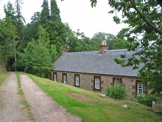
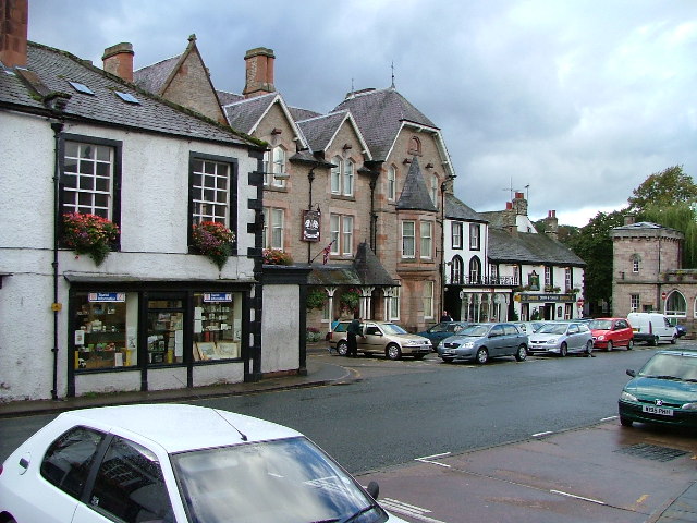
Despite its small size, Langton is rich in history and heritage. The village dates back to medieval times and is mentioned in the Domesday Book of 1086. It has retained its traditional character with a cluster of charming stone cottages, a historic church, and a village green. The church, dedicated to St. John the Evangelist, is a notable landmark and features stunning architectural details.

Langton offers a peaceful and idyllic setting for its residents and visitors alike. The surrounding countryside provides ample opportunities for outdoor activities such as hiking, cycling, and exploring the nearby Lake District National Park. The village is also within close proximity to the River Kent, offering fishing and boating opportunities.

Although small, Langton is a close-knit community with a friendly and welcoming atmosphere. It has a strong sense of community spirit and hosts various events and gatherings throughout the year, including a summer fete and a Christmas market. The village also has a pub and a small shop, catering to the daily needs of its residents.

In summary, Langton is a quaint and historic village in Westmorland, offering a tranquil setting, stunning natural beauty, and a strong sense of community.

If you have any feedback on the listing, please let us know in the comments section below.

Langton Images

Images are sourced within 2km of 54.575918/-2.4508736 or Grid Reference NY7020. Thanks to Geograph Open Source API. All images are credited.

Ordnance Survey Cut Mark This OS cut mark can be found on the wall SW side of the road junction. It marks a point 168.155m above mean sea level.
Ordnance Survey Cut Mark
This OS cut mark can be found on the wall SW side of the road junction. It marks a point 168.155m above mean sea level.
Ordnance Survey Cut Mark This OS cut mark can be found on the north face of the railway bridge. It marks a point 158.005m above mean sea level.
Ordnance Survey Cut Mark
This OS cut mark can be found on the north face of the railway bridge. It marks a point 158.005m above mean sea level.
Hilton Beck at Langton Hilton Beck runs along the northern and western edges of Brackenber Moor (Appleby Golf Course) and for the aficionado of obscure ditches who prefer their paddling not to be too scary, looks quite an attractive proposition. The level seen here is fairly high through snowmelt, but with some rain too it would perhaps be a little quicker from a put-in at Hilton to a take-out at Coupland. This view is from just upstream of the footbridge at Langton and shows what would, in lower water, be an easy ford. The beck seems relatively free of tree hazard for a lowland trip, but there is at least one livestock fence (just around a blind bend) to watch out for - there may be other hazards not seen on my walk (it was a dog walk, not a full river reconnaissance).
Hilton Beck at Langton
Hilton Beck runs along the northern and western edges of Brackenber Moor (Appleby Golf Course) and for the aficionado of obscure ditches who prefer their paddling not to be too scary, looks quite an attractive proposition. The level seen here is fairly high through snowmelt, but with some rain too it would perhaps be a little quicker from a put-in at Hilton to a take-out at Coupland. This view is from just upstream of the footbridge at Langton and shows what would, in lower water, be an easy ford. The beck seems relatively free of tree hazard for a lowland trip, but there is at least one livestock fence (just around a blind bend) to watch out for - there may be other hazards not seen on my walk (it was a dog walk, not a full river reconnaissance).
House nearly finished, Langton The fresh local sandstone construction looks quite colourful but will no doubt weather quite quickly to be a match for the other nearby properties. Open eaves on the nearest part of the building show that there is still work to do on the house, but the next main challenge will surely be the garden. It's a heavy clay soil left by the retreat of the Eden Valley glacier, but at least the site is not beset by the sort of rubble often seen on building sites. I wish them luck.
House nearly finished, Langton
The fresh local sandstone construction looks quite colourful but will no doubt weather quite quickly to be a match for the other nearby properties. Open eaves on the nearest part of the building show that there is still work to do on the house, but the next main challenge will surely be the garden. It's a heavy clay soil left by the retreat of the Eden Valley glacier, but at least the site is not beset by the sort of rubble often seen on building sites. I wish them luck.
Footpath south of Low Barn The footpath leaves the minor road to Flakebridge to follow the northern edge of a patch of woodland. The bits of plastic pipe (seemingly much loved by gamekeepers as markers for all sorts of things) bear numbers for shooting positions, presumably to annihilate pheasant being driven over the horizon from the fields to the north (right, in this view). Anything being driven out of the woods would be in your face before having time to fire a shot and a shorter-range weapon would seem more in order. Tennis rackets to return serve or a net on a long pole as used for Puffins in the Faeroes, perhaps ?
Footpath south of Low Barn
The footpath leaves the minor road to Flakebridge to follow the northern edge of a patch of woodland. The bits of plastic pipe (seemingly much loved by gamekeepers as markers for all sorts of things) bear numbers for shooting positions, presumably to annihilate pheasant being driven over the horizon from the fields to the north (right, in this view). Anything being driven out of the woods would be in your face before having time to fire a shot and a shorter-range weapon would seem more in order. Tennis rackets to return serve or a net on a long pole as used for Puffins in the Faeroes, perhaps ?
Flakebridge Flakebridge comprises a scattering of houses along the southern edge of Flakebridge Wood, above the very flat valley of Murton Beck. This house sits opposite the junction track heading north alongside Swine Gill, deeper into the forest. Judging by the noise which assailed us for the best part of an hour as we approached this point, which had fortunately ceased by the time we got here, the main activity here is slaughtering anything that comes into shotgun range. Just to the west, after the shooting had desisted, the howls of very many dogs serenaded our passing from a building in which they were clearly imprisoned but keen to escape and either greet or devour passers by.
Flakebridge
Flakebridge comprises a scattering of houses along the southern edge of Flakebridge Wood, above the very flat valley of Murton Beck. This house sits opposite the junction track heading north alongside Swine Gill, deeper into the forest. Judging by the noise which assailed us for the best part of an hour as we approached this point, which had fortunately ceased by the time we got here, the main activity here is slaughtering anything that comes into shotgun range. Just to the west, after the shooting had desisted, the howls of very many dogs serenaded our passing from a building in which they were clearly imprisoned but keen to escape and either greet or devour passers by.
Copse south of Murton Beck This stand of trees (which we would have called a copse where I grew up, but they are not coppiced, so whether the term would apply here I'm less sure) occupies the corner of a field south of Murton Beck, the northern edge of which is followed by the public footpath from the Flakebridge road towards Murton, upon which the photographer and his trusty but dawdling hound are standing as the daylight fades (again).
Copse south of Murton Beck
This stand of trees (which we would have called a copse where I grew up, but they are not coppiced, so whether the term would apply here I'm less sure) occupies the corner of a field south of Murton Beck, the northern edge of which is followed by the public footpath from the Flakebridge road towards Murton, upon which the photographer and his trusty but dawdling hound are standing as the daylight fades (again).
Footbridge over Murton Beck The public footpath west from Murton splits here with one way remaining on the north bank of Murton Beck to turn northwards shortly, heading for Brackenthwaite, whilst the footbridge carries the other branch across the beck, to head west to Shepherd's Cottage and Flakebridge (and the end of a minor road to Appleby).
Footbridge over Murton Beck
The public footpath west from Murton splits here with one way remaining on the north bank of Murton Beck to turn northwards shortly, heading for Brackenthwaite, whilst the footbridge carries the other branch across the beck, to head west to Shepherd's Cottage and Flakebridge (and the end of a minor road to Appleby).
Ordnance Survey Cut Mark This OS cut mark can be found on the barn at Kirkber Farm. It marks a point 155.466m above mean sea level.
Ordnance Survey Cut Mark
This OS cut mark can be found on the barn at Kirkber Farm. It marks a point 155.466m above mean sea level.
Ordnance Survey Cut Mark This OS cut mark can be found on the barn at Langton Farm. It marks a point 159.602m above mean sea level.
Ordnance Survey Cut Mark
This OS cut mark can be found on the barn at Langton Farm. It marks a point 159.602m above mean sea level.
Ordnance Survey Pivot This OS pivot can be found on the wall SW side of the road. It marks a point 164.857m above mean sea level.
Ordnance Survey Pivot
This OS pivot can be found on the wall SW side of the road. It marks a point 164.857m above mean sea level.
Ordnance Survey Pivot This OS pivot can be found on the culvert NW side of the road. It marks a point 182.426m above mean sea level.
Ordnance Survey Pivot
This OS pivot can be found on the culvert NW side of the road. It marks a point 182.426m above mean sea level.
Eden Valley Railway from B6547
Bridge on Settle to Carlisle rail line
B6542 turn off, A66 The A66 is a major road in northern England running from near Middlesbrough to Workington. The section between Scotch Corner and Penrith is a Trans-Pennine route between the A1 and M6, following an old Roman Road.
Wikipedia: <span class="nowrap"><a title="http://en.wikipedia.org/wiki/A66_road" rel="nofollow ugc noopener" href="http://en.wikipedia.org/wiki/A66_road">Link</a><img style="margin-left:2px;" alt="External link" title="External link - shift click to open in new window" src="https://s1.geograph.org.uk/img/external.png" width="10" height="10"/></span>
B6542 turn off, A66
The A66 is a major road in northern England running from near Middlesbrough to Workington. The section between Scotch Corner and Penrith is a Trans-Pennine route between the A1 and M6, following an old Roman Road. Wikipedia: LinkExternal link
Sandford Thorn A house by the A66.
Sandford Thorn
A house by the A66.
Cattle grazing by the A66
Sandstone Outcrop This is a small valley near Appleby golf course.
Sandstone Outcrop
This is a small valley near Appleby golf course.
Show me another place!

Langton is located at Grid Ref: NY7020 (Lat: 54.575918, Lng: -2.4508736)

Administrative County: Cumbria

District: Eden

Police Authority: Cumbria

What 3 Words

///series.pink.appoints. Near Appleby-in-Westmorland, Cumbria

Nearby Locations

Langton

Related Wikis

Coupland, Cumbria

Coupland is a small village in Cumbria, England, in the civil parish of Warcop. It is situated a short distance to the south-east of Appleby-in-Westmorland...

Flakebridge

Flakebridge is a woodland and small hamlet in the Eden District, Cumbria, England, 3 kilometres (1.9 mi) south-west from the village of Dufton and 1.95...

Appleby-in-Westmorland

Appleby-in-Westmorland is a market town and civil parish in Westmorland and Furness, Cumbria, England, with a population of 3,048 at the 2011 Census. Crossed...

Appleby East railway station

Appleby East railway station is a closed railway station that was situated on the Eden Valley Railway between Kirkby Stephen East and Penrith in Cumberland...

Nearby Amenities

Located within 500m of 54.575918,-2.4508736
Langton Gate
Naptan AtcoCode: 090074481431
Naptan Bearing: W
Naptan BusStopType: CUS
Naptan CommonName: Langton Gate
Naptan Indicator: o/s
Naptan Landmark: Langton Gate
Naptan NaptanCode: cumdatjm
Naptan Street: No name
Naptan Verified: no
Source: naptan_import
Lat/Long: 54.5759007/-2.4506868
Post Box
Ref: CA16 174
Lat/Long: 54.5758546/-2.4508888
Kirkber
Place: locality
Lat/Long: 54.5758847/-2.4572709
Power: pole
Lat/Long: 54.5779879/-2.4576756
Power: pole
Lat/Long: 54.5781104/-2.4560621
Power: pole
Lat/Long: 54.578185/-2.4550793
Power: pole
Lat/Long: 54.5782549/-2.4541282
Power: pole
Lat/Long: 54.57835/-2.4528172
Power: pole
Lat/Long: 54.5784532/-2.4514983
Power: pole
Lat/Long: 54.5785804/-2.4498394
Power: pole
Lat/Long: 54.5786893/-2.4483781
Power: pole
Lat/Long: 54.5787915/-2.4470656
Power: pole
Lat/Long: 54.5789087/-2.4455035
Power: pole
Lat/Long: 54.5793691/-2.4459385
Power: pole
Lat/Long: 54.5773014/-2.4557971
Power: pole
Lat/Long: 54.5764877/-2.4555697
Power: pole
Lat/Long: 54.5755857/-2.4553067
Power: pole
Lat/Long: 54.5751066/-2.4551782
Power: pole
Lat/Long: 54.5743318/-2.4549389
Power: pole
Lat/Long: 54.5735065/-2.4546997
Power: pole
Lat/Long: 54.5726778/-2.4544486
Power: pole
Lat/Long: 54.575871/-2.4536299
Power: pole
Lat/Long: 54.5760326/-2.452661
Power: pole
Lat/Long: 54.5761931/-2.4517
The data included in this document is from www.openstreetmap.org. The data is made available under ODbL.

Have you been to Langton?

Leave your review of Langton below (or comments, questions and feedback).