Langney Village

Settlement in Sussex Eastbourne

England

Langney Village

Princes Park
Princes Park Credit: N Chadwick

Langney Village is a residential area located in Eastbourne, a town in East Sussex, England. Situated on the eastern outskirts of Eastbourne, Langney Village is bordered by the A22 road to the west and the Pevensey Levels to the east. The village is primarily known for its peaceful surroundings and close proximity to nature.

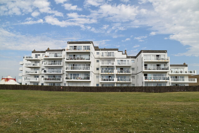
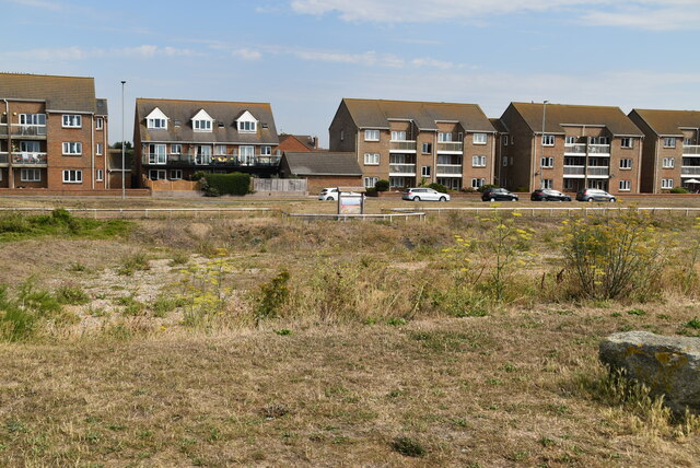
Langney Village is characterized by its well-maintained housing estates, featuring a mix of detached and semi-detached houses, as well as some low-rise apartment buildings. The area attracts families and professionals seeking a suburban lifestyle, with many amenities and facilities conveniently located nearby.

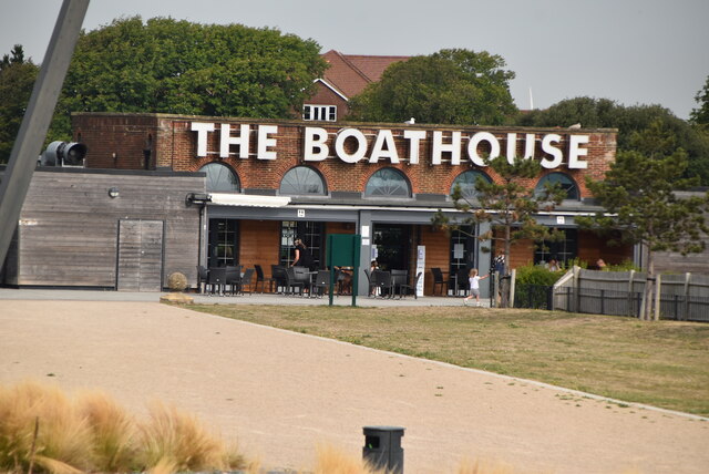
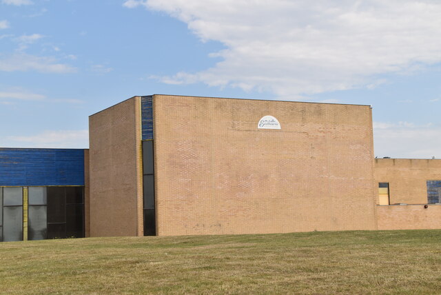
The village offers a range of amenities for its residents, including shops, restaurants, and local businesses. The Langney Shopping Centre is a popular retail hub, providing a variety of stores and services to cater to the needs of the community. Additionally, there are several schools in the area, making it an attractive location for families with children.

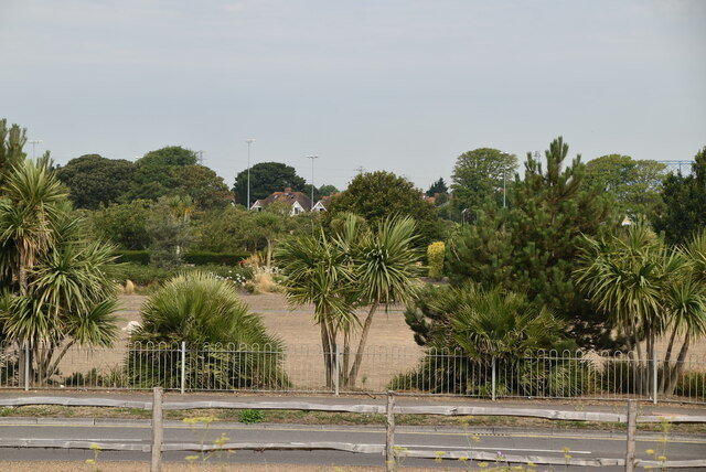
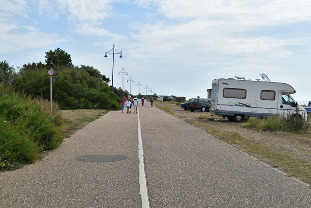
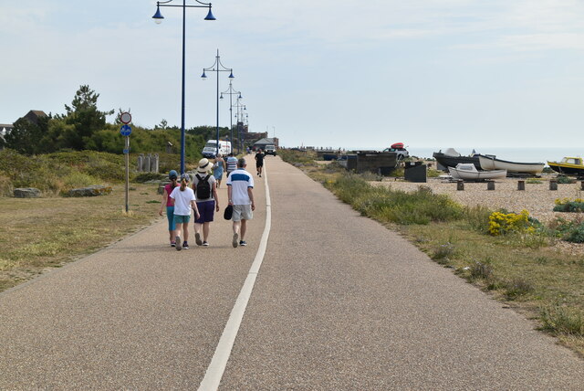
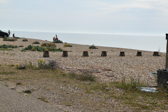
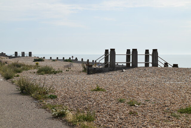
Nature enthusiasts are drawn to Langney Village due to its close proximity to the Pevensey Levels, a Site of Special Scientific Interest. This wetland area is renowned for its diverse wildlife, including rare bird species and unique plant life. The Pevensey Levels provide ample opportunities for outdoor activities such as birdwatching, walking, and cycling.

Overall, Langney Village offers a tranquil and family-friendly environment, with a range of amenities and natural attractions to enjoy. Its convenient location and peaceful surroundings make it an appealing place to live in Sussex.

If you have any feedback on the listing, please let us know in the comments section below.

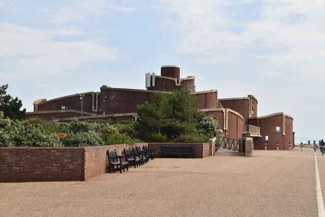
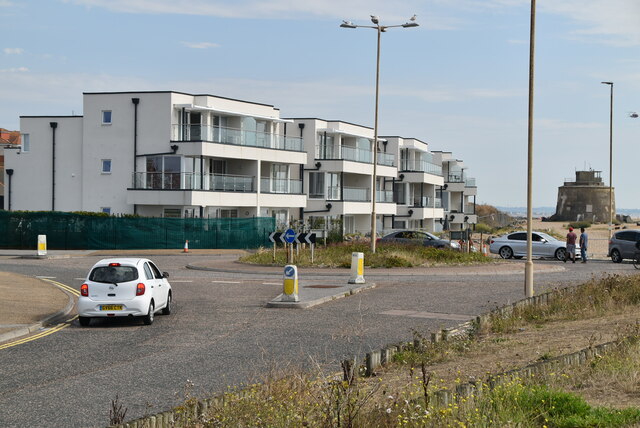
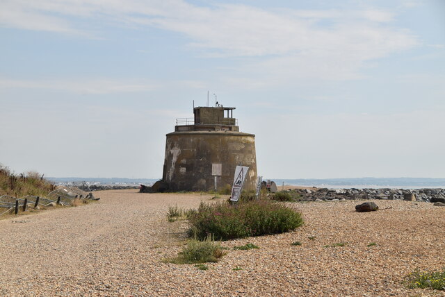
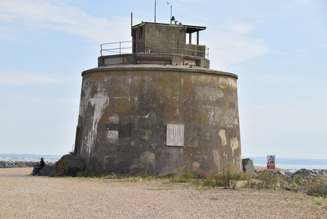
Langney Village Images

Images are sourced within 2km of 50.796667/0.31670541 or Grid Reference TQ6302. Thanks to Geograph Open Source API. All images are credited.

Princes Park
Princes Park
The Boathouse
The Boathouse
Beach huts A beach hut is a small, usually wooden and often brightly coloured, box or structure above the high tide mark on popular bathing beaches. They are generally used as a shelter from the sun or wind, changing into and out of swimming costumes and for the safe storing of some personal belongings. Some beach huts incorporate simple facilities for preparing food and hot drinks by either bottled gas or occasionally mains electricity.
Wikipedia: <span class="nowrap"><a title="http://en.wikipedia.org/wiki/Beach_hut" rel="nofollow ugc noopener" href="http://en.wikipedia.org/wiki/Beach_hut">Link</a><img style="margin-left:2px;" alt="External link" title="External link - shift click to open in new window" src="https://s1.geograph.org.uk/img/external.png" width="10" height="10"/></span>
Beach huts
A beach hut is a small, usually wooden and often brightly coloured, box or structure above the high tide mark on popular bathing beaches. They are generally used as a shelter from the sun or wind, changing into and out of swimming costumes and for the safe storing of some personal belongings. Some beach huts incorporate simple facilities for preparing food and hot drinks by either bottled gas or occasionally mains electricity. Wikipedia: LinkExternal link
Car park
Car park
Monarch House
Monarch House
Sovereign Centre
Sovereign Centre
Cycle route 21 Route 21 of The National Cycle Network runs south from Greenwich out of London through Lewisham (the Waterlink Way) to Crawley, and then via East Grinstead and Eridge to Heathfield and Eastbourne, a distance of 95 miles.
The section between Groombridge and East Grinstead follows the Forest Way. <a title="https://www.geograph.org.uk/snippet/2922" href="https://www.geograph.org.uk/snippet/2922">Link</a> 
See <span class="nowrap"><a title="http://www.sustrans.org.uk/what-we-do/national-cycle-network/route-numbering-system/route-21" rel="nofollow ugc noopener" href="http://www.sustrans.org.uk/what-we-do/national-cycle-network/route-numbering-system/route-21">Link</a><img style="margin-left:2px;" alt="External link" title="External link - shift click to open in new window" src="https://s1.geograph.org.uk/img/external.png" width="10" height="10"/></span> for a map of the route.
Cycle route 21
Route 21 of The National Cycle Network runs south from Greenwich out of London through Lewisham (the Waterlink Way) to Crawley, and then via East Grinstead and Eridge to Heathfield and Eastbourne, a distance of 95 miles. The section between Groombridge and East Grinstead follows the Forest Way. Link See LinkExternal link for a map of the route.
Skate Board Park
Skate Board Park
Cycle route 21 Route 21 of The National Cycle Network runs south from Greenwich out of London through Lewisham (the Waterlink Way) to Crawley, and then via East Grinstead and Eridge to Heathfield and Eastbourne, a distance of 95 miles.
The section between Groombridge and East Grinstead follows the Forest Way. <a title="https://www.geograph.org.uk/snippet/2922" href="https://www.geograph.org.uk/snippet/2922">Link</a> 
See <span class="nowrap"><a title="http://www.sustrans.org.uk/what-we-do/national-cycle-network/route-numbering-system/route-21" rel="nofollow ugc noopener" href="http://www.sustrans.org.uk/what-we-do/national-cycle-network/route-numbering-system/route-21">Link</a><img style="margin-left:2px;" alt="External link" title="External link - shift click to open in new window" src="https://s1.geograph.org.uk/img/external.png" width="10" height="10"/></span> for a map of the route.
Cycle route 21
Route 21 of The National Cycle Network runs south from Greenwich out of London through Lewisham (the Waterlink Way) to Crawley, and then via East Grinstead and Eridge to Heathfield and Eastbourne, a distance of 95 miles. The section between Groombridge and East Grinstead follows the Forest Way. Link See LinkExternal link for a map of the route.
The beach
The beach
Sovereign Park Prior to 1600, the landscape of Sovereign Park consisted of fossil storm beaches formed by strong wave action which caused the shingle to be driven onshore and large ridges were formed that can still be seen today.
With the dry exposed conditions created by the wave actions various plants and wildlife adapted to this environment and became tolerant to the extreme exposure to the wind, salt, heat and unstable ground and the shingle heath land evolved. Sovereign Park is now home to almost 130 different species of wildflowers such as Viper’s Bugloss, Curled Dock, Red Valerian, Wild Carrot, Sea Campion, Sea Kale, Sea Holly, Sea Pea and Yellow Horn Poppies to name a few. Living along side these plants are several kinds on animals including moths and spiders that are not found in many other places.
With development going on nearby in 1998 the council decided to preserve a small area of this unusual habitat as an informal nature reserve which has since been officially recognised as a Site of Nature Conservation Importance.
Website: <span class="nowrap"><a title="http://www.eastbourne.gov.uk/leisure/parks/parks/sovereign-park/" rel="nofollow ugc noopener" href="http://www.eastbourne.gov.uk/leisure/parks/parks/sovereign-park/">Link</a><img style="margin-left:2px;" alt="External link" title="External link - shift click to open in new window" src="https://s1.geograph.org.uk/img/external.png" width="10" height="10"/></span>
Sovereign Park
Prior to 1600, the landscape of Sovereign Park consisted of fossil storm beaches formed by strong wave action which caused the shingle to be driven onshore and large ridges were formed that can still be seen today. With the dry exposed conditions created by the wave actions various plants and wildlife adapted to this environment and became tolerant to the extreme exposure to the wind, salt, heat and unstable ground and the shingle heath land evolved. Sovereign Park is now home to almost 130 different species of wildflowers such as Viper’s Bugloss, Curled Dock, Red Valerian, Wild Carrot, Sea Campion, Sea Kale, Sea Holly, Sea Pea and Yellow Horn Poppies to name a few. Living along side these plants are several kinds on animals including moths and spiders that are not found in many other places. With development going on nearby in 1998 the council decided to preserve a small area of this unusual habitat as an informal nature reserve which has since been officially recognised as a Site of Nature Conservation Importance. Website: LinkExternal link
Beach, Sovereign Park
Eastbourne Waste Water Treatment Works
Roundabout
Roundabout
Martello Tower Martello Towers, or 'Martellos', were small defensive forts first built in 1805 in South East England during the Napoleonic War. They were also built on the East Coast of England and around Ireland, as well as three in Scotland and some in the Channel Islands.

On the flat parapet roof was mounted a cannon. The round shape of the building allowed it to rotate 360°, able to defend all directions. The entrance to the tower was raised above ground level to stop easy access by the enemy. Read more <a title="https://www.geograph.org.uk/article/Martello-Towers" href="https://www.geograph.org.uk/article/Martello-Towers">Link</a>
Martello Tower
Martello Towers, or 'Martellos', were small defensive forts first built in 1805 in South East England during the Napoleonic War. They were also built on the East Coast of England and around Ireland, as well as three in Scotland and some in the Channel Islands. On the flat parapet roof was mounted a cannon. The round shape of the building allowed it to rotate 360°, able to defend all directions. The entrance to the tower was raised above ground level to stop easy access by the enemy. Read more Link
Sovereign Harbour lock Sovereign Harbour is a large development of beach-lands on the outskirts of Eastbourne, East Sussex, that began construction in 1991.

The development , includes a harbour, 24 hour marinas, business park, shops and restaurants, and over 3000 houses, apartments, flats and townhouses; including holiday properties.

Entering the marina from the sea through the outer marina by two sea locks leads you to the inner marina and off that three further marinas, south marina, west marina and north marina.
Sovereign Harbour lock
Sovereign Harbour is a large development of beach-lands on the outskirts of Eastbourne, East Sussex, that began construction in 1991. The development , includes a harbour, 24 hour marinas, business park, shops and restaurants, and over 3000 houses, apartments, flats and townhouses; including holiday properties. Entering the marina from the sea through the outer marina by two sea locks leads you to the inner marina and off that three further marinas, south marina, west marina and north marina.
Sovereign Harbour Sovereign Harbour is a large development of beach-lands on the outskirts of Eastbourne, East Sussex, that began construction in 1991.

The development , includes a harbour, 24 hour marinas, business park, shops and restaurants, and over 3000 houses, apartments, flats and townhouses; including holiday properties.

Entering the marina from the sea through the outer marina by two sea locks leads you to the inner marina and off that three further marinas, south marina, west marina and north marina.
Sovereign Harbour
Sovereign Harbour is a large development of beach-lands on the outskirts of Eastbourne, East Sussex, that began construction in 1991. The development , includes a harbour, 24 hour marinas, business park, shops and restaurants, and over 3000 houses, apartments, flats and townhouses; including holiday properties. Entering the marina from the sea through the outer marina by two sea locks leads you to the inner marina and off that three further marinas, south marina, west marina and north marina.
Show me another place!

Langney Village is located at Grid Ref: TQ6302 (Lat: 50.796667, Lng: 0.31670541)

Administrative County: East Sussex

District: Eastbourne

Police Authority: Sussex

What 3 Words

///just.bend.hills. Near Pevensey, East Sussex

Nearby Locations

Langney Village

Related Wikis

Langney Priory

Langney Priory is the modern name of Langney Grange (now a private house) which served an agricultural manor of several hundred acres providing produce...

St Catherine's College, Eastbourne

St Catherine's College (previously The Bishop Bell Church of England Mathematics & Computing Specialist School) is a coeducational Church of England secondary...

Langney

Langney is a distinct part of Eastbourne, East Sussex and is on the eastern side of the popular seaside resort. The original village and priory have now...

Priory Lane

Priory Lane is an association football stadium located in Langney, an eastern suburb of Eastbourne, East Sussex, England. It is the home of Eastbourne...

Eastbourne Lifeboat Station

Eastbourne Lifeboat Station is a Royal National Lifeboat Institution (RNLI) lifeboat station in the town of Eastbourne in East Sussex. Founded two years...
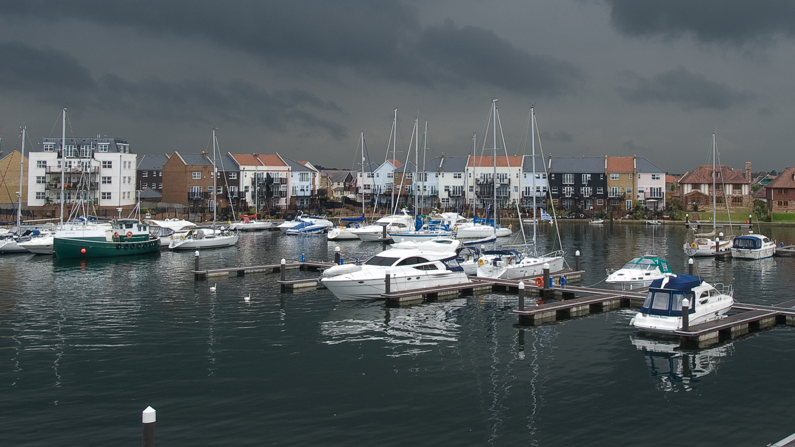
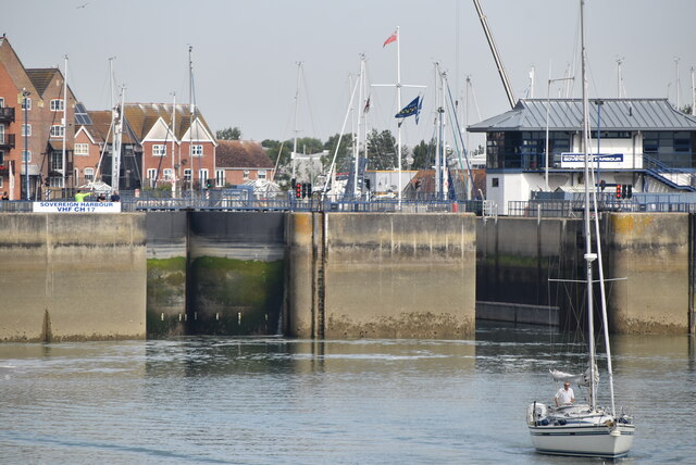
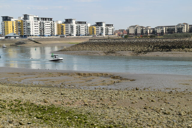
Sovereign Harbour

Sovereign Harbour is a development of the beachland in the seaside resort of Eastbourne, England to the east of the town centre. Opened in 1993 and formerly...

East Sussex College

East Sussex College or East Sussex College Group is the largest higher education college in East Sussex, providing education and training from foundation...

Eastbourne United A.F.C.

Eastbourne United A.F.C. is a football club based in Eastbourne, England. They were formed in 2003 after a merger between Eastbourne United F.C. and Shinewater...

Nearby Amenities

Located within 500m of 50.796667,0.31670541
Turning Circle
Lat/Long: 50.7935147/0.3148762
Noexit: yes
Lat/Long: 50.7994855/0.3216911
Bus Stop
Priory Road
Bus: yes
Public Transport: platform
Lat/Long: 50.7954761/0.3127709
Bus Stop
Martello Inn
Bus: yes
Public Transport: platform
Lat/Long: 50.7972664/0.3117517
Bus Stop
Martello Inn
Bus: yes
Departures Board: yes
Operator: Stagecoach
Public Transport: platform
Shelter: yes
Lat/Long: 50.7974074/0.3119957
Bus Stop
Priory Road
Bus: yes
Naptan AtcoCode: 1400EB0317
Naptan NaptanCode: esuadwad
Public Transport: platform
Shelter: yes
Lat/Long: 50.7945368/0.3137562
Bus Stop
ASDA
Bus: yes
Naptan AtcoCode: 1400EB75077
Naptan NaptanCode: esuagjat
Public Transport: platform
Shelter: yes
Lat/Long: 50.7965754/0.3208366
Bus Stop
Langney Green
Bus: yes
Public Transport: platform
Lat/Long: 50.7936038/0.3170386
Bus Stop
Spring Lodge Close
Bus: yes
Naptan AtcoCode: 1400EB0311
Naptan NaptanCode: esuadtwd
Public Transport: platform
Lat/Long: 50.8003257/0.3185614
Bus Stop
Netherfield Avenue (27)
Bus: yes
Naptan AtcoCode: 1400EB0314
Naptan NaptanCode: esuadtwm
Public Transport: platform
Lat/Long: 50.8000927/0.3210196
Bus Stop
Netherfield Avenue (21)
Bus: yes
Departures Board: timetable
Naptan AtcoCode: 1400EB0313
Naptan NaptanCode: esuadtwj
Public Transport: platform
Shelter: no
Lat/Long: 50.8000062/0.3204365
Bus Stop
Spring Lodge Close
Bus: yes
Public Transport: platform
Lat/Long: 50.7999896/0.3189307
Bus Stop
Langney Green
Bus: yes
Public Transport: platform
Lat/Long: 50.7934706/0.3159412
Crossing
Crossing: traffic_signals
Crossing Ref: puffin
Lat/Long: 50.7930212/0.3147198
11th Eastbourne Scouts
Lat/Long: 50.7958602/0.3148768
Speed Camera
Maxspeed: 30 mph
Lat/Long: 50.7976558/0.3117403
Restaurant
Tasty Work
Addr City: Eastbourne
Addr Postcode: BN23 7DR
Addr Street: Etchingham Road
Lat/Long: 50.7970611/0.3127921
Social Facility
Langney Community Cafe
Addr City: Eastbourne
Addr Postcode: BN23 7DR
Addr Street: Etchingham Road
Lat/Long: 50.7971098/0.3129338
Best-one
Addr City: Eastbourne
Addr Postcode: BN23 7BP
Addr Street: Etchingham Road
Brand: Best-one
Brand Wikidata: Q4896532
Brand Wikipedia: en:Best-one
Shop: convenience
Lat/Long: 50.7974589/0.3130742
The Barber Shop
Addr City: Eastbourne
Addr Postcode: BN23 7BP
Addr Street: Etchingham Road
Shop: hairdresser
Lat/Long: 50.7976402/0.3129936
Post Box
Ref: BN23 889D
Lat/Long: 50.7943983/0.3178683
Post Box
Brand: Royal Mail
Brand Wikidata: Q638098
Brand Wikipedia: en:Royal Mail
Collection Times: Mo-Fr 09:00; Sa 07:00
Drive Through: no
Operator: Royal Mail
Operator Wikidata: Q638098
Post Box Type: lamp
Ref: BN23 995D
Royal Cypher: EIIR
Royal Cypher Wikidata: Q33102113
Lat/Long: 50.793608/0.3185023
Man Made: mast
Lat/Long: 50.7958063/0.3197246
Post Box
Collection Times: Mo-Fr 09:00; Sa 07:00
Post Box Type: lamp
Ref: BN23 891D
Royal Cypher: EIIR
Royal Cypher Wikidata: Q33102113
Lat/Long: 50.7927012/0.3197957
Charging Station
Access: customers
Brand: BP Pulse
Brand Wikidata: Q39057719
Capacity: 2
Fee: no
Operator: BP Pulse
Operator Wikidata: Q39057719
Lat/Long: 50.7956915/0.3213849
Addr Housenumber: 1;2;3;4
Addr Street: Sovereign Close
Building: house
Lat/Long: 50.7960983/0.3190058
Bus Stop
ASDA
Bus: yes
Public Transport: platform
Shelter: yes
Lat/Long: 50.7958927/0.3193183
Crossing
Crossing: traffic_signals
Kerb: lowered
Tactile Paving: yes
Lat/Long: 50.7962334/0.3200644
Crossing
Crossing: traffic_signals
Kerb: lowered
Tactile Paving: yes
Lat/Long: 50.7962748/0.3198463
Generator Method: photovoltaic
Generator Output Electricity: yes
Generator Source: solar
Generator Type: solar_photovoltaic_panel
Location: roof
Power: generator
Lat/Long: 50.800941/0.3188302
Generator Method: photovoltaic
Generator Output Electricity: yes
Generator Source: solar
Generator Type: solar_photovoltaic_panel
Location: roof
Power: generator
Lat/Long: 50.7998917/0.3180765
Generator Method: photovoltaic
Generator Output Electricity: yes
Generator Source: solar
Generator Type: solar_photovoltaic_panel
Location: roof
Power: generator
Lat/Long: 50.7995408/0.3155123
Generator Method: photovoltaic
Generator Output Electricity: yes
Generator Source: solar
Generator Type: solar_photovoltaic_panel
Location: roof
Power: generator
Lat/Long: 50.7993339/0.316907
Generator Method: photovoltaic
Generator Output Electricity: yes
Generator Source: solar
Generator Type: solar_photovoltaic_panel
Location: roof
Power: generator
Lat/Long: 50.7991508/0.3162794
Generator Method: photovoltaic
Generator Output Electricity: yes
Generator Source: solar
Generator Type: solar_photovoltaic_panel
Location: roof
Power: generator
Lat/Long: 50.7991017/0.3148095
Generator Method: photovoltaic
Generator Output Electricity: yes
Generator Source: solar
Generator Type: solar_photovoltaic_panel
Location: roof
Power: generator
Lat/Long: 50.7990729/0.314654
Generator Method: photovoltaic
Generator Output Electricity: yes
Generator Source: solar
Generator Type: solar_photovoltaic_panel
Location: roof
Power: generator
Lat/Long: 50.7981371/0.3140183
Generator Method: photovoltaic
Generator Output Electricity: yes
Generator Source: solar
Generator Type: solar_photovoltaic_panel
Location: roof
Power: generator
Lat/Long: 50.7980862/0.313278
Generator Method: photovoltaic
Generator Output Electricity: yes
Generator Source: solar
Generator Type: solar_photovoltaic_panel
Location: roof
Power: generator
Lat/Long: 50.7980455/0.3131788
Generator Method: photovoltaic
Generator Output Electricity: yes
Generator Source: solar
Generator Type: solar_photovoltaic_panel
Location: roof
Power: generator
Lat/Long: 50.7980048/0.3130715
Generator Method: photovoltaic
Generator Output Electricity: yes
Generator Source: solar
Generator Type: solar_photovoltaic_panel
Location: roof
Power: generator
Lat/Long: 50.7980241/0.3127827
Generator Method: photovoltaic
Generator Output Electricity: yes
Generator Source: solar
Generator Type: solar_photovoltaic_panel
Location: roof
Power: generator
Lat/Long: 50.7981558/0.3126084
Generator Method: photovoltaic
Generator Output Electricity: yes
Generator Source: solar
Generator Type: solar_photovoltaic_panel
Location: roof
Power: generator
Lat/Long: 50.797837/0.3140398
Generator Method: photovoltaic
Generator Output Electricity: yes
Generator Source: solar
Generator Type: solar_photovoltaic_panel
Location: roof
Power: generator
Lat/Long: 50.797559/0.3128649
Generator Method: photovoltaic
Generator Output Electricity: yes
Generator Source: solar
Generator Type: solar_photovoltaic_panel
Location: roof
Power: generator
Lat/Long: 50.797303/0.3138305
Generator Method: photovoltaic
Generator Output Electricity: yes
Generator Source: solar
Generator Type: solar_photovoltaic_panel
Location: roof
Power: generator
Lat/Long: 50.7971928/0.3139003
Generator Method: photovoltaic
Generator Output Electricity: yes
Generator Source: solar
Generator Type: solar_photovoltaic_panel
Location: roof
Power: generator
Lat/Long: 50.7969944/0.3141095
Generator Method: photovoltaic
Generator Output Electricity: yes
Generator Source: solar
Generator Type: solar_photovoltaic_panel
Location: roof
Power: generator
Lat/Long: 50.7982846/0.3150912
Generator Method: photovoltaic
Generator Output Electricity: yes
Generator Source: solar
Generator Type: solar_photovoltaic_panel
Location: roof
Power: generator
Lat/Long: 50.7993916/0.3149195
Generator Method: photovoltaic
Generator Output Electricity: yes
Generator Source: solar
Generator Type: solar_photovoltaic_panel
Location: roof
Power: generator
Lat/Long: 50.7992848/0.3143482
Generator Method: photovoltaic
Generator Output Electricity: yes
Generator Source: solar
Generator Type: solar_photovoltaic_panel
Location: roof
Power: generator
Lat/Long: 50.7992102/0.3140371
Generator Method: photovoltaic
Generator Output Electricity: yes
Generator Source: solar
Generator Type: solar_photovoltaic_panel
Location: roof
Power: generator
Lat/Long: 50.7988847/0.3131519
Generator Method: photovoltaic
Generator Output Electricity: yes
Generator Source: solar
Generator Type: solar_photovoltaic_panel
Location: roof
Power: generator
Lat/Long: 50.7985236/0.3127389
Generator Method: photovoltaic
Generator Output Electricity: yes
Generator Source: solar
Generator Type: solar_photovoltaic_panel
Location: roof
Power: generator
Lat/Long: 50.7982032/0.3125163
Generator Method: photovoltaic
Generator Output Electricity: yes
Generator Source: solar
Generator Type: solar_photovoltaic_panel
Location: roof
Power: generator
Lat/Long: 50.7984151/0.3119449
Generator Method: photovoltaic
Generator Output Electricity: yes
Generator Source: solar
Generator Type: solar_photovoltaic_panel
Location: roof
Power: generator
Lat/Long: 50.7978726/0.3118189
Generator Method: photovoltaic
Generator Output Electricity: yes
Generator Source: solar
Generator Type: solar_photovoltaic_panel
Location: roof
Power: generator
Lat/Long: 50.7979285/0.3122614
Generator Method: photovoltaic
Generator Output Electricity: yes
Generator Source: solar
Generator Type: solar_photovoltaic_panel
Location: roof
Power: generator
Lat/Long: 50.7965367/0.3118859
Generator Method: photovoltaic
Generator Output Electricity: yes
Generator Source: solar
Generator Type: solar_photovoltaic_panel
Location: roof
Power: generator
Lat/Long: 50.7959569/0.3120308
Generator Method: photovoltaic
Generator Output Electricity: yes
Generator Source: solar
Generator Type: solar_photovoltaic_panel
Location: roof
Power: generator
Lat/Long: 50.7954618/0.3123795
Generator Method: photovoltaic
Generator Output Electricity: yes
Generator Source: solar
Generator Type: solar_photovoltaic_panel
Location: roof
Power: generator
Lat/Long: 50.7954432/0.3123151
Generator Method: photovoltaic
Generator Output Electricity: yes
Generator Source: solar
Generator Type: solar_photovoltaic_panel
Location: roof
Power: generator
Lat/Long: 50.7948277/0.3157161
Generator Method: photovoltaic
Generator Output Electricity: yes
Generator Source: solar
Generator Type: solar_photovoltaic_panel
Location: roof
Power: generator
Lat/Long: 50.7950464/0.3155901
Generator Method: photovoltaic
Generator Output Electricity: yes
Generator Source: solar
Generator Type: solar_photovoltaic_panel
Location: roof
Power: generator
Lat/Long: 50.7952634/0.3153862
Generator Method: photovoltaic
Generator Output Electricity: yes
Generator Source: solar
Generator Type: solar_photovoltaic_panel
Location: roof
Power: generator
Lat/Long: 50.7952448/0.3160568
Generator Method: photovoltaic
Generator Output Electricity: yes
Generator Source: solar
Generator Type: solar_photovoltaic_panel
Location: roof
Power: generator
Lat/Long: 50.7954482/0.316502
Generator Method: photovoltaic
Generator Output Electricity: yes
Generator Source: solar
Generator Type: solar_photovoltaic_panel
Location: roof
Power: generator
Lat/Long: 50.7950702/0.3167515
Generator Method: photovoltaic
Generator Output Electricity: yes
Generator Source: solar
Generator Type: solar_photovoltaic_panel
Location: roof
Power: generator
Lat/Long: 50.7957805/0.3171753
Generator Method: photovoltaic
Generator Output Electricity: yes
Generator Source: solar
Generator Type: solar_photovoltaic_panel
Location: roof
Power: generator
Lat/Long: 50.796062/0.3161372
Generator Method: photovoltaic
Generator Output Electricity: yes
Generator Source: solar
Generator Type: solar_photovoltaic_panel
Location: roof
Power: generator
Lat/Long: 50.7959526/0.3173362
Generator Method: photovoltaic
Generator Output Electricity: yes
Generator Source: solar
Generator Type: solar_photovoltaic_panel
Location: roof
Power: generator
Lat/Long: 50.7963807/0.3175119
Generator Method: photovoltaic
Generator Output Electricity: yes
Generator Source: solar
Generator Type: solar_photovoltaic_panel
Location: roof
Power: generator
Lat/Long: 50.7966316/0.3170331
Generator Method: photovoltaic
Generator Output Electricity: yes
Generator Source: solar
Generator Type: solar_photovoltaic_panel
Location: roof
Power: generator
Lat/Long: 50.7966859/0.3170894
Generator Method: photovoltaic
Generator Output Electricity: yes
Generator Source: solar
Generator Type: solar_photovoltaic_panel
Location: roof
Power: generator
Lat/Long: 50.7965316/0.3157939
Generator Method: photovoltaic
Generator Output Electricity: yes
Generator Source: solar
Generator Type: solar_photovoltaic_panel
Location: roof
Power: generator
Lat/Long: 50.7963756/0.3157322
Generator Method: photovoltaic
Generator Output Electricity: yes
Generator Source: solar
Generator Type: solar_photovoltaic_panel
Location: roof
Power: generator
Lat/Long: 50.7970385/0.3168722
Generator Method: photovoltaic
Generator Output Electricity: yes
Generator Source: solar
Generator Type: solar_photovoltaic_panel
Location: roof
Power: generator
Lat/Long: 50.7970123/0.3173684
Generator Method: photovoltaic
Generator Output Electricity: yes
Generator Source: solar
Generator Type: solar_photovoltaic_panel
Location: roof
Power: generator
Lat/Long: 50.8005511/0.3195544
Generator Method: photovoltaic
Generator Output Electricity: yes
Generator Source: solar
Generator Type: solar_photovoltaic_panel
Location: roof
Power: generator
Lat/Long: 50.7986796/0.3221534
Generator Method: photovoltaic
Generator Output Electricity: yes
Generator Source: solar
Generator Type: solar_photovoltaic_panel
Location: roof
Power: generator
Lat/Long: 50.7998457/0.3132099
Generator Method: photovoltaic
Generator Output Electricity: yes
Generator Source: solar
Generator Type: solar_photovoltaic_panel
Location: roof
Power: generator
Lat/Long: 50.7997862/0.3127985
Generator Method: photovoltaic
Generator Output Electricity: yes
Generator Source: solar
Generator Type: solar_photovoltaic_panel
Location: roof
Power: generator
Lat/Long: 50.7998912/0.3137848
Generator Method: photovoltaic
Generator Output Electricity: yes
Generator Source: solar
Generator Type: solar_photovoltaic_panel
Location: roof
Power: generator
Lat/Long: 50.7998959/0.3138567
Generator Method: photovoltaic
Generator Output Electricity: yes
Generator Source: solar
Generator Type: solar_photovoltaic_panel
Location: roof
Power: generator
Lat/Long: 50.7999432/0.314583
Generator Method: photovoltaic
Generator Output Electricity: yes
Generator Source: solar
Generator Type: solar_photovoltaic_panel
Location: roof
Power: generator
Lat/Long: 50.7999551/0.3146554
Generator Method: photovoltaic
Generator Output Electricity: yes
Generator Source: solar
Generator Type: solar_photovoltaic_panel
Location: roof
Power: generator
Lat/Long: 50.7997042/0.3147278
Generator Method: photovoltaic
Generator Output Electricity: yes
Generator Source: solar
Generator Type: solar_photovoltaic_panel
Location: roof
Power: generator
Lat/Long: 50.8000626/0.3154888
Generator Method: photovoltaic
Generator Output Electricity: yes
Generator Source: solar
Generator Type: solar_photovoltaic_panel
Location: roof
Power: generator
Lat/Long: 50.7992189/0.3122376
Generator Method: photovoltaic
Generator Output Electricity: yes
Generator Source: solar
Generator Type: solar_photovoltaic_panel
Location: roof
Power: generator
Lat/Long: 50.7992155/0.3121786
Post Box
Brand: Royal Mail
Brand Wikidata: Q638098
Brand Wikipedia: en:Royal Mail
Collection Times: Mo-Fr 17:15; Sa 12:00; Su off
Indoor: yes
Note: Located inside ASDA
Operator: Royal Mail
Operator Wikidata: Q638098
Post Box Type: wooden_box
Ref: BN23 874
Royal Cypher: no
Source: survey
Lat/Long: 50.7956756/0.3210596
Cafe
Asda Café
Addr City: Eastbourne
Addr Country: GB
Addr Postcode: BN23 6JH
Brand: Asda
Brand Wikidata: Q297410
Brand Wikipedia: en:Asda
Contact Phone: +44 1323 470014
Contact Website: https://storelocator.asda.com/south-east/eastbourne/the-crumbles-pevensey-bay-road/cafe
Cuisine: coffee_shop
Drinking Water Refill: yes
Drinking Water Refill Network: Refill
Fhrs Id: 130700
Fixme: Location not accurate
Internet Access: wlan
Internet Access Fee: no
Opening Hours Covid19: Mo-Su off
Operator: Asda Stores Ltd
Takeaway: yes
Lat/Long: 50.7952142/0.3213608
Asda Opticians
Brand: Asda
Brand Wikidata: Q297410
Brand Wikipedia: en:Asda
Contact Phone: +44 1323 471420
Contact Website: https://storelocator.asda.com/south-east/eastbourne/the-crumbles-pevensey-bay-road/opticians
Fixme: Location not accurate
Operator: Asda Stores Ltd
Shop: optician
Lat/Long: 50.7953057/0.3214574
Pharmacy
Asda
Brand: Asda
Brand Wikidata: Q297410
Brand Wikipedia: en:Asda
Contact Phone: +44 1323 471410
Contact Website: https://storelocator.asda.com/south-east/eastbourne/the-crumbles-pevensey-bay-road/pharmacy
Fixme: Location not accurate
Healthcare: pharmacy
Operator: Asda Stores Ltd
Lat/Long: 50.7953837/0.3215432
Crossing
Crossing: uncontrolled
Crossing Markings: yes
Lat/Long: 50.795528/0.3218751
Crossing
Crossing: traffic_signals
Crossing Ref: puffin
Lat/Long: 50.7933715/0.3138772
Crossing
Crossing: traffic_signals
Crossing Ref: puffin
Lat/Long: 50.793305/0.314007
Barrier: bollard
Lat/Long: 50.7930343/0.3131342
Crossing
Crossing: traffic_signals
Crossing Ref: puffin
Lat/Long: 50.7929627/0.3148917
Crossing
Crossing: unmarked
Crossing Island: yes
Crossing Markings: no
Kerb: lowered
Tactile Paving: yes
Lat/Long: 50.7952196/0.3130616
Crossing
Crossing: traffic_signals
Crossing Island: no
Crossing Ref: puffin
Kerb: lowered
Tactile Paving: yes
Lat/Long: 50.79821/0.3114791
Crossing
Crossing: unmarked
Crossing Island: yes
Crossing Markings: no
Kerb: lowered
Tactile Paving: yes
Lat/Long: 50.7988422/0.311046
Langney Village
Place: suburb
Source: OS Open Names
Lat/Long: 50.7966615/0.3167342
Communication 5G: yes
Communication Mobile Phone: yes
Man Made: mast
Tower Construction: freestanding
Tower Type: communication
Lat/Long: 50.7927888/0.3138491
Post Box
Brand: Royal Mail
Brand Wikidata: Q638098
Collection Times: Mo-Fr 09:00; Sa 07:00
Operator: Royal Mail
Operator Wikidata: Q638098
Post Box Mounting: pier
Post Box Type: lamp
Ref: BN23 868D
Royal Cypher: EIIR
Royal Cypher Wikidata: Q33102113
Lat/Long: 50.8008799/0.3184023
Post Box
Collection Times: Mo-Fr 09:00; Sa 07:00
Operator: Royal Mail
Operator Wikidata: Q638098
Post Box Type: pillar
Ref: BN23 870D
Royal Cypher: EIIR
Royal Cypher Wikidata: Q33102113
Lat/Long: 50.7974979/0.3131747
Post Box
Brand: Royal Mail
Brand Wikidata: Q638098
Collection Times: Mo-Fr 09:00; Sa 07:00
Operator: Royal Mail
Operator Wikidata: Q638098
Post Box Type: pillar
Ref: BN23 871D
Royal Cypher: EIIR
Royal Cypher Wikidata: Q33102113
Lat/Long: 50.7955194/0.3144488
Post Box
Collection Times: Mo-Fr 09:00; Sa 07:00
Operator: Royal Mail
Operator Wikidata: Q638098
Post Box Mounting: pier
Post Box Type: lamp
Ref: BN23 818D
Royal Cypher: EIIR
Royal Cypher Wikidata: Q33102113
Lat/Long: 50.7953897/0.3117733
Traffic Signals
Traffic Signals: signal
Traffic Signals Direction: both
Lat/Long: 50.7983908/0.3180523
Bus Stop
Asda Grounds
Bus: yes
Departures Board: no
Network: 44
Operator: Cuckmere Buses
Public Transport: platform
Ref: 1400EB0278
Lat/Long: 50.7958025/0.3218111
Street Lamp
Fhrs Authority: eastbourne Borough council
Height: 3
Lamp Mount: pole
Lamp Type: led
Power: connection
Support: pole
Lat/Long: 50.798248/0.3127132
Street Lamp
Fhrs Authority: eastbourne Borough council
Height: 3
Lamp Mount: pole
Lamp Type: led
Power: connection
Support: pole
Lat/Long: 50.7980636/0.3122902
Street Lamp
Fhrs Authority: eastbourne Borough council
Height: 3
Lamp Mount: pole
Lamp Type: led
Power: connection
Support: pole
Lat/Long: 50.7979484/0.3121018
Street Lamp
Fhrs Authority: eastbourne Borough council
Height: 3
Lamp Mount: pole
Lamp Type: led
Power: connection
Support: pole
Lat/Long: 50.7978021/0.3121615
Street Lamp
Fhrs Authority: eastbourne Borough council
Height: 3
Lamp Mount: pole
Lamp Type: led
Power: connection
Support: pole
Lat/Long: 50.7976765/0.3143147
Street Lamp
Fhrs Authority: eastbourne Borough council
Height: 3
Lamp Mount: pole
Lamp Type: led
Power: connection
Support: pole
Lat/Long: 50.7973808/0.3144522
Street Lamp
Fhrs Authority: eastbourne Borough council
Height: 3
Lamp Mount: pole
Lamp Type: led
Power: connection
Support: pole
Lat/Long: 50.7972776/0.3142027
Street Lamp
Fhrs Authority: eastbourne Borough council
Height: 3
Lamp Mount: pole
Lamp Type: halogen
Power: connection
Support: pole
Lat/Long: 50.7973069/0.3122119
Street Lamp
Fhrs Authority: eastbourne Borough council
Height: 3
Lamp Mount: pole
Lamp Type: led
Power: connection
Support: pole
Lat/Long: 50.798064/0.3130609
Traffic Signals
Traffic Signals: pedestrian_crossing
Traffic Signals Direction: forward
Lat/Long: 50.7962446/0.319803
Traffic Signals
Traffic Signals: pedestrian_crossing
Traffic Signals Direction: forward
Lat/Long: 50.7962649/0.320115
The data included in this document is from www.openstreetmap.org. The data is made available under ODbL.

Have you been to Langney Village?

Leave your review of Langney Village below (or comments, questions and feedback).