Langham Moor

Settlement in Essex Colchester

England

Langham Moor

Old Boundary Marker off Langham Lane, Langham MOD Boundary Marker southeast of Langham Lane, at the entrance to Boxted Airfield Museum, on the former Boxted airfield. Langham parish. While the airfield was used from 1943 to 1947, the Royal Observer Corps post was used from 1961 to 1991 and the marker will date after 1964. Reference <span class="nowrap"><a title="https://www.subbrit.org.uk/sites/langham-roc-post/" rel="nofollow ugc noopener" href="https://www.subbrit.org.uk/sites/langham-roc-post/">Link</a><img style="margin-left:2px;" alt="External link" title="External link - shift click to open in new window" src="https://s1.geograph.org.uk/img/external.png" width="10" height="10"/></span>.

Milestone Society National ID: EX_MODLAN01em
Old Boundary Marker off Langham Lane, Langham Credit: M Bardell

Langham Moor is a picturesque area located in the county of Essex, England. Situated within the rural landscape of East Anglia, it encompasses a vast expanse of heathland and marshes. Covering an area of approximately 500 acres, Langham Moor is known for its diverse and unique ecosystem.

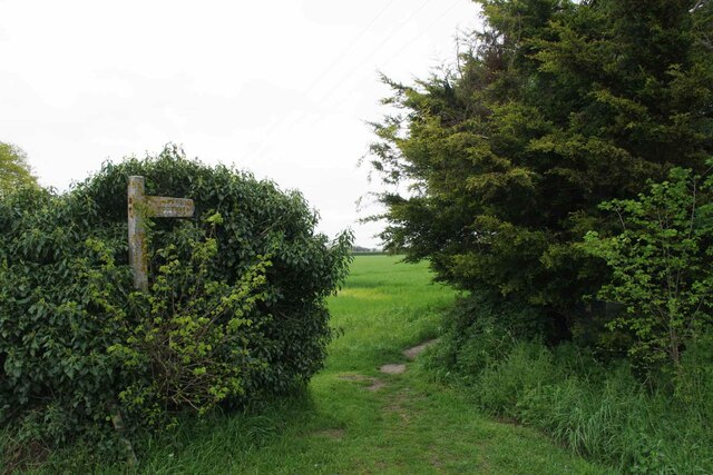
The moorland is characterized by its wide open spaces, featuring a mixture of grasses, gorse, and heather. This creates a stunning display of colors, particularly during the summer months when the heather blooms in vibrant hues of purple and pink. The area is also home to numerous species of birds, including skylarks, stonechats, and kestrels, making it a popular destination for birdwatchers.

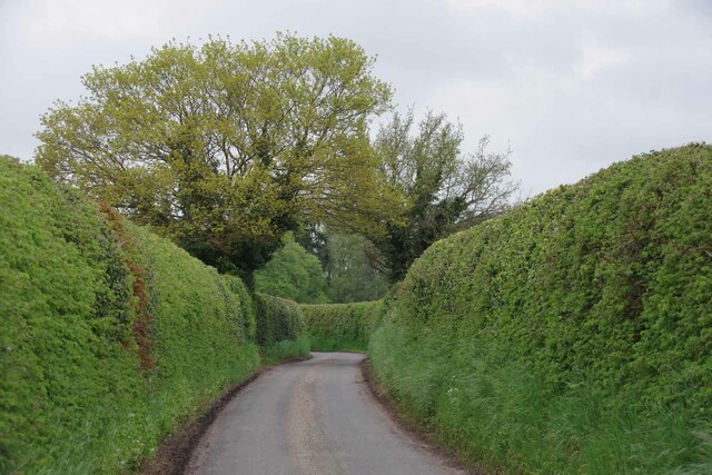
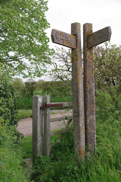
Langham Moor is crisscrossed by a network of footpaths and trails, allowing visitors to explore the landscape and enjoy the tranquility of the surroundings. The area is renowned for its natural beauty and is often frequented by hikers, nature enthusiasts, and photographers.

In addition to its natural attractions, Langham Moor also holds historical significance. The remains of ancient burial mounds can be found scattered throughout the area, serving as a reminder of the moor's long history. The moorland has been used for grazing livestock for centuries, and evidence of this can still be seen in the form of traditional grazing enclosures.

Overall, Langham Moor offers a peaceful retreat from the hustle and bustle of urban life. Its unspoiled beauty and rich biodiversity make it a cherished destination for both locals and visitors seeking to reconnect with nature.

If you have any feedback on the listing, please let us know in the comments section below.
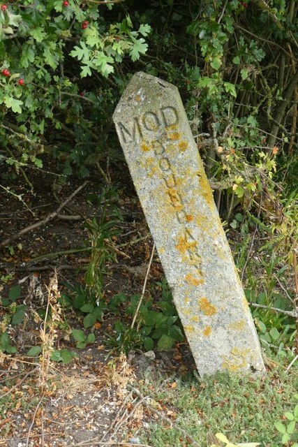
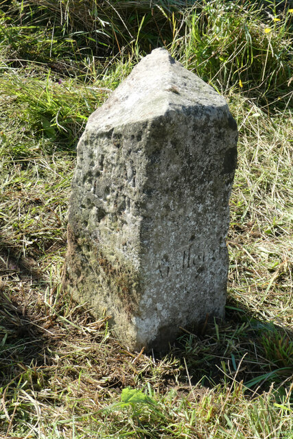
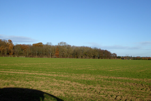
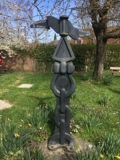
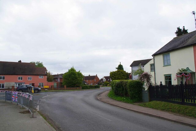
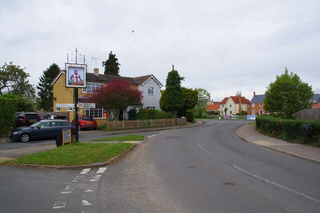
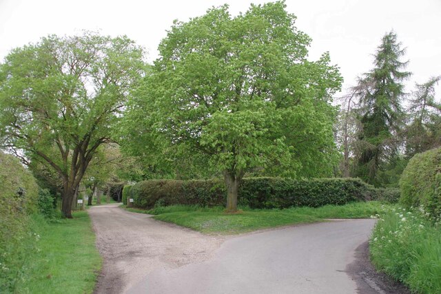
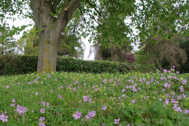
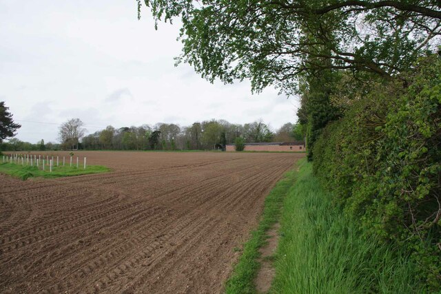
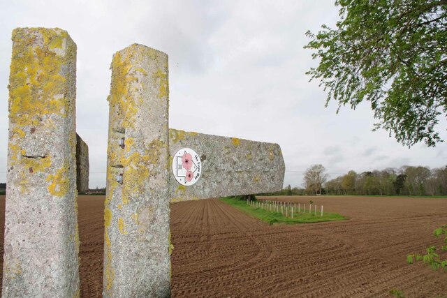
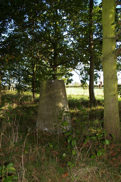
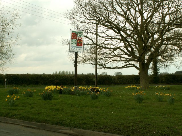
Langham Moor Images

Images are sourced within 2km of 51.944971/0.93213392 or Grid Reference TM0131. Thanks to Geograph Open Source API. All images are credited.

Old Boundary Marker off Langham Lane, Langham MOD Boundary Marker southeast of Langham Lane, at the entrance to Boxted Airfield Museum, on the former Boxted airfield. Langham parish. While the airfield was used from 1943 to 1947, the Royal Observer Corps post was used from 1961 to 1991 and the marker will date after 1964. Reference <span class="nowrap"><a title="https://www.subbrit.org.uk/sites/langham-roc-post/" rel="nofollow ugc noopener" href="https://www.subbrit.org.uk/sites/langham-roc-post/">Link</a><img style="margin-left:2px;" alt="External link" title="External link - shift click to open in new window" src="https://s1.geograph.org.uk/img/external.png" width="10" height="10"/></span>.

Milestone Society National ID: EX_MODLAN01em
Old Boundary Marker off Langham Lane, Langham
MOD Boundary Marker southeast of Langham Lane, at the entrance to Boxted Airfield Museum, on the former Boxted airfield. Langham parish. While the airfield was used from 1943 to 1947, the Royal Observer Corps post was used from 1961 to 1991 and the marker will date after 1964. Reference LinkExternal link. Milestone Society National ID: EX_MODLAN01em
Old Milestone, Old Ipswich Road (Was A12), 240m South of Harts Lane Junction The milestone is located in front of  the PRM Commercials garage on the east side of road. Parish of Ardleigh (Tendring District). Carved stone post, erected by the Chelmsford (Division of Essex First District) turnpike trust in the 19th century. 

Inscription is now largely eroded but the following is discernible on the front face:- Ardleigh

Listed grade II, list entry number:1147792  <span class="nowrap"><a title="https://historicengland.org.uk/listing/the-list/list-entry/1147792" rel="nofollow ugc noopener" href="https://historicengland.org.uk/listing/the-list/list-entry/1147792">Link</a><img style="margin-left:2px;" alt="External link" title="External link - shift click to open in new window" src="https://s1.geograph.org.uk/img/external.png" width="10" height="10"/></span>
Essex HER listed. SMR Number: 15743 <span class="nowrap"><a title="https://www.heritagegateway.org.uk/Gateway/Results_Single.aspx?uid=MEX1009948&resourceID=1001" rel="nofollow ugc noopener" href="https://www.heritagegateway.org.uk/Gateway/Results_Single.aspx?uid=MEX1009948&resourceID=1001">Link</a><img style="margin-left:2px;" alt="External link" title="External link - shift click to open in new window" src="https://s1.geograph.org.uk/img/external.png" width="10" height="10"/></span>

The milestone was found by a Milestone Society member fallen, probably following local flooding, and was re-erected by a working party from the Society for the Protection of Ancient Buildings in August 2021.

Milestone Society National ID: EX_COIP55
Old Milestone, Old Ipswich Road (Was A12), 240m South of Harts Lane Junction
The milestone is located in front of the PRM Commercials garage on the east side of road. Parish of Ardleigh (Tendring District). Carved stone post, erected by the Chelmsford (Division of Essex First District) turnpike trust in the 19th century. Inscription is now largely eroded but the following is discernible on the front face:- Ardleigh Listed grade II, list entry number:1147792 LinkExternal link Essex HER listed. SMR Number: 15743 LinkExternal link The milestone was found by a Milestone Society member fallen, probably following local flooding, and was re-erected by a working party from the Society for the Protection of Ancient Buildings in August 2021. Milestone Society National ID: EX_COIP55
Field north of Birchwood Road
National Cycle Network Milestone Langham Rowe Type National Cycle Network Milepost on Route 1 in Langham, Near Colchester, Essex.

1000 Millennium cast iron mileposts were funded by the Royal Bank of Scotland to mark the creation of the National Cycle Network, and found along the cycles routes through the UK.

There are four different types of posts, "Fossil Tree" by John Mills, "The Cockerel" by Iain McColl, "Rowe Type" by Andrew Rowe, and "Tracks" by David Dudgeon. The four artists are from each country of the UK though all posts can be found in all four countries.
National Cycle Network Milestone Langham
Rowe Type National Cycle Network Milepost on Route 1 in Langham, Near Colchester, Essex. 1000 Millennium cast iron mileposts were funded by the Royal Bank of Scotland to mark the creation of the National Cycle Network, and found along the cycles routes through the UK. There are four different types of posts, "Fossil Tree" by John Mills, "The Cockerel" by Iain McColl, "Rowe Type" by Andrew Rowe, and "Tracks" by David Dudgeon. The four artists are from each country of the UK though all posts can be found in all four countries.
Bunting and Boxted Cross Coronation morning in Boxted Cross
Bunting and Boxted Cross
Coronation morning in Boxted Cross
The Village Sign at Boxted Cross Taken on coronation morning.
The Village Sign at Boxted Cross
Taken on coronation morning.
Boxted Footpath # 18 This path heads for Hill Farm.
Boxted Footpath # 18
This path heads for Hill Farm.
High Hedges Near Rivers Hall
The Way to Rivers Hall The right hand fork is Sky Hall Hill. The flush of pink under the tree 
is <a href="https://www.geograph.org.uk/photo/7477285">TM0133 : Red Stem Stork's-Bill</a>
The Way to Rivers Hall
The right hand fork is Sky Hall Hill. The flush of pink under the tree is TM0133 : Red Stem Stork's-Bill
Red Stem Stork's-Bill Well that is what my phone app told me!
Red Stem Stork's-Bill
Well that is what my phone app told me!
Boxted Footpath #46 Part of the Essex Way.
Boxted Footpath #46
Part of the Essex Way.
The Essex Way A brace of concrete fingerposts at a footpath junction.
The Essex Way
A brace of concrete fingerposts at a footpath junction.
Footpath Junction at Rivers Hall This is the Junction with Boxted Footpath #46 (The Essex Way) and Boxted footpath 10 to Boxted Cross.
Footpath Junction at Rivers Hall
This is the Junction with Boxted Footpath #46 (The Essex Way) and Boxted footpath 10 to Boxted Cross.
Langham Trig This triangulation point is near Langham Lodge farm. If satellite imaging had not rendered triangulation points obsolete some lumberjacking would be required before this one could be used again!
Langham Trig
This triangulation point is near Langham Lodge farm. If satellite imaging had not rendered triangulation points obsolete some lumberjacking would be required before this one could be used again!
Recently harvested wheat field, near footpath, Boxted
Langham village sign, Essex Langham lies just west of the A12 near the Essex/Suffolk border.
Langham village sign, Essex
Langham lies just west of the A12 near the Essex/Suffolk border.
'Shepherd & Dog' public house, Langham, Essex This is now the only remaining pub in Langham. It stands on the corner of Moor Road and High Street and was built in 1928.
'Shepherd & Dog' public house, Langham, Essex
This is now the only remaining pub in Langham. It stands on the corner of Moor Road and High Street and was built in 1928.
Boxted Methodist Church, Essex This church was built in 1832.
Boxted Methodist Church, Essex
This church was built in 1832.
Show me another place!

Langham Moor is located at Grid Ref: TM0131 (Lat: 51.944971, Lng: 0.93213392)

Administrative County: Essex

District: Colchester

Police Authority: Essex

What 3 Words

///barmaid.trio.encoding. Near Boxted, Essex

Nearby Locations

Langham Moor Langham Moor

Related Wikis

RAF Boxted

Royal Air Force Boxted or more simply RAF Boxted is a former Royal Air Force station located 4 miles (6.4 km) north-northeast of Colchester, Essex England...

Langham, Essex

Langham is a small village in the City of Colchester district of Essex, England. == History == There is little evidence of pre-Roman occupation of what...

Workhouse Hill

Workhouse Hill is a hamlet in the Colchester district, in the English county of Essex. == References == Sources

Boxted House

Boxted House is a Grade II listed house in Boxted, Essex. It was built in about 1830.It was home to the advertising executive Bobby Bevan (1901-1974),...

Nearby Amenities

Located within 500m of 51.944971,0.93213392
Pub
The Shepherd
Food: yes
Garden: yes
Old Name: The Shepherd and Dog
Opening Hours: Mo-Sa 10:00-23:00; Su 10:00-17:00
Phone: +44 1206 272711
Postal Code: CO4 5NR
Source: survey;local_knowledge;website
Website: http://www.shepherdlangham.co.uk/
Lat/Long: 51.9481903/0.936832
Post Box
Post Box Design: type_m
Post Box Type: lamp
Royal Cypher: EIIR
Royal Cypher Wikidata: Q33102113
Lat/Long: 51.9477701/0.9367966
Bus Stop
Chapel Road
Naptan AtcoCode: 1500IM2002
Naptan Bearing: SW
Naptan CommonName: Chapel Road
Naptan Crossing: Chapel Road
Naptan Indicator: Adj
Naptan Landmark: Chapel Road
Naptan NaptanCode: esxgwatw
Naptan Street: Moor Road
Naptan Verified: no
Public Transport: platform
Source: naptan_import
Lat/Long: 51.9452902/0.9328898
Bus Stop
The Shepherd & Dog
Naptan AtcoCode: 1500IM2005
Naptan Bearing: NE
Naptan BusStopType: CUS
Naptan CommonName: The Shepherd & Dog
Naptan Indicator: o/s
Naptan Landmark: The Shepherd & Dog
Naptan NaptanCode: esxadmtm
Naptan Street: Moor Road
Naptan Verified: no
Public Transport: platform
Source: naptan_import
Lat/Long: 51.9480065/0.937062
Bus Stop
The Shepherd & Dog
Address Street: Moor Road
Direction: SW
Naptan AtcoCode: 1500IM20Y5
Naptan NaptanCode: esxjmgtd
Operator: Constable Coaches
Public Transport: platform
Shelter: no
Source: survey;website
Lat/Long: 51.9478611/0.937023
Bus Stop
Chapel Road
Naptan AtcoCode: 1500IM20Y2
Naptan NaptanCode: esxjmgtg
Naptan Verified: no
Public Transport: platform
Source: naptan_import
Lat/Long: 51.9447727/0.931859
The data included in this document is from www.openstreetmap.org. The data is made available under ODbL.

Have you been to Langham Moor?

Leave your review of Langham Moor below (or comments, questions and feedback).