Ladyes Hills

Settlement in Warwickshire Warwick

England

Ladyes Hills

A452 Birmingham Road at Red Lane
A452 Birmingham Road at Red Lane Credit: Ian S

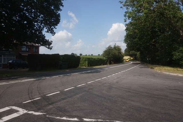
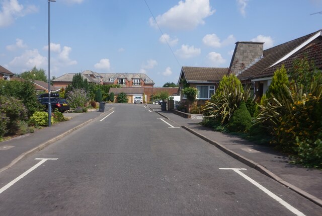
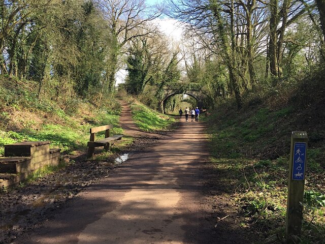
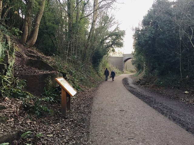
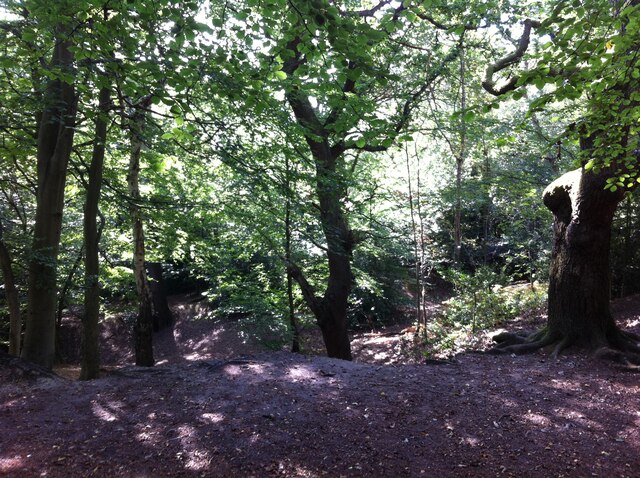
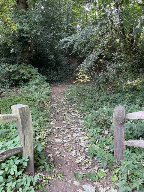
Ladyes Hills is a small village located in the county of Warwickshire, England. Situated just north of the town of Kenilworth, Ladyes Hills is known for its picturesque countryside and charming rural atmosphere. The village is surrounded by rolling hills and lush green fields, offering residents and visitors a tranquil escape from the hustle and bustle of city life.

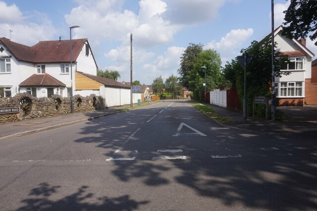
The origins of Ladyes Hills can be traced back to medieval times, with evidence of its existence dating back to the 12th century. Throughout its history, the village has retained its traditional charm, with many of its buildings boasting beautiful architecture from various periods.

One of the standout features of Ladyes Hills is its close proximity to the renowned Kenilworth Castle. This historic site, just a short distance from the village, attracts tourists from all over the world with its rich history and stunning ruins. Visitors can explore the castle's magnificent grounds and learn about its role in English history.

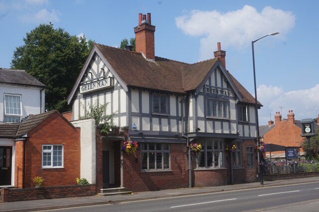
In terms of amenities, Ladyes Hills offers a range of local shops, pubs, and restaurants, providing residents with essential services and a vibrant community atmosphere. The village also benefits from excellent transport links, with easy access to major roads and nearby train stations, making it an ideal location for commuters.

Overall, Ladyes Hills provides a peaceful and idyllic setting for those seeking a rural lifestyle, while still being conveniently located close to nearby towns and attractions. With its rich history, natural beauty, and welcoming community, it is no wonder that Ladyes Hills is a highly sought-after place to live in Warwickshire.

If you have any feedback on the listing, please let us know in the comments section below.

Ladyes Hills Images

Images are sourced within 2km of 52.351532/-1.5752371 or Grid Reference SP2972. Thanks to Geograph Open Source API. All images are credited.

A452 Birmingham Road at Red Lane
The Green Man public house, Kenilworth
Clarke's Avenue, Kenilworth
Mortimer Road, Kenilworth
East on Kenilworth Greenway, Crackley The Greenway, a County Council amenity, follows the route of the former Kenilworth-Berkswell railway line. Here it is crossed by and connected to a public footpath, a track at this point, between north Kenilworth and south Coventry.
East on Kenilworth Greenway, Crackley
The Greenway, a County Council amenity, follows the route of the former Kenilworth-Berkswell railway line. Here it is crossed by and connected to a public footpath, a track at this point, between north Kenilworth and south Coventry.
Making a deck, The Engine public house, Mill End, Kenilworth In the later phase of the pandemic, pubs that had had to close invested in creating outdoor space so that they could safely serve socially-distanced patrons.
Making a deck, The Engine public house, Mill End, Kenilworth
In the later phase of the pandemic, pubs that had had to close invested in creating outdoor space so that they could safely serve socially-distanced patrons.
Kenilworth Greenway turns south, Crackley, Kenilworth The Greenway was created on a former railway line. The information board has accounts of the Kenilworth Sandstone, exposed here, and of the railway.
Kenilworth Greenway turns south, Crackley, Kenilworth
The Greenway was created on a former railway line. The information board has accounts of the Kenilworth Sandstone, exposed here, and of the railway.
Odibourne Allotments, Manor Road, Kenilworth The allotments were open to the public for the Heritage Open Days 2021 and Edible England events; members of the Kenilworth Allotment Tenants' Association (KATA) can be seen welcoming visitors. 

The Odibourne site was established in 1919, when Kenilworth Urban District Council bought land from the estate of the deceased William Thomas Pears. The council had recently decided to build on the 'Noah's Ark' allotments nearby, but was obliged under the 1908 Smallholding & Allotments Act to provide sufficient land for local people who wanted plots for growing food. The site is owned today by Kenilworth Town Council, but has been managed since 1983 by KATA (information taken from a notice board on the site).
Odibourne Allotments, Manor Road, Kenilworth
The allotments were open to the public for the Heritage Open Days 2021 and Edible England events; members of the Kenilworth Allotment Tenants' Association (KATA) can be seen welcoming visitors. The Odibourne site was established in 1919, when Kenilworth Urban District Council bought land from the estate of the deceased William Thomas Pears. The council had recently decided to build on the 'Noah's Ark' allotments nearby, but was obliged under the 1908 Smallholding & Allotments Act to provide sufficient land for local people who wanted plots for growing food. The site is owned today by Kenilworth Town Council, but has been managed since 1983 by KATA (information taken from a notice board on the site).
Plot 58a, Odibourne Allotments, Kenilworth These allotments, which to this city dweller appear impossibly idyllic, were open to the public for the Heritage Open Days 2021. Behind the idyll, of course, lies hard work and long term commitment, the challenge of group politics, the uncertainty of the weather and the threat, even here, of theft and vandalism. The Odibourne allotments were established in 1919.
Plot 58a, Odibourne Allotments, Kenilworth
These allotments, which to this city dweller appear impossibly idyllic, were open to the public for the Heritage Open Days 2021. Behind the idyll, of course, lies hard work and long term commitment, the challenge of group politics, the uncertainty of the weather and the threat, even here, of theft and vandalism. The Odibourne allotments were established in 1919.
I'm in the Green Zone A scarecrow, probably more decorative than functional, at the Odibourne allotments in Kenilworth, which were open to the public for the Heritage Open Days 2021.
I'm in the Green Zone
A scarecrow, probably more decorative than functional, at the Odibourne allotments in Kenilworth, which were open to the public for the Heritage Open Days 2021.
Apple Pressing at Odibourne Allotments, Kenilworth The allotment site was open to the public as part of the Heritage Open Days 2021 and Edible England events.
Apple Pressing at Odibourne Allotments, Kenilworth
The allotment site was open to the public as part of the Heritage Open Days 2021 and Edible England events.
'My Shed, My Rules' The sheds of the Odibourne Allotments, Kenilworth, are the subject of their own book, 'Odibourne Sheds: rural retreats in a Kenilworth allotment', by Peter James, published by the Bothy Press in 2020.
'My Shed, My Rules'
The sheds of the Odibourne Allotments, Kenilworth, are the subject of their own book, 'Odibourne Sheds: rural retreats in a Kenilworth allotment', by Peter James, published by the Bothy Press in 2020.
The Rules: Water butt on Odibourne Allotments, Kenilworth A water butt and rules governing its use, on the Odibourne Allotments, open to the public for the Heritage Open Days 2021 and Edible England events.
The Rules: Water butt on Odibourne Allotments, Kenilworth
A water butt and rules governing its use, on the Odibourne Allotments, open to the public for the Heritage Open Days 2021 and Edible England events.
Odibourne Allotments, Kenilworth, looking towards Lower Ladyes Hills Not normally open to the public, the allotments were welcoming visitors for the day as part of the Heritage Open Days 2021 and Edible England events. A scarecrow in the form of a Tokyo Olympics mascot can be seen to the right of the picture.
Odibourne Allotments, Kenilworth, looking towards Lower Ladyes Hills
Not normally open to the public, the allotments were welcoming visitors for the day as part of the Heritage Open Days 2021 and Edible England events. A scarecrow in the form of a Tokyo Olympics mascot can be seen to the right of the picture.
Bridge over the Finham Brook, Odibourne Allotments, Kenilworth No doubt flooding is another hazard of allotment life here, but the stream must have enriched the fertility of the valley over the years. Not normally accessible to the public, the allotments were open as part of the Heritage Open Days 2021 and Edible England events.
Bridge over the Finham Brook, Odibourne Allotments, Kenilworth
No doubt flooding is another hazard of allotment life here, but the stream must have enriched the fertility of the valley over the years. Not normally accessible to the public, the allotments were open as part of the Heritage Open Days 2021 and Edible England events.
Lower Ladyes Hills, Kenilworth, seen from the entrance to the Odibourne Allotments The allotments, which were established in the valley of the Finham Brook in 1919, were open to the public as part of the Heritage Open Days.
Lower Ladyes Hills, Kenilworth, seen from the entrance to the Odibourne Allotments
The allotments, which were established in the valley of the Finham Brook in 1919, were open to the public as part of the Heritage Open Days.
Kenilworth Common Once a heath used for grazing farm animals, the common was colonised by birch and oak trees once grazing stopped, and is now a wood with a few remnants of heathland. The land slopes down to the Finham Brook and is crossed by the Coventry to Leamington railway. The common is now a local nature reserve: see the website of the Warwickshire Wildlife Trust here <span class="nowrap"><a title="https://www.warwickshirewildlifetrust.org.uk/reserves/KenilworthCommon" rel="nofollow ugc noopener" href="https://www.warwickshirewildlifetrust.org.uk/reserves/KenilworthCommon">Link</a><img style="margin-left:2px;" alt="External link" title="External link - shift click to open in new window" src="https://s1.geograph.org.uk/img/external.png" width="10" height="10"/></span> .
Kenilworth Common
Once a heath used for grazing farm animals, the common was colonised by birch and oak trees once grazing stopped, and is now a wood with a few remnants of heathland. The land slopes down to the Finham Brook and is crossed by the Coventry to Leamington railway. The common is now a local nature reserve: see the website of the Warwickshire Wildlife Trust here LinkExternal link .
Path to castle earthworks Kenilworth Castle remains.
Path to castle earthworks
Kenilworth Castle remains.
Show me another place!

Ladyes Hills is located at Grid Ref: SP2972 (Lat: 52.351532, Lng: -1.5752371)

Administrative County: Warwickshire

District: Warwick

Police Authority: Warwickshire

What 3 Words

///them.poetic.canny. Near Kenilworth, Warwickshire

Related Wikis

Nearby Amenities

Located within 500m of 52.351532,-1.5752371
Traffic Signals
Lat/Long: 52.3499863/-1.5810529
Crossing
Crossing: uncontrolled
Crossing Island: no
Crossing Ref: zebra
Tactile Paving: yes
Lat/Long: 52.3479873/-1.5790564
Post Box
Brand: Royal Mail
Brand Wikidata: Q638098
Mapillary: 1313441185716388
Operator: Royal Mail
Operator Wikidata: Q638098
Post Box Mounting: brick_pillar
Post Box Type: wall
Ref: CV8 394
Survey Date: 2021-03-18
Lat/Long: 52.3515933/-1.5753854
Post Box
Brand: Royal Mail
Brand Wikidata: Q638098
Brand Wikipedia: en:Royal Mail
Collection Times: Mo-Fr 09:00; Sa 07:00
Operator: Royal Mail
Operator Wikidata: Q638098
Post Box Type: lamp
Ref: CV8 384D
Royal Cypher: EIIR
Royal Cypher Wikidata: Q33102113
Source: survey
Lat/Long: 52.3544251/-1.573722
Just Tyres
Shop: automotive
Lat/Long: 52.3516725/-1.5696008
Bus Stop
Spring Lane
Bus: yes
Covered: no
Naptan AtcoCode: 4200F030002
Naptan Bearing: S
Naptan CommonName: Spring Lane
Naptan Indicator: Adj
Naptan NaptanCode: waragtdp
Naptan Street: Albion Street
Naptan Verified: yes
Passenger Information Display: no
Public Transport: platform
Source: naptan_import
Lat/Long: 52.3477738/-1.5744714
Bus Stop
Sports & Social Club
Bus: yes
Covered: no
Naptan AtcoCode: 4200F106601
Naptan Bearing: NE
Naptan CommonName: Sports & Social Club
Naptan Indicator: Opp
Naptan Landmark: Sports & Social Club
Naptan NaptanCode: warapdmj
Naptan Street: Upper Rosemary Hill
Naptan Verified: no
Passenger Information Display: no
Public Transport: platform
Shelter: no
Source: naptan_import
Tactile Paving: no
Lat/Long: 52.3473284/-1.57678
Bus Stop
Wyandotte
Bus: yes
Covered: no
Naptan AtcoCode: 4200F106701
Naptan Bearing: N
Naptan CommonName: Wyandotte
Naptan Indicator: Nr
Naptan NaptanCode: warapdmt
Naptan Street: Albion Street
Naptan Verified: no
Passenger Information Display: no
Public Transport: platform
Shelter: no
Source: naptan_import
Lat/Long: 52.3499538/-1.5721722
Bus Stop
Herberts Lane
Bus: yes
Covered: no
Naptan AtcoCode: 4200F106702
Naptan Bearing: SW
Naptan CommonName: Herberts Lane
Naptan Crossing: Herberts Lane
Naptan Indicator: Adj
Naptan NaptanCode: warapdmw
Naptan Street: Albion Street
Naptan Verified: no
Passenger Information Display: no
Public Transport: platform
Source: naptan_import
Lat/Long: 52.3494983/-1.5723746
Bus Stop
Forge Road
Bus: yes
Covered: no
Naptan AtcoCode: 4200F106801
Naptan Bearing: E
Naptan CommonName: Forge Road
Naptan Crossing: Forge Road
Naptan Indicator: Adj
Naptan NaptanCode: warapdpa
Naptan Street: Mill End
Naptan Verified: no
Passenger Information Display: no
Public Transport: platform
Source: naptan_import
Lat/Long: 52.3517406/-1.5690571
Bus Stop
Manor Road
Bus: yes
Covered: no
Naptan AtcoCode: 4200F108001
Naptan Bearing: SW
Naptan CommonName: Manor Road
Naptan Crossing: Manor Road
Naptan Indicator: Adj
Naptan NaptanCode: warajwmw
Naptan Street: New Street
Passenger Information Display: no
Public Transport: platform
Shelter: no
Source: naptan_import;survey
Lat/Long: 52.3512523/-1.5782911
Bus Stop
Manor Road
Bus: yes
Covered: no
Naptan AtcoCode: 4200F108002
Naptan Bearing: NE
Naptan CommonName: Manor Road
Naptan Indicator: Opp
Naptan Landmark: Manor Street
Naptan NaptanCode: warajwpa
Naptan Street: New Street
Passenger Information Display: no
Public Transport: platform
Shelter: no
Source: naptan_import;survey
Lat/Long: 52.3508511/-1.5793514
Bus Stop
Tainters Hill
Bus: yes
Covered: no
Naptan AtcoCode: 4200F108101
Naptan Bearing: SW
Naptan CommonName: Tainters Hill
Naptan Crossing: Tainters Hill
Naptan Indicator: Adj
Naptan NaptanCode: warajwpd
Naptan Street: Coventry Road
Naptan Verified: no
Passenger Information Display: no
Public Transport: platform
Shelter: yes
Source: naptan_import
Tactile Paving: no
Lat/Long: 52.3535007/-1.5761124
Bus Stop
Tainters Hill
Bus: yes
Covered: no
Naptan AtcoCode: 4200F108102
Naptan Bearing: NE
Naptan CommonName: Tainters Hill
Naptan Crossing: Tainters Hill
Naptan Indicator: Opp
Naptan NaptanCode: warajwpg
Naptan Street: Coventry Road
Naptan Verified: no
Passenger Information Display: no
Public Transport: platform
Shelter: no
Source: naptan_import
Lat/Long: 52.3535501/-1.5762206
Bus Stop
Abbey Fields
Bus: yes
Covered: no
Naptan AtcoCode: 4200F108601
Naptan Bearing: NW
Naptan CommonName: Abbey Fields
Naptan Indicator: Adj
Naptan Landmark: Abbey Fields
Naptan NaptanCode: warajpga
Naptan Street: Bridge Street
Naptan Verified: yes
Passenger Information Display: no
Public Transport: platform
Shelter: yes
Source: naptan_import
Tactile Paving: no
Wheelchair: yes
Lat/Long: 52.3481201/-1.5792843
Bus Stop
Abbey Fields
Bus: yes
Covered: no
Naptan AtcoCode: 4200F108602
Naptan Bearing: SE
Naptan CommonName: Abbey Fields
Naptan Indicator: Opp
Naptan Landmark: Abbey Fields
Naptan NaptanCode: warajpgd
Naptan Street: Bridge Street
Naptan Verified: yes
Passenger Information Display: no
Public Transport: platform
Source: naptan_import
Lat/Long: 52.3488232/-1.5797889
Post Box
Brand: Royal Mail
Brand Wikidata: Q638098
Brand Wikipedia: en:Royal Mail
Collection Times: Mo-Fr 16:15; Sa 12:00
Operator: Royal Mail
Operator Wikidata: Q638098
Post Box Type: pillar
Ref: CV8 398
Royal Cypher: GR
Royal Cypher Wikidata: Q33102273
Source: survey
Lat/Long: 52.3492075/-1.5726685
Source: survey
Lat/Long: 52.3526274/-1.5697242
Pub
The Royal Oak
Source: survey
Wikidata: Q26646624
Lat/Long: 52.3509823/-1.5784814
Restaurant
The Cross at Kenilworth
Addr Housenumber: 16
Addr Postcode: CV8 2EZ
Addr Street: New Street
Email: enquiries@thecrosskenilworth.co.uk
Phone: +44 1926 853840
Source: survey
Website: https://www.thecrosskenilworth.co.uk/
Lat/Long: 52.3506635/-1.5790687
Mike Vaughan Cycles
Addr Housenumber: 3
Addr Postcode: CV8 1LY
Addr Street: High Street
Contact Facebook: https://www.facebook.com/MikeVaughanCyc/
Contact Instagram: https://www.instagram.com/mikevaughancycles/
Email: shop@mikevaughan.co.uk
Phone: +44 1926 853944
Shop: bicycle
Source: survey
Website: https://www.mikevaughan.co.uk/
Lat/Long: 52.3498573/-1.5812034
Pub
The Old Bakery
Source: survey
Lat/Long: 52.3499831/-1.5819181
Fast Food
Kenilworth Cantonese Takeaway
Addr Housenumber: 2
Addr Postcode: CV8 1LZ
Addr Street: High Street
Fhrs Id: 242366
Source: survey
Wheelchair: no
Lat/Long: 52.350149/-1.5812923
Milsoms Hotel
Tourism: hotel
Lat/Long: 52.3500301/-1.581658
Man Made: surveillance
Source: survey
Lat/Long: 52.3499204/-1.5811282
Restaurant
Loch Fyne Bar & Grill
Addr Postcode: CV8 1LZ
Addr Street: High Street
Fhrs Id: 241850
Source: survey
Wheelchair: limited
Lat/Long: 52.3500713/-1.5815232
Turning Circle
Lat/Long: 52.349209/-1.5697946
Turning Circle
Lat/Long: 52.349972/-1.5766275
Park Road
Shop: hairdresser
Lat/Long: 52.350448/-1.572239
Bar
Royal British Leigion
Addr City: Kenilworth
Addr Housenumber: 1
Addr Postcode: CV8 2GF
Addr Street: Park Road
Lat/Long: 52.3502638/-1.5719667
Grit Bin
Lat/Long: 52.3473397/-1.5751438
Waste Basket
Lat/Long: 52.3473413/-1.5752505
Operator: BT
Removed Amenity: telephone
Lat/Long: 52.3473557/-1.5754741
Barrier: bollard
Bicycle: yes
Bollard: fixed
Vehicle: no
Lat/Long: 52.3511948/-1.5686917
Barrier: lift_gate
Lat/Long: 52.3488468/-1.5802723
Barrier: lift_gate
Lat/Long: 52.348905/-1.5802713
Give Way
Direction: backward
Source: Warwickshire CC Aerial Imagery2013
Lat/Long: 52.3515524/-1.5780192
Grit Bin
Source: survey
Lat/Long: 52.3515507/-1.5781638
Public Transport: stop_position
Lat/Long: 52.3487899/-1.5798831
Albion Food and wine
Addr City: Kenilworth
Addr Housenumber: 87
Addr Postcode: CV8 2FY
Addr Street: Albion Street
Phone: +44 1926 858851
Shop: convenience
Source: survey
Lat/Long: 52.3489402/-1.5728109
Castle Butchers
Addr City: Kenilworth
Addr Housenumber: 85
Addr Postcode: CV8 2FY
Addr Street: Albion Street
Fhrs Id: 241684
Shop: butcher
Source: survey
Lat/Long: 52.348951/-1.5728905
Cafe
Albion Street Kitchen
Addr City: Kenilworth
Addr Housenumber: 83
Addr Postcode: CV8 2FY
Addr Street: Albion Street
Fhrs Id: 242590
Phone: +44 1926 852022
Source: survey
Lat/Long: 52.3489542/-1.5729583
Post Box
Brand: Royal Mail
Brand Wikidata: Q638098
Brand Wikipedia: en:Royal Mail
Collection Times: Mo-Fr 09:00; Sa 07:00
Operator: Royal Mail
Operator Wikidata: Q638098
Post Box Type: pillar
Ref: CV8 255D
Royal Cypher: GR
Royal Cypher Wikidata: Q33102273
Source: survey
Lat/Long: 52.347375/-1.5733498
Note: was Albion Street Laundrette but now closed
Shop: vacant
Source: survey
Lat/Long: 52.3489349/-1.5727399
Give Way
Direction: backward
Source: Warwickshire CC Aerial Imagery2013
Lat/Long: 52.3514226/-1.5764416
Give Way
Direction: backward
Source: Warwickshire CC Aerial Imagery2013
Lat/Long: 52.3536982/-1.5758042
Give Way
Direction: forward
Source: Warwickshire CC Aerial Imagery2013
Lat/Long: 52.3539141/-1.5755457
Give Way
Direction: backward
Source: Warwickshire CC Aerial Imagery2013
Lat/Long: 52.3541443/-1.5749424
Give Way
Direction: forward
Source: Warwickshire CC Aerial Imagery2013
Lat/Long: 52.3544787/-1.5737633
Man Made: windmill
Lat/Long: 52.3523852/-1.5760826
Post Office
Kenilworth News
Brand: Post Office
Brand Wikidata: Q1783168
Note: inside Kenilworth News
Source: survey
Website: https://www.postoffice.co.uk/branch-finder/5592461/fieldgate
Wheelchair: yes
Lat/Long: 52.3497651/-1.5809415
Bus Stop
Sports & Social Club
Bus: yes
Covered: no
Naptan AtcoCode: 4200F106602
Naptan Bearing: SW
Naptan CommonName: Sports & Social Club
Naptan Indicator: Adj
Naptan Landmark: Sports & Social Club
Naptan NaptanCode: warapdmp
Naptan Street: Upper Rosemary Hill
Naptan Verified: no
Passenger Information Display: no
Public Transport: platform
Shelter: no
Source: naptan_import
Tactile Paving: no
Lat/Long: 52.3472411/-1.576716
Fast Food
Chips and Fish
Addr City: Kenilworth
Addr Housenumber: 101
Addr Street: School Lane
Cuisine: fish_and_chips
Lat/Long: 52.3498504/-1.5753318
Generator Method: photovoltaic
Generator Output Electricity: yes
Generator Source: solar
Generator Type: solar_photovoltaic_panel
Location: roof
Power: generator
Lat/Long: 52.3505671/-1.5692318
Generator Method: photovoltaic
Generator Output Electricity: yes
Generator Source: solar
Generator Type: solar_photovoltaic_panel
Location: roof
Power: generator
Lat/Long: 52.3541369/-1.57031
Bicycle Parking
Bicycle Parking: stands
Capacity: 4
Covered: no
Fee: no
Lat/Long: 52.3499039/-1.5812262
Entrance: yes
Lat/Long: 52.3473733/-1.5759428
Entrance: yes
Lat/Long: 52.3473624/-1.5762659
Ladyes Hills
Place: suburb
Lat/Long: 52.351741/-1.5759191
Mill End
Place: suburb
Lat/Long: 52.3516029/-1.568633
Generator Method: photovoltaic
Generator Output Electricity: yes
Generator Source: solar
Generator Type: solar_photovoltaic_panel
Location: roof
Power: generator
Lat/Long: 52.3538519/-1.5812574
Direction: forward
Maxspeed: 60 mph
Traffic Sign: maxspeed
Lat/Long: 52.3543079/-1.5749825
Pub
The Abbey Field
Brand: Chef & Brewer
Brand Wikidata: Q5089491
Website: https://www.chefandbrewer.com/pubs/warwickshire/abbey-field
Lat/Long: 52.3501108/-1.5814291
Pipeline: substation
Substance: gas
Lat/Long: 52.3540611/-1.5755756
Colour: yellow
Marker: sign
Utility: gas
Lat/Long: 52.3540597/-1.5755921
Colour: yellow
Marker: sign
Utility: gas
Lat/Long: 52.3540512/-1.57558
The data included in this document is from www.openstreetmap.org. The data is made available under ODbL.

Have you been to Ladyes Hills?

Leave your review of Ladyes Hills below (or comments, questions and feedback).