Whitemoor

Settlement in Warwickshire Warwick

England

Whitemoor

The Green Man public house, Kenilworth
The Green Man public house, Kenilworth Credit: Ian S

Whitemoor is a small village located in the county of Warwickshire in central England. Situated approximately 5 miles southwest of the market town of Rugby, it is a rural settlement that offers a peaceful and picturesque environment for its residents. The village is surrounded by beautiful countryside, characterized by rolling hills, fields, and woodlands.

Whitemoor is home to a close-knit community, with a population of around 500 people. The village mainly consists of traditional stone-built houses, giving it a quaint and charming atmosphere. The local economy is primarily based on agriculture, with farming and livestock rearing being the main occupations for the villagers.

The heart of the village is its small but welcoming parish church, which dates back to the 13th century. This historic building serves as a focal point for the community and hosts regular religious services and community events. Nearby, there is also a village hall that provides space for various social activities and gatherings.

Residents of Whitemoor benefit from its proximity to Rugby, where they can access a wider range of amenities, including shops, schools, and healthcare facilities. The village is well-connected to the surrounding areas through a network of roads, making it easily accessible for commuters.

With its tranquil setting and strong sense of community, Whitemoor offers a peaceful and idyllic lifestyle for its residents, making it an appealing place to live for those seeking a rural retreat.

If you have any feedback on the listing, please let us know in the comments section below.
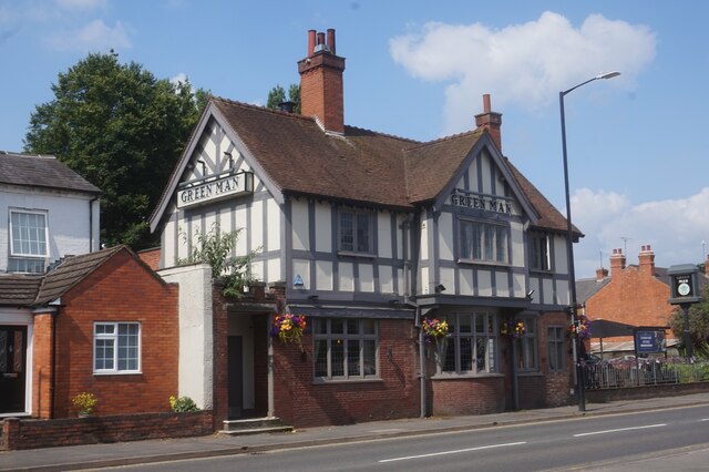
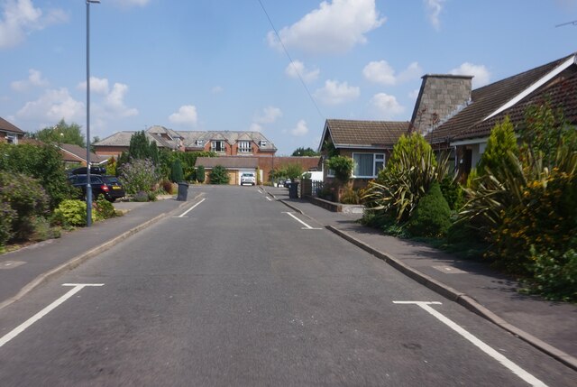
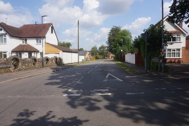
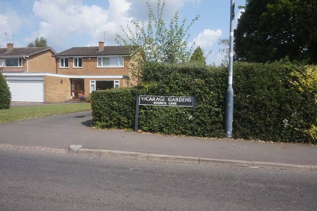
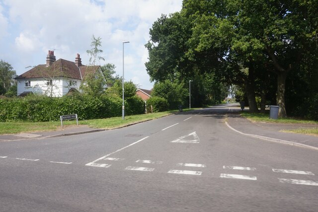
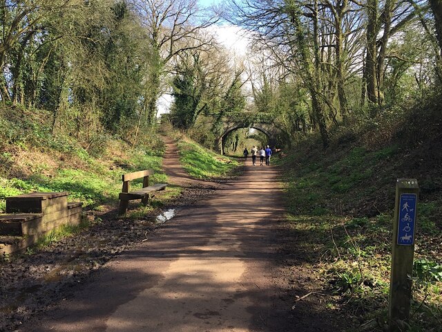
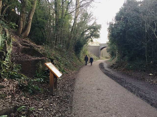
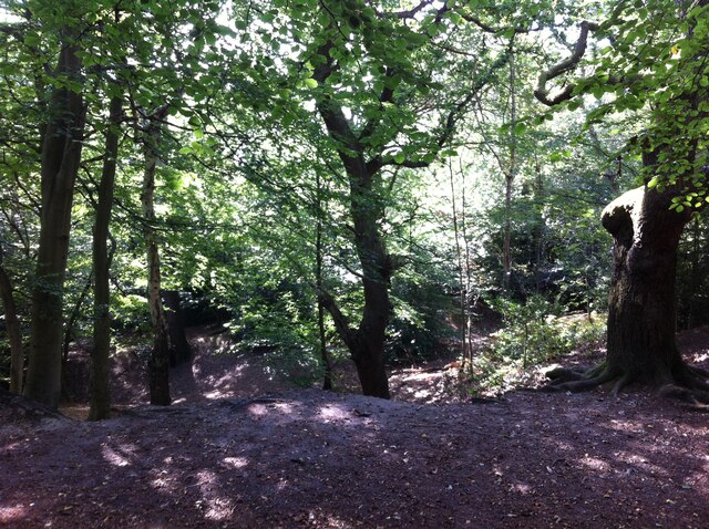
Whitemoor Images

Images are sourced within 2km of 52.345615/-1.5674549 or Grid Reference SP2972. Thanks to Geograph Open Source API. All images are credited.

The Green Man public house, Kenilworth
Clarke's Avenue, Kenilworth
Mortimer Road, Kenilworth
Vicarage Gardens off Rouncil Lane, Kenilworth
Rounds Hill off Mortimer Road
East on Kenilworth Greenway, Crackley The Greenway, a County Council amenity, follows the route of the former Kenilworth-Berkswell railway line. Here it is crossed by and connected to a public footpath, a track at this point, between north Kenilworth and south Coventry.
East on Kenilworth Greenway, Crackley
The Greenway, a County Council amenity, follows the route of the former Kenilworth-Berkswell railway line. Here it is crossed by and connected to a public footpath, a track at this point, between north Kenilworth and south Coventry.
Making a deck, The Engine public house, Mill End, Kenilworth In the later phase of the pandemic, pubs that had had to close invested in creating outdoor space so that they could safely serve socially-distanced patrons.
Making a deck, The Engine public house, Mill End, Kenilworth
In the later phase of the pandemic, pubs that had had to close invested in creating outdoor space so that they could safely serve socially-distanced patrons.
Kenilworth Greenway turns south, Crackley, Kenilworth The Greenway was created on a former railway line. The information board has accounts of the Kenilworth Sandstone, exposed here, and of the railway.
Kenilworth Greenway turns south, Crackley, Kenilworth
The Greenway was created on a former railway line. The information board has accounts of the Kenilworth Sandstone, exposed here, and of the railway.
Odibourne Allotments, Manor Road, Kenilworth The allotments were open to the public for the Heritage Open Days 2021 and Edible England events; members of the Kenilworth Allotment Tenants' Association (KATA) can be seen welcoming visitors. 

The Odibourne site was established in 1919, when Kenilworth Urban District Council bought land from the estate of the deceased William Thomas Pears. The council had recently decided to build on the 'Noah's Ark' allotments nearby, but was obliged under the 1908 Smallholding & Allotments Act to provide sufficient land for local people who wanted plots for growing food. The site is owned today by Kenilworth Town Council, but has been managed since 1983 by KATA (information taken from a notice board on the site).
Odibourne Allotments, Manor Road, Kenilworth
The allotments were open to the public for the Heritage Open Days 2021 and Edible England events; members of the Kenilworth Allotment Tenants' Association (KATA) can be seen welcoming visitors. The Odibourne site was established in 1919, when Kenilworth Urban District Council bought land from the estate of the deceased William Thomas Pears. The council had recently decided to build on the 'Noah's Ark' allotments nearby, but was obliged under the 1908 Smallholding & Allotments Act to provide sufficient land for local people who wanted plots for growing food. The site is owned today by Kenilworth Town Council, but has been managed since 1983 by KATA (information taken from a notice board on the site).
Plot 58a, Odibourne Allotments, Kenilworth These allotments, which to this city dweller appear impossibly idyllic, were open to the public for the Heritage Open Days 2021. Behind the idyll, of course, lies hard work and long term commitment, the challenge of group politics, the uncertainty of the weather and the threat, even here, of theft and vandalism. The Odibourne allotments were established in 1919.
Plot 58a, Odibourne Allotments, Kenilworth
These allotments, which to this city dweller appear impossibly idyllic, were open to the public for the Heritage Open Days 2021. Behind the idyll, of course, lies hard work and long term commitment, the challenge of group politics, the uncertainty of the weather and the threat, even here, of theft and vandalism. The Odibourne allotments were established in 1919.
I'm in the Green Zone A scarecrow, probably more decorative than functional, at the Odibourne allotments in Kenilworth, which were open to the public for the Heritage Open Days 2021.
I'm in the Green Zone
A scarecrow, probably more decorative than functional, at the Odibourne allotments in Kenilworth, which were open to the public for the Heritage Open Days 2021.
Apple Pressing at Odibourne Allotments, Kenilworth The allotment site was open to the public as part of the Heritage Open Days 2021 and Edible England events.
Apple Pressing at Odibourne Allotments, Kenilworth
The allotment site was open to the public as part of the Heritage Open Days 2021 and Edible England events.
'My Shed, My Rules' The sheds of the Odibourne Allotments, Kenilworth, are the subject of their own book, 'Odibourne Sheds: rural retreats in a Kenilworth allotment', by Peter James, published by the Bothy Press in 2020.
'My Shed, My Rules'
The sheds of the Odibourne Allotments, Kenilworth, are the subject of their own book, 'Odibourne Sheds: rural retreats in a Kenilworth allotment', by Peter James, published by the Bothy Press in 2020.
The Rules: Water butt on Odibourne Allotments, Kenilworth A water butt and rules governing its use, on the Odibourne Allotments, open to the public for the Heritage Open Days 2021 and Edible England events.
The Rules: Water butt on Odibourne Allotments, Kenilworth
A water butt and rules governing its use, on the Odibourne Allotments, open to the public for the Heritage Open Days 2021 and Edible England events.
Odibourne Allotments, Kenilworth, looking towards Lower Ladyes Hills Not normally open to the public, the allotments were welcoming visitors for the day as part of the Heritage Open Days 2021 and Edible England events. A scarecrow in the form of a Tokyo Olympics mascot can be seen to the right of the picture.
Odibourne Allotments, Kenilworth, looking towards Lower Ladyes Hills
Not normally open to the public, the allotments were welcoming visitors for the day as part of the Heritage Open Days 2021 and Edible England events. A scarecrow in the form of a Tokyo Olympics mascot can be seen to the right of the picture.
Bridge over the Finham Brook, Odibourne Allotments, Kenilworth No doubt flooding is another hazard of allotment life here, but the stream must have enriched the fertility of the valley over the years. Not normally accessible to the public, the allotments were open as part of the Heritage Open Days 2021 and Edible England events.
Bridge over the Finham Brook, Odibourne Allotments, Kenilworth
No doubt flooding is another hazard of allotment life here, but the stream must have enriched the fertility of the valley over the years. Not normally accessible to the public, the allotments were open as part of the Heritage Open Days 2021 and Edible England events.
Lower Ladyes Hills, Kenilworth, seen from the entrance to the Odibourne Allotments The allotments, which were established in the valley of the Finham Brook in 1919, were open to the public as part of the Heritage Open Days.
Lower Ladyes Hills, Kenilworth, seen from the entrance to the Odibourne Allotments
The allotments, which were established in the valley of the Finham Brook in 1919, were open to the public as part of the Heritage Open Days.
Kenilworth Common Once a heath used for grazing farm animals, the common was colonised by birch and oak trees once grazing stopped, and is now a wood with a few remnants of heathland. The land slopes down to the Finham Brook and is crossed by the Coventry to Leamington railway. The common is now a local nature reserve: see the website of the Warwickshire Wildlife Trust here <span class="nowrap"><a title="https://www.warwickshirewildlifetrust.org.uk/reserves/KenilworthCommon" rel="nofollow ugc noopener" href="https://www.warwickshirewildlifetrust.org.uk/reserves/KenilworthCommon">Link</a><img style="margin-left:2px;" alt="External link" title="External link - shift click to open in new window" src="https://s1.geograph.org.uk/img/external.png" width="10" height="10"/></span> .
Kenilworth Common
Once a heath used for grazing farm animals, the common was colonised by birch and oak trees once grazing stopped, and is now a wood with a few remnants of heathland. The land slopes down to the Finham Brook and is crossed by the Coventry to Leamington railway. The common is now a local nature reserve: see the website of the Warwickshire Wildlife Trust here LinkExternal link .
Show me another place!

Whitemoor is located at Grid Ref: SP2972 (Lat: 52.345615, Lng: -1.5674549)

Administrative County: Warwickshire

District: Warwick

Police Authority: Warwickshire

What 3 Words

///blues.tent.seats. Near Kenilworth, Warwickshire

Related Wikis

Related Videos

Kenilworth Castle - England

Welcome to my series of Castle Shorts! In each video I tell you a small nugget of information about each Castle. In this Short I tell ...

Kenilworth, un orasel ca o bijuterie

Kenilworth, un orasel ca o bijuterie #kenilworth #traveluk #travel.

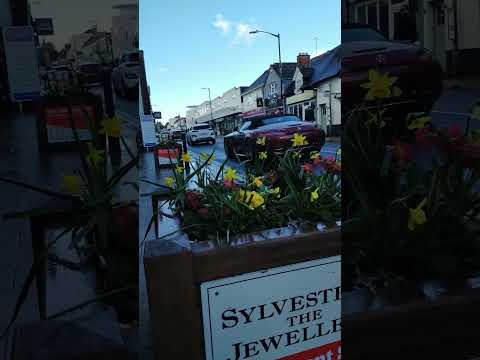
Warwickshire Walking Tour: Kenilworth Old Town

Click to subscribe! https://www.youtube.com/c/flaneurc21?sub_confirmation=1 Kenilworth is a small town in Warwickshire, a few ...

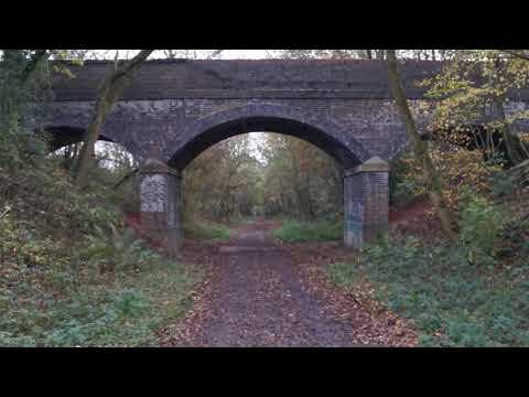
2020.11.06 #3 13.3km hike in Coventry and Kenilworth Greenway, UK

Dave Hurr enjoys a 13.3km hike in Coventry and Kenilworth Greenway, UK.

Nearby Amenities

Located within 500m of 52.345615,-1.5674549
Crossing
Crossing: unmarked
Crossing Island: yes
Lat/Long: 52.3463597/-1.5643128
Traffic Calming: table
Lat/Long: 52.3467353/-1.5623962
Bus Stop
Willow Meer
Bus: yes
Covered: no
Naptan AtcoCode: 4200F029900
Naptan Bearing: NW
Naptan CommonName: Willow Meer
Naptan Indicator: Adj
Naptan NaptanCode: warajwdm
Naptan Street: Adcock Drive
Naptan Verified: no
Passenger Information Display: no
Public Transport: platform
Source: naptan_import
Lat/Long: 52.347589/-1.5671304
Bus Stop
Whitemoor Road
Bench: no
Bin: no
Bus: yes
Covered: no
Lit: yes
Naptan AtcoCode: 4200F031001
Naptan Bearing: S
Naptan CommonName: Whitemoor Road
Naptan Indicator: Nr
Naptan NaptanCode: wardamdg
Naptan Street: Elmdene Road
Naptan Verified: no
Passenger Information Display: no
Public Transport: platform
Source: naptan_import
Tactile Paving: no
Lat/Long: 52.3453681/-1.5670786
Bus Stop
Brookline Travel
Bench: no
Bin: no
Bus: yes
Covered: no
Naptan AtcoCode: 4200F031100
Naptan Bearing: N
Naptan CommonName: Brookline Travel
Naptan Indicator: Adj
Naptan NaptanCode: wardamdj
Naptan Street: Farmer Ward Road
Naptan Verified: no
Passenger Information Display: no
Public Transport: platform
Shelter: no
Source: naptan_import
Tactile Paving: no
Lat/Long: 52.3431279/-1.5715923
Bus Stop
Leyes Lane
Bench: no
Bin: no
Bus: yes
Covered: no
Lit: yes
Naptan AtcoCode: 4200F031701
Naptan Bearing: S
Naptan CommonName: Leyes Lane
Naptan Indicator: Adj
Naptan NaptanCode: warapdtm
Naptan Street: Park Hill
Naptan Verified: no
Passenger Information Display: no
Public Transport: platform
Source: naptan_import
Tactile Paving: no
Lat/Long: 52.3471839/-1.5645798
Bus Stop
Offa Drive
Bus: yes
Covered: no
Naptan AtcoCode: 4200F032400
Naptan Bearing: NE
Naptan CommonName: Offa Drive
Naptan Crossing: Offa Drive
Naptan Indicator: Opp
Naptan NaptanCode: warapgad
Naptan Street: Whateleys Drive
Naptan Verified: no
Passenger Information Display: no
Public Transport: platform
Source: naptan_import
Lat/Long: 52.3459135/-1.5736793
Bus Stop
Offa Drive
Bus: yes
Covered: no
Naptan AtcoCode: 4200F032401
Naptan Bearing: SW
Naptan CommonName: Offa Drive
Naptan Indicator: Adj
Naptan NaptanCode: warapgag
Naptan Street: Whateleys Drive
Naptan Verified: no
Passenger Information Display: no
Public Transport: platform
Source: naptan_import
Lat/Long: 52.3458764/-1.5733566
Bus Stop
Villiers Road
Bus: yes
Covered: no
Naptan AtcoCode: 4200F107602
Naptan Bearing: SE
Naptan CommonName: Villiers Road
Naptan Crossing: Villiers Road
Naptan Indicator: Adj
Naptan NaptanCode: warapgmw
Naptan Street: Park Hill
Naptan Verified: no
Passenger Information Display: no
Public Transport: platform
Source: naptan_import
Lat/Long: 52.3489633/-1.5668232
Bus Stop
Adcock Drive
Bus: yes
Covered: no
Naptan AtcoCode: 4200F107701
Naptan Bearing: N
Naptan CommonName: Adcock Drive
Naptan Indicator: Nr
Naptan NaptanCode: warapgpa
Naptan Street: Holmewood Close
Naptan Verified: no
Passenger Information Display: no
Public Transport: platform
Source: naptan_import
Lat/Long: 52.3483117/-1.5680921
Bus Stop
Adcock Drive
Bus: yes
Covered: no
Naptan AtcoCode: 4200F107702
Naptan Bearing: S
Naptan BusStopType: CUS
Naptan CommonName: Adcock Drive
Naptan Indicator: Nr
Naptan NaptanCode: warajwmd
Naptan Street: Holmewood Close
Naptan Verified: no
Passenger Information Display: no
Public Transport: platform
Source: naptan_import
Lat/Long: 52.3482658/-1.5678577
Bus Stop
Kenilworth School
Bench: no
Bin: no
Bus: yes
Covered: no
Lit: no
Naptan AtcoCode: 4200F123071
Naptan Bearing: W
Naptan CommonName: Kenilworth School
Naptan Indicator: Adj
Naptan Landmark: Kenilworth School
Naptan NaptanCode: warapwmj
Naptan Street: Leyes Lane
Naptan Verified: no
Passenger Information Display: no
Public Transport: platform
Source: naptan_import
Tactile Paving: no
Lat/Long: 52.346719/-1.5621676
Bus Stop
Lime Grove
Bus: yes
Covered: no
Naptan AtcoCode: 4200F152880
Naptan Bearing: S
Naptan CommonName: Lime Grove
Naptan Indicator: Adj
Naptan NaptanCode: wardjpwg
Naptan Street: Farmer Ward Road
Naptan Verified: no
Passenger Information Display: no
Public Transport: platform
Shelter: no
Source: naptan_import
Lat/Long: 52.3419679/-1.5715301
Turning Circle
Lat/Long: 52.3477768/-1.5616483
Post Box
Brand: Royal Mail
Brand Wikidata: Q638098
Brand Wikipedia: en:Royal Mail
Collection Times: Mo-Fr 16:00; Sa 08:00
Operator: Royal Mail
Operator Wikidata: Q638098
Post Box Type: pillar
Ref: CV8 388
Royal Cypher: EIIR
Royal Cypher Wikidata: Q33102113
Source: survey
Lat/Long: 52.3455339/-1.5674057
Post Box
Brand: Royal Mail
Brand Wikidata: Q638098
Brand Wikipedia: en:Royal Mail
Collection Times: Mo-Fr 09:00; Sa 07:00
Operator: Royal Mail
Operator Wikidata: Q638098
Post Box Type: wall
Ref: CV8 391D
Royal Cypher: GR
Royal Cypher Wikidata: Q33102273
Source: survey
Lat/Long: 52.3490766/-1.5675987
Turning Circle
Lat/Long: 52.349209/-1.5697946
Operator: Network Rail
Railway: switch
Lat/Long: 52.3475483/-1.570385
Kenilworth
Addr City: Kenilworth
Addr Postcode: CV8 1LQ
Addr Street: Priory Road
Network: National Rail
Public Transport: stop_position
Railway: stop
Source: local_knowledge
Train: yes
Lat/Long: 52.3427453/-1.5723888
Turning Circle
Lat/Long: 52.3457384/-1.5654429
Traffic Calming: table
Lat/Long: 52.3468219/-1.5614175
Turning Circle
Lat/Long: 52.3472516/-1.5614824
Hollyhurst
Addr City: Kenilworth
Addr Housenumber: 47
Addr Postcode: CV8 1LL
Addr Street: Priory Road
Building: residential
Lat/Long: 52.3441611/-1.5743865
Post Box
Brand: Royal Mail
Brand Wikidata: Q638098
Brand Wikipedia: en:Royal Mail
Collection Times: Mo-Fr 09:00; Sa 07:00
Operator: Royal Mail
Operator Wikidata: Q638098
Post Box Type: pillar
Ref: CV8 255D
Royal Cypher: GR
Royal Cypher Wikidata: Q33102273
Source: survey
Lat/Long: 52.347375/-1.5733498
Elevator
Lat/Long: 52.3431528/-1.5722291
Elevator
Lat/Long: 52.3431749/-1.572441
Crossing
Crossing: zebra
Tactile Paving: yes
Lat/Long: 52.3429289/-1.5727875
Bicycle Parking
Covered: yes
Mapillary: 509572900080751
Survey Date: 2018-09-26
Lat/Long: 52.3426984/-1.5726253
Motorcycle Parking
Covered: no
Lat/Long: 52.3428488/-1.5728503
Bus Stop
Kenilworth Railway Station
Bench: yes
Bin: no
Bus: yes
Covered: no
Lit: yes
Passenger Information Display: no
Public Transport: platform
Tactile Paving: no
Lat/Long: 52.3430659/-1.5731167
Kenilworth
Addr City: Kenilworth
Addr Postcode: CV8 1JJ
Addr Street: Waverley Road
Naptan AtcoCode: 9100KENLSTN
Network: National Rail
Network Website: https://www.nationalrail.co.uk/stations/knw/
Network Wikidata: Q26334
Public Transport: station
Railway: station
Ref Crs: KNW
Train: yes
Wheelchair: yes
Wikidata: Q6389304
Wikipedia: en:Kenilworth railway station
Lat/Long: 52.3428168/-1.5724185
Generator Method: photovoltaic
Generator Output Electricity: yes
Generator Source: solar
Generator Type: solar_photovoltaic_panel
Location: roof
Power: generator
Lat/Long: 52.3465742/-1.5732698
Generator Method: photovoltaic
Generator Output Electricity: yes
Generator Source: solar
Generator Type: solar_photovoltaic_panel
Power: generator
Lat/Long: 52.3499428/-1.5664382
Generator Method: photovoltaic
Generator Output Electricity: yes
Generator Source: solar
Generator Type: solar_photovoltaic_panel
Location: roof
Power: generator
Lat/Long: 52.3417157/-1.5683842
Crossing
Crossing: traffic_signals
Crossing Island: no
Lat/Long: 52.3462694/-1.5640765
Generator Method: photovoltaic
Generator Output Electricity: yes
Generator Source: solar
Generator Type: solar_photovoltaic_panel
Location: roof
Power: generator
Lat/Long: 52.3475769/-1.5610617
Bench
Backrest: yes
Lat/Long: 52.343711/-1.5682372
Waste Basket
Lat/Long: 52.3435871/-1.5691117
Bench
Backrest: no
Lat/Long: 52.3438707/-1.5683869
Whitemoor
Place: suburb
Lat/Long: 52.3450865/-1.5699082
Bench
Backrest: no
Lat/Long: 52.3435691/-1.5685778
Bus Stop
Villiers Road
Bench: no
Bin: no
Bus: yes
Covered: no
Passenger Information Display: no
Public Transport: platform
Shelter: no
Tactile Paving: no
Lat/Long: 52.3487541/-1.5666453
Waste Basket
Lat/Long: 52.3468442/-1.5614527
Covered: no
Leisure: picnic_table
Lat/Long: 52.345803/-1.561298
Covered: no
Leisure: picnic_table
Lat/Long: 52.3457545/-1.5612142
Covered: no
Leisure: picnic_table
Lat/Long: 52.3458189/-1.5611439
Covered: no
Leisure: picnic_table
Lat/Long: 52.3457809/-1.5611223
Covered: no
Leisure: picnic_table
Lat/Long: 52.3457259/-1.5611151
Barrier: lift_gate
Locked: yes
Lat/Long: 52.3467352/-1.5607003
Traffic Calming: table
Lat/Long: 52.3466108/-1.5637124
Give Way
Direction: backward
Lat/Long: 52.3485579/-1.5636276
Give Way
Direction: backward
Lat/Long: 52.348389/-1.564533
Give Way
Direction: backward
Lat/Long: 52.3481317/-1.5654231
Give Way
Direction: backward
Lat/Long: 52.3481419/-1.5652303
Give Way
Direction: forward
Lat/Long: 52.3466214/-1.5640269
Give Way
Direction: forward
Lat/Long: 52.346547/-1.5642263
Give Way
Direction: backward
Lat/Long: 52.3463824/-1.5642421
Give Way
Direction: backward
Lat/Long: 52.345911/-1.5663354
Give Way
Direction: backward
Lat/Long: 52.3456094/-1.5674164
Direction: backward
Maxspeed: 20 mph
Traffic Sign: maxspeed
Lat/Long: 52.3465903/-1.5639324
Direction: forward
Maxspeed: 20 mph
Traffic Sign: maxspeed
Lat/Long: 52.3468889/-1.5624419
The data included in this document is from www.openstreetmap.org. The data is made available under ODbL.

Have you been to Whitemoor?

Leave your review of Whitemoor below (or comments, questions and feedback).