Beedon

Settlement in Berkshire

England

Beedon

The A34 northbound towards Didcot
The A34 northbound towards Didcot Credit: Ian S

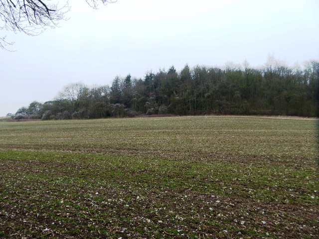
Beedon is a small village located in the county of Berkshire, England. It is situated approximately 6 miles west of Newbury and 52 miles west of London. The village is surrounded by beautiful countryside, with rolling hills and farmland stretching as far as the eye can see.

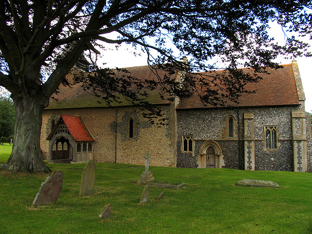
Historically, Beedon was mentioned in the Domesday Book of 1086, where it was listed as "Biedan". The village has a rich history and is home to several historic buildings, including the 13th-century St. Nicholas Church, which is a Grade II listed building. The church features a beautiful stained glass window and a well-preserved medieval tower.

In terms of amenities, Beedon offers a range of facilities for its residents and visitors. The village has a local pub, The Six Bells, which is known for its friendly atmosphere and traditional British pub food. There is also a village hall that hosts various community events and activities throughout the year.

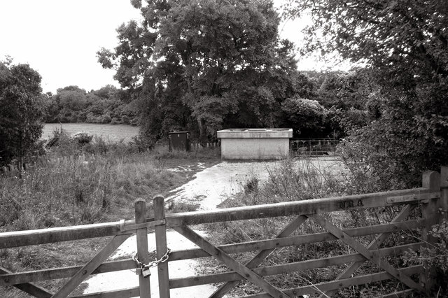
Nature enthusiasts will be delighted to explore the surrounding countryside, with plenty of walking and cycling trails to enjoy. The area is known for its scenic beauty, and there are several nature reserves nearby, such as the Beedon Common Nature Reserve and the Sydmonton Court Lakes.

Overall, Beedon is a charming village that offers a peaceful and picturesque setting, perfect for those seeking a quieter countryside lifestyle while still being within easy reach of larger towns and cities.

If you have any feedback on the listing, please let us know in the comments section below.

Beedon Images

Images are sourced within 2km of 51.494645/-1.297041 or Grid Reference SU4877. Thanks to Geograph Open Source API. All images are credited.

The A34 northbound towards Didcot
Ashridge Wood OBH The kiosk houses a groundwater observation bore hole (obh) belonging to the Environment Agency.
The concrete track leads to one of their pumping stations.
Ashridge Wood OBH
The kiosk houses a groundwater observation bore hole (obh) belonging to the Environment Agency. The concrete track leads to one of their pumping stations.
Ashridge Wood Pumping Station A groundwater source owned and operated by the Environment Agency.
Part of a network of similar installations designed to be used for drought alleviation.
Ashridge Wood Pumping Station
A groundwater source owned and operated by the Environment Agency. Part of a network of similar installations designed to be used for drought alleviation.
Beedon War Memorial: late December 2015
St Nicholas, Beedon: churchyard (a)
St Nicholas, Beedon: churchyard (b)
St Nicholas, Beedon: the men who fell
St Nicholas, Beedon: gate memorial
St Nicholas, Beedon: late December 2015
St Nicholas, Beedon: west end
St Nicholas, Beedon: churchyard (c)
St Nicholas, Beedon: churchyard (e)
St Nicholas, Beedon: churchyard (d)
Track through Elephant Grass Large stands of this stuff on both sides of the path on the edge of World's End village..
Grown as bio fuel, you have to wonder what would happen if this lot caught, or was set, on fire so near to people's houses.
Track through Elephant Grass
Large stands of this stuff on both sides of the path on the edge of World's End village.. Grown as bio fuel, you have to wonder what would happen if this lot caught, or was set, on fire so near to people's houses.
Poor old Langley Hall Yet another pub gone.
Many's the lunch I've had here when we had work around this area.
There was a landlord called Fred who made proper fresh chips out of real potatoes done in lard.
Aahh...nostalgia...
Poor old Langley Hall
Yet another pub gone. Many's the lunch I've had here when we had work around this area. There was a landlord called Fred who made proper fresh chips out of real potatoes done in lard. Aahh...nostalgia...
Gas pipeline marker by Old Street Lane
Footpath Heading North Looking north, low winter sun, mid day, there's not much you can do about your own shadow.
This path runs parallel to the more heavily used Old Street Lane, the green lane in the trees on the left.
On a fine frosty day, going along here was a sunnier alternative to a shaded and muddy bridleway.
Footpath Heading North
Looking north, low winter sun, mid day, there's not much you can do about your own shadow. This path runs parallel to the more heavily used Old Street Lane, the green lane in the trees on the left. On a fine frosty day, going along here was a sunnier alternative to a shaded and muddy bridleway.
Ebenezer Wesleyan Chapel This is set into a wall on the corner of a short residential street called Chapel Court.
Presumably the chapel was demolished to make way for the new houses and they kept the foundation stone as a memento.
Ebenezer Wesleyan Chapel
This is set into a wall on the corner of a short residential street called Chapel Court. Presumably the chapel was demolished to make way for the new houses and they kept the foundation stone as a memento.
Show me another place!

Beedon is located at Grid Ref: SU4877 (Lat: 51.494645, Lng: -1.297041)

Unitary Authority: West Berkshire

Police Authority: Thames Valley

What 3 Words

///dwarf.falls.truffles. Near Compton, Berkshire

Related Wikis

World's End, Berkshire

World's End is a hamlet in Berkshire, England. It is in the district of West Berkshire, near the A34 north of Newbury. To the north is the village of Beedon...

Ashridge Wood

Ashridge Wood is a 15.9-hectare (39-acre) biological Site of Special Scientific Interest south-west of Compton in Berkshire. It is in the North Wessex...

Beedon

Beedon is a village and civil parish about 6+1⁄2 miles (10.5 km) north of Newbury in West Berkshire, England. == Geography == The village has outlying...

Bothampstead

Bothampstead is a hamlet in the English county of Berkshire, and within the civil parish of Hampstead Norreys. It consists of several houses and a farm...

Nearby Amenities

Located within 500m of 51.494645,-1.297041
Booth: K6
Covered: booth
Disused Amenity: telephone
Man Made: telephone_box
Lat/Long: 51.4972631/-1.2999147
The data included in this document is from www.openstreetmap.org. The data is made available under ODbL.

Have you been to Beedon?

Leave your review of Beedon below (or comments, questions and feedback).