Beecroft

Settlement in Bedfordshire

England

Beecroft

Wind Talkers Intending paragliders discuss the state of the thermals on Dunstable Downs.  Totternhoe is visible in the vale below on the left.
Wind Talkers Credit: Martin Addison

Beecroft is a small village located in the county of Bedfordshire, England. Situated approximately 5 miles south of Bedford, Beecroft boasts a picturesque rural setting, surrounded by rolling hills and beautiful countryside. The village is positioned within the borough of Central Bedfordshire, which offers a range of amenities and services for its residents.

With a population of around 500, Beecroft is a close-knit community known for its friendly and welcoming atmosphere. The village is characterized by a mix of traditional and modern architecture, with charming cottages and well-maintained houses dotting its landscape.

Although small in size, Beecroft has a strong sense of community spirit and is home to several local clubs and organizations. The village hall serves as a hub for various activities and events, including community meetings, fitness classes, and social gatherings.

Nature enthusiasts will find plenty to explore in and around Beecroft. The village is surrounded by lush greenery, providing ample opportunities for walking, hiking, and cycling. The nearby countryside features several footpaths and bridleways, allowing residents to enjoy the tranquil beauty of the area.

Despite its rural charm, Beecroft benefits from its proximity to larger towns and cities. The bustling town of Bedford offers a wide range of shopping, dining, and entertainment options, while London is easily accessible by road and rail.

Overall, Beecroft offers a peaceful and idyllic setting for those seeking a quiet village lifestyle, with easy access to both rural and urban amenities.

If you have any feedback on the listing, please let us know in the comments section below.

Beecroft Images

Images are sourced within 2km of 51.887059/-0.5375 or Grid Reference TL0021. Thanks to Geograph Open Source API. All images are credited.

Wind Talkers Intending paragliders discuss the state of the thermals on Dunstable Downs.  Totternhoe is visible in the vale below on the left.
Wind Talkers
Intending paragliders discuss the state of the thermals on Dunstable Downs. Totternhoe is visible in the vale below on the left.
Shops on High Street North, Dunstable
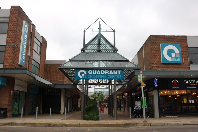
The Quadrant Shopping Centre, Dunstable
Dunstable Municipal Offices
Floral display by Dunstable Municipal Offices
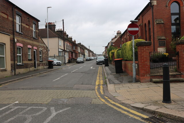
Waterlow Road, Dunstable
High Street North, Dunstable
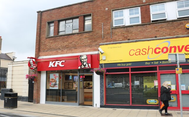
KFC on High Street South, Dunstable
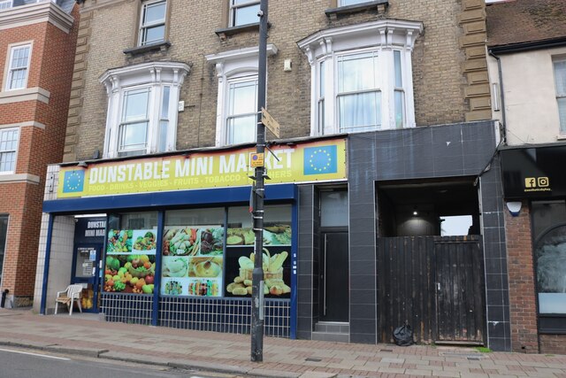
Dunstable Mini Market on High Street South
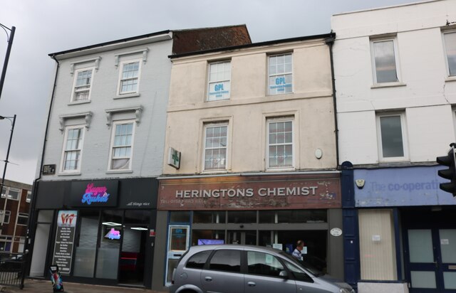
Heringtons Chemist on High Street South, Dunstable
Southfields Road at the junction of London Road, Dunstable My last visit here <a title="https://www.geograph.org.uk/photo/6524693" href="https://www.geograph.org.uk/photo/6524693">Link</a>
Southfields Road at the junction of London Road, Dunstable
My last visit here Link
The Greenway A view of the end of Sewell Cutting Greenway near French's Avenue.  This path follows the course of the old Dunstable North to Leighton Buzzard railway branch line.
The Greenway
A view of the end of Sewell Cutting Greenway near French's Avenue. This path follows the course of the old Dunstable North to Leighton Buzzard railway branch line.
Site of Dunstable North Station Central Bedfordshire Council offices now occupy the site of the old Dunstable North Station.  It was on the L&NWR branch from Leighton Buzzard and connected to the GNR branch onwards to Luton and Hatfield.  There was a bridge over the A5 in the foreground below the council sign; the road still dips where it once was.
Site of Dunstable North Station
Central Bedfordshire Council offices now occupy the site of the old Dunstable North Station. It was on the L&NWR branch from Leighton Buzzard and connected to the GNR branch onwards to Luton and Hatfield. There was a bridge over the A5 in the foreground below the council sign; the road still dips where it once was.
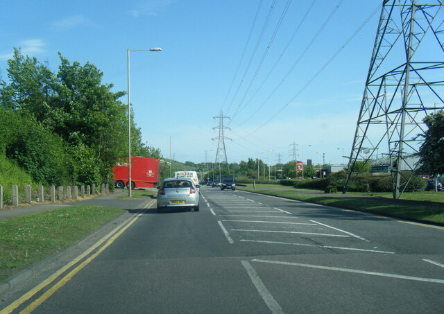
A5505 Boscombe Road
A5505 Boscombe Road
B4541 Whipsnade Road
B5451 on Dunstable Downs
Red Kite in flight Red Kites [Milvus milvus] have become very common in various parts of the UK since  reintroduction programmes began in 1990. They frequently visit a garden  in Dunstable to feed. The Chiltern Hills is where the first introductions took place.
Red Kite in flight
Red Kites [Milvus milvus] have become very common in various parts of the UK since reintroduction programmes began in 1990. They frequently visit a garden in Dunstable to feed. The Chiltern Hills is where the first introductions took place.
 Red Kite in flight Red Kites [Milvus milvus] have become very common in various parts of the UK since reintroduction programmes began in 1990. They frequently visit a garden in Dunstable to feed. The Chiltern Hills is where the first introductions took place.
Red Kite in flight
Red Kites [Milvus milvus] have become very common in various parts of the UK since reintroduction programmes began in 1990. They frequently visit a garden in Dunstable to feed. The Chiltern Hills is where the first introductions took place.
Show me another place!

Beecroft is located at Grid Ref: TL0021 (Lat: 51.887059, Lng: -0.5375)

Unitary Authority: Central Bedfordshire

Police Authority: Bedfordshire

What 3 Words

///clever.burst.during. Near Dunstable, Bedfordshire

Nearby Locations

Beecroft

Related Wikis

Weatherfield Academy

Weatherfield Academy (formerly Weatherfield School) is a mixed special school located in Dunstable, Bedfordshire, England. The school accepts pupils from...

Lancot Meadow

Lancot Meadow is a 2-hectare (4.9-acre) nature reserve in western Dunstable in Bedfordshire. It is managed by the Wildlife Trust for Bedfordshire, Cambridgeshire...

Heart Four Counties

Heart Four Counties was a local radio station owned and operated by Global Radio as part of the Heart network. It broadcast to Bedfordshire, Buckinghamshire...

Heart Dunstable

Heart Dunstable (formerly 97.6 Chiltern FM) was an Independent Local Radio station based in Chiltern Road in Dunstable, Bedfordshire. == History == Together...

Nearby Amenities

Located within 500m of 51.887059,-0.5375
Mini Roundabout
Lat/Long: 51.8892687/-0.5312903
Mini Roundabout
Direction: clockwise
Lat/Long: 51.8913568/-0.5365733
Mini Roundabout
Direction: clockwise
Lat/Long: 51.8863132/-0.5315449
Post Box
Collection Times: Mo-Fr 16:15; Sa 11:30
Operator: Royal Mail
Ref: LU6 70
Source: survey
Lat/Long: 51.8894912/-0.5396239
Turning Circle
Turning Circle: square
Lat/Long: 51.8831857/-0.5391504
Turning Circle
Turning Circle: square
Lat/Long: 51.8871417/-0.5428952
Parking
Lat/Long: 51.8878467/-0.5436849
Turning Circle
Turning Circle: circle
Lat/Long: 51.8881677/-0.5338833
Turning Circle
Turning Circle: circle
Lat/Long: 51.8875025/-0.5339565
Speed Camera
Maxspeed: 30 mph
Lat/Long: 51.8852196/-0.5377566
Post Box
Collection Times: Mo-Fr 16:15; Sa 11:45
Not Operator Wikidata: Q638098
Operator: Royal Mail
Ref: LU6 66
Source: survey
Lat/Long: 51.886822/-0.5356475
Post Box
Collection Times: Mo-Fr 17:15; Sa 11:45
Operator: Royal Mail
Ref: LU6 80
Source: survey
Lat/Long: 51.8881198/-0.5376214
Union Store Trading
Addr City: Dunstable
Addr Country: GB
Addr Housenumber: 174
Addr Postcode: LU6 1HB
Addr Street: Union Street
Fhrs Authority: Central Bedfordshire
Fhrs Id: 450680
Fhrs Local Authority Id: 67087
Shop: convenience
Lat/Long: 51.8864451/-0.5313937
Post Box
Collection Times: Mo-Fr 16:15; Sa 11:45
Note: Detail missing from postbox: surveyed on 28/10/2013. Collection times and reference assumed from Royal Mail data.
Operator: Royal Mail
Operator Wikidata: Q638098
Ref: LU6 50
Source: survey
Lat/Long: 51.8864268/-0.5314885
Traffic Calming: hump
Lat/Long: 51.8865056/-0.5315763
Crossing
Crossing: uncontrolled
Crossing Markings: yes
Lat/Long: 51.8842285/-0.540913
Pegasus Flooring
Shop: carpet
Lat/Long: 51.8857547/-0.5314247
Thompson News & Food
Addr City: Dunstable
Addr Country: GB
Addr Housenumber: 144-14
Addr Postcode: LU6 1EU
Addr Street: Chiltern Road
Fhrs Authority: Central Bedfordshire
Fhrs Id: 450679
Fhrs Local Authority Id: 67074
Shop: convenience
Lat/Long: 51.8858126/-0.5314207
Fast Food
Mister Chips
Addr City: Dunstable
Addr Country: GB
Addr Housenumber: 142
Addr Postcode: LU6 1EU
Addr Street: Chiltern Road
Fhrs Authority: Central Bedfordshire
Fhrs Id: 450678
Fhrs Local Authority Id: 67072
Lat/Long: 51.8858813/-0.5314234
Fast Food
Jade River
Addr City: Dunstable
Addr Country: GB
Addr Housenumber: 138
Addr Postcode: LU6 1ET
Addr Street: Chiltern Road
Fhrs Authority: Central Bedfordshire
Fhrs Id: 450659
Fhrs Local Authority Id: 66817
Lat/Long: 51.886085/-0.5314006
Changes
Shop: hairdresser
Lat/Long: 51.8861247/-0.5314086
RMS Supermarket
Addr City: Dunstable
Addr Country: GB
Addr Housenumber: 67-69
Addr Postcode: LU6 1ES
Addr Street: Chiltern Road
Fhrs Authority: Central Bedfordshire
Fhrs Id: 733124
Fhrs Local Authority Id: 66811
Shop: convenience
Lat/Long: 51.8889465/-0.53152
Fast Food
Favorite Chicken & Ribs
Addr City: Dunstable
Addr Country: GB
Addr Housenumber: 65
Addr Postcode: LU6 1ES
Addr Street: Chiltern Road
Brand: Favorite Chicken & Ribs
Brand Wikidata: Q120070660
Cuisine: chicken
Fhrs Authority: Central Bedfordshire
Fhrs Id: 727550
Fhrs Local Authority Id: 66810
Takeaway: yes
Website: https://favorite.co.uk/store-finder/favorite-chicken-ribs-dunstable.html
Lat/Long: 51.8890524/-0.5315468
Social Facility
Chiltern View
Addr City: Dunstable
Addr Country: GB
Addr Housenumber: 198-200
Addr Postcode: LU6 1NX
Addr Street: West Street
Fhrs Authority: Central Bedfordshire
Fhrs Id: 450661
Fhrs Local Authority Id: 66855
Social Facility: assisted_living
Social Facility For: senior
Lat/Long: 51.8834125/-0.5355742
Co-op Food
Addr City: Dunstable
Addr Country: GB
Addr Housenumber: 121
Addr Postcode: LU6 1DP
Addr Street: Westfield Road
Brand: Co-op Food
Brand Wikidata: Q3277439
Fhrs Authority: Central Bedfordshire
Fhrs Id: 624729
Fhrs Local Authority Id: 81060
Operator: The Co-operative Group
Shop: supermarket
Lat/Long: 51.8885872/-0.5362728
Aurora
Shop: hairdresser
Lat/Long: 51.8882677/-0.537461
Ron Cherry
Addr City: Dunstable
Addr Country: GB
Addr Housenumber: 154
Addr Postcode: LU6 1DL
Addr Street: Westfield Road
Fhrs Authority: Central Bedfordshire
Fhrs Id: 1173434
Fhrs Local Authority Id: 67174
Shop: greengrocer
Lat/Long: 51.8881966/-0.5375737
Direction: 185
Generator Method: photovoltaic
Generator Output Electricity: yes
Generator Solar Modules: 18
Generator Source: solar
Generator Type: solar_photovoltaic_panel
Location: roof
Power: generator
Lat/Long: 51.8894523/-0.532307
Direction: 135
Generator Method: photovoltaic
Generator Output Electricity: yes
Generator Solar Modules: 8
Generator Source: solar
Generator Type: solar_photovoltaic_panel
Location: roof
Power: generator
Lat/Long: 51.8905856/-0.5339686
Traffic Calming: island
Lat/Long: 51.8901654/-0.5344748
Traffic Calming: island
Lat/Long: 51.8900454/-0.5343217
Direction: 185
Generator Method: photovoltaic
Generator Output Electricity: yes
Generator Solar Modules: 13
Generator Source: solar
Generator Type: solar_photovoltaic_panel
Location: roof
Power: generator
Lat/Long: 51.8878465/-0.5317177
Crossing
Crossing: uncontrolled
Lat/Long: 51.88617/-0.5315993
Bus Stop
Bus: yes
Naptan AtcoCode: 021013807
Naptan NaptanCode: ahlajtmt
Public Transport: platform
Shelter: no
Lat/Long: 51.885803/-0.5332447
Bus Stop
Bus: yes
Naptan AtcoCode: 021013805
Naptan NaptanCode: ahlajtmj
Public Transport: platform
Shelter: no
Lat/Long: 51.8850735/-0.5357342
Give Way
Direction: forward
Lat/Long: 51.8853467/-0.5345275
Give Way
Direction: backward
Lat/Long: 51.8854118/-0.5345755
Direction: 120
Generator Method: photovoltaic
Generator Output Electricity: yes
Generator Solar Modules: 8
Generator Source: solar
Generator Type: solar_photovoltaic_panel
Location: roof
Power: generator
Lat/Long: 51.8869125/-0.5332384
Direction: 300
Generator Method: photovoltaic
Generator Output Electricity: yes
Generator Solar Modules: 8
Generator Source: solar
Generator Type: solar_photovoltaic_panel
Location: roof
Power: generator
Lat/Long: 51.886928/-0.533283
Direction: 120
Generator Method: photovoltaic
Generator Output Electricity: yes
Generator Solar Modules: 14
Generator Source: solar
Generator Type: solar_photovoltaic_panel
Location: roof
Power: generator
Lat/Long: 51.8866274/-0.5325855
Direction: 180
Generator Method: photovoltaic
Generator Output Electricity: yes
Generator Solar Modules: 12
Generator Source: solar
Generator Type: solar_photovoltaic_panel
Location: roof
Power: generator
Lat/Long: 51.8872643/-0.534046
Direction: 135
Generator Method: photovoltaic
Generator Output Electricity: yes
Generator Solar Modules: 14
Generator Source: solar
Generator Type: solar_photovoltaic_panel
Location: roof
Power: generator
Lat/Long: 51.8894521/-0.5357196
Traffic Calming: table
Lat/Long: 51.8878896/-0.5377614
Direction: both
Surface: concrete
Traffic Calming: table
Lat/Long: 51.8871678/-0.5388604
Crossing
Crossing: marked
Lat/Long: 51.8865696/-0.5393952
Crossing
Lat/Long: 51.8913013/-0.536667
Crossing
Crossing: marked
Lat/Long: 51.8900119/-0.5386896
Crossing
Lat/Long: 51.8887328/-0.5407092
Crossing
Lat/Long: 51.8886547/-0.5408312
Direction: 225
Generator Method: photovoltaic
Generator Output Electricity: yes
Generator Solar Modules: 119
Generator Source: solar
Generator Type: solar_photovoltaic_panel
Location: roof
Power: generator
Lat/Long: 51.8880856/-0.5432063
Fixme: does this connect to Green Lane?
Lat/Long: 51.8858709/-0.5432555
Noexit: yes
Lat/Long: 51.8866232/-0.5397474
Direction: 140
Generator Method: photovoltaic
Generator Output Electricity: yes
Generator Solar Modules: 12
Generator Source: solar
Generator Type: solar_photovoltaic_panel
Location: roof
Power: generator
Lat/Long: 51.8866756/-0.5412679
Fixme: does this connect to Green Lane?
Lat/Long: 51.8853572/-0.5412903
Crossing
Crossing: traffic_signals
Crossing Island: no
Crossing Ref: pelican
Tactile Paving: yes
Lat/Long: 51.8845358/-0.5369178
Parking Space
Capacity: 7
Lat/Long: 51.8867005/-0.5435907
Turning Circle
Turning Circle: knuckle
Lat/Long: 51.884908/-0.5419029
Direction: 200
Generator Method: photovoltaic
Generator Output Electricity: yes
Generator Solar Modules: 10
Generator Source: solar
Generator Type: solar_photovoltaic_panel
Location: roof
Power: generator
Lat/Long: 51.8829756/-0.5392625
Crossing
Crossing: uncontrolled
Lat/Long: 51.8859871/-0.5315152
Crossing
Crossing: uncontrolled
Lat/Long: 51.8912857/-0.5364457
Crossing
Crossing: unmarked
Crossing Island: no
Crossing Markings: no
Tactile Paving: yes
Lat/Long: 51.8891277/-0.5313081
Crossing
Crossing: unmarked
Crossing Island: no
Crossing Markings: no
Tactile Paving: yes
Lat/Long: 51.8892874/-0.5314898
Crossing
Crossing: uncontrolled
Lat/Long: 51.8871681/-0.5388599
Crossing
Crossing: uncontrolled
Lat/Long: 51.8889776/-0.5403905
Crossing
Crossing: uncontrolled
Lat/Long: 51.8904777/-0.537969
Crossing
Crossing: uncontrolled
Lat/Long: 51.8907792/-0.5374989
Crossing
Crossing: uncontrolled
Lat/Long: 51.8906822/-0.5377962
Crossing
Crossing: uncontrolled
Lat/Long: 51.8878856/-0.5377672
Crossing
Crossing: uncontrolled
Lat/Long: 51.8856825/-0.5381705
Bus Stop
Bus: yes
Naptan AtcoCode: 021016558
Naptan NaptanCode: ahlajwda
Public Transport: platform
Lat/Long: 51.8835499/-0.5357866
Crossing
Crossing: unmarked
Crossing Island: no
Crossing Markings: no
Tactile Paving: yes
Lat/Long: 51.8846709/-0.5369772
Bus Stop
Bus: yes
Public Transport: platform
Lat/Long: 51.8882539/-0.5368545
Crossing
Crossing: uncontrolled
Lat/Long: 51.8838101/-0.5361308
Barrier: cycle_barrier
Lat/Long: 51.8827437/-0.537783
Barrier: cycle_barrier
Lat/Long: 51.8832798/-0.5380515
Barrier: cycle_barrier
Lat/Long: 51.8842879/-0.5408296
Bus Stop
Bus: yes
Public Transport: platform
Lat/Long: 51.8864322/-0.5432499
Crossing
Crossing: unmarked
Crossing Island: no
Crossing Markings: no
Tactile Paving: yes
Lat/Long: 51.883281/-0.5356063
Crossing
Crossing: unmarked
Crossing Island: no
Crossing Markings: no
Tactile Paving: yes
Lat/Long: 51.8896557/-0.5393379
Crossing
Crossing: unmarked
Crossing Island: no
Crossing Markings: no
Tactile Paving: yes
Lat/Long: 51.8885616/-0.5312762
Crossing
Crossing: unmarked
Crossing Island: no
Crossing Markings: no
Tactile Paving: yes
Lat/Long: 51.8887721/-0.5363684
Crossing
Crossing: unmarked
Crossing Island: no
Crossing Markings: no
Tactile Paving: yes
Lat/Long: 51.888594/-0.5366422
Crossing
Lat/Long: 51.8878327/-0.5379569
Crossing
Lat/Long: 51.8872741/-0.5387885
Crossing
Crossing: unmarked
Crossing Island: no
Crossing Markings: no
Tactile Paving: yes
Lat/Long: 51.8859953/-0.5316926
Crossing
Crossing: unmarked
Crossing Island: no
Crossing Markings: no
Tactile Paving: yes
Lat/Long: 51.8867325/-0.5438557
Mini Roundabout
Direction: clockwise
Lat/Long: 51.8886972/-0.5407669
Crossing
Crossing: unmarked
Crossing Island: no
Crossing Markings: no
Tactile Paving: yes
Lat/Long: 51.8887612/-0.5408739
Barrier: bollard
Lat/Long: 51.8847657/-0.5401619
Crossing
Lat/Long: 51.8898307/-0.5338241
Crossing
Lat/Long: 51.8901319/-0.5343452
Crossing
Lat/Long: 51.8894771/-0.5333805
Crossing
Lat/Long: 51.8900767/-0.5344296
Crossing
Lat/Long: 51.8910389/-0.5361133
Crossing
Lat/Long: 51.8854668/-0.5315954
Crossing
Lat/Long: 51.8867487/-0.5395232
Crossing
Lat/Long: 51.8861489/-0.5389756
Crossing
Lat/Long: 51.8900507/-0.5343283
Crossing
Lat/Long: 51.8887514/-0.5363444
Crossing
Lat/Long: 51.888574/-0.5366196
Crossing
Lat/Long: 51.8883645/-0.5369447
Crossing
Lat/Long: 51.8883766/-0.5369655
Crossing
Lat/Long: 51.8892857/-0.5357503
Crossing
Lat/Long: 51.8888844/-0.5363762
Crossing
Lat/Long: 51.8884385/-0.5370718
Crossing
Lat/Long: 51.8893406/-0.5326033
Crossing
Lat/Long: 51.8877876/-0.5327476
Crossing
Lat/Long: 51.8895211/-0.5333999
Crossing
Lat/Long: 51.8860517/-0.5350533
Crossing
Lat/Long: 51.8878063/-0.5359936
Crossing
Lat/Long: 51.8862454/-0.5370571
Crossing
Lat/Long: 51.8867363/-0.5375204
Crossing
Lat/Long: 51.8893496/-0.5327085
Crossing
Lat/Long: 51.8877915/-0.5328544
Crossing
Lat/Long: 51.8894783/-0.5333098
Crossing
Lat/Long: 51.8891084/-0.5338665
Crossing
Lat/Long: 51.8861108/-0.5350975
Crossing
Lat/Long: 51.8881899/-0.5352491
Crossing
Lat/Long: 51.8873223/-0.536555
Crossing
Lat/Long: 51.887777/-0.5314436
Crossing
Lat/Long: 51.8878269/-0.5328018
Crossing
Lat/Long: 51.8878679/-0.5339197
Crossing
Lat/Long: 51.8882392/-0.5352532
Crossing
Lat/Long: 51.8877042/-0.5314506
Crossing
Lat/Long: 51.8877579/-0.5328083
Crossing
Lat/Long: 51.8878021/-0.533927
Crossing
Lat/Long: 51.8881862/-0.5353319
Crossing
Lat/Long: 51.8862346/-0.5369874
Crossing
Lat/Long: 51.8858475/-0.5377473
Crossing
Lat/Long: 51.8862927/-0.5370549
Crossing
Lat/Long: 51.8859103/-0.5378046
Crossing
Lat/Long: 51.8878019/-0.5358949
Crossing
Lat/Long: 51.8884303/-0.5369624
Crossing
Lat/Long: 51.8877522/-0.5359689
Crossing
Lat/Long: 51.8883877/-0.5370269
Crossing
Lat/Long: 51.8886/-0.5373804
Crossing
Lat/Long: 51.8875248/-0.5405913
Crossing
Lat/Long: 51.8870938/-0.544763
Crossing
Lat/Long: 51.889363/-0.5417766
Crossing
Lat/Long: 51.8874471/-0.5404867
Crossing
Lat/Long: 51.8872178/-0.5402022
Crossing
Lat/Long: 51.887385/-0.5407063
Crossing
Lat/Long: 51.8877196/-0.5408758
Crossing
Lat/Long: 51.8912533/-0.5387471
Crossing
Lat/Long: 51.8901213/-0.5407102
Crossing
Lat/Long: 51.8892992/-0.5417724
Crossing
Lat/Long: 51.8893683/-0.5418879
Crossing
Lat/Long: 51.8912468/-0.5388408
Crossing
Lat/Long: 51.8913221/-0.5387241
Crossing
Lat/Long: 51.8853901/-0.5345171
Crossing
Lat/Long: 51.8853657/-0.5346002
Crossing
Lat/Long: 51.8860902/-0.5350298
Crossing
Lat/Long: 51.8860641/-0.5351188
Crossing
Lat/Long: 51.8866002/-0.5354273
Crossing
Lat/Long: 51.8869621/-0.5358497
Crossing
Lat/Long: 51.8873785/-0.5365396
Crossing
Lat/Long: 51.8873255/-0.5366202
Crossing
Lat/Long: 51.8857867/-0.5331523
Crossing
Lat/Long: 51.8847691/-0.5354199
Crossing
Lat/Long: 51.8855081/-0.5329475
Crossing
Lat/Long: 51.8858165/-0.5330499
Crossing
Lat/Long: 51.8850306/-0.5357384
Crossing
Lat/Long: 51.885058/-0.5356445
Crossing
Lat/Long: 51.8890231/-0.5327375
Waste Basket
Waste: dog_excrement
Lat/Long: 51.8848649/-0.5400084
Crossing
Lat/Long: 51.8837328/-0.5401505
Crossing
Lat/Long: 51.8863837/-0.5315564
Crossing
Lat/Long: 51.8859487/-0.5316255
Crossing
Lat/Long: 51.8856801/-0.5383199
Crossing
Lat/Long: 51.8856001/-0.5382221
The data included in this document is from www.openstreetmap.org. The data is made available under ODbL.

Have you been to Beecroft?

Leave your review of Beecroft below (or comments, questions and feedback).