Keresley

Settlement in Warwickshire

England

Keresley

Pillar Box at the junction of Beake Avenue and Rylston Avenue Rylston Avenue was once on the boundary of the city.  It now stands some distance inside.  Beake Avenue is a well established, fairly typical Coventry residential road
Pillar Box at the junction of Beake Avenue and Rylston Avenue Credit: Dave and Vicky

Keresley is a village located in the county of Warwickshire, England. It is situated approximately 4 miles north of the city of Coventry. The village is part of the larger Keresley Parish, which includes nearby areas such as Keresley End and Keresley Green.

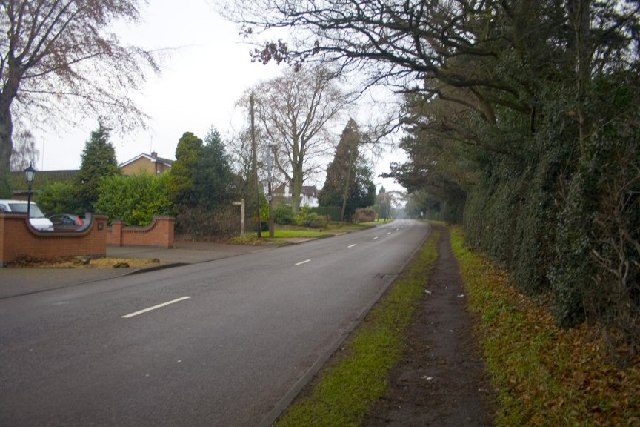
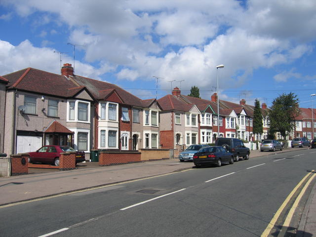
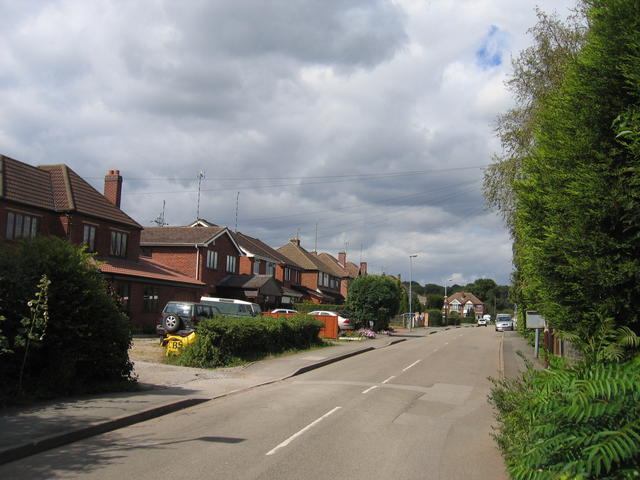
Keresley is known for its peaceful and rural setting, surrounded by open countryside and farmland. The village retains its traditional charm with a mix of old cottages and more modern houses. It offers a sense of community and a tight-knit neighborhood, with a number of local amenities and services.

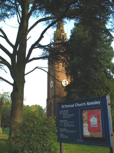
One of the notable landmarks in Keresley is the ancient St. Thomas Church, which dates back to the 12th century. It is a Grade II listed building and is often visited by history enthusiasts and tourists. The church stands as a testament to the village's rich history.

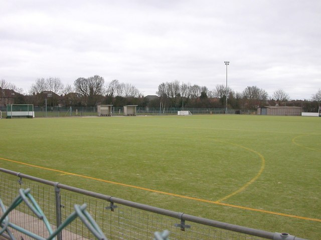
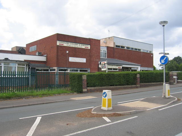
The village is also home to Keresley Rugby Football Club, a popular local sports team. The club provides opportunities for both adults and children to participate in rugby, promoting a sense of camaraderie and fitness within the community.

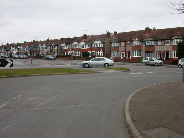
Furthermore, Keresley benefits from its close proximity to Coventry, where residents can access a wider range of amenities, entertainment venues, and shopping opportunities. The village is well-connected to the city via road networks, making it convenient for commuters.

Overall, Keresley offers a tranquil and picturesque setting, combined with a strong sense of community and a range of local amenities, making it an attractive place to live or visit in Warwickshire.

If you have any feedback on the listing, please let us know in the comments section below.
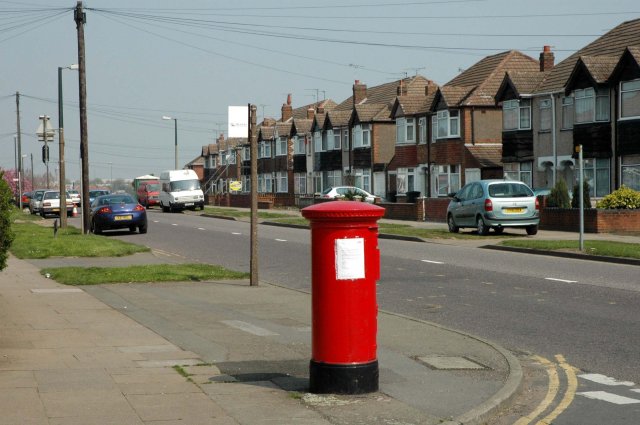
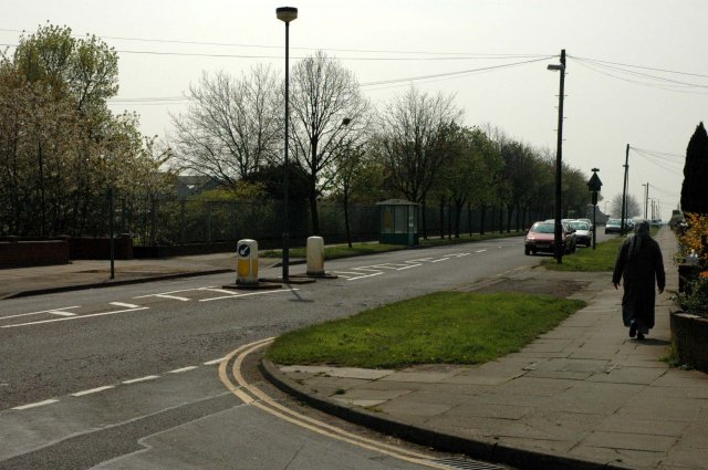
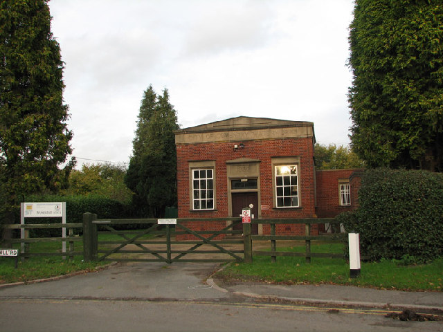
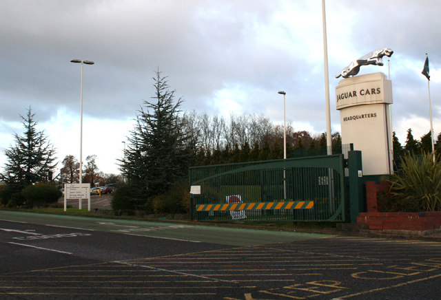
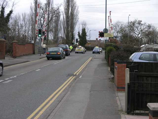
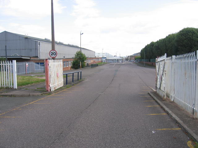
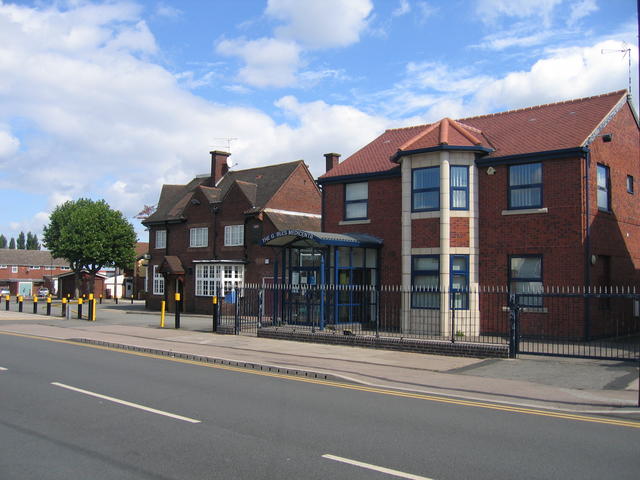
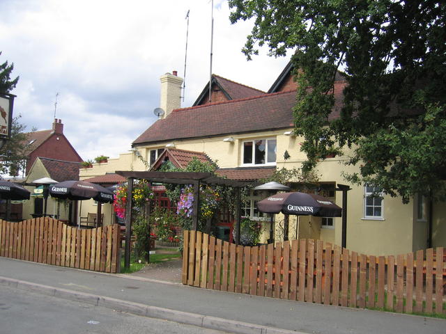
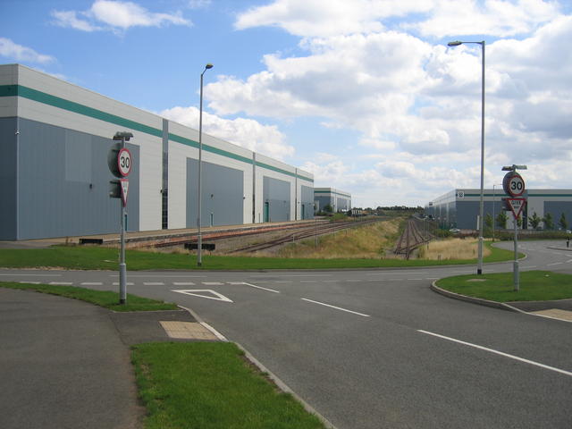
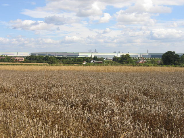
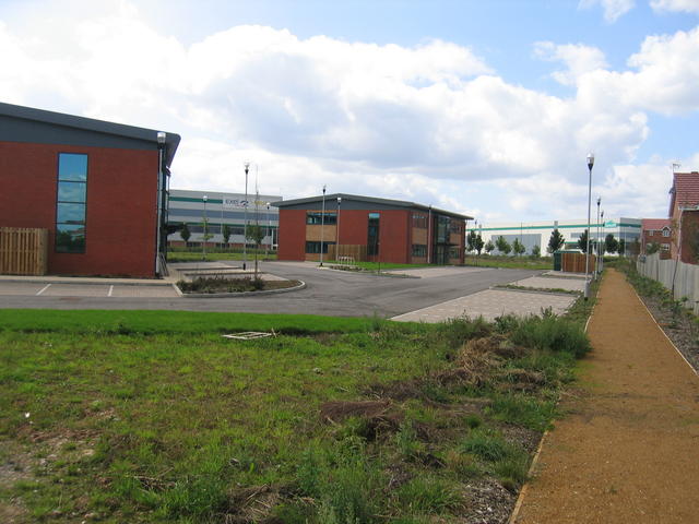
Keresley Images

Images are sourced within 2km of 52.442475/-1.5319497 or Grid Reference SP3182. Thanks to Geograph Open Source API. All images are credited.

Pillar Box at the junction of Beake Avenue and Rylston Avenue Rylston Avenue was once on the boundary of the city.  It now stands some distance inside.  Beake Avenue is a well established, fairly typical Coventry residential road
Pillar Box at the junction of Beake Avenue and Rylston Avenue
Rylston Avenue was once on the boundary of the city. It now stands some distance inside. Beake Avenue is a well established, fairly typical Coventry residential road
Looking down Beake Avenue from the junction with Rylston Avenue The huge Dunlop factory can be seen just beyond the trees on the left.
Looking down Beake Avenue from the junction with Rylston Avenue
The huge Dunlop factory can be seen just beyond the trees on the left.
Brownshill Green Water Works Opposite the White Lion public house, fantastic food and service, very busy so be quick on a Sunday lunch time!
Brownshill Green Water Works
Opposite the White Lion public house, fantastic food and service, very busy so be quick on a Sunday lunch time!
Will the last leaper to leave please turn off the engine? The entrance to the Brown's Lane plant of Coventry's most famous export...apart from the nudie lady of course.  Only the wood veneer fabrication line remains at Brown's Lane as of December 2005 as most of the engineers/designers have moved to Whitley (on the outskirts of Coventry) or the sites in Liverpool or Birmingham.
Will the last leaper to leave please turn off the engine?
The entrance to the Brown's Lane plant of Coventry's most famous export...apart from the nudie lady of course. Only the wood veneer fabrication line remains at Brown's Lane as of December 2005 as most of the engineers/designers have moved to Whitley (on the outskirts of Coventry) or the sites in Liverpool or Birmingham.
St. Thomas' Church, Keresley Does what it says on the sign....
St. Thomas' Church, Keresley
Does what it says on the sign....
Tamworth Road, Coventry The road that links Coventry, Radford with Corley, M6.
Tamworth Road, Coventry
The road that links Coventry, Radford with Corley, M6.
Coventry - Coundon Duncroft Avenue at the entrance to Bablake Playing Fields which is home to Christ the King F.C., Old Wheatleyans R.F.C. and Bablake Old Boys Cricket Club.
Coventry - Coundon
Duncroft Avenue at the entrance to Bablake Playing Fields which is home to Christ the King F.C., Old Wheatleyans R.F.C. and Bablake Old Boys Cricket Club.
Coventry - Coundon Astroturf pitch at Bablake Playing Fields.
Coventry - Coundon
Astroturf pitch at Bablake Playing Fields.
Traffic on a Level Crossing Although the traffic appears to be turning onto the railway it isn't but onto a new link road to the A444.
Traffic on a Level Crossing
Although the traffic appears to be turning onto the railway it isn't but onto a new link road to the A444.
Empty factory at Whitmore Park This factory site occupies much of this square however it is currently largely empty awaiting new owners.
Empty factory at Whitmore Park
This factory site occupies much of this square however it is currently largely empty awaiting new owners.
Holbrook Lane The pub and the Gables Medical centre on the corner of Holbrooks Lane and Lythalls Lane in this northern suburb of Coventry.
Holbrook Lane
The pub and the Gables Medical centre on the corner of Holbrooks Lane and Lythalls Lane in this northern suburb of Coventry.
Parkville Highway Housing typical of the 1930s suburban expansion of Coventry.
Parkville Highway
Housing typical of the 1930s suburban expansion of Coventry.
Hare and Hounds, Keresley Green The pub shown on the OS map in Watery Lane near the junction with Bennetts Road.
Hare and Hounds, Keresley Green
The pub shown on the OS map in Watery Lane near the junction with Bennetts Road.
Redevelopment at Coventry Colliery, Keresley The railway sidings formerly served Coventry Colliery which occupied the east of  this square and some of the adjacent squares.  As can be seen from the large new buildings, a substantial amount of redevelopment has taken place on this site since the colliery closed. The colliery commenced operation in 1917 and the railway connection was added in 1919.  The colliery closed in 1993.
Redevelopment at Coventry Colliery, Keresley
The railway sidings formerly served Coventry Colliery which occupied the east of this square and some of the adjacent squares. As can be seen from the large new buildings, a substantial amount of redevelopment has taken place on this site since the colliery closed. The colliery commenced operation in 1917 and the railway connection was added in 1919. The colliery closed in 1993.
Distant view of Coventry Colliery site Although <a href="https://www.geograph.org.uk/photo/227046">SP3184 : Redevelopment at Coventry Colliery, Keresley</a> occupies the east of the square most of the remainder is farmland.  This is the view looking across the square from Fivefield Road.
Distant view of Coventry Colliery site
Although SP3184 : Redevelopment at Coventry Colliery, Keresley occupies the east of the square most of the remainder is farmland. This is the view looking across the square from Fivefield Road.
New offices at the site of Coventry Colliery Some of the new office blocks, and in the distance, warehouse units on the site of the former Coventry Colliery.  The colliery closed in 1993.
New offices at the site of Coventry Colliery
Some of the new office blocks, and in the distance, warehouse units on the site of the former Coventry Colliery. The colliery closed in 1993.
Coventry & Keresley Colliery Sports and Social Club
Fivefield Road, Keresley A view in the village along Fivefield Road.
Fivefield Road, Keresley
A view in the village along Fivefield Road.
Show me another place!

Keresley is located at Grid Ref: SP3182 (Lat: 52.442475, Lng: -1.5319497)

Unitary Authority: Coventry

Police Authority: West Midlands

What 3 Words

///posts.hats.burn. Near Keresley, West Midlands

Related Wikis

Cardinal Newman Catholic School and Community College

Cardinal Newman Catholic School is a coeducational Roman Catholic secondary school and sixth form located in the Keresley area of Coventry, West Midlands...

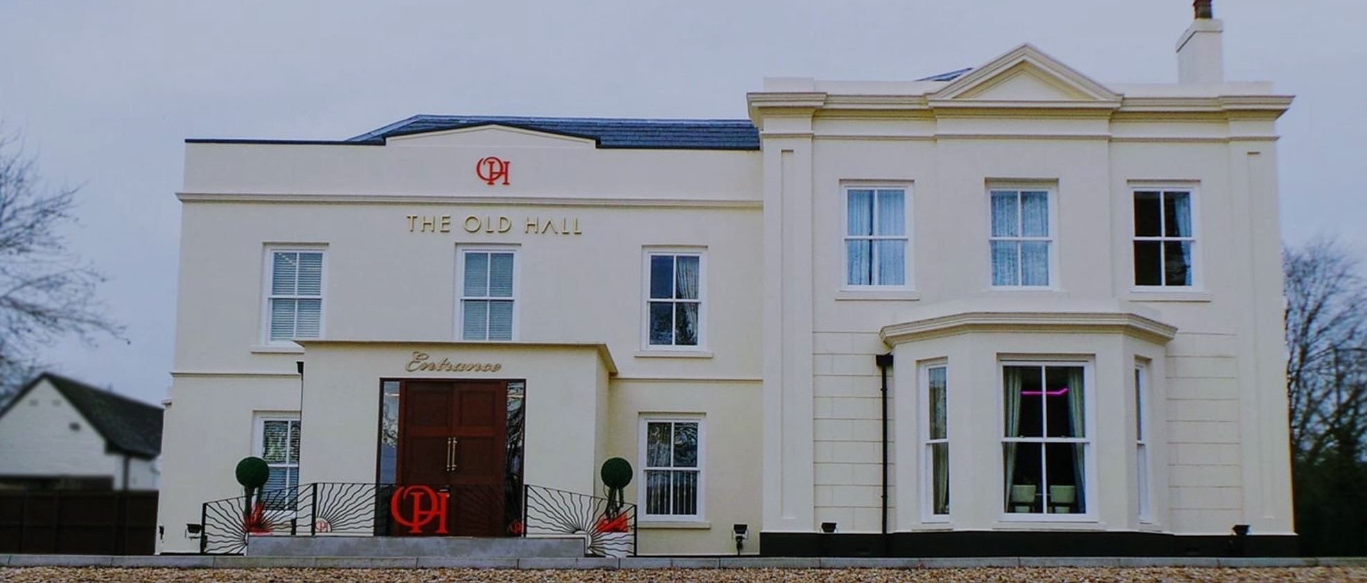
The Old Hall Hotel, Coventry

The Old Hall Hotel in Coundon near Coventry, England, is a building of historical significance and is Grade II listed on the English Heritage Register...

Keresley

Keresley is a suburban village and civil parish in the City of Coventry, West Midlands, England, about 4.5 miles (7 km) north of Coventry city centre and...

President Kennedy School

President Kennedy School is a coeducational secondary school and sixth form with academy status, located in the Keresley area of Coventry, England. The...

Brownshill Green

Brownshill Green is a suburban hamlet 3.5 miles northwest of Coventry by road, adjacent to the suburbs of Allesley, Coundon and Keresley. It is bordered...

St Luke's Church, Holbrooks

St Luke's Church is a parish church of the Church of England located in Holbrooks, Coventry, West Midlands, England. == History == The earliest church...

Corley

Corley (and the associated hamlets of Corley Ash and Corley Moor) is a village and civil parish in the North Warwickshire district of Warwickshire, England...

Holbrooks

Holbrooks is a residential area of Coventry, West Midlands, England. Most of the length of the four brooks which pass through the area are covered or culverted...

Nearby Amenities

Located within 500m of 52.442475,-1.5319497
Crossing
Crossing: unmarked
Crossing Island: no
Tactile Paving: no
Lat/Long: 52.4396378/-1.5302255
Odbl: clean
Lat/Long: 52.4434514/-1.5291505
Post Box
Collection Times: Mo-Fr 09:00; Sa 07:00
Operator: Royal Mail
Post Box Type: pillar
Ref: CV6 167D
Royal Cypher: EIIR
Royal Cypher Wikidata: Q33102113
Source: survey
Lat/Long: 52.441959/-1.531956
Bus Stop
Bennetts Road South / Cardinal Newman School
Bench: no
Bin: no
Bus: yes
Lit: yes
Naptan AtcoCode: 43000002801
Naptan Bearing: N
Naptan BusStopType: MKD
Naptan CommonName: Cardinal Newman School
Naptan Indicator: adj
Naptan NaptanCode: nwmtwdat
Naptan PlusbusZoneRef: BHAMNWS
Naptan Status: ACT
Naptan StopType: BCT
Naptan Street: BENNETTS ROAD SOUTH
Naptan Towards: Keresley
Naptan Verified: no
Public Transport: platform
Shelter: no
Source: WMCA
Tactile Paving: no
Lat/Long: 52.4423465/-1.5320321
Bus Stop
Bennetts Road South / Greens Rd
Bench: no
Bin: no
Bus: yes
Lit: yes
Naptan AtcoCode: 43000011501
Naptan Bearing: N
Naptan BusStopType: MKD
Naptan CommonName: Greens Rd
Naptan Indicator: adj
Naptan Landmark: The Bell
Naptan NaptanCode: nwmptmjm
Naptan PlusbusZoneRef: BHAMNWS
Naptan Status: ACT
Naptan StopType: BCT
Naptan Street: BENNETTS ROAD SOUTH
Naptan Towards: Keresley
Naptan Verified: no
Public Transport: platform
Route Ref: 16;16A;735
Shelter: no
Source: WMCA
Tactile Paving: no
Lat/Long: 52.4393633/-1.5315473
Bus Stop
Bennetts Road South / Greens Rd
NaPTANAreaCode: 43000011502
Bench: yes
Bin: no
Bus: yes
Lit: yes
Naptan AtcoCode: 43000011502
Naptan Bearing: S
Naptan BusStopType: MKD
Naptan CommonName: Greens Rd
Naptan Indicator: opp
Naptan Landmark: The Bell
Naptan NaptanCode: nwmptmjp
Naptan PlusbusZoneRef: BHAMNWS
Naptan Status: ACT
Naptan StopType: BCT
Naptan Street: BENNETTS ROAD SOUTH
Naptan Towards: City Centre
Naptan Verified: no
Public Transport: platform
Route Ref: 16;16A;735
Shelter: yes
Shelter Ref: 709907
Source: WMCA
Tactile Paving: no
Lat/Long: 52.4391303/-1.531316
Bus Stop
Bennetts Road South / Lowe Rd
Bench: no
Bin: no
Bus: yes
Lit: yes
Naptan AtcoCode: 43000011601
Naptan Bearing: N
Naptan BusStopType: MKD
Naptan CommonName: Lowe Rd
Naptan Indicator: opp
Naptan NaptanCode: nwmptmjt
Naptan PlusbusZoneRef: BHAMNWS
Naptan Status: ACT
Naptan StopType: BCT
Naptan Street: BENNETTS ROAD SOUTH
Naptan Towards: Keresley
Naptan Verified: no
Public Transport: platform
Route Ref: 16;16A;735
Shelter: no
Source: WMCA
Tactile Paving: no
Lat/Long: 52.4405185/-1.531933
Bus Stop
Bennetts Road South / Lowe Rd
Bench: no
Bin: no
Bus: yes
Lit: yes
Naptan AtcoCode: 43000011602
Naptan Bearing: S
Naptan BusStopType: MKD
Naptan CommonName: Lowe Rd
Naptan Indicator: adj
Naptan NaptanCode: nwmptmjw
Naptan PlusbusZoneRef: BHAMNWS
Naptan Status: ACT
Naptan StopType: BCT
Naptan Street: BENNETTS ROAD SOUTH
Naptan Towards: City Centre
Naptan Verified: no
Public Transport: platform
Route Ref: 16;16A
Shelter: no
Source: WMCA
Tactile Paving: no
Lat/Long: 52.4401255/-1.5316941
Bus Stop
Bennetts Road South / Sandpits Lane
Bench: no
Bin: no
Bus: yes
Lit: yes
Naptan AtcoCode: 43000011701
Naptan Bearing: N
Naptan BusStopType: MKD
Naptan CommonName: Sandpits Lane
Naptan Indicator: adj
Naptan NaptanCode: nwmptmpa
Naptan PlusbusZoneRef: BHAMNWS
Naptan Status: ACT
Naptan StopType: BCT
Naptan Street: BENNETTS ROAD SOUTH
Naptan Towards: Keresley
Public Transport: platform
Route Ref: 16;16A
Shelter: no
Source: WMCA
Tactile Paving: no
Lat/Long: 52.4435596/-1.5318309
Bus Stop
Bennetts Road South / Sandpits Lane
NaPTANAreaCode: 43000011702
Bench: yes
Bin: yes
Bus: yes
Lit: yes
Naptan AtcoCode: 43000011702
Naptan Bearing: S
Naptan BusStopType: MKD
Naptan CommonName: Sandpits Lane
Naptan Indicator: opp
Naptan NaptanCode: nwmptmpd
Naptan PlusbusZoneRef: BHAMNWS
Naptan Status: ACT
Naptan StopType: BCT
Naptan Street: BENNETTS ROAD SOUTH
Naptan Towards: City Centre
Naptan Verified: no
Public Transport: platform
Route Ref: 16;16A
Shelter: yes
Shelter Ref: 709906
Source: WMCA
Tactile Paving: no
Lat/Long: 52.443226/-1.531737
Bus Stop
Tamworth Rd / Keresley Church
Bench: no
Bin: no
Bus: yes
Lit: yes
Naptan AtcoCode: 43000011801
Naptan Bearing: SE
Naptan BusStopType: MKD
Naptan CommonName: Keresley Church
Naptan Indicator: adj
Naptan NaptanCode: nwmptmpg
Naptan PlusbusZoneRef: BHAMNWS
Naptan Status: ACT
Naptan StopType: BCT
Naptan Street: TAMWORTH RD
Naptan Towards: Coventry
Naptan Verified: no
Public Transport: platform
Shelter: no
Source: WMCA
Tactile Paving: no
Lat/Long: 52.4387036/-1.5347211
Bus Stop
Tamworth Rd / Keresley Church
Bench: no
Bin: no
Bus: yes
Lit: yes
Naptan AtcoCode: 43000011802
Naptan Bearing: NW
Naptan BusStopType: MKD
Naptan CommonName: Keresley Church
Naptan Indicator: opp
Naptan NaptanCode: nwmptmpj
Naptan PlusbusZoneRef: BHAMNWS
Naptan Status: ACT
Naptan StopType: BCT
Naptan Street: TAMWORTH RD
Naptan Towards: Corley
Public Transport: platform
Route Ref: 735
Shelter: no
Source: WMCA
Tactile Paving: no
Lat/Long: 52.4395579/-1.5360475
Sandpits Lane / Cardinal Newman School
Naptan AtcoCode: 43000013501
Naptan Bearing: W
Naptan BusStopType: CUS
Naptan CommonName: Cardinal Newman School
Naptan Indicator: adj
Naptan NaptanCode: nwmptpdp
Naptan PlusbusZoneRef: BHAMNWS
Naptan Status: ACT
Naptan StopType: BCT
Naptan Street: SANDPITS LANE
Naptan Towards: City Centre
Naptan Verified: no
Source: WMCA
Lat/Long: 52.4432637/-1.5360033
Bus Stop
Cottage Farm Rd / Taunton Way
Bench: no
Bin: no
Bus: yes
Lit: yes
Naptan AtcoCode: 43000014001
Naptan Bearing: SW
Naptan BusStopType: MKD
Naptan CommonName: Taunton Way
Naptan Indicator: before
Naptan NaptanCode: nwmptpga
Naptan PlusbusZoneRef: BHAMNWS
Naptan Status: ACT
Naptan StopType: BCT
Naptan Street: COTTAGE FARM RD
Naptan Towards: City Centre
Naptan Verified: no
Public Transport: platform
Shelter: no
Source: WMCA
Tactile Paving: no
Lat/Long: 52.4391881/-1.5279912
Bus Stop
Cottage Farm Rd / Taunton Way
Bench: no
Bin: no
Bus: yes
Lit: yes
Naptan AtcoCode: 43000014002
Naptan Bearing: N
Naptan BusStopType: MKD
Naptan CommonName: Taunton Way
Naptan Indicator: after
Naptan NaptanCode: nwmtmptp
Naptan PlusbusZoneRef: BHAMNWS
Naptan Status: ACT
Naptan StopType: BCT
Naptan Street: COTTAGE FARM RD
Naptan Towards: Corley
Naptan Verified: no
Public Transport: platform
Shelter: no
Source: WMCA
Tactile Paving: no
Lat/Long: 52.4394195/-1.528073
Bus Stop
Bennetts Road South / Penny Park Lane
Bench: no
Bin: no
Bus: yes
Lit: yes
Naptan AtcoCode: 43000014101
Naptan Bearing: N
Naptan BusStopType: MKD
Naptan CommonName: Penny Park Lane
Naptan Indicator: opp
Naptan NaptanCode: nwmptjdj
Naptan PlusbusZoneRef: BHAMNWS
Naptan Status: ACT
Naptan StopType: BCT
Naptan Street: BENNETTS ROAD SOUTH
Naptan Towards: Keresley
Public Transport: platform
Route Ref: 16;16A
Shelter: no
Source: WMCA
Tactile Paving: no
Lat/Long: 52.4456816/-1.5314742
Bus Stop
Bennetts Road South / Penny Park Lane
Bench: no
Bin: no
Bus: yes
Lit: yes
Naptan AtcoCode: 43000014102
Naptan Bearing: S
Naptan BusStopType: MKD
Naptan CommonName: Penny Park Lane
Naptan Indicator: adj
Naptan NaptanCode: nwmptpgd
Naptan PlusbusZoneRef: BHAMNWS
Naptan Status: ACT
Naptan StopType: BCT
Naptan Street: BENNETTS ROAD SOUTH
Naptan Towards: City Centre
Naptan Verified: no
Public Transport: platform
Route Ref: 16;16A
Shelter: no
Source: WMCA
Tactile Paving: no
Lat/Long: 52.4455509/-1.5313536
Bus Stop
Taunton Way / Taunton Way
Bench: no
Bin: no
Bus: yes
Lit: yes
Naptan AtcoCode: 43000018101
Naptan Bearing: N
Naptan BusStopType: MKD
Naptan CommonName: Taunton Way
Naptan Indicator: on
Naptan NaptanCode: nwmptwjt
Naptan PlusbusZoneRef: BHAMNWS
Naptan Status: ACT
Naptan StopType: BCT
Naptan Street: TAUNTON WAY
Naptan Towards: City Centre
Naptan Verified: no
Public Transport: platform
Shelter: no
Source: WMCA
Tactile Paving: no
Lat/Long: 52.4396378/-1.530294
Bus Stop
Taunton Way / Taunton Way
Bench: no
Bin: no
Bus: yes
Lit: yes
Naptan AtcoCode: 43000018102
Naptan Bearing: W
Naptan BusStopType: MKD
Naptan CommonName: Taunton Way
Naptan NaptanCode: nwmtmptw
Naptan PlusbusZoneRef: BHAMNWS
Naptan Status: ACT
Naptan StopType: BCT
Naptan Street: TAUNTON WAY
Naptan Towards: Corley
Naptan Verified: no
Public Transport: platform
Shelter: no
Source: WMCA
Tactile Paving: no
Lat/Long: 52.4398945/-1.5297146
Bus Stop
Halford Lane / Glentworth Avenue
Bench: no
Bin: no
Bus: yes
Lit: yes
Naptan AtcoCode: 43001050201
Naptan Bearing: S
Naptan BusStopType: MKD
Naptan CommonName: Glentworth Avenue
Naptan Indicator: opp
Naptan NaptanCode: nwmtjamd
Naptan PlusbusZoneRef: BHAMNWS
Naptan Status: ACT
Naptan StopType: BCT
Naptan Street: HALFORD LANE
Naptan Towards: Coundon
Naptan Verified: no
Public Transport: platform
Route Ref: 61
Shelter: no
Source: WMCA
Tactile Paving: no
Lat/Long: 52.4420141/-1.5263769
Bus Stop
Halford Lane / Glentworth Avenue
Bench: no
Bin: no
Bus: yes
Lit: yes
Naptan AtcoCode: 43001050202
Naptan Bearing: N
Naptan BusStopType: MKD
Naptan CommonName: Glentworth Avenue
Naptan Indicator: adj
Naptan NaptanCode: nwmtjamg
Naptan PlusbusZoneRef: BHAMNWS
Naptan Status: ACT
Naptan StopType: BCT
Naptan Street: HALFORD LANE
Naptan Towards: Arena Park
Naptan Verified: no
Public Transport: platform
Route Ref: 61
Shelter: no
Source: WMCA
Tactile Paving: no
Lat/Long: 52.4419389/-1.5265325
Bus Stop
Halford Lane / Leacrest Rd
Bench: no
Bin: no
Bus: yes
Lit: yes
Naptan AtcoCode: 43001050301
Naptan Bearing: S
Naptan BusStopType: MKD
Naptan CommonName: Leacrest Rd
Naptan Indicator: opp
Naptan NaptanCode: nwmtjamj
Naptan PlusbusZoneRef: BHAMNWS
Naptan Status: ACT
Naptan StopType: BCT
Naptan Street: HALFORD LANE
Naptan Towards: Coundon
Naptan Verified: no
Public Transport: platform
Shelter: no
Source: WMCA
Tactile Paving: no
Lat/Long: 52.444328/-1.5261448
Bus Stop
Lowe Rd / Bennetts Rd South
Bench: no
Bin: no
Bus: yes
Lit: yes
Naptan AtcoCode: 43001549301
Naptan Bearing: E
Naptan BusStopType: MKD
Naptan CommonName: Bennetts Rd South
Naptan Indicator: after
Naptan NaptanCode: nwmtptmt
Naptan PlusbusZoneRef: BHAMNWS
Naptan Status: ACT
Naptan StopType: BCT
Naptan Street: LOWE RD
Naptan Towards: City Centre
Naptan Verified: no
Public Transport: platform
Shelter: no
Source: WMCA
Tactile Paving: no
Lat/Long: 52.4408722/-1.5307915
Give Way
Source: Warwicks CC Aerial Imagery 2013
Lat/Long: 52.4423143/-1.5263368
Barrier: bollard
Bollard: fixed
Lat/Long: 52.4394277/-1.5275011
Barrier: cycle_barrier
Bicycle: dismount
Cycle Barrier: tilted
Foot: yes
Motor Vehicle: no
Lat/Long: 52.4454996/-1.5266288
Crossing: informal
Lat/Long: 52.4447105/-1.5270832
Crossing
Crossing: unmarked
Crossing Island: no
Tactile Paving: no
Lat/Long: 52.4394432/-1.528011
Fuel
Texaco
Addr City: Keresley, Coventry
Addr Housenumber: 6-8
Addr Postcode: CV6 2FR
Addr Street: Sandpits Lane
Brand: Texaco
Brand Wikidata: Q775060
Brand Wikipedia: en:Texaco
Compressed Air: no
Description: This petrol station is the "Sandpits Service Station".
Source: receipt from visit
Website: https://locations.valero.com/en-gb/LocationDetails/Index/6-7-SANDPITS-LANE/0000886554
Lat/Long: 52.443045/-1.5321388
Generator Method: photovoltaic
Generator Output Electricity: yes
Generator Source: solar
Generator Type: solar_photovoltaic_panel
Location: roof
Power: generator
Lat/Long: 52.4402243/-1.5257166
Generator Method: photovoltaic
Generator Output Electricity: yes
Generator Source: solar
Generator Type: solar_photovoltaic_panel
Location: roof
Power: generator
Lat/Long: 52.4406756/-1.5256281
Generator Method: photovoltaic
Generator Output Electricity: yes
Generator Source: solar
Generator Type: solar_photovoltaic_panel
Location: roof
Power: generator
Lat/Long: 52.4415225/-1.525325
Generator Method: photovoltaic
Generator Output Electricity: yes
Generator Source: solar
Generator Type: solar_photovoltaic_panel
Location: roof
Power: generator
Lat/Long: 52.443231/-1.5253787
Generator Method: photovoltaic
Generator Output Electricity: yes
Generator Source: solar
Generator Type: solar_photovoltaic_panel
Location: roof
Power: generator
Lat/Long: 52.4439193/-1.5280394
Generator Method: photovoltaic
Generator Output Electricity: yes
Generator Source: solar
Generator Type: solar_photovoltaic_panel
Location: roof
Power: generator
Lat/Long: 52.443903/-1.5282862
Generator Method: photovoltaic
Generator Output Electricity: yes
Generator Source: solar
Generator Type: solar_photovoltaic_panel
Location: roof
Power: generator
Lat/Long: 52.4438899/-1.5284364
Generator Method: photovoltaic
Generator Output Electricity: yes
Generator Source: solar
Generator Type: solar_photovoltaic_panel
Location: roof
Power: generator
Lat/Long: 52.4418375/-1.5306397
Generator Method: photovoltaic
Generator Output Electricity: yes
Generator Source: solar
Generator Type: solar_photovoltaic_panel
Location: roof
Power: generator
Lat/Long: 52.438429/-1.5340838
Crossing
Crossing: unmarked
Tactile Paving: no
Lat/Long: 52.4442651/-1.5263262
Crossing
Crossing: unmarked
Tactile Paving: no
Lat/Long: 52.4445311/-1.5262896
The data included in this document is from www.openstreetmap.org. The data is made available under ODbL.

Have you been to Keresley?

Leave your review of Keresley below (or comments, questions and feedback).