The Spinney

Wood, Forest in Warwickshire

England

The Spinney

Browns Lane, Allesley, Coventry Browns Lane runs for over a mile along the western edge of Coventry: between-the-wars, 1920s-1930s ribbon development, houses with fields beyond their back gardens on the western side, the gaps gradually filled in later with more modern housing. On the Coventry side, visible on the left in this photo, a 'shadow factory' was built behind the houses in the late 1930s, using equipment and skills from the motor industry, in this case Daimler, to make aircraft parts for the coming war. This was to become the Jaguar Browns Lane car plant, in operation from 1951 to 2005. Since 2008 housing and a business park have been built on the site. <span class="nowrap"><a title="https://en.wikipedia.org/wiki/Browns_Lane_plant" rel="nofollow ugc noopener" href="https://en.wikipedia.org/wiki/Browns_Lane_plant">Link</a><img style="margin-left:2px;" alt="External link" title="External link - shift click to open in new window" src="https://s1.geograph.org.uk/img/external.png" width="10" height="10"/></span>
Browns Lane, Allesley, Coventry Credit: A J Paxton

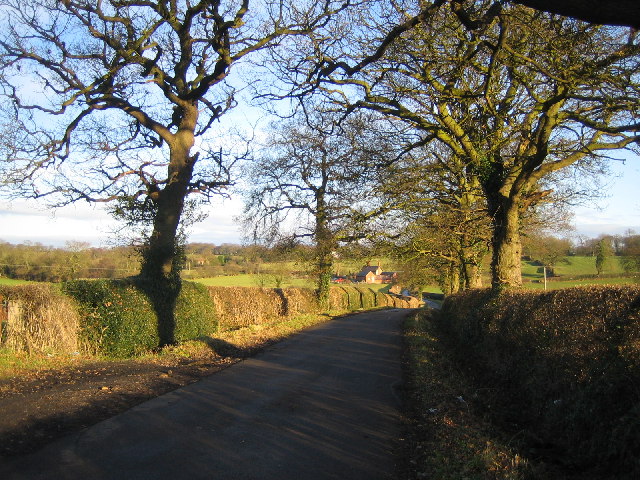
The Spinney is a picturesque woodland located in Warwickshire, England. Situated in the heart of the county, this enchanting forest covers an area of approximately 50 acres, making it a perfect retreat for nature lovers and outdoor enthusiasts.

The Spinney is known for its diverse range of trees, including oak, beech, birch, and ash. These majestic trees create a dense canopy, providing a cool and shaded atmosphere during the summer months. The forest floor is adorned with a carpet of wildflowers, adding bursts of color to the landscape.

Nature enthusiasts visiting The Spinney can expect to encounter an array of wildlife. The forest is home to various bird species, including woodpeckers, owls, and thrushes. Additionally, visitors may spot rabbits, squirrels, and deer roaming freely in their natural habitat.

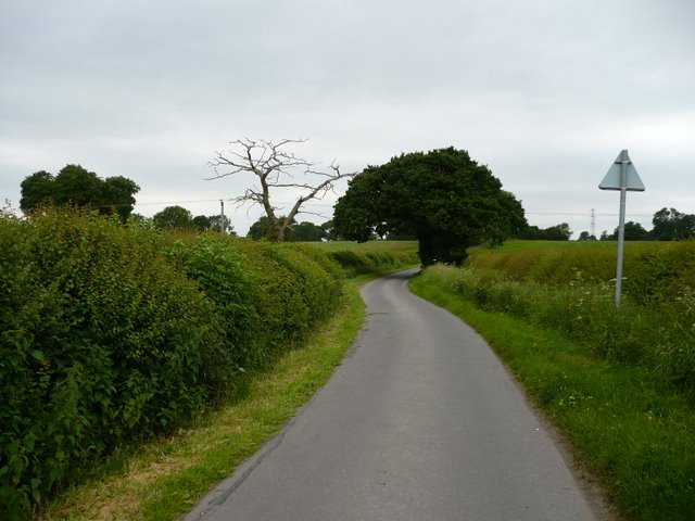
The Spinney offers several walking trails, allowing visitors to explore the forest at their own pace. These well-maintained paths wind through the woodland, providing opportunities to immerse oneself in the tranquility of nature. Along the way, informative signs offer insights into the local flora and fauna, enhancing the educational experience.

The forest also features a picnic area, where visitors can relax and enjoy a meal amidst the peaceful surroundings. The Spinney is a popular destination for families, offering a safe and serene environment for children to play and explore.

Overall, The Spinney in Warwickshire is a captivating woodland that offers a haven of natural beauty and tranquility. Its diverse range of trees, abundant wildlife, and well-marked trails make it a perfect destination for those seeking solace in nature.

If you have any feedback on the listing, please let us know in the comments section below.

The Spinney Images

Images are sourced within 2km of 52.44187/-1.5427985 or Grid Reference SP3182. Thanks to Geograph Open Source API. All images are credited.

Browns Lane, Allesley, Coventry Browns Lane runs for over a mile along the western edge of Coventry: between-the-wars, 1920s-1930s ribbon development, houses with fields beyond their back gardens on the western side, the gaps gradually filled in later with more modern housing. On the Coventry side, visible on the left in this photo, a 'shadow factory' was built behind the houses in the late 1930s, using equipment and skills from the motor industry, in this case Daimler, to make aircraft parts for the coming war. This was to become the Jaguar Browns Lane car plant, in operation from 1951 to 2005. Since 2008 housing and a business park have been built on the site. <span class="nowrap"><a title="https://en.wikipedia.org/wiki/Browns_Lane_plant" rel="nofollow ugc noopener" href="https://en.wikipedia.org/wiki/Browns_Lane_plant">Link</a><img style="margin-left:2px;" alt="External link" title="External link - shift click to open in new window" src="https://s1.geograph.org.uk/img/external.png" width="10" height="10"/></span>
Browns Lane, Allesley, Coventry
Browns Lane runs for over a mile along the western edge of Coventry: between-the-wars, 1920s-1930s ribbon development, houses with fields beyond their back gardens on the western side, the gaps gradually filled in later with more modern housing. On the Coventry side, visible on the left in this photo, a 'shadow factory' was built behind the houses in the late 1930s, using equipment and skills from the motor industry, in this case Daimler, to make aircraft parts for the coming war. This was to become the Jaguar Browns Lane car plant, in operation from 1951 to 2005. Since 2008 housing and a business park have been built on the site. LinkExternal link
Off to work at BHX4 BHX4 is a 'receive centre' or 'cross dock facility' for Amazon goods. According to the Coventry Telegraph, everything sold by Amazon in the UK passes in and out of this facility, but the goods are not stored here for more than a few hours. Once processed, they are sent on to 'fulfilment centres' elsewhere in the UK 'and even Europe'. It is one of four Amazon sites in the Midlands, all named after the code for Birmingham Airport. The Telegraph reporter claims to have observed a 'fast-paced but good-natured atmosphere' in the building, which has three floors, each the size of eight football pitches. <span class="nowrap"><a title="https://www.coventrytelegraph.net/news/coventry-news/coventry-news-amazon-coventry-warehouse-15580127" rel="nofollow ugc noopener" href="https://www.coventrytelegraph.net/news/coventry-news/coventry-news-amazon-coventry-warehouse-15580127">Link</a><img style="margin-left:2px;" alt="External link" title="External link - shift click to open in new window" src="https://s1.geograph.org.uk/img/external.png" width="10" height="10"/></span> 

The receive centre is built on part of the site of the Jaguar Browns Lane plant, which made Jaguar cars between 1951 and 2005. This change of use is emblematic of the shift of employment in Coventry away from manufacturing to distribution and services.
Off to work at BHX4
BHX4 is a 'receive centre' or 'cross dock facility' for Amazon goods. According to the Coventry Telegraph, everything sold by Amazon in the UK passes in and out of this facility, but the goods are not stored here for more than a few hours. Once processed, they are sent on to 'fulfilment centres' elsewhere in the UK 'and even Europe'. It is one of four Amazon sites in the Midlands, all named after the code for Birmingham Airport. The Telegraph reporter claims to have observed a 'fast-paced but good-natured atmosphere' in the building, which has three floors, each the size of eight football pitches. LinkExternal link The receive centre is built on part of the site of the Jaguar Browns Lane plant, which made Jaguar cars between 1951 and 2005. This change of use is emblematic of the shift of employment in Coventry away from manufacturing to distribution and services.
Brown's Lane, Allesley
Direction Sign – Signpost on Washbrook Lane in Allesley Located on a grass triangle in the centre of the junction of Washbrook Lane and Hawkes Mill Lane in Allesley parish. 3 arms and annulus finial. See also <a title="https://www.geograph.org.uk/photo/6832485" href="https://www.geograph.org.uk/photo/6832485">Link</a>.

Milestone Society National ID: WA_SP2982B
Direction Sign – Signpost on Washbrook Lane in Allesley
Located on a grass triangle in the centre of the junction of Washbrook Lane and Hawkes Mill Lane in Allesley parish. 3 arms and annulus finial. See also Link. Milestone Society National ID: WA_SP2982B
Jaguar's Heritage Centre, Coventry The small heritage centre at the back of the Brown's Lane works...only open by appointment, relive the glory days of Jag in Cov!
Jaguar's Heritage Centre, Coventry
The small heritage centre at the back of the Brown's Lane works...only open by appointment, relive the glory days of Jag in Cov!
Pikers Lane Looking West towards Pikers Lane Farm.
Pikers Lane
Looking West towards Pikers Lane Farm.
Footpath Near Pikers Lane Footpath from Hawkes End to Pikers Lane Farm.
Footpath Near Pikers Lane
Footpath from Hawkes End to Pikers Lane Farm.
Townfields, Allesley Taken from Butt Lane, Allesley. The trees behind Townfields, on the skyline, screen the Browns Lane Jaguar car plant, which will soon be no more.

2012: <a title="https://www.geograph.org.uk/photo/2784406" href="https://www.geograph.org.uk/photo/2784406">Link</a>
Townfields, Allesley
Taken from Butt Lane, Allesley. The trees behind Townfields, on the skyline, screen the Browns Lane Jaguar car plant, which will soon be no more. 2012: Link
Footpath between Jaguar and Townfields Looking towards the edge of Allesley at the allotments, centre and Butt Lane, right. Taken from the permissive footpath which runs between the nearly-defunct Jaguar plant (off to the left) and Townfields ( <a href="https://www.geograph.org.uk/photo/333261">SP2981 : Townfields, Allesley</a> off to the right). The footpath is marked on 1977 editions (Pathfinder) of 1:25,000 Ordnance Survey. From here, it goes to the right, crosses the Sherbourne via a small wooden footbridge (visible, with no associated footpath, on the current 1:25,000 OS), then joins Butt Lane via a stile.
Footpath between Jaguar and Townfields
Looking towards the edge of Allesley at the allotments, centre and Butt Lane, right. Taken from the permissive footpath which runs between the nearly-defunct Jaguar plant (off to the left) and Townfields ( SP2981 : Townfields, Allesley off to the right). The footpath is marked on 1977 editions (Pathfinder) of 1:25,000 Ordnance Survey. From here, it goes to the right, crosses the Sherbourne via a small wooden footbridge (visible, with no associated footpath, on the current 1:25,000 OS), then joins Butt Lane via a stile.
Field near Hawkes End Looking towards the gate on the footpath between Hawkes Mill Lane and Browns Lane.   Metal gates have replaced many of the wooden stiles round here. Sheep with lambs are in the field beyond.
Field near Hawkes End
Looking towards the gate on the footpath between Hawkes Mill Lane and Browns Lane. Metal gates have replaced many of the wooden stiles round here. Sheep with lambs are in the field beyond.
Fields near Browns Lane Looking NW across farmland from the Browns Lane end of the footpath from Hawkes Mill Lane.
Fields near Browns Lane
Looking NW across farmland from the Browns Lane end of the footpath from Hawkes Mill Lane.
Stile at Browns Lane The transition from suburb to rural is at the end of an entry on Browns Lane. This  stile leads to the footpath across fields to Hawkes End.
Stile at Browns Lane
The transition from suburb to rural is at the end of an entry on Browns Lane. This stile leads to the footpath across fields to Hawkes End.
Junction in Hawkes End
Pikers Lane Pikers lane, taken on a cloudy day.
Pikers Lane
Pikers lane, taken on a cloudy day.
The Farm on "Pikers" Watch out for cars and horses on this bend, and the scary dog which lives on the farm.
The Farm on "Pikers"
Watch out for cars and horses on this bend, and the scary dog which lives on the farm.
Pikers Lane The northern end of Pikers Lane.
Pikers Lane
The northern end of Pikers Lane.
Pikers lane junction The junction of Pikers lane and wall hill road, the road goes up a noticeable hill just outside the picture
Pikers lane junction
The junction of Pikers lane and wall hill road, the road goes up a noticeable hill just outside the picture
Hollyfast Lane This is the only straight part of Hollyfast Lane, all the rest is tight blind turns.
Hollyfast Lane
This is the only straight part of Hollyfast Lane, all the rest is tight blind turns.
Show me another place!

The Spinney is located at Grid Ref: SP3182 (Lat: 52.44187, Lng: -1.5427985)

Unitary Authority: Coventry

Police Authority: West Midlands

What 3 Words

///mixer.shout.slot. Near Keresley, West Midlands

Related Wikis

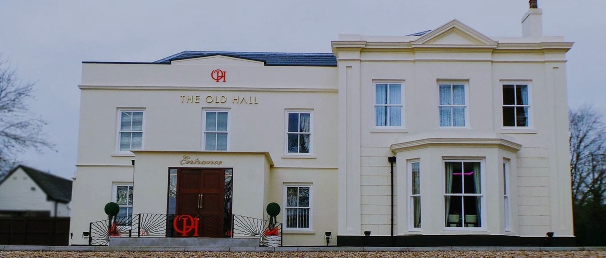
The Old Hall Hotel, Coventry

The Old Hall Hotel in Coundon near Coventry, England, is a building of historical significance and is Grade II listed on the English Heritage Register...

Cardinal Newman Catholic School and Community College

Cardinal Newman Catholic School is a coeducational Roman Catholic secondary school and sixth form located in the Keresley area of Coventry, West Midlands...

Brownshill Green

Brownshill Green is a suburban hamlet 3.5 miles northwest of Coventry by road, adjacent to the suburbs of Allesley, Coundon and Keresley. It is bordered...

Corley

Corley (and the associated hamlets of Corley Ash and Corley Moor) is a village and civil parish in the North Warwickshire district of Warwickshire, England...

Keresley

Keresley is a suburban village and civil parish in the City of Coventry, West Midlands, England, about 4.5 miles (7 km) north of Coventry city centre and...

Browns Lane plant

The Browns Lane plant in Coventry, England was built as a Second World War shadow factory run by the Daimler Company. In 1951 it was leased by Jaguar Cars...

Coundon Court

Coundon Court is an all-inclusive Academy in Coundon, Coventry, England. The Headteacher is Chris Heal.Coundon Court has, as of June 2021, approximately...

President Kennedy School

President Kennedy School is a coeducational secondary school and sixth form with academy status, located in the Keresley area of Coventry, England. The...

Nearby Amenities

Located within 500m of 52.44187,-1.5427985
Bus Stop
Tamworth Rd / Long Lane
Bus: yes
Naptan AtcoCode: 43000011901
Naptan Bearing: SE
Naptan BusStopType: MKD
Naptan CommonName: Long Lane
Naptan Indicator: opp
Naptan Landmark: Royal Court Hotel
Naptan NaptanCode: nwmptmpm
Naptan PlusbusZoneRef: BHAMNWS
Naptan Status: ACT
Naptan StopType: BCT
Naptan Street: TAMWORTH RD
Naptan Towards: Coventry
Naptan Verified: no
Public Transport: platform
Route Ref: 735
Source: WMCA
Lat/Long: 52.4438567/-1.541603
Bus Stop
Tamworth Rd / Long Lane
Bus: yes
Naptan AtcoCode: 43000011902
Naptan Bearing: NW
Naptan BusStopType: MKD
Naptan CommonName: Long Lane
Naptan Indicator: adj
Naptan NaptanCode: nwmptmpt
Naptan PlusbusZoneRef: BHAMNWS
Naptan Status: ACT
Naptan StopType: BCT
Naptan Street: TAMWORTH RD
Naptan Towards: Corley
Public Transport: platform
Route Ref: 735
Source: WMCA
Lat/Long: 52.4440648/-1.5420528
Bus Stop
Tamworth Rd / Long Lane
Bus: yes
Naptan AtcoCode: 43000013201
Naptan Bearing: SE
Naptan BusStopType: MKD
Naptan CommonName: Long Lane
Naptan Indicator: opp
Naptan NaptanCode: nwmptpda
Naptan PlusbusZoneRef: BHAMNWS
Naptan Status: ACT
Naptan StopType: BCT
Naptan Street: TAMWORTH RD
Naptan Towards: Coventry
Naptan Verified: no
Public Transport: platform
Route Ref: 735
Source: WMCA
Lat/Long: 52.4457782/-1.5440806
Bus Stop
Tamworth Rd / Long Lane
Bus: yes
Naptan AtcoCode: 43000013202
Naptan Bearing: NW
Naptan BusStopType: MKD
Naptan CommonName: Long Lane
Naptan Indicator: adj
Naptan NaptanCode: nwmptpdg
Naptan PlusbusZoneRef: BHAMNWS
Naptan Status: ACT
Naptan StopType: BCT
Naptan Street: TAMWORTH RD
Naptan Towards: Corley
Naptan Verified: no
Public Transport: platform
Route Ref: 735
Source: WMCA
Lat/Long: 52.4459841/-1.5444829
Sandpits Lane / Cardinal Newman School
Naptan AtcoCode: 43000013501
Naptan Bearing: W
Naptan BusStopType: CUS
Naptan CommonName: Cardinal Newman School
Naptan Indicator: adj
Naptan NaptanCode: nwmptpdp
Naptan PlusbusZoneRef: BHAMNWS
Naptan Status: ACT
Naptan StopType: BCT
Naptan Street: SANDPITS LANE
Naptan Towards: City Centre
Naptan Verified: no
Source: WMCA
Lat/Long: 52.4432637/-1.5360033
Power: tower
Source: OS 1:25k
Lat/Long: 52.4455503/-1.5463799
Spindles Health Club
Entrance: yes
Lat/Long: 52.4455044/-1.5419235
Entrance: yes
Lat/Long: 52.4452561/-1.5412941
Barrier: kissing_gate
Lat/Long: 52.445153/-1.5433603
Barrier: kissing_gate
Lat/Long: 52.4414142/-1.5446581
Post Box
Collection Plate: CP7D
Collection Times: Mo-Fr 09:00; Sa 07:00
Operator: Royal Mail
Post Box Type: lamp
Ref: CV6 119D
Royal Cypher: EIIR
Royal Cypher Wikidata: Q33102113
Lat/Long: 52.4394967/-1.5487195
The data included in this document is from www.openstreetmap.org. The data is made available under ODbL.

Have you been to The Spinney?

Leave your review of The Spinney below (or comments, questions and feedback).