Kennington Lees

Settlement in Kent Ashford

England

Kennington Lees

Gatehouse for Eastwell Park The neo-Jacobean gatehouse for Eastwell Park was built in the 1840s.
Gatehouse for Eastwell Park Credit: Marathon

Kennington Lees is a small village located in the county of Kent, in southeastern England. Situated just a few miles southeast of the historic city of Canterbury, Kennington Lees offers a peaceful and picturesque setting, surrounded by rolling countryside and farmland.

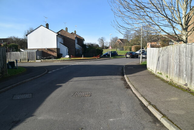
The village is known for its charming character, with a mix of traditional and modern architecture. It is predominantly residential, with a tight-knit community that values its rural atmosphere. Kennington Lees boasts a range of amenities, including a local pub, a village hall, and a primary school, making it an attractive place for families.

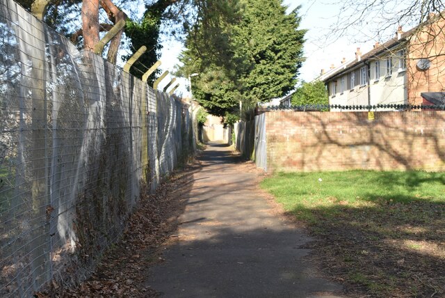
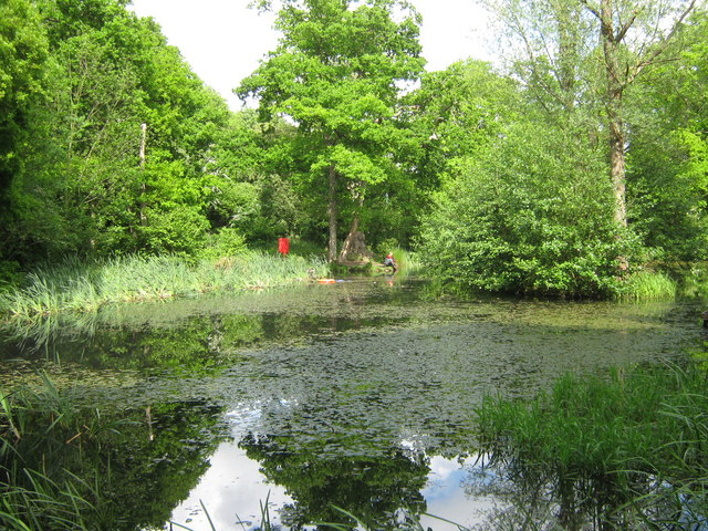
Nature lovers will appreciate the scenic beauty of the area, as Kennington Lees is nestled in the heart of the Kent Downs, an Area of Outstanding Natural Beauty. This designation ensures the preservation of the region's unique landscapes and wildlife. The village is also surrounded by numerous walking and cycling trails, providing opportunities for outdoor recreation and exploration.

For those seeking cultural and historical attractions, the city of Canterbury is within easy reach. Here, visitors can explore renowned landmarks such as Canterbury Cathedral, a UNESCO World Heritage Site, as well as numerous museums, art galleries, and historic buildings.

Overall, Kennington Lees offers a tranquil and idyllic setting, perfect for those seeking a peaceful rural lifestyle while still being within close proximity to urban amenities and attractions.

If you have any feedback on the listing, please let us know in the comments section below.

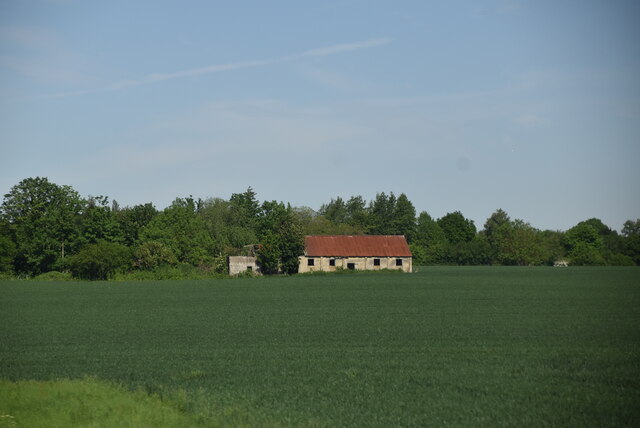
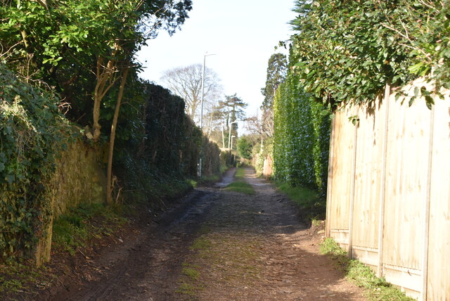
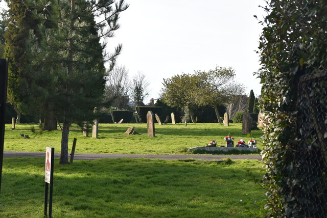
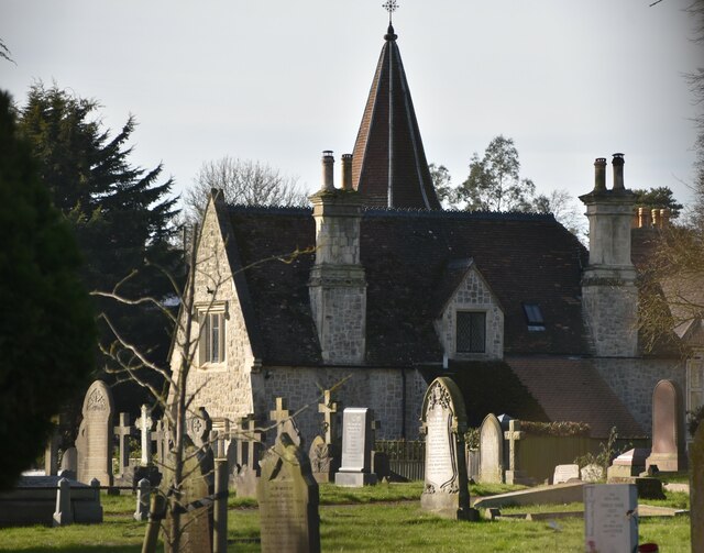
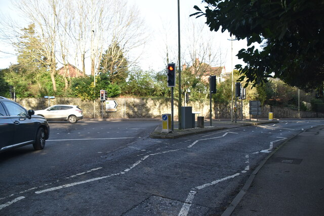
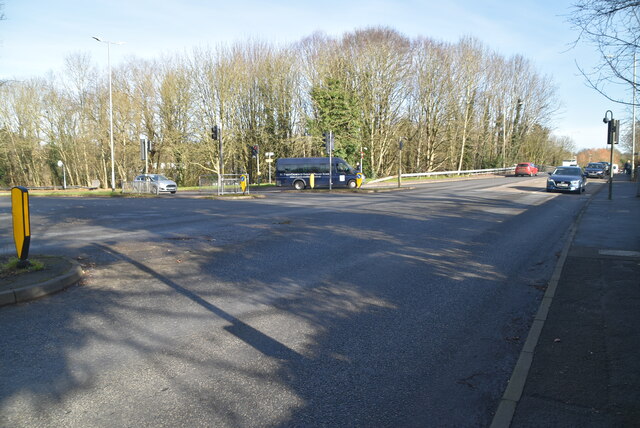
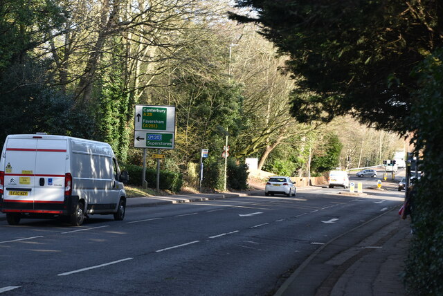
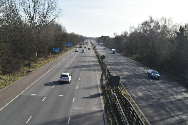
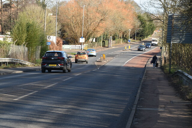
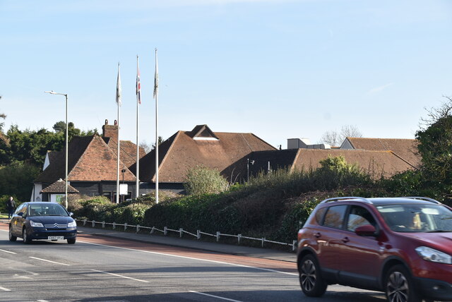
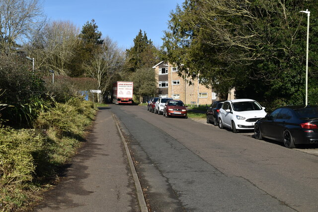
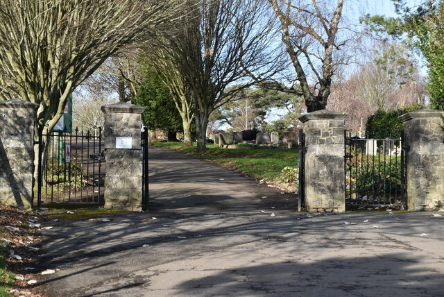
Kennington Lees Images

Images are sourced within 2km of 51.171135/0.87882026 or Grid Reference TR0145. Thanks to Geograph Open Source API. All images are credited.

Gatehouse for Eastwell Park The neo-Jacobean gatehouse for Eastwell Park was built in the 1840s.
Gatehouse for Eastwell Park
The neo-Jacobean gatehouse for Eastwell Park was built in the 1840s.
Gatehouse for Eastwell Park The neo-Jacobean gatehouse for Eastwell Park was built in the 1840s.
Gatehouse for Eastwell Park
The neo-Jacobean gatehouse for Eastwell Park was built in the 1840s.
Eastwell Lake Eastwell House has been demolished and the nearby church is ruined. This view is from where the road crosses the inflow to the lake near Aviary Wood.
Eastwell Lake
Eastwell House has been demolished and the nearby church is ruined. This view is from where the road crosses the inflow to the lake near Aviary Wood.
Arable landscape
Arable landscape
Isolated building
Isolated building
Northbrook Lane
Northbrook Lane
Canterbury Road (Ashford) Cemetery
Chapel, Ashford Cemetery
Canterbury Rd The A28 is a 58 mile long road in southern England. It runs south-west from Margate in Kent to Hastings in East Sussex via  Canterbury, Ashford & Tenterden before joining the A21 <a href="https://www.geograph.org.uk/photo/5968545">TQ7913 : A21, A28 junction</a> .
<span class="nowrap"><a title="http://www.sabre-roads.org.uk/wiki/index.php?title=A28" rel="nofollow ugc noopener" href="http://www.sabre-roads.org.uk/wiki/index.php?title=A28">Link</a><img style="margin-left:2px;" alt="External link" title="External link - shift click to open in new window" src="https://s1.geograph.org.uk/img/external.png" width="10" height="10"/></span>
Canterbury Rd
The A28 is a 58 mile long road in southern England. It runs south-west from Margate in Kent to Hastings in East Sussex via Canterbury, Ashford & Tenterden before joining the A21 TQ7913 : A21, A28 junction . LinkExternal link
M20 The M20 is a 51 mile motorway running between the M25 motorway near Swanley and Folkestone in Kent. It was constructed from 1960. It is a key route for lorries connecting to mainland Europe via the Channel Tunnel and Ferries.
M20
The M20 is a 51 mile motorway running between the M25 motorway near Swanley and Folkestone in Kent. It was constructed from 1960. It is a key route for lorries connecting to mainland Europe via the Channel Tunnel and Ferries.
Canterbury Rd The A28 is a 58 mile long road in southern England. It runs south-west from Margate in Kent to Hastings in East Sussex via  Canterbury, Ashford & Tenterden before joining the A21 <a href="https://www.geograph.org.uk/photo/5968545">TQ7913 : A21, A28 junction</a> .
<span class="nowrap"><a title="http://www.sabre-roads.org.uk/wiki/index.php?title=A28" rel="nofollow ugc noopener" href="http://www.sabre-roads.org.uk/wiki/index.php?title=A28">Link</a><img style="margin-left:2px;" alt="External link" title="External link - shift click to open in new window" src="https://s1.geograph.org.uk/img/external.png" width="10" height="10"/></span>
Canterbury Rd
The A28 is a 58 mile long road in southern England. It runs south-west from Margate in Kent to Hastings in East Sussex via Canterbury, Ashford & Tenterden before joining the A21 TQ7913 : A21, A28 junction . LinkExternal link
Holiday Inn, Ashford Holiday Inn is a brand of hotels, forming part of the InterContinental Hotels Group (IHG). It is one of the world's largest hotel chains with over 1,300 hotels globally. The first Holiday Inn opened in Memphis in 1952.
Website: <span class="nowrap"><a title="http://www.holidayinn.com/hotels/us/en/reservation" rel="nofollow ugc noopener" href="http://www.holidayinn.com/hotels/us/en/reservation">Link</a><img style="margin-left:2px;" alt="External link" title="External link - shift click to open in new window" src="https://s1.geograph.org.uk/img/external.png" width="10" height="10"/></span>
Holiday Inn, Ashford
Holiday Inn is a brand of hotels, forming part of the InterContinental Hotels Group (IHG). It is one of the world's largest hotel chains with over 1,300 hotels globally. The first Holiday Inn opened in Memphis in 1952. Website: LinkExternal link
Cemetery Lane
Cemetery Lane
Bybrook Cemetery
Bybrook Cemetery
Footpath by Bybrook Cemetery
Nine Acres
Nine Acres
Show me another place!

Kennington Lees is located at Grid Ref: TR0145 (Lat: 51.171135, Lng: 0.87882026)

Administrative County: Kent

District: Ashford

Police Authority: Kent

What 3 Words

///artichoke.mimes.tops. Near Kennington, Kent

Nearby Locations

Goat Lees Kennington Lees

Related Wikis

The Towers School

The Towers School and Sixth Form Centre is a secondary school (Academy) in Ashford, Kent. The school was first established in 1967 and was named after...

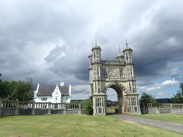
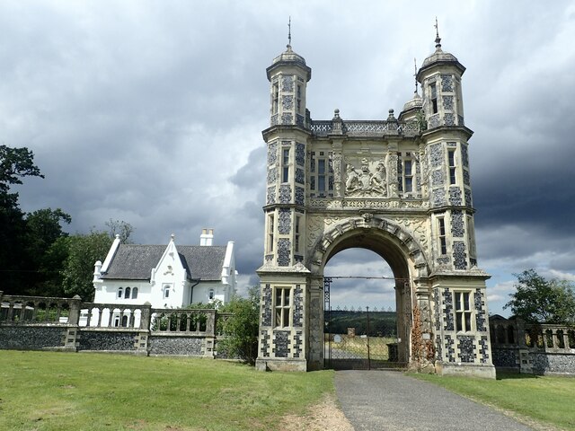
Grosvenor Hall (estate)

Grosvenor Hall is an estate in Kennington, Ashford, Kent. At first a sanitorium, it was repurposed as a training site for police recruits and called the...

Kennington, Kent

Kennington is a suburb of Ashford and civil parish in Kent, England. It is about a mile northeast of the town centre and north of the M20 motorway, and...

Ashford Warren and Hoads Wood

Ashford Warren and Hoads Wood is a 34.5-hectare (85-acre) nature reserve north of Ashford in Kent. It is owned by Ashford Borough Council and managed...

Kennington Stream

Kennington Stream (or Penlee / Pen Lee) is a tributary of the Great Stour river in Ashford, Kent, England. The stream runs from its source near Kennington...

Saint Christopher's Church, Boughton Lees

Saint Christopher's Church is a mediaeval Grade II listed church in Boughton Lees near Ashford, Kent, part of the Church of England.The building was originally...

A28 road

The A28 is a trunk road in the counties of Kent and East Sussex in south east England, connecting Margate, Canterbury, Ashford and Hastings. Starting at...

Ashford Green Corridor

Ashford Green Corridor is a green space that runs through the town of Ashford in Kent, England. The Green Corridor is made up of parks, recreation grounds...

Nearby Amenities

Located within 500m of 51.171135,0.87882026
Crossing
Crossing Island: yes
Lat/Long: 51.1736796/0.8786622
Crossing
Crossing: traffic_signals
Crossing Ref: pelican
Lat/Long: 51.1730377/0.8839112
Pub
The Rose
Lat/Long: 51.1718046/0.8848102
Mini Roundabout
Direction: clockwise
Lat/Long: 51.1691938/0.8759541
Turning Circle
Lat/Long: 51.1700816/0.8777558
Turning Circle
Lat/Long: 51.1715066/0.8782615
Traffic Calming: table
Lat/Long: 51.1718933/0.8759115
Crossing
Crossing Island: yes
Lat/Long: 51.1714773/0.8727805
Traffic Calming: choker
Lat/Long: 51.1704571/0.8726662
Crossing
Crossing: unmarked
Crossing Markings: no
Lat/Long: 51.1699297/0.8732657
Traffic Calming: choker
Lat/Long: 51.1696235/0.8740906
Traffic Calming: table
Lat/Long: 51.1724178/0.8762327
Traffic Calming: table
Lat/Long: 51.1737703/0.8777038
Bicycle Bypass: no
Traffic Calming: choker
Lat/Long: 51.174682/0.8777201
Traffic Calming: choker
Lat/Long: 51.172771/0.8739508
Turning Circle
Lat/Long: 51.1670105/0.8796405
Traffic Calming: choker
Lat/Long: 51.1734156/0.8742309
Crossing
Crossing Island: yes
Lat/Long: 51.1721846/0.8737376
Addr Housenumber: 263
Lat/Long: 51.1714766/0.8848949
Post Box
Postal Code: TN24
Ref: TN24 184
Lat/Long: 51.1718797/0.8845697
Post Box
Postal Code: TN25
Ref: TN25 69
Lat/Long: 51.1723115/0.8743761
Addr Housenumber: 290
Lat/Long: 51.1721184/0.8842847
Addr Housenumber: 19
Lat/Long: 51.1684881/0.8835303
Addr Housenumber: 24
Lat/Long: 51.1688156/0.8834796
Addr Housenumber: 72
Lat/Long: 51.1693611/0.883144
Addr Housenumber: 39
Lat/Long: 51.1689823/0.8830554
Addr Housenumber: 136
Lat/Long: 51.1695612/0.8795054
Addr Housenumber: 89
Lat/Long: 51.1693073/0.8792017
Trinity Road
Power: substation
Ref: 37-1073
Lat/Long: 51.1723597/0.8743576
Edwards & Co. Solicitors
Office: lawyer
Lat/Long: 51.1716829/0.8731287
Fast Food
Wok Express
Addr City: Ashford
Cuisine: chinese
Lat/Long: 51.1717088/0.8731906
Veterinary
Eureka Veterinary Centre
Lat/Long: 51.1703619/0.8719868
Coral
Brand: Coral
Brand Wikidata: Q54621344
Shop: bookmaker
Lat/Long: 51.1706873/0.8717514
Crossing
Crossing: traffic_signals
Crossing Ref: pelican
Lat/Long: 51.1754118/0.8806991
Crossing
Crossing Island: yes
Lat/Long: 51.1726603/0.8763968
Crossing
Crossing: unmarked
Crossing Markings: no
Lat/Long: 51.1724617/0.8752846
Bicycle Parking
Bicycle Parking: stands
Capacity: 12
Covered: no
Cyclestreets Id: 47500
Lat/Long: 51.1715587/0.8731995
Addr Housenumber: 113
Lat/Long: 51.1710755/0.872031
Crossing
Crossing: unmarked
Crossing Markings: no
Lat/Long: 51.1709604/0.8716542
Addr Housenumber: 4
Lat/Long: 51.1740486/0.882734
Addr Housenumber: 3
Lat/Long: 51.1740343/0.8827562
Goat Lees House
Addr Street: Faversham Road
Building: yes
Lat/Long: 51.1737747/0.8827701
Bus Stop
Towers School
Bus: yes
Local Ref: o/s
Naptan AtcoCode: 240099792
Naptan Bearing: SE
Naptan BusStopType: CUS
Naptan CommonName: Towers School
Naptan Indicator: o/s
Naptan Landmark: Towers School
Naptan NaptanCode: kntgpwpd
Naptan PlusbusZoneRef: ASHFKY
Naptan RevisionNumber: 1
Naptan Status: act
Naptan Street: Towers School Grounds
Naptan Verified: no
Public Transport: platform
Ref: kntgpwpd
Source: naptan_import
Source Date: 2018-04-13
Lat/Long: 51.1739964/0.8835172
Bus Stop
Towers School
Bus: yes
Local Ref: opp
Naptan AtcoCode: 240099794
Naptan Bearing: NW
Naptan BusStopType: MKD
Naptan CommonName: Towers School
Naptan Indicator: opp
Naptan Landmark: Towers School
Naptan NaptanCode: kntgtapd
Naptan PlusbusZoneRef: ASHFKY
Naptan RevisionNumber: 1
Naptan Status: act
Naptan Street: Faversham Road
Naptan Verified: no
Public Transport: platform
Ref: kntgtapd
Source: naptan_import
Source Date: 2018-04-13
Lat/Long: 51.1743486/0.882339
Bus Stop
Jersey Close
Bus: yes
Local Ref: adj
Naptan AtcoCode: 240099796
Naptan Bearing: SW
Naptan BusStopType: MKD
Naptan CommonName: Jersey Close
Naptan Indicator: adj
Naptan Landmark: Jersey Close
Naptan NaptanCode: kntgtapw
Naptan PlusbusZoneRef: ASHFKY
Naptan RevisionNumber: 2
Naptan Status: act
Naptan Street: Trinity Road
Naptan Verified: yes
Public Transport: platform
Ref: kntgtapw
Source: naptan_import
Source Date: 2018-04-13
Lat/Long: 51.173934/0.8791372
Bus Stop
Guernsey Way
Bus: yes
Local Ref: adj
Naptan AtcoCode: 240099798
Naptan Bearing: W
Naptan BusStopType: MKD
Naptan CommonName: Guernsey Way
Naptan Indicator: adj
Naptan Landmark: Guernsey Way
Naptan NaptanCode: kntgtata
Naptan PlusbusZoneRef: ASHFKY
Naptan RevisionNumber: 2
Naptan Status: act
Naptan Street: Trinity Road
Naptan Verified: yes
Public Transport: platform
Ref: kntgtata
Source: naptan_import
Source Date: 2018-04-13
Lat/Long: 51.1721561/0.8746182
Bus Stop
Hurst Road
Bus: yes
Local Ref: o/s 114
Naptan AtcoCode: 240099800
Naptan Bearing: SW
Naptan BusStopType: MKD
Naptan CommonName: Hurst Road
Naptan Indicator: o/s 114
Naptan NaptanCode: kntgtama
Naptan PlusbusZoneRef: ASHFKY
Naptan RevisionNumber: 6
Naptan Status: act
Naptan Street: Hurst Road
Naptan Verified: no
Public Transport: platform
Ref: kntgtama
Source: naptan_import
Source Date: 2018-04-13
Lat/Long: 51.1709777/0.8728729
Bus Stop
Kenbrook
Bus: yes
Local Ref: adj
Naptan AtcoCode: 240099802
Naptan Bearing: W
Naptan BusStopType: MKD
Naptan CommonName: Kenbrook
Naptan Indicator: adj
Naptan Landmark: Kenbrook
Naptan NaptanCode: kntgtadp
Naptan PlusbusZoneRef: ASHFKY
Naptan RevisionNumber: 2
Naptan Status: act
Naptan Street: Tile Kiln Road
Naptan Verified: no
Public Transport: platform
Ref: kntgtadp
Source: naptan_import
Source Date: 2018-04-13
Lat/Long: 51.1706797/0.8798753
Bus Stop
Upper Vicarage Road
Bus: yes
Local Ref: opp
Naptan AtcoCode: 2400A024670A
Naptan Bearing: N
Naptan BusStopType: MKD
Naptan CommonName: Upper Vicarage Road
Naptan Indicator: opp
Naptan Landmark: Upper Vicarage Road
Naptan NaptanCode: kntdajpj
Naptan PlusbusZoneRef: ASHFKY
Naptan RevisionNumber: 3
Naptan Status: act
Naptan Street: Faversham Road
Naptan Verified: no
Public Transport: platform
Ref: kntdajpj
Shelter: yes
Source: naptan_import
Source Date: 2018-04-13
Lat/Long: 51.1698794/0.8854113
Bus Stop
The Rose
Bus: yes
Local Ref: opp
Naptan AtcoCode: 2400A024740A
Naptan Bearing: N
Naptan BusStopType: MKD
Naptan CommonName: The Rose
Naptan Indicator: opp
Naptan Landmark: The Rose Inn
Naptan NaptanCode: kntdajtj
Naptan PlusbusZoneRef: ASHFKY
Naptan RevisionNumber: 2
Naptan Status: act
Naptan Street: Faversham Road
Naptan Verified: no
Public Transport: platform
Ref: kntdajtj
Source: naptan_import
Source Date: 2014-01-30
Lat/Long: 51.1719025/0.8844374
Bus Stop
Bloomsbury Way
Bus: yes
Local Ref: opp
Naptan AtcoCode: 2400A039290A
Naptan Bearing: E
Naptan BusStopType: MKD
Naptan CommonName: Bloomsbury Way
Naptan Indicator: opp
Naptan Landmark: Bloomsbury Way
Naptan NaptanCode: kntdpmam
Naptan PlusbusZoneRef: ASHFKY
Naptan RevisionNumber: 4
Naptan Status: act
Naptan Street: Hurst Road
Naptan Verified: no
Public Transport: platform
Ref: kntdpmam
Source: naptan_import
Source Date: 2018-04-13
Lat/Long: 51.1695258/0.8749148
Bus Stop
Bockhanger Lane
Bus: yes
Local Ref: opp
Naptan AtcoCode: 2400A039300A
Naptan Bearing: E
Naptan BusStopType: MKD
Naptan CommonName: Bockhanger Lane
Naptan Indicator: opp
Naptan Landmark: Bockhanger Lane
Naptan NaptanCode: kntdpmap
Naptan PlusbusZoneRef: ASHFKY
Naptan RevisionNumber: 2
Naptan Status: act
Naptan Street: Rothbrook Drive
Naptan Verified: yes
Public Transport: platform
Ref: kntdpmap
Source: naptan_import
Source Date: 2018-04-13
Lat/Long: 51.1697897/0.8780211
Bus Stop
Broadhurst Drive west end
Bus: yes
Local Ref: S-bound
Naptan AtcoCode: 2400A039310A
Naptan Bearing: S
Naptan BusStopType: MKD
Naptan CommonName: Broadhurst Drive west end
Naptan Indicator: S-bound
Naptan Landmark: Grosvenor Road
Naptan NaptanCode: kntdpmat
Naptan PlusbusZoneRef: ASHFKY
Naptan RevisionNumber: 11
Naptan ShortCommonName: Broadhurst Dv West
Naptan Status: act
Naptan Street: Broadhurst Drive
Naptan Verified: no
Public Transport: platform
Ref: kntdpmat
Short Name: Broadhurst Dv West
Source: naptan_import
Source Date: 2018-04-13
Lat/Long: 51.1714054/0.8821707
Bus Stop
Broadhurst Drive east end
Bus: yes
Local Ref: E-bound
Naptan AtcoCode: 2400A039320A
Naptan Bearing: E
Naptan BusStopType: MKD
Naptan CommonName: Broadhurst Drive east end
Naptan Indicator: E-bound
Naptan Landmark: Faversham Road
Naptan NaptanCode: kntdpmaw
Naptan PlusbusZoneRef: ASHFKY
Naptan RevisionNumber: 6
Naptan ShortCommonName: Broadhurst Dv East
Naptan Status: act
Naptan Street: Broadhurst Drive
Naptan Verified: no
Public Transport: platform
Ref: kntdpmaw
Short Name: Broadhurst Dv East
Source: naptan_import
Source Date: 2014-07-04
Lat/Long: 51.1708434/0.8843446
Bus Stop
Towers View
Bus: yes
Local Ref: NE-bound
Naptan AtcoCode: 2400A074390A
Naptan Bearing: NE
Naptan BusStopType: MKD
Naptan CommonName: Towers View
Naptan Indicator: NE-bound
Naptan Landmark: Goteley Mere
Naptan NaptanCode: kntgjgtp
Naptan PlusbusZoneRef: ASHFKY
Naptan RevisionNumber: 4
Naptan Status: act
Naptan Street: Towers View
Naptan Verified: no
Public Transport: platform
Ref: kntgjgtp
Shelter: yes
Source: naptan_import
Source Date: 2018-04-13
Lat/Long: 51.171736/0.879829
Post Box
Ref: TN24 301
Lat/Long: 51.1694386/0.8785397
Scout Hall
1st Kennington Scout Group
Building: yes
Lat/Long: 51.169699/0.8847478
Traffic Calming: cushion
Lat/Long: 51.1715563/0.8857015
Traffic Calming: cushion
Lat/Long: 51.1718312/0.8850563
Crossing
Crossing Island: yes
Lat/Long: 51.1724347/0.8757659
Catch
Shop: seafood
Lat/Long: 51.1705334/0.8718599
Completely Bathrooms & Kitchens
Addr Housenumber: 8
Shop: interiors
Lat/Long: 51.1703898/0.8719586
Restaurant
Cinnamon Spice
Cuisine: bangladesh
Lat/Long: 51.1705895/0.8718273
Wiseguys and Dolls
Addr Housenumber: 7
Shop: hairdresser
Lat/Long: 51.1704298/0.871935
Pharmacy
Delmergate Pharmacy
Dispensing: yes
Healthcare: pharmacy
Lat/Long: 51.1706292/0.8717905
Traffic Calming: choker
Lat/Long: 51.1722586/0.8727614
Turning Circle
Lat/Long: 51.1722326/0.8801019
Crossing
Crossing Island: yes
Lat/Long: 51.1732647/0.8779764
Traffic Calming: table
Lat/Long: 51.1755986/0.8796602
Bicycle Bypass: no
Traffic Calming: choker
Lat/Long: 51.1751224/0.8790143
Crossing
Crossing Island: yes
Lat/Long: 51.1717262/0.8727328
Mini Roundabout
Direction: clockwise
Lat/Long: 51.1731184/0.8748394
Crossing
Crossing: unmarked
Crossing Markings: no
Lat/Long: 51.1698602/0.8761007
Turning Circle
Lat/Long: 51.1715119/0.8806637
Traffic Calming: choker
Lat/Long: 51.1693017/0.8847432
Traffic Calming: choker
Lat/Long: 51.1719062/0.8753412
Traffic Calming: chicane
Lat/Long: 51.1723529/0.8768661
Generator Method: photovoltaic
Generator Output Electricity: yes
Generator Source: solar
Generator Type: solar_photovoltaic_panel
Location: roof
Power: generator
Lat/Long: 51.1748054/0.877173
Generator Method: photovoltaic
Generator Output Electricity: yes
Generator Source: solar
Generator Type: solar_photovoltaic_panel
Location: roof
Power: generator
Lat/Long: 51.1746775/0.879324
Generator Method: photovoltaic
Generator Output Electricity: yes
Generator Source: solar
Generator Type: solar_photovoltaic_panel
Location: roof
Power: generator
Lat/Long: 51.1712714/0.883517
Generator Method: photovoltaic
Generator Output Electricity: yes
Generator Source: solar
Generator Type: solar_photovoltaic_panel
Location: roof
Power: generator
Lat/Long: 51.1705482/0.8858719
Generator Method: photovoltaic
Generator Output Electricity: yes
Generator Source: solar
Generator Type: solar_photovoltaic_panel
Location: roof
Power: generator
Lat/Long: 51.1705852/0.8858532
Generator Method: photovoltaic
Generator Output Electricity: yes
Generator Source: solar
Generator Type: solar_photovoltaic_panel
Location: roof
Power: generator
Lat/Long: 51.1706273/0.8858451
Generator Method: photovoltaic
Generator Output Electricity: yes
Generator Source: solar
Generator Type: solar_photovoltaic_panel
Location: roof
Power: generator
Lat/Long: 51.170634/0.8859256
Generator Method: photovoltaic
Generator Output Electricity: yes
Generator Source: solar
Generator Type: solar_photovoltaic_panel
Location: roof
Power: generator
Lat/Long: 51.1694601/0.8835492
Generator Method: photovoltaic
Generator Output Electricity: yes
Generator Source: solar
Generator Type: solar_photovoltaic_panel
Location: roof
Power: generator
Lat/Long: 51.1694164/0.8838844
Generator Method: photovoltaic
Generator Output Electricity: yes
Generator Source: solar
Generator Type: solar_photovoltaic_panel
Location: roof
Power: generator
Lat/Long: 51.1693693/0.8838871
Generator Method: photovoltaic
Generator Output Electricity: yes
Generator Source: solar
Generator Type: solar_photovoltaic_panel
Location: roof
Power: generator
Lat/Long: 51.1716094/0.880588
Generator Method: photovoltaic
Generator Output Electricity: yes
Generator Source: solar
Generator Type: solar_photovoltaic_panel
Location: roof
Power: generator
Lat/Long: 51.1716195/0.8804941
Generator Method: photovoltaic
Generator Output Electricity: yes
Generator Source: solar
Generator Type: solar_photovoltaic_panel
Location: roof
Power: generator
Lat/Long: 51.1716649/0.8804029
Generator Method: photovoltaic
Generator Output Electricity: yes
Generator Source: solar
Generator Type: solar_photovoltaic_panel
Location: roof
Power: generator
Lat/Long: 51.1717002/0.8803359
Generator Method: photovoltaic
Generator Output Electricity: yes
Generator Source: solar
Generator Type: solar_photovoltaic_panel
Location: roof
Power: generator
Lat/Long: 51.1717254/0.8802876
Generator Method: photovoltaic
Generator Output Electricity: yes
Generator Source: solar
Generator Type: solar_photovoltaic_panel
Location: roof
Power: generator
Lat/Long: 51.1721173/0.8804807
Generator Method: photovoltaic
Generator Output Electricity: yes
Generator Source: solar
Generator Type: solar_photovoltaic_panel
Location: roof
Power: generator
Lat/Long: 51.1721543/0.8804861
Generator Method: photovoltaic
Generator Output Electricity: yes
Generator Source: solar
Generator Type: solar_photovoltaic_panel
Location: roof
Power: generator
Lat/Long: 51.1721913/0.8805102
Generator Method: photovoltaic
Generator Output Electricity: yes
Generator Source: solar
Generator Type: solar_photovoltaic_panel
Location: roof
Power: generator
Lat/Long: 51.1723594/0.8801052
Generator Method: photovoltaic
Generator Output Electricity: yes
Generator Source: solar
Generator Type: solar_photovoltaic_panel
Location: roof
Power: generator
Lat/Long: 51.1723998/0.8800811
Generator Method: photovoltaic
Generator Output Electricity: yes
Generator Source: solar
Generator Type: solar_photovoltaic_panel
Location: roof
Power: generator
Lat/Long: 51.1726979/0.8742158
Generator Method: photovoltaic
Generator Output Electricity: yes
Generator Source: solar
Generator Type: solar_photovoltaic_panel
Location: roof
Power: generator
Lat/Long: 51.1726359/0.8740009
Generator Method: photovoltaic
Generator Output Electricity: yes
Generator Source: solar
Generator Type: solar_photovoltaic_panel
Location: roof
Power: generator
Lat/Long: 51.1733818/0.8733264
Generator Method: photovoltaic
Generator Output Electricity: yes
Generator Source: solar
Generator Type: solar_photovoltaic_panel
Location: roof
Power: generator
Lat/Long: 51.1731281/0.8738558
Generator Method: photovoltaic
Generator Output Electricity: yes
Generator Source: solar
Generator Type: solar_photovoltaic_panel
Location: roof
Power: generator
Lat/Long: 51.1738124/0.8763839
Generator Method: photovoltaic
Generator Output Electricity: yes
Generator Source: solar
Generator Type: solar_photovoltaic_panel
Location: roof
Power: generator
Lat/Long: 51.1743363/0.8763275
Generator Method: photovoltaic
Generator Output Electricity: yes
Generator Source: solar
Generator Type: solar_photovoltaic_panel
Location: roof
Power: generator
Lat/Long: 51.1749996/0.8815053
Generator Method: photovoltaic
Generator Output Electricity: yes
Generator Source: solar
Generator Type: solar_photovoltaic_panel
Location: roof
Power: generator
Lat/Long: 51.1746902/0.8816287
Generator Method: photovoltaic
Generator Output Electricity: yes
Generator Source: solar
Generator Type: solar_photovoltaic_panel
Location: roof
Power: generator
Lat/Long: 51.1740848/0.8823636
Generator Method: photovoltaic
Generator Output Electricity: yes
Generator Source: solar
Generator Type: solar_photovoltaic_panel
Location: roof
Power: generator
Lat/Long: 51.1736358/0.8824655
Generator Method: photovoltaic
Generator Output Electricity: yes
Generator Source: solar
Generator Type: solar_photovoltaic_panel
Location: roof
Power: generator
Lat/Long: 51.1736594/0.8823261
Generator Method: photovoltaic
Generator Output Electricity: yes
Generator Source: solar
Generator Type: solar_photovoltaic_panel
Location: roof
Power: generator
Lat/Long: 51.1735568/0.8822027
Generator Method: photovoltaic
Generator Output Electricity: yes
Generator Source: solar
Generator Type: solar_photovoltaic_panel
Location: roof
Power: generator
Lat/Long: 51.1730203/0.8817333
Generator Method: photovoltaic
Generator Output Electricity: yes
Generator Source: solar
Generator Type: solar_photovoltaic_panel
Location: roof
Power: generator
Lat/Long: 51.1722384/0.8817226
Generator Method: photovoltaic
Generator Output Electricity: yes
Generator Source: solar
Generator Type: solar_photovoltaic_panel
Location: roof
Power: generator
Lat/Long: 51.1703145/0.8797485
Generator Method: photovoltaic
Generator Output Electricity: yes
Generator Source: solar
Generator Type: solar_photovoltaic_panel
Location: roof
Power: generator
Lat/Long: 51.170444/0.8799684
Generator Method: photovoltaic
Generator Output Electricity: yes
Generator Source: solar
Generator Type: solar_photovoltaic_panel
Location: roof
Power: generator
Lat/Long: 51.1699596/0.8841258
Generator Method: photovoltaic
Generator Output Electricity: yes
Generator Source: solar
Generator Type: solar_photovoltaic_panel
Location: roof
Power: generator
Lat/Long: 51.170333/0.8834955
Generator Method: photovoltaic
Generator Output Electricity: yes
Generator Source: solar
Generator Type: solar_photovoltaic_panel
Location: roof
Power: generator
Lat/Long: 51.1703313/0.8838388
Generator Method: photovoltaic
Generator Output Electricity: yes
Generator Source: solar
Generator Type: solar_photovoltaic_panel
Location: roof
Power: generator
Lat/Long: 51.170639/0.8842894
Generator Method: photovoltaic
Generator Output Electricity: yes
Generator Source: solar
Generator Type: solar_photovoltaic_panel
Location: roof
Power: generator
Lat/Long: 51.1730641/0.8818084
Generator Method: photovoltaic
Generator Output Electricity: yes
Generator Source: solar
Generator Type: solar_photovoltaic_panel
Location: roof
Power: generator
Lat/Long: 51.1736072/0.8805102
Generator Method: photovoltaic
Generator Output Electricity: yes
Generator Source: solar
Generator Type: solar_photovoltaic_panel
Location: roof
Power: generator
Lat/Long: 51.1735999/0.879019
Generator Method: photovoltaic
Generator Output Electricity: yes
Generator Source: solar
Generator Type: solar_photovoltaic_panel
Location: roof
Power: generator
Lat/Long: 51.1672502/0.8784395
Generator Method: photovoltaic
Generator Output Electricity: yes
Generator Source: solar
Generator Type: solar_photovoltaic_panel
Location: roof
Power: generator
Lat/Long: 51.1672334/0.8783698
Generator Method: photovoltaic
Generator Output Electricity: yes
Generator Source: solar
Generator Type: solar_photovoltaic_panel
Location: roof
Power: generator
Lat/Long: 51.168044/0.877659
Generator Method: photovoltaic
Generator Output Electricity: yes
Generator Source: solar
Generator Type: solar_photovoltaic_panel
Location: roof
Power: generator
Lat/Long: 51.1688597/0.8807221
Generator Method: photovoltaic
Generator Output Electricity: yes
Generator Source: solar
Generator Type: solar_photovoltaic_panel
Location: roof
Power: generator
Lat/Long: 51.169191/0.8822
Generator Method: photovoltaic
Generator Output Electricity: yes
Generator Source: solar
Generator Type: solar_photovoltaic_panel
Location: roof
Power: generator
Lat/Long: 51.1687807/0.8836377
Generator Method: photovoltaic
Generator Output Electricity: yes
Generator Source: solar
Generator Type: solar_photovoltaic_panel
Location: roof
Power: generator
Lat/Long: 51.1677547/0.8811244
Generator Method: photovoltaic
Generator Output Electricity: yes
Generator Source: solar
Generator Type: solar_photovoltaic_panel
Location: roof
Power: generator
Lat/Long: 51.1676034/0.8814919
Generator Method: photovoltaic
Generator Output Electricity: yes
Generator Source: solar
Generator Type: solar_photovoltaic_panel
Location: roof
Power: generator
Lat/Long: 51.1675765/0.8815563
Generator Method: photovoltaic
Generator Output Electricity: yes
Generator Source: solar
Generator Type: solar_photovoltaic_panel
Location: roof
Power: generator
Lat/Long: 51.1755986/0.8793242
Generator Method: photovoltaic
Generator Output Electricity: yes
Generator Source: solar
Generator Type: solar_photovoltaic_panel
Location: roof
Power: generator
Lat/Long: 51.1708513/0.8834012
Generator Method: photovoltaic
Generator Output Electricity: yes
Generator Source: solar
Generator Type: solar_photovoltaic_panel
Location: roof
Power: generator
Lat/Long: 51.1722704/0.8847663
Generator Method: photovoltaic
Generator Output Electricity: yes
Generator Source: solar
Generator Type: solar_photovoltaic_panel
Location: roof
Power: generator
Lat/Long: 51.172315/0.8847476
Generator Method: photovoltaic
Generator Output Electricity: yes
Generator Source: solar
Generator Type: solar_photovoltaic_panel
Location: roof
Power: generator
Lat/Long: 51.1724848/0.8846537
Generator Method: photovoltaic
Generator Output Electricity: yes
Generator Source: solar
Generator Type: solar_photovoltaic_panel
Location: roof
Power: generator
Lat/Long: 51.1725386/0.8846309
Generator Method: photovoltaic
Generator Output Electricity: yes
Generator Source: solar
Generator Type: solar_photovoltaic_panel
Location: roof
Power: generator
Lat/Long: 51.1726378/0.8845705
Generator Method: photovoltaic
Generator Output Electricity: yes
Generator Source: solar
Generator Type: solar_photovoltaic_panel
Location: roof
Power: generator
Lat/Long: 51.1726975/0.884545
Generator Method: photovoltaic
Generator Output Electricity: yes
Generator Source: solar
Generator Type: solar_photovoltaic_panel
Location: roof
Power: generator
Lat/Long: 51.1727976/0.8844847
Generator Method: photovoltaic
Generator Output Electricity: yes
Generator Source: solar
Generator Type: solar_photovoltaic_panel
Location: roof
Power: generator
Lat/Long: 51.1731895/0.8740171
Crossing
Crossing: unmarked
Crossing Markings: no
Lat/Long: 51.1734409/0.8752039
Crossing
Crossing: unmarked
Crossing Markings: no
Lat/Long: 51.1713454/0.8730771
Crossing
Crossing: unmarked
Crossing Markings: no
Lat/Long: 51.1712374/0.8731096
Crossing
Crossing: unmarked
Crossing Markings: no
Lat/Long: 51.1717016/0.8723764
Crossing
Crossing: unmarked
Crossing Markings: no
Lat/Long: 51.1714504/0.8724229
Traffic Calming: choker
Lat/Long: 51.1694389/0.8731226
Traffic Calming: choker
Lat/Long: 51.1734507/0.8790415
Generator Method: photovoltaic
Generator Output Electricity: yes
Generator Source: solar
Generator Type: solar_photovoltaic_panel
Power: generator
Lat/Long: 51.1740173/0.8804277
Entrance: yes
Lat/Long: 51.1740835/0.8811694
Entrance: yes
Lat/Long: 51.1736519/0.8817783
Bus Stop
Guernsey Way
Bus: yes
Local Ref: opp
Naptan AtcoCode: 2400A074950A
Naptan Bearing: E
Naptan BusStopType: MKD
Naptan CommonName: Guernsey Way
Naptan Indicator: opp
Naptan Landmark: Guernsey Way
Naptan NaptanCode: kntjtjgd
Naptan RevisionNumber: 3
Naptan Status: act
Naptan Street: Trinity Road
Naptan Verified: no
Public Transport: platform
Ref: kntjtjgd
Source: naptan_import
Source Date: 2018-04-13
Lat/Long: 51.172251/0.8742524
Bus Stop
Jersey Close
Bus: yes
Local Ref: opp
Naptan AtcoCode: 2400A074940A
Naptan Bearing: NE
Naptan BusStopType: MKD
Naptan CommonName: Jersey Close
Naptan Indicator: opp
Naptan Landmark: Jersey Close
Naptan NaptanCode: kntjtjgm
Naptan RevisionNumber: 3
Naptan Status: act
Naptan Street: Trinity Road
Naptan Verified: no
Public Transport: platform
Ref: kntjtjgm
Source: naptan_import
Source Date: 2018-04-13
Lat/Long: 51.1739538/0.878987
Bus Stop
The Rose
Bus: yes
Local Ref: adj
Naptan AtcoCode: 2400102366
Naptan Bearing: S
Naptan BusStopType: MKD
Naptan CommonName: The Rose
Naptan Indicator: adj
Naptan Landmark: The Rose Inn
Naptan NaptanCode: kntgtmja
Naptan RevisionNumber: 2
Naptan Status: act
Naptan Street: Faversham Road
Naptan Verified: no
Public Transport: platform
Ref: kntgtmja
Shelter: yes
Source: naptan_import
Source Date: 2014-01-30
Lat/Long: 51.1715649/0.8847672
Crossing
Crossing: unmarked
Crossing Markings: no
Lat/Long: 51.172113/0.8843361
Defibrillator
Colour: yellow
Emergency: defibrillator
Indoor: no
Not Ref GB The Circuit: 5F82BD78-81ED-49C5-B11F-B10200F52EA0
Opening Hours: 24/7
Operator: The Community Heartbeat Trust
Operator Website: https://www.communityheartbeat.org.uk/
Phone: +44 845 8627739
Source: survey
Survey Date: 2023-05-02
Lat/Long: 51.1716918/0.8732745
Restaurant
Kennington Carvery
Lat/Long: 51.1719638/0.8857328
Waste Basket
Colour: black
Covered: yes
Source: survey
Survey Date: 2024-03-30
Lat/Long: 51.1754057/0.8807842
Grit Bin
Colour: yellow
Source: survey
Survey Date: 2024-03-30
Lat/Long: 51.1751737/0.8801589
The data included in this document is from www.openstreetmap.org. The data is made available under ODbL.

Have you been to Kennington Lees?

Leave your review of Kennington Lees below (or comments, questions and feedback).