Jordan

Settlement in Yorkshire

England

Jordan

Iccles Locks View from the Iccles road bridge across the Sheffield and South Yorkshire Navigation canal.
Iccles Locks Credit: Ryk Rak

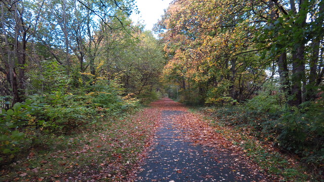
Jordan is a small village located in the county of Yorkshire, England. Situated in the heart of the Yorkshire Dales, it is known for its picturesque surroundings and tranquil atmosphere. The village is nestled amidst rolling hills and lush green valleys, offering visitors breathtaking views of the countryside.

With its origins dating back to medieval times, Jordan showcases a rich history and heritage. The village is dotted with traditional stone houses and buildings, giving it a charming and timeless appeal. Its narrow winding streets and quaint cottages add to the village's character and create a welcoming atmosphere.

Despite its small size, Jordan offers a range of amenities to its residents and visitors. The village boasts a local pub, providing a cozy spot to enjoy a drink or traditional British meal. There are also a few small shops and businesses catering to the daily needs of the community.

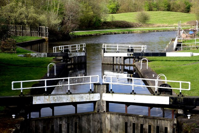
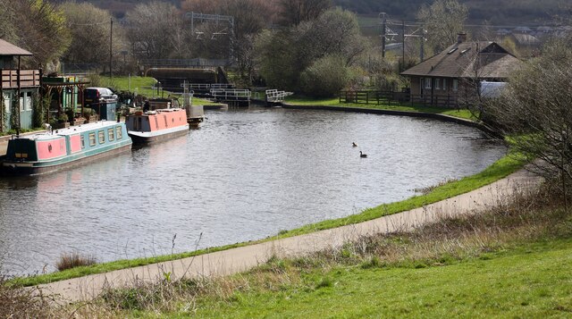
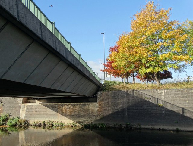
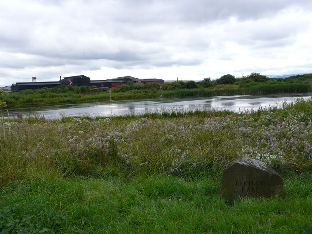
Surrounded by natural beauty, Jordan is an ideal destination for outdoor enthusiasts. The Yorkshire Dales National Park offers numerous hiking trails and cycling routes, allowing visitors to explore the stunning countryside. The village is also home to the River Jordan, a serene waterway that meanders through the landscape, offering opportunities for fishing and boating.

Overall, Jordan, Yorkshire, is a peaceful and picturesque village that offers a glimpse into the beauty and tranquility of rural England. Its rich history, stunning landscapes, and warm community make it a delightful destination for both locals and tourists alike.

If you have any feedback on the listing, please let us know in the comments section below.
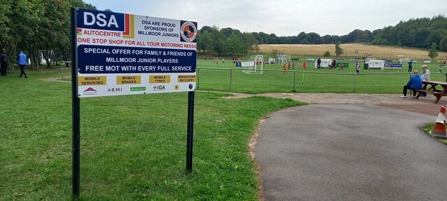
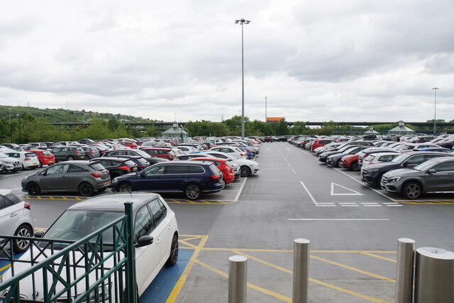
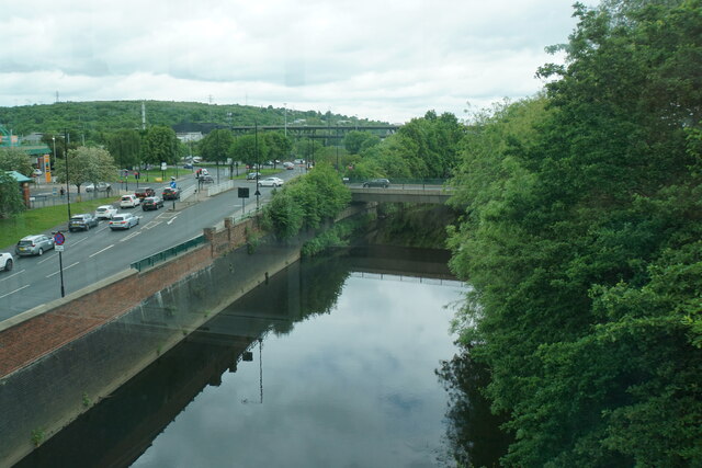
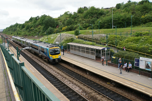
Jordan Images

Images are sourced within 2km of 53.428836/-1.3950109 or Grid Reference SK4092. Thanks to Geograph Open Source API. All images are credited.

Iccles Locks View from the Iccles road bridge across the Sheffield and South Yorkshire Navigation canal.
Iccles Locks
View from the Iccles road bridge across the Sheffield and South Yorkshire Navigation canal.
Iccles canal basin Canal basin next to the Iccles locks (seen in the background)
Iccles canal basin
Canal basin next to the Iccles locks (seen in the background)
Old milestone In March 2018 this milestone on the Tinsley to Doncaster tollroad (1764 -1873), now A6178, was the only one of the 5 remaining posts to have retained its plate.
Old milestone
In March 2018 this milestone on the Tinsley to Doncaster tollroad (1764 -1873), now A6178, was the only one of the 5 remaining posts to have retained its plate.
Old milestone During the summer of 2018 the pavement was relayed and the plate disappeared from the stone.  The 'authorities' were questioned and the plate was to be put back.   It hasn't happened.  But the stone remains by the side of Deadman's Hole Lane.
Old milestone
During the summer of 2018 the pavement was relayed and the plate disappeared from the stone. The 'authorities' were questioned and the plate was to be put back. It hasn't happened. But the stone remains by the side of Deadman's Hole Lane.
Old milestone In the contract between the West Riding County Council and Gill & Frank Stead, stonemasons, of Mirfield, six of these milestones were to be erected from this one on the A629, Wortley Road, in Kimberworth to where the route meets the Sheffield to Penistone road, A61.   Rotherham 3 & 4 are now missing with 5, 6 and 7 still in situ.   They were set up in 1893/94.
Old milestone
In the contract between the West Riding County Council and Gill & Frank Stead, stonemasons, of Mirfield, six of these milestones were to be erected from this one on the A629, Wortley Road, in Kimberworth to where the route meets the Sheffield to Penistone road, A61. Rotherham 3 & 4 are now missing with 5, 6 and 7 still in situ. They were set up in 1893/94.
Tinsley Viaduct from Meadowhall shopping centre car park The two-tier Tinsley Viaduct section of the M1 motorway. Construction began in 1965 and both tiers opened three years later.
Tinsley Viaduct from Meadowhall shopping centre car park
The two-tier Tinsley Viaduct section of the M1 motorway. Construction began in 1965 and both tiers opened three years later.
Bears of Sheffield: #52 Flora #52 of 61 big bear sculptures, this one was decorated by Laura Slater and is located in Meadowhall Shopping Centre.

Laura’s Bear design was based on interpreting aspects of the Sheffield Peak District, observing shape, texture and composition inspired by the landscape. Her chosen colour palette references shades and accent colours found in ordnance survey maps.
Bears of Sheffield: #52 Flora
#52 of 61 big bear sculptures, this one was decorated by Laura Slater and is located in Meadowhall Shopping Centre. Laura’s Bear design was based on interpreting aspects of the Sheffield Peak District, observing shape, texture and composition inspired by the landscape. Her chosen colour palette references shades and accent colours found in ordnance survey maps.
Bears of Sheffield: #54 Pieces #54 of 61 big bear sculptures, this one was decorated by Nicolas Burrows and is located in Meadowhall Shopping Centre.

Pieces reflects the artist's dynamic style. The design is made up of wild and wonky shapes that interact all over the Bear’s surface achieving a feeling of movement.
Bears of Sheffield: #54 Pieces
#54 of 61 big bear sculptures, this one was decorated by Nicolas Burrows and is located in Meadowhall Shopping Centre. Pieces reflects the artist's dynamic style. The design is made up of wild and wonky shapes that interact all over the Bear’s surface achieving a feeling of movement.
Meadowhall and the M1, Sheffield
Millmoor Juniors Football Club, Rotherham
Pink car park, Meadowhall One of the car parks at the Meadowhall Centre. A lot of cars park here but there is very little provision for pedestrians getting to their cars. In the background is the M1 on the Tinsley Viaduct.
Pink car park, Meadowhall
One of the car parks at the Meadowhall Centre. A lot of cars park here but there is very little provision for pedestrians getting to their cars. In the background is the M1 on the Tinsley Viaduct.
River Don at Meadowhall The river is viewed from the walkway between the Meadowhall Centre and the transport interchange.
River Don at Meadowhall
The river is viewed from the walkway between the Meadowhall Centre and the transport interchange.
Meadowhall railway station Part of the Meadowhall Interchange. The line links Sheffield with Barnsley and Rotherham.
Meadowhall railway station
Part of the Meadowhall Interchange. The line links Sheffield with Barnsley and Rotherham.
Autumn colours, Blackburn Valley Trail, NW of Meadowhall A surprisingly pleasant walkway in what is quite an industrial area.
Autumn colours, Blackburn Valley Trail, NW of Meadowhall
A surprisingly pleasant walkway in what is quite an industrial area.
Blackburn Meadows Power Station
By The River Don at Meadowhall Sharp October sunshine on the trees and ripples of The Don reflected under one of the bridges to The Meadowhall Shopping Centre as a magpie flies over the scene.
By The River Don at Meadowhall
Sharp October sunshine on the trees and ripples of The Don reflected under one of the bridges to The Meadowhall Shopping Centre as a magpie flies over the scene.
M1, North of Tinsley The M1 is a north–south motorway connecting London to Leeds, where it joins the A1(M) near Aberford. It was the first motorway to be completed in the United Kingdom.
The motorway is 193 miles long and was constructed in four phases. Most of the motorway was opened between 1959 and 1968 but the southern end was extended in 1977 and the northern end was extended in 1999.
M1, North of Tinsley
The M1 is a north–south motorway connecting London to Leeds, where it joins the A1(M) near Aberford. It was the first motorway to be completed in the United Kingdom. The motorway is 193 miles long and was constructed in four phases. Most of the motorway was opened between 1959 and 1968 but the southern end was extended in 1977 and the northern end was extended in 1999.
Debenhams, Meadowhall Debenhams was founded in London in 1778 by Thomas Clark under the name 'Flint and Clark'; there were a number of partner and name changes before the store became 'Debenhams Limited' in 1905.

The large department store was best known for its clothing, cosmetics and home ware.

In 2009 Debenhams had over 153 stores in the UK, with more due to open.

All stores closed for ever in 2021.
Debenhams, Meadowhall
Debenhams was founded in London in 1778 by Thomas Clark under the name 'Flint and Clark'; there were a number of partner and name changes before the store became 'Debenhams Limited' in 1905. The large department store was best known for its clothing, cosmetics and home ware. In 2009 Debenhams had over 153 stores in the UK, with more due to open. All stores closed for ever in 2021.
Show me another place!

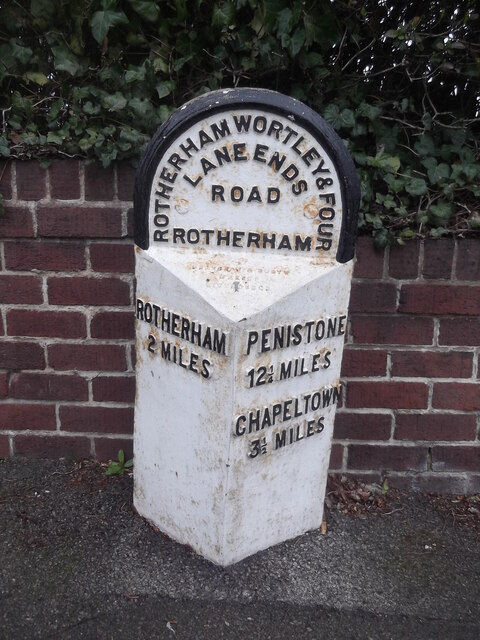
Jordan is located at Grid Ref: SK4092 (Lat: 53.428836, Lng: -1.3950109)

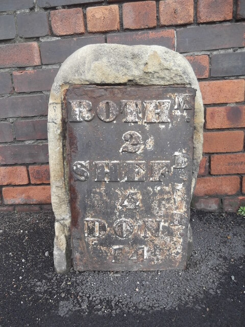
Division: West Riding

Unitary Authority: Rotherham

Police Authority: South Yorkshire

What 3 Words

///secret.mining.quiz. Near Rotherham, South Yorkshire

Nearby Locations

Jordon Jordan

Related Wikis

Winterhill School

Winterhill School is a mixed secondary school located in Kimberworth, Rotherham, South Yorkshire, England. The school was formed in 2004 by the merger...

Old Hall Comprehensive School

Old Hall Comprehensive School was a comprehensive school located in Kimberworth, Rotherham, South Yorkshire, England. It merged with Kimberworth Comprehensive...

Blackburn Meadows

Blackburn Meadows is an area of land just inside the Sheffield city border at Tinsley, England. It became the location of the main sewage treatment works...

Man of Steel (sculpture)

The Steel Man will be a 32-metre-high sculpture and visitor centre located in Rotherham, at Junction 34 of the M1. Its plans, designed by sculptor Steve...

Related Videos

a walk (and fly) around Rotherham past present and future

a walk aroud rotherham using dji pocket 2 and mini 3 pro.

Rotherham on a Snowy Night #city #travel #rotherham #walkingtour

I short walk on a snowy January night around Rotherham center - pretty grim city in general but there is some magic too if you ...

ROTHERHAM | Full tour of Rotherham Town Centre in South Yorkshire, England (Filmed in 4K)

A 4K walking tour through Rotherham England to see what's happening in the town, what is there, what has gone and what has ...

Nearby Amenities

Located within 500m of 53.428836,-1.3950109
Seamark Type: gate
Waterway: lock_gate
Lat/Long: 53.4245051/-1.3937422
Seamark Type: gate
Waterway: lock_gate
Lat/Long: 53.4245399/-1.394085
Turning Circle
Lat/Long: 53.4316637/-1.3917082
Turning Circle
Lat/Long: 53.4277843/-1.390466
Post Box
Brand: Royal Mail
Brand Wikidata: Q638098
Collection Times: Mo-Fr 09:00; Sa 07:00
Operator: Royal Mail
Operator Wikidata: Q638098
Post Box Type: pillar
Ref: S61 216
Royal Cypher: GR
Royal Cypher Wikidata: Q33102273
Lat/Long: 53.4270246/-1.3917757
Bus Stop
Meadowhall Road/Winter Hill Lane
Alt Name: Meadowhall Road/Winter Hill Lane
Bus: yes
Naptan AltCommonName: Meadowhall Road/Winter Hill Lane
Naptan AtcoCode: 370030229
Naptan Bearing: N
Naptan CommonName: Meadowhall Road/Winter Hill Lane
Naptan Indicator: 30229
Naptan Landmark: CHURCH
Naptan PlusbusZoneRef: ROTHCEN
Naptan Street: Meadowhall Road
Naptan Verified: no
Public Transport: platform
Source: naptan_import
Lat/Long: 53.4327725/-1.3952528
Bus Stop
Meadowhall Road/Winter Hill Lane
Alt Name: Meadowhall Road/Winter Hill Lane
Bus: yes
Naptan AltCommonName: Meadowhall Road/Winter Hill Lane
Naptan AtcoCode: 370030230
Naptan Bearing: NE
Naptan CommonName: Meadowhall Road/Winter Hill Lane
Naptan Indicator: 30230
Naptan Landmark: CHURCH
Naptan PlusbusZoneRef: ROTHCEN
Naptan Street: Meadowhall Road
Naptan Verified: no
Public Transport: platform
Source: naptan_import
Lat/Long: 53.4324005/-1.3959199
Bus Stop
Richmond Park Avenue/Sopewell Road
Bus: yes
Naptan AtcoCode: 370030810
Naptan Bearing: SW
Naptan CommonName: Richmond Park Avenue/Sopewell Road
Naptan Indicator: 30810
Naptan Landmark: 30810
Naptan PlusbusZoneRef: ROTHCEN
Naptan Street: Richmond Park Avenue
Naptan Verified: no
Public Transport: platform
Source: naptan_import
Lat/Long: 53.4296324/-1.3997128
Bus Stop
South Street/Deepdale Road
Bus: yes
Naptan AtcoCode: 370031041
Naptan Bearing: SW
Naptan CommonName: South Street/Deepdale Road
Naptan Indicator: 31041
Naptan Landmark: CORNER HOUSE
Naptan PlusbusZoneRef: ROTHCEN
Naptan Street: South Street
Naptan Verified: no
Public Transport: platform
Source: naptan_import
Lat/Long: 53.429494/-1.3934731
Bus Stop
Kimberworth/Deepdale Road
Bus: yes
Naptan AtcoCode: 370031042
Naptan Bearing: NE
Naptan CommonName: Kimberworth/Deepdale Road
Naptan Indicator: 31042
Naptan Landmark: 31042
Naptan PlusbusZoneRef: ROTHCEN
Naptan Street: South Street
Naptan Verified: no
Public Transport: platform
Source: naptan_import
Lat/Long: 53.4294505/-1.3937597
Bus Stop
South Street/Richmond Road
Bus: yes
Naptan AtcoCode: 370031043
Naptan Bearing: N
Naptan CommonName: South Street/Richmond Road
Naptan Indicator: 31043
Naptan Landmark: SHOP
Naptan PlusbusZoneRef: ROTHCEN
Naptan Street: South Street
Naptan Verified: no
Public Transport: platform
Source: naptan_import
Lat/Long: 53.4282596/-1.3946646
Bus Stop
South Street/Fox Street
Bus: yes
Naptan AtcoCode: 370031044
Naptan Bearing: N
Naptan CommonName: South Street/Fox Street
Naptan Indicator: 31044
Naptan Landmark: 31044
Naptan PlusbusZoneRef: ROTHCEN
Naptan Street: South Street
Naptan Verified: no
Public Transport: platform
Source: naptan_import
Lat/Long: 53.4275957/-1.3949149
Bus Stop
South Street/Thornton Street
Bus: yes
Naptan AtcoCode: 370031045
Naptan Bearing: SW
Naptan CommonName: South Street/Thornton Street
Naptan Indicator: 31045
Naptan Landmark: 31045
Naptan PlusbusZoneRef: ROTHCEN
Naptan Street: South Street
Naptan Verified: no
Public Transport: platform
Source: naptan_import
Lat/Long: 53.4266595/-1.3964331
Bus Stop
Meadow Bank Road/South Street
Bench: yes
Bus: yes
Naptan AtcoCode: 370031047
Naptan Bearing: SW
Naptan CommonName: Meadow Bank Road/South Street
Naptan Indicator: 31047
Naptan Landmark: 31047
Naptan PlusbusZoneRef: ROTHCEN
Naptan Street: Meadow Bank Road
Naptan Verified: no
Public Transport: platform
Shelter: yes
Source: naptan_import
Lat/Long: 53.4259885/-1.3971501
Bus Stop
Pitt Street/Pembroke Street
Bus: yes
Naptan AtcoCode: 370031048
Naptan Bearing: NE
Naptan CommonName: Pitt Street/Pembroke Street
Naptan Indicator: 31048
Naptan Landmark: CORNER SHOP
Naptan PlusbusZoneRef: ROTHCEN
Naptan Street: Pitt Street
Naptan Verified: no
Public Transport: platform
Source: naptan_import
Lat/Long: 53.42934/-1.3879517
Bus Stop
Deepdale Road/Oakdale Road
Bus: yes
Naptan AtcoCode: 370031049
Naptan Bearing: SE
Naptan CommonName: Deepdale Road/Oakdale Road
Naptan Indicator: 31049
Naptan Landmark: BRICK WALL
Naptan PlusbusZoneRef: ROTHCEN
Naptan Street: Deepdale Road
Naptan Verified: no
Public Transport: platform
Source: naptan_import
Lat/Long: 53.4290923/-1.3904838
Bus Stop
Deepdale Road/Oakdale Road
Bus: yes
Naptan AtcoCode: 370031050
Naptan Bearing: NW
Naptan CommonName: Deepdale Road/Oakdale Road
Naptan Indicator: 31050
Naptan Landmark: 31050
Naptan PlusbusZoneRef: ROTHCEN
Naptan Street: Deepdale Road
Naptan Verified: no
Public Transport: platform
Source: naptan_import
Lat/Long: 53.4290496/-1.3909359
Bus Stop
Meadow Bank Road/Jordan Crescent
Bus: yes
Naptan AtcoCode: 370031051
Naptan Bearing: SW
Naptan CommonName: Meadow Bank Road/Jordan Crescent
Naptan Indicator: 31051
Naptan Landmark: 31051
Naptan PlusbusZoneRef: ROTHCEN
Naptan Street: Meadow Bank Road
Naptan Verified: no
Public Transport: platform
Shelter: yes
Source: naptan_import
Lat/Long: 53.4268662/-1.3923904
Bus Stop
Meadow Bank Road/Jordan Crescent
Bench: yes
Bin: no
Bus: yes
Lit: no
Naptan AtcoCode: 370031052
Naptan Bearing: NE
Naptan CommonName: Meadow Bank Road/Jordan Crescent
Naptan Indicator: 31052
Naptan Landmark: ROTHERHAM BOILER COMPANY
Naptan PlusbusZoneRef: ROTHCEN
Naptan Street: Meadow Bank Road
Naptan Verified: no
Public Transport: platform
Shelter: yes
Source: naptan_import
Tactile Paving: yes
Lat/Long: 53.4270075/-1.3921929
Bus Stop
Meadow Bank Road/Pembroke Street
Bench: no
Bus: yes
Naptan AtcoCode: 370031053
Naptan Bearing: NE
Naptan CommonName: Meadow Bank Road/Pembroke Street
Naptan Indicator: 31053
Naptan Landmark: BARLOW HANDLING
Naptan PlusbusZoneRef: ROTHCEN
Naptan Street: Meadow Bank Road
Naptan Verified: no
Public Transport: platform
Shelter: no
Source: naptan_import
Lat/Long: 53.4273551/-1.3889033
Bus Stop
Meadow Bank Road/Pembroke Street
Bench: yes
Bin: yes
Bus: yes
Naptan AtcoCode: 370031054
Naptan Bearing: SW
Naptan CommonName: Meadow Bank Road/Pembroke Street
Naptan Indicator: 31054
Naptan Landmark: Barlow Handling
Naptan PlusbusZoneRef: ROTHCEN
Naptan Street: Meadow Bank Road
Naptan Verified: no
Public Transport: platform
Shelter: yes
Source: naptan_import
Lat/Long: 53.4274937/-1.3880859
Bus Stop
Pitt Street/Pembroke Street
Bus: yes
Naptan AtcoCode: 370031055
Naptan Bearing: SW
Naptan CommonName: Pitt Street/Pembroke Street
Naptan Indicator: 31055
Naptan Landmark: CORNER HOUSE
Naptan PlusbusZoneRef: ROTHCEN
Naptan Street: Pitt Street
Naptan Verified: no
Public Transport: platform
Source: naptan_import
Lat/Long: 53.429047/-1.3886633
Bus Stop
Meadowhall Road
Alt Name: Meadowhall Road
Bus: yes
Naptan AltCommonName: Meadowhall Road
Naptan AtcoCode: 370031216
Naptan Bearing: SW
Naptan CommonName: Meadowhall Road
Naptan Indicator: 31216
Naptan Landmark: MEADOWHALL JUNIOR SCHOOL
Naptan PlusbusZoneRef: ROTHCEN
Naptan Street: Meadowhall Road
Naptan Verified: no
Public Transport: platform
Source: naptan_import
Lat/Long: 53.4318028/-1.3964383
Bus Stop
Richmond Park Avenue/Sopewell Road
Alt Name: Richmond Park Avenue/Sopewell Road
Bus: yes
Naptan AltCommonName: Richmond Park Avenue/Sopewell Road
Naptan AtcoCode: 370035334
Naptan Bearing: E
Naptan CommonName: Richmond Park Avenue/Sopewell Road
Naptan Indicator: 35334
Naptan Landmark: P D G Station
Naptan PlusbusZoneRef: ROTHCEN
Naptan Street: Richmond Park Avenue
Naptan Verified: no
Public Transport: platform
Source: naptan_import
Lat/Long: 53.4287447/-1.4021163
Bus Stop
Richmond Park Avenue/Meadowhall Road
Alt Name: Richmond Park Avenue/Meadowhall Road
Bus: yes
Naptan AltCommonName: Richmond Park Avenue/Meadowhall Road
Naptan AtcoCode: 370035339
Naptan Bearing: N
Naptan CommonName: Richmond Park Avenue/Meadowhall Road
Naptan Indicator: 35339
Naptan Landmark: Outside Roman Court
Naptan PlusbusZoneRef: ROTHCEN
Naptan Street: Richmond Park Avenue
Naptan Verified: no
Public Transport: platform
Source: naptan_import
Lat/Long: 53.4312959/-1.3974861
Bus Stop
Meadow Bank Road/South Street
Bench: yes
Bin: no
Bus: yes
Lit: no
Naptan AtcoCode: 370035347
Naptan Bearing: NE
Naptan CommonName: Meadow Bank Road/South Street
Naptan Indicator: 35347
Naptan Landmark: 35347
Naptan PlusbusZoneRef: ROTHCEN
Naptan Street: Meadow Bank Road
Naptan Verified: no
Public Transport: platform
Shelter: yes
Source: naptan_import
Tactile Paving: no
Lat/Long: 53.4259611/-1.3978756
Bus Stop
Richmond Park Avenue/Sopewell Road
Bus: yes
Naptan AtcoCode: 370035401
Naptan Bearing: NE
Naptan CommonName: Richmond Park Avenue/Sopewell Road
Naptan Indicator: 35401
Naptan Landmark: 35401
Naptan PlusbusZoneRef: ROTHCEN
Naptan Street: Richmond Park Avenue
Naptan Verified: no
Public Transport: platform
Source: naptan_import
Lat/Long: 53.4299412/-1.3995124
Turning Circle
Lat/Long: 53.4261304/-1.3993124
Noexit: yes
Lat/Long: 53.4285924/-1.3991856
Noexit: yes
Lat/Long: 53.4291437/-1.3984185
Barrier: bollard
Lat/Long: 53.4327627/-1.3968852
Richmond Park
Place: neighbourhood
Lat/Long: 53.4304496/-1.3992954
Mini Roundabout
Lat/Long: 53.4313003/-1.394616
Noexit: yes
Lat/Long: 53.4288145/-1.3984963
Turning Circle
Lat/Long: 53.4324654/-1.3969218
Fast Food
Dave's Fish Bar
Lat/Long: 53.4301175/-1.3977167
Post Box
Collection Times: Mo-Fr 09:00; Sa 07:00
Post Box Type: pillar
Ref: S61 112
Royal Cypher: GVIR
Royal Cypher Wikidata: Q33102169
Lat/Long: 53.429163/-1.3881905
Post Box
Collection Times: Mo-Fr 09:00; Sa 07:00
Post Box Type: lamp
Ref: S61 96
Royal Cypher: EIIR
Royal Cypher Wikidata: Q33102113
Lat/Long: 53.4293635/-1.3989336
Post Box
Collection Times: Mo-Fr 09:00; Sa 07:00
Post Box Type: lamp
Ref: S61 149
Royal Cypher: EIIR
Royal Cypher Wikidata: Q33102113
Lat/Long: 53.4303875/-1.4020977
Meadowhall Road/Winter Hill Lane
Bus: yes
Public Transport: stop_position
Lat/Long: 53.4328006/-1.3953103
Meadowhall Road/Winter Hill Lane
Bus: yes
Public Transport: stop_position
Lat/Long: 53.4323628/-1.3958429
Meadowhall Road
Bus: yes
Public Transport: stop_position
Lat/Long: 53.4318277/-1.3964966
Richmond Park Avenue/Meadowhall Road
Bus: yes
Public Transport: stop_position
Lat/Long: 53.4312361/-1.397517
Richmond Park Avenue/Sopewell Road
Bus: yes
Public Transport: stop_position
Lat/Long: 53.4299194/-1.3994515
Richmond Park Avenue/Sopewell Road
Bus: yes
Public Transport: stop_position
Lat/Long: 53.4296566/-1.3997683
Richmond Park Avenue/Sopewell Road
Bus: yes
Public Transport: stop_position
Lat/Long: 53.4286975/-1.4021011
Meadow Bank Road/South Street
Bus: yes
Public Transport: stop_position
Lat/Long: 53.4259088/-1.3978505
Meadow Bank Road/South Street
Bus: yes
Public Transport: stop_position
Lat/Long: 53.4260504/-1.3971856
Meadow Bank Road/Jordan Crescent
Bus: yes
Public Transport: stop_position
Lat/Long: 53.4269148/-1.392401
Meadow Bank Road/Jordan Crescent
Bus: yes
Public Transport: stop_position
Lat/Long: 53.426931/-1.3921836
Meadow Bank Road/Pembroke Street
Bus: yes
Public Transport: stop_position
Lat/Long: 53.4272876/-1.3888615
Meadow Bank Road/Pembroke Street
Bus: yes
Public Transport: stop_position
Lat/Long: 53.4275368/-1.3881377
Generator Method: photovoltaic
Generator Output Electricity: yes
Generator Source: solar
Generator Type: solar_photovoltaic_panel
Power: generator
Lat/Long: 53.4284002/-1.3899756
Generator Method: photovoltaic
Generator Output Electricity: yes
Generator Source: solar
Generator Type: solar_photovoltaic_panel
Power: generator
Lat/Long: 53.4283653/-1.3898601
Generator Method: photovoltaic
Generator Output Electricity: yes
Generator Source: solar
Generator Type: solar_photovoltaic_panel
Power: generator
Lat/Long: 53.4283598/-1.3897615
Generator Method: photovoltaic
Generator Output Electricity: yes
Generator Source: solar
Generator Type: solar_photovoltaic_panel
Power: generator
Lat/Long: 53.4283423/-1.3896583
Generator Method: photovoltaic
Generator Output Electricity: yes
Generator Source: solar
Generator Type: solar_photovoltaic_panel
Power: generator
Lat/Long: 53.4283359/-1.3895689
Generator Method: photovoltaic
Generator Output Electricity: yes
Generator Source: solar
Generator Type: solar_photovoltaic_panel
Power: generator
Lat/Long: 53.4281266/-1.3893147
Generator Method: photovoltaic
Generator Output Electricity: yes
Generator Source: solar
Generator Type: solar_photovoltaic_panel
Power: generator
Lat/Long: 53.4280771/-1.3892269
Generator Method: photovoltaic
Generator Output Electricity: yes
Generator Source: solar
Generator Type: solar_photovoltaic_panel
Power: generator
Lat/Long: 53.4280073/-1.3890852
Generator Method: photovoltaic
Generator Output Electricity: yes
Generator Source: solar
Generator Type: solar_photovoltaic_panel
Power: generator
Lat/Long: 53.4280743/-1.3898601
Generator Method: photovoltaic
Generator Output Electricity: yes
Generator Source: solar
Generator Type: solar_photovoltaic_panel
Power: generator
Lat/Long: 53.4281422/-1.3899833
Generator Method: photovoltaic
Generator Output Electricity: yes
Generator Source: solar
Generator Type: solar_photovoltaic_panel
Power: generator
Lat/Long: 53.4280257/-1.3898339
Generator Method: photovoltaic
Generator Output Electricity: yes
Generator Source: solar
Generator Type: solar_photovoltaic_panel
Power: generator
Lat/Long: 53.4279532/-1.3898169
Generator Method: photovoltaic
Generator Output Electricity: yes
Generator Source: solar
Generator Type: solar_photovoltaic_panel
Power: generator
Lat/Long: 53.4278953/-1.3897907
Generator Method: photovoltaic
Generator Output Electricity: yes
Generator Source: solar
Generator Type: solar_photovoltaic_panel
Power: generator
Lat/Long: 53.427843/-1.3897538
Generator Method: photovoltaic
Generator Output Electricity: yes
Generator Source: solar
Generator Type: solar_photovoltaic_panel
Power: generator
Lat/Long: 53.4276558/-1.3898169
Generator Method: photovoltaic
Generator Output Electricity: yes
Generator Source: solar
Generator Type: solar_photovoltaic_panel
Power: generator
Lat/Long: 53.4276686/-1.3897599
Generator Method: photovoltaic
Generator Output Electricity: yes
Generator Source: solar
Generator Type: solar_photovoltaic_panel
Power: generator
Lat/Long: 53.427698/-1.3895882
Generator Method: photovoltaic
Generator Output Electricity: yes
Generator Source: solar
Generator Type: solar_photovoltaic_panel
Power: generator
Lat/Long: 53.4276851/-1.3896452
Generator Method: photovoltaic
Generator Output Electricity: yes
Generator Source: solar
Generator Type: solar_photovoltaic_panel
Power: generator
Lat/Long: 53.4277237/-1.3894033
Generator Method: photovoltaic
Generator Output Electricity: yes
Generator Source: solar
Generator Type: solar_photovoltaic_panel
Power: generator
Lat/Long: 53.4277108/-1.3894603
Generator Method: photovoltaic
Generator Output Electricity: yes
Generator Source: solar
Generator Type: solar_photovoltaic_panel
Power: generator
Lat/Long: 53.4277475/-1.3892061
Generator Method: photovoltaic
Generator Output Electricity: yes
Generator Source: solar
Generator Type: solar_photovoltaic_panel
Power: generator
Lat/Long: 53.4277329/-1.3893016
Generator Method: photovoltaic
Generator Output Electricity: yes
Generator Source: solar
Generator Type: solar_photovoltaic_panel
Power: generator
Lat/Long: 53.4277806/-1.389049
Generator Method: photovoltaic
Generator Output Electricity: yes
Generator Source: solar
Generator Type: solar_photovoltaic_panel
Power: generator
Lat/Long: 53.4277677/-1.389106
Generator Method: photovoltaic
Generator Output Electricity: yes
Generator Source: solar
Generator Type: solar_photovoltaic_panel
Power: generator
Lat/Long: 53.4279844/-1.3888056
Generator Method: photovoltaic
Generator Output Electricity: yes
Generator Source: solar
Generator Type: solar_photovoltaic_panel
Power: generator
Lat/Long: 53.4279972/-1.3888872
Generator Method: photovoltaic
Generator Output Electricity: yes
Generator Source: solar
Generator Type: solar_photovoltaic_panel
Power: generator
Lat/Long: 53.4278017/-1.3888988
Bench
Backrest: yes
Lat/Long: 53.424769/-1.3954561
Addr Country: GB
Addr Housenumber: 35
Addr Street: Richmond Park Avenue
Lat/Long: 53.4298452/-1.3992263
Addr Country: GB
Addr Housenumber: 45
Addr Street: Richmond Park Avenue
Lat/Long: 53.429479/-1.3996132
Addr Country: GB
Addr Housenumber: 87
Addr Street: Richmond Park Avenue
Lat/Long: 53.4285032/-1.402104
Defibrillator
Access: yes
Defibrillator Location: On the outside wall of the sandwich shop.
Emergency: defibrillator
Indoor: no
Lat/Long: 53.4332387/-1.3952538
South Street Convenience Store
Brand: Premier
Brand Wikidata: Q7240340
Shop: convenience
Lat/Long: 53.4280896/-1.3949002
The data included in this document is from www.openstreetmap.org. The data is made available under ODbL.

Have you been to Jordan?

Leave your review of Jordan below (or comments, questions and feedback).