Horringford

Settlement in Hampshire

England

Horringford

Orchard at Merstone Station The former Merstone Station is now a parking area and cycleway access point. The old platform is still intact and beyond it a picnic area has been laid out and some fruit trees have been planted.
Orchard at Merstone Station Credit: Des Blenkinsopp

Horringford is a small village located in the county of Hampshire, England. Situated in the eastern part of the island, it is nestled within the picturesque countryside, surrounded by rolling hills and lush green fields. The village is part of the civil parish of Newchurch, and it falls under the local government district of the Isle of Wight.

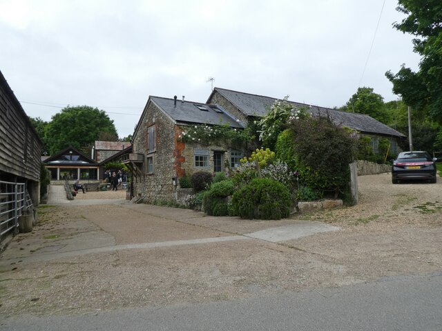
The village of Horringford is known for its tranquility and rural charm. It is primarily a residential area, with a small population that enjoys a close-knit community atmosphere. The architecture in the village reflects its rich history, with several traditional cottages and farmhouses dotting the landscape.

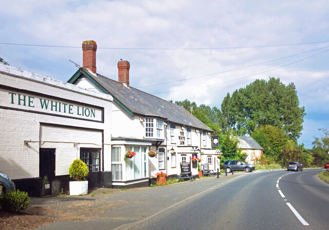
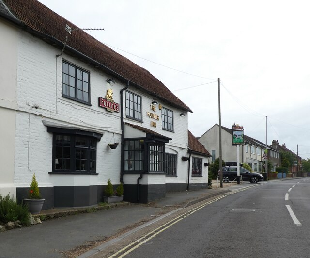
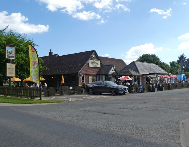
Despite its small size, Horringford offers a range of amenities to its residents. The village has a local pub, providing a gathering place for locals and visitors alike. Additionally, there are several small businesses and shops catering to the daily needs of the community.

Horringford benefits from its proximity to the nearby towns and attractions on the Isle of Wight. The popular tourist destinations of Newport and Ryde are within easy reach, offering a wider range of amenities, shopping opportunities, and cultural attractions.

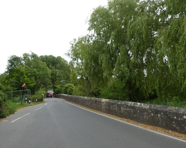
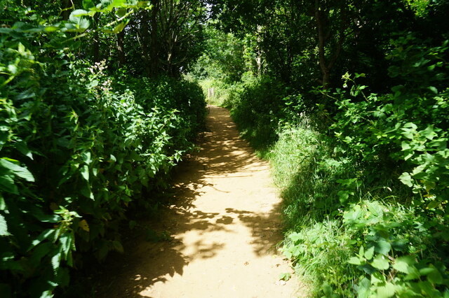
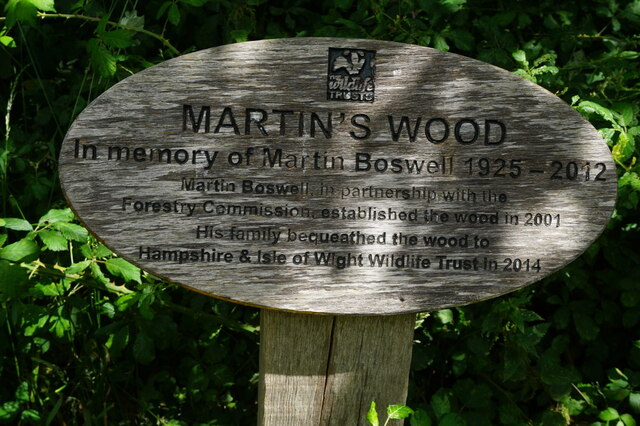
The surrounding countryside provides ample opportunities for outdoor activities, such as walking, cycling, and horse-riding. Horringford is also close to some beautiful beaches, allowing residents and visitors to enjoy the natural beauty of the island.

Overall, Horringford offers a peaceful and idyllic setting, making it an attractive place to live or visit for those seeking a slower pace of life in the stunning Hampshire countryside.

If you have any feedback on the listing, please let us know in the comments section below.
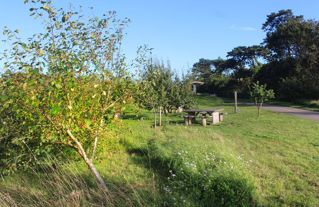
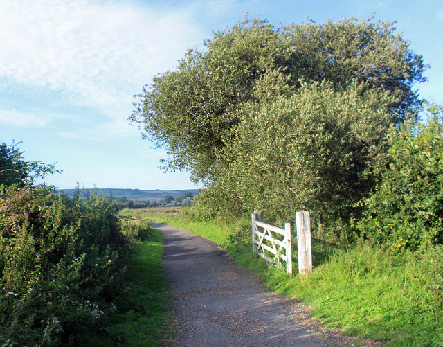
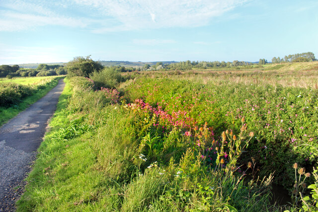
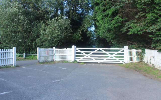
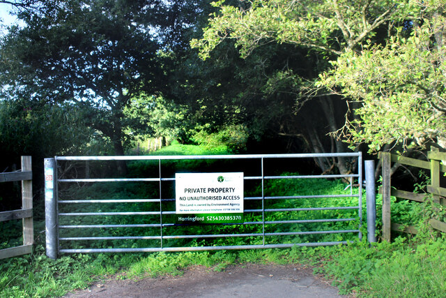
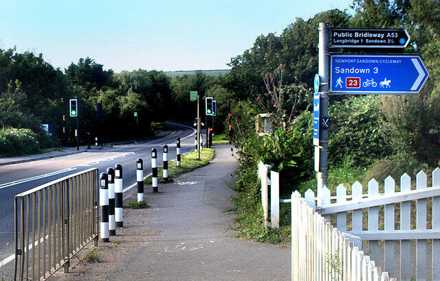
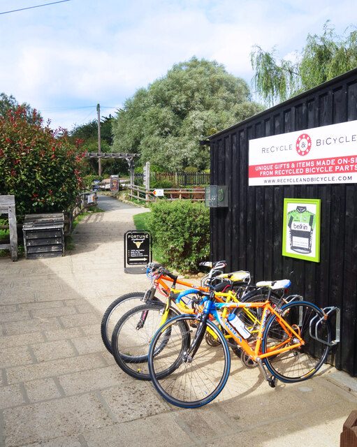
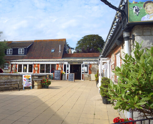
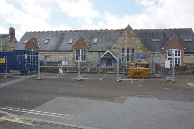
Horringford Images

Images are sourced within 2km of 50.665667/-1.2319884 or Grid Reference SZ5485. Thanks to Geograph Open Source API. All images are credited.

Orchard at Merstone Station The former Merstone Station is now a parking area and cycleway access point. The old platform is still intact and beyond it a picnic area has been laid out and some fruit trees have been planted.
Orchard at Merstone Station
The former Merstone Station is now a parking area and cycleway access point. The old platform is still intact and beyond it a picnic area has been laid out and some fruit trees have been planted.
White Gate by the Cycleway A neat white painted wooden gate is beside the cycleway just here.
White Gate by the Cycleway
A neat white painted wooden gate is beside the cycleway just here.
Flowers by the Path A stream flows beside the track along here, down in a deep ditch. Wild flowers grow along the bank beside the old railway line.
Flowers by the Path
A stream flows beside the track along here, down in a deep ditch. Wild flowers grow along the bank beside the old railway line.
Access to the Old Railway An old railway line used to cross the road here. It is now a path and cycleway and a small parking area has been made at the crossing.
Access to the Old Railway
An old railway line used to cross the road here. It is now a path and cycleway and a small parking area has been made at the crossing.
The Rail Track Ends Here For some reason the Environment Agency needs the couple of hundred metres of old railway trackbed between here and the road. The path which has been using it for some time is diverted off to the left.
The Rail Track Ends Here
For some reason the Environment Agency needs the couple of hundred metres of old railway trackbed between here and the road. The path which has been using it for some time is diverted off to the left.
Cycleway Crosses the Road A signal controlled road crossing has been put in where the Newport Sandown Cycleway crosses the A3056.
Cycleway Crosses the Road
A signal controlled road crossing has been put in where the Newport Sandown Cycleway crosses the A3056.
Cycle Rack, Arreton Craft Village Part of a large site where craftspeople make and sell their products in a mixed collection of sheds and barns and new workshops.
Cycle Rack, Arreton Craft Village
Part of a large site where craftspeople make and sell their products in a mixed collection of sheds and barns and new workshops.
The Dairyman's Daughter's Yard Arreton Craft Village incorporates a pub restaurant called The Dairyman's Daughter.
The Dairyman's Daughter's Yard
Arreton Craft Village incorporates a pub restaurant called The Dairyman's Daughter.
The White Lion at Arreton Arreton is a long village with the pub at one end, near the church. The rest of the place straggles along the road for the next kilometre or so, mostly on this side only.
The White Lion at Arreton
Arreton is a long village with the pub at one end, near the church. The rest of the place straggles along the road for the next kilometre or so, mostly on this side only.
Cyclists riding on the Red Squirrel Trail, travelling west Captured during a cycle tour around the Isle of Wight in late May 2021.

The cyclists are using the so-called 'Red Squirrel Trail.'
Cyclists riding on the Red Squirrel Trail, travelling west
Captured during a cycle tour around the Isle of Wight in late May 2021. The cyclists are using the so-called 'Red Squirrel Trail.'
Modern Waymarker, Merston, Isle of Wight On the grass verge of Budbridge Lane, outside Little Budbridge Farm. One of 20 designed by sculpture Paul Mason along the path from the source of the Eastern river called Yar and the Sea.

Inscription: logo // 12 // 9

Milestone Society National ID: tbc
Modern Waymarker, Merston, Isle of Wight
On the grass verge of Budbridge Lane, outside Little Budbridge Farm. One of 20 designed by sculpture Paul Mason along the path from the source of the Eastern river called Yar and the Sea. Inscription: logo // 12 // 9 Milestone Society National ID: tbc
The Garlic Farm, near Newchurch
The Shute, Newchurch
The Pointer Inn
The Pointer Inn
The Fighting Cocks
The Fighting Cocks
Path at Martin's Wood Nature Reserve, Newchurch
Sign in Martin's Wood Nature Reserve, Newchurch
Newchurch Primary School, Newchurch
Show me another place!

Horringford is located at Grid Ref: SZ5485 (Lat: 50.665667, Lng: -1.2319884)

Unitary Authority: Isle of Wight

Police Authority: Hampshire

What 3 Words

///cautious.shipwreck.slab. Near Newchurch, Isle of Wight

Nearby Locations

Horringford

Related Wikis

Horringford railway station

Horringford railway station was an intermediate station situated on the edge of Horringford village on the line from Newport to Sandown incorporated by...

Horringford

Horringford is a settlement on the Isle of Wight, off the south coast of England. It is in the civil parish of Arreton. The hamlet lies on the A3056 road...

Haseley Manor (Isle of Wight)

Haseley Manor is a 14th-century, Grade 2* listed property located in Arreton on the Isle of Wight. The name Haseley is derived from the Saxon Haesel-leah...

Hale Manor

Hale Manor (also Atehalle, la Hale) is a manor house on the Isle of Wight, situated in the parish of Arreton. It forms the south-eastern portion of...

Hale Common

Hale Common is a farming hamlet on the Isle of Wight. Hale Common is on the A3056 road between Lake and Arreton. Hale Common is northeast of Bathingbourne...

Amazon World Zoo Park

Amazon World Zoo Park is a medium-sized zoo located in Newchurch, Isle of Wight on the outskirts of Sandown, England. The collection is based around the...

Arreton

Arreton is a village and civil parish in the central eastern part of the Isle of Wight, England. It is about 3 miles south east of Newport. == Name... ==

St George's Church, Arreton

St George's Church, Arreton, is a parish church in the Church of England located in Arreton, Isle of Wight. == History == The church is medieval and the...

Nearby Amenities

Located within 500m of 50.665667,-1.2319884
Source: Bing
Lat/Long: 50.6659386/-1.2349348
Source: Bing
Lat/Long: 50.6658175/-1.234994
Source: Bing
Lat/Long: 50.6657094/-1.2349354
Source: Bing
Lat/Long: 50.6655081/-1.2349386
Source: Bing
Lat/Long: 50.66549/-1.2350102
Source: Bing
Lat/Long: 50.6651747/-1.235423
Source: Bing
Lat/Long: 50.6649873/-1.2355809
Source: Bing
Lat/Long: 50.6648144/-1.235777
Source: Bing
Lat/Long: 50.6660622/-1.2341662
Source: Bing
Lat/Long: 50.6660719/-1.2339489
Crossing
Bicycle: yes
Crossing: traffic_signals
Crossing Ref: toucan
Kerb: lowered
Source: survey
Tactile Paving: yes
Lat/Long: 50.6663715/-1.2320687
Source: Bing
Lat/Long: 50.6660782/-1.2350997
Source: Bing
Lat/Long: 50.6660741/-1.2344536
Source: Locally rectified NPE map
Lat/Long: 50.6662409/-1.2356696
Source: Locally rectified NPE map
Lat/Long: 50.6686073/-1.2356117
Source: Locally rectified NPE map
Lat/Long: 50.669026/-1.2354459
Source: Locally rectified NPE map
Lat/Long: 50.6680318/-1.237307
Barrier: stile
Foot: yes
Source: Locally rectified NPE map
Lat/Long: 50.6687292/-1.2347298
Source: Locally rectified NPE map
Lat/Long: 50.6690287/-1.2326643
Source: Locally rectified NPE map
Lat/Long: 50.6690124/-1.2284343
Source: Locally rectified NPE map
Lat/Long: 50.6673177/-1.2256608
Source: Locally rectified NPE map
Lat/Long: 50.667027/-1.2272031
Source: Locally rectified NPE map
Lat/Long: 50.666976/-1.2281083
Source: Locally rectified NPE map
Lat/Long: 50.6665986/-1.2297566
Source: Locally rectified NPE map
Lat/Long: 50.6660222/-1.2317816
Source: Locally rectified NPE map
Lat/Long: 50.6656615/-1.2334716
Source: Bing
Lat/Long: 50.6655762/-1.2343526
Source: Bing
Lat/Long: 50.665249/-1.2355114
Source: Bing
Lat/Long: 50.6648375/-1.2358654
Source: Locally rectified NPE map
Lat/Long: 50.6642507/-1.2363709
Source: Locally rectified NPE map
Lat/Long: 50.6634907/-1.237264
Source: Bing
Lat/Long: 50.6653903/-1.2380251
Bus Stop
Stickworth Hall
Bench: no
Bin: no
Bus: yes
Contact Website: https://www.islandbuses.info/stops/230000005210
Naptan AtcoCode: 230000005210
Naptan Bearing: N
Naptan CommonName: Horringford Station
Naptan Indicator: towards Newport
Naptan NaptanCode: iowdpdp
Public Transport: platform
Shelter: no
Lat/Long: 50.6666419/-1.2320572
Bus Stop
Stickworth Hall
Bench: no
Bin: no
Bus: yes
Contact Website: https://www.islandbuses.info/stops/230000005220
Naptan AtcoCode: 230000005220
Naptan Bearing: S
Naptan CommonName: Horringford Station
Naptan Indicator: towards Shanklin
Naptan NaptanCode: iowdpdt
Public Transport: platform
Shelter: no
Lat/Long: 50.6661823/-1.2320276
Post Box
Check Date: 2016-05-08
Check Date Collection Times: 2016-05-08
Collection Plate: CP5D
Collection Times: Mo-Fr 09:00; Sa 07:00; Su off
Operator: Royal Mail
Operator Wikidata: Q638098
Post Box Type: lamp
Ref: PO30 41D
Ref GB Uprn: 10015307917
Royal Cypher: GR
Royal Cypher Wikidata: Q33102273
Lat/Long: 50.6656119/-1.2322921
Source: Bing
Lat/Long: 50.6660928/-1.2352951
Source: Bing
Lat/Long: 50.6647921/-1.2373701
Source: Bing
Lat/Long: 50.6656077/-1.2364007
Power: pole
Source: Bing
Lat/Long: 50.6699205/-1.2315283
Power: pole
Source: Bing
Lat/Long: 50.6656041/-1.2289319
Power: pole
Source: Bing
Lat/Long: 50.6666888/-1.2296561
Power: pole
Source: Bing
Lat/Long: 50.6675847/-1.2302784
Power: pole
Source: Bing
Lat/Long: 50.6629332/-1.2271053
Power: pole
Source: Bing
Lat/Long: 50.669028/-1.2312896
Power: pole
Source: Bing
Lat/Long: 50.6638105/-1.2277088
Power: pole
Source: Bing
Lat/Long: 50.6647047/-1.2283177
Source: Bing
Lat/Long: 50.6635383/-1.2375121
Source: Bing
Lat/Long: 50.6655283/-1.2351132
Source: Bing
Lat/Long: 50.6655291/-1.2348868
Source: Bing
Lat/Long: 50.6652734/-1.238009
Source: Bing
Lat/Long: 50.6652615/-1.2384057
Barrier: stile
Foot: yes
Lat/Long: 50.6680673/-1.2353329
Barrier: stile
Foot: yes
Lat/Long: 50.666253/-1.2356488
Barrier: stile
Foot: yes
Lat/Long: 50.6675736/-1.2351056
Barrier: stile
Foot: yes
Lat/Long: 50.6681106/-1.2353548
Barrier: stile
Foot: yes
Lat/Long: 50.6686297/-1.2356119
Source: Locally rectified NPE map
Lat/Long: 50.6668922/-1.2281717
Crossing
Crossing: traffic_signals
Crossing Ref: pegasus
Horse: yes
Kerb: lowered
Source: seen on journey
Lat/Long: 50.6664244/-1.2320559
Traffic Signals
Traffic Signals Direction: forward
Lat/Long: 50.6663312/-1.2320776
Traffic Signals
Traffic Signals Direction: backward
Lat/Long: 50.6664594/-1.232048
Turning Loop
Lat/Long: 50.6646792/-1.23775
Hiking: yes
Information: guidepost
Tourism: information
Lat/Long: 50.6659395/-1.2320312
Hiking: yes
Information: guidepost
Tourism: information
Lat/Long: 50.6664735/-1.2321681
Hiking: yes
Information: guidepost
Tourism: information
Lat/Long: 50.6671426/-1.2270784
Hiking: yes
Information: guidepost
Tourism: information
Lat/Long: 50.6693866/-1.2330034
Bicycle: yes
Hiking: yes
Information: guidepost
Tourism: information
Lat/Long: 50.6660427/-1.2347657
Barrier: bollard
Lat/Long: 50.666054/-1.2346686
Barrier: cycle_barrier
Lat/Long: 50.6659602/-1.2321095
Leisure: fishing
Lat/Long: 50.6630436/-1.2355059
Horringford
Historic Railway: station
Railway: site
Wikidata: Q15225282
Wikipedia: en:Horringford railway station
Lat/Long: 50.6656927/-1.232512
The data included in this document is from www.openstreetmap.org. The data is made available under ODbL.

Have you been to Horringford?

Leave your review of Horringford below (or comments, questions and feedback).