Hopton on Sea

Settlement in Suffolk Great Yarmouth

England

Hopton on Sea

Site of the former railway bridge The bridge was a plate girder construction on Station Road, Hopton-on-Sea
Site of the former railway bridge Credit: Adrian S Pye

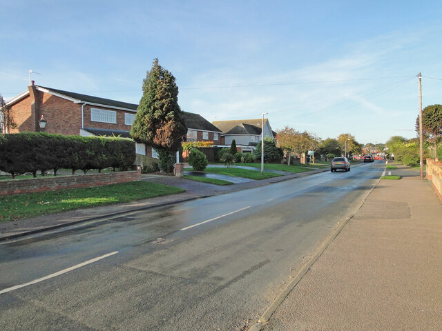
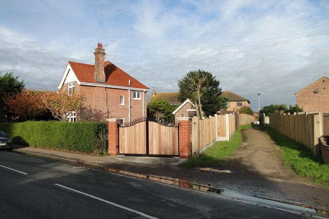
Hopton on Sea is a coastal village located in the county of Suffolk, England. Situated on the eastern coast, it lies approximately 5 miles south of the town of Great Yarmouth and 30 miles northeast of the city of Norwich. With its stunning views of the North Sea, Hopton on Sea is a popular destination for both tourists and locals alike.

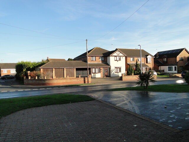
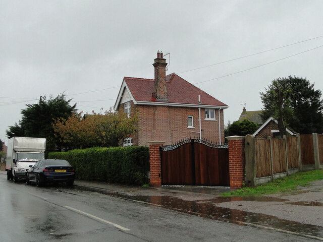
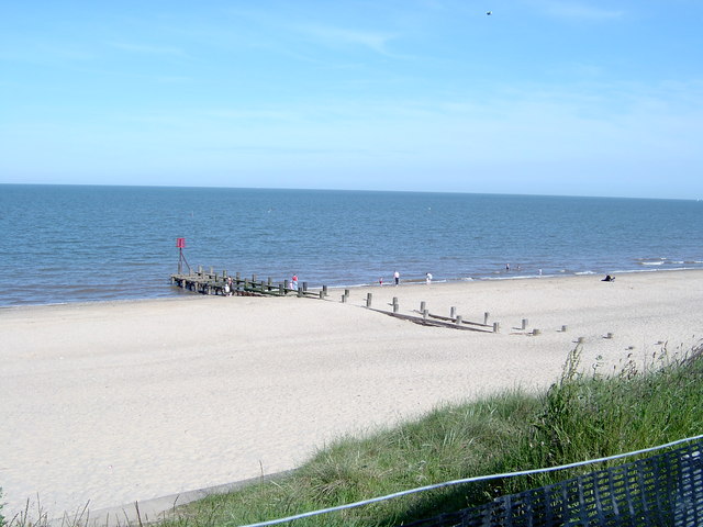
The village is known for its beautiful sandy beach, which stretches for miles along the coast. The beach is a perfect spot for sunbathing, picnicking, and taking long walks. Hopton on Sea offers a range of amenities for visitors, including cafes, restaurants, and shops, making it an ideal place for a day trip or a longer stay.

In addition to its natural beauty, Hopton on Sea is also home to a number of attractions. One of the highlights is Pleasurewood Hills, a theme park that offers thrilling rides and entertainment for all ages. The park is a popular destination for families and is located just a short distance from the village.

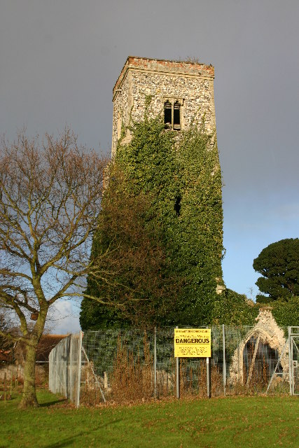
For those interested in history, Hopton on Sea is also close to several historical sites. The nearby village of Corton is home to the ruins of an ancient Roman fort, while the town of Lowestoft, just a few miles to the south, boasts a rich maritime heritage.

Overall, Hopton on Sea offers a perfect blend of natural beauty, attractions, and history, making it a must-visit destination for anyone exploring the Suffolk coast.

If you have any feedback on the listing, please let us know in the comments section below.

Hopton on Sea Images

Images are sourced within 2km of 52.538832/1.7217861 or Grid Reference TM5299. Thanks to Geograph Open Source API. All images are credited.

Site of the former railway bridge The bridge was a plate girder construction on Station Road, Hopton-on-Sea
Site of the former railway bridge
The bridge was a plate girder construction on Station Road, Hopton-on-Sea
The railway passed over where this house now stands The railway bridge was in the centre foreground.
The railway passed over where this house now stands
The railway bridge was in the centre foreground.
The former station master's house (modernised) Station Road, Hopton-on-Sea
The former station master's house (modernised)
Station Road, Hopton-on-Sea
Potters Drive built on the former railway line The road here, follows the same line as the old railway track
Potters Drive built on the former railway line
The road here, follows the same line as the old railway track
The site of the former Hopton-on-Sea railway station The Station had two platforms, a loop, sidings, a goods yard, and a footbridge on the south side The station was built on a series of brick arches which were covered and concealed by the embankment.
The site of the former Hopton-on-Sea railway station
The Station had two platforms, a loop, sidings, a goods yard, and a footbridge on the south side The station was built on a series of brick arches which were covered and concealed by the embankment.
Gorleston Golf Club practice range In the gap between the trees is where the former Lowestoft to Great Yarmouth railway passed on its way to Gorleston Links Halt and beyond.
Gorleston Golf Club practice range
In the gap between the trees is where the former Lowestoft to Great Yarmouth railway passed on its way to Gorleston Links Halt and beyond.
This house was built on the site of the railway bridge The bridge, which was a plate girder construction, carried the line over Links Road which at the time did not go beyond Warren Road and the access to Gorleston Golf Club.
Gorleston Links Halt was 100 yards north of the Links Road bridge on the embankment at the southwest end of what is now Hill Avenue, named after the fact there was once an embankment creating the hill.
Needless to say all traces of the embankment were removed for the housing development.
This house was built on the site of the railway bridge
The bridge, which was a plate girder construction, carried the line over Links Road which at the time did not go beyond Warren Road and the access to Gorleston Golf Club. Gorleston Links Halt was 100 yards north of the Links Road bridge on the embankment at the southwest end of what is now Hill Avenue, named after the fact there was once an embankment creating the hill. Needless to say all traces of the embankment were removed for the housing development.
The gas governor marks the route of the former railway The bricked-in gas governor would have been buried beneath the embankment had it been there at the time.
The bridge, which was a plate girder construction, spanned Links Road on an embankment which extended to Gorleston Links Halt, 100 yards north of here and beyond. The Halt stood at the southwest end of what is now Hill Avenue, named after the fact there was once an embankment creating the hill.
Needless to say all traces of the embankment were removed for the housing development.
The gas governor marks the route of the former railway
The bricked-in gas governor would have been buried beneath the embankment had it been there at the time. The bridge, which was a plate girder construction, spanned Links Road on an embankment which extended to Gorleston Links Halt, 100 yards north of here and beyond. The Halt stood at the southwest end of what is now Hill Avenue, named after the fact there was once an embankment creating the hill. Needless to say all traces of the embankment were removed for the housing development.
North of Potters Drive Hopton The track would have been in the treeline with a goods siding on either side of the track
North of Potters Drive Hopton
The track would have been in the treeline with a goods siding on either side of the track
The former Station Master's house The houses were all built to a standard design but this one has been recently modernised.
The lane to the right is the access which once led to the goods yard behind the station.
The former Station Master's house
The houses were all built to a standard design but this one has been recently modernised. The lane to the right is the access which once led to the goods yard behind the station.
St Margaret's Church, Hopton-on-Sea A grade II listed ruin, there is nevertheless a sign welcoming worshippers to Communion and Sunday Service...
St Margaret's Church, Hopton-on-Sea
A grade II listed ruin, there is nevertheless a sign welcoming worshippers to Communion and Sunday Service...
League Hole, Hopton A modern beacon and Golf Course overlook League Hole, a gap in the sea cliffs
League Hole, Hopton
A modern beacon and Golf Course overlook League Hole, a gap in the sea cliffs
HoptonA12 Roundabout
Leading To Bloodmans Corner Road junction of Church Lane Jay Lane and Dorking Road in front leading to Bloodmans Corner near to Bloodmans Corner Suffolk
Leading To Bloodmans Corner
Road junction of Church Lane Jay Lane and Dorking Road in front leading to Bloodmans Corner near to Bloodmans Corner Suffolk
Market Lane Looking east along Market Lane from the edge of the village of Blundeston Suffolk.
Market Lane
Looking east along Market Lane from the edge of the village of Blundeston Suffolk.
Hopton on Sea: postbox № NR31 3165, Potter’s Leisure Centre A modern interior box serving this large holiday complex, emptied finally at 4:15pm on weekdays and at 8:30am on Saturdays.
Hopton on Sea: postbox № NR31 3165, Potter’s Leisure Centre
A modern interior box serving this large holiday complex, emptied finally at 4:15pm on weekdays and at 8:30am on Saturdays.
The White Hart public house The pub is situated by the junction of Lowestoft and Station roads.
The White Hart public house
The pub is situated by the junction of Lowestoft and Station roads.
The White Hart public house The pub is situated by the junction of Lowestoft and Station roads.
The White Hart public house
The pub is situated by the junction of Lowestoft and Station roads.
Show me another place!

Hopton on Sea is located at Grid Ref: TM5299 (Lat: 52.538832, Lng: 1.7217861)

Administrative County: Norfolk

District: Great Yarmouth

Police Authority: Norfolk

What 3 Words

///breaches.enrolling.sunflower. Near Hopton on Sea, Norfolk

Nearby Locations

Hopton on Sea

Related Wikis

Hopton-on-Sea railway station

Hopton-on-Sea was a railway station serving the village of Hopton-on-Sea in Norfolk on the Norfolk and Suffolk Joint Railway line between Great Yarmouth...

Hopton-on-Sea

Hopton-on-Sea is a village, civil parish and seaside resort on the coast of East Anglia in the county of Norfolk. The village is 4 miles (6.4 km) south...

Potters Resorts

Potters Resorts is a short breaks holiday company in the United Kingdom, operating two five-star resorts in Norfolk and Essex. The company has been privately...

Newton, Norfolk

Newton was a village on the north-east coast of the English county of Suffolk. The village, which since 1974 would have been in Norfolk, is now lost to...

Nearby Amenities

Located within 500m of 52.538832,1.7217861
Hopton-on-Sea
Historic Railway: station
Railway: site
Wikidata: Q15225105
Wikipedia: en:Hopton-on-Sea railway station
Lat/Long: 52.5407328/1.7271587
Turning Circle
Lat/Long: 52.5403451/1.7266427
Turning Circle
Lat/Long: 52.5410531/1.7275152
Turning Circle
Lat/Long: 52.5418811/1.72271
Turning Circle
Lat/Long: 52.5421222/1.720844
Bus Stop
The Turnstone, opp
Naptan AtcoCode: 2900H5410
Naptan Bearing: W
Naptan CommonName: The Turnstone
Naptan Indicator: opp
Naptan Locality: Hopton-on-Sea
Naptan NaptanCode: nfodadtm
Naptan Street: Station Road
Naptan Verified: no
Source: naptan_import
Lat/Long: 52.5393336/1.7278347
Bus Stop
Access Road, NE-bound
Naptan AtcoCode: 2900H543
Naptan Bearing: NE
Naptan BusStopType: CUS
Naptan CommonName: Access Road
Naptan Indicator: NE-bound
Naptan Locality: Hopton-on-Sea
Naptan NaptanCode: nfodadwp
Naptan Street: Lowestoft Road
Naptan Verified: no
Source: naptan_import
Lat/Long: 52.5384135/1.7215176
Bus Stop
Access Road, SE-bound
Naptan AtcoCode: 2900H546
Naptan Bearing: SE
Naptan BusStopType: CUS
Naptan CommonName: Access Road
Naptan Indicator: SE-bound
Naptan Locality: Hopton-on-Sea
Naptan NaptanCode: nfodadwt
Naptan Street: Lowestoft Road
Naptan Verified: no
Source: naptan_import
Lat/Long: 52.5382863/1.722171
Bus Stop
Anglian Way, adj
Naptan AtcoCode: 2900H547
Naptan Bearing: NE
Naptan CommonName: Anglian Way
Naptan Indicator: adj
Naptan Landmark: Anglian Way
Naptan Locality: Hopton-on-Sea
Naptan NaptanCode: nfodagad
Naptan Street: Station Road
Naptan Verified: no
Source: naptan_import
Lat/Long: 52.5392153/1.7231935
Bus Stop
Anglian Way, opp
Bench: yes
Naptan AtcoCode: 2900H548
Naptan Bearing: S
Naptan CommonName: Anglian Way
Naptan Indicator: opp
Naptan Locality: Hopton-on-Sea
Naptan NaptanCode: nfodagag
Naptan Street: Lowestoft Road
Naptan Verified: no
Public Transport: platform
Shelter: yes
Source: naptan_import
Tactile Paving: yes
Lat/Long: 52.538311/1.722165
Bus Stop
The Turnstone, adj
Naptan AtcoCode: 2900H549
Naptan Bearing: E
Naptan CommonName: The Turnstone
Naptan Indicator: adj
Naptan Locality: Hopton-on-Sea
Naptan NaptanCode: nfodagaj
Naptan Street: Station Road
Naptan Verified: no
Source: naptan_import
Lat/Long: 52.5394089/1.7273258
Post Office
Hopton Post Office
Addr City: Great Yarmouth
Addr Housename: McColls
Addr Housenumber: 35
Addr Postcode: NR31 9BH
Addr Street: Station Road
Addr Village: Hopton-on-Sea
Brand: Post Office
Brand Wikidata: Q1783168
Contact Website: https://www.postoffice.co.uk/branch-finder/3364585/hopton
Opening Hours: Mo-Sa 06:00-20:00; Su 07:00-20:00
Ref Pol Id: 123743
Source Addr: pol_branch_list_2018-02
Source Opening Hours: pol_branch_list_2018-02
Lat/Long: 52.5395179/1.7283014
Give Way
Direction: forward
Lat/Long: 52.5381683/1.721125
Give Way
Direction: forward
Lat/Long: 52.5385135/1.7205178
Entrance: main
Lat/Long: 52.5397507/1.7209692
Note: Path overgrown.
Lat/Long: 52.5345972/1.7236599
Crossing
Crossing: uncontrolled
Crossing Markings: yes
Crossing Signals: no
Lat/Long: 52.5351035/1.7231038
Crossing
Crossing: unmarked
Crossing Markings: no
Lat/Long: 52.5352011/1.7227677
The Links
Place: locality
Lat/Long: 52.5413336/1.727936
Entrance: main
Lat/Long: 52.5395992/1.7206616
Entrance: yes
Lat/Long: 52.5396394/1.7209357
Historic: memorial
Memorial: war_memorial
Lat/Long: 52.5395546/1.7208061
Kerb: lowered
Lat/Long: 52.5373194/1.7248708
Kerb: lowered
Lat/Long: 52.5373768/1.7248502
Surface: brick
Traffic Calming: table
Lat/Long: 52.537325/1.7247008
Hopton on-Sea
Alt Name: Hopton-on-Sea
Man Made: village_sign
Material: wood;fibreglass
Lat/Long: 52.5383287/1.7217247
Bench
Backrest: yes
Material: wood
Seats: 4
Lat/Long: 52.5384779/1.7216
Give Way
Direction: forward
Lat/Long: 52.5384891/1.7219033
Generator Method: photovoltaic
Generator Output Electricity: yes
Generator Source: solar
Generator Type: solar_photovoltaic_panel
Location: roof
Power: generator
Lat/Long: 52.5418589/1.7263153
Generator Method: photovoltaic
Generator Output Electricity: yes
Generator Source: solar
Generator Type: solar_photovoltaic_panel
Location: roof
Power: generator
Lat/Long: 52.5416811/1.7268142
Generator Method: photovoltaic
Generator Output Electricity: yes
Generator Source: solar
Generator Type: solar_photovoltaic_panel
Location: roof
Power: generator
Lat/Long: 52.5414315/1.7267928
Generator Method: photovoltaic
Generator Output Electricity: yes
Generator Source: solar
Generator Type: solar_photovoltaic_panel
Location: roof
Power: generator
Lat/Long: 52.5413059/1.727297
Generator Method: photovoltaic
Generator Output Electricity: yes
Generator Source: solar
Generator Type: solar_photovoltaic_panel
Location: roof
Power: generator
Lat/Long: 52.5403059/1.7241722
Generator Method: photovoltaic
Generator Output Electricity: yes
Generator Source: solar
Generator Type: solar_photovoltaic_panel
Location: roof
Power: generator
Lat/Long: 52.5405375/1.7235205
Generator Method: photovoltaic
Generator Output Electricity: yes
Generator Source: solar
Generator Type: solar_photovoltaic_panel
Location: roof
Power: generator
Lat/Long: 52.5401264/1.7240542
Generator Method: photovoltaic
Generator Output Electricity: yes
Generator Source: solar
Generator Type: solar_photovoltaic_panel
Location: roof
Power: generator
Lat/Long: 52.5402357/1.7227051
Generator Method: photovoltaic
Generator Output Electricity: yes
Generator Source: solar
Generator Type: solar_photovoltaic_panel
Location: roof
Power: generator
Lat/Long: 52.5402422/1.722756
Generator Method: photovoltaic
Generator Output Electricity: yes
Generator Source: solar
Generator Type: solar_photovoltaic_panel
Location: roof
Power: generator
Lat/Long: 52.5428637/1.7236412
Generator Method: photovoltaic
Generator Output Electricity: yes
Generator Source: solar
Generator Type: solar_photovoltaic_panel
Location: roof
Power: generator
Lat/Long: 52.5424624/1.7228848
Generator Method: photovoltaic
Generator Output Electricity: yes
Generator Source: solar
Generator Type: solar_photovoltaic_panel
Location: roof
Power: generator
Lat/Long: 52.5424217/1.7215463
Generator Method: photovoltaic
Generator Output Electricity: yes
Generator Source: solar
Generator Type: solar_photovoltaic_panel
Location: roof
Power: generator
Lat/Long: 52.5423809/1.7214981
Generator Method: photovoltaic
Generator Output Electricity: yes
Generator Source: solar
Generator Type: solar_photovoltaic_panel
Location: roof
Power: generator
Lat/Long: 52.5421982/1.7205888
Generator Method: photovoltaic
Generator Output Electricity: yes
Generator Source: solar
Generator Type: solar_photovoltaic_panel
Location: roof
Power: generator
Lat/Long: 52.5422014/1.7206424
Generator Method: photovoltaic
Generator Output Electricity: yes
Generator Source: solar
Generator Type: solar_photovoltaic_panel
Location: roof
Power: generator
Lat/Long: 52.5420791/1.7206854
Generator Method: photovoltaic
Generator Output Electricity: yes
Generator Source: solar
Generator Type: solar_photovoltaic_panel
Location: roof
Power: generator
Lat/Long: 52.5419747/1.7194274
Generator Method: photovoltaic
Generator Output Electricity: yes
Generator Source: solar
Generator Type: solar_photovoltaic_panel
Location: roof
Power: generator
Lat/Long: 52.541929/1.7194381
Generator Method: photovoltaic
Generator Output Electricity: yes
Generator Source: solar
Generator Type: solar_photovoltaic_panel
Location: roof
Power: generator
Lat/Long: 52.5417936/1.7195588
Generator Method: photovoltaic
Generator Output Electricity: yes
Generator Source: solar
Generator Type: solar_photovoltaic_panel
Location: roof
Power: generator
Lat/Long: 52.5416811/1.719583
Generator Method: photovoltaic
Generator Output Electricity: yes
Generator Source: solar
Generator Type: solar_photovoltaic_panel
Location: roof
Power: generator
Lat/Long: 52.5415864/1.7195186
Generator Method: photovoltaic
Generator Output Electricity: yes
Generator Source: solar
Generator Type: solar_photovoltaic_panel
Location: roof
Power: generator
Lat/Long: 52.5414967/1.7194757
Generator Method: photovoltaic
Generator Output Electricity: yes
Generator Source: solar
Generator Type: solar_photovoltaic_panel
Location: roof
Power: generator
Lat/Long: 52.5414364/1.719532
Generator Method: photovoltaic
Generator Output Electricity: yes
Generator Source: solar
Generator Type: solar_photovoltaic_panel
Location: roof
Power: generator
Lat/Long: 52.5415799/1.7198458
Generator Method: photovoltaic
Generator Output Electricity: yes
Generator Source: solar
Generator Type: solar_photovoltaic_panel
Location: roof
Power: generator
Lat/Long: 52.5414706/1.71987
Generator Method: photovoltaic
Generator Output Electricity: yes
Generator Source: solar
Generator Type: solar_photovoltaic_panel
Location: roof
Power: generator
Lat/Long: 52.5414853/1.7202401
Generator Method: photovoltaic
Generator Output Electricity: yes
Generator Source: solar
Generator Type: solar_photovoltaic_panel
Location: roof
Power: generator
Lat/Long: 52.5416908/1.7202213
Generator Method: photovoltaic
Generator Output Electricity: yes
Generator Source: solar
Generator Type: solar_photovoltaic_panel
Location: roof
Power: generator
Lat/Long: 52.5417479/1.719878
Generator Method: photovoltaic
Generator Output Electricity: yes
Generator Source: solar
Generator Type: solar_photovoltaic_panel
Location: roof
Power: generator
Lat/Long: 52.5418654/1.7198566
Generator Method: photovoltaic
Generator Output Electricity: yes
Generator Source: solar
Generator Type: solar_photovoltaic_panel
Location: roof
Power: generator
Lat/Long: 52.5419763/1.7198431
Generator Method: photovoltaic
Generator Output Electricity: yes
Generator Source: solar
Generator Type: solar_photovoltaic_panel
Location: roof
Power: generator
Lat/Long: 52.542097/1.7198485
Generator Method: photovoltaic
Generator Output Electricity: yes
Generator Source: solar
Generator Type: solar_photovoltaic_panel
Location: roof
Power: generator
Lat/Long: 52.5373661/1.7233515
Generator Method: photovoltaic
Generator Output Electricity: yes
Generator Source: solar
Generator Type: solar_photovoltaic_panel
Location: roof
Power: generator
Lat/Long: 52.5414021/1.725347
Generator Method: photovoltaic
Generator Output Electricity: yes
Generator Source: solar
Generator Type: solar_photovoltaic_panel
Location: roof
Power: generator
Lat/Long: 52.5408638/1.7266506
Generator Method: photovoltaic
Generator Output Electricity: yes
Generator Source: solar
Generator Type: solar_photovoltaic_panel
Location: roof
Power: generator
Lat/Long: 52.5404429/1.7270851
Generator Method: photovoltaic
Generator Output Electricity: yes
Generator Source: solar
Generator Type: solar_photovoltaic_panel
Location: roof
Power: generator
Lat/Long: 52.5391052/1.7263716
Generator Method: photovoltaic
Generator Output Electricity: yes
Generator Source: solar
Generator Type: solar_photovoltaic_panel
Location: roof
Power: generator
Lat/Long: 52.5389225/1.7238074
Hopton-on-Sea
Place: village
Population: 2,970
Lat/Long: 52.5393579/1.7289108
Give Way
Lat/Long: 52.5407201/1.7242825
Give Way
Direction: forward
Lat/Long: 52.5377911/1.7205727
Communication Mobile Phone: yes
Man Made: mast
Material: metal
Operator: O2-UK;Vodafone UK;Three UK;EE
Tower Construction: freestanding
Tower Type: communication
Lat/Long: 52.5360691/1.7230135
Post Box
Brand: Royal Mail
Brand Wikidata: Q638098
Brand Wikipedia: en:Royal Mail
Collection Times: Mo-Fr 09:00; Sa 07:00
Operator: Royal Mail
Operator Type: private
Operator Wikidata: Q638098
Post Box Type: lamp
Ref: NR31 3156
Royal Cypher: EIIR
Royal Cypher Wikidata: Q33102113
Lat/Long: 52.5422607/1.7240242
Fuel
Asda Express Petrol
Addr City: Hopton-on-Sea
Addr Postcode: NR31 9AH
Addr Street: Lowestoft Road
Brand: Asda
Brand Wikidata: Q297410
Opening Hours: Mo-Su 07:00-23:00
Phone: +44 1493 516988
Website: https://storelocator.asda.com/east-of-england/great-yarmouth/lowestoft-road
Lat/Long: 52.5379473/1.7215355
The data included in this document is from www.openstreetmap.org. The data is made available under ODbL.

Have you been to Hopton on Sea?

Leave your review of Hopton on Sea below (or comments, questions and feedback).