Hillend

Settlement in Cheshire

England

Hillend

View South East from Hague End Pleasing view over the Etherow Valley towards the distant Dark Peak
View South East from Hague End Credit: Chris Heaton

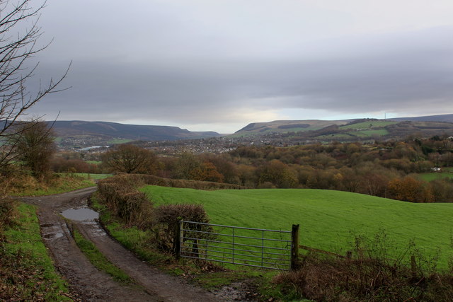
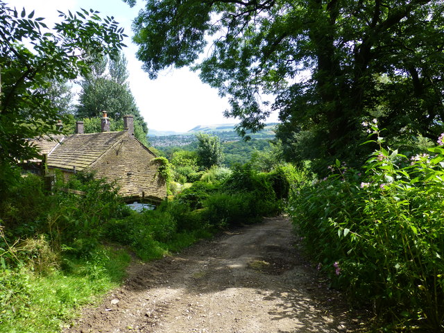
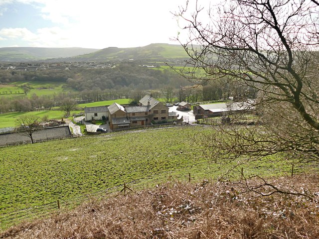
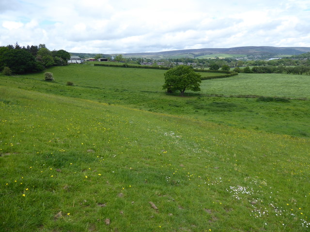
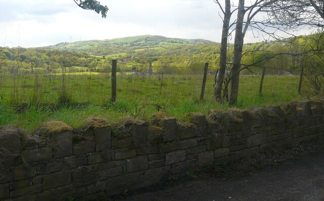
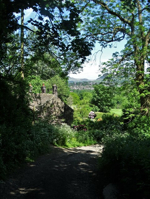
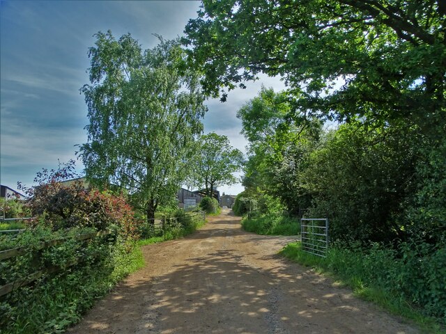
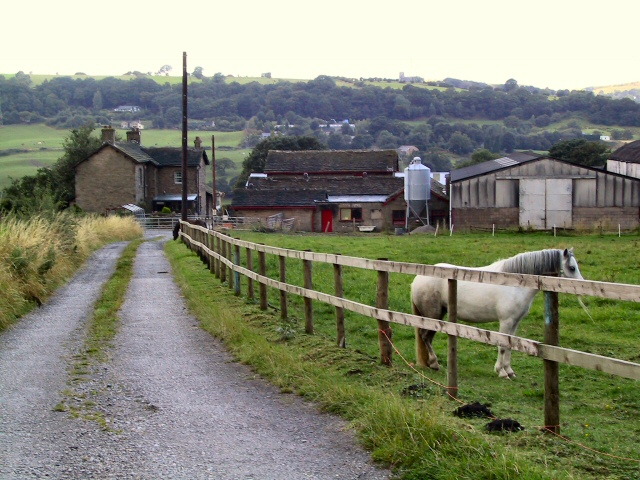
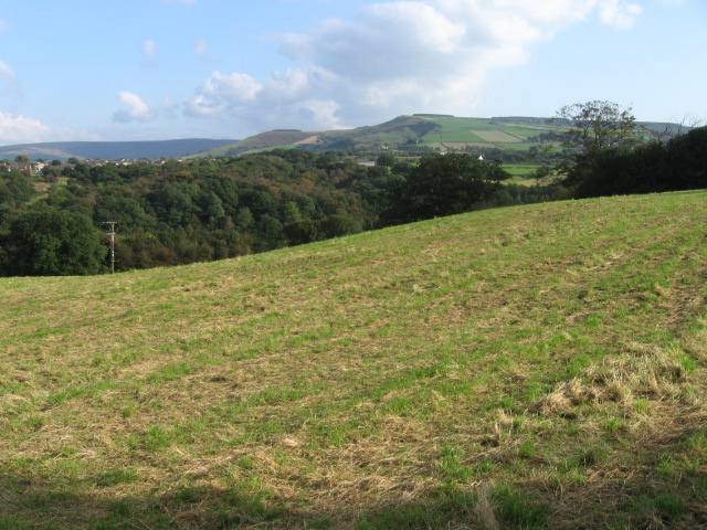
Hillend is a small village located in the county of Cheshire, England. Situated approximately 6 miles south of the town of Macclesfield, Hillend is known for its rural charm and picturesque surroundings. The village is set amidst rolling hills and beautiful countryside, providing residents and visitors with stunning views and a peaceful atmosphere.

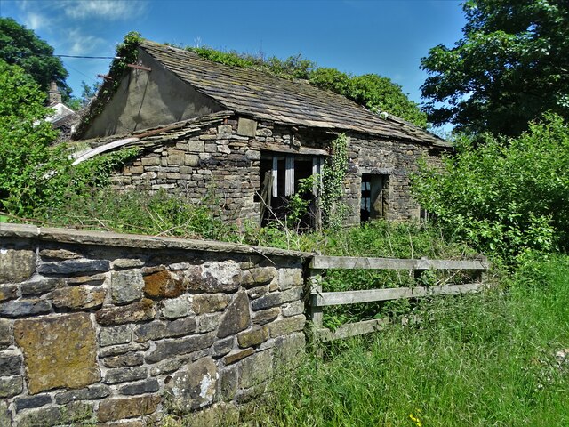
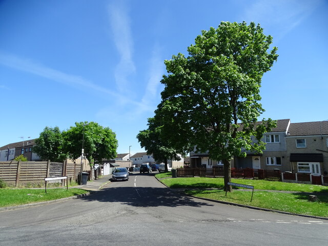
Hillend is home to a small but tight-knit community, with a population of around 200 people. The village is characterized by a mix of traditional stone-built cottages and modern houses, giving it a unique blend of old-world charm and contemporary living. The village is well-maintained, with neat gardens and clean streets contributing to its overall appeal.

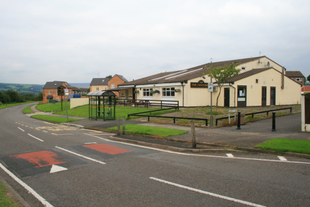
Despite its small size, Hillend offers a range of amenities to its residents. There is a local pub, The Hillend Arms, which serves as a social hub for the village and provides a warm and friendly environment for locals to gather. Additionally, there is a small convenience store that caters to the daily needs of the community.

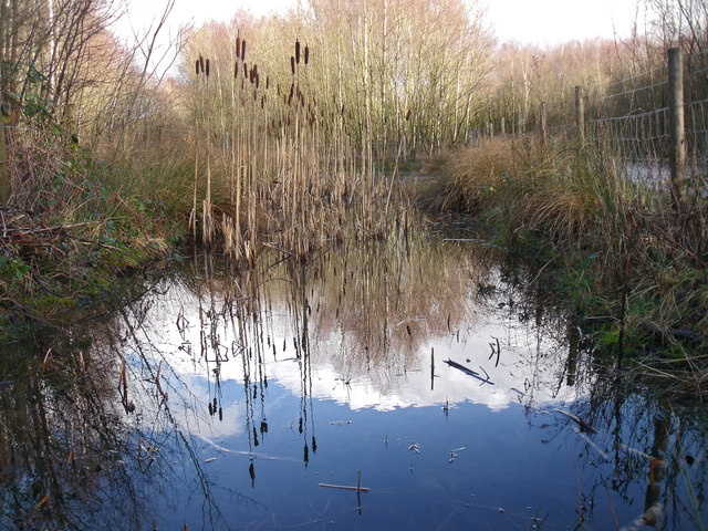
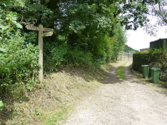
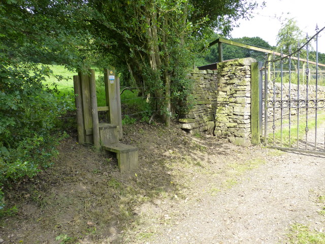
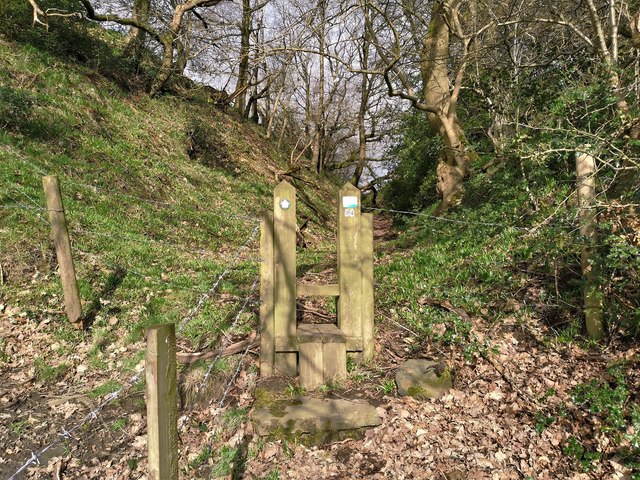
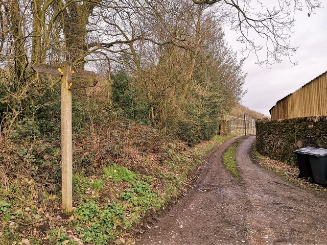
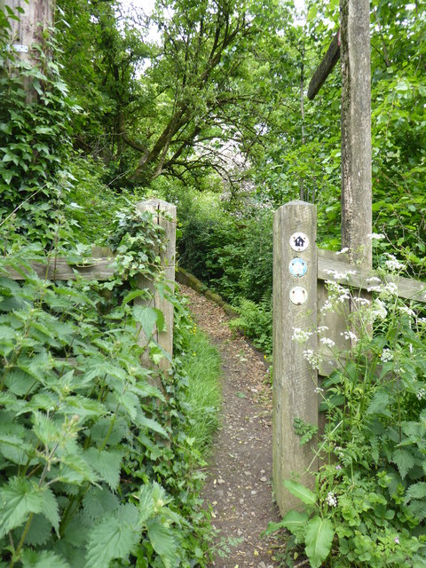
The surrounding countryside provides ample opportunities for outdoor activities. The nearby Peak District National Park offers breathtaking landscapes and is a popular destination for hiking, cycling, and nature enthusiasts. Hillend is also close to several walking trails and bridleways, allowing residents to explore the surrounding countryside at their leisure.

Overall, Hillend is a charming village that offers a tranquil and close-knit community, stunning natural scenery, and easy access to outdoor activities. It is a place where residents can enjoy the beauty of the countryside while still being within a short distance of larger towns and cities in Cheshire.

If you have any feedback on the listing, please let us know in the comments section below.

Hillend Images

Images are sourced within 2km of 53.446662/-2.0186309 or Grid Reference SJ9894. Thanks to Geograph Open Source API. All images are credited.

View South East from Hague End Pleasing view over the Etherow Valley towards the distant Dark Peak
View South East from Hague End
Pleasing view over the Etherow Valley towards the distant Dark Peak
Gamesley Woodlands (wildlife pond) Gamesley Woodlands runs alongside the Manchester to Glossop rail line, it was originally railway sidings which formed part of the Mottram and Dinting Marshalling Yard. When the sidings closed pioneer tree species appeared, recently a bridleway has been laid and this pond constructed for the benefit of the public.
Gamesley Woodlands (wildlife pond)
Gamesley Woodlands runs alongside the Manchester to Glossop rail line, it was originally railway sidings which formed part of the Mottram and Dinting Marshalling Yard. When the sidings closed pioneer tree species appeared, recently a bridleway has been laid and this pond constructed for the benefit of the public.
Hidden signpost near Pear Tree Farm The marker for the Etherow Goyt Valley Trail is on the left leading up stone steps. a large fingerpost is out of view marked Valley Way. The area is also marked on the map as The Hague, the manor house of this name is half a mile away.
Hidden signpost near Pear Tree Farm
The marker for the Etherow Goyt Valley Trail is on the left leading up stone steps. a large fingerpost is out of view marked Valley Way. The area is also marked on the map as The Hague, the manor house of this name is half a mile away.
Fingerpost at The Hague The way straight on towards the gate leads onto the path towards Woolley Bridge.
Fingerpost at The Hague
The way straight on towards the gate leads onto the path towards Woolley Bridge.
Parting of the ways at Pear Tree Farm The stole on the left leads onto the path for Mottram .The hidden unmarked bridleway for Woolley Bridge is beside the stone pillar next to the gate for Pear Tree Farm.
Parting of the ways at Pear Tree Farm
The stole on the left leads onto the path for Mottram .The hidden unmarked bridleway for Woolley Bridge is beside the stone pillar next to the gate for Pear Tree Farm.
Looking over the Etherow Valley On a public footpath from Mottram
Looking over the Etherow Valley
On a public footpath from Mottram
Stile on path from Gamesley to Mottram On an old hollow way from the hamlet of The Hague up to Mottram
Stile on path from Gamesley to Mottram
On an old hollow way from the hamlet of The Hague up to Mottram
Paths for Broadbottom, Woolley Bridge and Melandra Castle
The Pennine Bridleway interim route near The Hague
The Pennine Bridleway interim route near Carr House
Farmland off Long Lane, Charlesworth
Neglected farm building at the end of Hague Road
Cottage on Hague Road Near Pear Tree Farm
Cottage on Hague Road
Near Pear Tree Farm
Looking across Melandra Castle Road, Gamesley... ...to Grassmoor Crescent
Looking across Melandra Castle Road, Gamesley...
...to Grassmoor Crescent
Track to Carr House Farm
Robin Wood Farm buildings on the Transpennine Trail, at Robin Wood near Gamesley.
Robin Wood
Farm buildings on the Transpennine Trail, at Robin Wood near Gamesley.
The Centurion Estate pub on the outer road of the Gamesley estate.

Named thus because of the proximity to the roman fort at Melandra Castle which lies just to the north of the estate.

People from the central Manchester slum clearances were shipped out here to the fresh air of Derbyshire in the 1960's.  This had a dramatic affect on the nearby townships of Glossop and Hadfield.
The Centurion
Estate pub on the outer road of the Gamesley estate. Named thus because of the proximity to the roman fort at Melandra Castle which lies just to the north of the estate. People from the central Manchester slum clearances were shipped out here to the fresh air of Derbyshire in the 1960's. This had a dramatic affect on the nearby townships of Glossop and Hadfield.
Near The Hague
Near The Hague
Show me another place!

Hillend is located at Grid Ref: SJ9894 (Lat: 53.446662, Lng: -2.0186309)

Unitary Authority: Tameside

Police Authority: Greater Manchester

What 3 Words

///stays.autumn.tinned. Near Longdendale, Manchester

Related Wikis

Hattersley

Hattersley is an area of Tameside, Greater Manchester, England; it is located 4 miles (6.4 km) west of Glossop and 10 miles (16 km) east of Manchester...

Broadbottom

Broadbottom is a village in Tameside, Greater Manchester, England. Historically in Cheshire, it stands on the River Etherow which forms the border with...

Broadbottom railway station

Broadbottom railway station serves the village of Broadbottom in Greater Manchester, England. It is on the Manchester-Glossop Line, 10 miles (16 km) east...

St Michael and All Angels Church, Mottram

St Michael and All Angels Church stands on Warhill overlooking the village of Mottram in Longdendale, Greater Manchester, England. The church is recorded...

Nearby Amenities

Located within 500m of 53.446662,-2.0186309
Traffic Calming: hump
Lat/Long: 53.442231/-2.0197446
Traffic Calming: hump
Lat/Long: 53.4427481/-2.0195922
Power: tower
Lat/Long: 53.445739/-2.022613
Power: tower
Lat/Long: 53.4443189/-2.0245813
Barrier: stile
Bicycle: yes
Foot: yes
Horse: yes
Note: Have to lift your bike
Lat/Long: 53.4495453/-2.0170621
Turning Circle
Lat/Long: 53.4454451/-2.0219118
Addr Housename: The Wagon
Description: no longer a pub..private housing
Disused Amenity: pub
Lat/Long: 53.4490846/-2.0164932
Barrier: stile
Lat/Long: 53.444158/-2.0167372
Barrier: stile
Lat/Long: 53.448324/-2.0169467
Barrier: stile
Lat/Long: 53.4479654/-2.0162431
Barrier: stile
Lat/Long: 53.4476068/-2.0155722
Barrier: stile
Lat/Long: 53.4474764/-2.0153502
Barrier: stile
Lat/Long: 53.4474035/-2.0151427
Barrier: stile
Lat/Long: 53.4469949/-2.0144177
Barrier: stile
Lat/Long: 53.4474176/-2.0151106
Barrier: stile
Lat/Long: 53.4478741/-2.0145182
Barrier: stile
Lat/Long: 53.4492198/-2.0162281
Barrier: stile
Lat/Long: 53.4490955/-2.0148843
Barrier: stile
Lat/Long: 53.448906/-2.0133602
Barrier: stile
Lat/Long: 53.4490545/-2.0123671
Barrier: stile
Lat/Long: 53.4468693/-2.0142431
Power: tower
Lat/Long: 53.4489865/-2.0226971
Bus Stop
Broadbottom Road/Bucklow Close
Bus: yes
Naptan AtcoCode: 1800EH00881
Naptan Bearing: N
Naptan CommonName: Broadbottom Road/Bucklow Close
Naptan Indicator: Opp House 221
Naptan Landmark: OPP HOUSE 221
Naptan NaptanCode: manatwtj
Naptan PlusbusZoneRef: MNCRPIC
Naptan ShortCommonName: Bucklow Close
Naptan Street: Broadbottom Road
Naptan Verified: no
Network: TfGM
Public Transport: platform
Source: naptan_import
Lat/Long: 53.4471043/-2.01855
Bus Stop
Stockport Road/Beaufort Road
Bus: yes
Naptan AtcoCode: 1800EH37131
Naptan Bearing: N
Naptan CommonName: Stockport Road/Beaufort Road
Naptan Indicator: Nr Open Land
Naptan Landmark: NR OPEN LAND
Naptan NaptanCode: mandawtg
Naptan PlusbusZoneRef: MNCRPIC
Naptan ShortCommonName: Beaufort Road
Naptan Street: STOCKPORT ROAD
Naptan Verified: no
Network: TfGM
Public Transport: platform
Source: naptan_import
Lat/Long: 53.4479571/-2.0249346
Bus Stop
Clough End Road/Broadbent Grove
Bus: yes
Naptan AtcoCode: 1800EH37511
Naptan Bearing: SE
Naptan CommonName: Clough End Road/Broadbent Grove
Naptan Indicator: Opp House 1
Naptan Landmark: OPP HOUSE 1
Naptan NaptanCode: mandgapt
Naptan PlusbusZoneRef: MNCRPIC
Naptan ShortCommonName: Broadbent Grove
Naptan Street: Clough End Road
Naptan Verified: no
Network: TfGM
Public Transport: platform
Source: naptan_import
Lat/Long: 53.4468247/-2.0243015
Bus Stop
Clough End Road/Broadbent Grove
Bus: yes
Naptan AtcoCode: 1800EH37521
Naptan Bearing: NW
Naptan CommonName: Clough End Road/Broadbent Grove
Naptan Indicator: Nr House 8
Naptan Landmark: HOUSE 8
Naptan NaptanCode: mandgapw
Naptan PlusbusZoneRef: MNCRPIC
Naptan ShortCommonName: Broadbent Grove
Naptan Street: Clough End Road
Naptan Verified: no
Network: TfGM
Public Transport: platform
Source: naptan_import
Lat/Long: 53.4469055/-2.0247081
Bus Stop
Clough End Road/Primary School
Bus: yes
Naptan AtcoCode: 1800EH37531
Naptan Bearing: N
Naptan CommonName: Clough End Road/Primary School
Naptan Indicator: Opp House 27
Naptan Landmark: HOUSE 56
Naptan NaptanCode: mandgata
Naptan PlusbusZoneRef: MNCRPIC
Naptan ShortCommonName: Primary School
Naptan Street: Clough End Road
Naptan Verified: no
Network: TfGM
Public Transport: platform
Source: naptan_import
Lat/Long: 53.4452787/-2.0237887
Bus Stop
Clough End Road/Primary School
Bus: yes
Naptan AtcoCode: 1800EH37541
Naptan Bearing: S
Naptan CommonName: Clough End Road/Primary School
Naptan Indicator: Grassland
Naptan Landmark: GRASSLAND
Naptan NaptanCode: mandgatd
Naptan PlusbusZoneRef: MNCRPIC
Naptan ShortCommonName: Primary School
Naptan Street: Clough End Road
Naptan Verified: no
Network: TfGM
Public Transport: platform
Source: naptan_import
Lat/Long: 53.4447663/-2.0238938
Bus Stop
Broadbottom Road/The Waggon
Bus: yes
Naptan AtcoCode: 1800EH48661
Naptan Bearing: S
Naptan CommonName: Broadbottom Road/The Waggon
Naptan Indicator: The Wagon
Naptan Landmark: HOUSE 195
Naptan NaptanCode: mandjdwj
Naptan PlusbusZoneRef: MNCRPIC
Naptan ShortCommonName: The Waggon
Naptan Street: Broadbottom Road
Naptan Verified: no
Network: TfGM
Public Transport: platform
Source: naptan_import
Lat/Long: 53.4488304/-2.0168342
Bus Stop
Broadbottom Road/The Waggon
Bus: yes
Naptan AtcoCode: 1800EH48671
Naptan Bearing: N
Naptan CommonName: Broadbottom Road/The Waggon
Naptan Indicator: The Wagon Opp
Naptan Landmark: WILMSLOW Avenue
Naptan NaptanCode: mandjdwm
Naptan PlusbusZoneRef: MNCRPIC
Naptan ShortCommonName: The Waggon
Naptan Street: Broadbottom Road
Naptan Verified: no
Network: TfGM
Public Transport: platform
Source: naptan_import
Lat/Long: 53.4487675/-2.01706
Bus Stop
Broadbottom Road/Bucklow Close
Bench: no
Bus: yes
Naptan AtcoCode: 1800EH48681
Naptan Bearing: S
Naptan CommonName: Broadbottom Road/Bucklow Close
Naptan Indicator: O/s House 223
Naptan Landmark: HOUSE 223
Naptan NaptanCode: mandjdwp
Naptan PlusbusZoneRef: MNCRPIC
Naptan ShortCommonName: Bucklow Close
Naptan Street: Broadbottom Road
Naptan Verified: no
Network: TfGM
Public Transport: platform
Shelter: no
Source: naptan_import
Lat/Long: 53.4470235/-2.0184295
Bus Stop
Broadbottom Road/Woodlands Close
Bus: yes
Naptan AtcoCode: 1800EH48691
Naptan Bearing: N
Naptan CommonName: Broadbottom Road/Woodlands Close
Naptan Indicator: Non Stand Shelt
Naptan Landmark: HOUSE 266
Naptan NaptanCode: mandjdwt
Naptan PlusbusZoneRef: MNCRPIC
Naptan ShortCommonName: Woodlands Close
Naptan Street: Broadbottom Road
Naptan Verified: no
Network: TfGM
Public Transport: platform
Source: naptan_import
Lat/Long: 53.4448931/-2.0186695
Bus Stop
Broadbottom Road/Woodlands Close
Bus: yes
Naptan AtcoCode: 1800EH48701
Naptan Bearing: S
Naptan CommonName: Broadbottom Road/Woodlands Close
Naptan Indicator: O/s House 263
Naptan Landmark: HOUSE 263
Naptan NaptanCode: mandjgad
Naptan PlusbusZoneRef: MNCRPIC
Naptan ShortCommonName: Woodlands Close
Naptan Street: Broadbottom Road
Naptan Verified: no
Network: TfGM
Public Transport: platform
Source: naptan_import
Lat/Long: 53.4448572/-2.0185189
Bus Stop
Mottram Road/Cricket Ground
Bus: yes
Naptan AtcoCode: 1800EH48711
Naptan Bearing: N
Naptan CommonName: Mottram Road/Cricket Ground
Naptan Indicator: Opp Cricket Fld
Naptan Landmark: Cricket Ground
Naptan NaptanCode: mandjgag
Naptan PlusbusZoneRef: MNCRPIC
Naptan ShortCommonName: Cricket Ground
Naptan Street: Mottram Road
Naptan Verified: no
Network: TfGM
Public Transport: platform
Source: naptan_import
Lat/Long: 53.4430143/-2.0194816
Bus Stop
Mottram Road/Cricket Ground
Bus: yes
Naptan AtcoCode: 1800EH48721
Naptan Bearing: S
Naptan CommonName: Mottram Road/Cricket Ground
Naptan Indicator: O/s Cricket Fld
Naptan Landmark: Cricket Ground
Naptan NaptanCode: mandjgaj
Naptan PlusbusZoneRef: MNCRPIC
Naptan ShortCommonName: Cricket Ground
Naptan Street: Mottram Road
Naptan Verified: no
Network: TfGM
Public Transport: platform
Source: naptan_import
Lat/Long: 53.4425199/-2.0196169
Barrier: cycle_barrier
Lat/Long: 53.4499514/-2.0210912
Generator Method: photovoltaic
Generator Output Electricity: yes
Generator Source: solar
Generator Type: solar_photovoltaic_panel
Location: roof
Power: generator
Lat/Long: 53.4435945/-2.024009
Generator Method: photovoltaic
Generator Output Electricity: yes
Generator Source: solar
Generator Type: solar_photovoltaic_panel
Location: roof
Power: generator
Lat/Long: 53.4437383/-2.0237059
Generator Method: photovoltaic
Generator Output Electricity: yes
Generator Source: solar
Generator Type: solar_photovoltaic_panel
Location: roof
Power: generator
Lat/Long: 53.4436297/-2.0238025
Generator Method: photovoltaic
Generator Output Electricity: yes
Generator Source: solar
Generator Type: solar_photovoltaic_panel
Location: roof
Power: generator
Lat/Long: 53.4437511/-2.0235986
Generator Method: photovoltaic
Generator Output Electricity: yes
Generator Source: solar
Generator Type: solar_photovoltaic_panel
Location: roof
Power: generator
Lat/Long: 53.444859/-2.0242987
Generator Method: photovoltaic
Generator Output Electricity: yes
Generator Source: solar
Generator Type: solar_photovoltaic_panel
Location: roof
Power: generator
Lat/Long: 53.4451194/-2.02419
Generator Method: photovoltaic
Generator Output Electricity: yes
Generator Source: solar
Generator Type: solar_photovoltaic_panel
Location: roof
Power: generator
Lat/Long: 53.4451321/-2.0242759
Generator Method: photovoltaic
Generator Output Electricity: yes
Generator Source: solar
Generator Type: solar_photovoltaic_panel
Location: roof
Power: generator
Lat/Long: 53.4451505/-2.0244355
Generator Method: photovoltaic
Generator Output Electricity: yes
Generator Source: solar
Generator Type: solar_photovoltaic_panel
Location: roof
Power: generator
Lat/Long: 53.4451433/-2.0246474
Generator Method: photovoltaic
Generator Output Electricity: yes
Generator Source: solar
Generator Type: solar_photovoltaic_panel
Location: roof
Power: generator
Lat/Long: 53.4451273/-2.0247667
Generator Method: photovoltaic
Generator Output Electricity: yes
Generator Source: solar
Generator Type: solar_photovoltaic_panel
Location: roof
Power: generator
Lat/Long: 53.4464668/-2.0244918
Generator Method: photovoltaic
Generator Output Electricity: yes
Generator Source: solar
Generator Type: solar_photovoltaic_panel
Location: roof
Power: generator
Lat/Long: 53.4469525/-2.0241994
Generator Method: photovoltaic
Generator Output Electricity: yes
Generator Source: solar
Generator Type: solar_photovoltaic_panel
Location: roof
Power: generator
Lat/Long: 53.450414/-2.015965
Bench
Backrest: yes
Lat/Long: 53.4431419/-2.0194176
Leisure: playground
Lat/Long: 53.4428826/-2.0191704
The data included in this document is from www.openstreetmap.org. The data is made available under ODbL.

Have you been to Hillend?

Leave your review of Hillend below (or comments, questions and feedback).