Hurstclough

Settlement in Cheshire

England

Hurstclough

Mass Vaccination Site (Tameside) As we approach the second winter of this Coronavirus era people are being given injections for Flu and Covid-19 at this Tameside vaccination site. This area was formerly the car park for British Gas who have moved to Stockport from this site on Hattersley Industrial Estate.
Mass Vaccination Site (Tameside) Credit: Stephen Burton

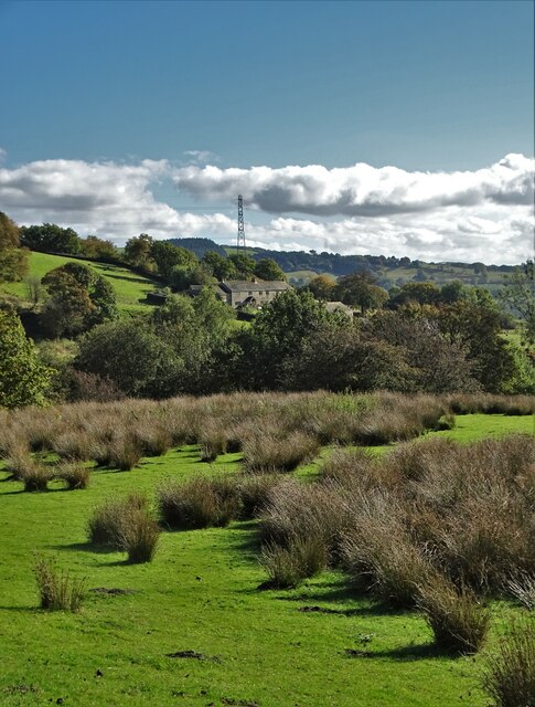
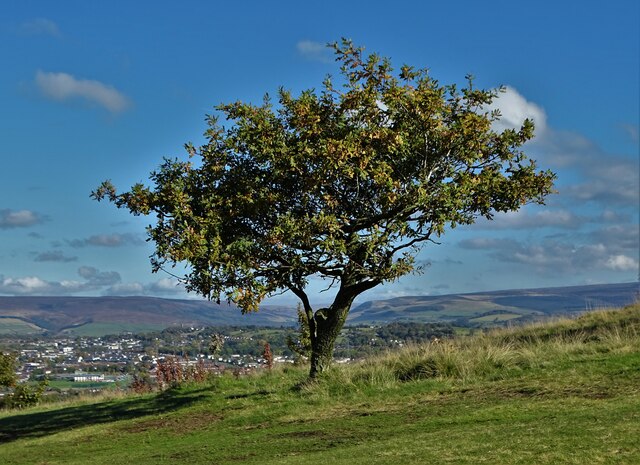
Hurstclough is a small village located in the county of Cheshire, England. Situated in the picturesque countryside, it is surrounded by rolling hills and lush green landscapes, offering residents and visitors a peaceful and serene environment.

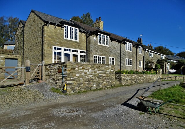
The village is known for its charming and traditional architecture, with many houses dating back to the 19th century. The stone-built cottages and farmhouses add to the village's rustic appeal. The community in Hurstclough is close-knit, creating a friendly and welcoming atmosphere for all who visit.

Despite its small size, Hurstclough offers various amenities to its residents. The village boasts a local pub, where locals and visitors can enjoy a drink or a traditional meal. Additionally, there is a small convenience store that caters to the basic needs of the community.

For those seeking outdoor activities, Hurstclough is a perfect destination. The surrounding countryside provides ample opportunities for hiking, cycling, and exploring nature. The village is also in close proximity to several nature reserves and parks, allowing residents to enjoy the beauty of the Cheshire countryside.

Although Hurstclough is a quiet village, it benefits from its proximity to larger towns and cities. The nearby town of Macclesfield offers a wider range of amenities, including shopping centers, restaurants, and entertainment venues. The village is also well-connected to the rest of Cheshire via the road network, making it easily accessible for commuters and travelers.

In summary, Hurstclough is a charming and idyllic village in Cheshire, offering a tranquil setting, a close-knit community, and a range of outdoor activities for residents and visitors to enjoy.

If you have any feedback on the listing, please let us know in the comments section below.
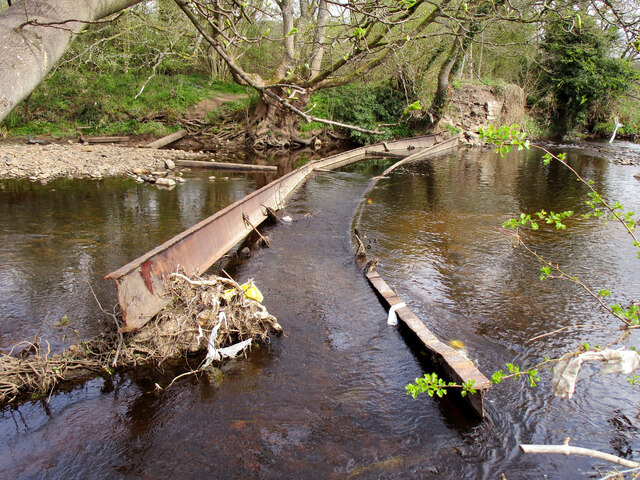
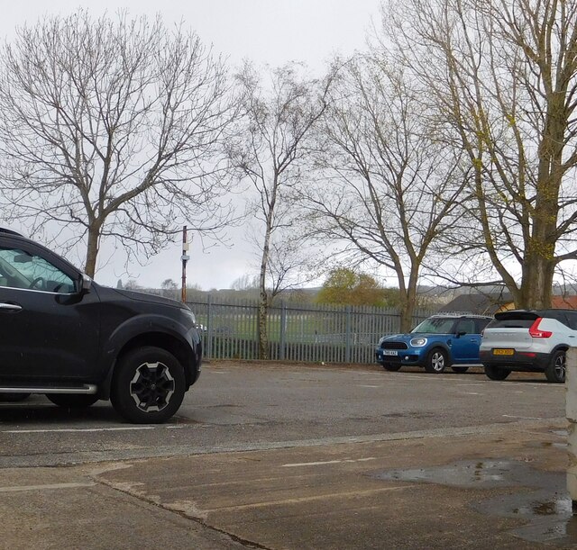
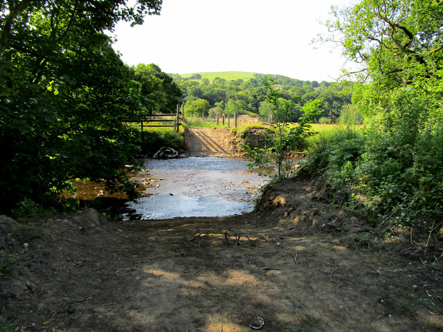
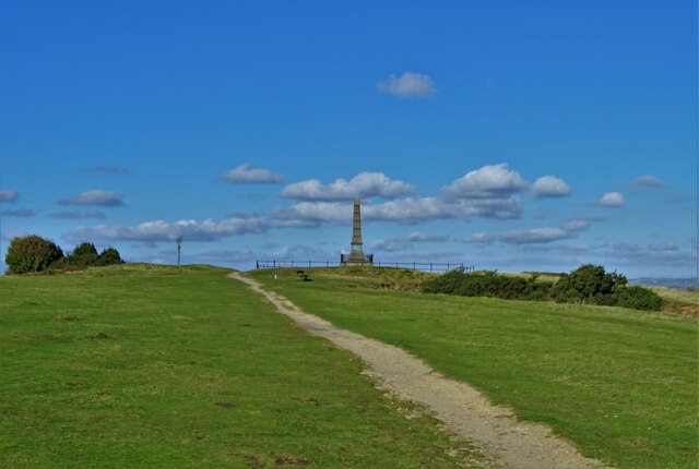
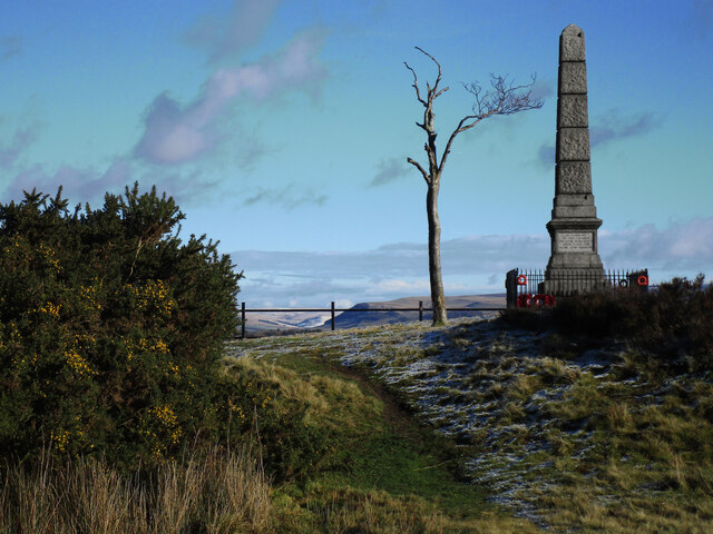
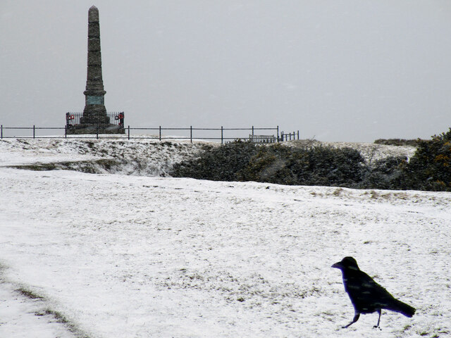
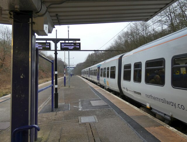
Hurstclough Images

Images are sourced within 2km of 53.442767/-2.0315763 or Grid Reference SJ9894. Thanks to Geograph Open Source API. All images are credited.

Mass Vaccination Site (Tameside) As we approach the second winter of this Coronavirus era people are being given injections for Flu and Covid-19 at this Tameside vaccination site. This area was formerly the car park for British Gas who have moved to Stockport from this site on Hattersley Industrial Estate.
Mass Vaccination Site (Tameside)
As we approach the second winter of this Coronavirus era people are being given injections for Flu and Covid-19 at this Tameside vaccination site. This area was formerly the car park for British Gas who have moved to Stockport from this site on Hattersley Industrial Estate.
Hyde Cenotaph Hyde War Memorial remembers the people who gave their lives for our country. This photograph was taken on Remembrance Say 2021.
Hyde Cenotaph
Hyde War Memorial remembers the people who gave their lives for our country. This photograph was taken on Remembrance Say 2021.
Water Trailer These fields at a higher level have no ponds or streams, the farmer's work includes filling and transporting water barrels to keep his stock watered. The hills of the Dark Peak can be seen in the distance.
Water Trailer
These fields at a higher level have no ponds or streams, the farmer's work includes filling and transporting water barrels to keep his stock watered. The hills of the Dark Peak can be seen in the distance.
Hattersley Science and Technology Park Trees were felled and the land was cleared in July 2021 but since then no progress has been made on the construction of the Science Park. View of the site in 2021 <a title="https://www.geograph.org.uk/photo/6893918" href="https://www.geograph.org.uk/photo/6893918">Link</a>
Hattersley Science and Technology Park
Trees were felled and the land was cleared in July 2021 but since then no progress has been made on the construction of the Science Park. View of the site in 2021 Link
Unsafe Bridge For about the last ten years this bridge has been closed to walkers with a sign telling "Unsafe Bridge" I for one ignored the sign but the authorities have been proved right with the bridge washing away over winter. <a title="https://www.geograph.org.uk/photo/6082029" href="https://www.geograph.org.uk/photo/6082029">Link</a>
Unsafe Bridge
For about the last ten years this bridge has been closed to walkers with a sign telling "Unsafe Bridge" I for one ignored the sign but the authorities have been proved right with the bridge washing away over winter. Link
British Gas Depot car park 
The site on the Hattersley Industrial Estate was being used as a drive-in centre for the administration of Covid vaccine boosters.
British Gas Depot car park
The site on the Hattersley Industrial Estate was being used as a drive-in centre for the administration of Covid vaccine boosters.
Ford across the River Etherow Following the destruction of the bridge <a title="https://www.geograph.org.uk/photo/6367523" href="https://www.geograph.org.uk/photo/6367523">Link</a> in winter 2021/22 a ford now gives access to the grazing meadows on the far bank of the river.
Ford across the River Etherow
Following the destruction of the bridge Link in winter 2021/22 a ford now gives access to the grazing meadows on the far bank of the river.
View to cottages on Mount Road From Near Cloughside
View to cottages on Mount Road
From Near Cloughside
Uplands Farm
Uplands Farm
Golf course tree With a view to Hattersley and Longdendale
Golf course tree
With a view to Hattersley and Longdendale
Hyde War Memorial, Werneth Low
"IN HONOUR OF THE 710 MEN..." Detail of Hyde War Memorial in Werneth Low Country Park. This face of the memorial refers to World War One.
"IN HONOUR OF THE 710 MEN..."
Detail of Hyde War Memorial in Werneth Low Country Park. This face of the memorial refers to World War One.
Approaching The War Memorial Hyde War Memorial, in Werneth Low Country Park, overlooks the town - now part of Greater Manchester.
Approaching The War Memorial
Hyde War Memorial, in Werneth Low Country Park, overlooks the town - now part of Greater Manchester.
View to Manchester city centre From Werneth Low Golf Course
View to Manchester city centre
From Werneth Low Golf Course
Hyde War Memorial
Hyde War Memorial
Hyde War Memorial
Hyde War Memorial
Hattersley Station 
The Northern service to Manchester Piccadilly is just about to depart.
Hattersley Station
The Northern service to Manchester Piccadilly is just about to depart.
Hattersley Station EMU 323225 leaving Hattersley for Manchester Piccadilly.
Hattersley Station
EMU 323225 leaving Hattersley for Manchester Piccadilly.
Show me another place!

Hurstclough is located at Grid Ref: SJ9894 (Lat: 53.442767, Lng: -2.0315763)

Unitary Authority: Tameside

Police Authority: Greater Manchester

What 3 Words

///condensed.chiefs.baths. Near Longdendale, Manchester

Related Wikis

Hattersley railway station

Hattersley railway station serves the Hattersley housing estate in Tameside, Greater Manchester, England. The station is 9 miles (14 km) east of Manchester...

Hattersley

Hattersley is an area of Tameside, Greater Manchester, England; it is located 4 miles (6.4 km) west of Glossop and 10 miles (16 km) east of Manchester...

Broadbottom

Broadbottom is a village in Tameside, Greater Manchester, England. Historically in Cheshire, it stands on the River Etherow which forms the border with...

Broadbottom railway station

Broadbottom railway station serves the village of Broadbottom in Greater Manchester, England. It is on the Manchester-Glossop Line, 10 miles (16 km) east...

Nearby Amenities

Located within 500m of 53.442767,-2.0315763
Power: tower
Lat/Long: 53.4443189/-2.0245813
Barrier: cattle_grid
Lat/Long: 53.4413032/-2.0315072
Bus Stop
Clough End Road/Chapman Arms
Bus: yes
Naptan AtcoCode: 1800EH37551
Naptan Bearing: NW
Naptan CommonName: Clough End Road/Chapman Arms
Naptan Indicator: Opp House 90
Naptan Landmark: HOUSE 73
Naptan NaptanCode: mandgatg
Naptan PlusbusZoneRef: MNCRPIC
Naptan ShortCommonName: Chapman Arms
Naptan Street: Clough End Road
Naptan Verified: no
Network: TfGM
Public Transport: platform
Source: naptan_import
Lat/Long: 53.4438757/-2.0274314
Bus Stop
Clough End Road/Chapman Arms
Bus: yes
Naptan AtcoCode: 1800EH37561
Naptan Bearing: SE
Naptan CommonName: Clough End Road/Chapman Arms
Naptan Indicator: Chapman Arms
Naptan Landmark: CHAPMAN ARMS
Naptan NaptanCode: mandgatj
Naptan PlusbusZoneRef: MNCRPIC
Naptan ShortCommonName: Chapman Arms
Naptan Street: Clough End Road
Naptan Verified: no
Network: TfGM
Public Transport: platform
Source: naptan_import
Lat/Long: 53.444271/-2.0281393
Bus Stop
Hattersley, Hattersley Road West / opposite Sandy Bank Avenue
Bus: yes
Naptan AtcoCode: 1800EH37751
Naptan Bearing: E
Naptan CommonName: Hattersley Road West/Sandy Bank Avenue
Naptan Indicator: Nr Grass Land
Naptan Landmark: NR GRASS LAND
Naptan NaptanCode: mandgdgd
Naptan PlusbusZoneRef: MNCRPIC
Naptan ShortCommonName: Sandy Bank Avenue
Naptan Street: Hattersley Road West
Naptan Verified: no
Network: TfGM
Operator: TfGM
Public Transport: platform
Source: naptan_import
Lat/Long: 53.4455193/-2.0326269
Bus Stop
Hattersley, Hattersley Road West / near Sandy Bank Avenue
Bus: yes
Naptan AtcoCode: 1800EH37761
Naptan Bearing: W
Naptan CommonName: Hattersley Road West/Sandy Bank Avenue
Naptan Indicator: O/s House 228
Naptan Landmark: HOUSE 228
Naptan NaptanCode: mandgdgj
Naptan PlusbusZoneRef: MNCRPIC
Naptan ShortCommonName: Sandy Bank Avenue
Naptan Street: Hattersley Road W
Naptan Verified: no
Network: TfGM
Operator: TfGM
Public Transport: platform
Source: naptan_import
Lat/Long: 53.4453302/-2.0338162
Bus Stop
Hattersley, Hattersley Road West / Beaver Walk (Stop D)
Bus: yes
Local Ref: D
Naptan AtcoCode: 1800EH37771
Naptan Bearing: E
Naptan CommonName: Hattersley Rd West/Beaver Walk (Stop D)
Naptan Indicator: Stop D
Naptan Landmark: FLATS
Naptan NaptanCode: mandgdgm
Naptan PlusbusZoneRef: MNCRPIC
Naptan ShortCommonName: Beaver Walk
Naptan Street: Hattersley Road W
Naptan Verified: no
Network: TfGM
Operator: TfGM
Public Transport: platform
Ref: D
Source: naptan_import
Lat/Long: 53.445842/-2.035804
Bus Stop
Chapman Road/Hattersley Road East
Bus: yes
Naptan AtcoCode: 1800EH37781
Naptan Bearing: NW
Naptan CommonName: Chapman Road/Hattersley Road East
Naptan Indicator: O/s House 1
Naptan Landmark: O/S HOUSE 1
Naptan NaptanCode: mandgdgp
Naptan PlusbusZoneRef: MNCRPIC
Naptan ShortCommonName: Hattersley Rd E
Naptan Street: CHAPMAN ROAD
Naptan Verified: no
Network: TfGM
Public Transport: platform
Source: naptan_import
Lat/Long: 53.4454928/-2.0310309
Bus Stop
Chapman Road/Hattersley Road East
Bus: yes
Naptan AtcoCode: 1800EH37791
Naptan Bearing: SE
Naptan CommonName: Chapman Road/Hattersley Road East
Naptan Indicator: O/s House 29
Naptan Landmark: HOUSE 29
Naptan NaptanCode: mandgdgt
Naptan PlusbusZoneRef: MNCRPIC
Naptan ShortCommonName: Hattersley Rd E
Naptan Street: CHAPMAN ROAD
Naptan Verified: no
Network: TfGM
Public Transport: platform
Source: naptan_import
Lat/Long: 53.44534/-2.0306845
Bus Stop
Chapman Road/Stockport Road
Bus: yes
Naptan AtcoCode: 1800EH37801
Naptan Bearing: NW
Naptan CommonName: Chapman Road/Stockport Road
Naptan Indicator: Non Stand Shelt
Naptan Landmark: HOUSE 8
Naptan NaptanCode: mandgdgw
Naptan PlusbusZoneRef: MNCRPIC
Naptan ShortCommonName: Stockport Road
Naptan Street: CHAPMAN ROAD
Naptan Verified: no
Network: TfGM
Public Transport: platform
Source: naptan_import
Lat/Long: 53.4445494/-2.0291482
Bus Stop
Hattersley, Hattersley Road East / near Chapman Road
Bus: yes
Naptan AtcoCode: 1800EH37811
Naptan Bearing: SW
Naptan CommonName: Hattersley Road East/Chapman Road
Naptan Indicator: Opp School
Naptan Landmark: HOUSE 2
Naptan NaptanCode: mandgdja
Naptan PlusbusZoneRef: MNCRPIC
Naptan ShortCommonName: Chapman Road
Naptan Street: Hattersley Road E
Naptan Verified: no
Network: TfGM
Operator: TfGM
Public Transport: platform
Source: naptan_import
Lat/Long: 53.4460951/-2.0306248
Bus Stop
Hattersley, Hattersley Road East / outside Pinfold School
Bus: yes
Naptan AtcoCode: 1800EH37821
Naptan Bearing: NE
Naptan CommonName: Hattersley Road East/Pinfold School
Naptan Indicator: Pinfold School
Naptan Landmark: PINFOLD SCHOOL
Naptan NaptanCode: mandgdjd
Naptan PlusbusZoneRef: MNCRPIC
Naptan ShortCommonName: Pinfold School
Naptan Street: Hattersley Road E
Naptan Verified: no
Network: TfGM
Operator: TfGM
Public Transport: platform
Source: naptan_import
Lat/Long: 53.446185/-2.0307152
Bus Stop
Mottram Old Road/Apple Street
Bus: yes
Naptan AtcoCode: 1800EH37111
Naptan Bearing: W
Naptan CommonName: Mottram Old Road/Apple Street
Naptan Indicator: Nr Grass Land
Naptan Landmark: NR GRASS LAND
Naptan NaptanCode: mandawta
Naptan PlusbusZoneRef: MNCRPIC
Naptan ShortCommonName: Apple Street
Naptan Street: Mottram Old Road
Naptan Verified: no
Network: TfGM
Public Transport: platform
Source: naptan_import
Lat/Long: 53.4419504/-2.0339641
Bus Stop
Mottram Old Road/Apple Street
Bus: yes
Naptan AtcoCode: 1800EH37121
Naptan Bearing: E
Naptan CommonName: Mottram Old Road/Apple Street
Naptan Indicator: Openland
Naptan Landmark: OPENLAND
Naptan NaptanCode: mandawtd
Naptan PlusbusZoneRef: MNCRPIC
Naptan ShortCommonName: Apple Street
Naptan Street: Mottram Old Road
Naptan Verified: no
Network: TfGM
Public Transport: platform
Source: naptan_import
Lat/Long: 53.4418692/-2.0348221
Power: tower
Lat/Long: 53.4416951/-2.0282754
Power: tower
Lat/Long: 53.4391552/-2.0318513
Generator Method: photovoltaic
Generator Output Electricity: yes
Generator Source: solar
Generator Type: solar_photovoltaic_panel
Location: roof
Power: generator
Lat/Long: 53.4441425/-2.0346493
Generator Method: photovoltaic
Generator Output Electricity: yes
Generator Source: solar
Generator Type: solar_photovoltaic_panel
Location: roof
Power: generator
Lat/Long: 53.4444923/-2.0349658
Generator Method: photovoltaic
Generator Output Electricity: yes
Generator Source: solar
Generator Type: solar_photovoltaic_panel
Location: roof
Power: generator
Lat/Long: 53.4445147/-2.0353226
Generator Method: photovoltaic
Generator Output Electricity: yes
Generator Source: solar
Generator Type: solar_photovoltaic_panel
Location: roof
Power: generator
Lat/Long: 53.4445259/-2.0354325
Generator Method: photovoltaic
Generator Output Electricity: yes
Generator Source: solar
Generator Type: solar_photovoltaic_panel
Location: roof
Power: generator
Lat/Long: 53.4445371/-2.0355398
Generator Method: photovoltaic
Generator Output Electricity: yes
Generator Source: solar
Generator Type: solar_photovoltaic_panel
Location: roof
Power: generator
Lat/Long: 53.4450243/-2.0353467
Generator Method: photovoltaic
Generator Output Electricity: yes
Generator Source: solar
Generator Type: solar_photovoltaic_panel
Location: roof
Power: generator
Lat/Long: 53.4461266/-2.0277748
Generator Method: photovoltaic
Generator Output Electricity: yes
Generator Source: solar
Generator Type: solar_photovoltaic_panel
Location: roof
Power: generator
Lat/Long: 53.4459365/-2.0278097
Generator Method: photovoltaic
Generator Output Electricity: yes
Generator Source: solar
Generator Type: solar_photovoltaic_panel
Location: roof
Power: generator
Lat/Long: 53.4456969/-2.0290918
Generator Method: photovoltaic
Generator Output Electricity: yes
Generator Source: solar
Generator Type: solar_photovoltaic_panel
Location: roof
Power: generator
Lat/Long: 53.4454221/-2.0288209
Generator Method: photovoltaic
Generator Output Electricity: yes
Generator Source: solar
Generator Type: solar_photovoltaic_panel
Location: roof
Power: generator
Lat/Long: 53.4432287/-2.0289577
Generator Method: photovoltaic
Generator Output Electricity: yes
Generator Source: solar
Generator Type: solar_photovoltaic_panel
Location: roof
Power: generator
Lat/Long: 53.4427798/-2.0289362
Generator Method: photovoltaic
Generator Output Electricity: yes
Generator Source: solar
Generator Type: solar_photovoltaic_panel
Location: roof
Power: generator
Lat/Long: 53.4423388/-2.0289308
Generator Method: photovoltaic
Generator Output Electricity: yes
Generator Source: solar
Generator Type: solar_photovoltaic_panel
Location: roof
Power: generator
Lat/Long: 53.4422957/-2.0284883
Generator Method: photovoltaic
Generator Output Electricity: yes
Generator Source: solar
Generator Type: solar_photovoltaic_panel
Location: roof
Power: generator
Lat/Long: 53.4424746/-2.0285097
Generator Method: photovoltaic
Generator Output Electricity: yes
Generator Source: solar
Generator Type: solar_photovoltaic_panel
Location: roof
Power: generator
Lat/Long: 53.4439939/-2.0273296
Note: These paths on the green seem invisible at ground level.
Lat/Long: 53.44431/-2.0330179
The data included in this document is from www.openstreetmap.org. The data is made available under ODbL.

Have you been to Hurstclough?

Leave your review of Hurstclough below (or comments, questions and feedback).