Hurstbourne Tarrant

Settlement in Hampshire Test Valley

England

Hurstbourne Tarrant

River Swift at Hurstbourne Tarrant Completely without water at the end of August.
River Swift at Hurstbourne Tarrant Credit: David Martin

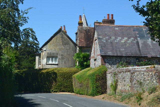
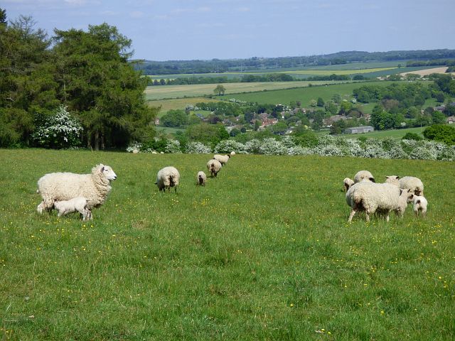
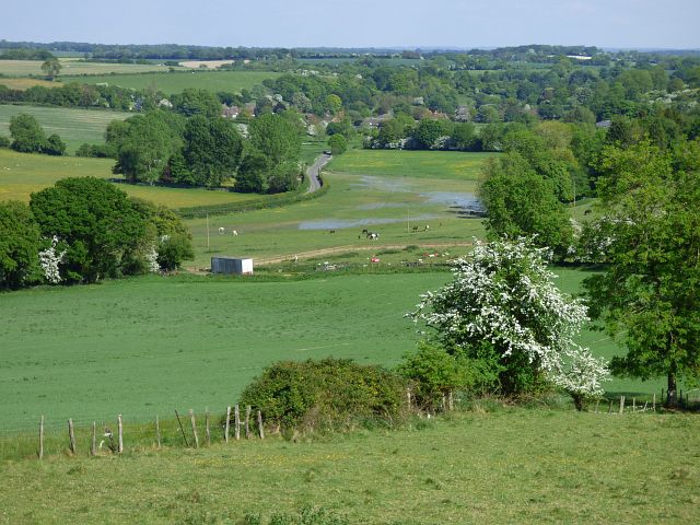
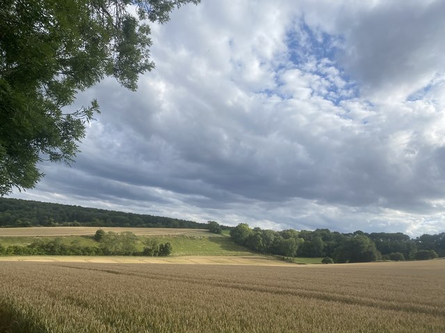
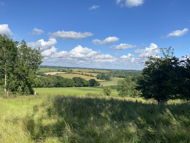
Hurstbourne Tarrant is a picturesque village located in the Test Valley district of Hampshire, England. Situated on the western edge of the North Wessex Downs Area of Outstanding Natural Beauty, it offers a stunning rural setting with rolling hills, charming countryside views, and a tranquil atmosphere.

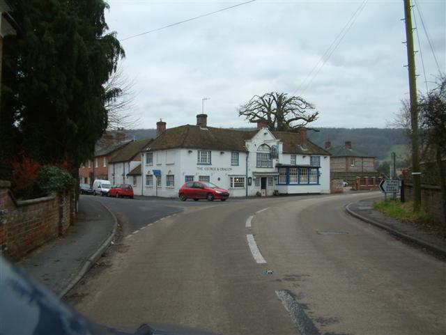
The village is home to approximately 700 residents and has a rich history dating back to the Domesday Book of 1086. It boasts a beautiful 12th-century church, St Peter's, which is a prominent architectural feature. The church is known for its iconic bell tower and intricate stained glass windows.

Hurstbourne Tarrant is surrounded by lush green fields and ancient woodlands, making it a perfect destination for nature enthusiasts. The area is known for its diverse wildlife and offers numerous walking trails, including the Test Way, which passes through the village, providing an opportunity to explore the surrounding countryside.

Despite its small size, the village has a strong sense of community and offers a range of amenities including a village hall, local pub, and a primary school. The community organizes various events throughout the year, such as the annual village fete and the Christmas market, fostering a sense of togetherness among residents.

With its idyllic setting and close proximity to the cities of Winchester and Basingstoke, Hurstbourne Tarrant is a popular destination for those seeking a peaceful countryside retreat while still enjoying convenient access to urban amenities.

If you have any feedback on the listing, please let us know in the comments section below.

Hurstbourne Tarrant Images

Images are sourced within 2km of 51.278957/-1.454465 or Grid Reference SU3853. Thanks to Geograph Open Source API. All images are credited.

River Swift at Hurstbourne Tarrant Completely without water at the end of August.
River Swift at Hurstbourne Tarrant
Completely without water at the end of August.
George and Dragon, Hurstbourne Tarrant
St Peter's church, Hurstbourne Tarrant
Primary School, Hurstbourne Tarrant
A343 descending towards Hurstbourne Tarrant
Entering Hurstbourne Tarrant on Stoke Road
Track and barn, Hurstbourne Tarrant The Test Way above Ibthorpe as in <a title="https://www.geograph.org.uk/photo/1790469" href="https://www.geograph.org.uk/photo/1790469">Link</a> .
Track and barn, Hurstbourne Tarrant
The Test Way above Ibthorpe as in Link .
Restricted byway, Hurstbourne Tarrant The Test Way above Ibthorpe.
Restricted byway, Hurstbourne Tarrant
The Test Way above Ibthorpe.
Farmland, Hurstbourne Tarrant A spring-sown cereal crop beside a footpath off the B3048.
Farmland, Hurstbourne Tarrant
A spring-sown cereal crop beside a footpath off the B3048.
Farmland, Hurstbourne Tarrant The A343 passes between the two fields.
Farmland, Hurstbourne Tarrant
The A343 passes between the two fields.
Pasture, Hurstbourne Tarrant Ewes and lambs beside Locke's Drove with Ibthorpe in the valley below.
Pasture, Hurstbourne Tarrant
Ewes and lambs beside Locke's Drove with Ibthorpe in the valley below.
Farmland, Hurstbourne Tarrant Below are Ibthorpe and the River Swift in a stretch where it lacks a defined channel.
Farmland, Hurstbourne Tarrant
Below are Ibthorpe and the River Swift in a stretch where it lacks a defined channel.
Old Milestone near Prosperous Farm, Hurstbourne Tarrant Carved stone post West of the A343, in parish of HURSTBOURNE TARRANT (TEST VALLEY District), near Prosperous Farm, by the UC road, on West side of road. Newbury waist, erected by the Andover & Chilton Pond turnpike trust in the 19th century. 

Inscription reads:-
: (NEWBURY / 10) : : SARUM / 24 : : (ANDOVER / 6) :

Milestone Society National ID: HA_NEAN10.
Old Milestone near Prosperous Farm, Hurstbourne Tarrant
Carved stone post West of the A343, in parish of HURSTBOURNE TARRANT (TEST VALLEY District), near Prosperous Farm, by the UC road, on West side of road. Newbury waist, erected by the Andover & Chilton Pond turnpike trust in the 19th century. Inscription reads:- : (NEWBURY / 10) : : SARUM / 24 : : (ANDOVER / 6) : Milestone Society National ID: HA_NEAN10.
Old Milestone by the A343, Hurstbourne Hill, Hurstbourne Tarrant Carved stone post by the A343, in parish of Hurstbourne Tarrant (Test Valley District), Hurstbourne Hill, by the road, on Northwest side of road. Newbury waist, erected by the Andover & Chilton Pond turnpike trust in the 19th century. 

Inscription reads:-
: NEWBURY / 11 : : SARUM / 22 : : OXFORD / 37 : : ANDOVER / 5 :

Milestone Society National ID: HA_NEAN11
Old Milestone by the A343, Hurstbourne Hill, Hurstbourne Tarrant
Carved stone post by the A343, in parish of Hurstbourne Tarrant (Test Valley District), Hurstbourne Hill, by the road, on Northwest side of road. Newbury waist, erected by the Andover & Chilton Pond turnpike trust in the 19th century. Inscription reads:- : NEWBURY / 11 : : SARUM / 22 : : OXFORD / 37 : : ANDOVER / 5 : Milestone Society National ID: HA_NEAN11
Farmland, Hurstbourne Tarrant Spring-sown cereals in fields to the north-west of Ibthorpe.
Farmland, Hurstbourne Tarrant
Spring-sown cereals in fields to the north-west of Ibthorpe.
Hurstbourne Hill from track Taken from track linking Dolomans Lane and the A343
Doles Copse can be seen on the distant left side.
Hurstbourne Hill from track
Taken from track linking Dolomans Lane and the A343 Doles Copse can be seen on the distant left side.
View down Upton/ Bourne Valley Disused shed just to the left off-camera. Looking down to Ibthorpe
The photo was taken from path that was applied to be a restricted Byway
View down Upton/ Bourne Valley
Disused shed just to the left off-camera. Looking down to Ibthorpe The photo was taken from path that was applied to be a restricted Byway
One Half of "Boundary Cottage" Timber framed thatch cottage. The building is split in two and only one half is shown. Grade two listed. Unfortunately, due to builders' malpractice in the 1950s, the panelling is likely to be concrete. Clearly a door has been bricked up as well.
One Half of "Boundary Cottage"
Timber framed thatch cottage. The building is split in two and only one half is shown. Grade two listed. Unfortunately, due to builders' malpractice in the 1950s, the panelling is likely to be concrete. Clearly a door has been bricked up as well.
Show me another place!

Hurstbourne Tarrant is located at Grid Ref: SU3853 (Lat: 51.278957, Lng: -1.454465)

Administrative County: Hampshire

District: Test Valley

Police Authority: Hampshire

What 3 Words

///dating.scope.entitles. Near Andover, Hampshire

Nearby Locations

Hurstbourne Tarrant

Related Wikis

Hurstbourne Tarrant

Hurstbourne Tarrant is a village and civil parish in Hampshire, England. It lies to the north of the county in the Test Valley. == History == The Tarrant...

Ibthorpe

Ibthorpe is a village in Hampshire, England. Ibthorpe is in the civil parish of Hurstbourne Tarrant. == Name == Ibthorpe is named after "Ibbaprop" which...

Upton, north Test Valley

Upton is a hamlet in Hampshire, located approximately 7 miles north of Andover. It has a population of approximately 250. The River Swift, a winterbourne...

Stoke, Basingstoke and Deane

Stoke is a small village in northwest Hampshire. At the 2011 Census the population of the village was included in the civil parish of St Mary Bourne....

Nearby Amenities

Located within 500m of 51.278957,-1.454465
Hurstbourne Tarrant
Is In: Hampshire, England, UK
Place: village
Lat/Long: 51.2764338/-1.4521293
Bus Stop
George and Dragon Ph
Naptan AtcoCode: 1900HA100464
Naptan Bearing: SW
Naptan CommonName: George and Dragon Ph
Naptan Crossing: B3048 Church Street
Naptan NaptanCode: hamatapd
Naptan Street: A343
Naptan Verified: no
Source: naptan_import
Lat/Long: 51.2759706/-1.4533377
Bus Stop
George and Dragon Ph
Naptan AtcoCode: 1900HA100465
Naptan Bearing: NE
Naptan CommonName: George and Dragon Ph
Naptan Crossing: B3048 Church Street
Naptan NaptanCode: hamatamt
Naptan Street: A343
Naptan Verified: no
Source: naptan_import
Lat/Long: 51.276052/-1.4534514
Bus Stop
Hurstbourne Post Office
Naptan AtcoCode: 1900HA100466
Naptan Bearing: SW
Naptan CommonName: Hurstbourne Post Office
Naptan NaptanCode: hamatawm
Naptan Street: A343
Naptan Verified: no
Source: naptan_import
Lat/Long: 51.2773929/-1.4510463
Bus Stop
Hurstbourne Post Office
Naptan AtcoCode: 1900HA100467
Naptan Bearing: NE
Naptan CommonName: Hurstbourne Post Office
Naptan NaptanCode: hamatawj
Naptan Street: A343
Naptan Verified: no
Source: naptan_import
Lat/Long: 51.2775808/-1.4512072
Bus Stop
Dines Close
Naptan AtcoCode: 1900HA100834
Naptan Bearing: N
Naptan CommonName: Dines Close
Naptan Crossing: Dines Close
Naptan NaptanCode: hamatajm
Naptan Street: B3048
Naptan Verified: no
Source: naptan_import
Lat/Long: 51.2789433/-1.454478
Bus Stop
Dines Close
Naptan AtcoCode: 1900HA100835
Naptan Bearing: S
Naptan CommonName: Dines Close
Naptan Crossing: Dines Close
Naptan NaptanCode: hamatajp
Naptan Street: B3048
Naptan Verified: no
Source: naptan_import
Lat/Long: 51.2790421/-1.4544625
Bus Stop
Horseshoe Lane
Naptan AtcoCode: 1900HA100847
Naptan Bearing: E
Naptan CommonName: Horseshoe Lane
Naptan Crossing: Horseshoe Lane
Naptan NaptanCode: hamatada
Naptan Street: B3048
Naptan Verified: no
Source: naptan_import
Lat/Long: 51.2808693/-1.4579771
Bus Stop
Horseshoe Lane
Naptan AtcoCode: 1900HA100848
Naptan Bearing: W
Naptan CommonName: Horseshoe Lane
Naptan Crossing: Horseshoe Lane
Naptan NaptanCode: hamapwtp
Naptan Street: B3048
Naptan Verified: no
Source: naptan_import
Lat/Long: 51.2808243/-1.4583174
Bus Stop
George and Dragon Ph
Naptan AtcoCode: 1900HA100851
Naptan Bearing: NW
Naptan CommonName: George and Dragon Ph
Naptan Crossing: A343
Naptan NaptanCode: hamatapa
Naptan Street: B3048
Naptan Verified: no
Source: naptan_import
Lat/Long: 51.2769058/-1.4533409
Turning Circle
Lat/Long: 51.2790399/-1.4554182
Ford: yes
Lat/Long: 51.2809518/-1.4583008
Barrier: stile
Lat/Long: 51.2750308/-1.4539606
Crossing
Crossing: unmarked
Kerb: lowered
Sloped Curb: yes
Lat/Long: 51.2767627/-1.4528675
Post Box
Operator: Royal Mail
Operator Wikidata: Q638098
Post Box Type: pillar
Ref: SP11 93
Royal Cypher: GVIR
Royal Cypher Wikidata: Q33102169
Lat/Long: 51.2774089/-1.4515042
Crossing
Crossing: marked
Lat/Long: 51.2794302/-1.4496989
Post Box
Post Box Type: wall
Ref: SP11 15D
Royal Cypher: EIIR
Royal Cypher Wikidata: Q33102113
Lat/Long: 51.2807379/-1.4581101
The data included in this document is from www.openstreetmap.org. The data is made available under ODbL.

Have you been to Hurstbourne Tarrant?

Leave your review of Hurstbourne Tarrant below (or comments, questions and feedback).